Andalucía
Every popular image associated with Spain can be found in Andalucía. It’s the land of mighty bulls, strutting thoroughbred horses, flamenco dancers and machine-gun guitar. Of searing heat and white-washed villages; sherry, siesta and fiesta; the Alhambra palace and Mezquita cathedral.
It caters for millions of tourists, but away from the Costa resorts and cities, Spain’s second largest region has remote and mountainous areas which are not so accessible and off the tourist trail.
The Cazorla, Segura y las Villas natural park is one of them; an expanse of peaks, ravines and river valleys with very few roads, served in the main by tracks and footpaths. It’s the largest protected area in Spain.
Better known is the Sierra Nevada, home to the highest mountain in mainland Spain (Mulhacén, 3,482 metres). Footpaths in the national park offer routes to summits which also include Veleta (3,394m) and Alcazaba (3,371m).
Sections of coast have been spared the scarring inflicted by the construction industry. The Cabo de Gata in Almería is perhaps the most impressive of these ‘saved’ areas.
Strung along the shore, the coastal sierra is dissected by volcanic-sand coves and fishing villages; there’s a fantastic six-day hike, reported in this section.
Walking the Cabo de Gata
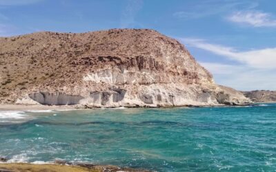
The Cabo de Gata area was formed when the African and European tectonic plates collided millions of years ago, and subsequent violent volcanic activity under the sea. The result is an extraordinary landscape, which in places looks prehistoric. Hills...
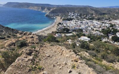
Cabo de Gata – day 1 (part 1)
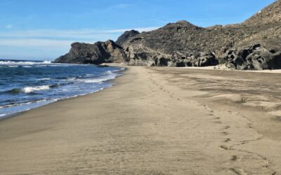
This is a varied and interesting day's walking along an undulating coastline. Away from the urban sprawl of Mojácar Playa, the route to Carboneras is mostly concrete-free. It's around 25km with approximately 350 metres of height gain, which will take...
Cabo de Gata – day 1 (part 2)
On reaching the hamlet of Sopalmo you will have a decision to make. At the entrance to the village, the Ruta del Argar pilgrim trail bears left to go down the surfaced track. However, some walkers may prefer to walk down the AL-5107 main road to...
Cabo de Gata – day 2 (part 1)
The second stage visits the extinct volcano of the Mesa Roldán, a flat-topped 'table' (mesa) which reaches a height of 222 metres. The ascent offers a first view along the mountainous coastline of the Cabo de Gata. It's an extraordinary vista taking in the...
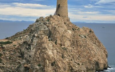
Cabo de Gata – day 2 (part 2)
Continuing up the Mesa Roldán path, more magnificent views await from the watchtower at the top. On the far side (north) of the tower we can see a large flat-ish area which looks like a volcano crater. However, it's actually an old mine. An information...
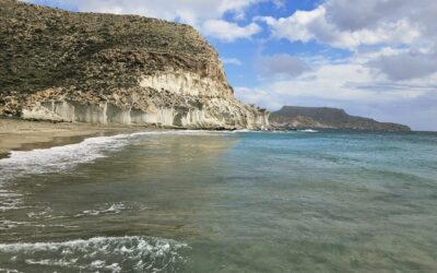
Cabo de Gata – day 3 (part 1)
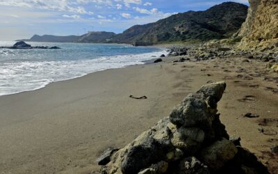
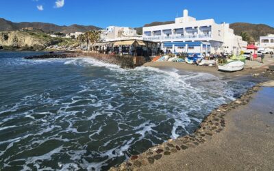
This stage of the walk goes from Agua Amarga to Las Negras. It's not a long day, approximately 13.5km of walking, with around 500 metres of ascent. The main highlights are the three wonderful coves that the route visits; Cala de Enmedio, Cala del Plomo...
Cabo de Gata – day 3 (part 2)
To get on the hill path to Cala de San Pedro we head back out of Cala del Plomo on the same route and turn left along the track, following the white/blue waymarks. After around 10 metres, turn left again onto the path, seeing the San Pedro sign after a...
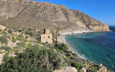
Cabo de Gata – day 4 (part 1)
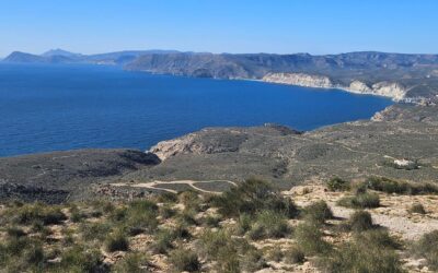
The route goes from Las Negras to San José and it's the longest stage of the six-day walk. There is around 27km to cover with approximately 600 metres of height gain, which will take between seven and nine hours. En route, La Isleta del Moro is a good...
Cabo de Gata – day 4 (part 2)
The alternative headline for this report is 'showing the way to San José'. The path emerges on the northern side of La Isleta del Moro, at the Playa del Peñon Blanco, which is a lovely beach. It's worth going 'off piste' to have a look at the dock in...
Cabo de Gata – day 5 (part 1)
Unless you are on a small island or peninsula, there are not many places where you can watch the sun rise out of the sea and then, after a day's walking, observe the sun sinking into the sea. But day 5 of the Cabo de Gata hike allows you do exactly that;...
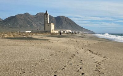
Cabo de Gata – day 5 (part 2)
From the vantage point high above Playa de Mónsul, pick your way down the slope to the beach. The route moves slightly to the right on the descent. You will probably want to have an explore of the beach and maybe a sit down in the shade provided by the...
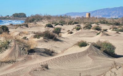
Cabo de Gata – day 6
This is the final stage of the walk. It's as flat as a pancake and runs from the town of Cabo de Gata to Almería along the seashore. It's the least interesting leg of the hike; but still has some merits which could persuade you to walk to the city rather...