This route could also be called ‘a short walk in La Mata-Torrevieja natural park’ – but that is probably not headline material. It is indeed a short stroll, incorporating other features, as well as grape vines and pine trees.
The route – starting from the natural park HQ, just off the N-332 road in La Mata, Torrevieja – also takes in the new-ish botanical garden and the two amphibian ponds; as well as two bird observation points, La Cigueñuela which is a hide that juts out into the salt lake and the tower at the shady picnic area.
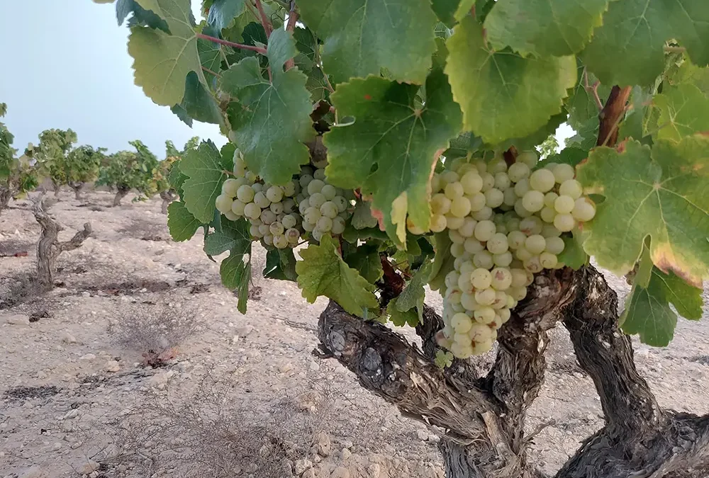
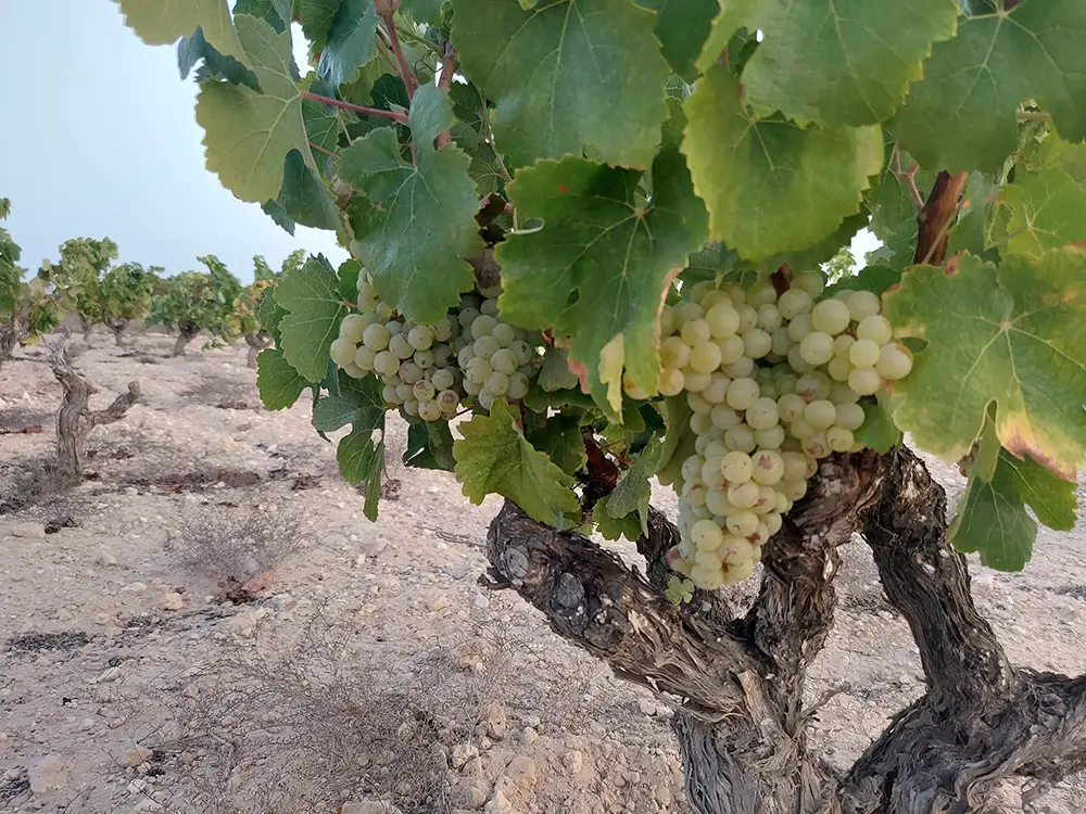
The spring and early summer are good times of year to do the walk. The grapes are maturing on the vines, with the first harvest now taking place at the end of July. The hotter summers in recent years have brought this harvest forward, which is something to bear in mind when timing your visit (if you want to see the picking).
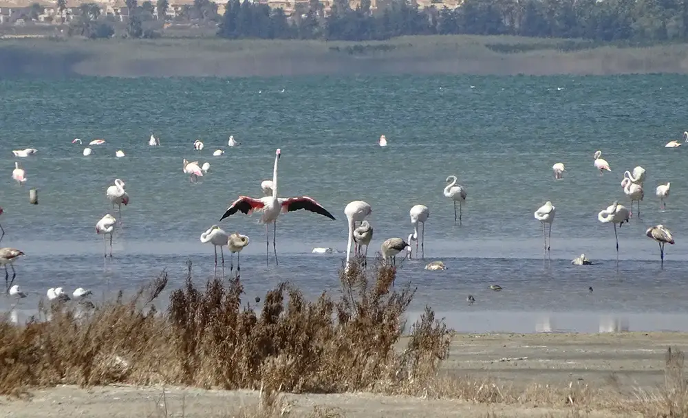
There is also a plethora of birdlife at that time of year. Nearly 6,000 flamingo chicks were born at nearby Torrevieja lake in spring, 2024. With similar, although not quite so spectacular feats occurring in the previous couple of years, the transient colony of these wading birds is growing. And, even though they move about a lot, large numbers can often be seen from the observation points at La Mata lake. Other birdlife on show includes the black-winged stilt, shelduck, avocet and many other species.
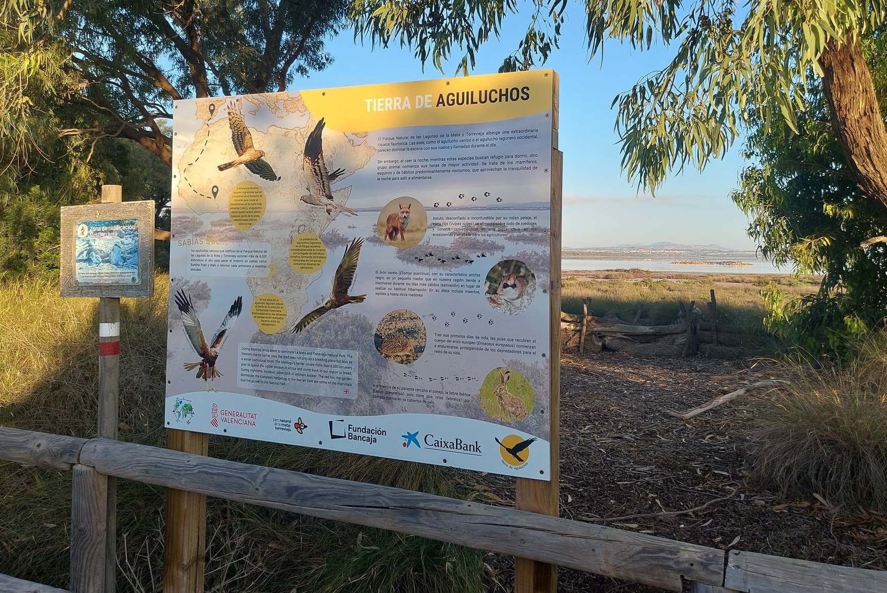
Information boards also explain about the presence of the western marsh harrier, which is present all year round and Montagu’s harrier which migrates from Africa in the spring. They note that the birds of prey nest in the reeds directly on the ground ‘which makes them vulnerable to predators and environmental disturbances’. Therefore it is imperative to make sure dogs are on leads.
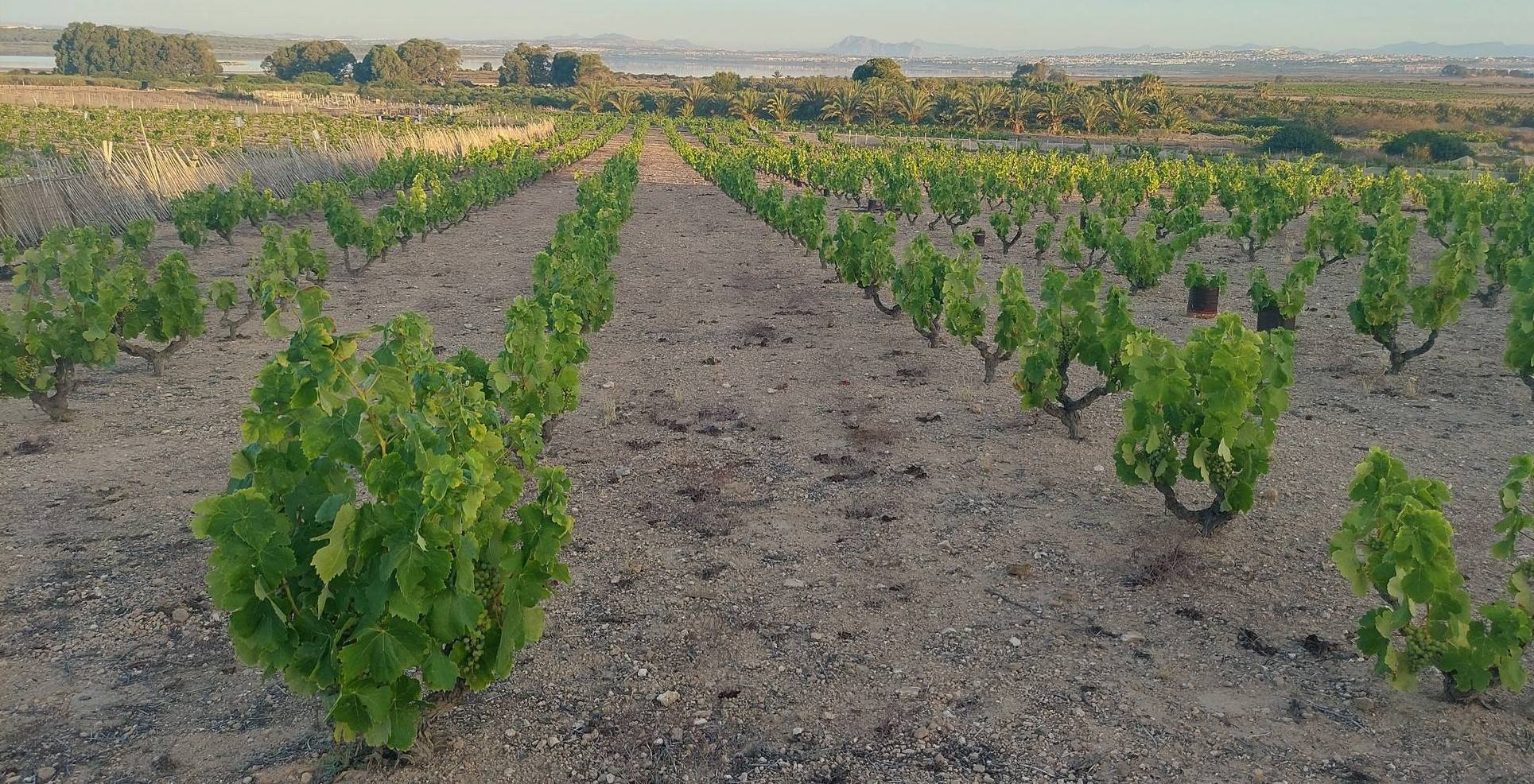
The walk is a flat route, slightly less than 3km in length, but early starts are advised in high summer in order not to suffer under the unrelenting sun. The path runs next to the vineyards in many sections; open fields, full of grapes during the summer, which are close to the shore of the salt lake.
Viticulture has a long history in La Mata, although sadly the practice is slowly disappearing. More of the vines are lying untended as the farmers grow old, with fewer people willing to replace them. Two types of grape can be found here – the merseguera, which is typical of the Valencia and Murcia regions, producing ‘light’ white wines; and the moscatel. The fruit is turned into wine and also sold as table grapes.
The sandy paths offer expansive views across the lagoon to the Sierra de Orihuela and Sierra de Callosa, amongst other ranges.
The walk
The route starts at the natural park headquarters (interpretation centre) in La Mata. At the doors of the centre, face this old white building and bear right, walking along the wide lane. On the right there is a regeneration zone, where saplings and bushes have been planted. On the left there is a field of vines running down towards the shore of the lake.
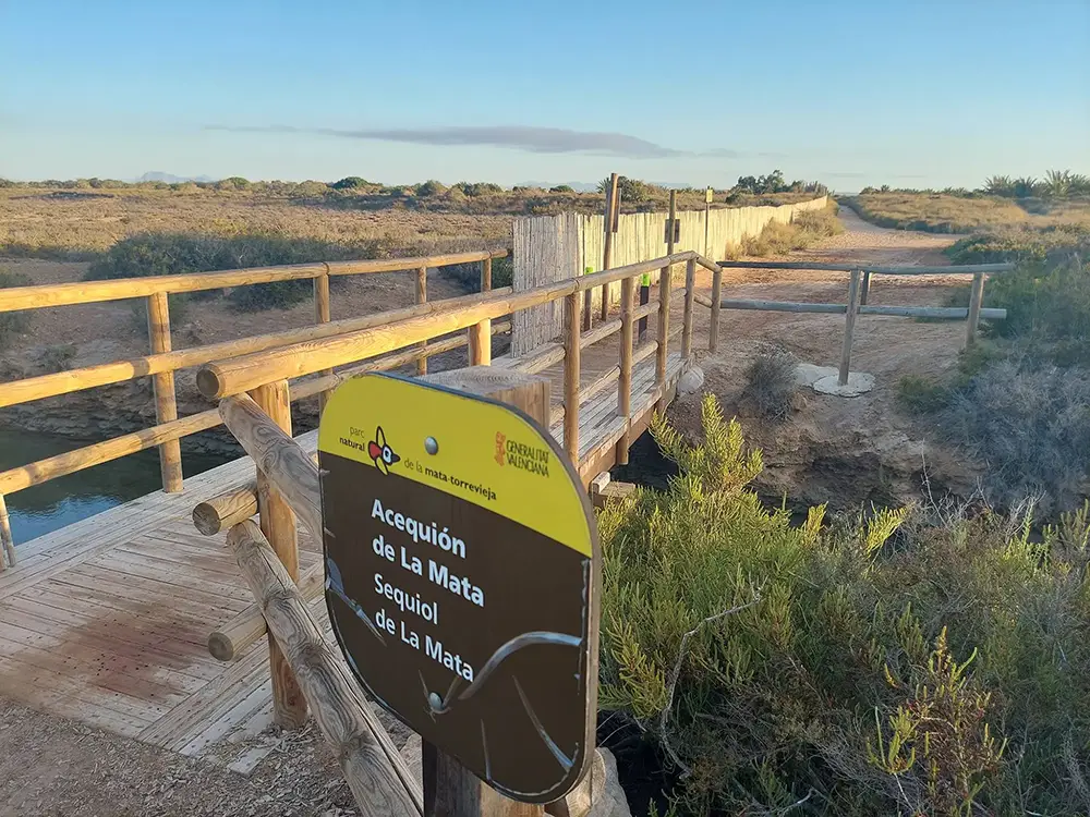
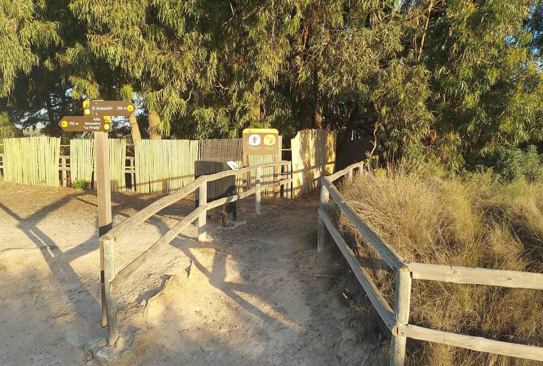
Arriving at the back road to the Campo de Guardamar, turn left to walk down the sandy track running along the left-hand side of the country road, with more good views of the vines on the left. At the bottom of the incline the track bears left to pass the shaded picnic table which stands next to the ‘acequión de La Mata’ – the channel that links La Mata lake with the sea.
Our route moves away from the road, to follow the channel. On the left are the allotments of La Mata, at first hidden by giant palms. Follow the track for a short distance towards the lake. It emerges at large eucalyptus trees. Pass to the right of them to have a look at the footbridge which crosses ‘el acequión’. Standing on the bridge, there is a great view along the channel to the lake and back up in the direction just travelled.
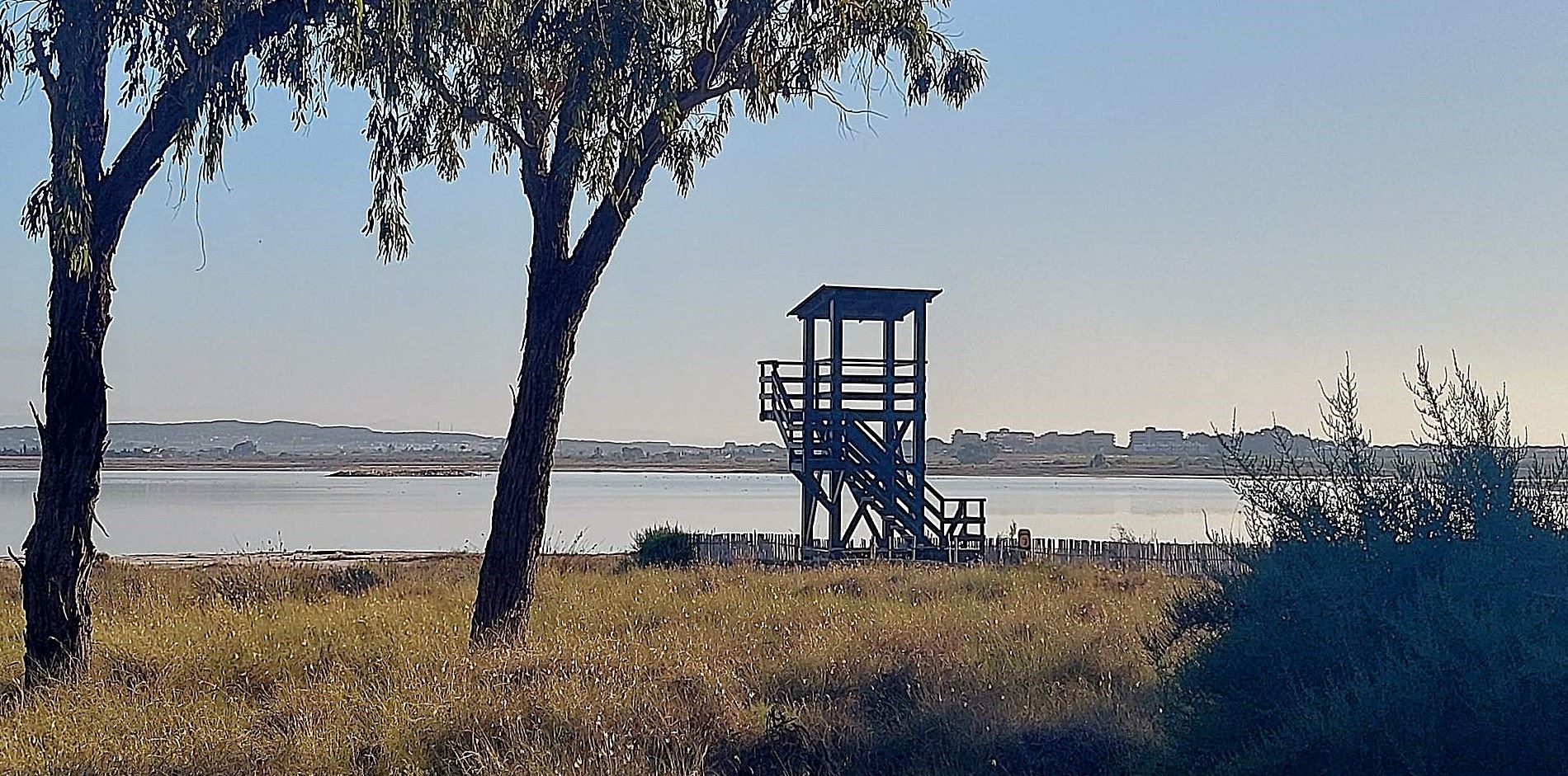
Don’t cross the bridge, turn back to walk along the wide track that runs close to the shore of the salt lake, now with good views across the flat area of the lake shore. Come to a board which gives information about the two different species of harrier which can be found in the area. Keep going along the track, passing another board with more information about the harriers, just before the sign which points right for the entrance to ‘La Cigueñuela’ bird hide. The route passes through the eucalyptus trees and along a narrow boardwalk, out into the lake, where there are fantastic views of different birdlife. Incidentally, a ‘cigueñuela’ in English is a black-winged stilt (himantopus himantopus).
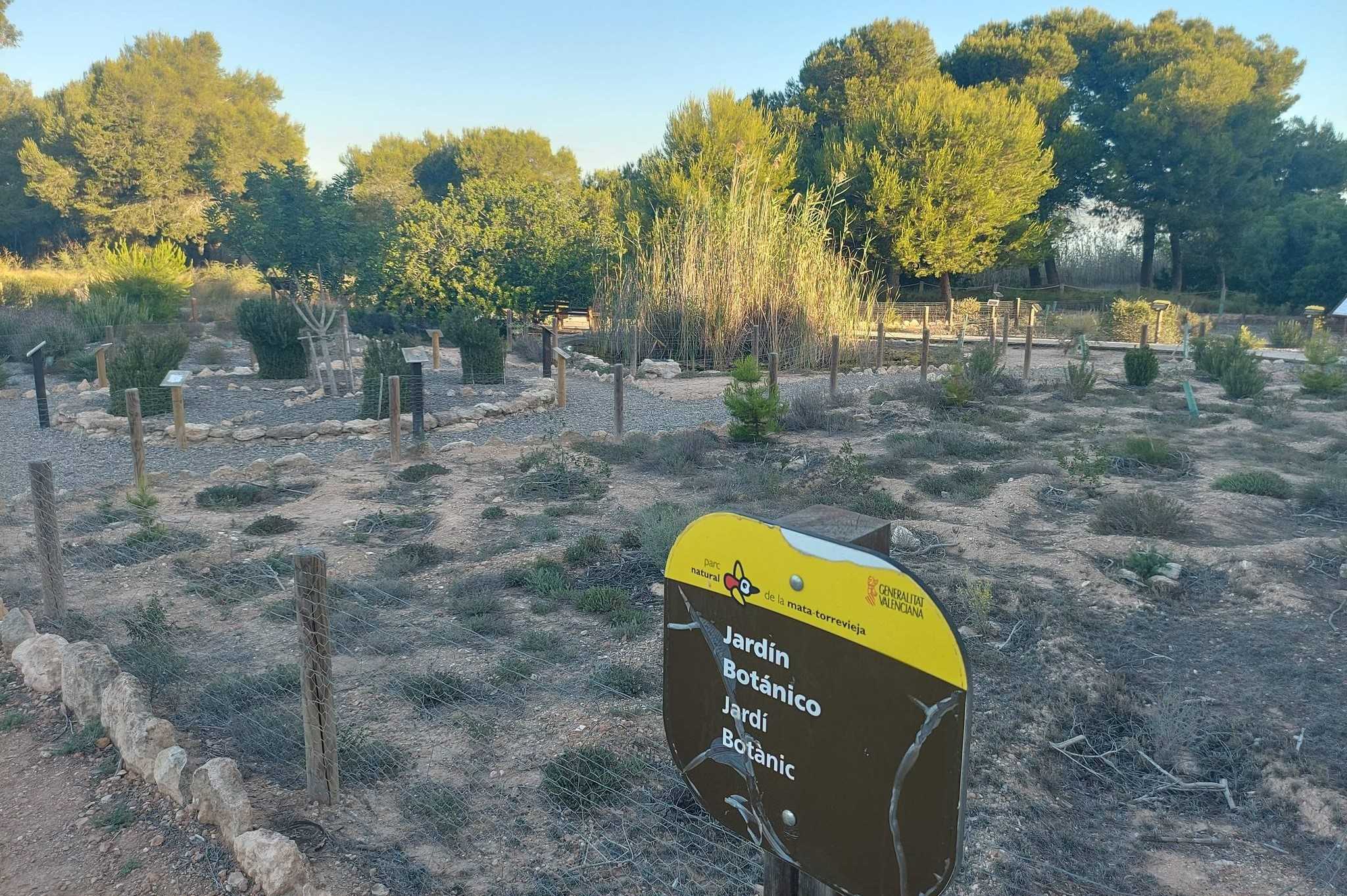
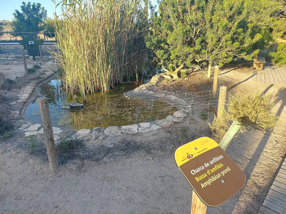
After a look at what is on offer, exit the hide and turn right on the sandy track to continue. The track leads over a rise and our route bears right to go down to reach the boardwalk. Turn right to walk along the boardwalk. After around a 100 metres the botanical garden is on the right, with the first amphibian pool. It is a fascinating spot where a lot can be learned about the native flora of this area, including the mastic tree, different kinds of pines, plants specially adapted to the saline environment and much more.
After a look round, continue on the boardwalk as it progresses under the shade of a tall stone pine tree and then the expansive eucalyptus. At the picnic tables bear right to get to the observation tower which gives great views over the lake.
Back at the picnic tables, walk onto the track which runs parallel to the boardwalk and start to head back. Almost immediately, the track forks. Turn right to follow the track which moves away from the boardwalk and then runs parallel to it. Pass the tall pines and after around 50 metres emerge at an open spot where there is a large field of vines on the right and an open area on the left. The open areas contains the second amphibian pond. Continue along the sandy track before turning left to check out the pool. Then walk back to the track and head straight on to reach the lane.
The whitewashed walls of La Mata cemetery lie ahead. Turn left to walk along the lane and follow it around the bend to the right. Walk along the cycle path which runs along the lane for around 400 metres.
See the sandy track on the left. Take it and go up the slight incline, taking the first right to head back towards the car park. Just before the car park bear left to see ‘El Altillo’ vantage point, where there are terrific views over the lake and a large information board which identifies all the mountains on the skyline. Then there is a boardwalk which leads back to the park interpretation centre.
Walk facts: length – approx 3km; time – one to two hours; ascent – negligible; getting lost rating – low; difficulty – none; season – all year round; getting to the walk – drive along the N-332 coast road from Guardamar del Segura to Torrevieja, turning right at the first roundabout in La Mata. Follow the road round to the left and park up at the information centre.
Recent Comments