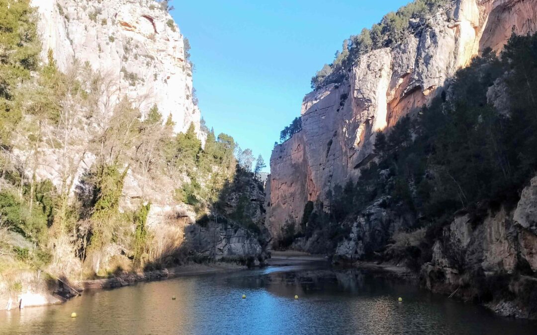
Walking above the narrows
This waymarked route in Montanejos heads to the top of ‘the narrows’ – the Estrechos de Chillapájaros – where towering cliffs close in and the Mijares river creates a sheer-sided ravine. The views from above, looking over the gorge, are spectacular. The...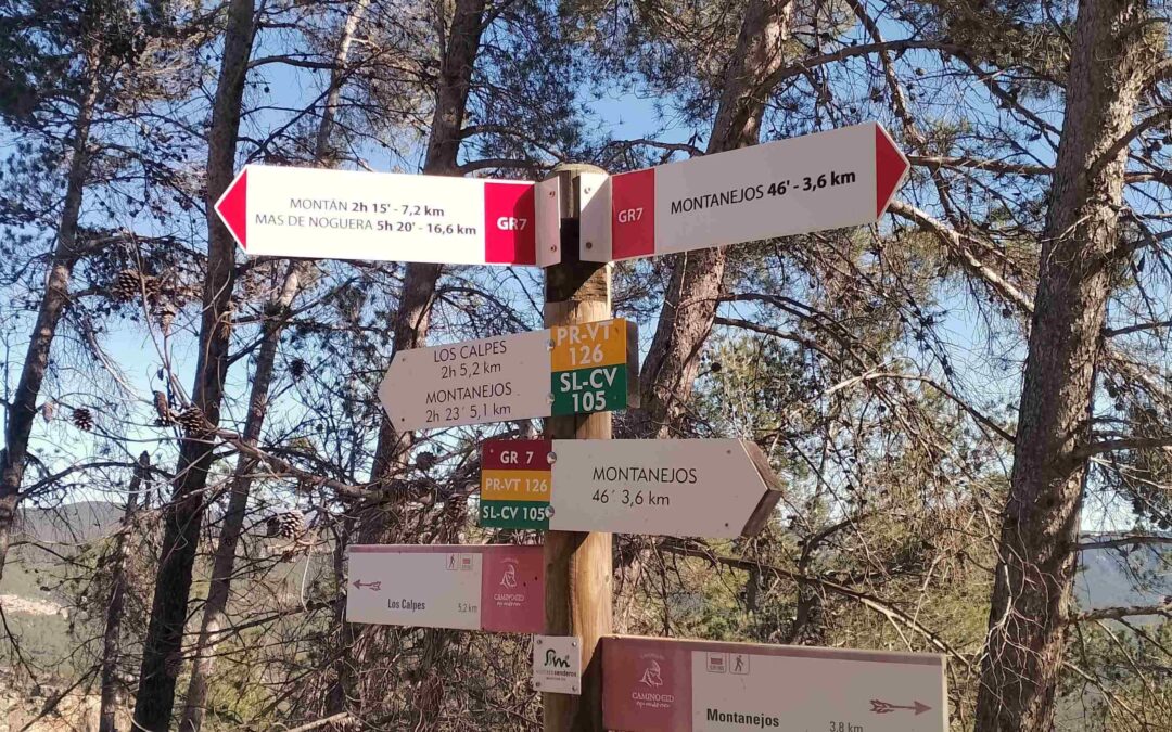
Monumental Maimona
This route runs along the side of the gargantuan Maimona ravine, up towards the summit of La Rosada at 949 metres. The walk follows the GR-7 footpath through the ravine, which is signed with white/red waymarks. There are spectacular views of the rock walls which...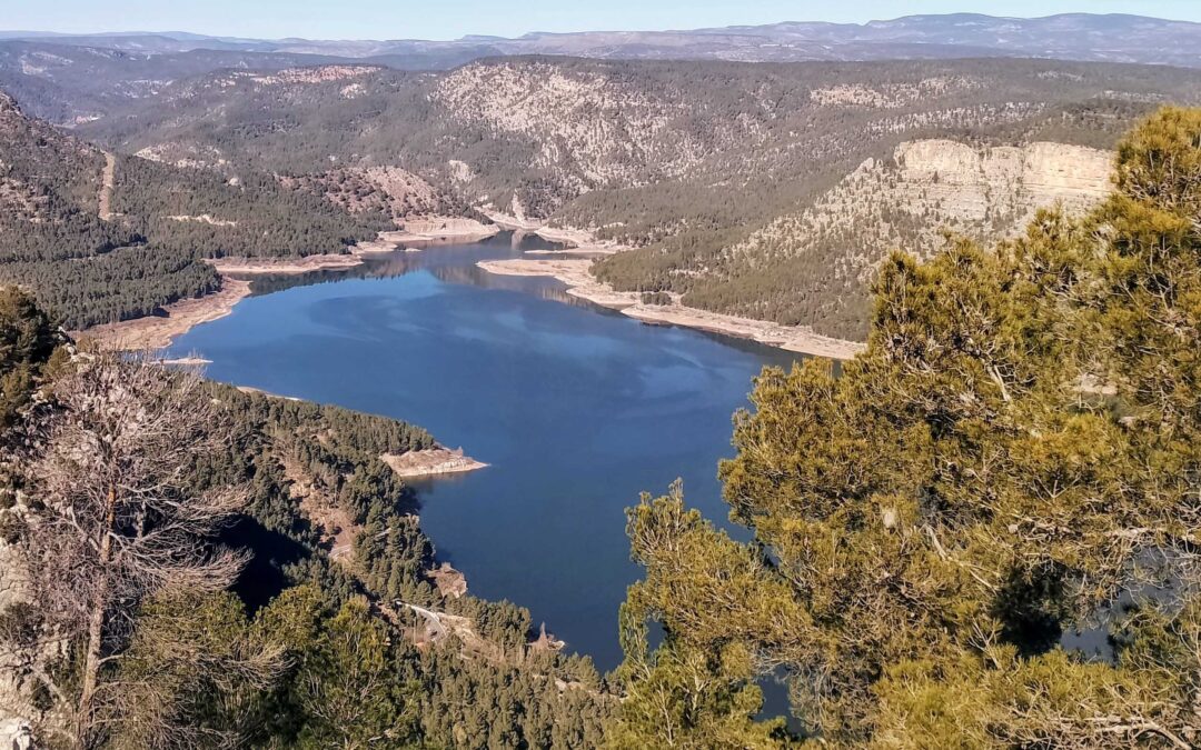
Morrón manoeuvres
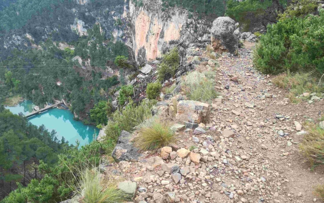
This circular walk goes up the highest mountain in the area, the Morrón de Campos (967 metres). There are fantastic views from the top, over the Arenoso reservoir and large swathes of the surrounding area. The route drops down to the water and crosses the canyon below...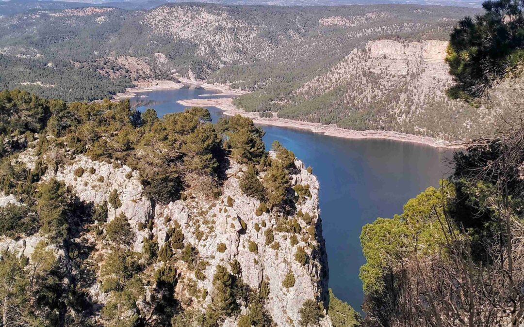
Morrón manoeuvres; part 2
There two ways to descend from the summit of Morrón de Campos to the Arenoso reservoir. It can be done on the wide forestry track which is used by vehicles driving up to the look-out point; or via a path that is not waymarked and which runs along the top of the...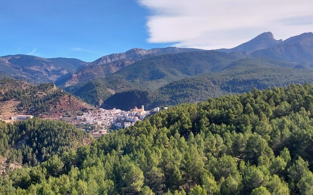
Villahermosa – it’s a beauty
The name Villahermosa del Río originated in the Moorish era. Meaning ‘beautiful village of the river’, it is hard to quibble with the sentiments. But, after visiting, it begs the question – which river? The village is perched on a ridge flanked by two long ravines...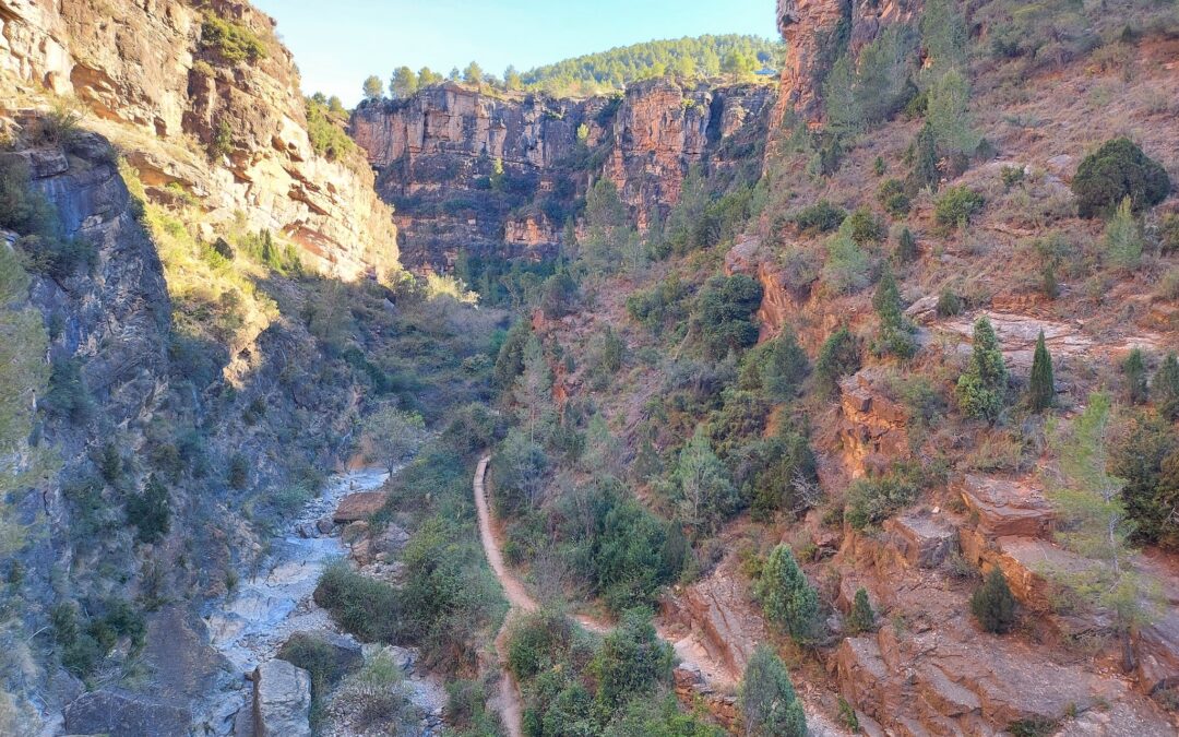
Villahermosa ravine walk
This short walk takes in the spectacular ravine forged by the River Carbo, which passes the eastern edge of Villahermosa del Río, with the whitewashed houses standing above, along the cliffs. There is no real difficulty to the route, but walkers should be aware that...
Carbo waterfall and Peñagolosa
This is probably the best walk from Villahermosa del Río. It can be an all-day affair, or a shorter route as far as the Río Carbo waterfall. The longer trek goes to the top of the second highest summit in the Valencia region, which is Peñagolosa (1,814 metres) – a...
Carbo waterfall/Peñagolosa – part 2
The path runs along the right side of the wide valley/ravine, high above the river. It arrives at a sign which points left for the ‘cascada’ (waterfall). Leaving the GR-7 behind, this offshoot heads down into the ravine. It is not overly steep and the waterfall area...
Pine pilgrims and a hermitage
For this route from Villahermosa del Río it’s back on the GR-7, which – as long-distance routes go – is extraordinarily long, spanning several European countries. However, our ambitions (at the moment) are not so grand, and we will content ourselves with a walk...
Recent Comments