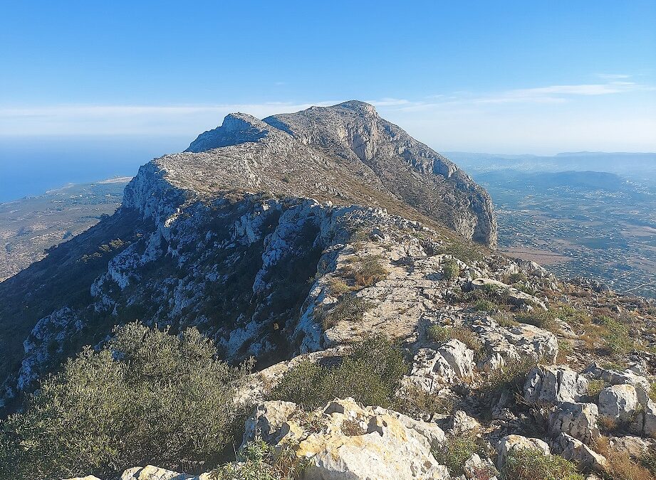
The most popular route up the Montgó is from the seaward end. But there is another footpath, which starts on the other side of the mountain, near the village of Jesús Pobre. There are always different ways of climbing a mountain – longer, easier, different features to cross, etc – and this route is slightly more difficult than the walk from the coast. However, it is also a well-used path and certainly not overly taxing for regular mountain walkers. The route follows the elongated, curving backbone of the Montgó. It’s a wide ridge in most places – although it depends exactly where you are on it.
There are improving views over the north of Alicante province and up the coast towards Valencia as height is gained, with different angles from which to observe the spectacle. The route offers a particularly good vantage point looking out over Denia and its port – then later, from the top of the mountain, over Jávea.
The only downside that I encountered was the broken nature of the ground. By this, I mean that it is extremely rocky/bitty underfoot in places and it is impossible to get into your stride in some areas because of the protrusions. This is the nature of a lot of mountain walking, but certainly not all. If you don’t enjoy this type of surface, then it’s best to avoid this route.
It also forms part of the GR-330 long-distance footpath which traverses Alicante province; and this particular stage runs from Denia to Gata de Gorgos, covering some 20.4km, and 1,200 metres of height gain. Our route is less taxing – with 6.3km each way, returning on the same path. Thanks to the GR we have signs to follow for Denia and white/red waymarks en route. Montgó reaches a height of 753 metres.
The walk
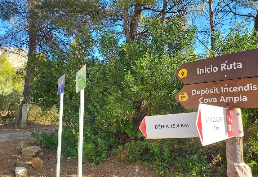
The start point lies close to the village of Jesús Pobre. Travelling from Jávea, it’s a right turn off the CV-735 road, just a few metres before the left turn which leads to Jesús Pobre (note that this turn-off is long before reaching La Sella golf club).
You will see the walk signs from the road, which are pictured here. After turning onto the surfaced lane it’s only a couple of metres to the parking spot, which is in the trees on the right. There is room for less than a dozen cars – something to bear in mind at busy times.
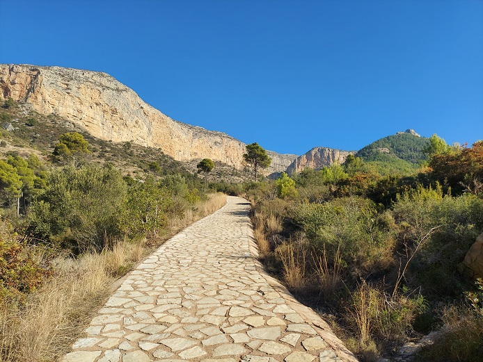
Walk up the surfaced lane, following the waymarks and signs for Denia. The lane rounds a bend, gently ascending to a signpost which informs us that the ‘cim del Montgó’ (summit of Montgó) is 5.8km away. This is where we turn left, off the lane to start ascending on a beautifully ‘stoned’ (not tiled!) track. Pass the walk boards which offer information about the route.
Dead ahead the hulking mass of the Montgó can be observed in all its splendour. The surfaced track bears to the left and turns into an eroded track. The ascent becomes steeper as height is gained. The track is moving away from the summit. It turns into a path and continues to climb, eventually reaching a signpost, which again points for the ‘cim’ (summit in Valencian).
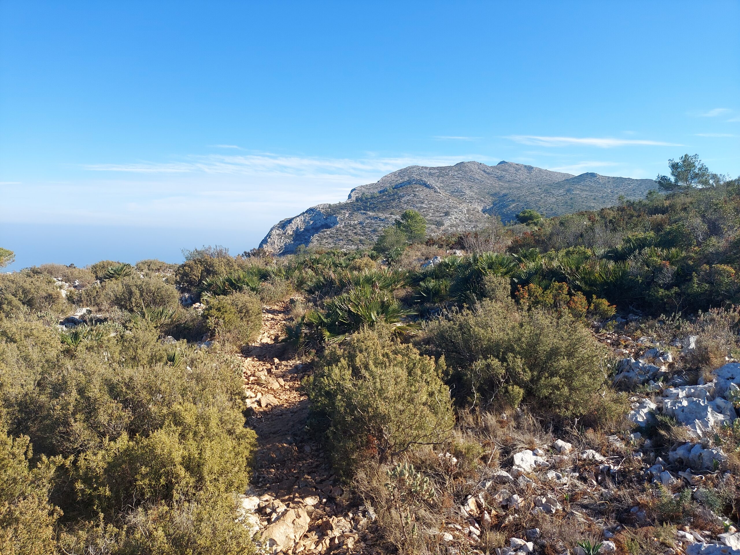
At first the path turns towards the coast, where there are great views over Denia and also up the coast to Valencia province. There is more ascending to be done in the general direction of the coast before arriving at a spot close to a cave. It’s only a short distance from the cave view before the path bears to the right. The walker is now heading south towards the summit in the distance, with some very good views over Denia port on the left.
At this point the path is on the ‘sea-side’ of the wide ridge, offering splendid vistas. The land has flattened out and walking on this section is much easier and very pleasant – amongst wild herbs and dwarf fans palms. The white/red waymarks of the GR-330 let the walker know that they are on the right path. As the route progresses, the going underfoot becomes a bit more awkward, with small protruding rocks breaking the stride. Pass through small groupings of dwarf fan palms before coming to a junction.
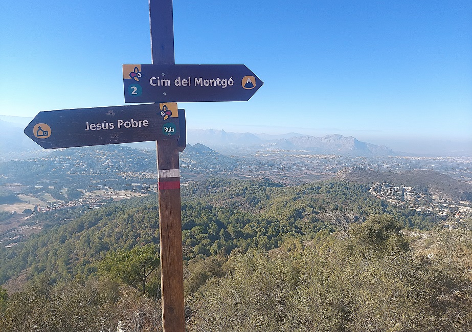
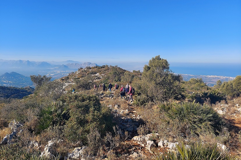
The path that bears left goes up to the Denia cross (Creu de Denia) – maybe a route for another day. Keep straight on for the summit. Soon afterwards the path becomes a little steeper. It has now moved from the seaward side of the ridge to western extreme.
Take care on the ascent of a short, steep section which leads to the final tranche up to the summit. The last bit is much easier walking – and again extremely pleasant, with panoramic views over a vast area of Alicante province.
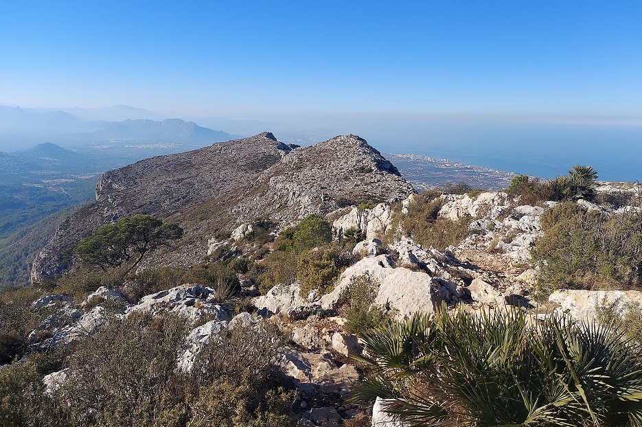
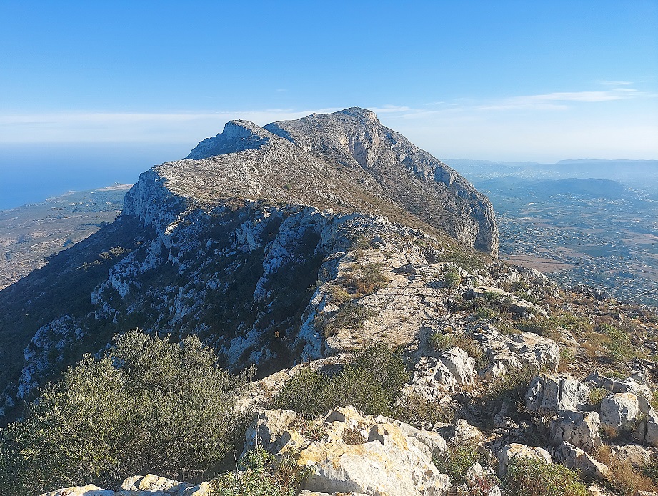
There is a trig point at the top to mark the peak. Terrific views over Jávea and the ‘south side’ can be admired from the summit. We return on the same path.
The information boards down below state that this route will take four hours, which is a little ambitious. Walkers should allow between five and six hours – more if they want longer rests. The route is 6.3km each way, making a total of 12.6km. The height gain according to the official information board is 746 metres.

Recent Comments