
Ice ages have left their mark in a dramatic fashion on this part of the Pyrenees. And many of the glacial lakes lie inside the Aigüestortes i Estany de Sant Maurici national park, which measures some 14,119 hectares in the province of Lleida. Entry from the east can be gleaned from the small town of Espot. It is perhaps the best-known access point and, as such, is a tourist trap in peak holiday season, with the famous lake of Sant Maurici attracting many visitors, who are certainly not all mountain walkers. It is worth taking this into account when planning a trip.
As with other areas of the Pyrenees, the footpaths from Espot mostly follow valleys or ravines along the banks of streams through pine forests and high pasturelands up to the glacial lakes and onto to the mountain passes and summits.
The Editorial Alpina 1:25,000 scale map (or equivalents), which can be bought from stores in Espot, is a necessary purchase for those who want to walk safely and see the full range of footpaths on offer. It is entitled Sant Maurici Els Encantats.
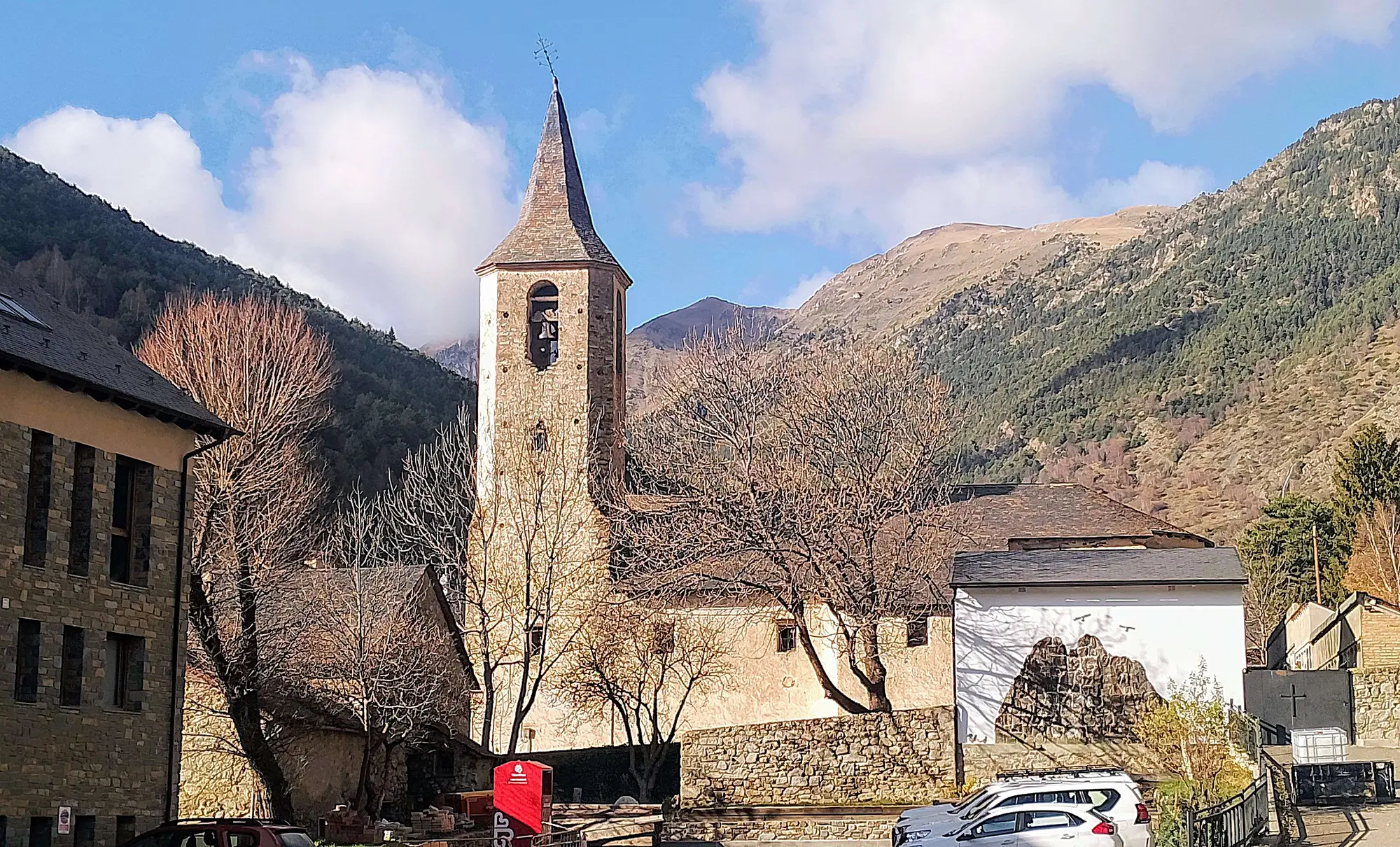
Espot is an attractive place to visit in its own right, with a mountain river flowing through the centre and attractive stone bridges spanning the watercourse. There are a number of restaurants and places to stay, including several campsites on the edges of the town. The Voraparc which has grassy fields above the river is one of them, with ‘glamping’ and chalets also available. It’s around a 15-minute walk from this campsite back down the road to Espot. More information at www.voraparc.com
Out of the hotels and guest houses, Pensió Casa Palmira has some of the best-priced rooms; and also an excellent three-course set menu at lunchtime and in the evening that includes a bottle of wine. More at www.hostalpalmira.com
Many more options can be found via www.booking.com
The walks
The initial section for several walks is the same, measuring around 4km one way up to the dammed lake of Sant Maurici. Fortunately is a lovely route and repeating the same path a number of times is no hardship. It starts from the Prat de Pierró car park at around 1,600 metres, which is the highest point that general public motorists can reach in the national park. To get there, drivers pass through the village of Espot and bear right to follow the signs to enter the national park. It’s around 4km up to the parking area at Prat de Pierró.
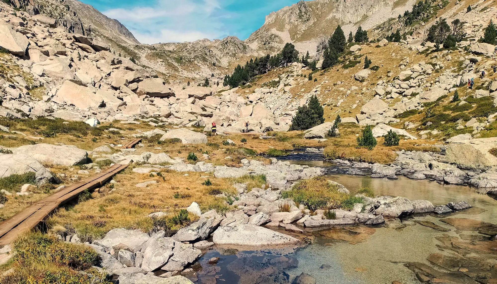
The initial 4-km walk is a route which would appeal to all levels of walkers, following the nascent River Escrita. The height gain of around 400m is gradual and there are no really steep sections. At the top of the car park turn right at the signs to pass through a gate and onto the trail. The footpath passes through wonderful deciduous woodland which has been very carefully conserved by the park authorities. On sections there is a boardwalk to encourage people to stay ‘en route’. In the autumn the forest floor is full of dozens of types of wild mushrooms, some of them edible – some of them poisonous.
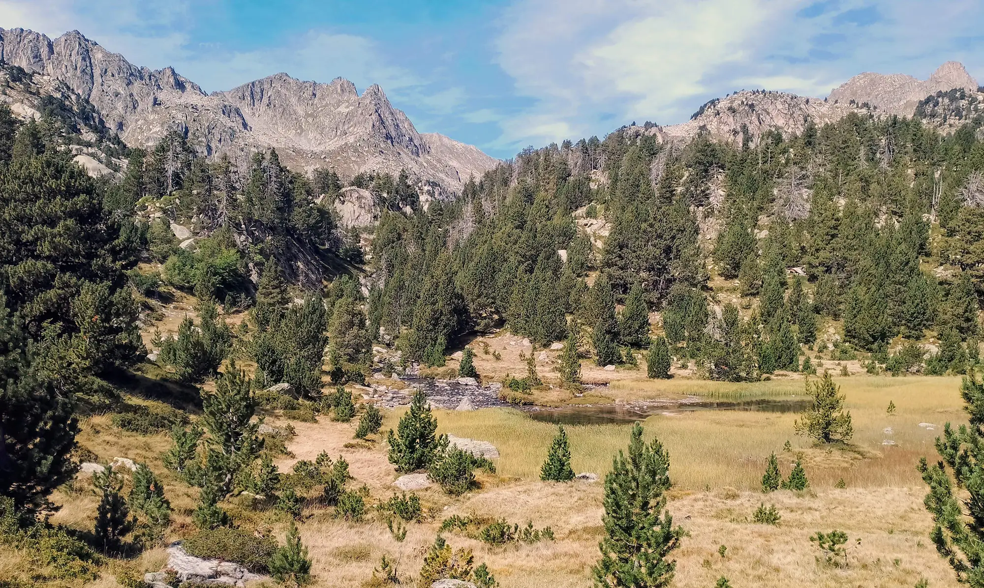
The route passes over the river/stream on a new bridge. A lovely section through verdant pasture follows, where cows may be grazing. Out of the trees, the views of the towering peaks above are breathtaking. Cross the country road and continue on, now heading back into the forest. It’s more of the same – fresh, earthy smells in the cooling shade provided by the canopy of foliage high above.
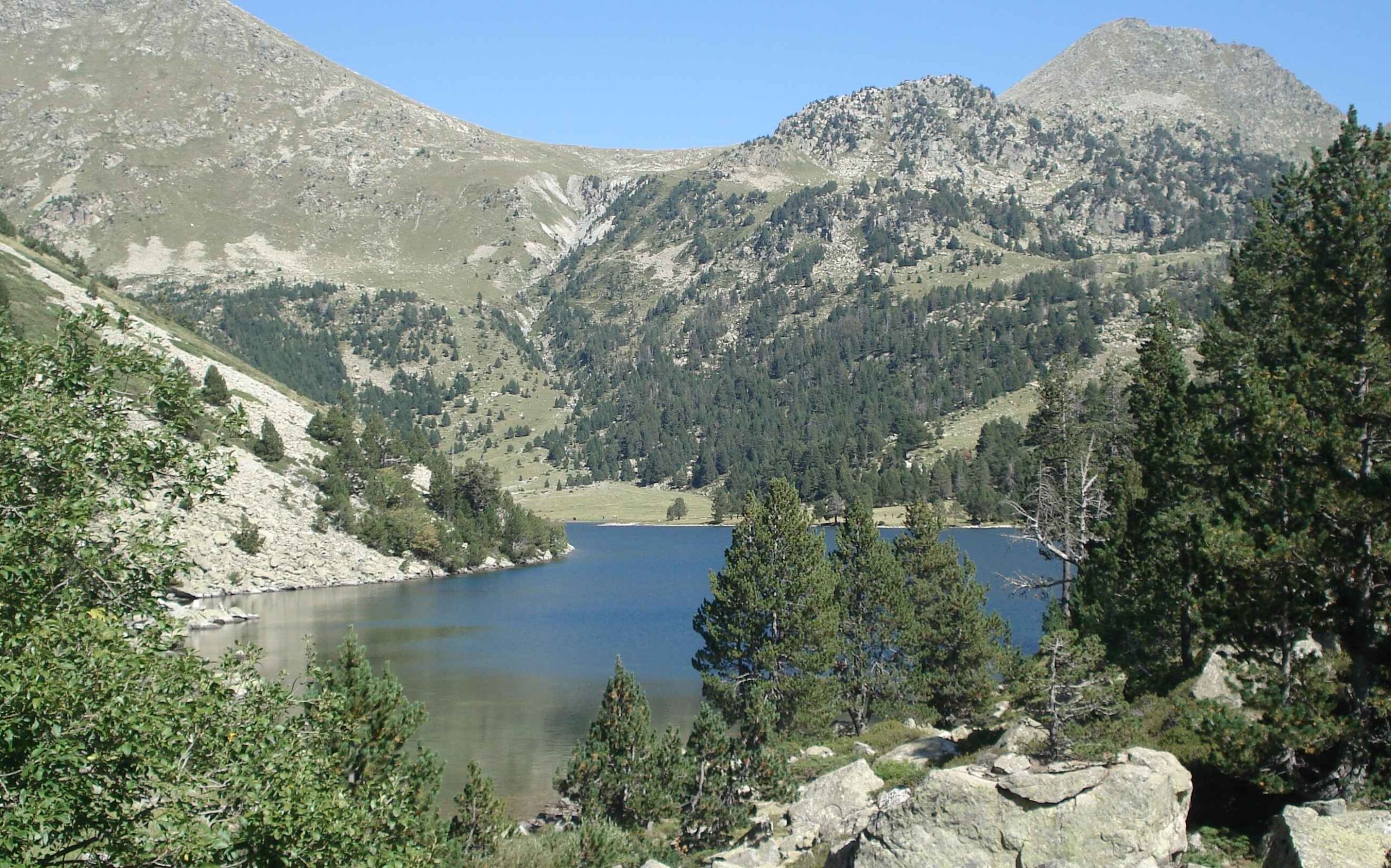
The forest path moves out onto a wide track. Pass the hermitage which is still the site of a pilgrimage. Shortly afterwards, the track forks. Keep straight on and it’s another five minutes up to Sant Maurici lake. Here, be warned! The lake is the stop-off point for Land Rover taxis from Espot and is a tourist ‘honey-trap’ at busy times (weekends, bank holidays, August). One positive thing to note is that most of the Land Rover visitors don’t venture very far – and you can be back in the ‘wilds’ again pretty quickly.
At the lake, there are several options. The two outlined here involve continuing along the GR-11 from Sant Maurici. The ascent to the Coll d’Amitges is steep in places but with the pass at 2,760m, it is an amazing spot to spend time watching the cruising vultures and gazing over a vast area of mountains which run away into the distance as far as the eye can see.
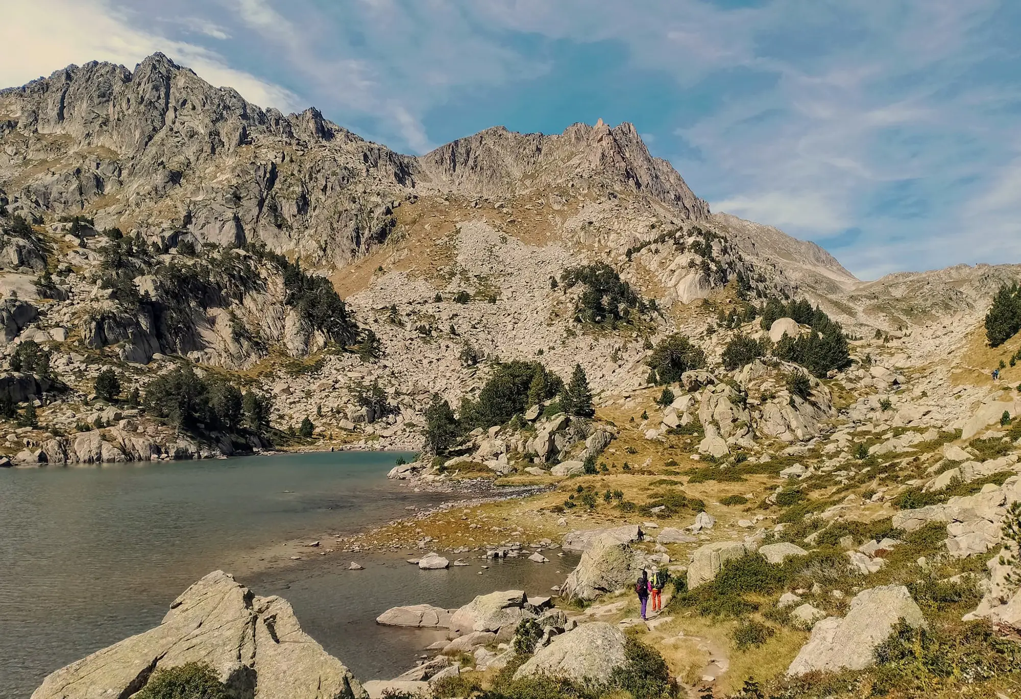
At the lake, the GR-11 starts to follow the wide track which is also used by Land Rover taxis carrying people who can’t be bothered to walk to the Amitges mountain refuge. Keep on the wide track, passing the Estany de Ratera glacial lake. Soon afterwards the track forks. Turn right for the Coll d’Amitges, coming off the GR-11. The wide track ascends to the refuge. It is quite steep in parts.
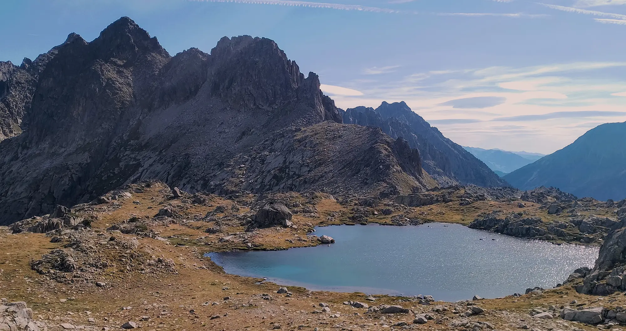
Keep on past the refuge which stands at 2,366m, safe in the knowledge that vehicles can go no further. Over the rise is the beautiful Estany dels Barbs glacial lake. The track keeps to the right then comes to a signpost and fork. Here bear right, keeping on the wide track. After around 20 metres the track runs out of steam. Turn off left to take the path down into the shallow ravine and up the other side. Here pick up the yellow-topped waymark posts and cairns. The path now runs above the shore of Estany Gran d’Amitges lake and then turns to start the ascent to the pass.
The path is pretty clear in most places. Be sure to keep en route by following the cairns and marker posts. This is important because the pass will probably not be where you imagine – it’s to the left of where many walkers would assume when looking up during the initial stages of the climb (or perhaps it’s just me).
After a steeper section, the path flattens out before heading up on the final ascent to the pass. By Pyrenees standards, this last section is not too steep. Arriving at the magnificent pass, many will be glad of a sit down with a panoramic view to gaze over. Those who still have the energy will turn right to bag the peak, the Pic d’Amitges (2,848m). Return on the same route, although the map shows some interesting variations for those who still have the legs. Allow between 7.5 to 9.5 hours for the Coll d’Amitges route which is approx 24km long with around 1,500 metres of ascent.
Back at Sant Maurici, another option is to follow the GR-11 up to the Port de Ratera pass at 2,594m, which is one of my favourite walks. To do this we have to rewind and get back to the fork which came after the Estany de Ratera glacial lake. Following the GR-11 is very easy; it’s a left at the fork, then take the next available right, where the path enters enchanted country, crossing pasture, running up the side of a stream, then coming out at the Obagues de Ratera glacial lake. The GR-11 passes along the right bank then starts the ascent of the Ratera ravine, following the stream which descends from the lakes below the pass. It is a lovely climb, quite steep in parts but not punishing. The path emerges above the Port de Ratera glacial lake, then carries on up to the pass.
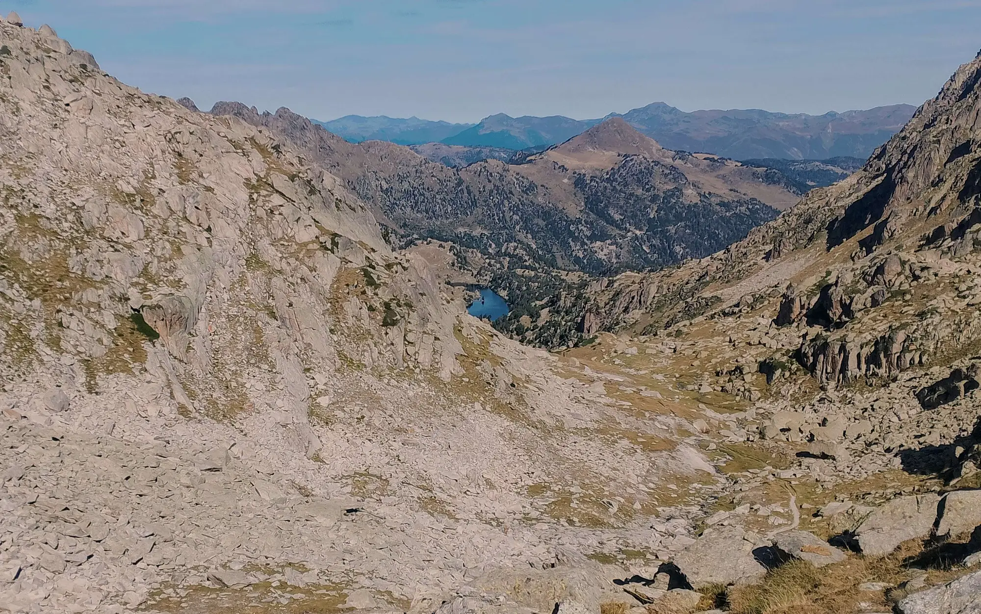
The area at the pass is quite simply awesome. It’s a high undulating ‘plateau’ which begs to be explored. Take the time to do this. It’s straight on for a view down the next valley which the GR-11 boldly descends; and to the right (north-west) for vistas over another verdant valley, glacial lakes and an off-shoot of the GR-11. And, among the undulations, you will discover a small glacial lake nestling just below 2,600m, mirroring the azure sky and looking across to soaring peaks. It’s a very good spot to sit on a tuft of grass and contemplate life in the company of the lake which has no name (and is my favourite of them all).
Return on the same path, which is the GR-11 back to the car park. Allow between 7 to 9 hours for the Ratera route, which is approx 22km, with approximate height gain of 1,300 metres.
A shorter route from close to Sant Maurici also leads to high places – up to the Portarró d’Espot – a wide expansive pass with magnificent views at 2,427m. It’s a relatively easy ascent on wide tracks with a gradient that won’t trouble most serious walkers. Ascending from Prat de Pierró, pass the hermitage. Shortly afterwards (before reaching Sant Maurici lake), the track forks. Take the left turn to Ernest Mallafré mountain refuge. The path curves round to the right. Follow the signs for Portarró d’Espot. The track starts to climb, offering views down through the trees to the lake. At a fork keep straight on. At the next fork keep left following the Portarró signs. The scenery improves and becomes more verdant on the way up to the pass, from where the walker can see the Estany Llong glacial lake in the valley below. Return on the same path. There is around 1,000 metres of ascent on this route of approximately 16km (total length).
Recent Comments