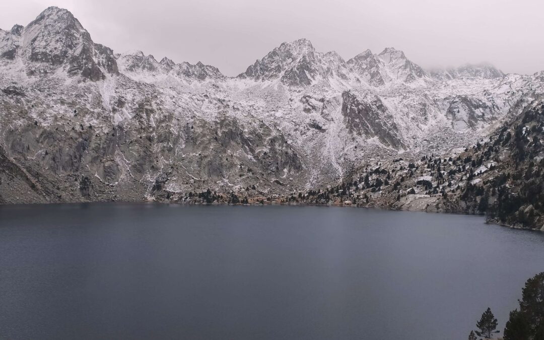
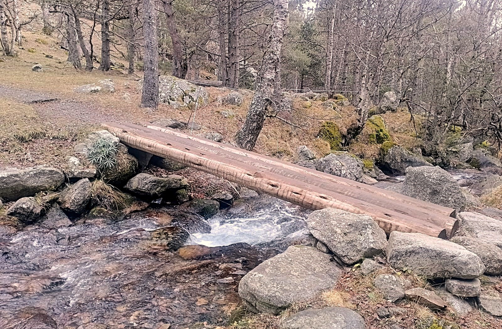
This route on the GR-11.20 ascends the beautiful Peguera valley, following the tumbling Peguera river – which is really a lusty mountain stream – along forest trails which criss-cross the watercourse on wonderful wooden bridges. The suggested finish point is the brooding Estany Negre (black lake) which lies in a cirque dominated by towering summits including the Pic de la Mainera which rises to 2,910 metres.
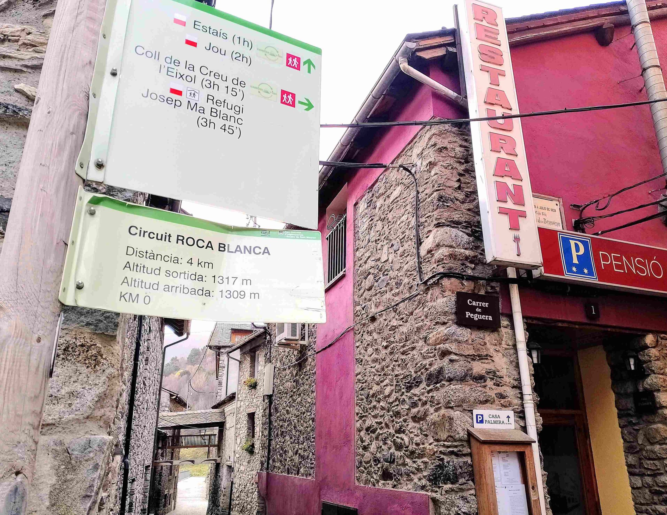
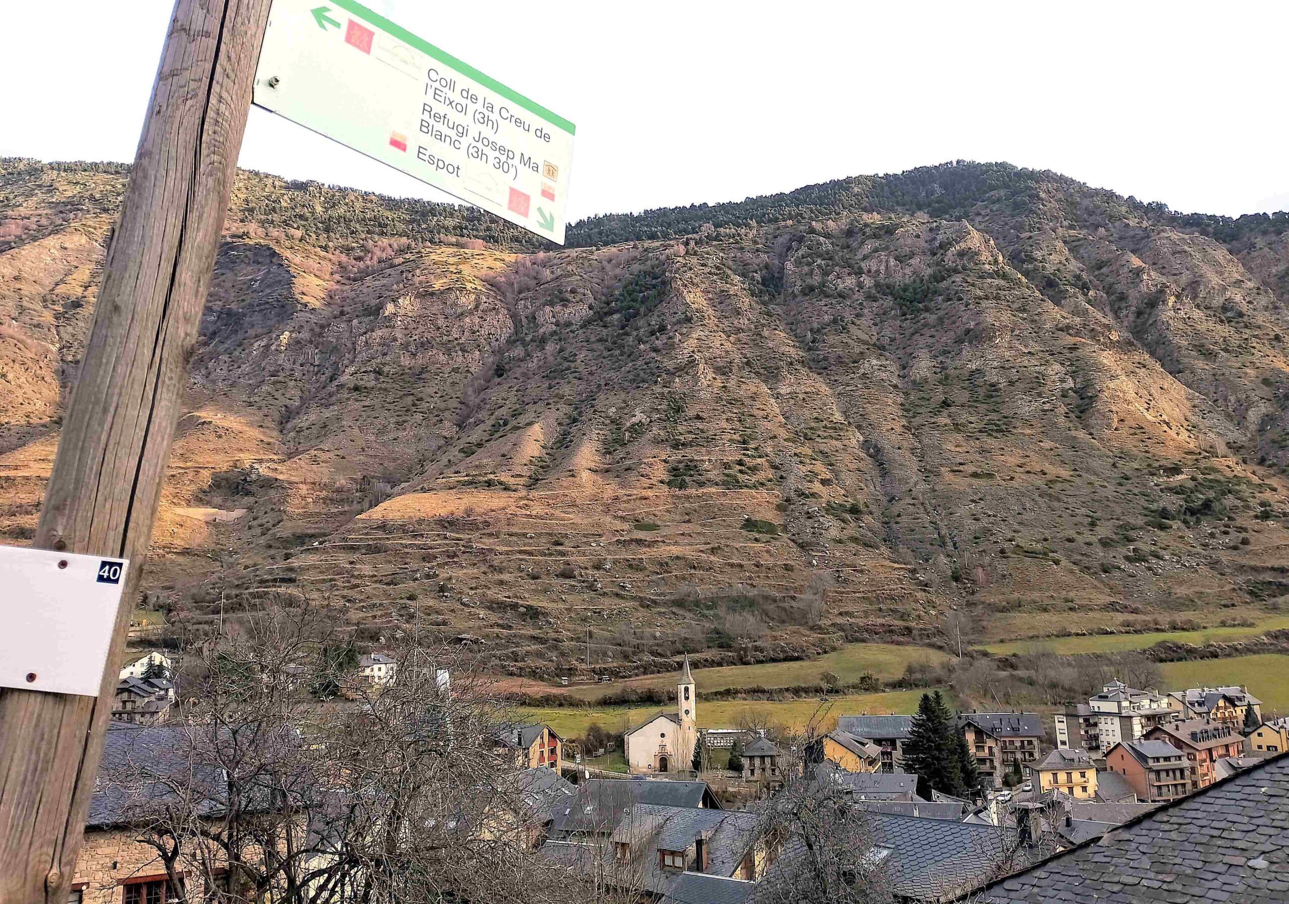
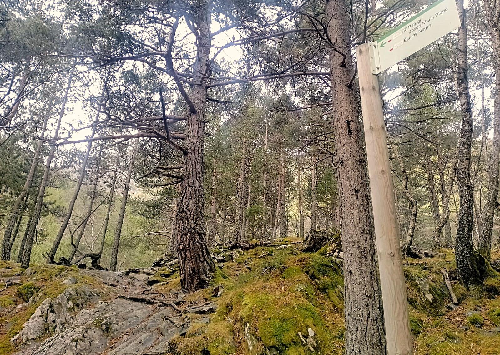
A walkboard in Espot highlights the route as far as the Josep María Blanc mountain refuge, which stands around 500 metres away from the ‘black’ lake. The climb to the refuge has a height gain of exactly 1,000 metres – up from 1,317m in Espot to 2,317 at the refuge. There are possibilities to get much higher, one of which is to continue on the GR-11.20 up to the Collado de Saburó at 2,668m, passing more glacial lakes.
The route is signed with the white/red waymarks of a GR. It is 6.7km from Espot to the mountain refuge, making a total of just over 14km for the walk to the Estany Negre, returning on the same path. The sign in Espot says it will take 3hrs 45mins to get to the refuge. Fortunately, this is a very conservative estimate and you will probably do it much quicker. Allow between five and six hours for the return trek.
I did the walk at the start of December. There was some ice on the track above 2,000 metres and it started to snow at the lake. This route could be done in the winter but snow shoes would almost certainly be needed.
The walk
The route starts in the centre of Espot by the bridge over the River Escrita at the walk information boards. Walk across the road to the supermarket/village store and on to the adjacent Casa Palmira pension. Here, on the corner, you will see the sign pointing for the Josep María Blanc ‘refugi’ (refuge). Walk up Carrer de Peguera, past Casa Palmira, following the waymarks which run up the street and out of the top of Espot.
Reach the road above and cross it. The route goes up the road for a short distance, passing La Torre campsite entrance and then turns immediately right to follow the wide track into the Peguera valley. The track runs along the right bank of the river, gently ascending. Keep following the waymarks and signs for the refuge. The track crosses the river to the left bank, before it turns into a path at a dogleg to the right. The path moves into the trees, which are both deciduous and pines at this height. It’s a very pleasant climb, as the path gains height, never too far from the mountain river.
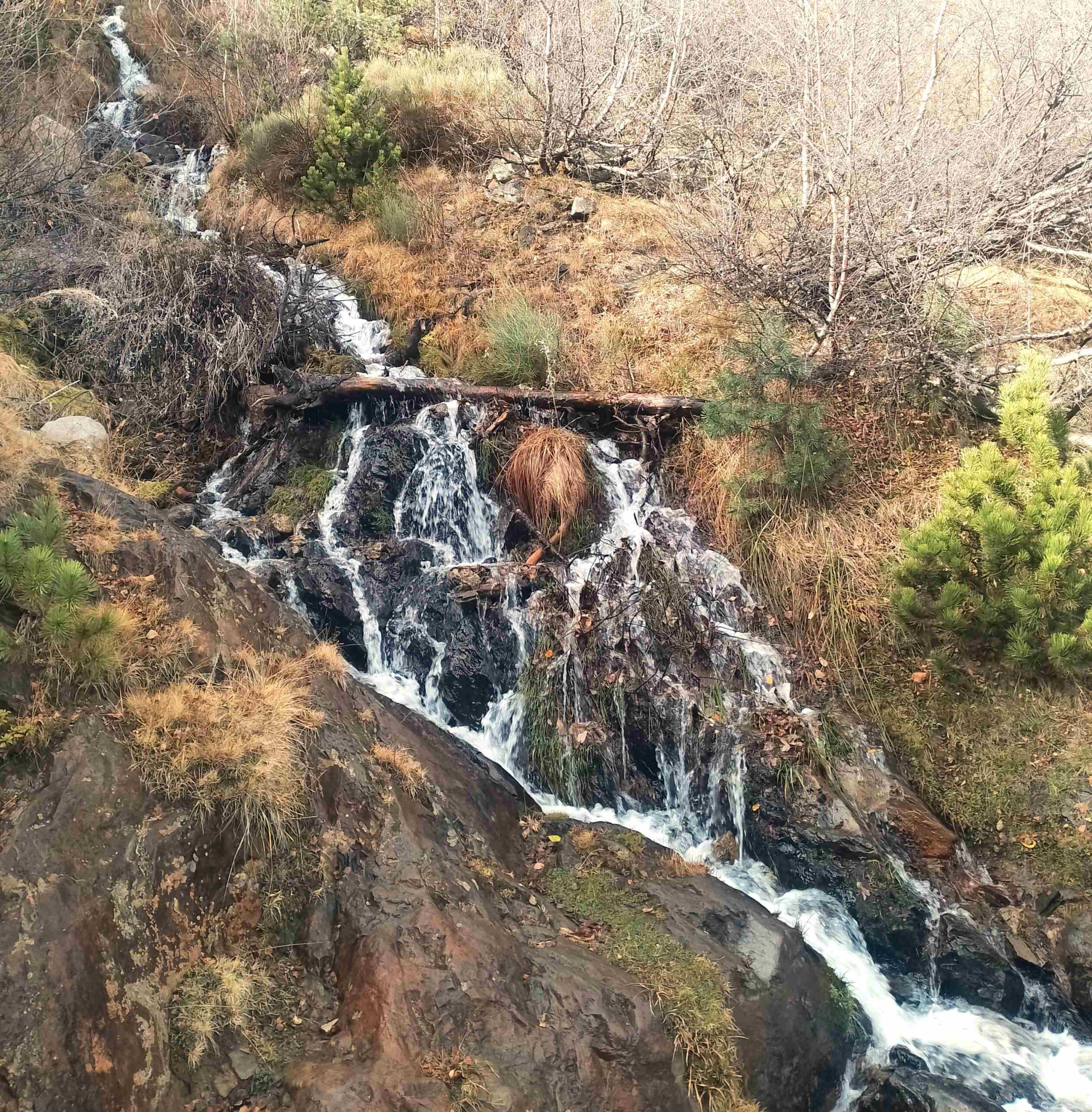
The first of the wooden bridges is soon upon us, taking the path back to the right bank, to continue the ascent through the trees. After more delightful bridges, the path crosses a stream next to a waterfall. Further on, at an open meadow, a wooden walkway has been constructed to cross an area which may be boggy after heavy rain. Then it’s back into the trees.
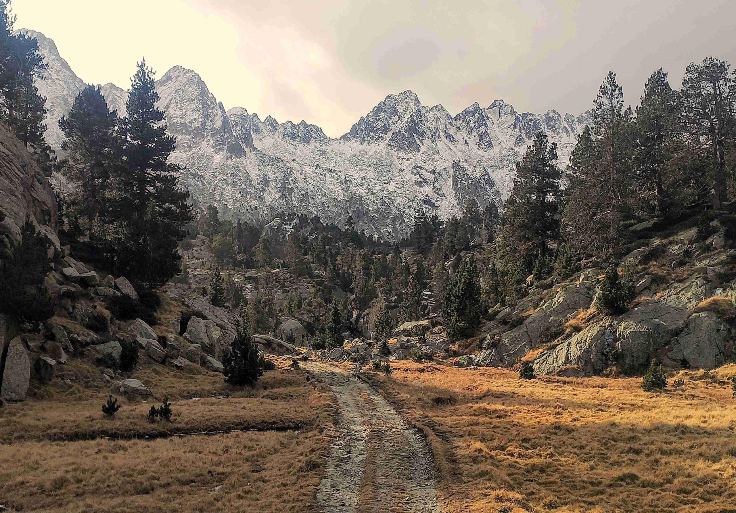
Soon the path becomes a track again, now in high mountain country as the tree coverage relents and the vistas become more expansive; a GR sign appears, pointing the walker straight ahead for the lake. Shortly afterwards, see the small Lladres lake on the left (which may be dry), where there is also a small dam. The track bears round to the right as views of the peaks and cirque ahead begin to beguile.
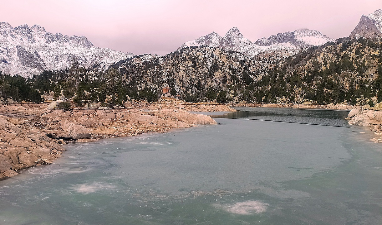
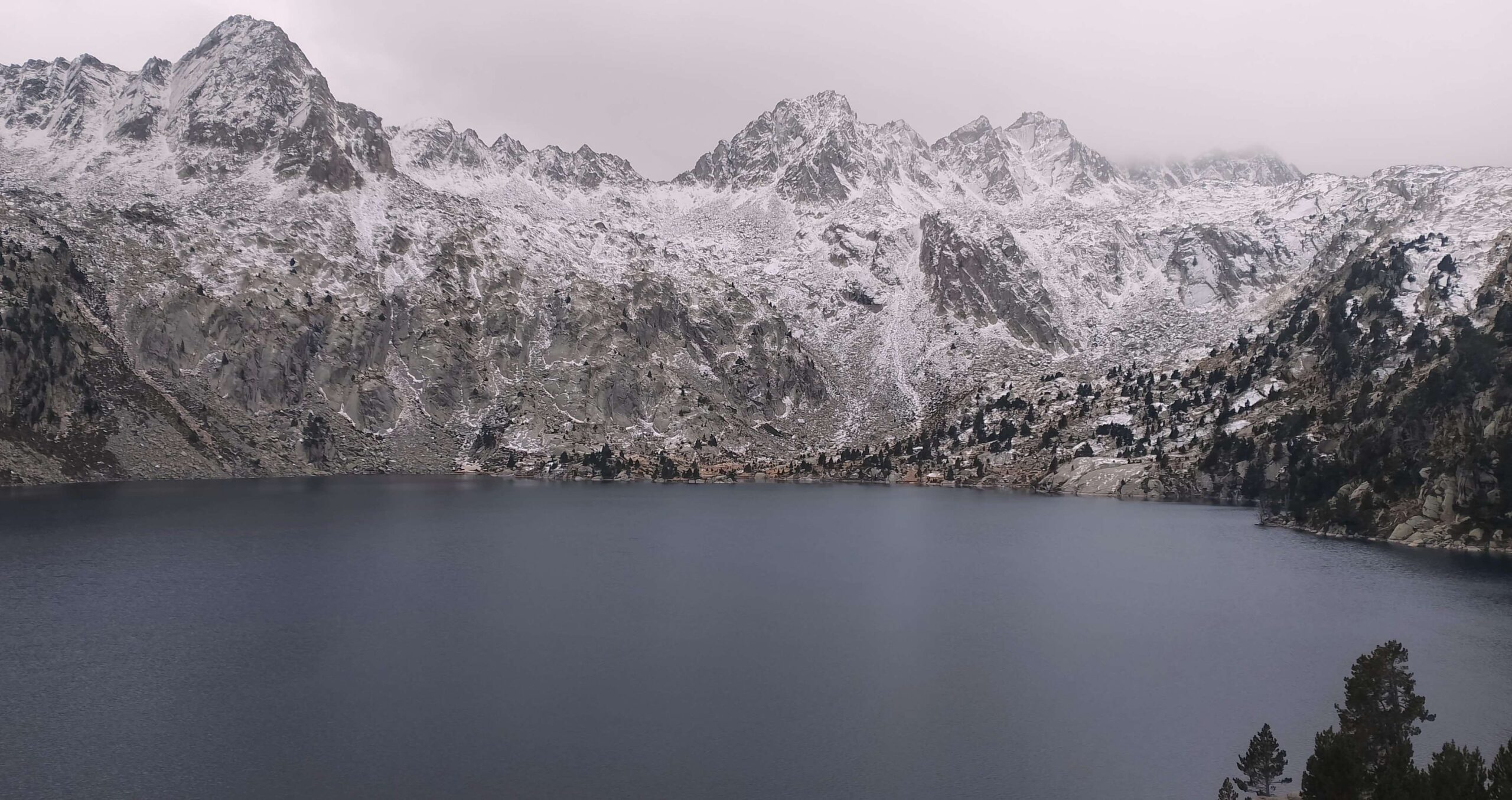
The track continues to ascend and emerges at the Estany Tort de Peguera lake, with Josep María Blanc refuge on the far side of it. The track passes to the left of the refuge and covers the short distance to the shore of the Estany Negre de Peguera. Both the lakes have the Peguera name added on as there are other Estany Negre and Estany Tort not too far away.
After admiring the fantastic vistas from the shore of the black lake, it’s decision time – to continue exploring up the GR-11.20 towards the Saburó (also known as Capdella) pass, or turn back to return on the same path. Back in December, it started to snow so I had a quick shinny up the path to the higher ground, before turning round for the descent to Espot.

Recent Comments