
Another approach from the south to Aigüestortes i Estany de Sant Maurici national park is via the Vall de Boí. At the head of this valley, which feeds up from a point close to the town of El Pont de Suert, is the Cavallers reservoir. The wall of the dam, which is inside the national park, stands at 1,750 metres and the car park is just below it. The walks outlined here start from this spot, which is a terrific launchpad for hikes and is near the highest summits in the area, the Pic de Comaloforno (3,029 metres) and the Besiberri Massif with two peaks over 3000 metres.
There are advantages to starting high, particularly in the summer. It is usually cooler but it is still essential to set out as early as possible in the hotter months to enjoy the shade cast by the towering peaks. There are a number of passes which can be reached at heights of over 2,500 metres offering stupendous views of vast areas of the Pyrenees mountain chain.
Back down at lower levels in the valley, there are villages which offer campsites, hostels and hotels. I stayed at the campsite in the village of Taüll (also Tahull), called Camping Taull, www.campingtaull.com principally because it stands at around 1,500 metres, with the luxury of cool nights in the summer heat. The old heart of the village is very picturesque. However, new apartments have been built to feed the nearby ski resort, which has brought in weekend residents from Barcelona and led to a bumping up of prices and a certain elitism in some establishments. I found the village of Boí (also Bohí), which is just below Taüll, to be more reasonable and a better place to eat and enjoy a drink.
The spa hamlet of Caldes de Boí, which is at the very top of the valley – just before the entrance to the national park – is probably the most picturesque spot to stay in, as well as perhaps the most expensive. Options can be viewed at www.caldesdeboi.com
This is the closest area to the walks, perched on the banks of the mountain river – but a little out of the way if you enjoy walking to other establishments and restaurants. Many of the accommodation options in the area can be viewed via booking.com
It is very useful to have a map to view the routes and to have as back up in the event of problems. I used the Editorial Alpina’s 1.40,000 scale Val d’Aran map which only shows the area to the north of Cavallers reservoir – but includes all the walks highlighted here.
The walks
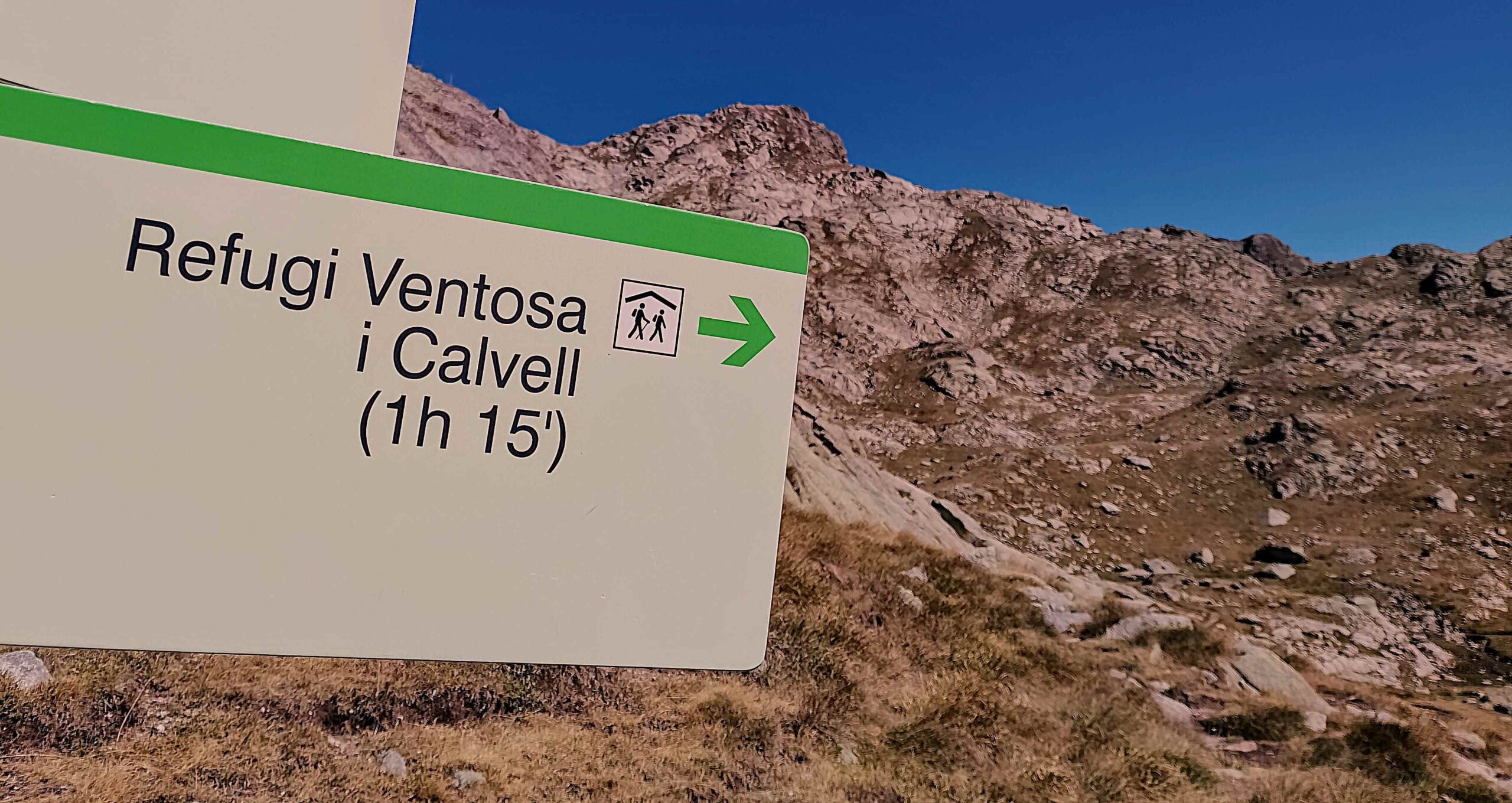
Setting out from Cavallers reservoir at a height of 1,750 metres, the walker has a well-trodden route to follow to the mountain refuge named after Joan Ventosa i Calvell (signposted as Ventosa i Calvell). It is only 4.4km with a height gain of 350m to reach the refuge at 2,215m. The footpath is well signed with posts which have yellow tops and the occasional signpost. However, it will take between two and three hours to reach it. This is due at first to the lumpy walking along the banks of the reservoir, where there are numerous boulders to negotiate. Once out of the boulder fields there is a short and pleasant section across the Riumalo flats – a lovely area of pastureland, with the footpath running alongside a mountain stream.
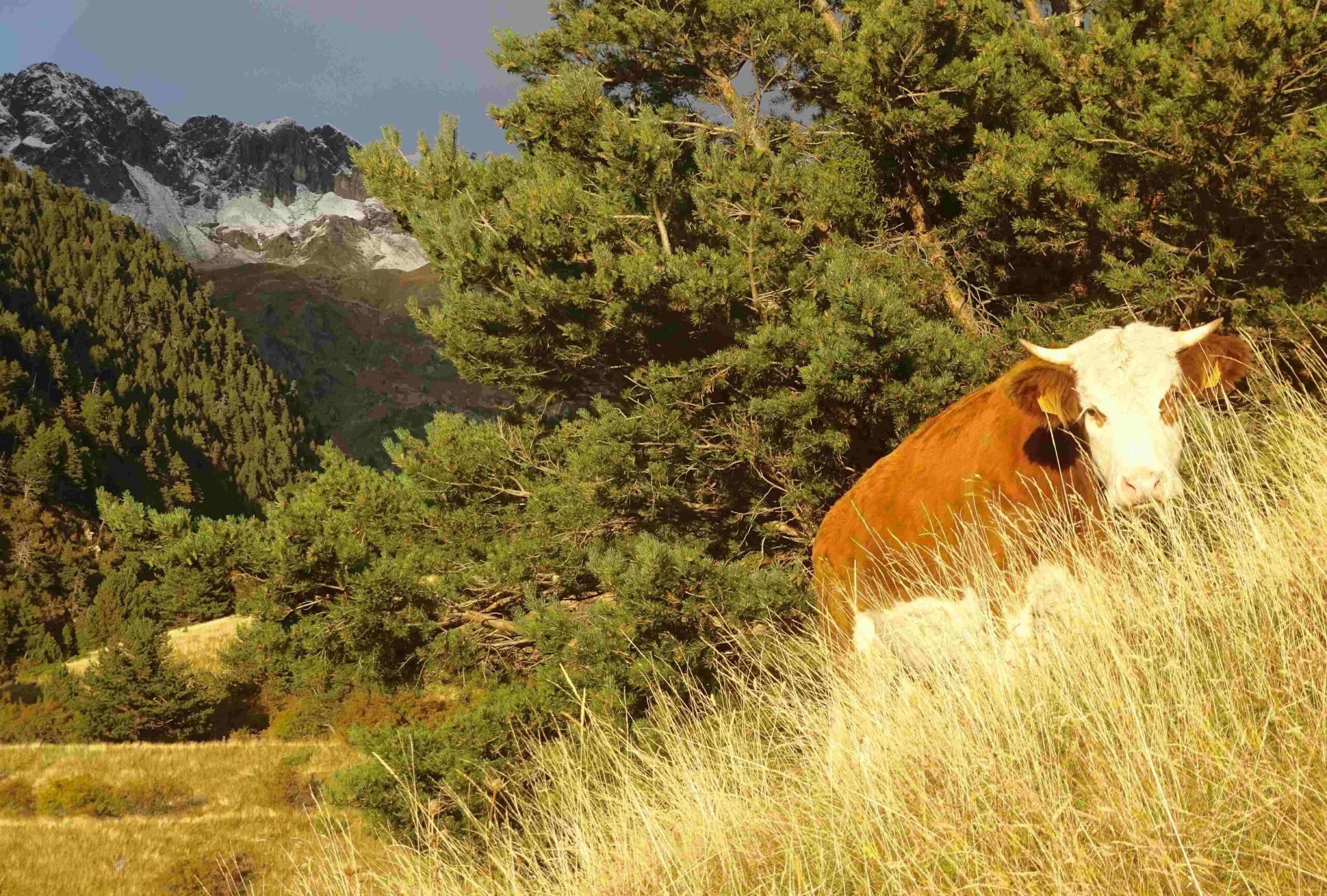
Then the main climb starts to the refuge. This is a spectacular ascent, following – and crossing on many occasions – the mountain stream, with intermittent waterfalls. Much of the climb is on giant slabs of rock which are easy to walk on and grip with good shoes. There are several sets of stepping stones over the stream in various spots, which are great fun to cross. The path doglegs to the right after a waterfall. Take care to cross the stream soon afterwards to ascend to another dramatic section over expansive rocks. Once the rock relents, the greenery returns and the pastureland is manna from heaven for the cows who munch their way across it, keeping cool in the summer as well as having a never-ending supply of food.
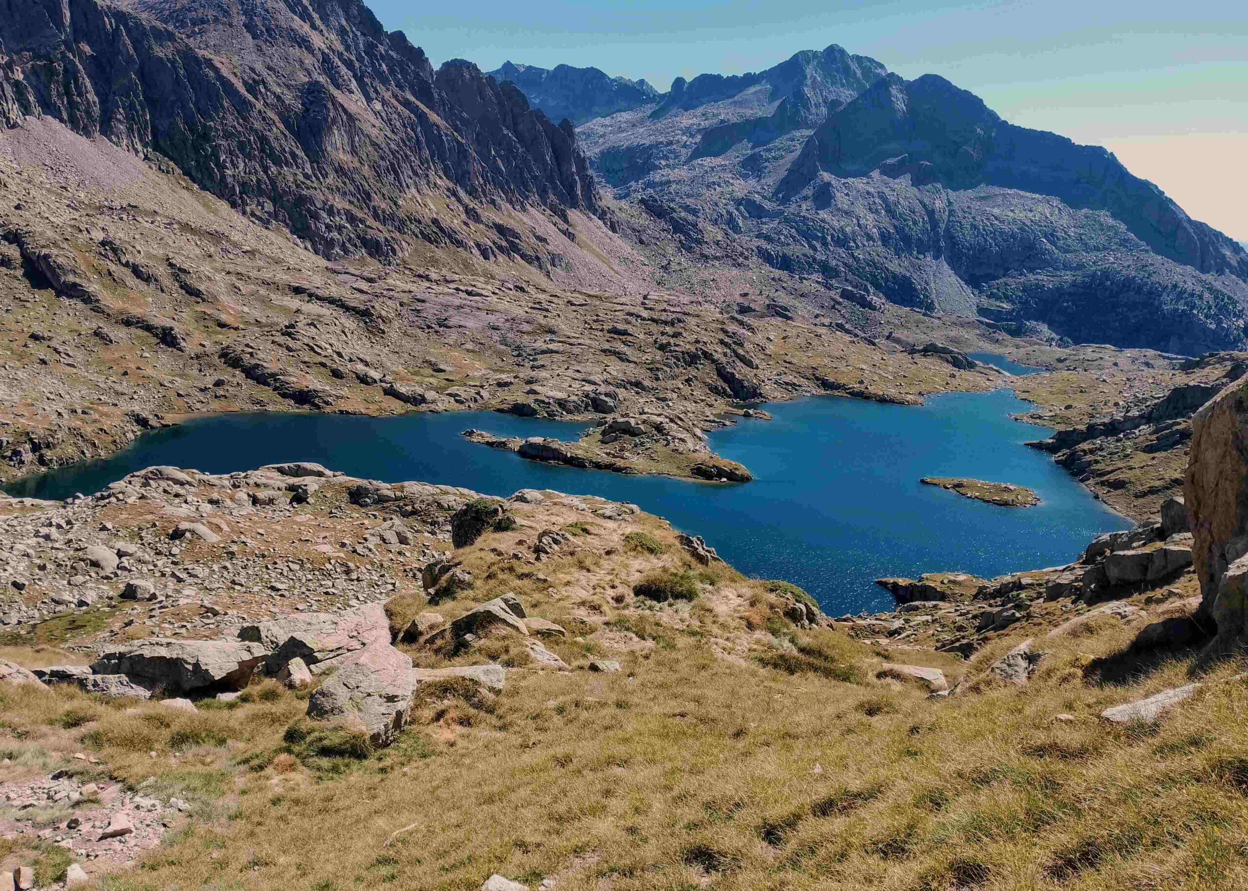
As the path rises, walkers will have a first view of glacial lake below them, on the right-hand side of the path. This is the Estany Negre (black lake). Up ahead in the distance is the mountain refuge. A double set of stepping stones leads to a confluence of paths. Turn left to head up to an area which contains an array of glacial lakes, with two mountain passes to aim for, as well as the GR-11.18 footpath. Or head straight on for 100 metres to the refuge where there are spectacular views over the Estany Negre and the start of a fantastic route up towards the Contraix pass (2,749m). Some walkers will be happy to put their feet up at the refuge for an hour – and perhaps order a drink and snack, while admiring the views – before heading back down to the car park on the same path.
For the first walk towards the GR-11.18, we turn left immediately after the stepping stones. Now inside the national park, most of the signs point for mountain refuges. This path heads towards two of them which are situated on the GR – Restanca and Colomers. Our route is well trodden and follows marker posts. It leads up to a wide undulating plateau which is home to several glacial lakes. The path passes along the right bank of a small lake and then the larger Estany de Travessani. The plateau is grassland where cows feed but is also rocky, which slows progress in places. In a little over a kilometre, the path forks. It’s left for Restanca and right for Colomers. Both routes lead to mountain passes which will probably be the end point of the walk for all but the most adventurous.
On the first option (the right turn), the walker will start a relatively steep climb of around 250 metres to the Port de Caldes pass at 2,568m. It isn’t always easy to follow the marker posts but persevere and bear in the mind that the pass is on the right-hand side of the ridge. Eventually the path passes over the ridge, where it joins the GR-11.18, descending for a few metres before heading up a short distance to the pass. Here, predictably there are achingly beautiful views over vast swathes of the Pyrenees. The options are to retrace your steps, or to head towards Restanca refuge on the GR-11.18 to reach the Port de Ruis pass. I took the latter option but even at the beginning of July there was still snow in places. Going down wasn’t a problem – in a ‘glissade’, sliding on my backside. However, I didn’t much fancy the ascent the other side in the snow, so cut back across to the original path over the undulating open country.
The second option from the original sign down below is to head for the Port de Rius pass (2,475m) on a marginally easier path. This passes a couple more glacial lakes before ascending to the pass to meet the GR-11.18. Again, there are options here. Return on the same path, or take the GR-11.18 on the rollercoaster ride across to the Port de Caldes pass. Much will depend on snow or no-snow, as well as the weather conditions and energy reserves.
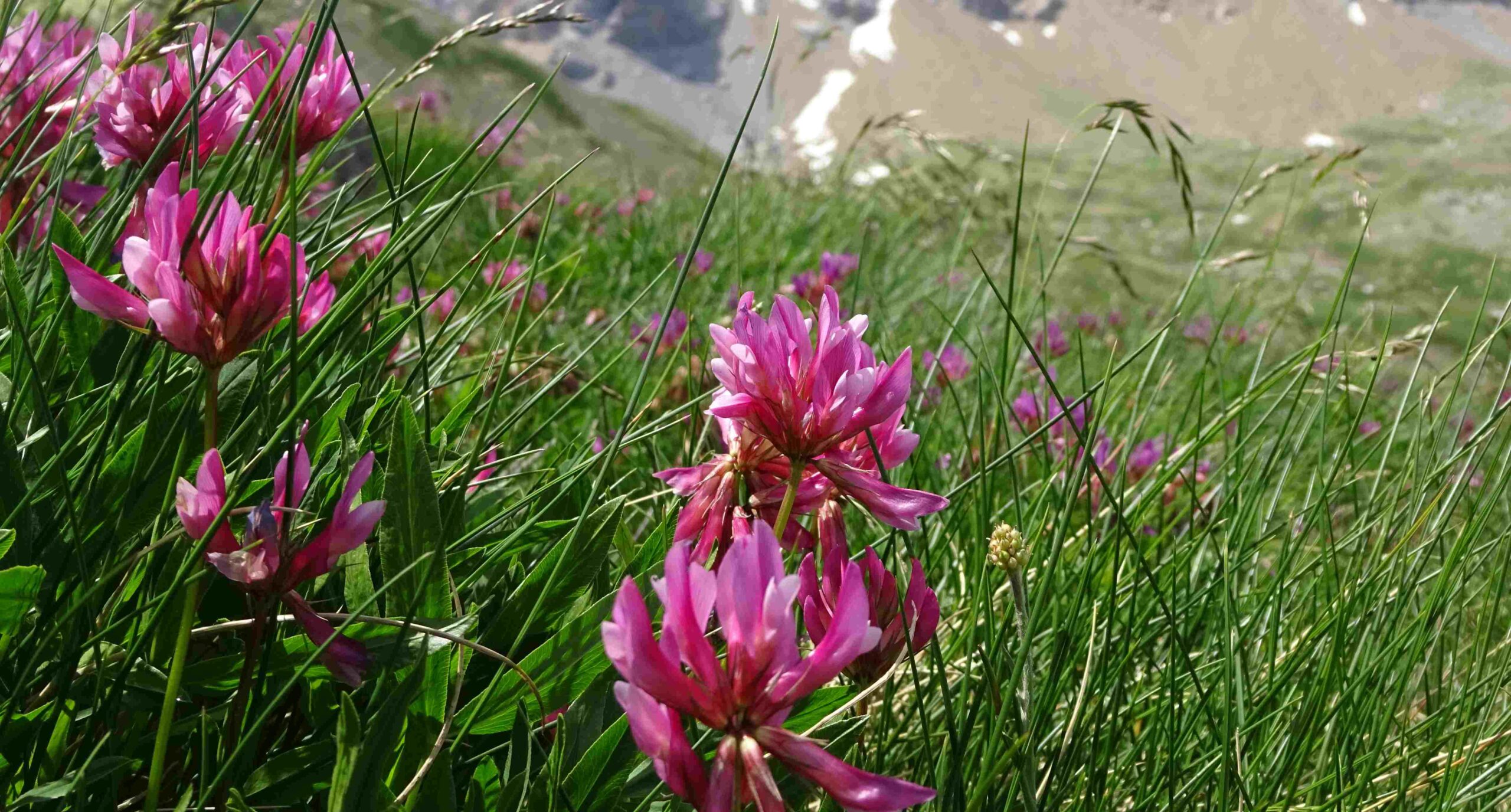
The walk up to the Contraix pass at 2,749m is a joy in early summer. As well as the enormous scale of the mountains and the epic views stretching for vast distances, it is the vivid and varied colours – the deep green of the grass and pines, the pink of the mountain flowers, the blue of the water and sky – which melt the heart of the walker. Water is the main protagonist, with the path passing from glacial lake to glacial lake – and, in between, following the gushing streams and waterfalls which are fed from the snowy summits.
Immediately behind Ventosa i Calvell refuge is a stunning view across the Estany Negre glacial lake. It is worth spending a few minutes at this wonderful vantage point before starting out on the path. The next couple of kilometres are some of the best you will ever walk. The initial section is through pine trees heading for the Estany de Colieto. The path keeps to the left bank, almost entering the water. Follow the posts with yellow tops which indicate the route. Past the lake, a series of terrific wooden footbridges criss-cross the lusty stream. Then the climb starts through grassy country with the pink mountain flowers in bloom in the summer.
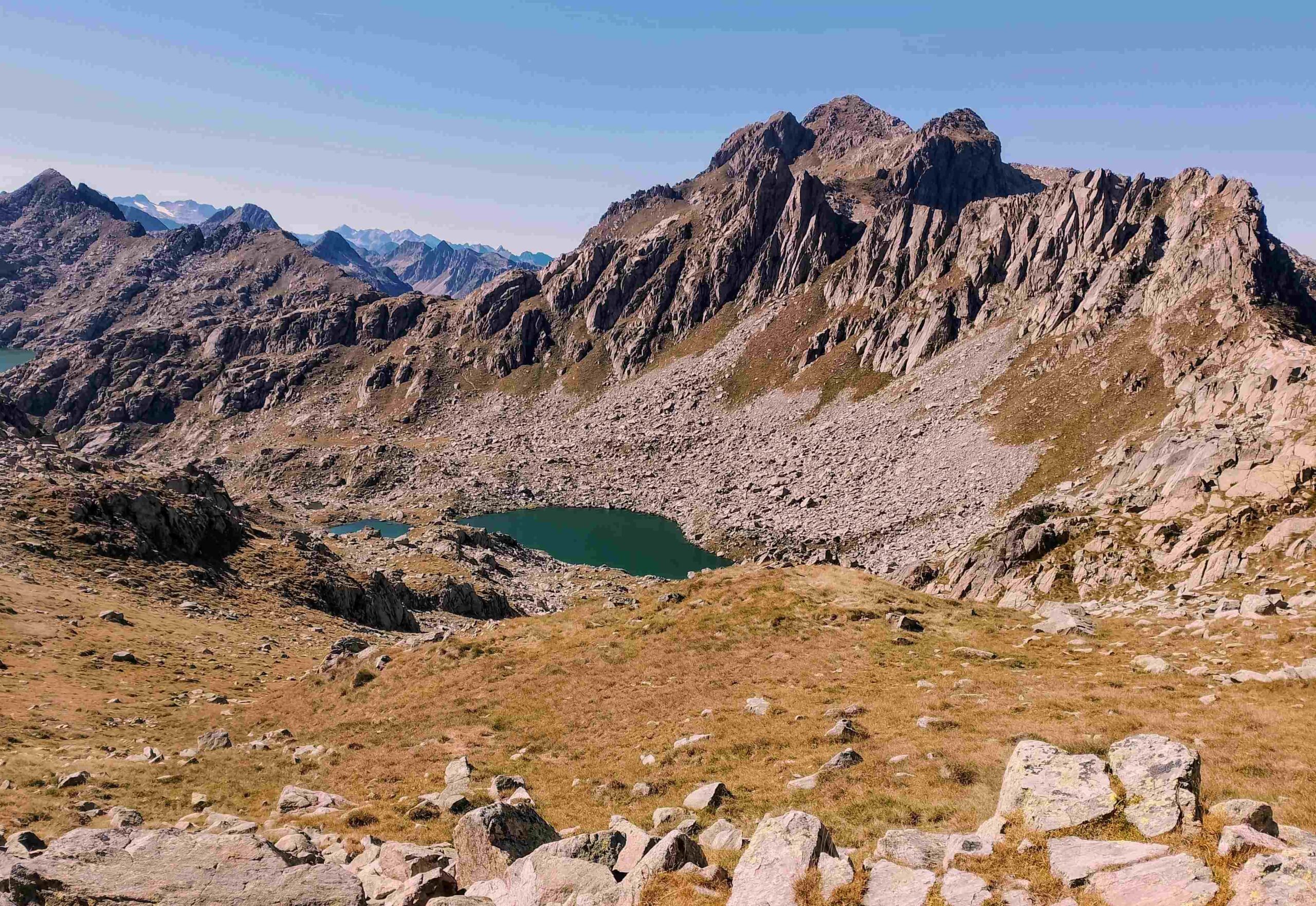
There is another bridge over the stream. Keep following the signs for Estany Llong refuge. The path ascends to the next glacial lake of Estany Gran de Colieto. This is another wonderfully grassy area. As the ascent continues the environment becomes more extreme. The grass begins to peter out at around 2,300 metres and rock takes over. There are a couple of stunning waterfalls which can be approached off the path.
The walker will now have to decide how high to go. It is worth persevering as the views become even more expansive. There can still be snow above 2,500 metres in early July. When I hit the boulder fields short of the pass, I decided to call it a day because I didn’t fancy the return journey on the snow-covered rock. The descent is on the same path which, unsurprisingly, really isn’t a hardship at all.
Recent Comments