
This route takes in another landscape dominated by glacial lakes and ascends to the wonderful mountain area around the Port de Ratera pass, which is the high-point of the walk at 2,594 metres. It almost a round walk, with the path circling the Tuc de Sendrosa mountain (2,702m) and the long chain of peaks which form an elongated ridge. Our hike starts near the top of the Val d’Aiguamòg which runs south off the main valley in the Val d’Aran.
To get to the start point leave Vielha town on the C-28 road heading for Baquèira ski resort. Turn off right at Tredos (another place with accommodation) to drive through the village, heading for the Aigüestortes i Estany de Sant Maurici national park. The mountain road runs up the Aiguamòg valley and is quite steep in places which means it would be difficult in icy conditions. I parked at the Banhs de Tredos area at around 1,800m, but it is possible to continue on an unsurfaced track for another 3km to the next car park.
The walk
From the Banhs de Tredos, head south on the unsurfaced track for around 3km to reach the Montanheta bridge. Cross it and continue on the track. Shortly afterwards it is possible to turn off right and walk on a path which runs parallel to the track to reach another parking area. Here a sign tells us that we have come 3.9km from Banhs de Tredos (it’s a further 1.7km to reach Colomers lake and 5.7km to the Ratera pass).
Soon after, turn off left, following another sign pointing for Colomers. Now on a footpath, it’s a well-used route which has boards to help the walker traverse marshy sections. Pass a small lake and cross a wooden footbridge to reach a path which runs alongside a dry stream bed, going uphill through the pines.
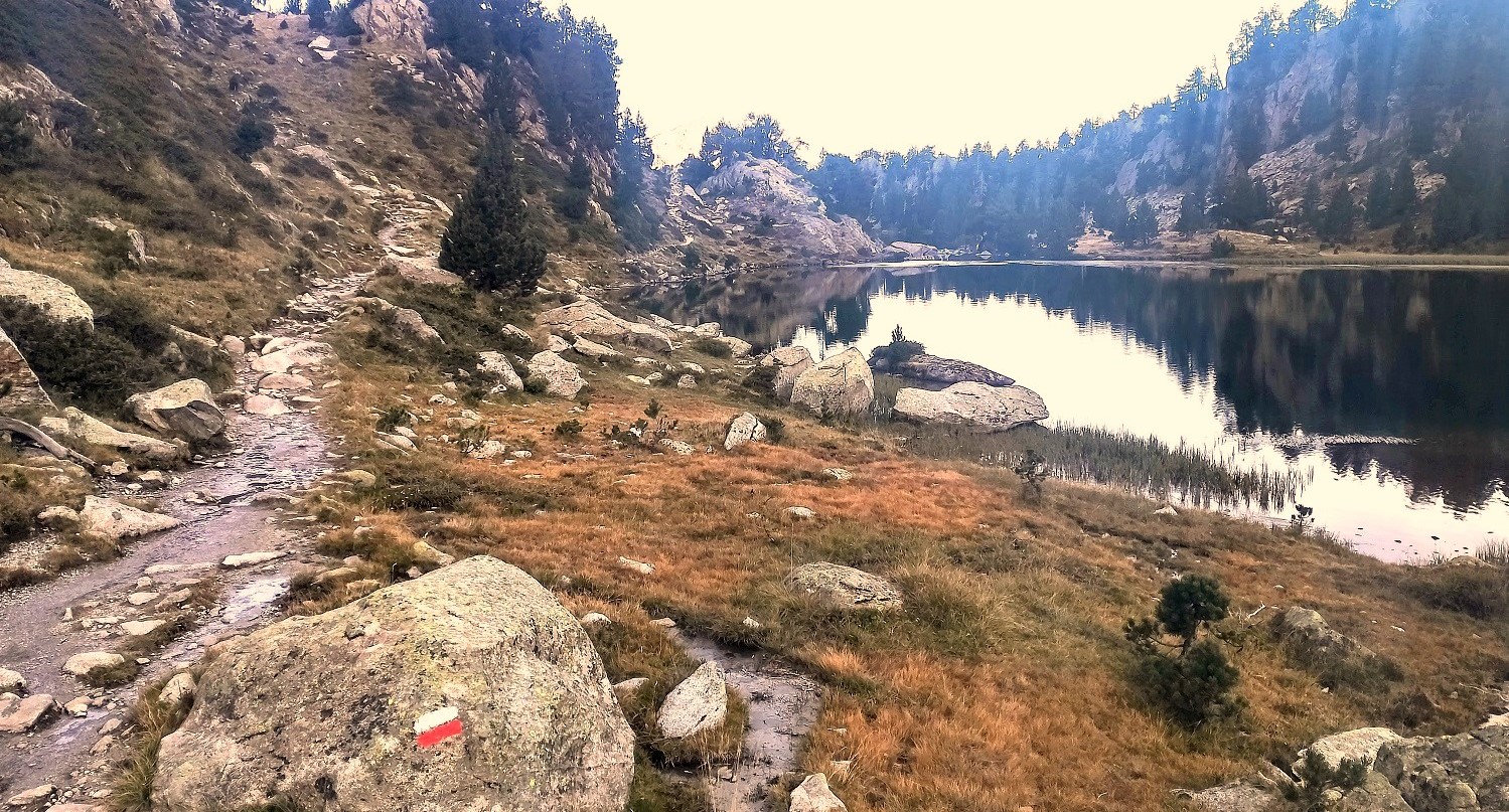
At the next sign head for Refugi d’Amitges, which is left – don’t turn off right to walk to Colomers refuge, unless you really want to. The ascending path heads away from Colomers lake and dam; now on the GR-11, the red/white waymarks appear to help with orientation. Stick on the GR-11. It’s a steady climb. The next sign is 5.4km from Banhs de Tredos – here keep straight on, heading for Refugi d’Amitges. It’s around 100 metres to reach the first spectacular glacial lake of the day, the Estanh Long. This first section of the walk is 5.5km, with around 400 metres of ascent.
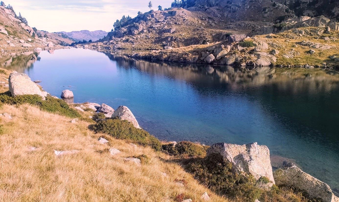
The path along the shore of the Long lake is a joy. The GR-11 follows the right bank, with the signs still pointing for Refugi d’Amitges. The Estanh Long runs into the smaller ‘round’ lake – the Estanh Redon – still following the right-hand bank. There is then a lake-free section of a less than 1km as the path ascends to the Estanh Obago, another wonderful product of the area’s glacial past. The path follows the right-hand shore there too.
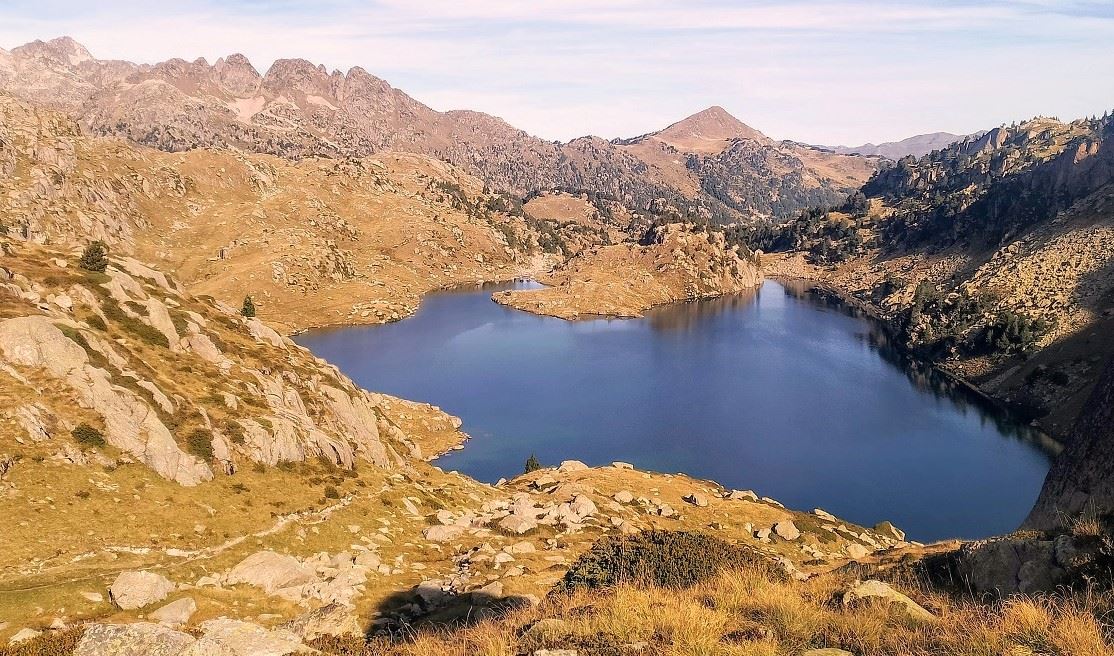
Towards the end of the lake a sign notes that it’s 2.6km to Ratera from this point. There is a small metal footbridge over a stream. Following the GR waymarks, the path then starts the long ascent to Ratera. In places it is fairly steep, in others less so. The spectacular views allow for very scenic rests. Take time to look back over the glacial lakes on the ascent, it is one of the most spectacular views in the Pyrenees.
Eventually the ascent comes to a flatter area with strewn boulders; cross it, to embark on the final section up to the pass. The wide, high-mountain area (an undulating plateau) that encompasses the Port de Ratera is one of my favourite spots on the planet. The rolling grassy land sits between peaks which reach up towards 2,900m, with quite incredible views at every turn. While crossing it notice the sign for Refugi de Saboredo. Our route turns off the GR-11 at this point to follow the GR-211.4 long distance footpath to the Saboredo refuge. But before walking away, it is worth having a proper explore of the Ratera area. It is quite awesome. It is also home to my favourite glacial lake of them all – one which does not have a name, but which sits at nearly 2,600m looking out over jagged peaks and an infinite blue sky (if you are lucky). This section of the walk from the Long lake covers approximately 4.5km, with around 450m of ascent.
Follow the signpost at the pass pointing for Refugi de Saboredo, now on the GR-211.4. It’s a terrific descent, with no fewer than six glacial lakes in the area below to gaze over. After passing the first cluster, the path reaches a stream, then it’s on to the Estanh deth Miel lake, before the path bears right to run to the Saboredo mountain refuge. Walkers wanting to break up this long day could stay overnight at the refuge. The sign at the ‘refugio’ tells us that the Sendrosa pass is 2.2km away. It’s a left turn for Sendrosa, leaving the GR-211.4.
Now the walker is away from GRs, the orientation is a little more difficult. The path cuts across a flattish area, and keeps to the right of the Baish glacial lake. It’s pleasant and grassy until the path reaches an area of large boulders. Cairns are in place to guide the walker across. Fortunately this does not take too long. Once across, the path bears to the left to start the ascent to the pass and the walking becomes a lot more pleasant again. The path rounds a bend and the pass is in sight. The ascent is not too steep by Pyrenees standards and soon the walker is standing at 2,451m, admiring yet another sumptuous view over a vast swathe of the mountain chain.
The descent is the return to the valley where the car is parked. Now there are white/yellow waymarks in places to help. The path drops down to a flat area. Here there is another signpost. Our route is turning off right, heading for Banhs de Tredòs, which is 4.4km away. Cross a stream, pass through boulders and then the path becomes clearer and there is a white/yellow waymark on a rock. The route heads into an area of pines and emerges later at the road which was ascended at the beginning, around 50m from the Montanheta bridge. At the road bear right and follow it back to the parking spot.
This last leg of the walk is approximately 10km, with around 250 metres of ascent. The total length for the whole day’s route is approximately 20km, with 1,100 metres of ascent.

Recent Comments