
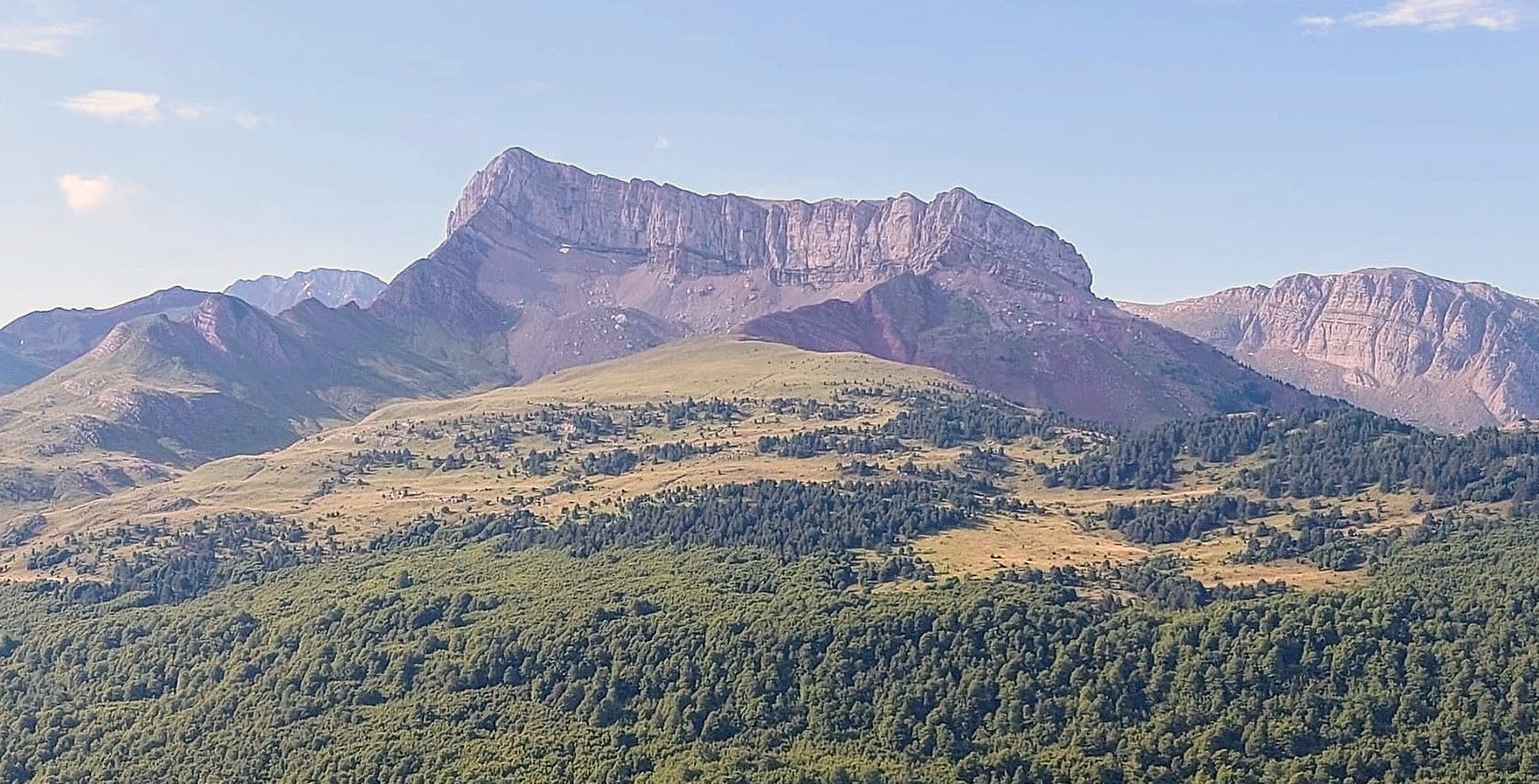
Like a famous mountain in the south of Spain named after a fortified structure, the Castillo d’Archer (Archer’s castle) looks impossible to climb from many angles. However, every castle has a gate, and – in the same way that the summit of Alcazaba (the fortress; 3,365 metres) in the Sierra Nevada can be reached via a back-door entrance – the walls of Archer can also be breached via a circuitous route from the rear.
The Castillo d’Archer is an elongated mountain with several peaks; the main summit standing at 2,384 metres. The ridge atop the vertical rock walls seems to be razor sharp but, as is often the case, views from down below are deceptive. There is a wide, open area up at 2,300 metres which gives a very easy and enjoyable stroll up to the summit. The difficult section comes directly before it, with a very steep ascent up a scree slope. Archer gets a lot of human traffic and it is this footfall that has led to erosion on the path. Great care has to be taken on this scree section, particularly on the way down. Otherwise, the route is a very enjoyable one and the views from the summit are extraordinary.
This route starts from the Selva de Oza campsite, measuring around 14km in total, with the return on the same path (7km each way). It’s not a long one, but with around 1,400 metres of ascent there is plenty of climbing to do. Allow at least six hours to complete the walk. The scree slope means the route is only advisable for experienced mountain walkers. However, there is an alternative. The walk up to the start of this slope is very pleasant and the views from that point are fantastic. The shorter version goes up to a height of around 2,000 metres. With the campsite situated at an altitude of 1,150m, this is also a reasonable climb.
The walk
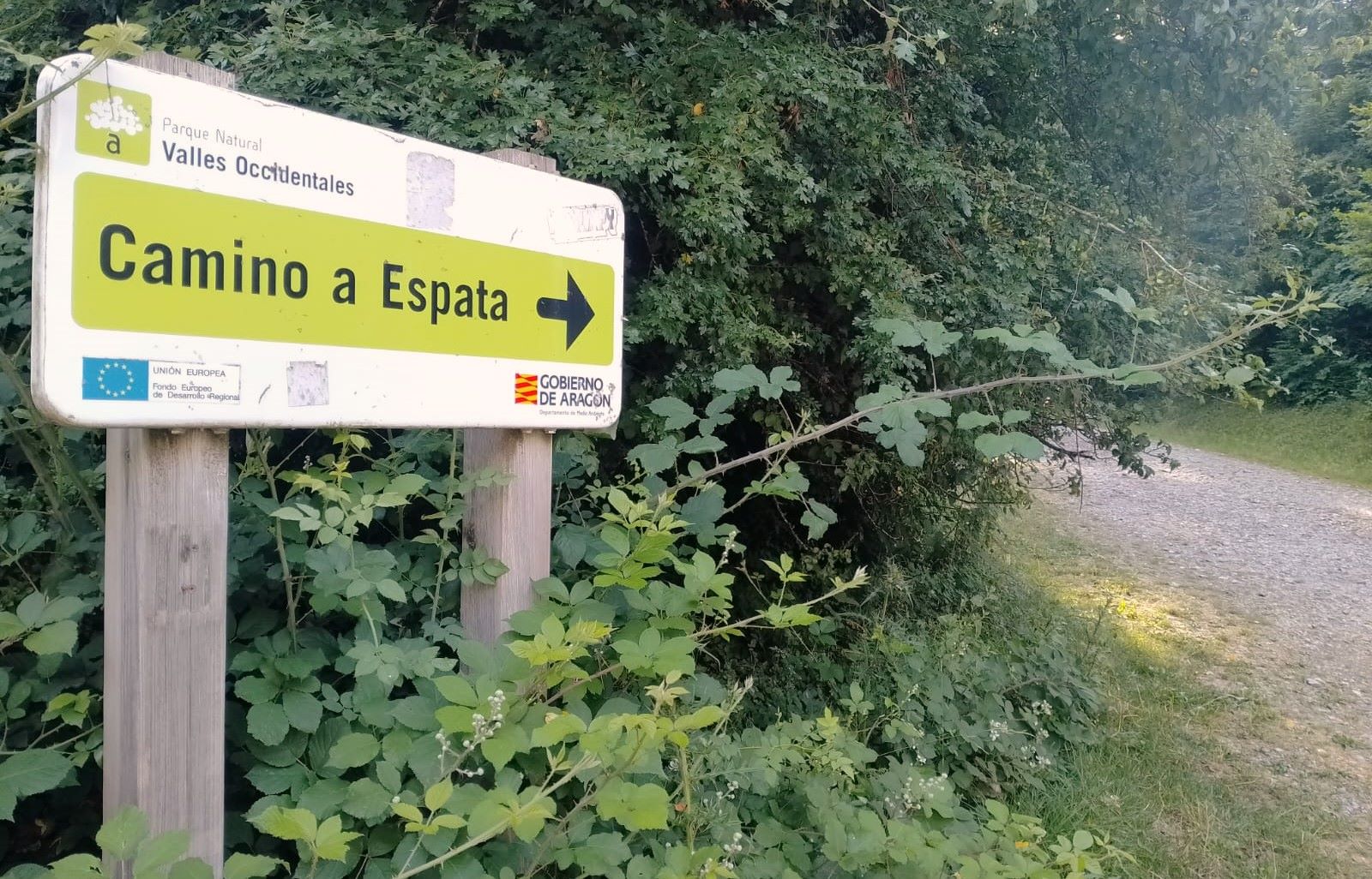
The start point is the wide track opposite the entrance to the campsite. Follow the sign which says ‘Camino a Espata’, with the Barranco de Espata being the forested ravine that the path negotiates. The ascent is gentle at first, with the deciduous trees providing welcome shade for most of the day. The track swings round to the right and continues through the trees. It leads to a sharp bend to the left. Notice the sign which points to Castillo d’Archer. Turn left to follow it, now on a path which heads up into the forest on a steeper slope.
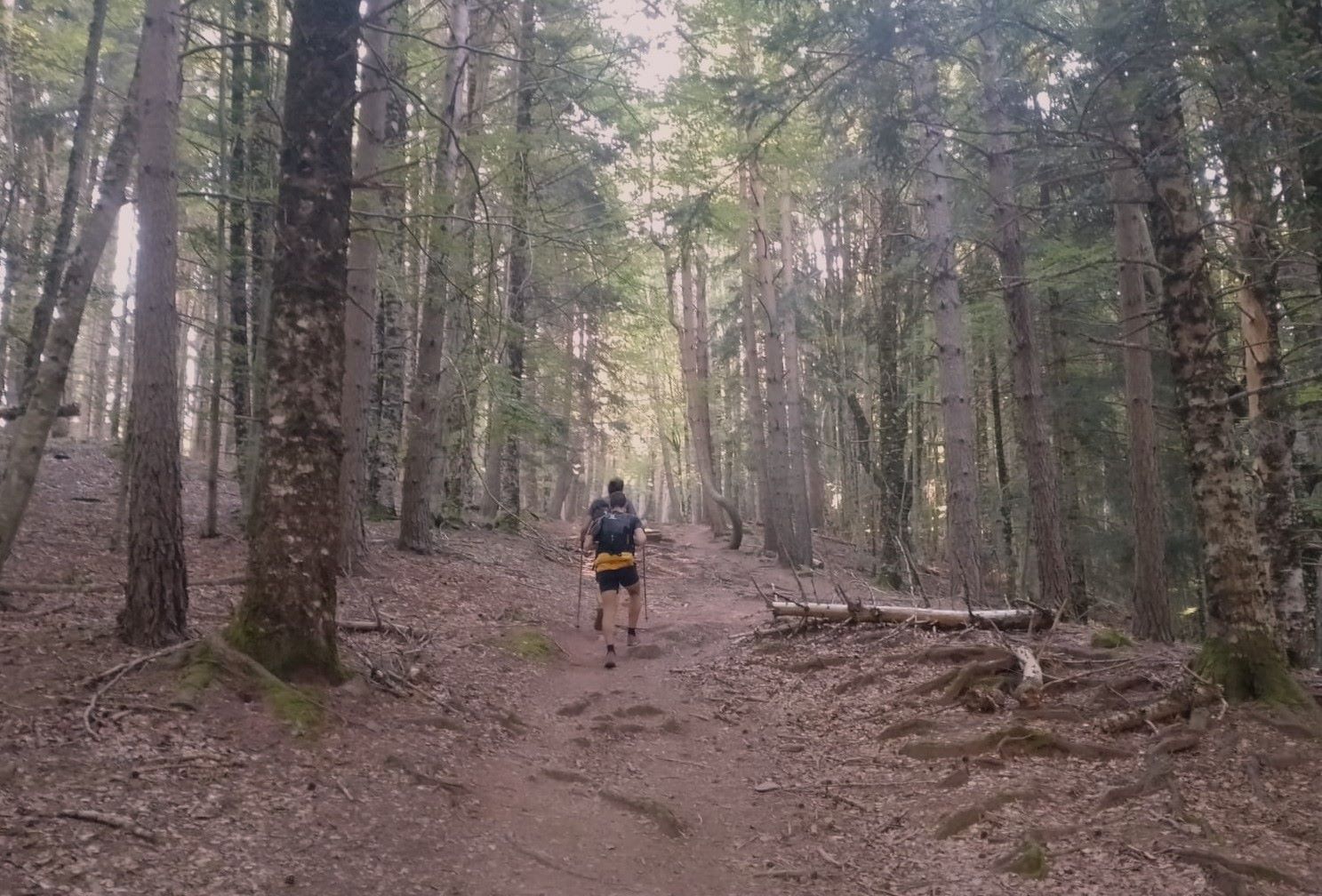
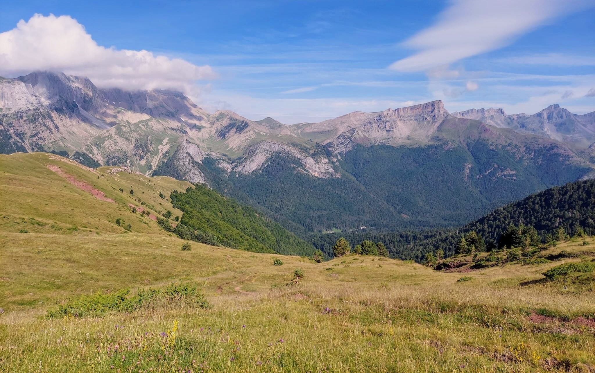
The path continues through the trees, a shady ascent, with the overhead cover very welcome on the return leg. It emerges at the ravine’s dry stream where winter avalanches and torrents have brought trees crashing down. They do not affect the route and the path crosses with no impediment. It is quite a steep climb, still in the forest. The path arrives at a steep slope, which is partly grassy but has also been eroded by the elements and the passage of cows. After negotiating this section, emerge at a wide, inviting grassy slope. The route goes straight up it. There are expansive vistas of the surrounding mountains.
Take care to notice the point where the path bears left. There is a short traverse across the slope to the left, before the ascent continues. It’s grassy again and very pleasant. The path continues up to the left turn, where the ascent to the summit begins. Some walkers may choose to stop here and go back. At first the summit route winds its way up and across a slope which is partly grass. It is steep but enjoyable.
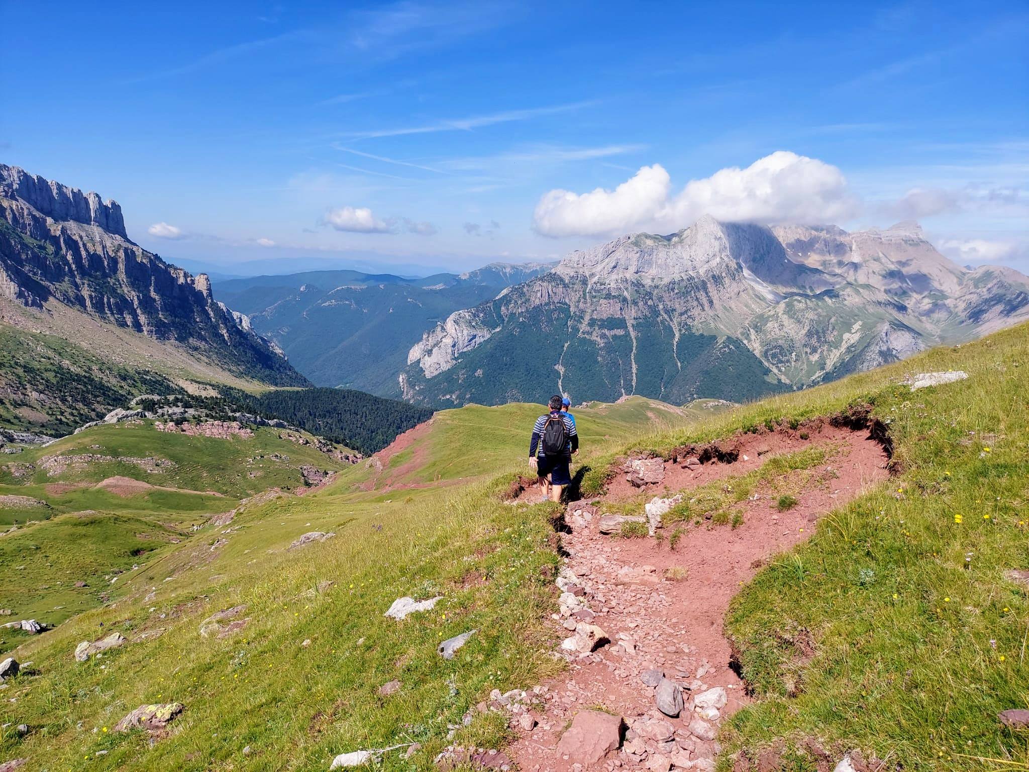
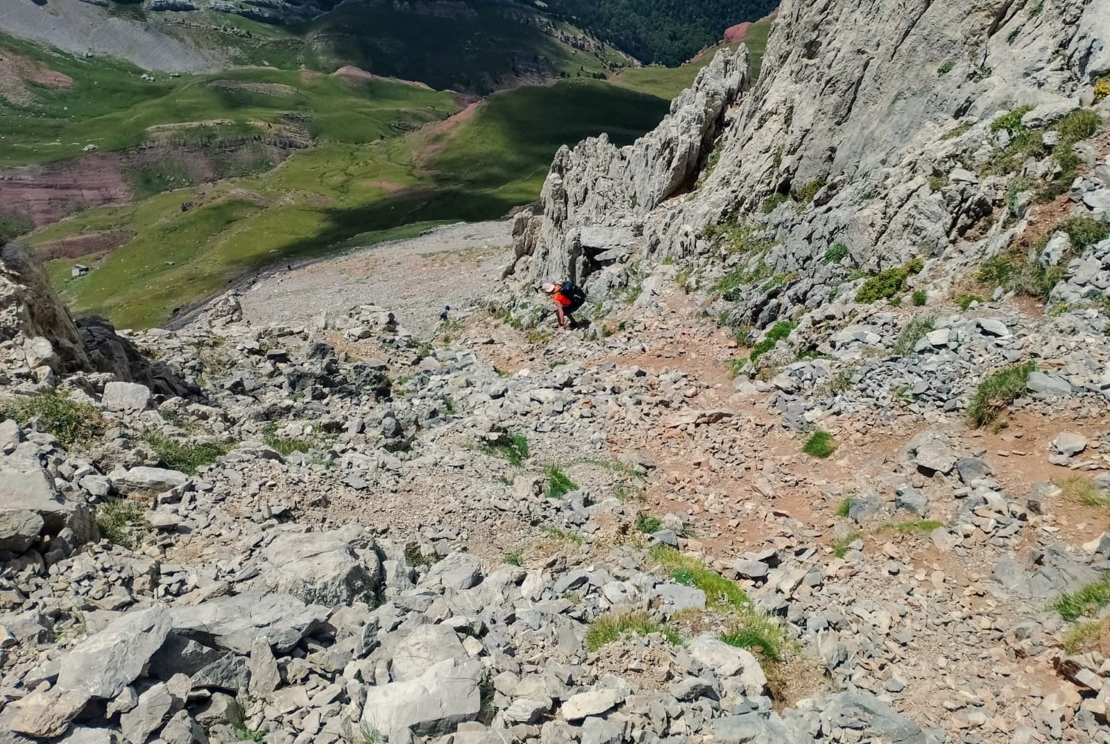
The second part of this section sees the path negotiating an eroded scree slope where there is a lot of loose stone and rock. Extreme care is needed on this section. It is very easy to cause rockfall (or stone fall) which could cause serious injury to walkers below. This means taking it easy, not rushing and planting the feet carefully. Even more so on the way down, when it is easier to slip.
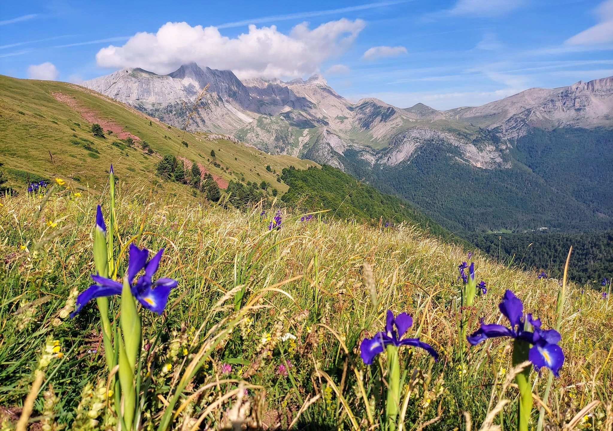
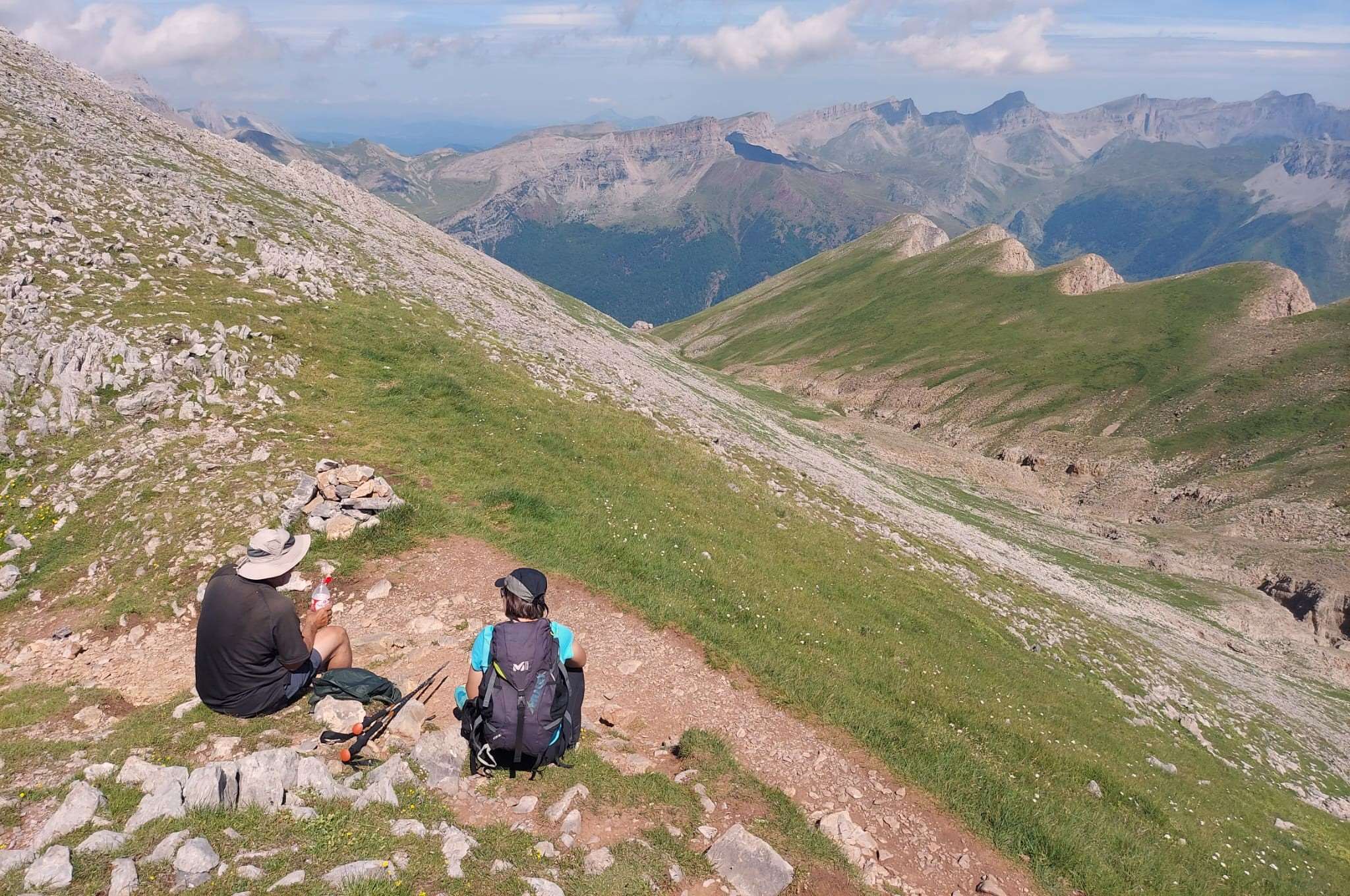
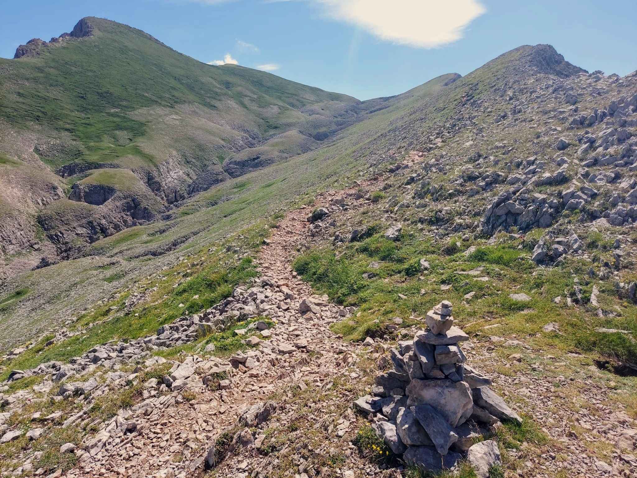
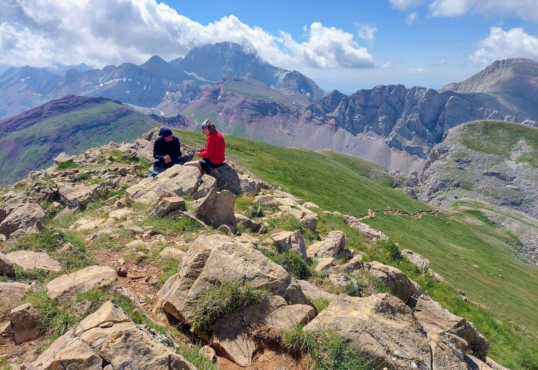
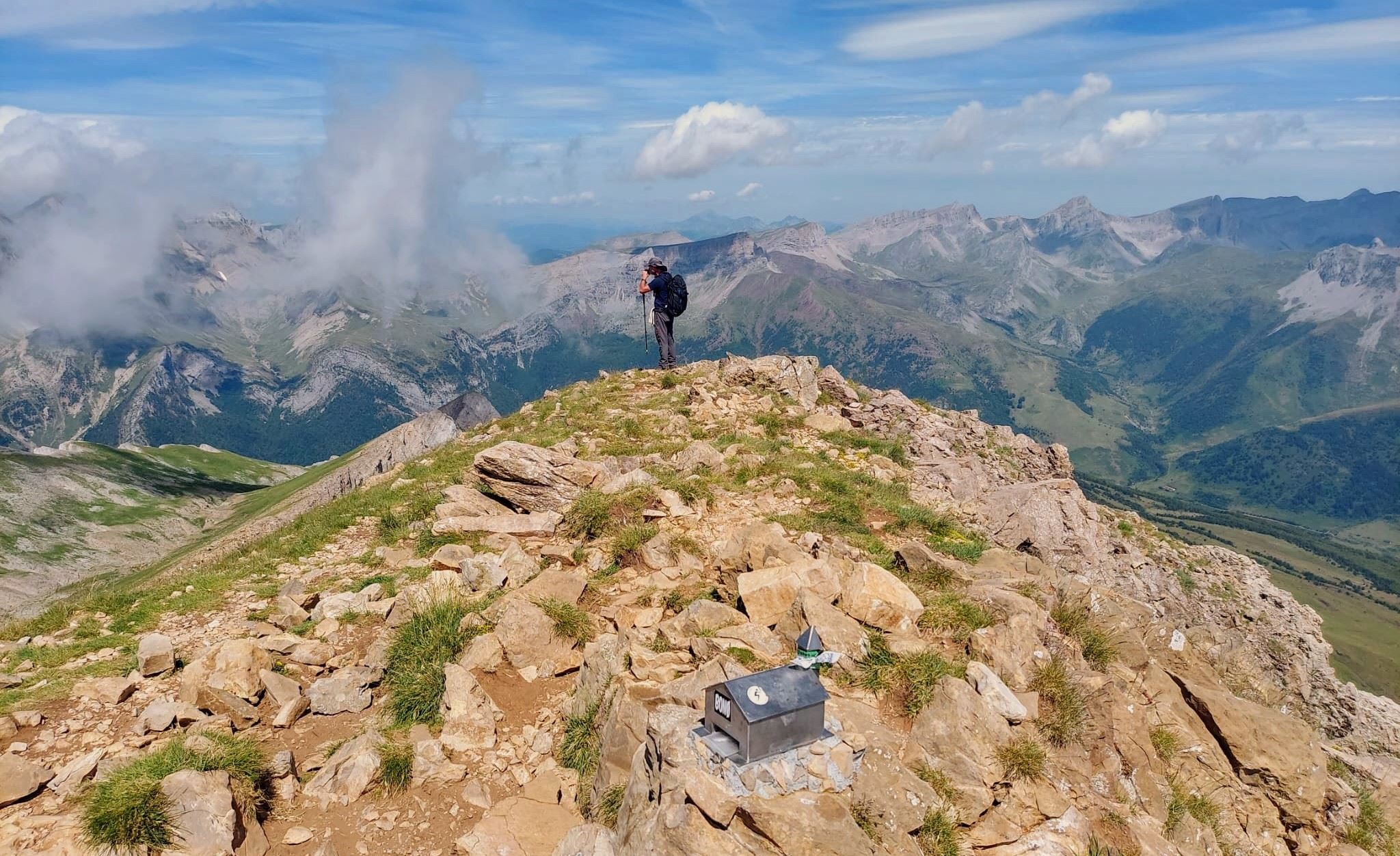
Several different paths have been created on the slope. They all head more or less straight up, leading to a gap in the rock walls above. The route goes through the gap and emerges onto the wide ridge, where there are panoramic views. At the gap, turn right to look along the wide ridge which leads to the summit. It is worth the effort to get up to this spot, just under 2,300 metres. The path runs below the ridge and it’s easy walking up to the right-hand corner, where the path veers left for the final short climb to the top.
There are wonderful views from the summit, which is actually part of a ridge. It is wide in the most part, but take care as fatal drops await off the northern edge. After indulging your thirst for Pyrenees mountain vistas, and having an amble along the ridge, it is time to turn round and head back on the same path. An early start is needed in the summer as after 12 noon the sun starts to make walking uncomfortable at lower levels. However, the shady trees help enormously towards the end.

Recent Comments