
Candanchú is officially a ski resort. But as it was inaugurated in 1928, it has become an established village over the last century and even has a small military base. It stands above the valley formed by the River Aragón and ice ages, with the historic city of Jaca at the bottom end.
One of Candanchú’s attributes – as well as the incredible mountain scenery – is that it stands at around 1,550 metres. This makes it a sought-after destination in the summer for those in the know. While the Aragón valley below may be sweltering in the high 20s (°C), the village is likely to be four or five degrees lower – sometimes more – due to a peculiar microclimate and its position in an area close to the pass into France. Cooling winds often blow over from the north, which can also bring mist and fog. On a recent visit I made at the end of July when there was stifling heat in Spain, the drive up had been a sweltering experience with temperatures hitting 40°C in Zaragoza. But relief was at hand in Candanchú. The mist had come over from France and it was around 12°C when I arrived in the evening. The enormous pleasure this cooling vapour gave after passing through the roasting hinterland should not be underestimated.
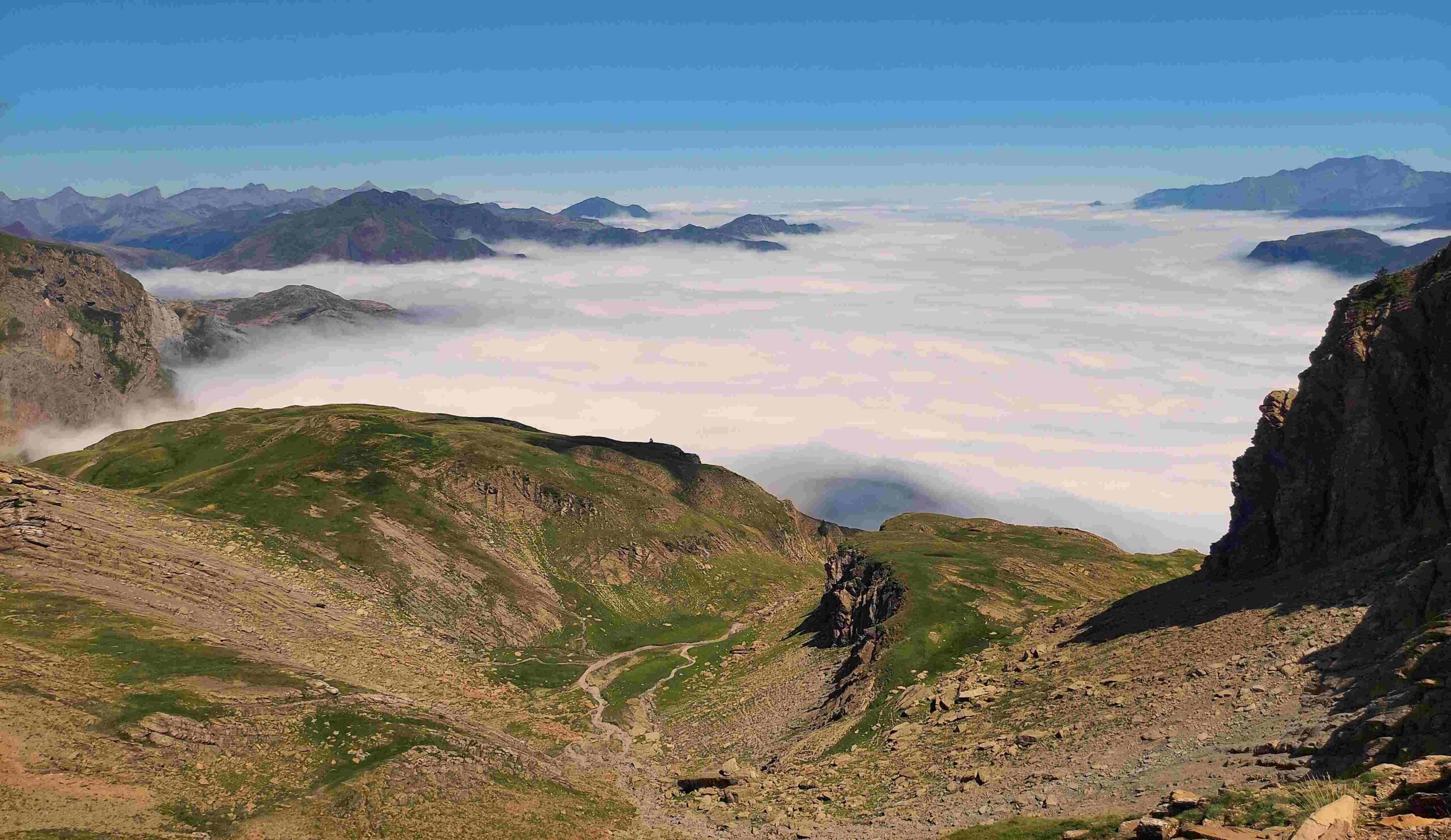
Mist came and went for the next three days, channeling up from France, but fortunately it was relatively low lying. Up at 1,900 metres, the walker was above the ‘clouds’ and in perfect conditions, a bit like being in a plane. Of course you have to be able to get to that point safely, which does imply having prior knowledge of the routes and a good map. I should point out that the mist is not a permanent feature.
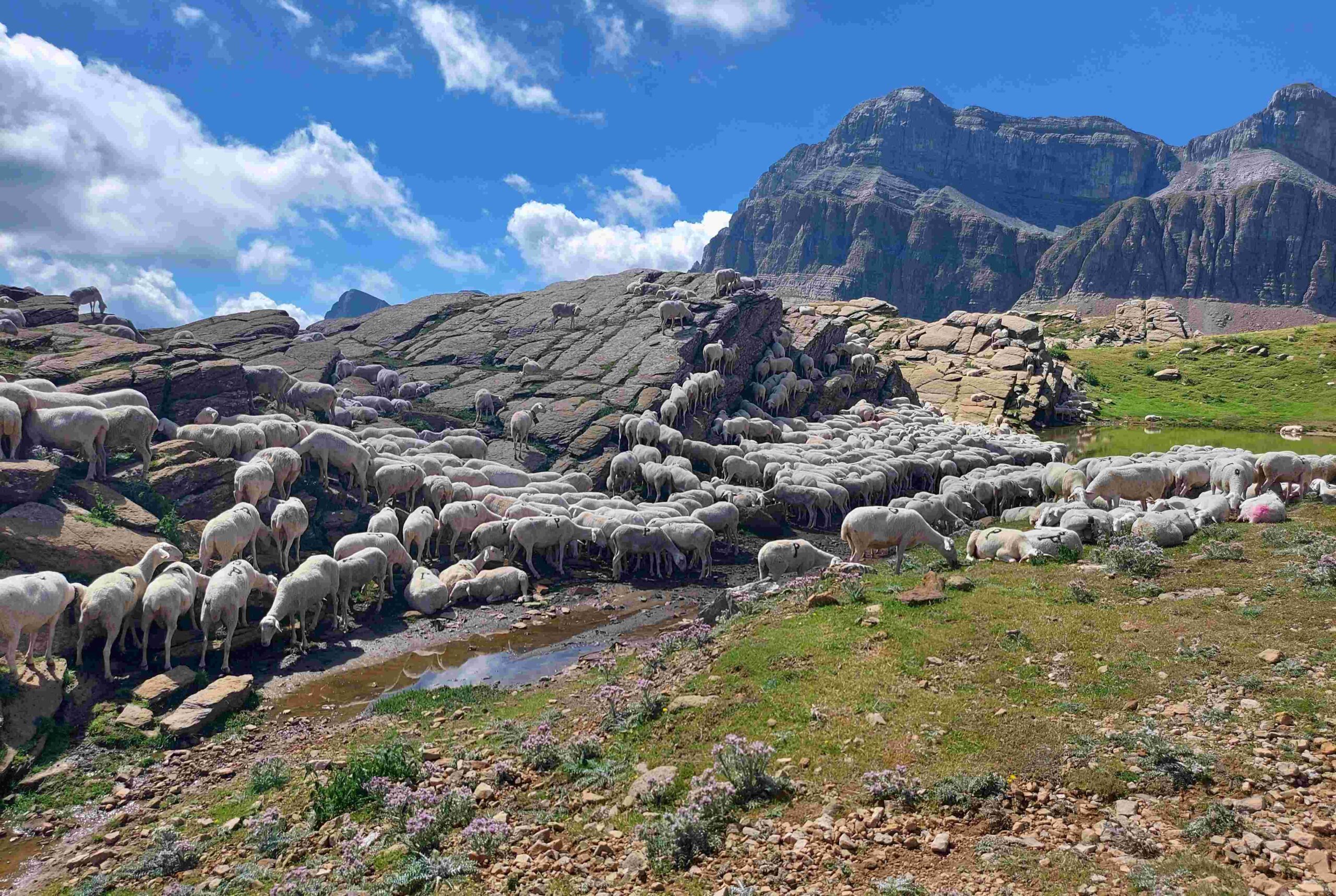
There are walks on all sides of the village. The newish route of the GR-11 arrives from Lizara refuge; the old GR-11 heads to (and from) the Estanés glacial lake. There are hikes to the north-east, up to Astún ski resort and along the meandering ridge above it which straddles the border, with an option of passing across into France. And the continuation of the GR-11 to the east heads up the Canal Roya valley to the Anayet lakes and summits. You will be spoiled for choice.
It should be noted that not everyone is happy that the old route of the GR-11 has been declassified. It’s a section of around 30km which takes in the Estanés glacial lake and strays into France for a couple of kilometres just outside Candanchú. The trail has been affected by erosion, but the damage is only on a very short section. Some walkers suggest that it has been done to reroute hikers via mountain refuges that need the business of the GR-11 trade. However, it has to be said that the new route is definitely more spectacular and is an absolutely terrific walk. One of the best stages on the GR-11.
The Editorial Alpina map entitled Valle de Canfranc shows dozens of options for walks. As well as the routes, it could save your life in an emergency. They can be bought in local stores or online at https://www.editorialalpina.com
As ever, a proper peruse of state weather agency AEMET’s website at www.aemet.es is advised before visiting to know what to expect. The nearest municipality for weather reports is Canfranc but bear in mind that it can be at least four degrees cooler up in Candanchú, and it may not show fog at the higher location.
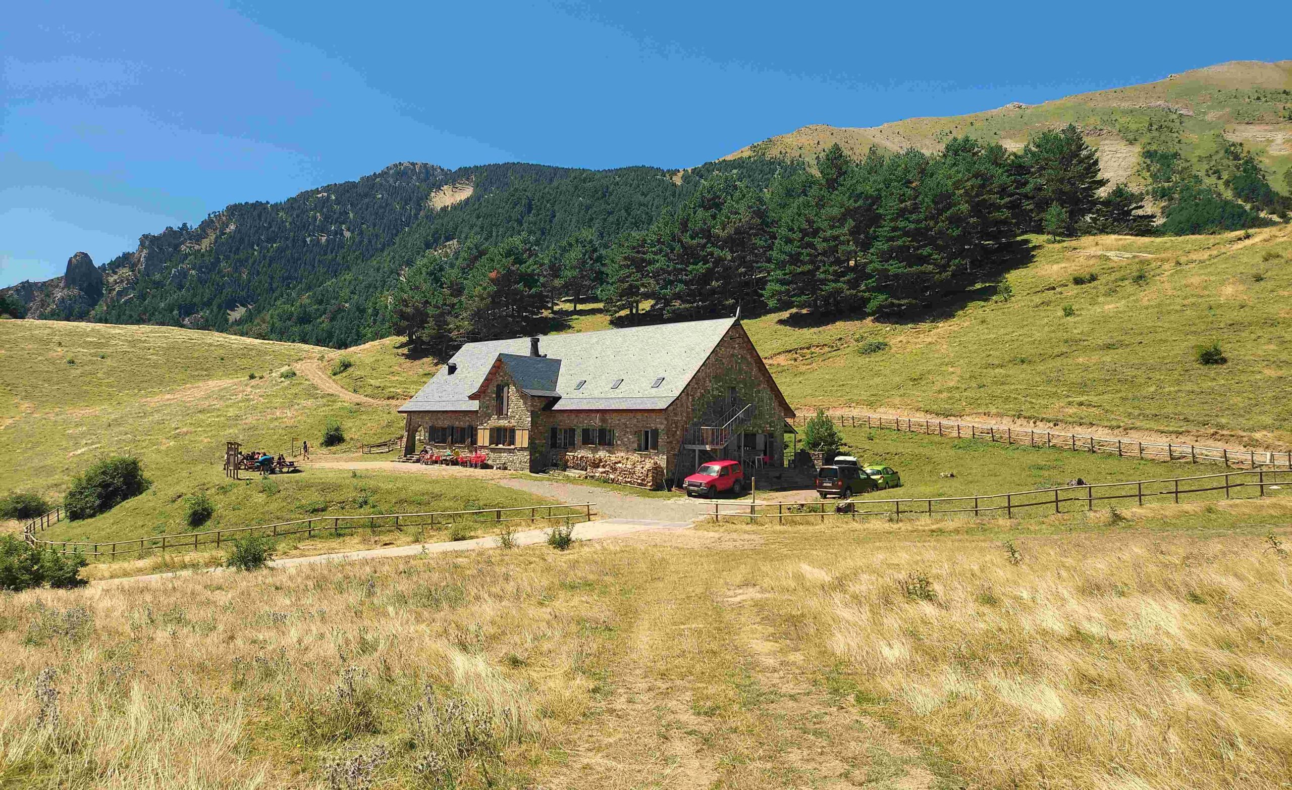
There are plenty of options for hotels – these can be viewed via booking.com The hotels have their own websites and it can be cheaper to reserve with them direct. Two hotels that I have enjoyed staying in are Hotel Eidelweiss www.edelweisscandanchu.com and Hotel Candanchú https://hotel-candanchu.com
The drive up the valley from Jaca is on the N-330 to Canfranc. The next village is Canfranc Estación; here, take care not to enter the long road tunnel which goes into France. Drive into the village of Canfranc Estación and take the N-330-a up to Candanchú.
Read about the walks in the following posts


Recent Comments