
My favourite walk from Candanchú is on the new route of the GR-11. It is possible to do a very long all-day walk, which goes to Lizara mountain refuge, continuing to the Estanés glacial lake and returning to the village on the old GR-11. However, this takes at least 12 hours and would have to be done in the summer, with the risk of encountering very hot conditions in the lower-lying bowl at Lizara. The sensible move is to stay overnight at the refuge and set out early the next day for the return leg to Candanchú. Or to go back before the descent to Lizara, returning on the same path to the village.
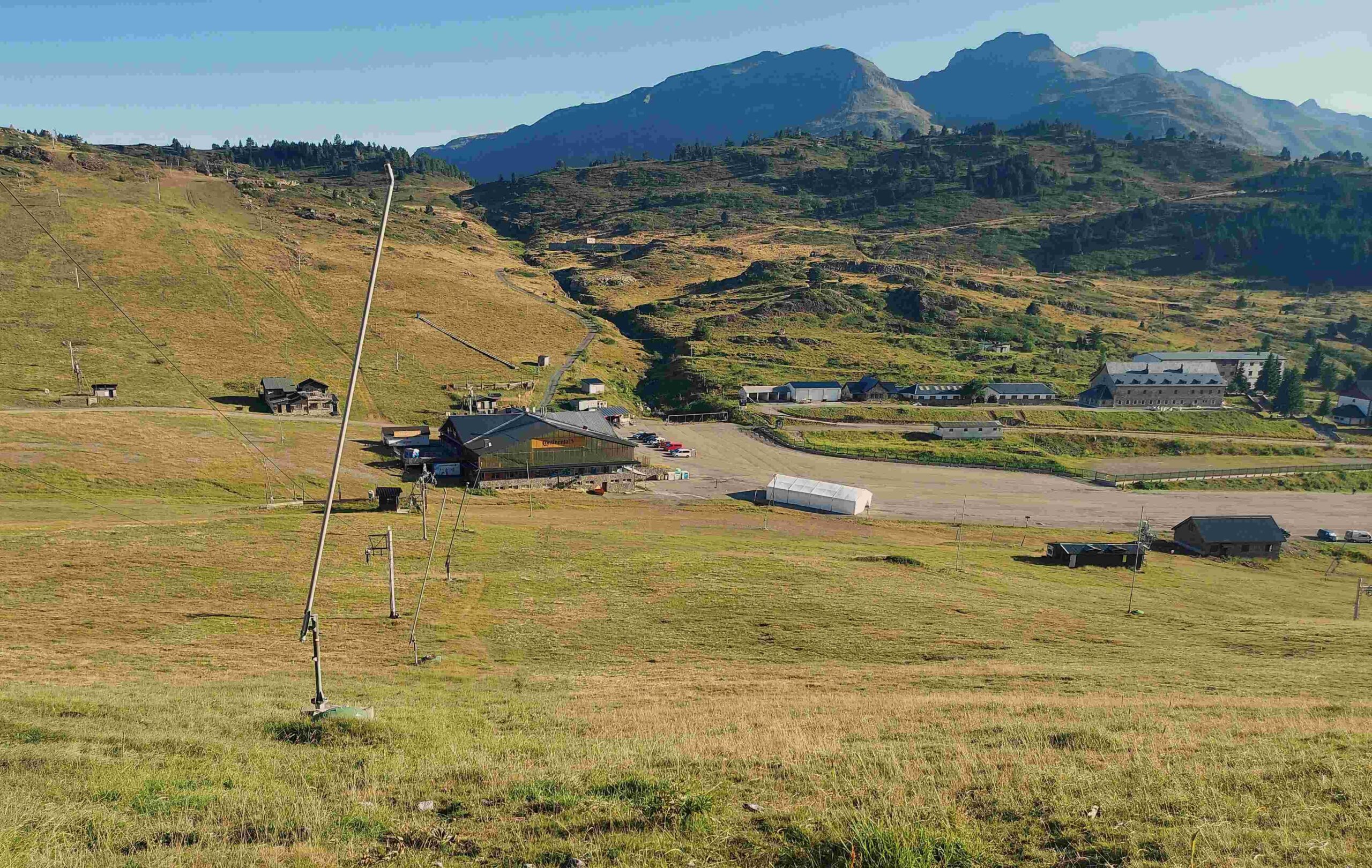
To get to the start point of the walk, head to the top of the town and the large car park which serves the ski station. There is a GR-11 sign at the entrance. The military installation is on the right-hand side. Walk up the left-hand side of the car park to the far left corner near the ski station buildings, where there is another GR sign, pointing for Lizara and the Tuca Blanca. A path heads straight up the grassy hillside for a couple of hundred metres to meet a wide track. Turn left on the track to continue climbing. From this point it’s a winding ascent which is far from back breaking, with ever-improving views on a clear day.
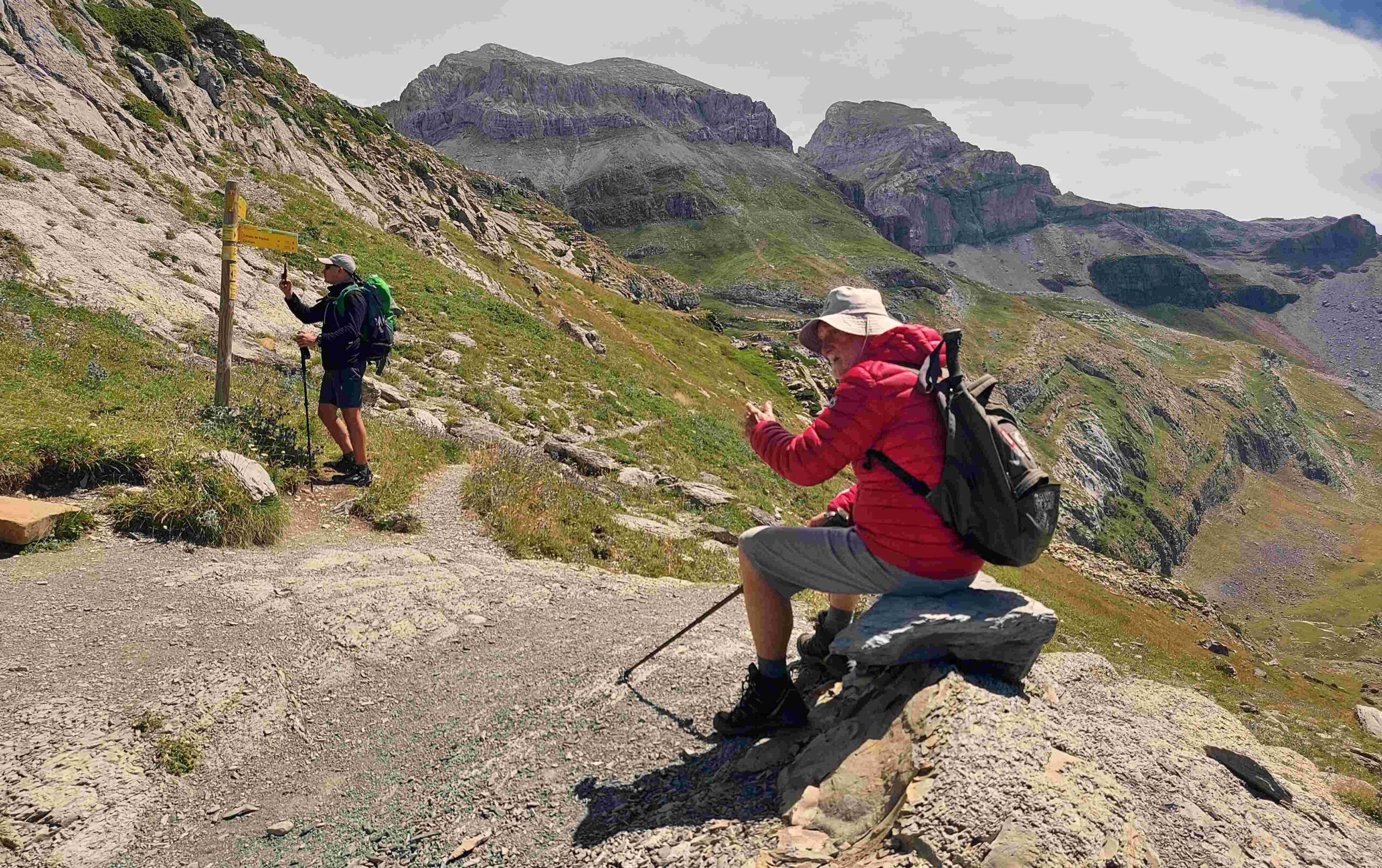
The track snakes up and then flattens out as it bears right on the approach to the Paso del Pastor (shepherd’s pass) at 1,970m. It becomes obvious to walkers why the pass was named after these hardy folk, as they see the large numbers of sheep and goats on the hillsides. There is also a good chance of seeing griffon vultures on this part of the walk. The wide track continues in a westerly direction, looking towards the bandsaw of peaks which comprise the Sierra de Aísa, with the highest being the Pico de Aspe at 2,645m. It’s a breathtaking sight.
It’s 2.3km from Paso del Pastor to the Tuca Blanca pass, with a height gain of a little under 300 metres. It’s a wide track all the way. The first thing to note is not to turn off left to the meadows of the Tortiellas Alto (this is different walk and a very good one); keep straight on at the junction of tracks, following the GR-11 signs and white/red waymarks.
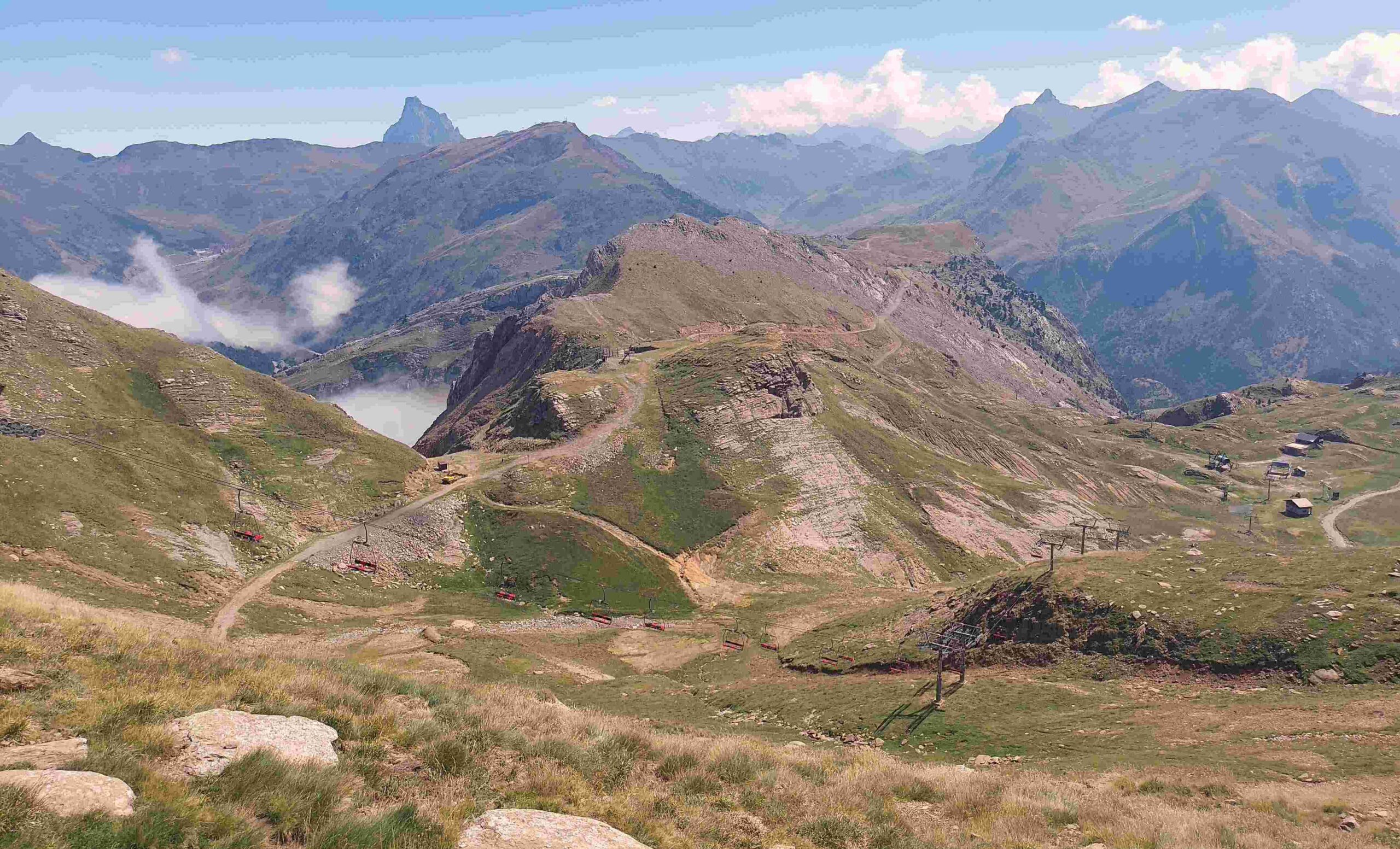
The next point shown on the map is the Puerto de Tortiellas pass at 1,988m. Here, walkers will notice a steep ‘track’ going down, which is part of the skiing infrastructure in the area. This can be ascended and descended, and helps to vary walks, as well as providing a shorter route back to Candanchú on a return leg. Soon after Tortiellas, the track starts to rise – it gains 250 metres in altitude to reach the Tuca Blanca; the track becomes steeper as it moves towards the pass. Walkers may see sheep on this section which have ascended from the mountain meadows below. They will also have to pass under a ski lift as they ascend.
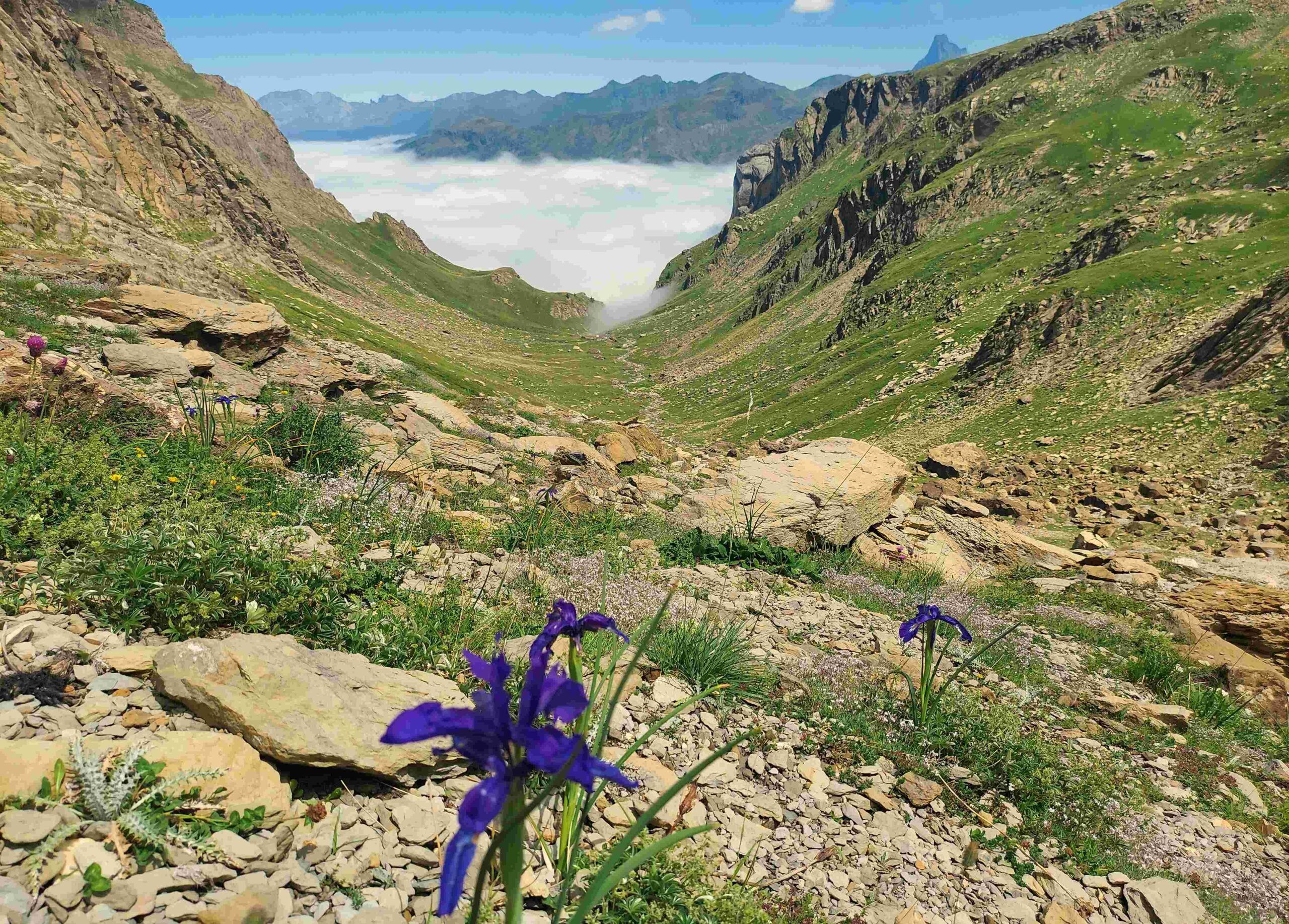
The track emerges at the pass at 2,235 metres. Predictably there are fantastic views – back over the area traversed and beyond towards the 3,000-metre peaks in the Panticosa area, which are in the far distance. It is 6.9km from Candanchú to the Tuca Blanca pass, so some people may opt to turn back here. However, the next 3.4km tranche to the Collado de Esper is spectacular and it would be a shame to miss it. Heading out of rocky Tuca Blanca, after traversing around 100 metres on a stony track, the route takes on a much greener hue. There are magnificent views into France, which can be obscured by low cloud/mist at times. The track turns into a path, which descends. It is important to keep a close eye on the red/white waymarks, as the path moves to the left to traverse the verdant slope. It’s lovely walking on the springy turf.
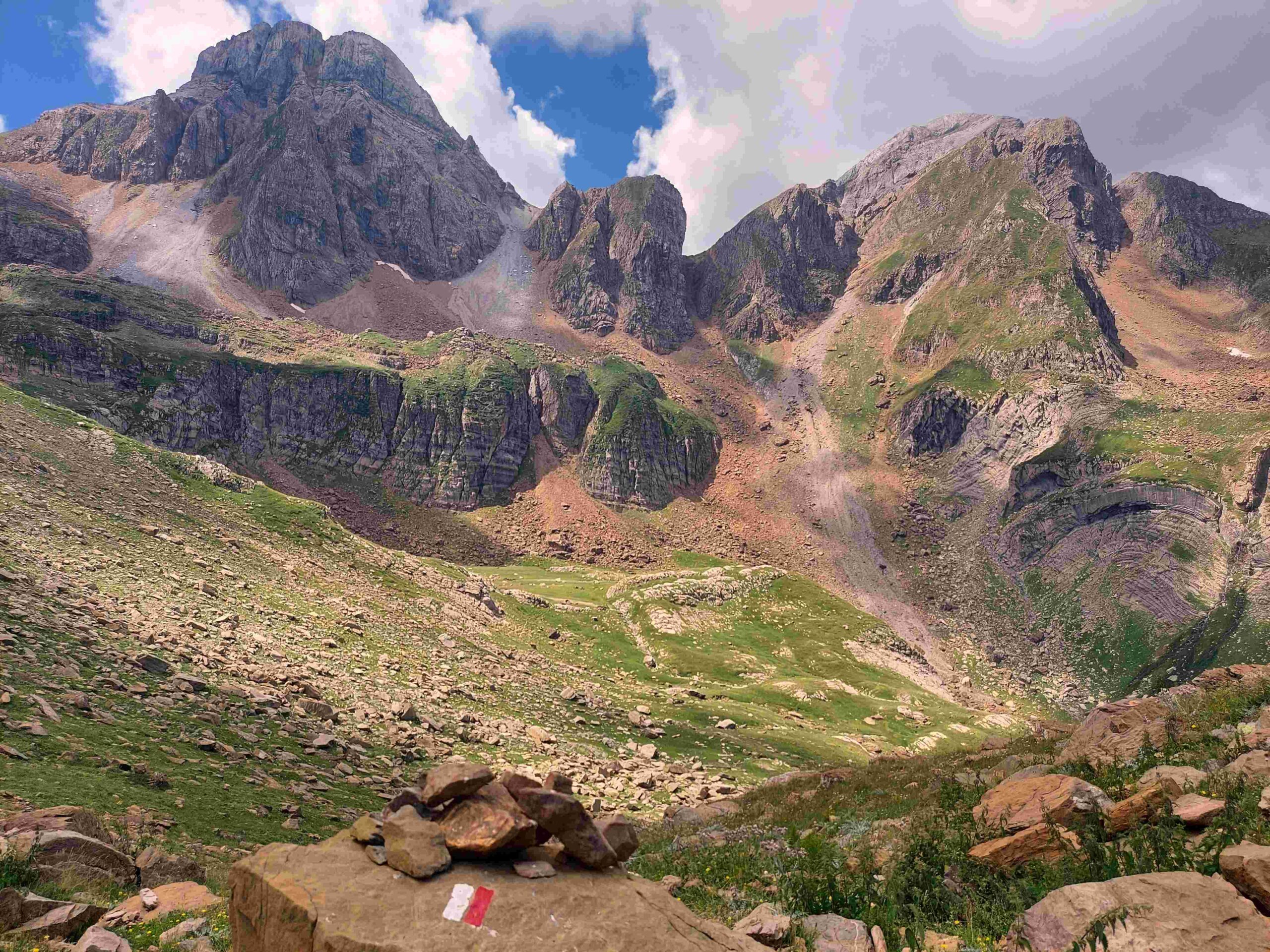
The path emerges at a corner where the route ahead becomes clearer. Bearing left, head towards the Aspe cirque – rock dramatically sculpted by glaciers. There are ‘neveros’ (snow holes) in the rock face. A pause is necessary here to drink in the magnificent view. The path descends around 100 metres in altitude to a flat area of breath-taking beauty with meadows and flowers, simply called ‘Esper’ on the map. It looks down the ‘barranco de Aspe’ ravine.
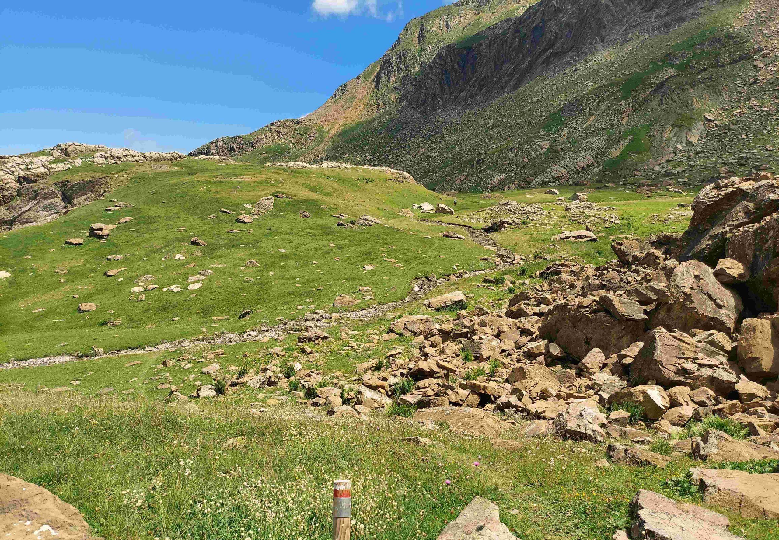
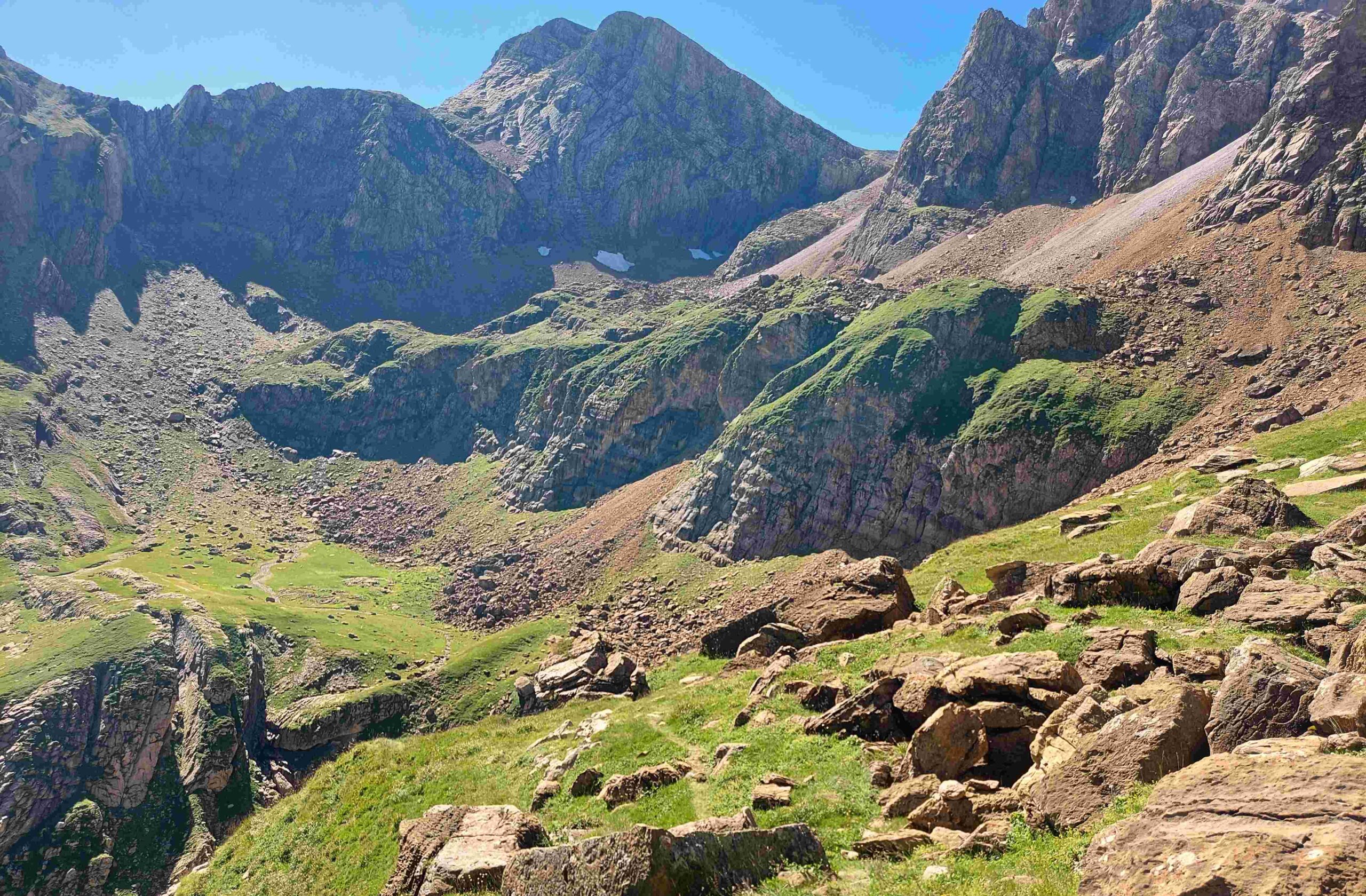
After crossing the stream which comes down from the cirque, the path continues across the flats to reach a small area of rocks which have to be crossed, following the waymarks. It’s not far before the path improves and starts the ascent to the pass – the Collado de Esper. This climb starts from a height of around 2,000 metres to go up to 2,270 metres. It is fairly steep in parts, but not stupidly so.
The first part of the ascent is on stony ground around the bottom of the cirque. It gets greener and moves to the right for a short section, where there is a metal rope attached to rock at the side of the path to help with balance – useful for icy conditions. The path then becomes steeper, moving higher, now with awesome views of the Aspe cirque and its ‘neveros’. Around half way up, the it flattens out for a lovely grassy section, where there may be colourful wildflowers. Gaining height, the views east to some of the giant peaks of the Pyrenees are breathtaking – the magnificent stand-alone Midi d’Ossau mountain (2,884 metres) in France and, on the Spanish side of the border, the Infiernos summits which are all over 3,000 metres (near Baños de Panticosa).
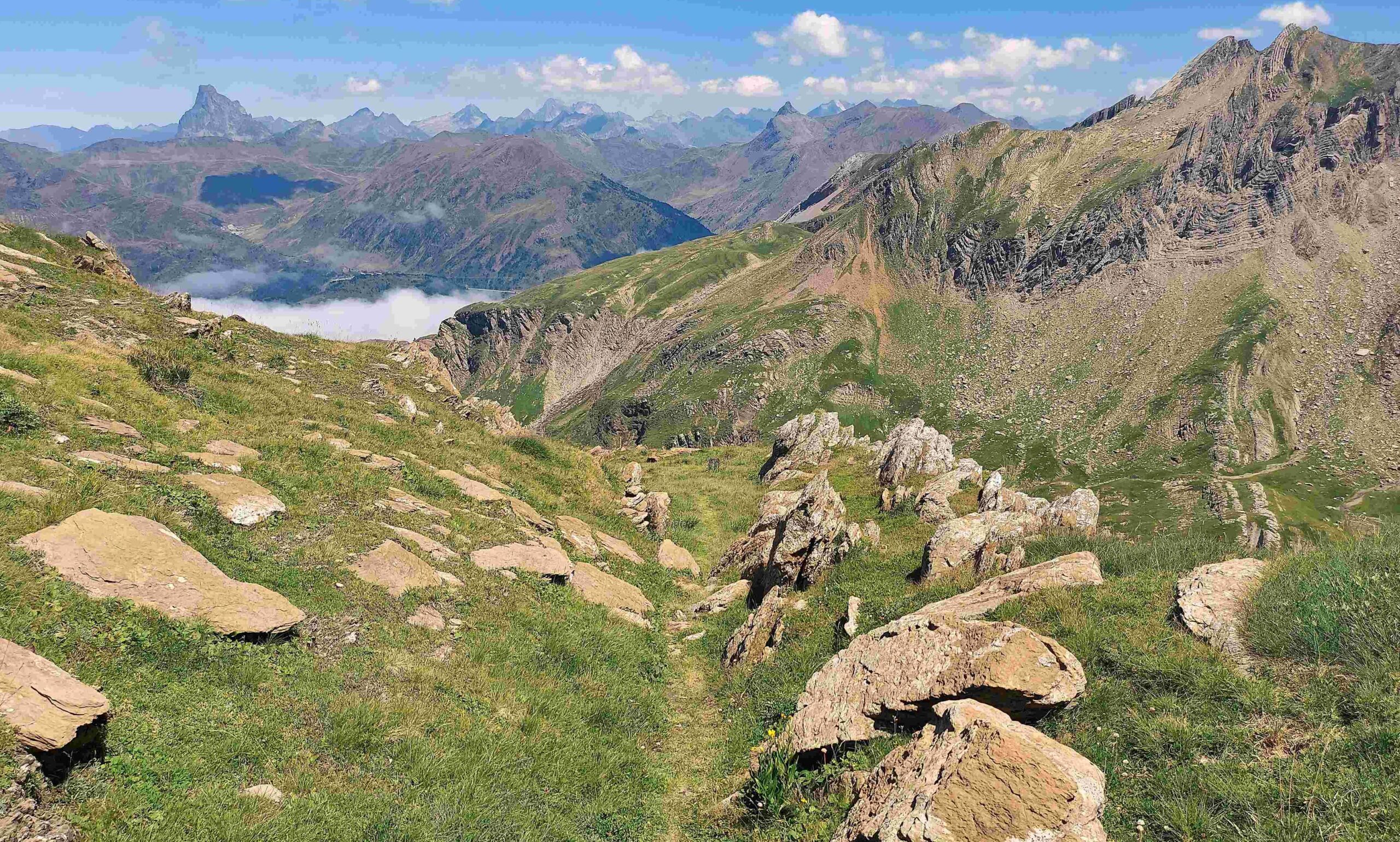
Then comes the final grassy climb up to the pass, where more stupendous views await. The pass gives access to a high-mountain plateau, named the Foya de Aragues. Some will turn back at the pass. It’s 10.4km on the GR-11 one-way from Candanchú to the Collado de Esper, with 970 metres of ascent.
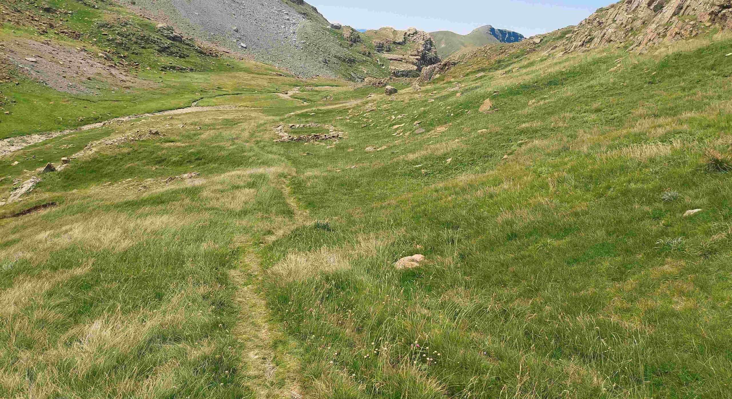
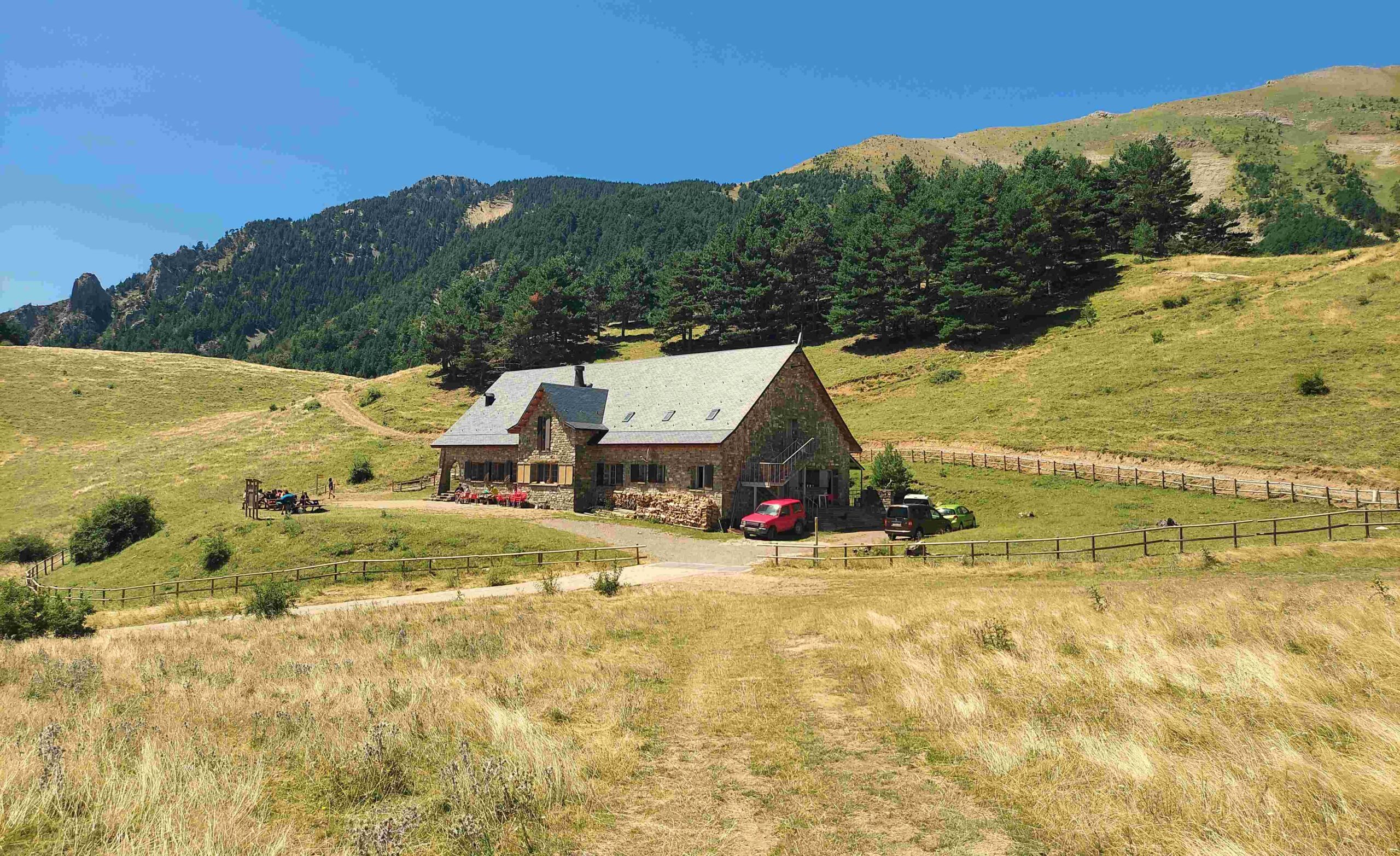
Intrepid adventurers will press on across the green, undulating land which comes after the pass. It is 3.1 km to the next pass; the path bears to the left, before turning left to descend, underneath the looming summit of the Llena del Bozo (2,559 metres). It’s another lovely, verdant section as the path moves across undulating high mountain pasture before starting the short descent to the Collado del Bozo. The route is very well signed and at the Bozo we are told that it’s 3.3 km to reach the Lizara refuge, which can be seen below. The Bozo stands at 1,995m and the refuge is at 1,540m. It’s a pleasant descent which gets greener on the lower slopes and cows can be seen munching on grass pretty much anywhere in this area.
On reaching Lizara, sensible people will rest easy for the remainder of the day and avail themselves of the food and drink on offer at the refuge before turning in for the night. This first section from Candanchú measures 16.8km, with 970m of ascent. Those intent on making it back the same day will press on. In summer it can get very hot in the area around Lizara so walkers will want to do the next section before noon if possible.
Part 2 comes next

Recent Comments