
This walk – starting from Candanchú – is a cracker. There are elements which would present difficulties to people who are not regular mountain walkers. But those who already have their ‘sea legs’ around summits will enjoy the challenge and the stupendously beautiful mountain scenery.
The route takes in three different high mountain pasture zones – lovely verdant areas of undulating grassland kept in trim by the ubiquitous flocks of sheep which are better climbers than most of us. The meadows are the Tortiellas Alto and the Tortiellas Bajo, with the third not warranting a name from the geographers.
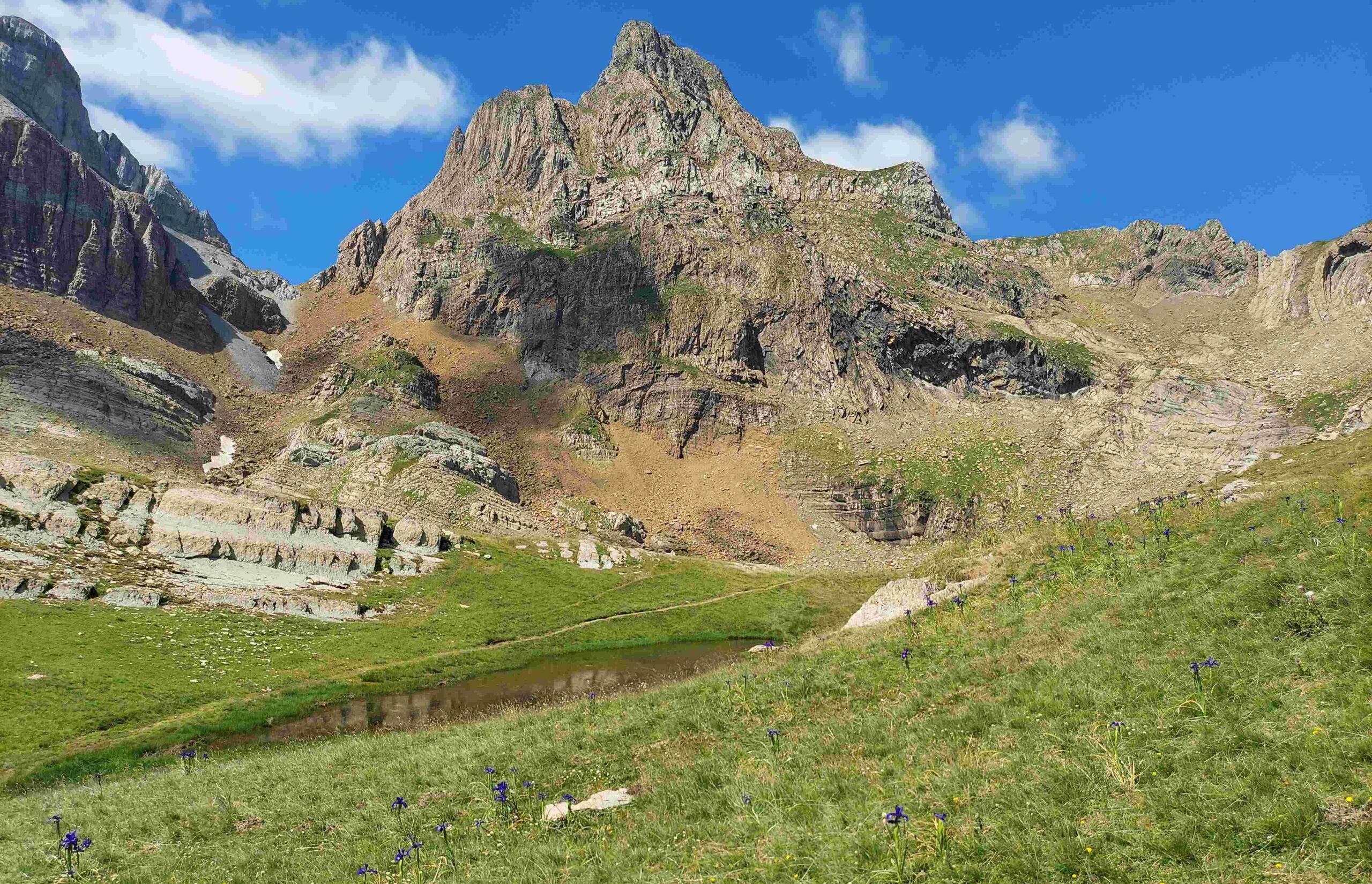
The walk ascends to and descends from these pastures. The main climb follows a tumbling stream which bears water from the peaks, with waterfalls next to the path. Some people may have problems with the ascent of a rock wall at the highest point of the route. But it is not as difficult as it looks on the photos. The major peak that towers over the Tortiellas is the Pico de Aspe at 2,645 metres, which is flanked by slightly lower summits in the high 2,500s. The high point of our route is approximately 2,150m, having started at 1,550m.
The walk
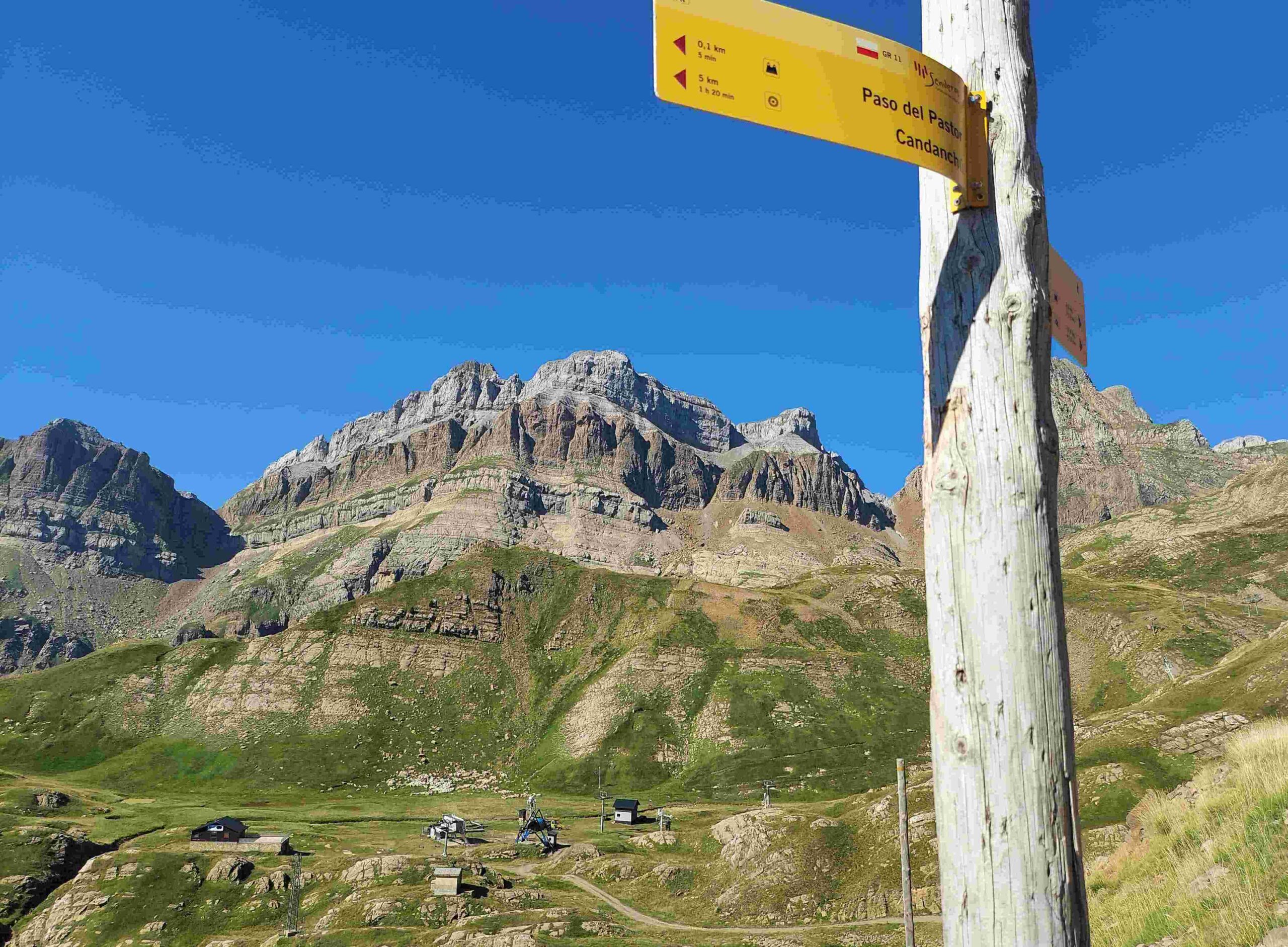
The start of the route is on the GR-11, with white/red waymarks and frequent signposts making it easy to follow. As with the previous walk from Candanchú, it departs from the large car park which serves the ski station. Walk up the left-hand side of the car park to the far left corner, where the GR sign points for the Lizara mountain refuge. The path heads straight up the grassy hillside for a couple of hundred metres to meet a wide track. Turn left on the track to continue ascending.
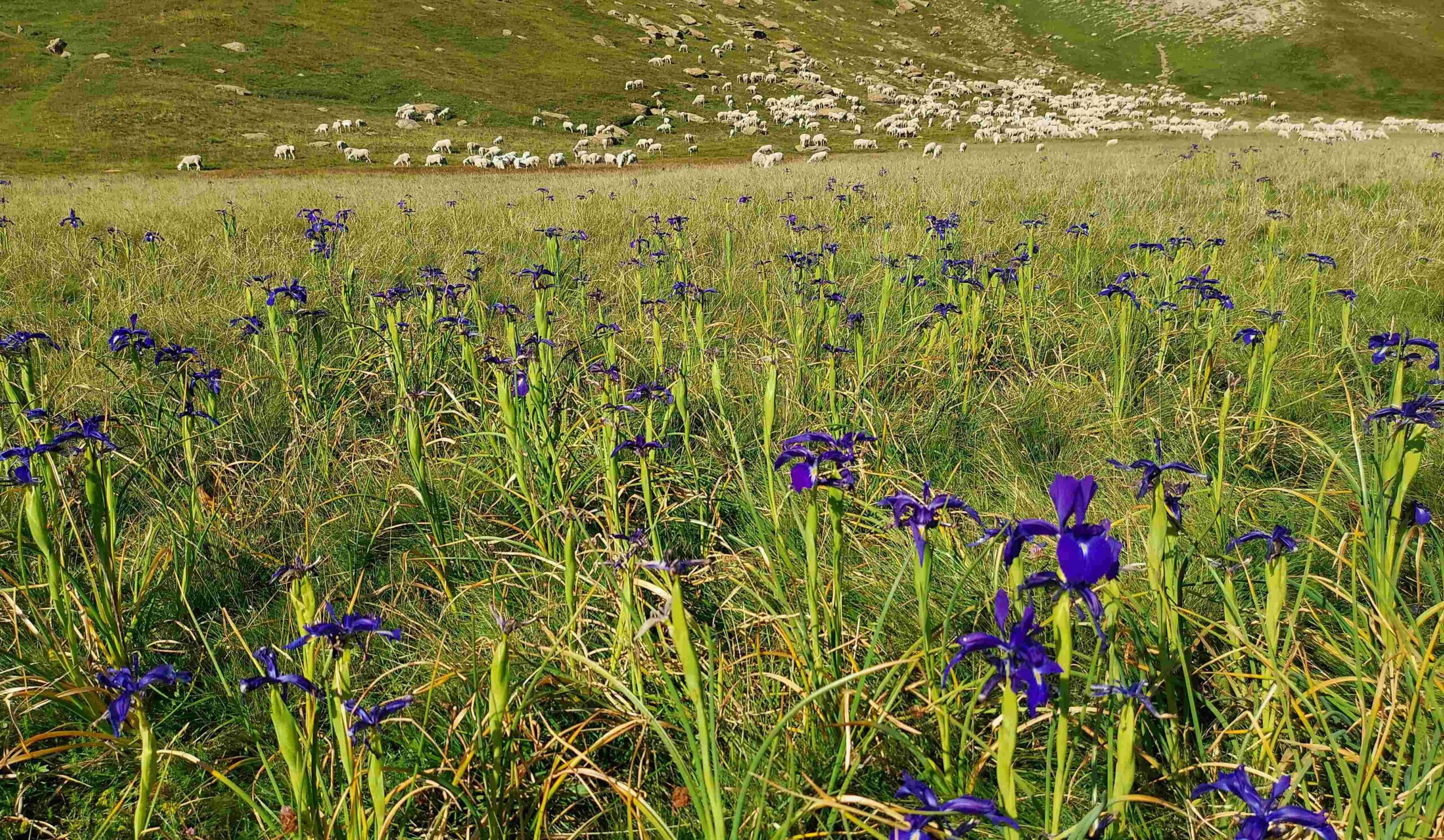
The track snakes up and then flattens out as it bears right on the approach to the Paso del Pastor (shepherd’s pass). On the wide track the pass is only noticeable because there is a small sign pointing it out. The track continues straight on. It’s less than 1km to reach the junction which sees this route turn left off the GR-11 on the descending track that leads to the first of the areas of pastureland – the Tortiellas Alto. There is skiing infrastructure at this wonderful high-mountain area which only partially diminishes its beauty. There may also be grazing sheep and wildflowers.
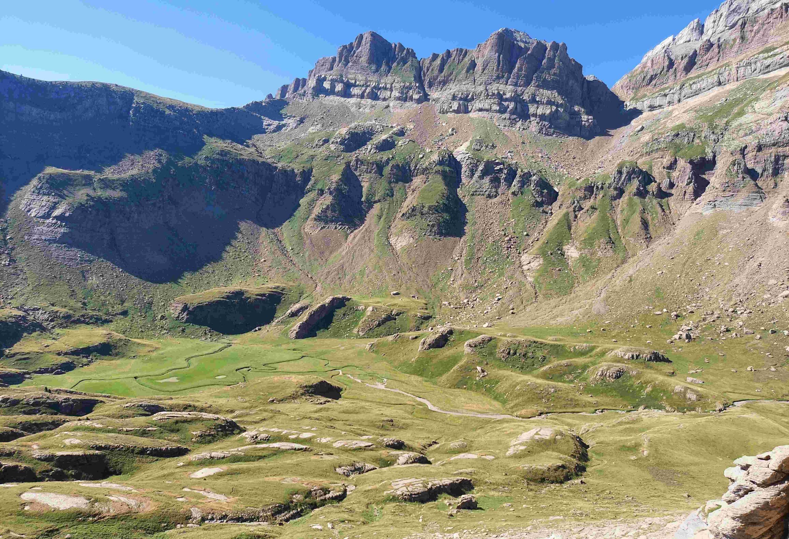
Keep on the left of the pastureland to cross it. Soon a magnificent view appears down the ravine/valley and across to the Canal Roya on the other side (the Canal Roya valley can be ascended on the GR-11). Pick up the white/yellow waymarks of a PR footpath. It’s a stony path which leads off the pastureland and crosses the short connecting strip above the valley. The path descends to the next area of pastureland, appropriately named the Tortiellas Bajo (lower Tortiellas).
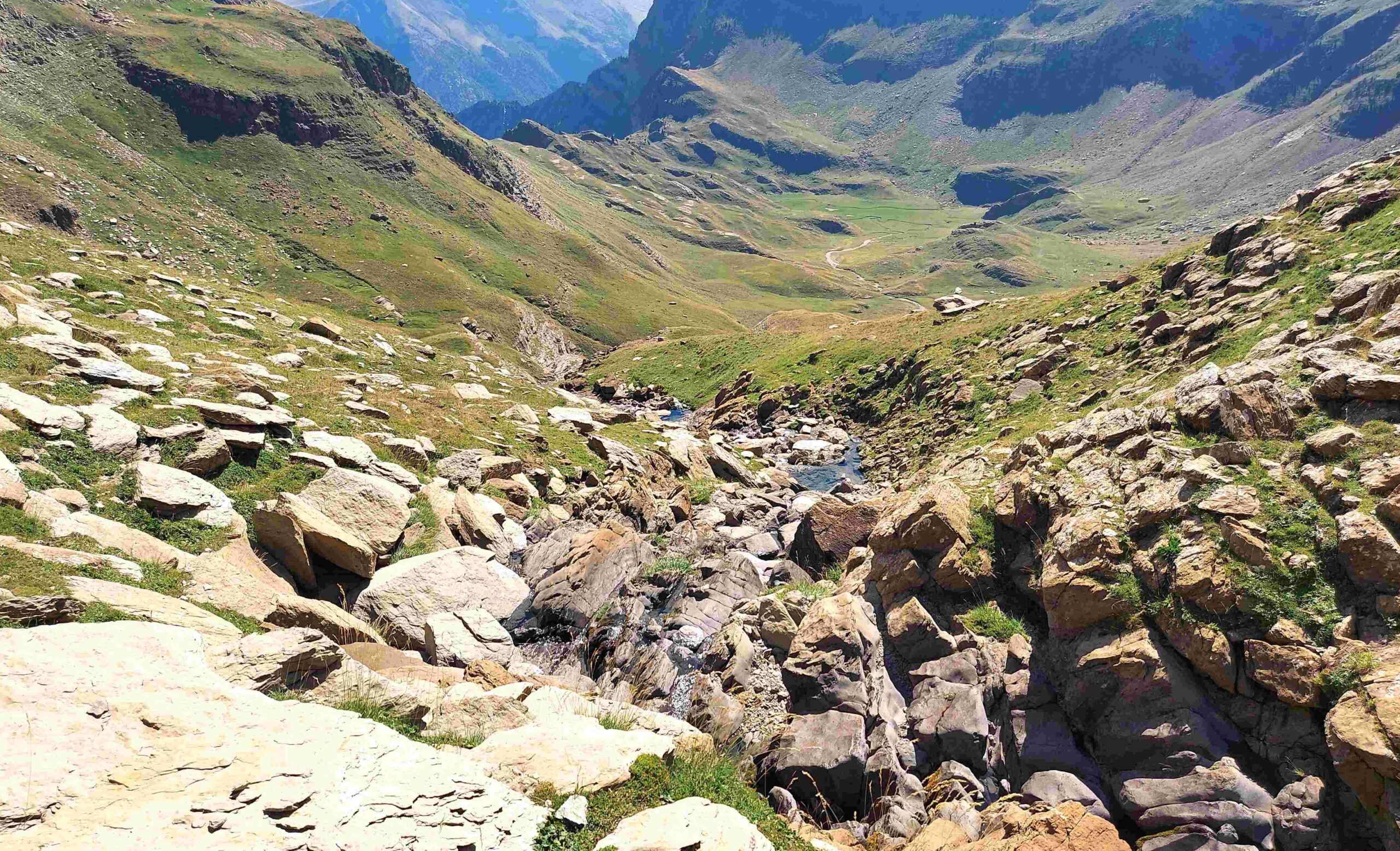
There are waymarks and cairns showing the way down, but they disappear at the bottom on a wide area of pasture which is used by livestock and covered with snow during the winter. The glacial lake (ibón) which is marked on the map dries out in high summer. Orientation is pretty easy, though. At the bottom it’s a right turn to follow the stream (dry in parts) up the Barranco de Tortiellas valley/ravine. It is possible to do so on either side of the stream.
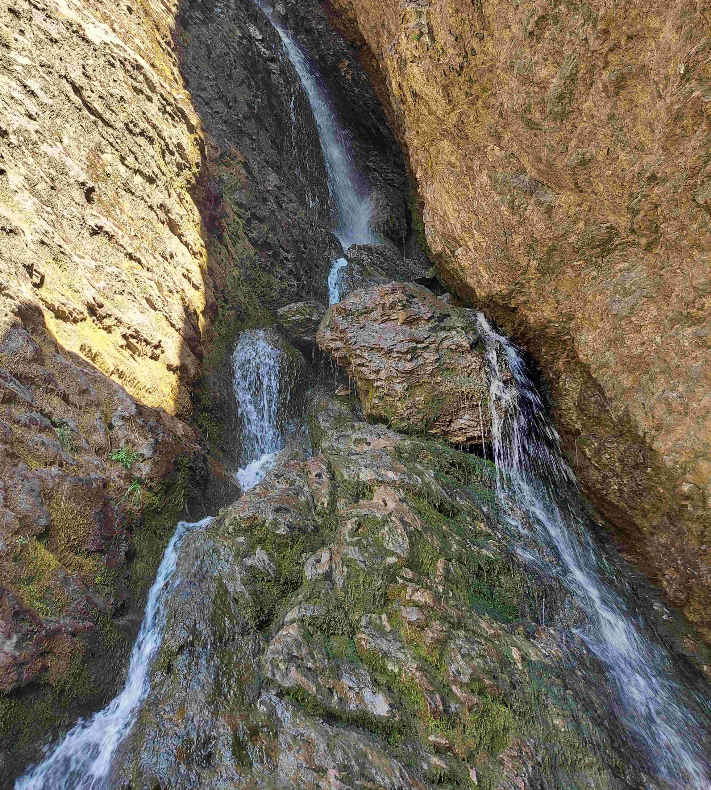
Head towards the waterfall ahead. You will probably want to have a close look and possibly a dip in one of the pools before retracing your steps for a few metres to start the climb around the waterfall. I did this on the right-hand side. The ascent is on grassy land, with some rocks to cross, following the line of the stream.
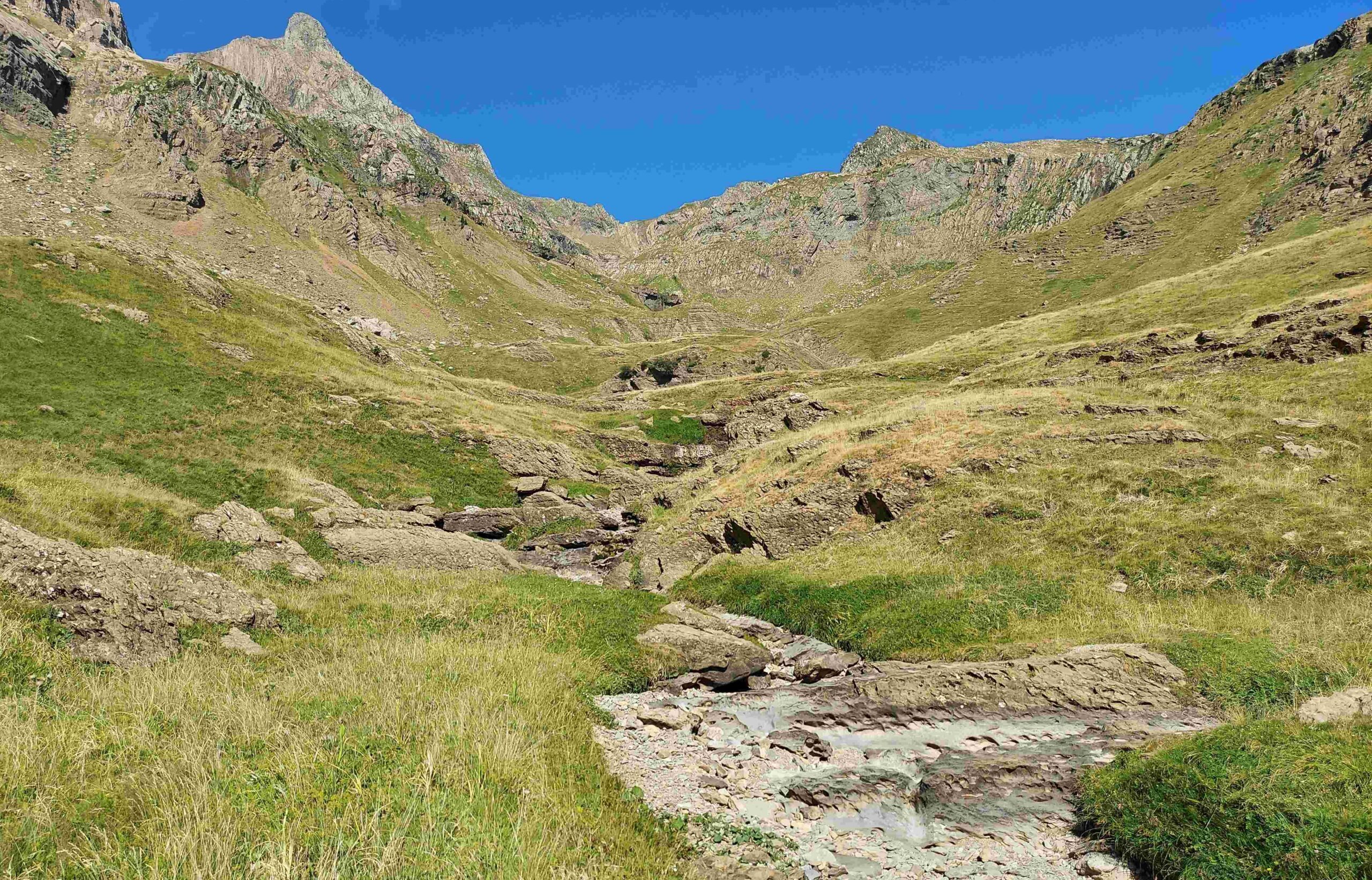
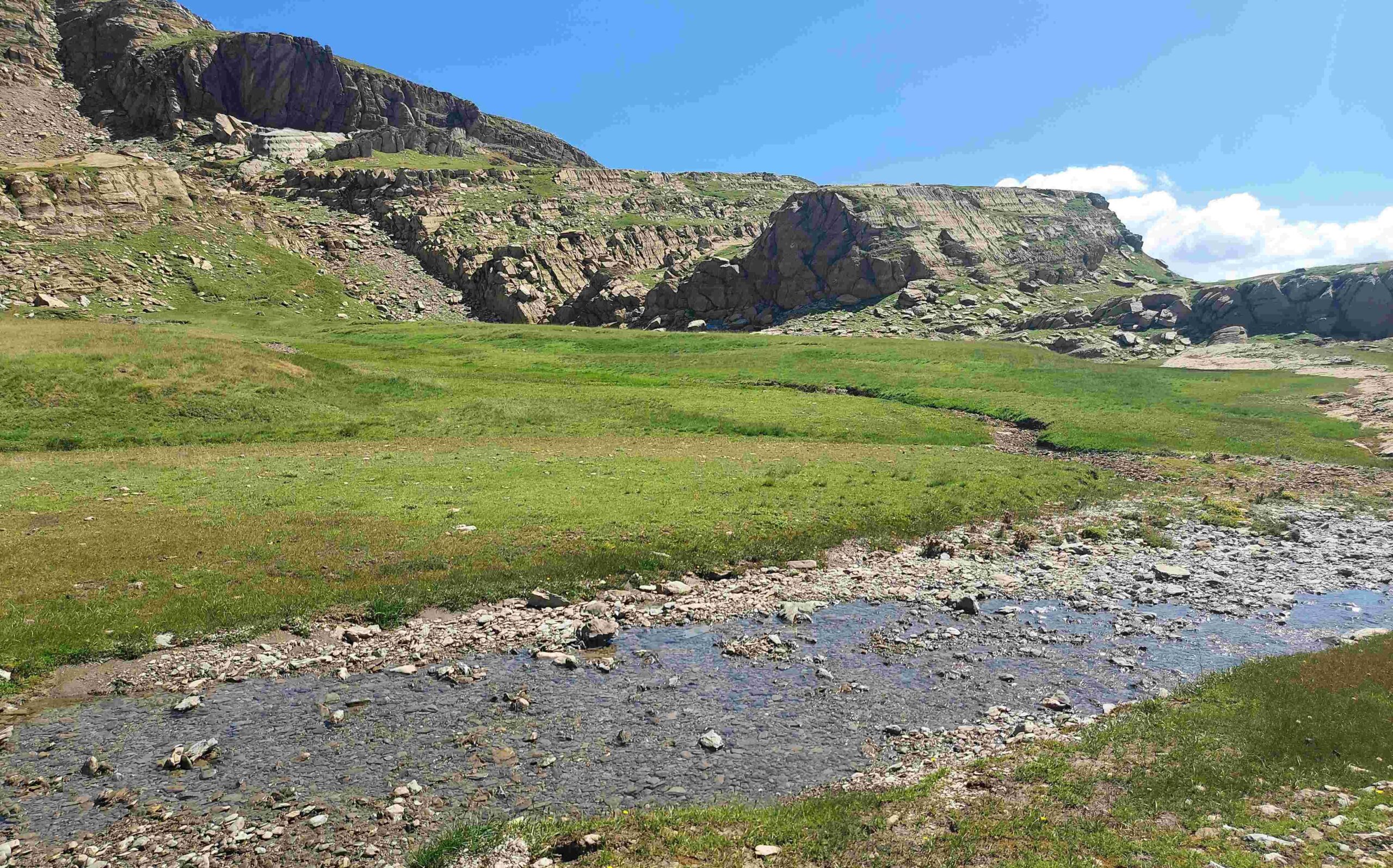
On the climb, the route which follows the right of the stream passes a second waterfall. Continue the ascent – following the stream – to emerge at a high, undulating area of pasture which does not have a name. This is where the ravine’s stream descends from. There are snow holes (neveros) high on the left, called the Neveros de Tortiellas. Bear right to cross the grassy area. There is a path on the right which leads out of the flat zone.
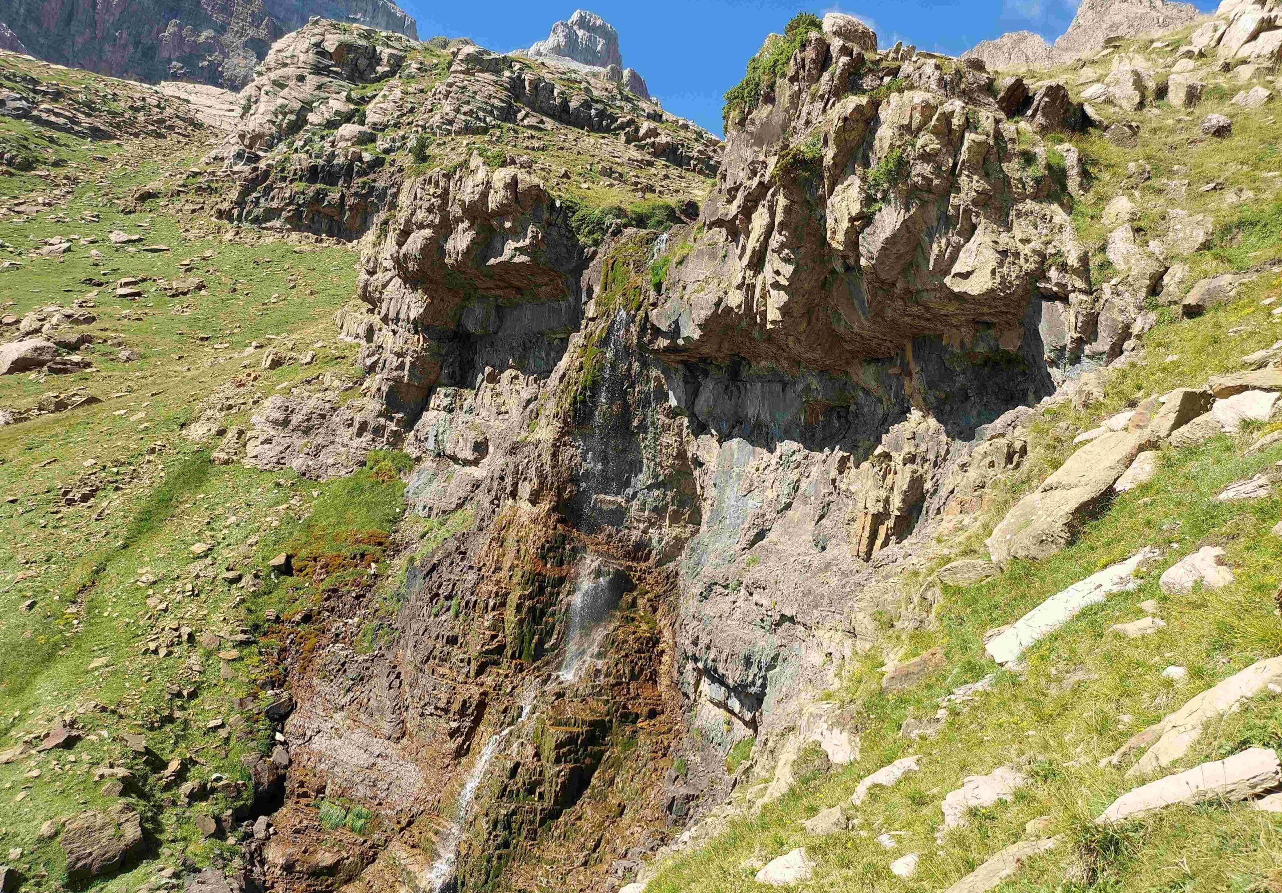
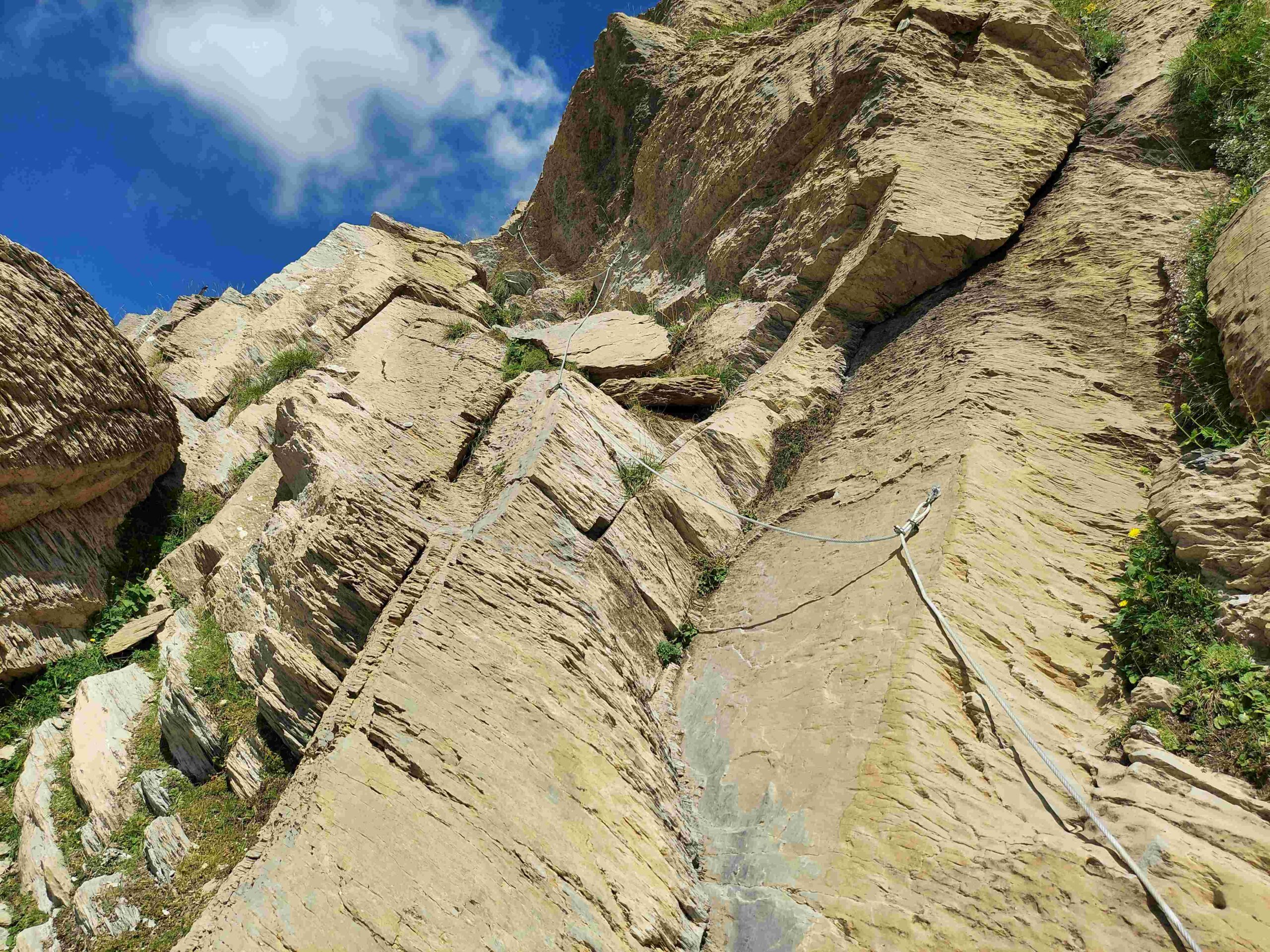
It climbs and starts to head across the slope, traversing an area above the Barranco de Tortiellas, eventually providing a wonderful view down it. There are some cairns to help with orientation. After a short climb the path flattens out. Look back for a terrific view of the Pico de Aspe (2,645m). The path skirts a tiny glacial lake and runs as far as a wall of rock which has to be scaled, with the help of a metal rope, fixed into the stone. At first glance the climb up looks fairly daunting. But, if you are a regular mountain walker and are used to ascents in rocky areas then this will not bother you. It’s only a short ascent of around 10 metres, and the metal rope (if it is needed) makes it much easier.
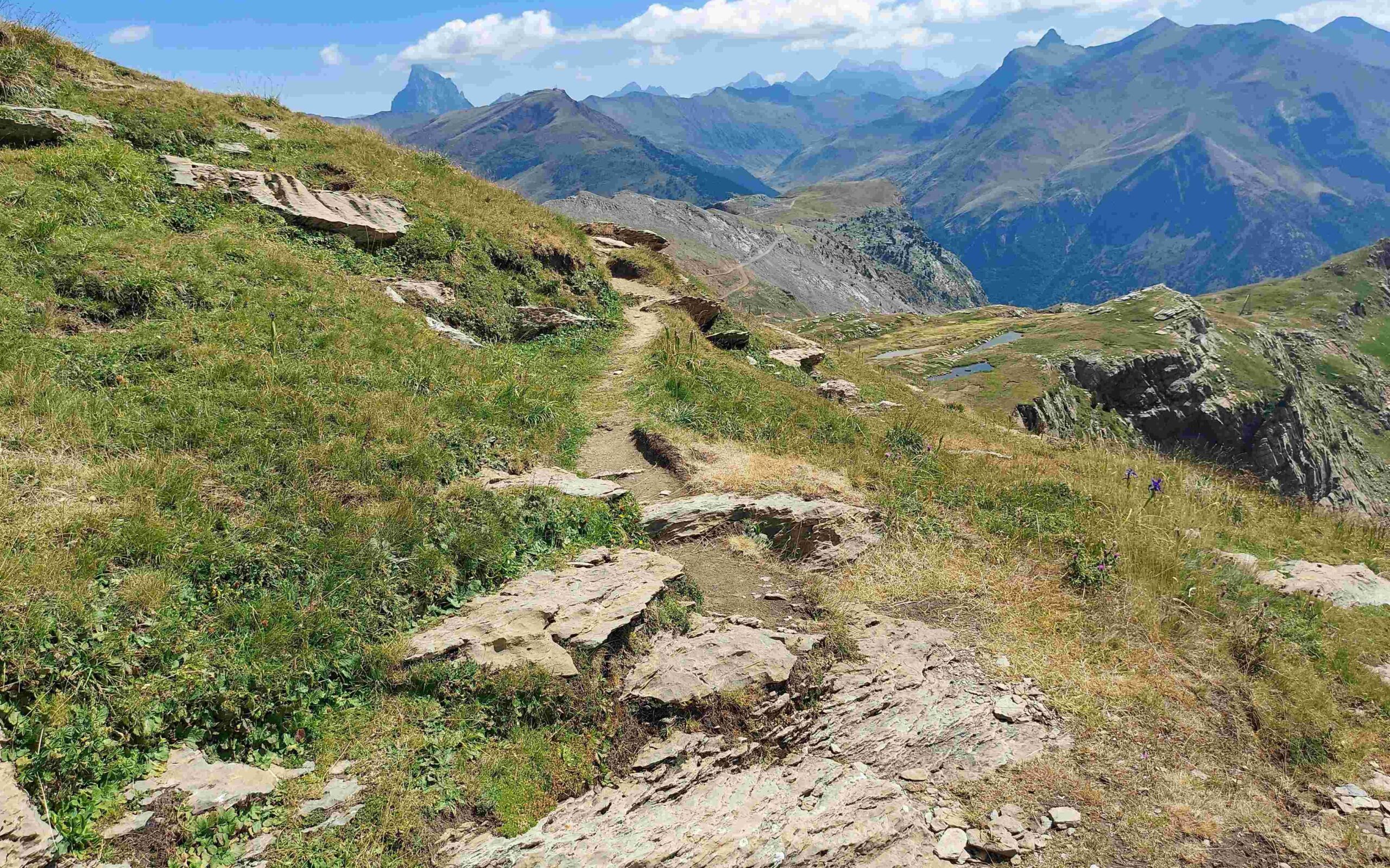
And once you are up, another exhilarating section of the route awaits. On high, there are incredible views over the area already walked – and eastwards to some of the giant peaks of the Pyrenees. The stand-alone Pic de Midi d’Ossau (2,884m) in France is the most dramatic, while further away on the Spanish side of the border there are a number of ‘tres mil’ (3,000m+) summits, including the Infiernos peaks near Baños de Panticosa.
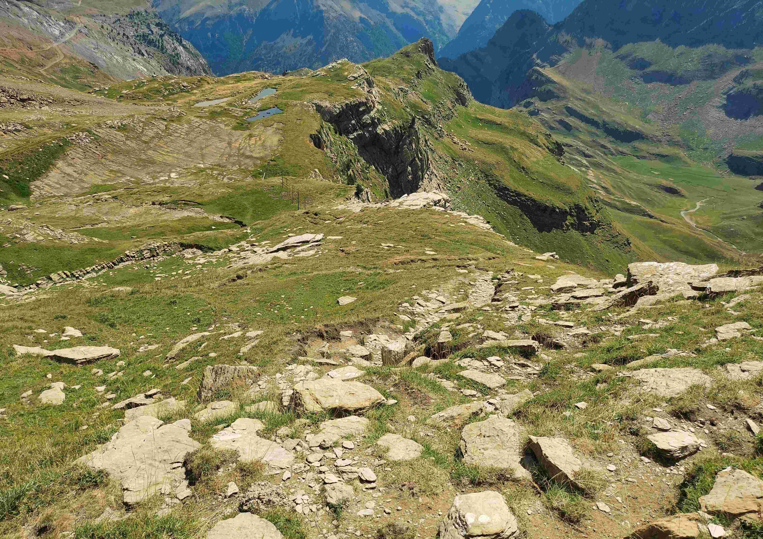
The path moves away from the rock wall, heading straight towards the Pic de Midi d’Ossau in the distance. Then there is a lovely descent. The path is heading for the two small glacial lakes below. Although they are slightly ‘off-piste’, it’s worth having a quick look at them, before settling onto the wide track, which is the GR-11 again. The GR-11 can be followed back to Candanchú, or a shortcut can be taken down the scree slope at the Puerto de Tortiellas pass.
The route without shortcuts is approximately 17km, with around 700 metres of ascent, which will take between six and eight hours.

Recent Comments