
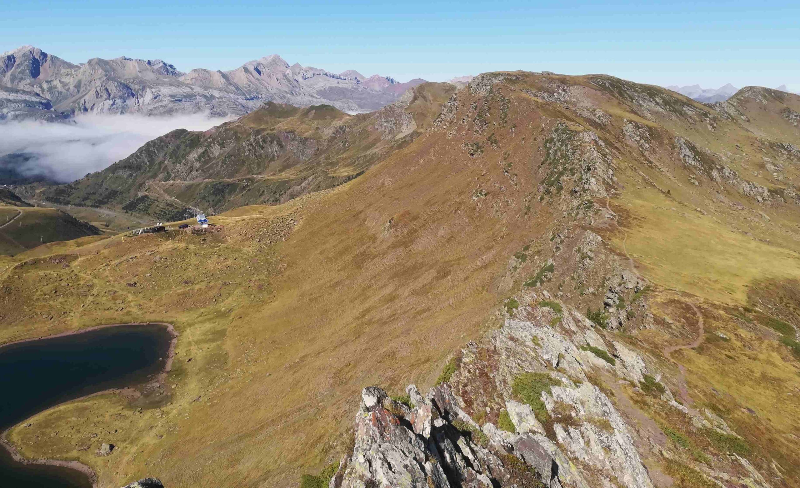
This is another terrific ridge walk, right on the border with France. It is similar to the one in the Echo valley, along rolling green hills which allow unencumbered walking on a path above 2,000 metres with captivating views.
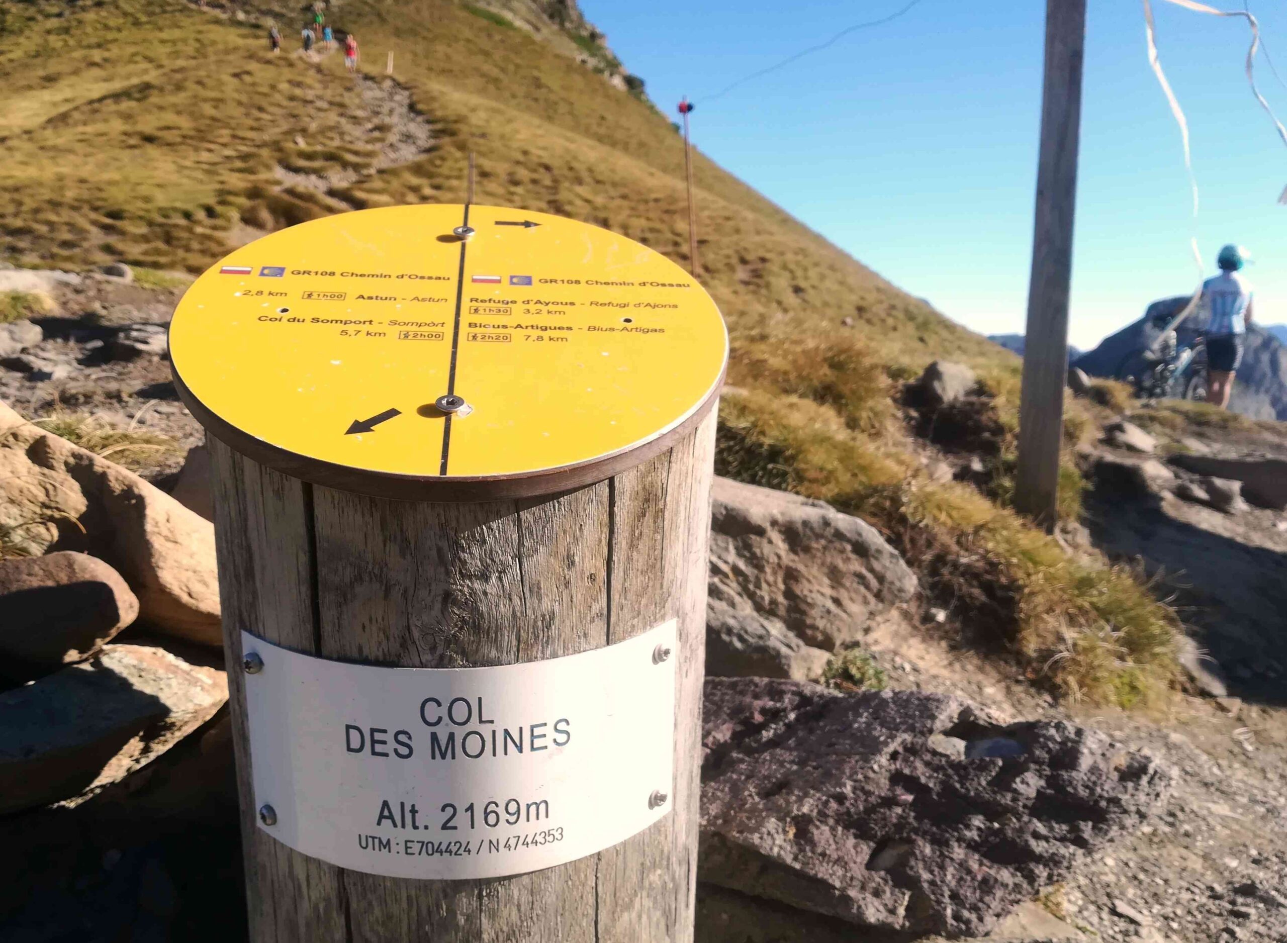
The route starts from Candanchú village, then runs up the Astún valley, before heading up to the Escalar glacial lake – and on to the Col des Moines (also known as Puerto de Jaca) at 2,167 metres to start the walk along the ridge which includes several ‘summits’, with the highest point I reached being the Punta Baguer at 2,331 metres. Then back to Astún via the glacial lake of the same name.
The aforementioned ridge forms a long, sweeping semi-circle measuring more than 15 kilometres in length which runs from the Somport pass as far as the Aneu pass, creating a natural amphitheatre. The map shows that – allegedly – the whole of the verdant ridge can be walked. It would be worth trying one day. However, my route only takes in around a third of it.
I should stress that in most places the ridge is ‘generous’ and grassy, although in a couple of very short sections it closes down to a narrow edge around a metre wide. These more difficult areas can be avoided by coming off the ridge to the grassy slopes below, which are in France. There are also options for shortening the walk; there is a road to Astún ski resort from Candanchú, so around 4km each way can be shaved off by driving up. Also, in high summer, a chair lift runs up to the Astún lake from Astún.
The walk
I set out from Hotel Edelweiss on Calle Única in Candanchú, heading downhill. After a couple of hundred metres, notice the path of the left which is up a sharp bank. It leads the short distance to the ‘Hospital de Santa Cristina’. The ruins lie next to the path, where there are information boards revealing that the complex was built in the 11th and 12th centuries and contained a monastery and a refuge for pilgrims arriving from France on the Camino de Santiago (Way of St James). A ‘hospital’ in Spanish is a place of refuge for travellers, as well as the more modern use of the word.
It is then a very pleasant jaunt of around 1km up to the Somport pass which is one of the traditional routes through the Pyrenees into France. The N-330 road now occupies the old track. At Somport there is a hotel and restaurant and an old border post. Bear right to cross the N-330, then follow the quiet road which leads to Astún ski resort. It’s a couple of kilometres up the Astún valley – walking above the Aragón river – to reach the hotels, bars and restaurants which comprise the resort.
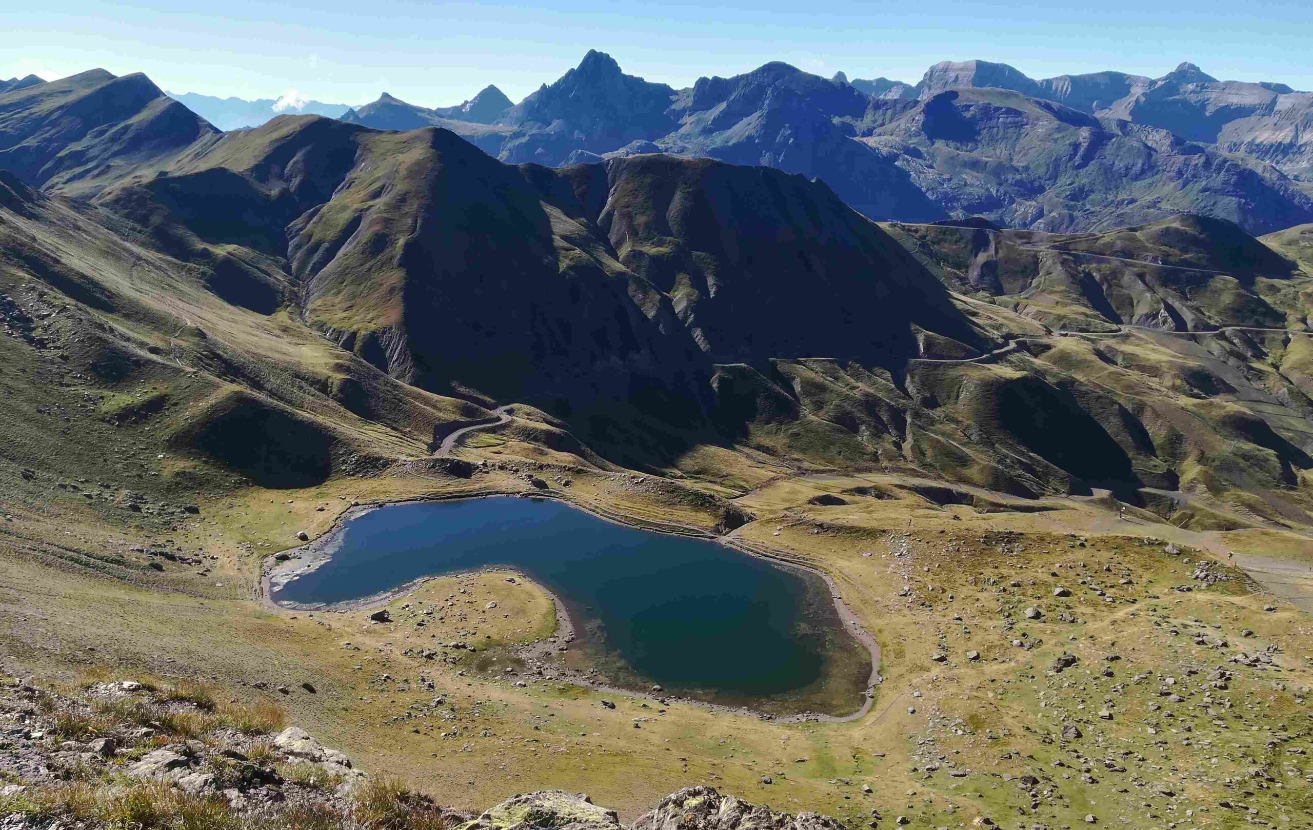
The map I have used to walk in this area for more than a decade is the Editorial Alpina 1:25,000 edition ‘Valle de Canfranc – Valle de Aísa’. Although very good in most aspects, it doesn’t enjoy its finest hour in the small section around Astún. The route from the ski resort runs up the Barranco del Escalar to reach the glacial lake of the same name, so ignore the map here if you have it. It is on a wide track out of the back of the ski resort which starts to ascend the ‘barranco’ (ravine), following the stream. It soon meets up with the path shown on the map. This is a very popular route in the summer. Although it is fairly steep in places, it is ascended by people of all ages in a variety of physical conditions.
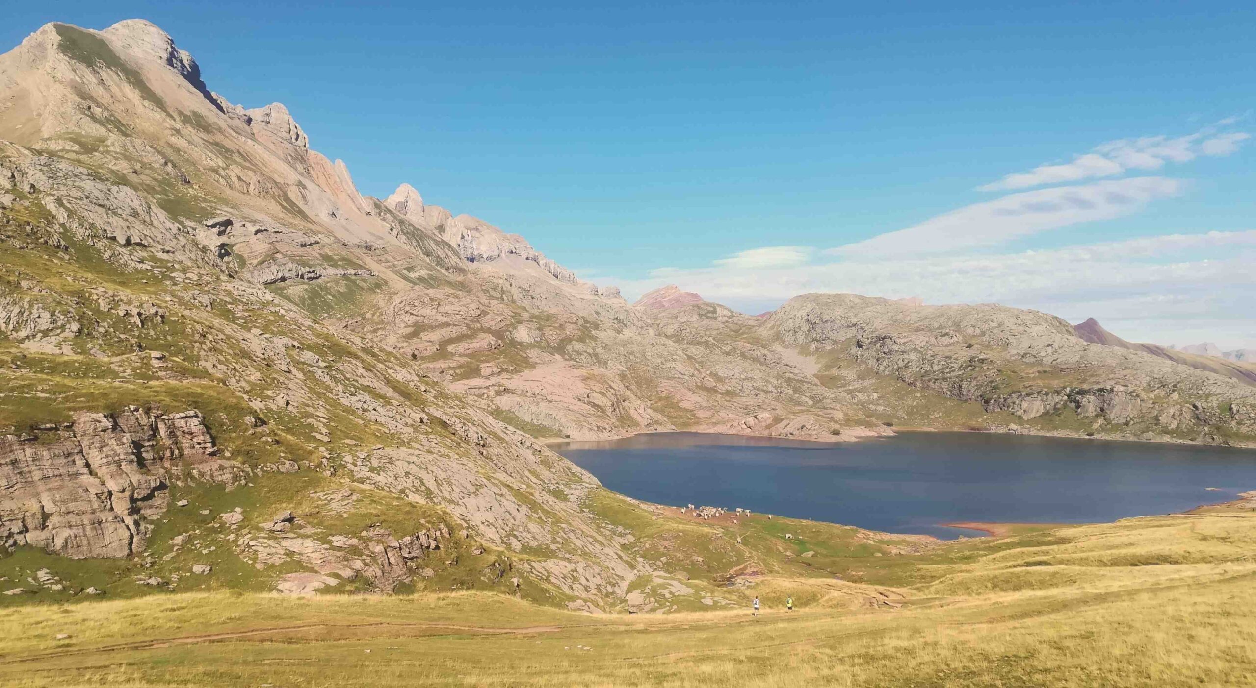
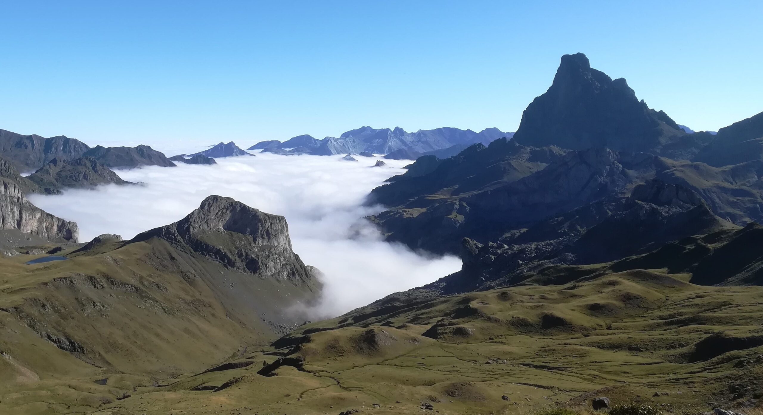
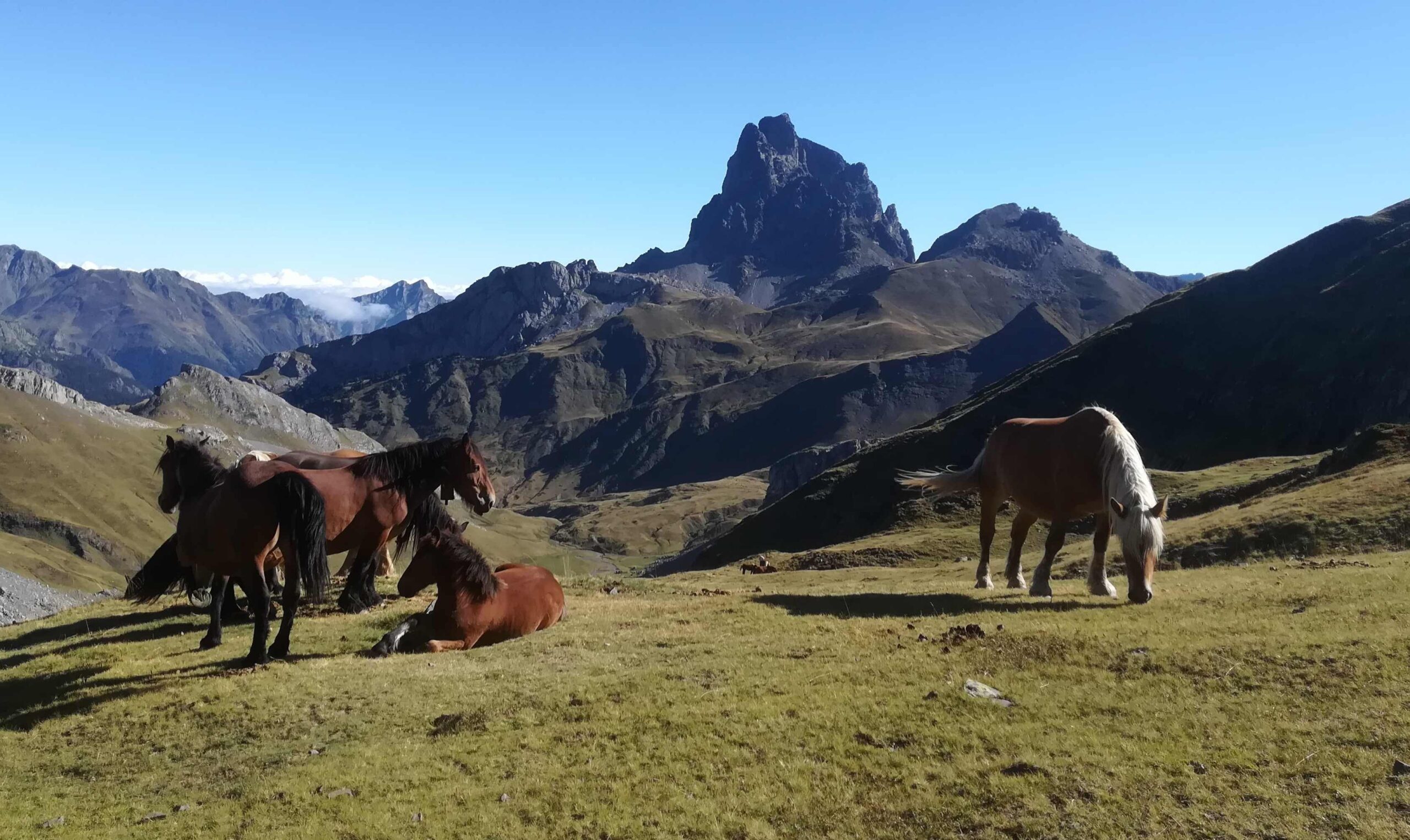
When free of people (early start needed), it’s a very pleasant climb of around 2km which emerges at the Escalar lake. It’s a wonderful sight in its verdant surroundings. Our route bears to the right to follow the shore of the lake, then continues straight on away from the water before doglegging to the right to embark on the short ascent to the Col des Moines (or Puerto de Jaca) at 2,167m. It’s an inspiring spot to emerge at; because it’s the border, but mostly due to incredible views of the Midi d’Ossau mountain in France – a towering pinnacle of rock which reaches some 2,884m. On the France side of the border it’s a national park, the highest level of protection available, so it is completely free of any skiing infrastructure, which is a blessing.
Our route lies along the ridge to the right of the pass. However, some may fancy a quick shin up towards the Pic des Moines (2,347m) on the left – as I did. Most people will not reach the jagged summit. But after around five minutes of ascent there are some fantastic views to be had back over the Escalar lake and mountains in different directions in two different countries.
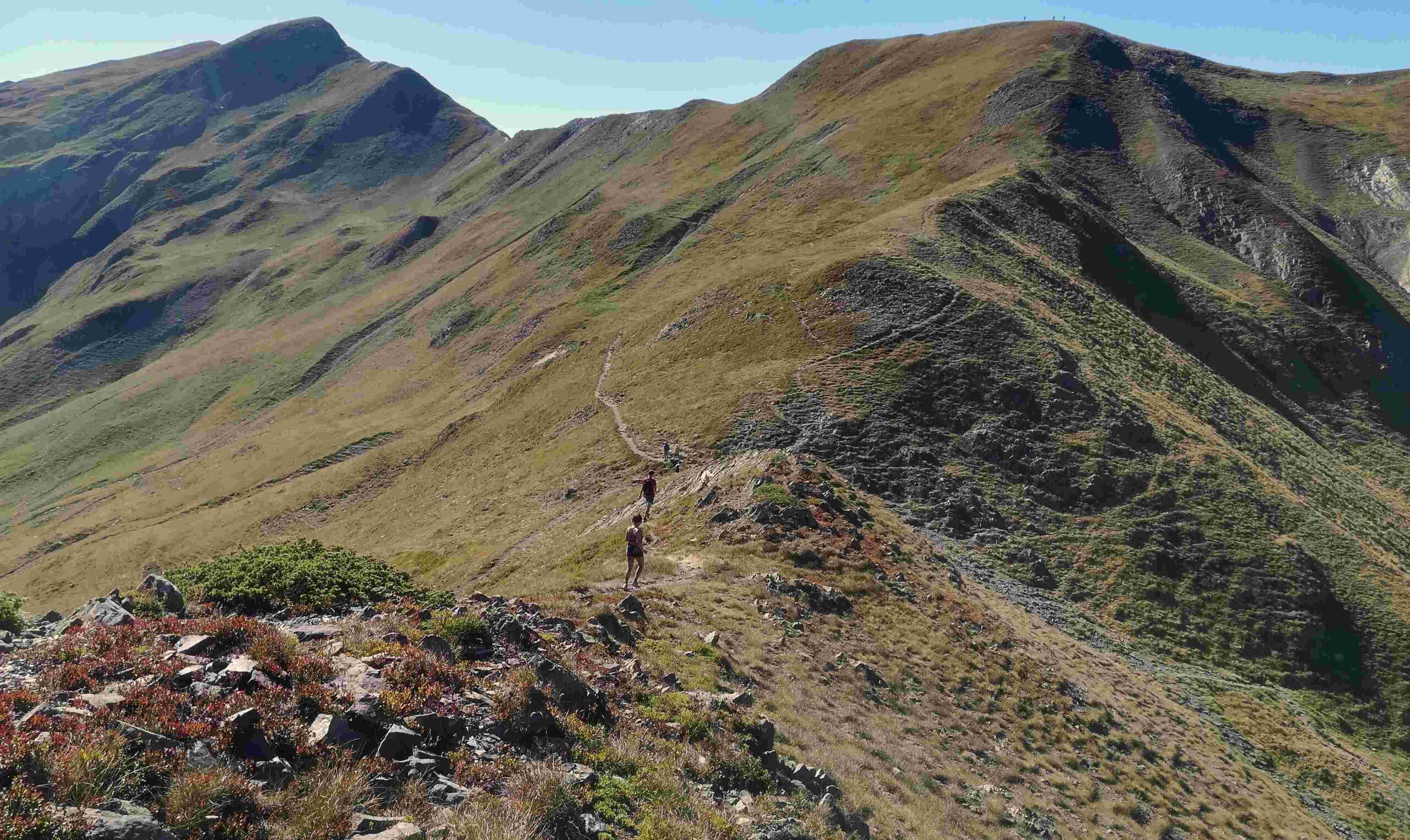
From the Col des Moines, the walker has choices. The ridge is evident – on the right from the pass. During the month of August dozens of people each day will follow the ridge path, not all of them experienced mountain walkers. That is not to say that it is plain sailing all the way. There are some narrow stretches which have to be crossed with care. On short sections the path strays from the true ridge when it becomes knife-edge.
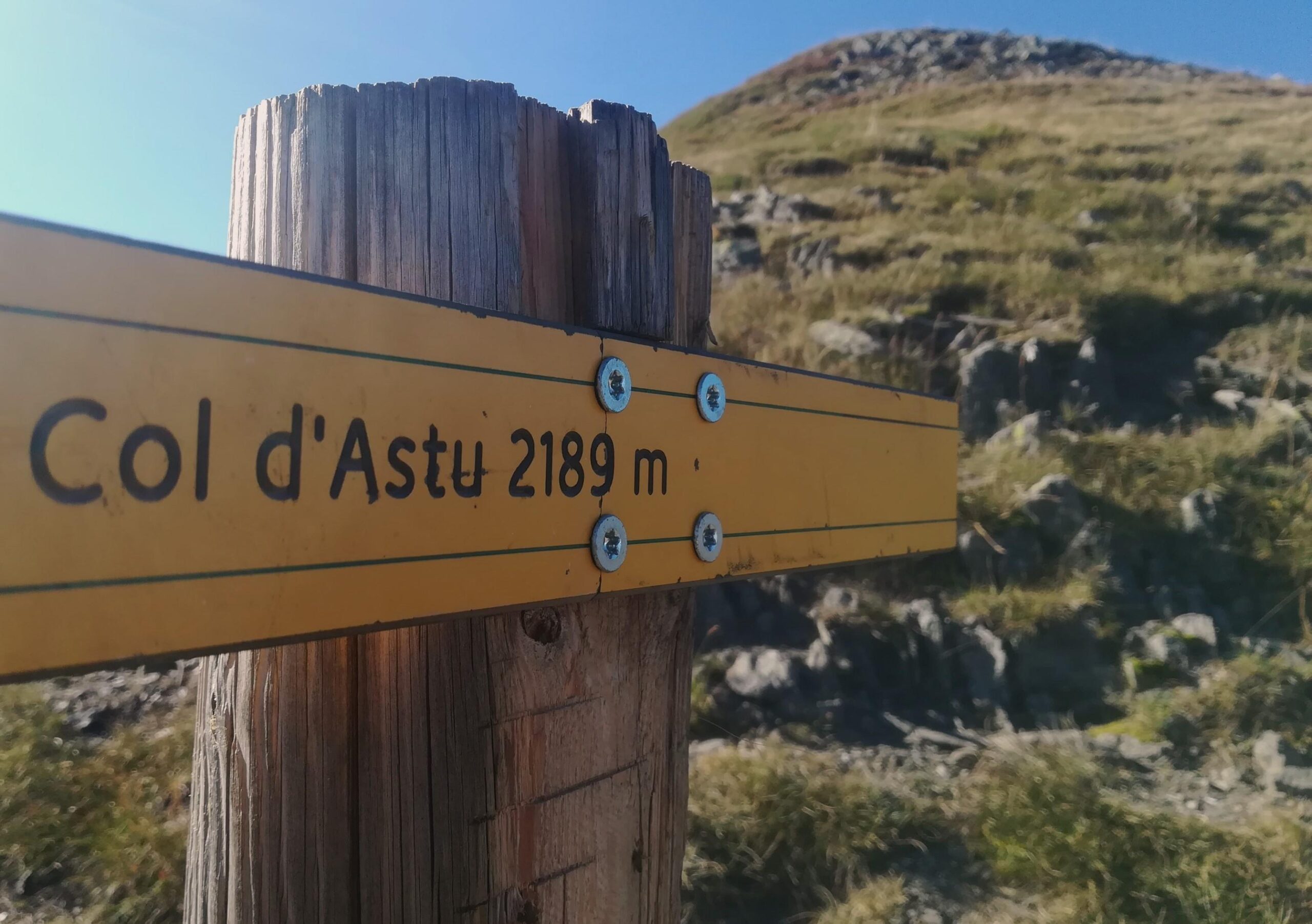
Now the choices. On the France side of the ridge the slope is mostly gently undulating and grassy, offering the opportunity for walkers to come off the ridge for a short or longer distance if they do not feel comfortable. There is also a lower path which allows people to completely avoid the ridge on the traverse eastwards to the Collado de Astún pass (2,187m).
All the paths are well used which makes them easy-ish to follow with the usual caveats of paying close attention and not being side-tracked by offshoots. Surprisingly the lower path does not appear on the Editorial Alpina map. The ridge path allows the walker to notch up several minor peaks before coming to the Pico de Astún, which is 2,287m.
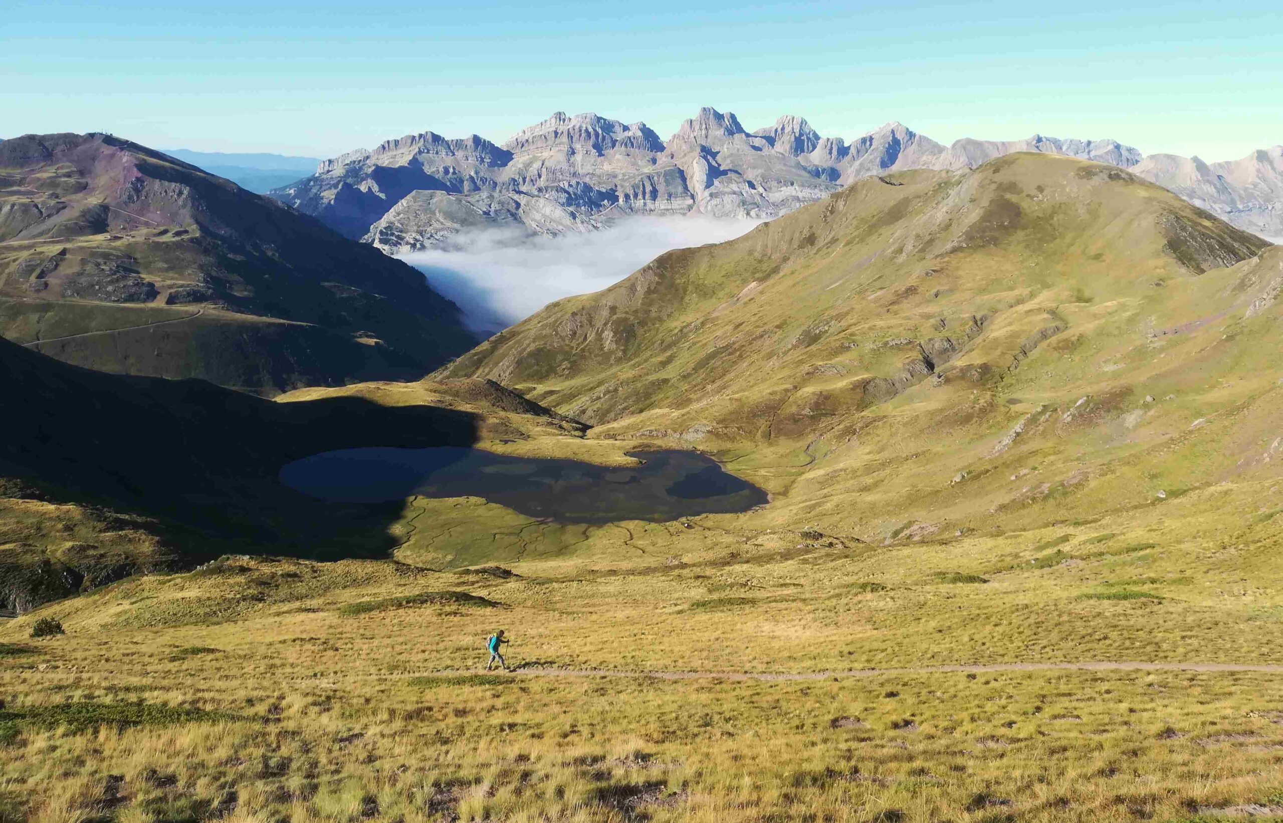
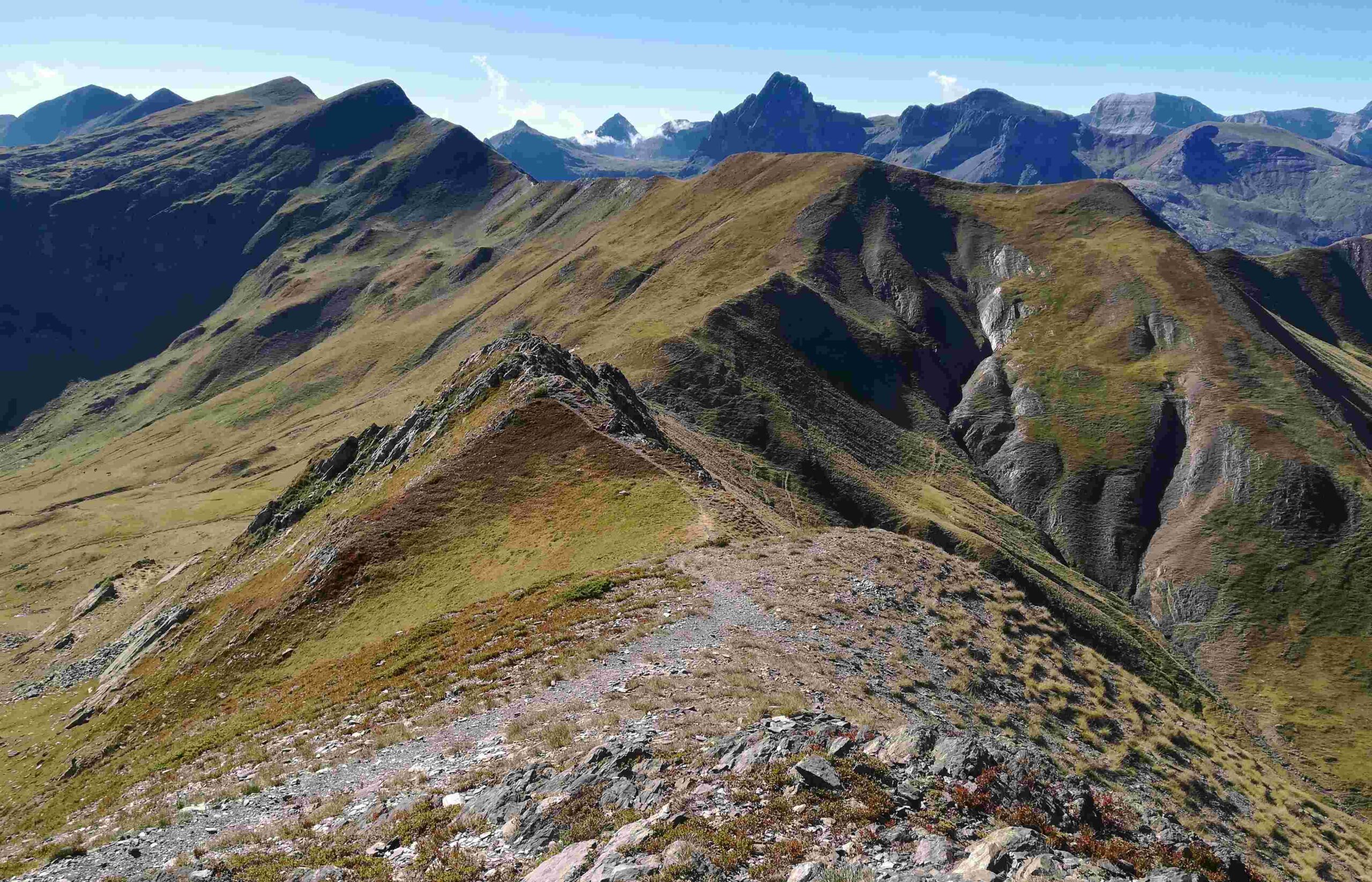
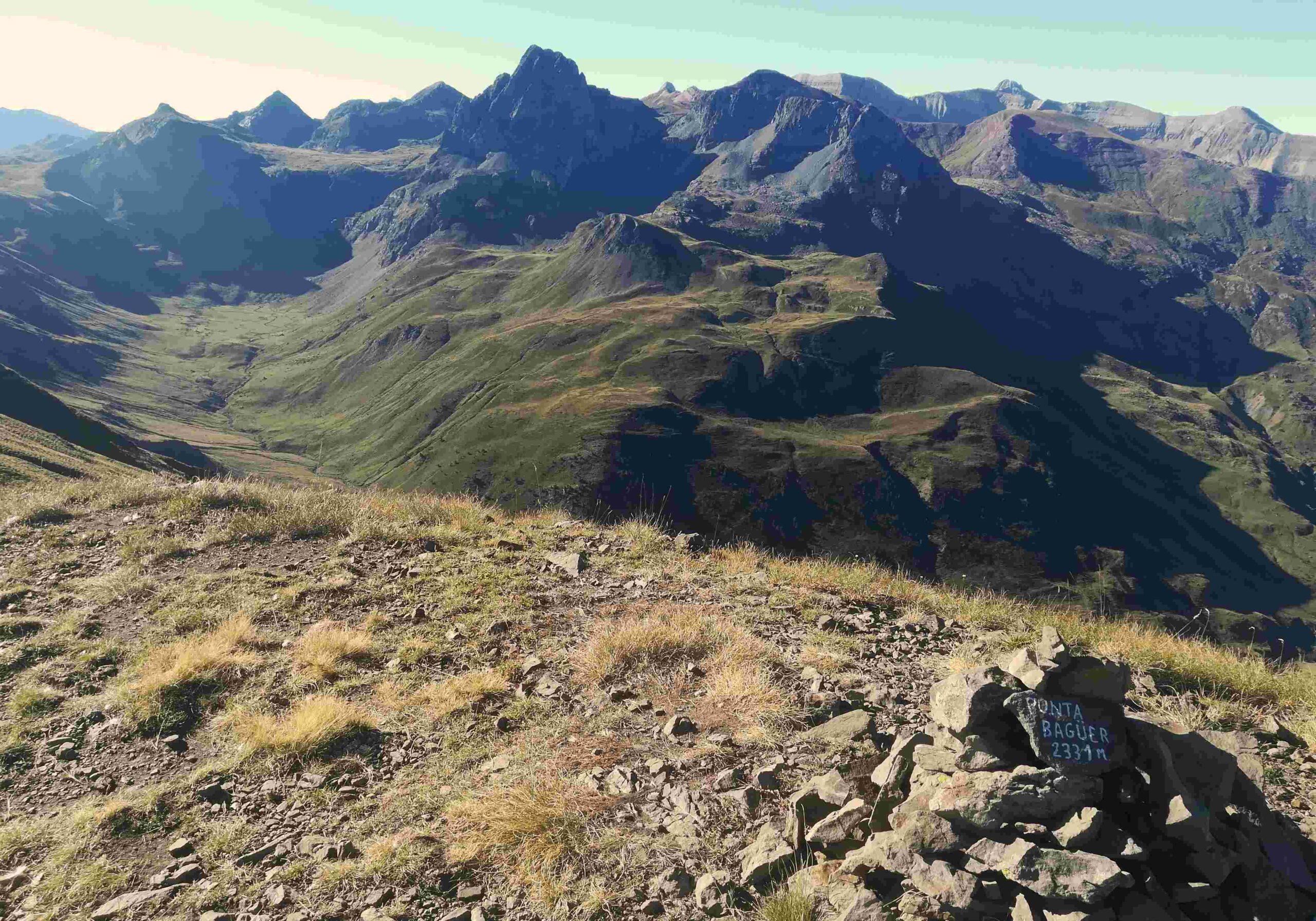
The path drops down to the Astún pass (2,187m), where there are more choices to be made. Walkers who have gone along the ridge may opt to return to Moines on the lower path, which is good option. Others may decide to return on the Spain side of the ridge. There is also the option to carry on eastwards along the winding ridge. The ridge path becomes more difficult from the Astún pass. I chose the lower option, which again is not on the Editorial Alpina map. This traverses without losing height, then doglegs right to gain height and return to the ridge. I emerged at the Punta Baguer at 2,331m – another dramatic point with terrific views to the east over the Canal Roya, the valley which bears the GR-11 footpath towards Sallent de Gállego.
I returned via the small glacial lake (in France) below Punta Baguer, then traversed left to get back to the path I’d used earlier in order to go back to the Astún pass. Back at the Collado de Astún, the route returning on the Spanish side of the border is a well-worn track which drops down to the Astún glacial lake. This side of the mountains has ski resort infrastructure. During high summer the chair lift is in operation, ferrying people up to a spot just above the glacial lake. Our route runs along the shore of the lake and then up to the chair lift. Here again the Editorial Alpina map is slightly ‘dodgy’. It shows a track descending to Astún village/ski resort via the eastern side of the Barranco del Escalar. However, it appears that this track no longer exists.
Our route keeps to the high ground and heads back to the Escalar glacial lake around 150 metres below the ridge. Return to Astún on the path which descends the western side of the Barranco del Escalar (the same path used on the ascent).
Back at Astún there are options to eat and drink before picking up the car, or returning to Candanchú on foot on the same route used earlier, via the Puerto de Somport. Despite the limitations of the Editorial Alpina map in some small sections, it is essential to have a map of the area, be it this one or one of the others which cover this zone. It will also allow walkers to see all the available routes and options, of which there are many.

Recent Comments