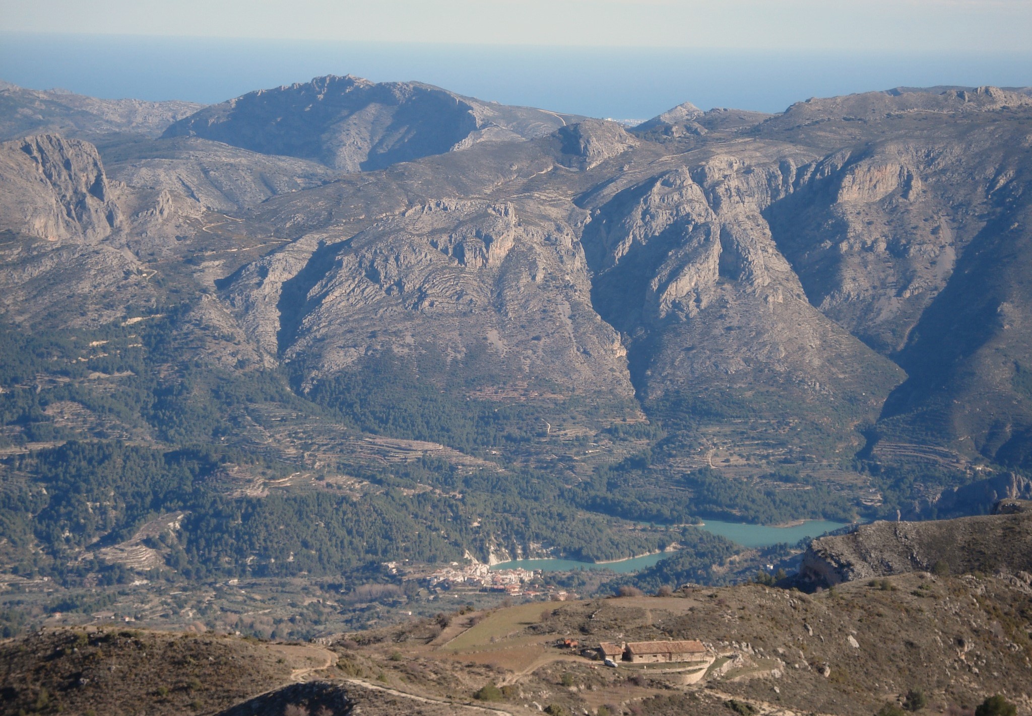
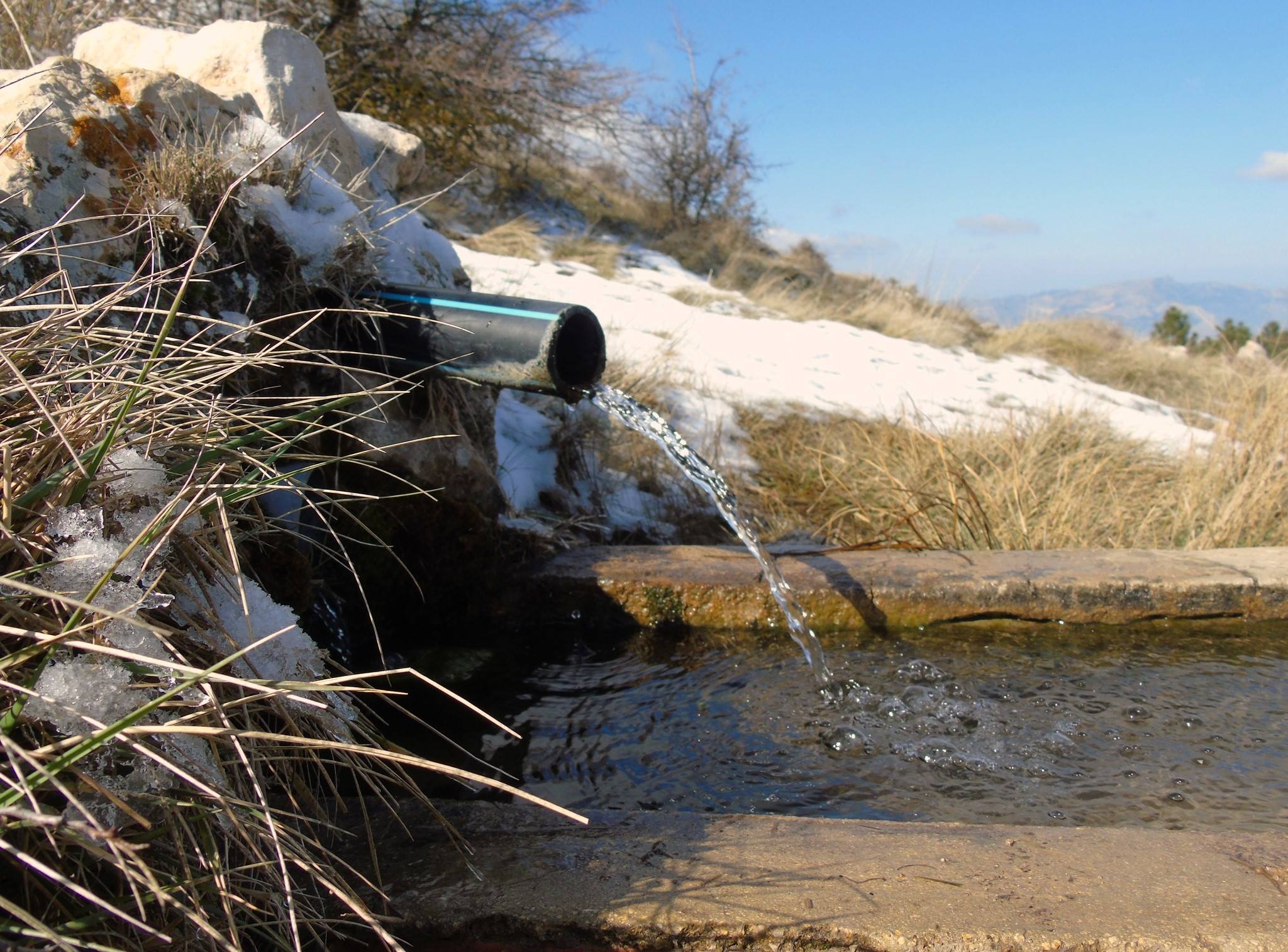
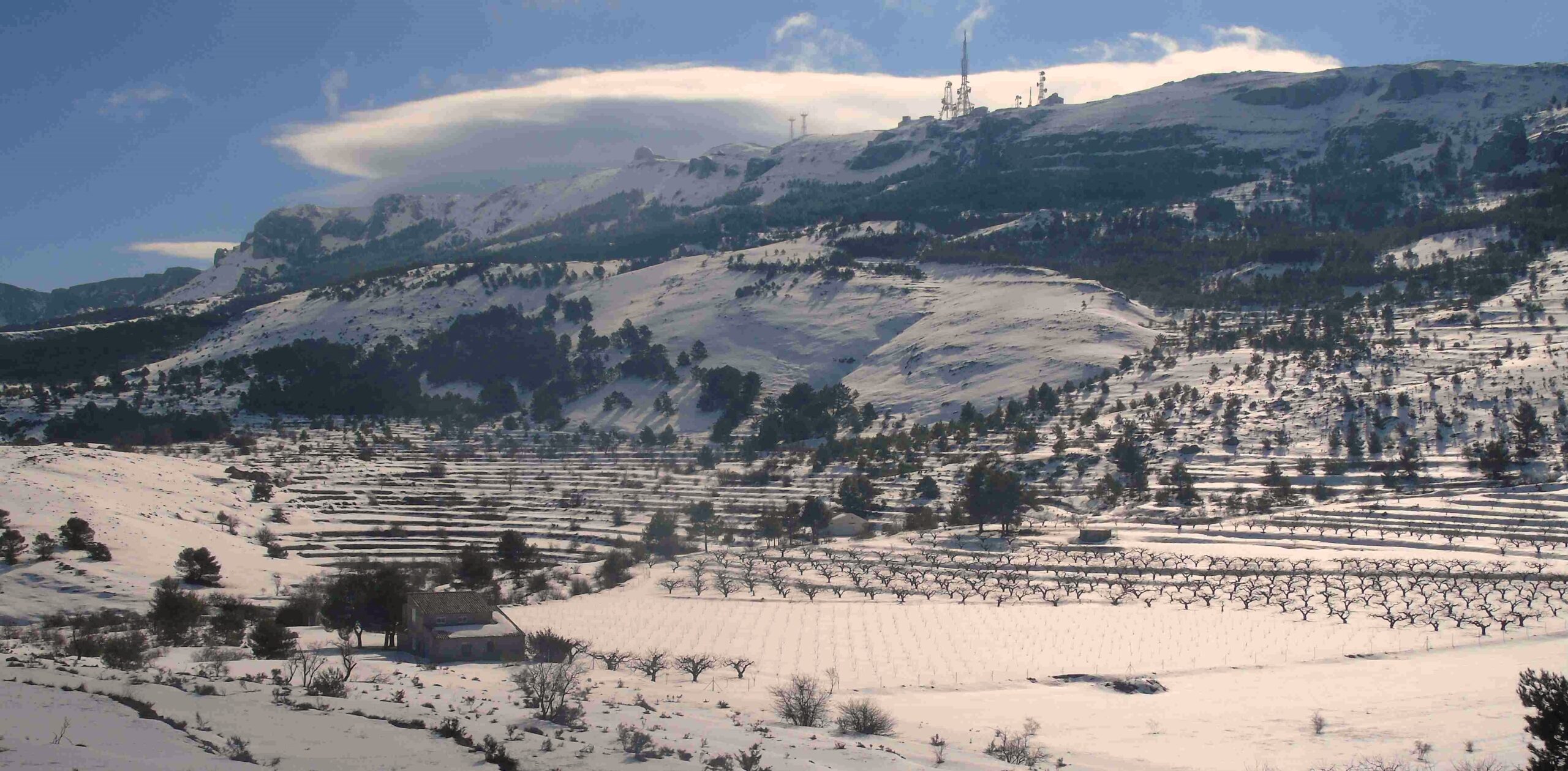
At 1,558 metres, Aitana is the highest summit in Alicante. This enormous lump of a massif is my favourite spot in the province – and one I return to on a regular basis for lots of reasons. The walk outlined here is on the north-west side of the mountain, which is a fertile area with cherry, almond and olive groves on the lower slopes. Gaining height, it’s the wonderful scent of the pine forest which takes over. Depending on the time of year, there are abundant streams – an added delight in a province which is often very dry.
For me, it’s the seasonal changes on Aitana which make it a truly special place. In summer it can be extremely hot and walkers would not want to be out after midday. However, in the winter there could be more than a metre of snow up near the summit, although snowfalls have become more scarce in recent years. It is this range of possibilities which I find enthralling.
The snow wells which can be viewed on the higher slopes are a reminder of how people lived in previous centuries, with the ‘snowmen’ packing fresh falls into the deep stone-walled pits to create ice which would be ferried down to the valleys and coast to be sold as a luxury item in pre-fridge days.
I love to be on Aitana in the winter. Getting to grips with snow in Alicante is something I will never tire of and the freezing winds at the top of the mountain are great to experience in an area which is such a short distance from Africa. In the autumn, the leaves on the deciduous trees turn colour and offer an amazing spectacle to gaze on. In late winter and early spring, it is the blossom on the fruit trees which provides the visual delights. Not forgetting the fields of poppies and other wild flowers which provide carpets of colour.
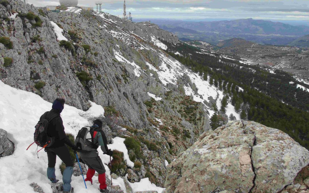
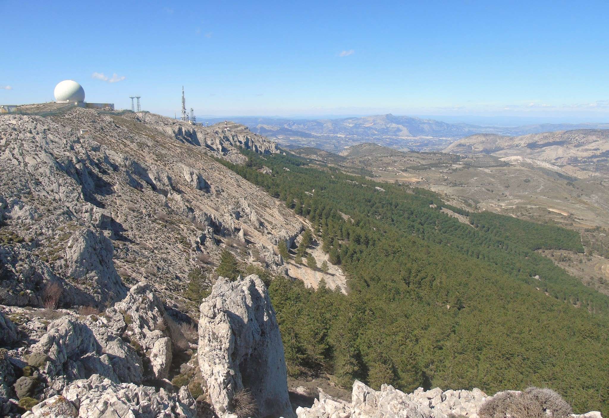
This route up Aitana is the most direct that I have found, taking in one of the spectacular features of the massif – a ravine with towering cliffs. It is a wild and wonderful spot which could be transported to the Pyrenees and not look out of place. And, although the true summit of Aitana cannot be reached because it’s in a disused military base, the high-point is only just below it.
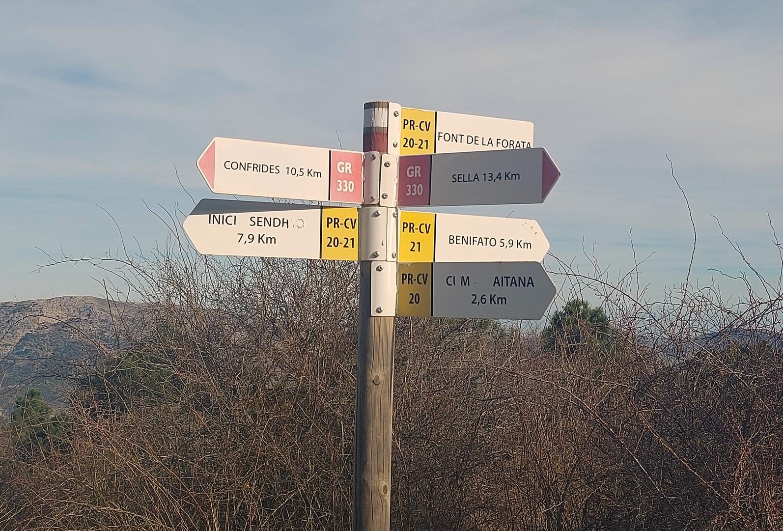
The route up – setting out from Confrides village – is a long one but it’s a terrific walk and one of the best in the province. Those who want to see the views but don’t think they can complete the whole walk can go as far as the Font de Forata (Forata spring) and avoid the final ascent to the summit ridge, which is steep but exhilarating. Forata is a great spot for a picnic and to admire the views over the Guadalest valley (the Aitana massif runs along the southern flank of the valley).
For an interactive map of part of the route, see the Femecv regional walking association page at
https://senders.femecv.com/es/sendero/ver/pr-cv-20
The Pension Pirineo hotel and restaurant usually has maps for sale which show the whole route, as well as many other paths in the area
The walk
From Pension Pirineo in Confrides, cross the CV-70 road to walk up the ramp (straight ahead then left) into the village. Take the first right (a sharp bend). Follow the Font de L’Arbre sign and the white/red waymarks which lead up and out of the village. Climb the road, round a couple of bends. At a very sharp bend – where there is a small pylon and a green house up above on the left – turn left off the road.
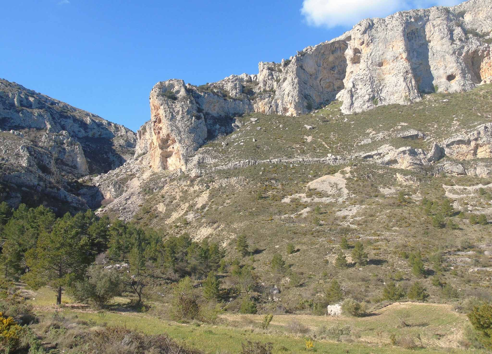
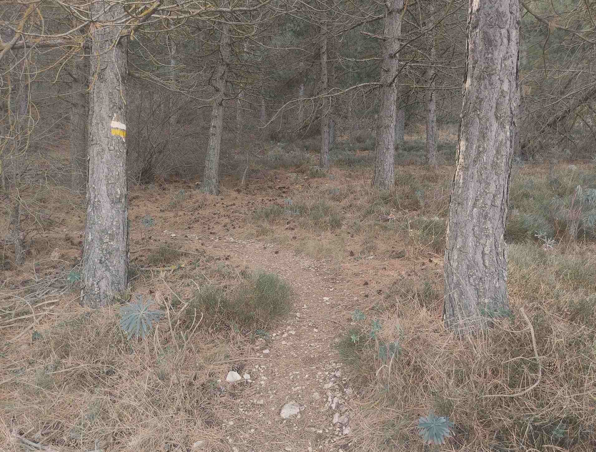
Follow the track, passing to the right of the green house. The track hugs a stone wall. Pass the gate of the ‘Rinconin’ property. Keep right at two forks in quick succession to stay on the main track and continue ascending. Soon after, pass a small white house. Arrive at the mouth of the ravine. Bear left to descend on the track for five metres, then right to drop down a short slope to cross the stream. The clear path then starts the ascent of the ravine. It’s not long before the ravine opens out and old dry stone walls are evidence of past farming activities.
Path turns into track. At a fork bear left. The track passes through the pine trees and starts on a steeper ascent. At the top of the rise turn right onto a wider track. It’s around 150 metres across this section of mountain. Emerge at another track and turn right to pass alongside an almond grove. The wide track winds up a hillside. Cutting through the rocks, the trail becomes more interesting. Arriving at the entrance to a farmstead, take the left turn around 15 metres before the entrance. Go up the bank and over. The path runs parallel to the property fence, then veers away left to enter a shallow ravine, then ascends the right-hand side of the ravine.
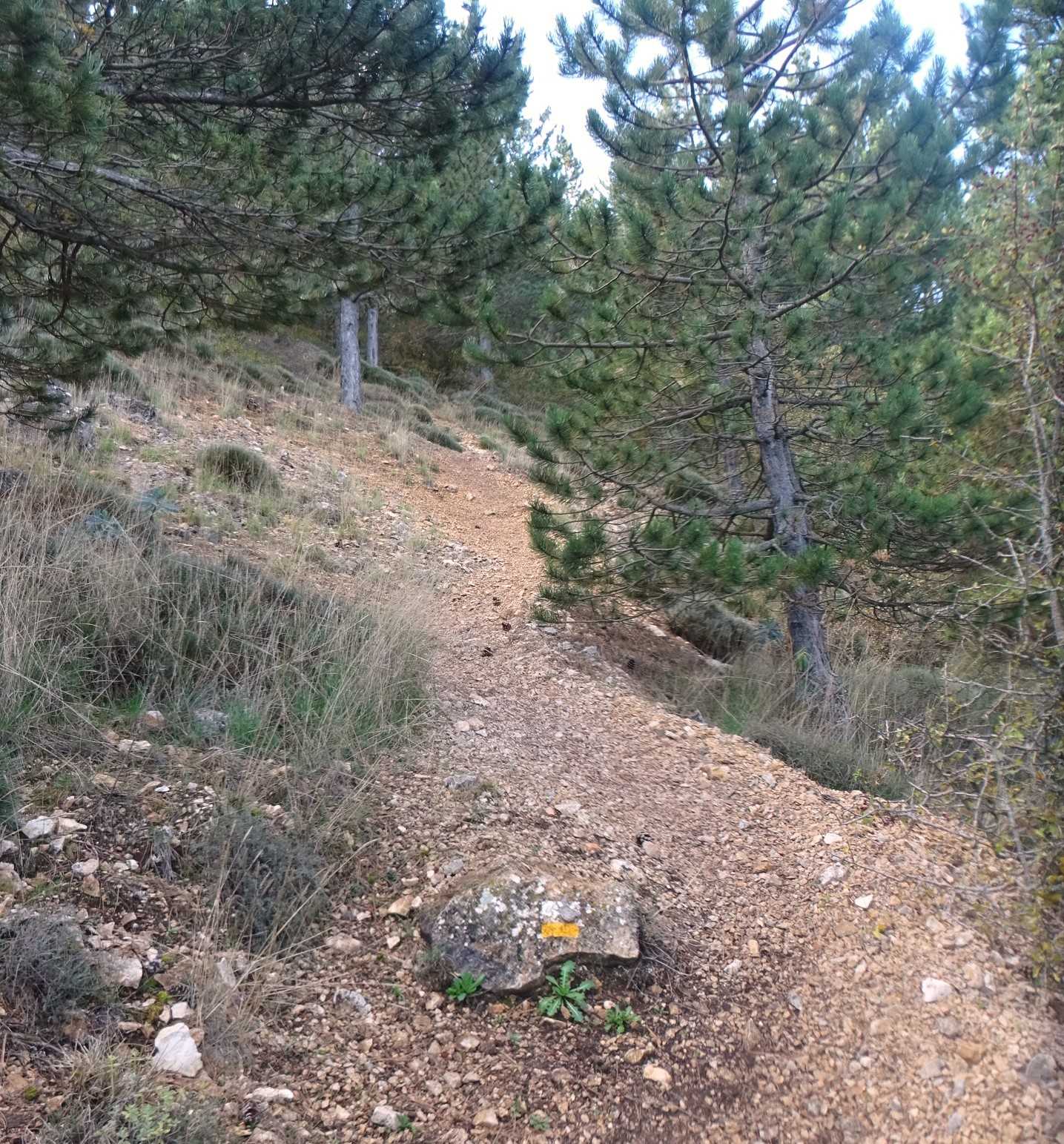
Levelling out, the path passes through pine trees, then bears round to the right to start a gentle ascent. The path goes up steadily, over a rise and down to a lovely area in the pines. At the junction, keep straight on. The track winds up through pines and ancient farmland. At a fork keep left to continue the ascent through the pines. This long section, climbing through the pines, meets another wide track which is waymarked – here, bear left.
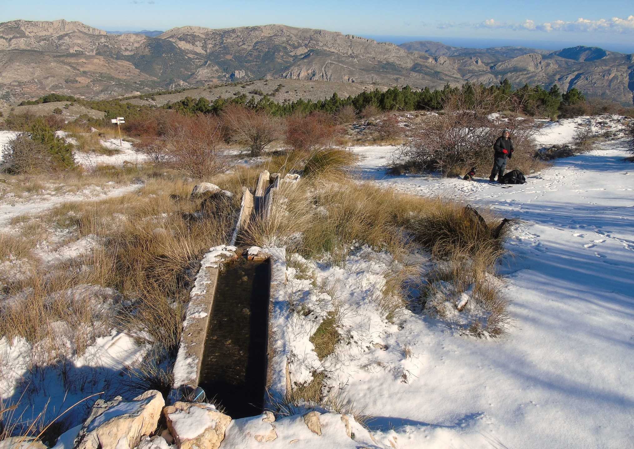
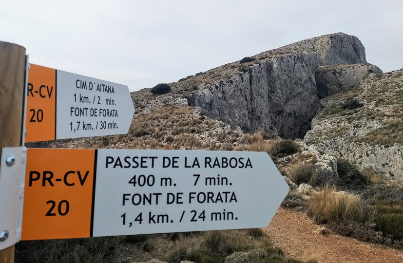
Soon the track descends to the Forata natural spring (Fuente/Font de Forata), which stands at 1,370 metres above sea level. The elongated mechanism which is the Forata spring looks a bit like a cow trough and it can get frozen up during cold spells. It is surrounded by tufty grass and it’s a good place for a sit down to gird the loins for the final push to the top.
The spring is named after the round hole in the rock up above and to the left, which is a phenomenon known as a ‘forata’ in Spanish and ‘forat’ in Valencian. For those who don’t fancy the climb to the top, skip this next section and go to the (*).
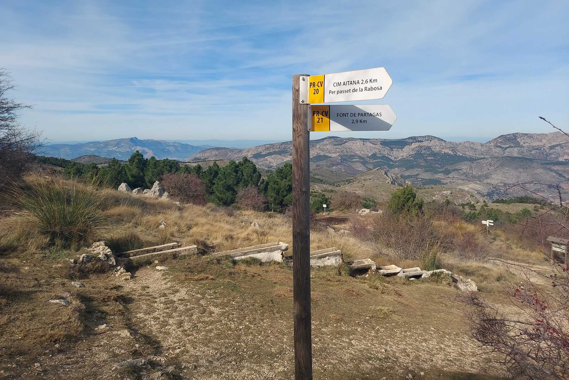
This final part of the route is waymarked – as part of the PR-CV 20 footpath.
The signpost near the spring points for the Rabosa ‘passet’ (passageway) to get to the summit (‘cim’ in Valencian). However, I prefer to do it the other way, which is to ascend the steepest section first and come down on the less steep path, which is via Rabosa. This route takes on the path in an anti-clockwise fashion.
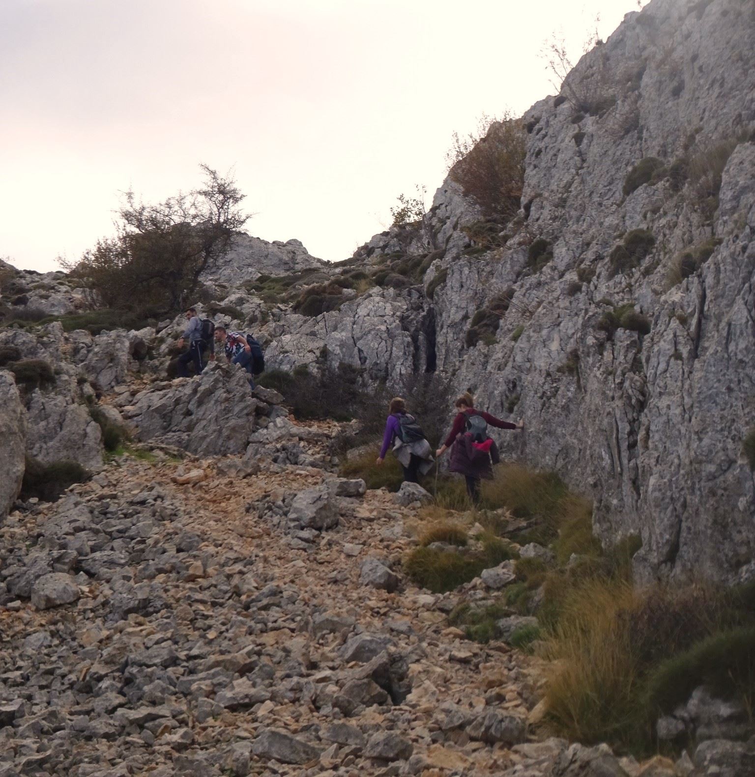
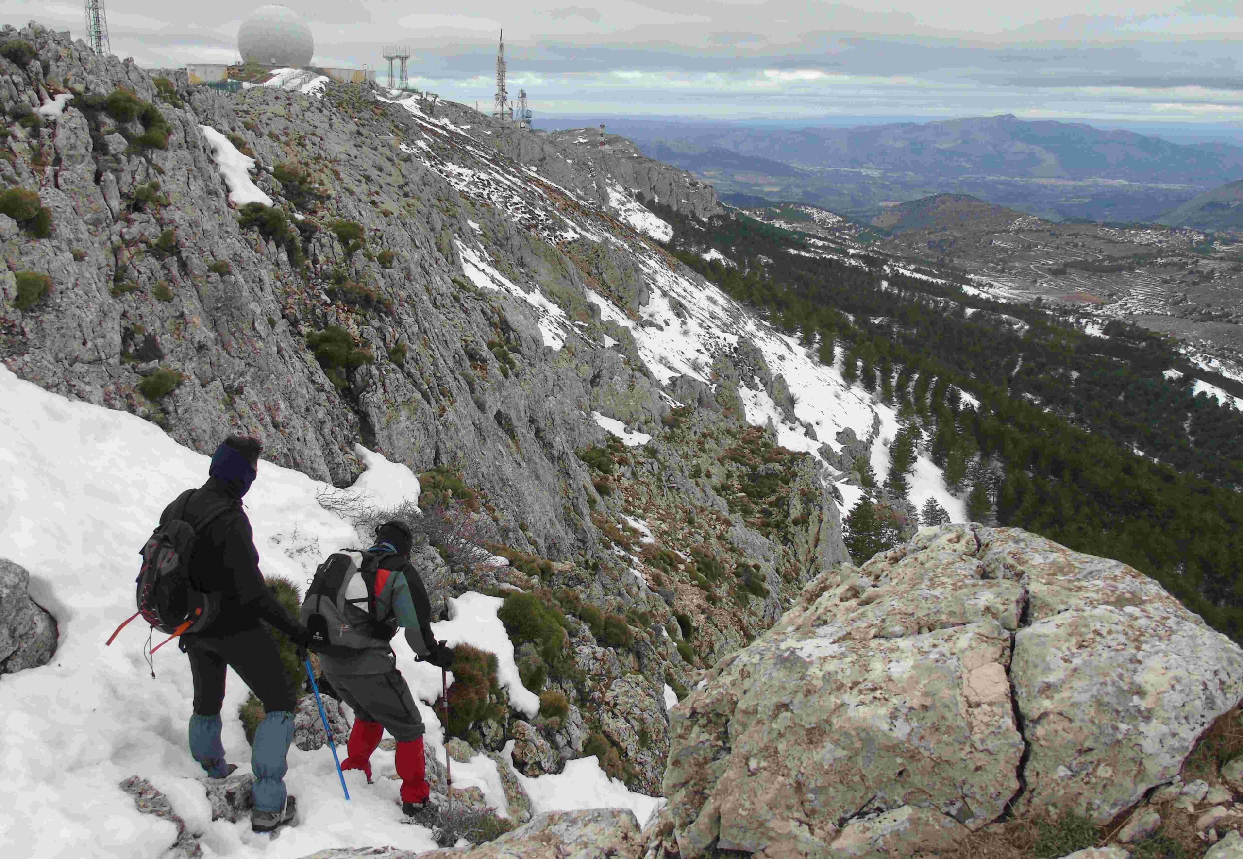
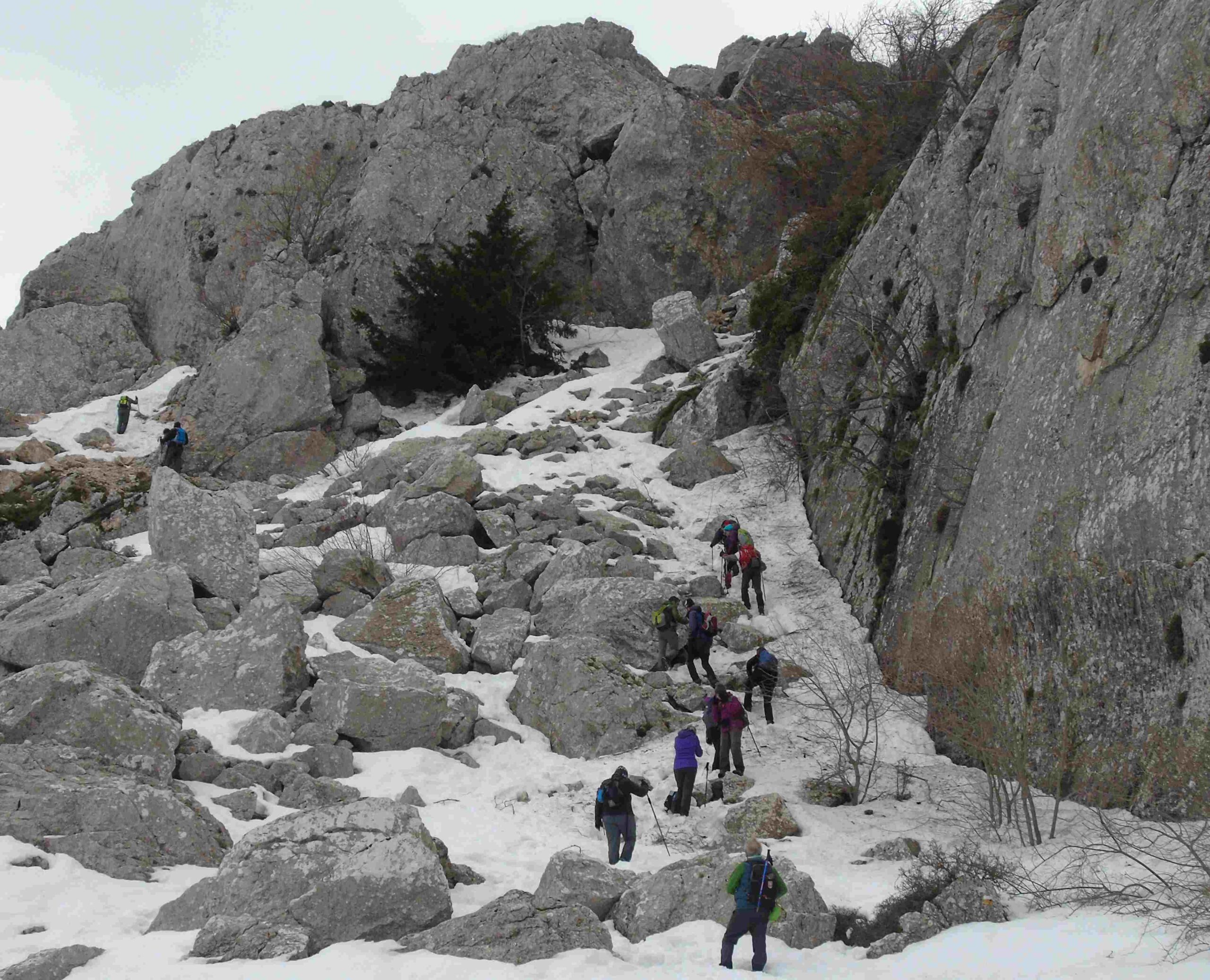
Take aim for the summit by looking along the long line of the Forata spring, which points to the peak and the listening devices up top. This sends the walker straight up the mountain – the direct route to the top. After approx 150 metres, pass to the right of a man-made rock shelter, which has been fashioned at a large lump of isolated rock. There are occasional white/yellow waymarks to help with orientation. The path continues into the pines and heads directly up the steep slope. Keep going straight, up through the trees. Emerge from the pines onto a scree path. This is the final, open section up to the top.
It looks steep and difficult, but it isn’t really. Take your time – but a fit person will get up this last bit in a couple of minutes. There are waymarks to help but the path is clear. With a rock wall on the right, it a bit like ascending an open-roofed tunnel. Emerge at the summit ridge of Aitana, with views over large swathes of Alicante province and beyond. This is as high as you can go. It’s a good spot for a sit down to take in the views.
To descend, follow the ridge away from the military base, observing the waymarks. The path starts to drop down into a dip. At the bottom bear left to follow the sign which points for Passet de la Rabosa, which is 400 metres away. The first 15 metres cross a grassy section. Then a few metres of rock. Tread carefully. There are deep fissures in places.
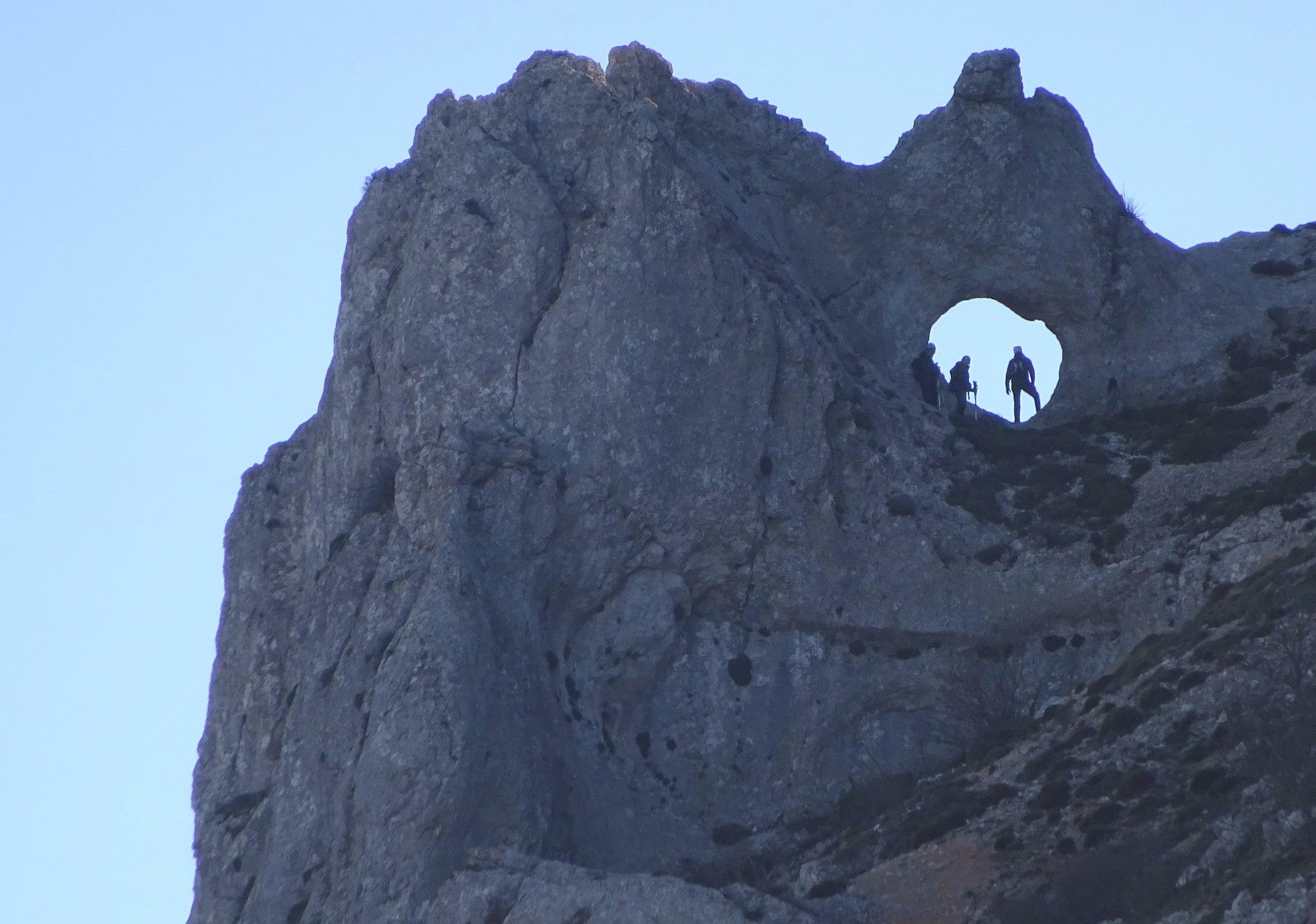
The waymarked route bears to the left. After around 300 metres, the path appears to stop at a huge lump of rock. However, there is a narrow opening which allows passage through – this is the Passet de la Rabosa.
It’s a short climb down of around two metres to get to the ‘slit’ in the rock. Before doing this, on the right of Rabosa, there is a ledge which offers a good spot for a sit down and splendid views over the surrounding area. Pass through the narrow opening in the rock. It’s a bit of a squeeze, which is why some refer to it as ‘fat man’s agony’, but it’s good fun.
Take care with the following descent. It’s not a long section and there are fixed chains in place to help with balance. But there is loose scree in some areas. In very cold weather you have to be extremely circumspect. I slipped here on ice a few years ago, which could have been very nasty, but luckily I only ended up with a few bruises.
Descend the rock path. At the bottom, bearing slightly left to keep to the high ground, pick up the ‘sender botanic’ (botanical footpath), which returns to the Forata spring. This is a pleasant section, in the shadow of the looming Aitana ridge above, and with rare plants on either side of the footpath.
(*) Back at Forata, return on the same route to Confrides.
Walk facts
Length – approx 17km; time – 6-8 hours; ascent – approx 850 metres; getting lost rating – medium/high; difficulty – high; season – spring/autumn/winter; getting to the walk – take the CV-70 from La Nucía to Confrides. Still on the CV-70, parking is available in front of Pension Pirineo, on the main road at the entrance to the village


Recent Comments