Sallent de Gállego is one of the classic Pyrenees village/towns; it gets a mention alongside names such as Benasque, Torla and Bielsa. It is a historic settlement, positioned towards the top of the Tena valley at a height of 1,305 metres. The fantastically-named Aguas Limpias (clean waters) river flows through Sallent and empties into the Lanuza reservoir just outside the village, along with the River Gállego. A wonderful old stone bridge named the Puente del Paco, crosses the river in the centre; not far from the church which was also constructed in the 16th century.
While neighbouring Formigal (which is in the municipality of Sallent) has most of the accommodation, one hotel I have enjoyed staying in is Hotel Aguas Limpias, which is close to the river in the street of the same name, with their website at www.hotelaguaslimpias.es
The mainstay for walks is the GR-11 long-distance footpath. When purchasing a map of the area, such as Editorial Alpina’s Valle de Tena (1:40,000 scale), you will see that paths branch off the GR-11 at different points, creating alternative routes from Sallent. This ensures that there is several days of interesting walking to be had if this is your base in the area.
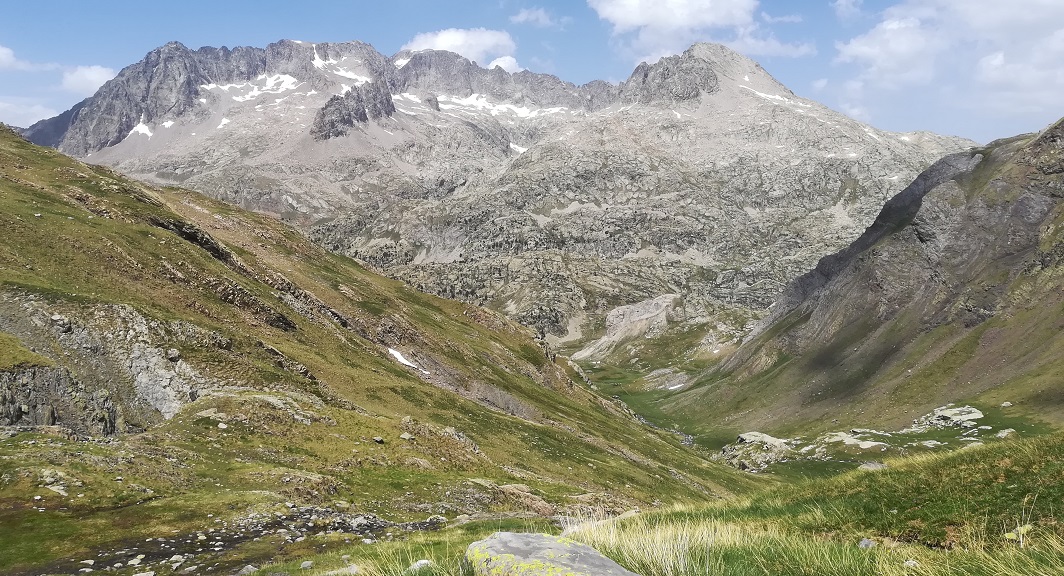
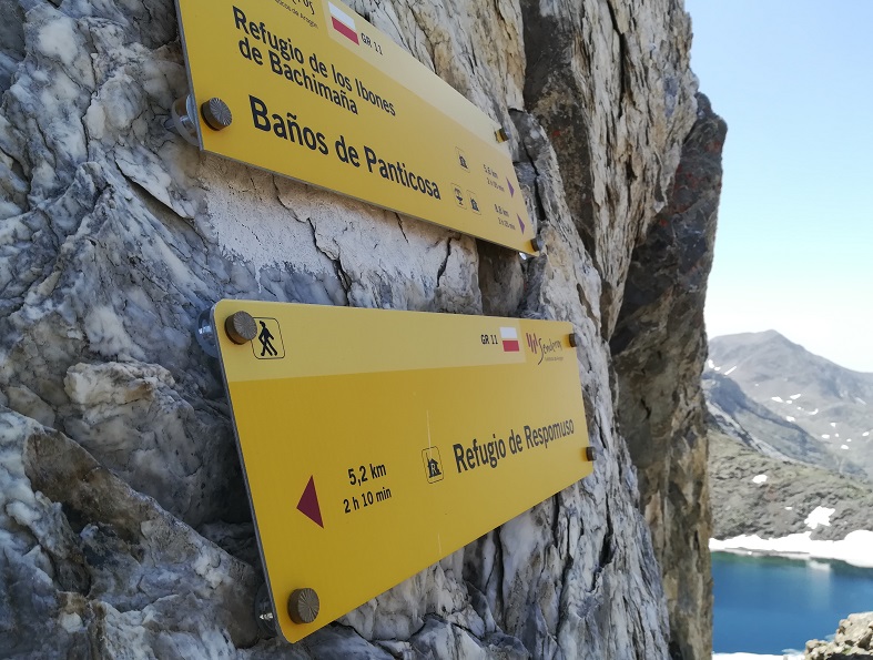
The GR-11 heads up to the Respumoso lake/reservoir; the short stage from Sallent measures just 11.9km, with 995 metres of ascent to reach the Respumoso mountain refuge. The next stage is to Baños de Panticosa and the best of the walking comes here – after the refuge, as the path heads up to the Tebarray pass. Most walkers won’t reach the pass if they are returning to Sallent the same day; it’s another 5.2km to get up to Tebarray (also known as Piedrafita), with the refuge standing at 2,140m and the pass at 2,782m (or 2,771m according to the Prames map). However, the Valle de Llena Cantal, which leads up to the Llena Cantal glacial lake, is worth making the effort for; walking up this wide, verdant valley is a joyful experience.
The route
The GR-11 heads out of the back of Sallent on the left-hand side of the Aguas Limpias. It’s a wide track which leads up to a path, then it’s a short stretch on a country road to get to La Sarra reservoir. The road runs along the right of the reservoir, while the GR-11 follows the left bank in an undulating fashion. The road has no shade but is a little bit quicker.
When La Sarra reservoir ends, a footpath follows the river to its source at the Respumoso lake/reservoir. The route describes a huge dogleg; running round a very long gradual bend. It starts with a grassy section which heads into deciduous forest, offering welcome shade in the summer. Next up is the Paso del Onso, where the river threads into a tight, spectacular ravine; there are sharp drops on the right but the track is wide and the danger is easily avoided by keeping to the left.
There are waterfalls en route, with water crossing the path, offering relief from any heat. At the Llano Chetó flats there is a large stream to cross; plot a course over on the rocks. Then the path doglegs right and the long ascent to the dam at Respumoso begins.
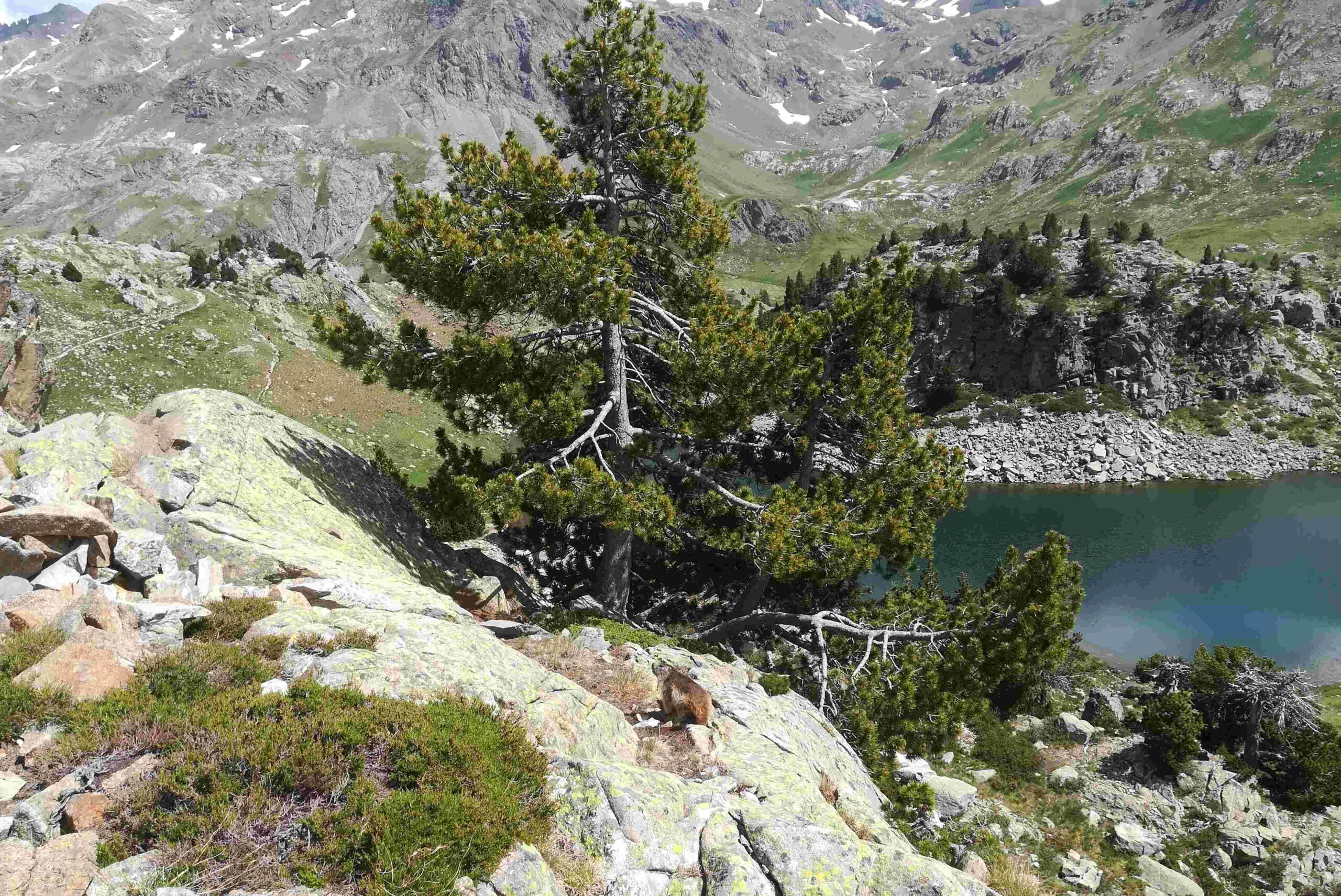
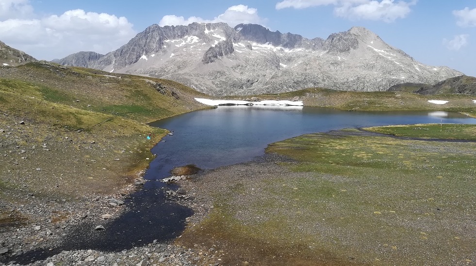
Emerging at the lake, the GR-11 hugs the left-hand side, although it is possible to walk on the other bank, which is a good option for the return route.
The GR-11 runs high above the water with plenty more up and down. The route passes above the mountain refuge. Those who want to break up the day and spend the night at the ‘refugio’, book ahead at www.alberguesyrefugios.com/respomuso
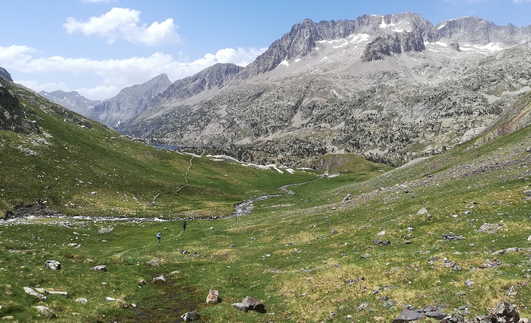
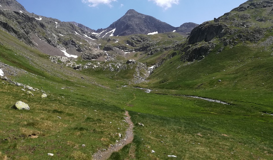
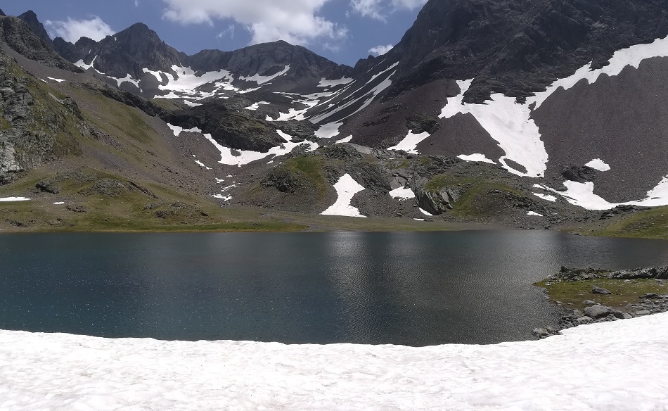
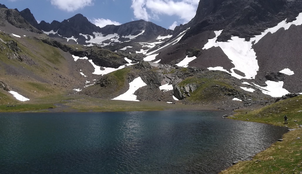
After the refuge, the route heads to an old dam, with a great view of the Campoplano glacial lake, before dropping down almost to the level of the reservoir. Then the ascent of the lovely Llena Cantal valley begins. Follow the stream up, walking on green bouncy grass. The Llena Cantal glacial lake stands at 2,433m and will be the end of the road for many day walkers. It’s a terrific spot for a picnic and some marmot watching, if they are about, not forgetting the views of the 3,000-metre summits. On a hot day, some people may be tempted to have a dip in the lake.
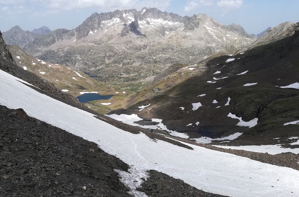
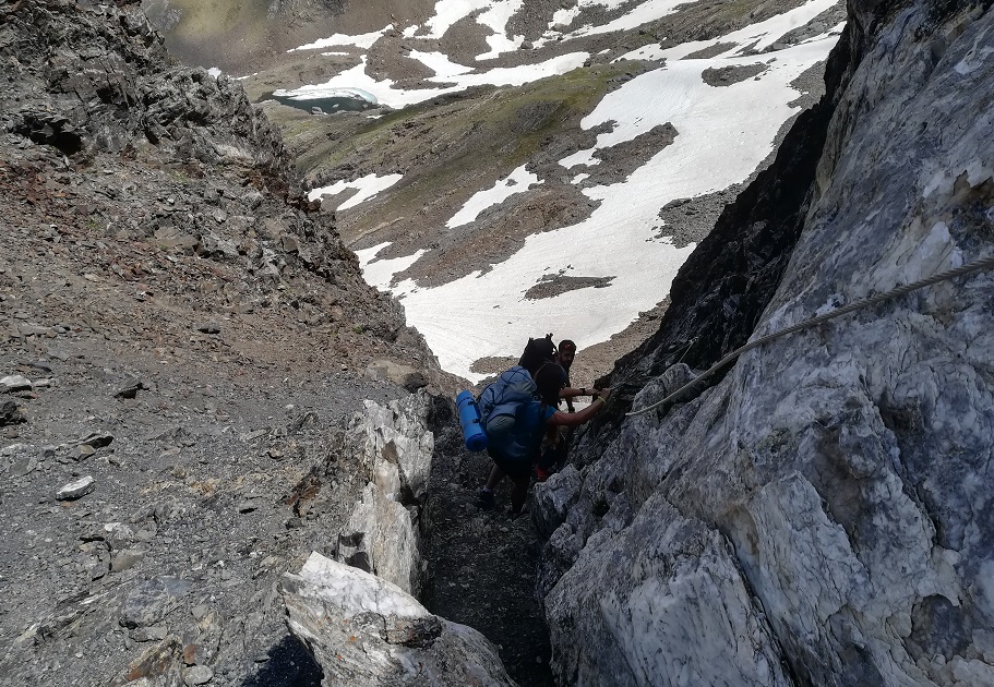
After Llena Cantal the meadows relent and a lunar landscape holds sway for the final ascent to the pass. It’s rocky terrain, with reminders of the area’s glacial past all around. There is just under 350 metres of ascent to get to the pass, under the watchful eye of the Pico de Tebarray summit (2,916m). The final section is difficult and should only be taken on by experienced mountain walkers. The main problem is that the route is eroded due to heavy traffic on the GR-11, with dozens of people passing over here each day in high summer – and also damage caused by snow, ice and extreme weather. Just before the pass there is a ‘path’ around 50 metres in length which is very steep and worn. The only way to do it is to walk very slowly and carefully. The final section is on rock and there is a fixed chain to help (bear in mind you have to go back the same way).
For those that make it, there are awesome views from the Tebarray pass at 2,771m Looking back, see the imposing peak of Balaitus, one of giants of the Pyrenees at 3,144m. Over the other side, it’s the sky-blue Tebarray glacial lake which is frozen for much of the year, with hell’s peaks above it.
Another point to bear in mind is that there may be some snow to cross. I did the walk to Tebarray at the beginning of July and the snow was below the pass, so it was not on the most difficult section. Heading back down, some people may decide on a glissade (in this case a slide on the backside) down some of the snow slopes. I did two, which was a relief for tired legs. However, walkers should only attempt this if they are experienced at this manoeuvre; also keep an eye open for rocks which could cause injury.
On the return to the Respomuso reservoir, walkers will want to study their map for the alternative route to the GR-11. This is on the left-hand bank of the lake. It leads round to the dam. Shortly after passing the dam bear right to go down then up to rejoin the GR-11 to return to Sallent.


Recent Comments