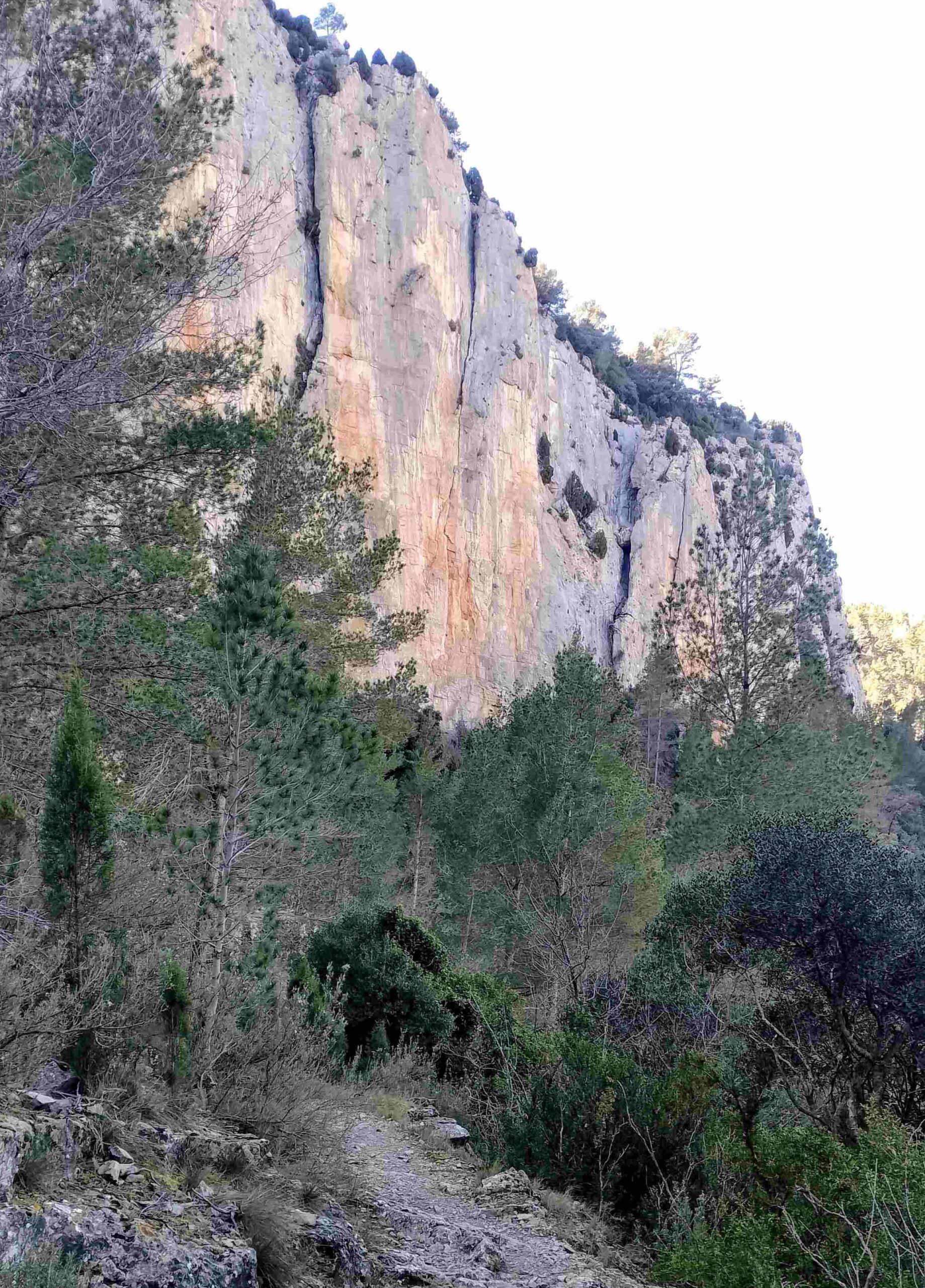
This route runs along the side of the gargantuan Maimona ravine, up towards the summit of La Rosada at 949 metres. The walk follows the GR-7 footpath through the ravine, which is signed with white/red waymarks. There are spectacular views of the rock walls which measure several hundred metres in height.
Walkers should be aware that great care has to be taken along a path which has vertical drops into the abyss below. A head for heights is needed on this section, which should only be attempted by experienced mountain walkers.
An interactive map of this stage of GR-7 can be found on the FEMECV regional walking association website at https://senders.femecv.com/es/sendero/ver/gr-7-e33
This is the Montanejos to Mas de Noguera stage of the long-distance footpath.
For the descent, the route turns off the GR-7 onto La Rosada footpath, which is signed with white/lime green waymarks and is route eight (senda 8) in the town hall’s ‘plano senderos’ leaflet.
This circular walk is approximately 11km in length, with around 500m of ascent. Allow between four and five hours for the walk.
The walk
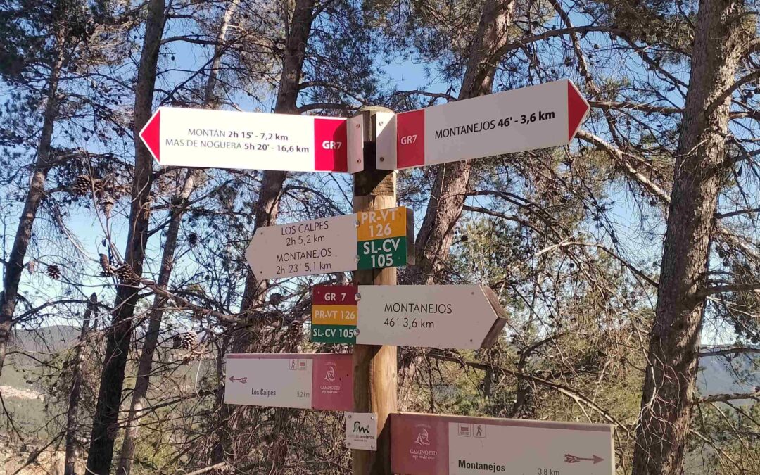
Walk out of the town on the CV-195 road, in the direction of the A-23 motorway. Around 100m after passing the petrol station, turn right; there are signs and a walk board here. Follow the GR-7 sign which points for Montán, heading along a lane which goes back towards Montanejos.
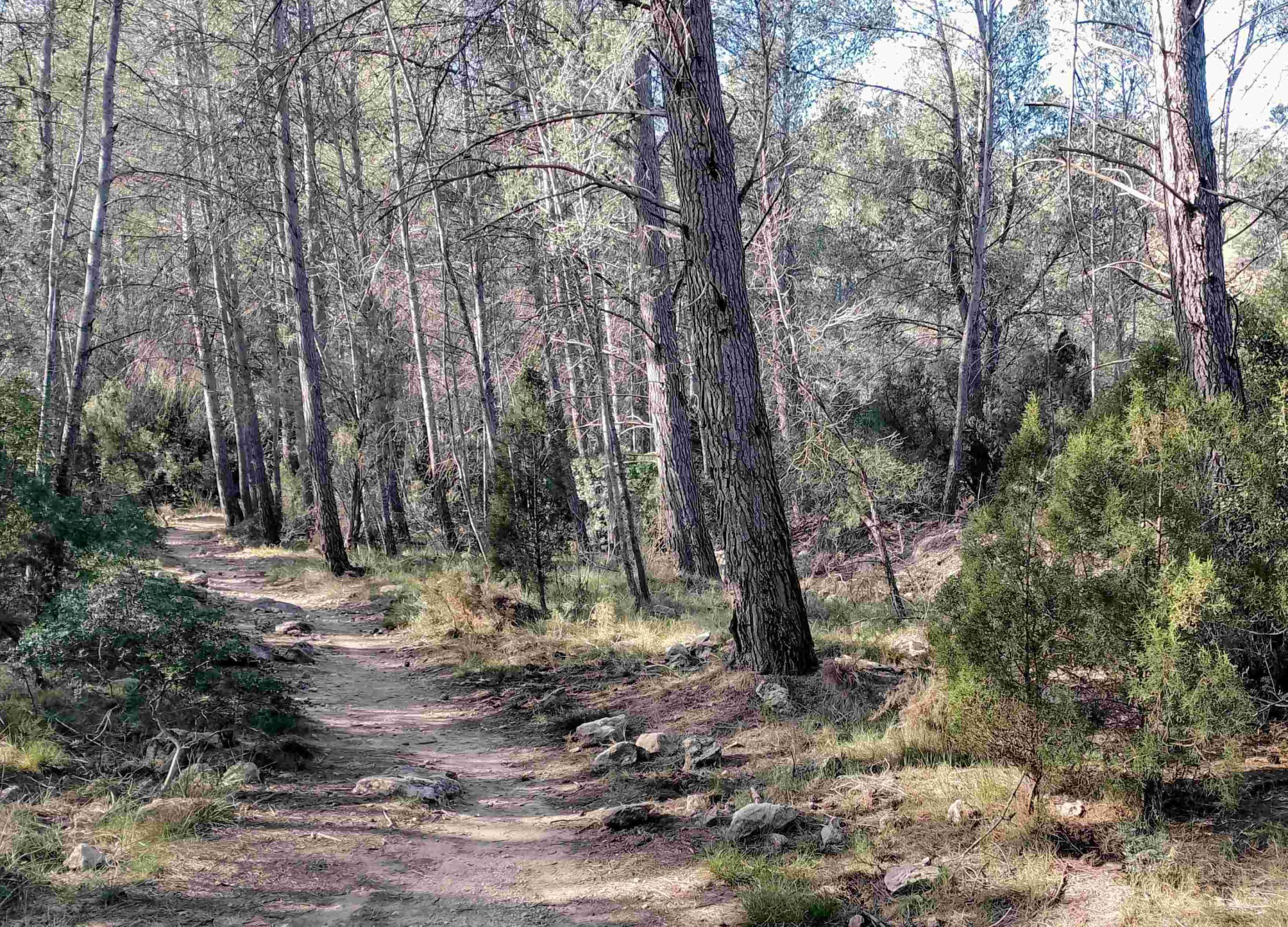
After around 300m, the lane bears left and turns into a track (near the mobile phone mast) to start ascending the mountainside. The route is well signed; it soon turns into a path which embarks on a pleasant climb through the pines. At a fork, bear right, following the GR-7 sign.
As the path rises, the views improve over the vast forested area around Montanejos. On the horizon, it is possible to glimpse Peñagolosa, the second highest mountain in the Valencia region at 1,814m.
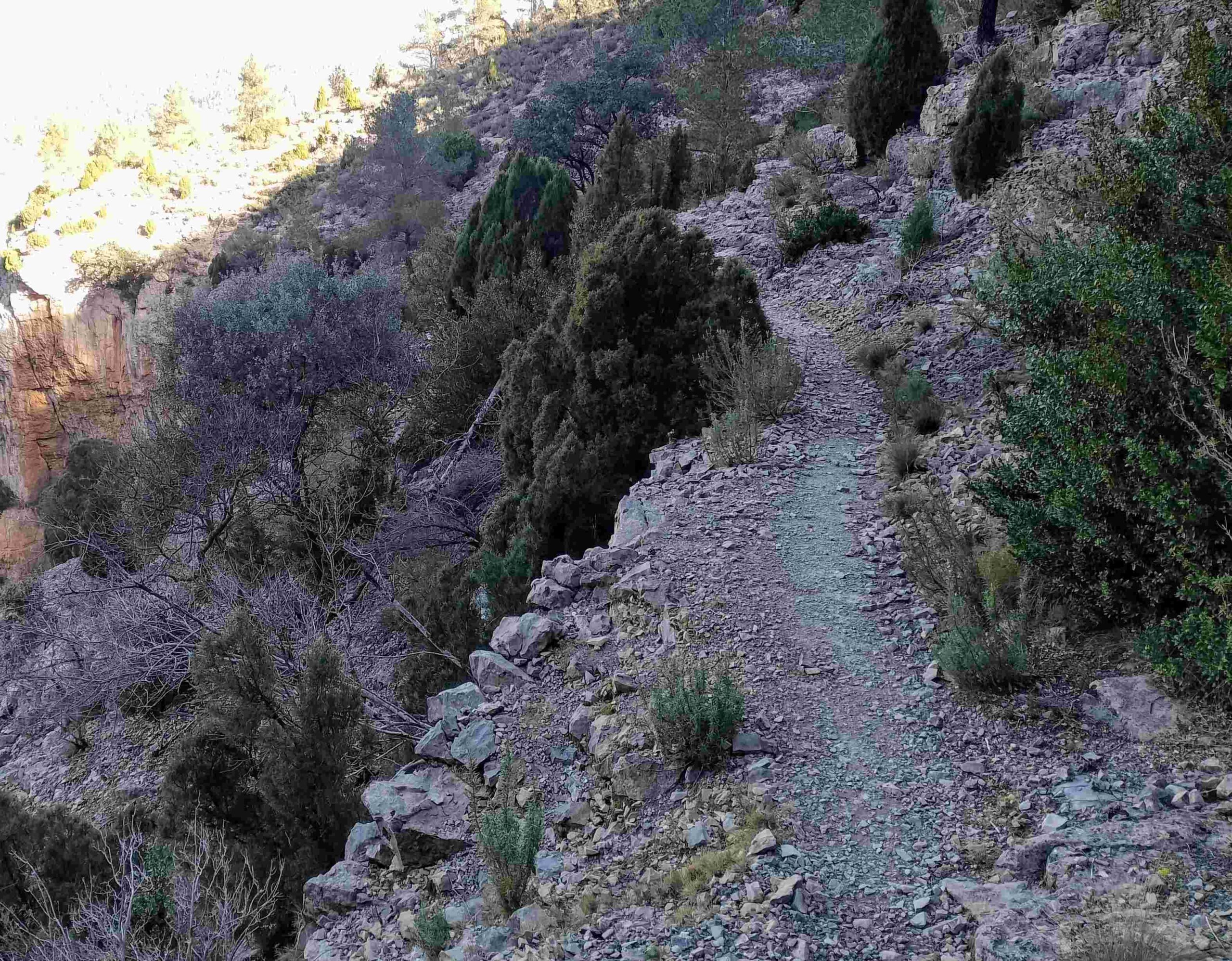
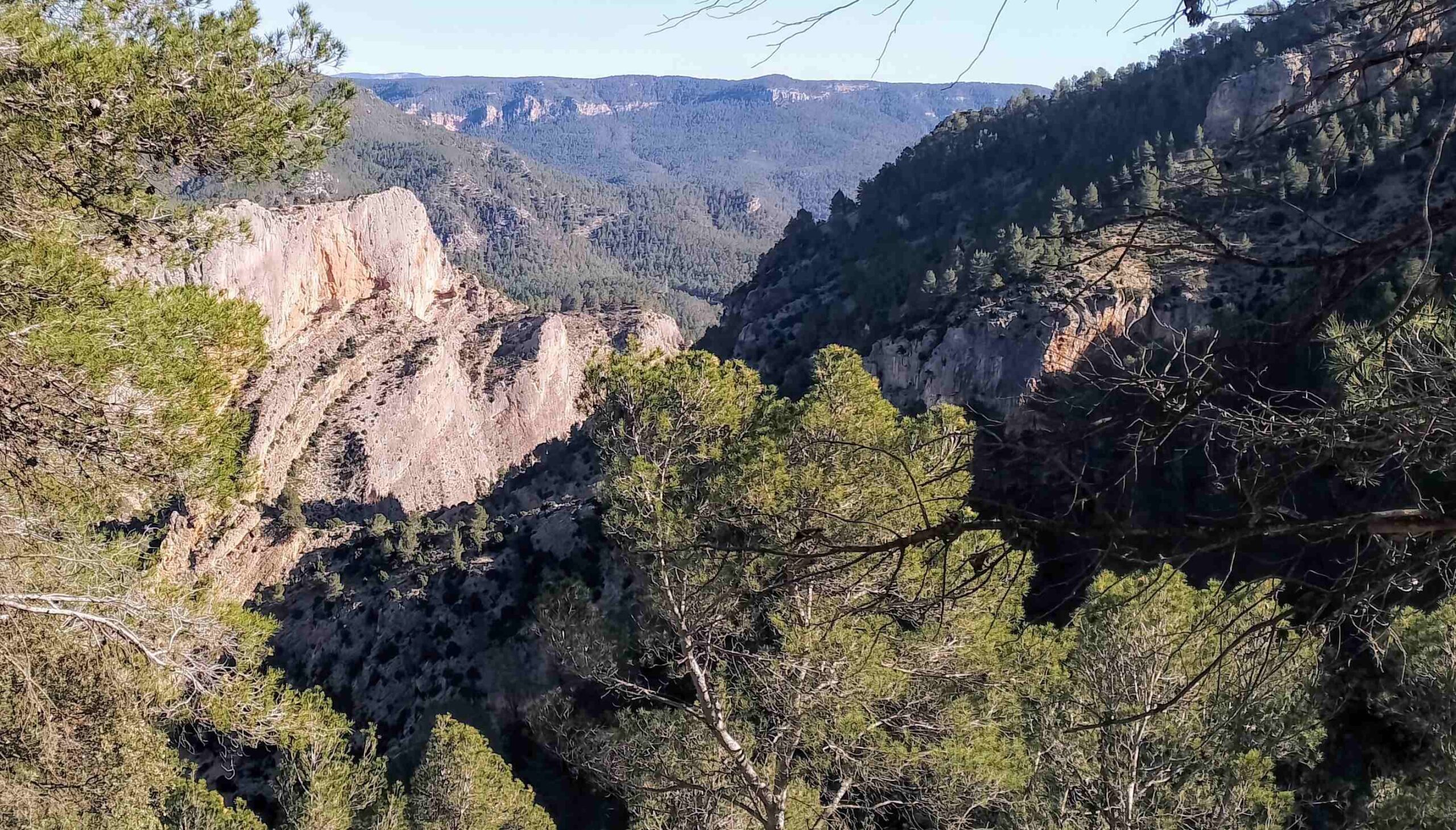
The path becomes a bit steeper and then rounds a corner to enter the Maimona ravine, which is a breathtaking sight. It’s a wide path but be aware of the potentially-fatal drops off to the right.
The path heads around the side of this incredible, sheer-sided ravine. While enjoying the views, also be aware that complete concentration is needed on this path; and particular care should be taken while taking photos.
The imposing vertical cliffs dwarf the walker, while down below there is an area beloved by climbers, known as the Plaza las Catedrales, where water has carved a path through the rock.
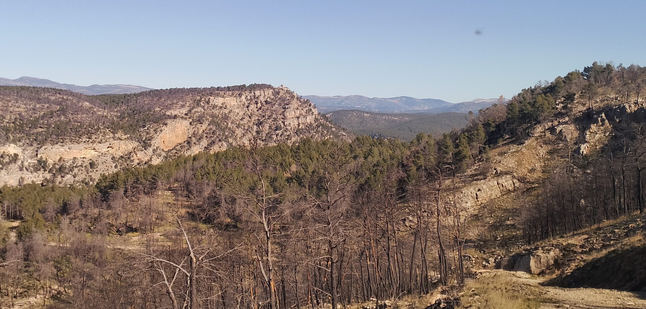
Leaving the Maimona ravine path behind, the path emerges at a track where there are lots of signs. Our route bears left to ascend on the surfaced track, continuing on the GR-7. Vistas appear of a different section of the Maimona, now further away and wider at this point. Heading up through the trees, evidence appears of the severe forest fire which hit this area in March, 2023. Some dead trees have been cleared, while others remain as a haunting reminder of how forests in Spain are drying out, leaving them more susceptible to fast-spreading wildfires.
The track emerges at a saddle, where there are views across to high-mountain areas in Teruel province which can be covered in snow in winter. This is the highpoint of the route and the track starts to descend on the other side. After around 100 metres the track forks; the GR-7 goes right and we turn left, following the La Rosada sign on a wide track. The route passes to the left of an abandoned farmstead (masía), with almond trees below it which will be in bloom in February; above more charred pines line the slope.
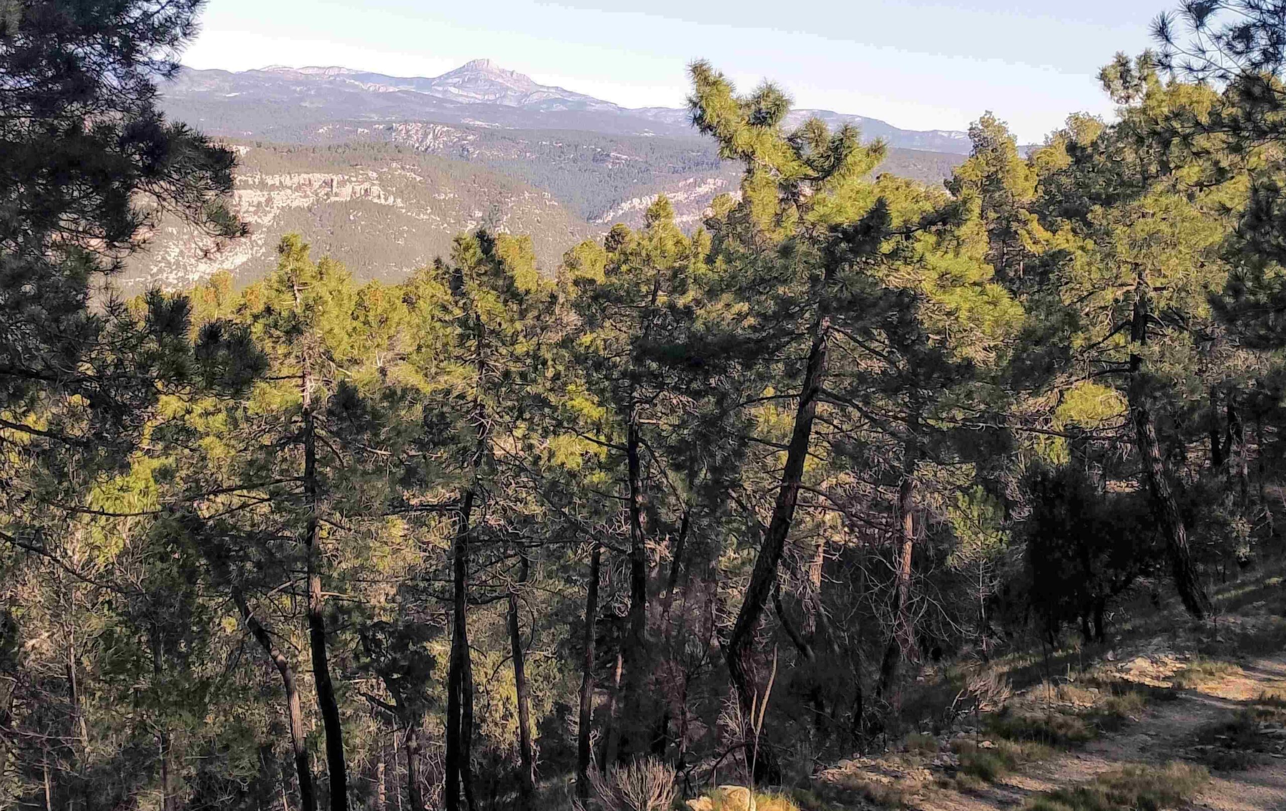
At the top of the rise, it is worth taking a moment to enjoy the view of Peñagolosa, which is dead ahead on the horizon. From here, the wide track descends and levels out; now running through the forested higher reaches of the Maimona ravine, giving a different perspective of the area and the wonderful rock formations.
The path ascends gently to a spur, where there are all-encompassing views over the area; across to Peñagolosa and over the ravine-riven landscape which is covered with pines. See the sign that says that Montanejos is 2.1km away; it points down the side of the mountain, following the white/lime green waymarks. At first its looks like a steep descent, bit it isn’t too bad. There are couple of short, scree sections at the top. The path heads down into a forested section which provides welcome relief from the sun.
Then the path runs into the same route used on the ascent. Follow the GR-7 back to Montanejos; it is 1.6km from this point.


Recent Comments