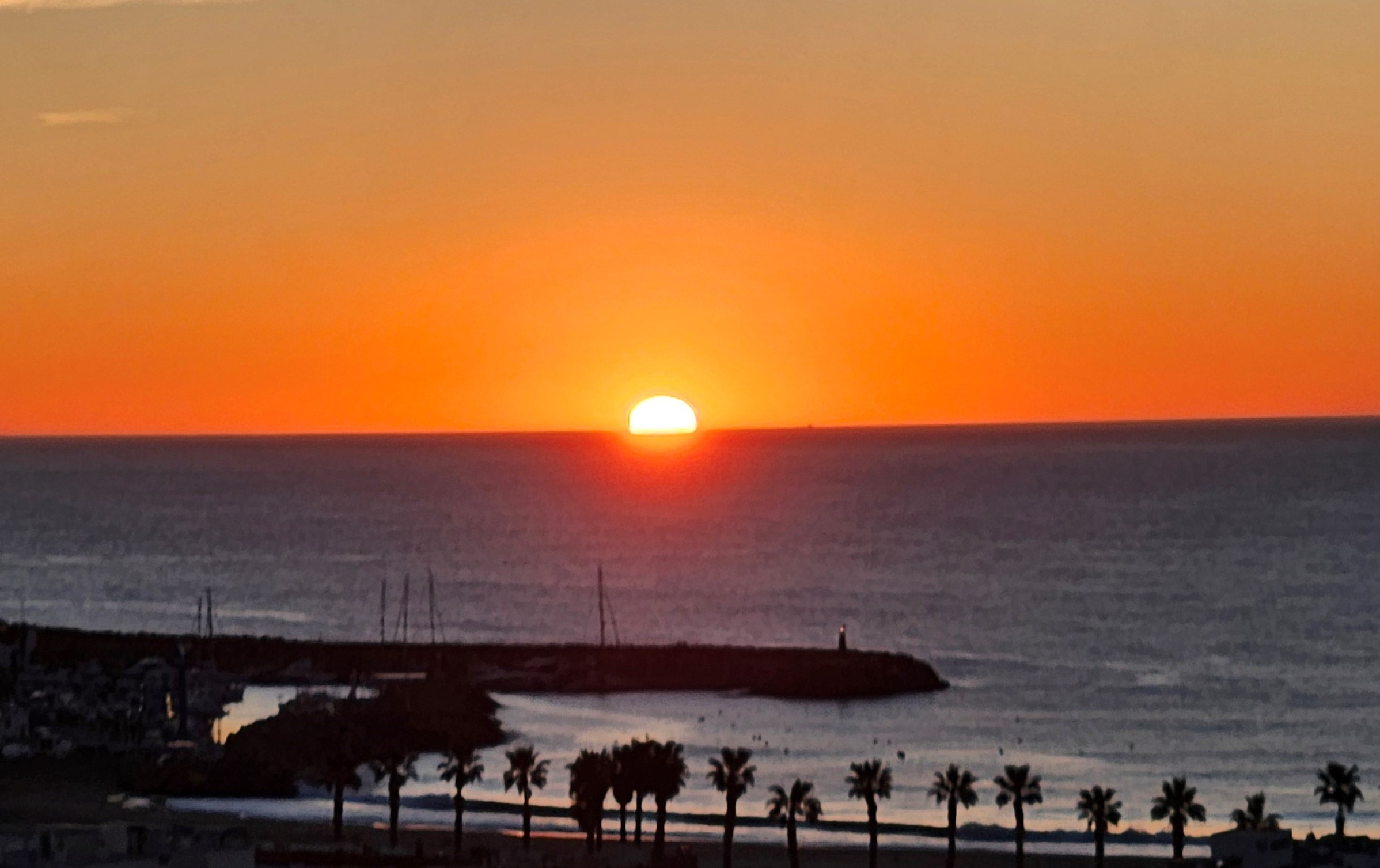
Unless you are on a small island or peninsula, there are not many places where you can watch the sun rise out of the sea and then, after a day’s walking, observe the sun sinking into the sea.
But day 5 of the Cabo de Gata hike allows you do exactly that; if the conditions are clear.
Waking up in San José, looking eastwards, you can enjoy the spectacle of the orange sphere emerging from the Mediterranean.
The day’s route goes to the south-eastern tip of Spain, before veering west to follow the coast to San Miguel de Cabo de Gata.
The shore of the destination town faces the other way to San José so, if you are lucky, you can watch the same day’s sun disappearing into the water.
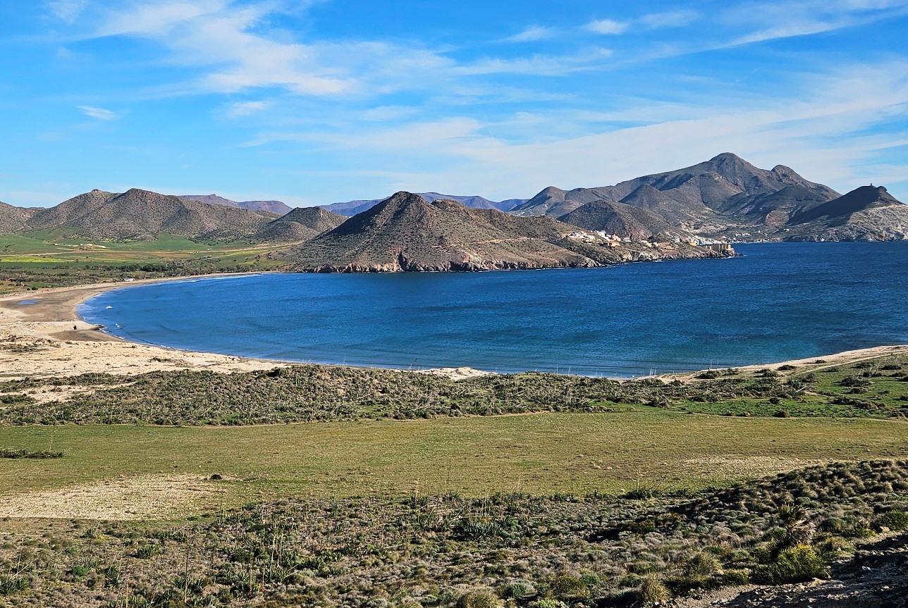
This is not the only attraction of this stage. It takes in some incredible volcanic scenery; twisted, multi-coloured cliffs and isolated coves.
The route measures around 26km with approximately 480 metres of height gain. With a couple of short stops, it is likely to take between seven and eight hours (allow extra time for a fish lunch and/or swimming).
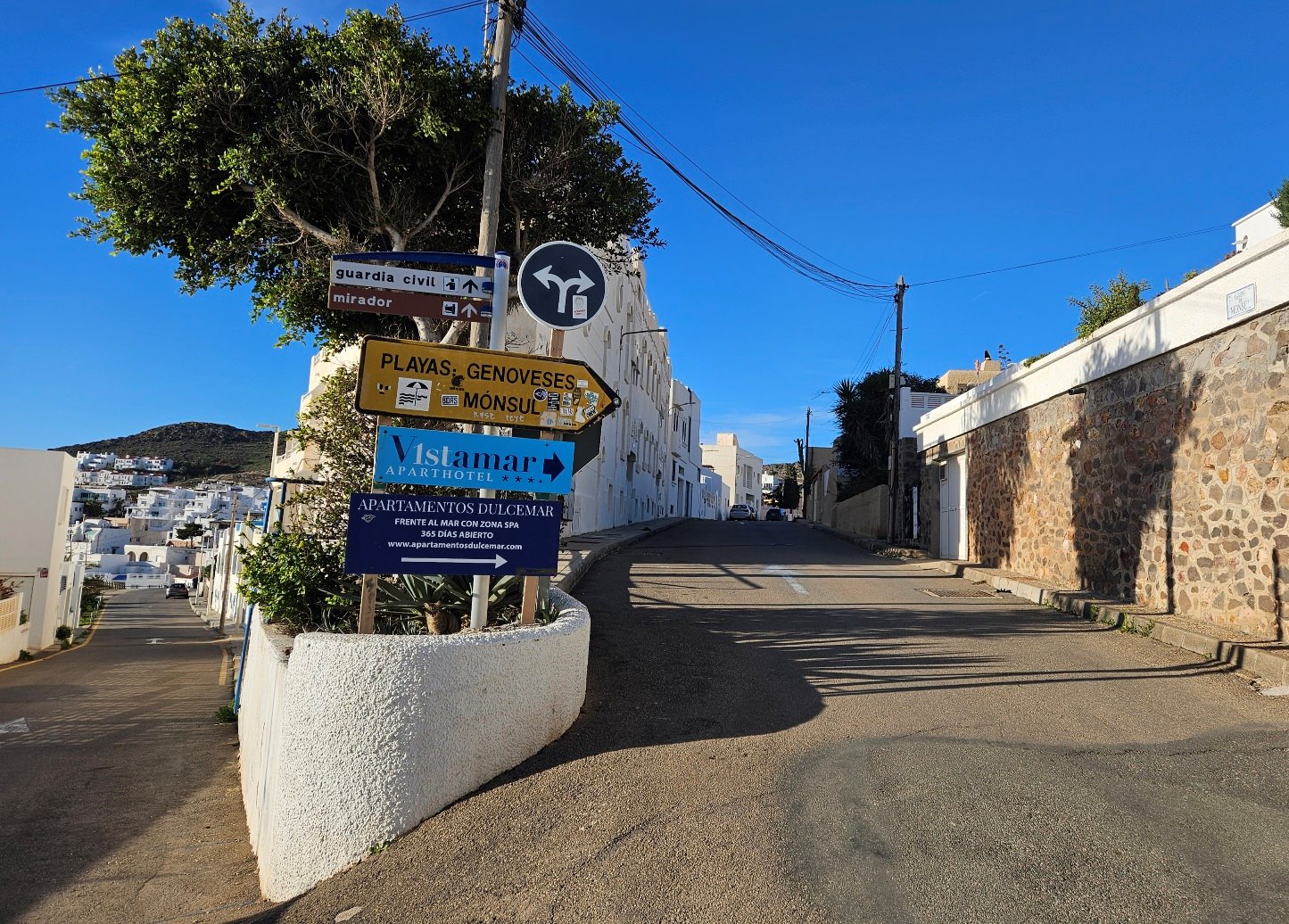
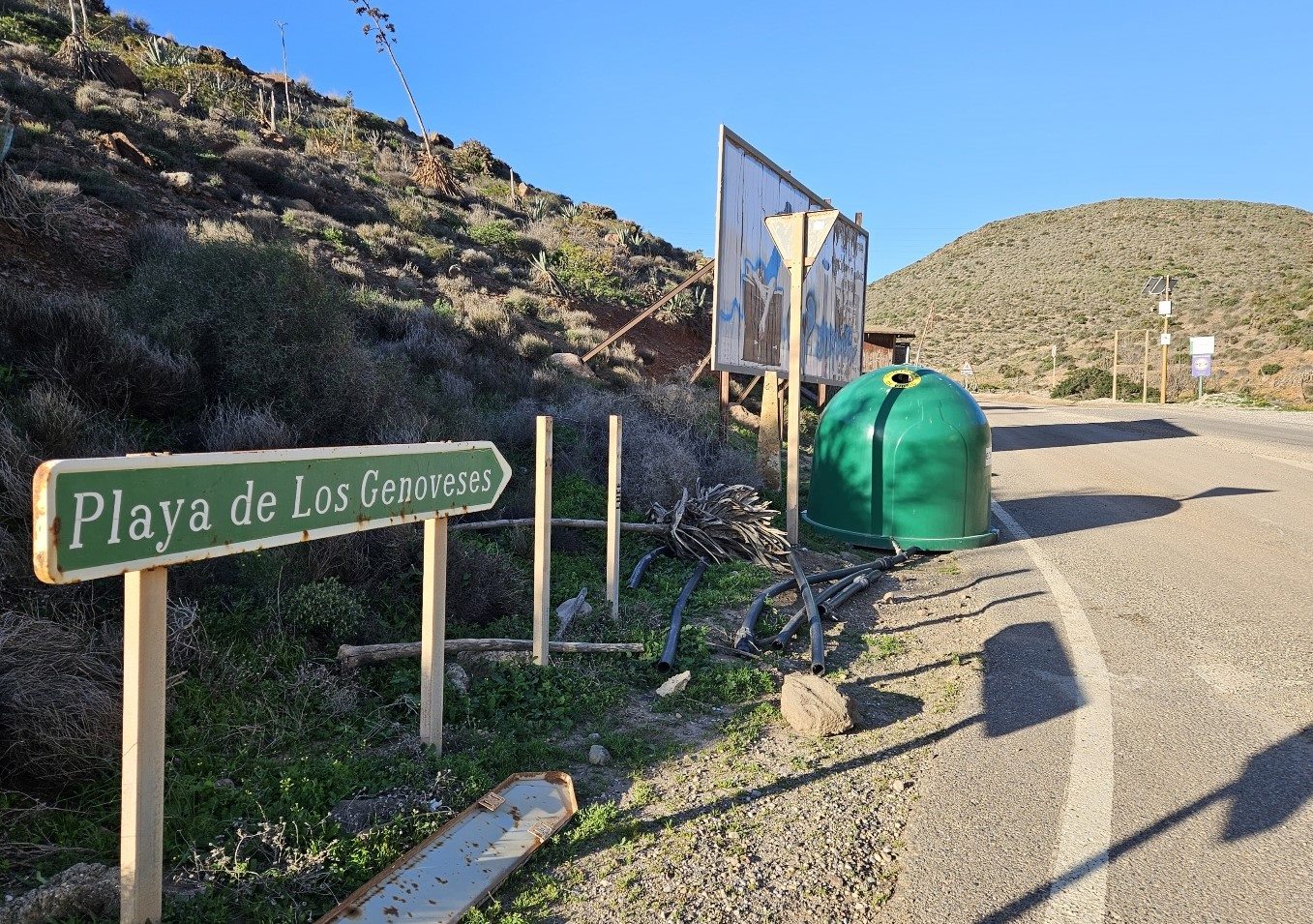
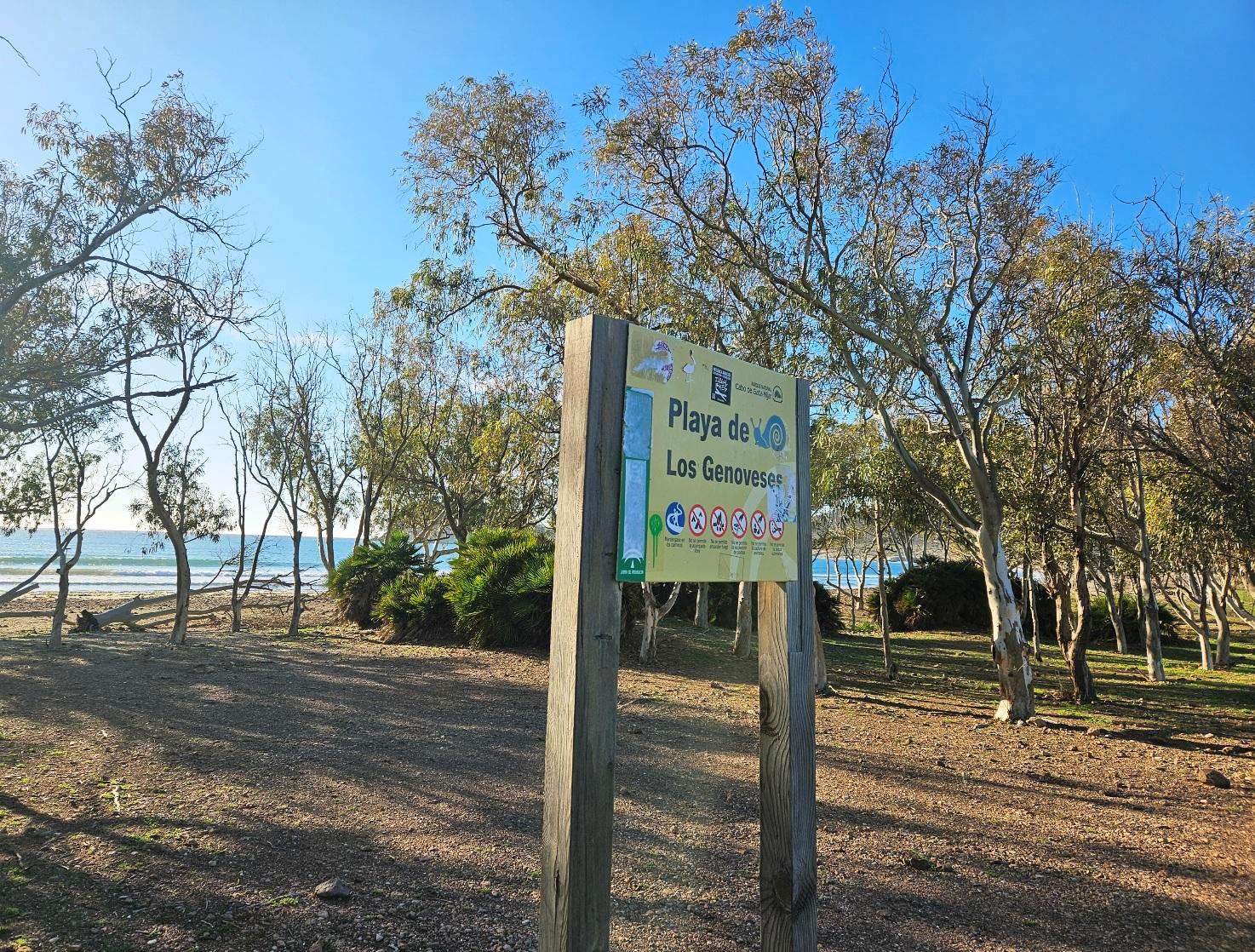
Starting out in San José, walk along Calle Correo, passing Hostal Costa Rica. Continue along Correo; soon after the small church, take the right fork for Playa de los Genoveses.
The street heads out of the back of San José, with another sign for Playa Genoveses at the roundabout.
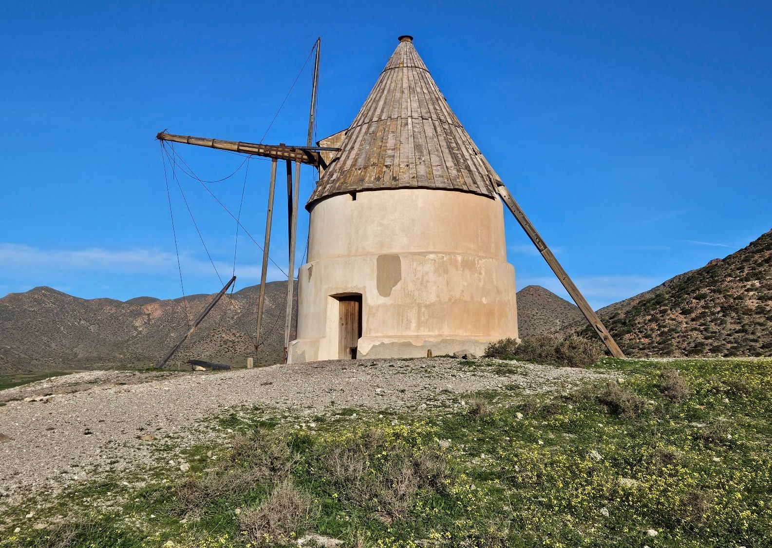
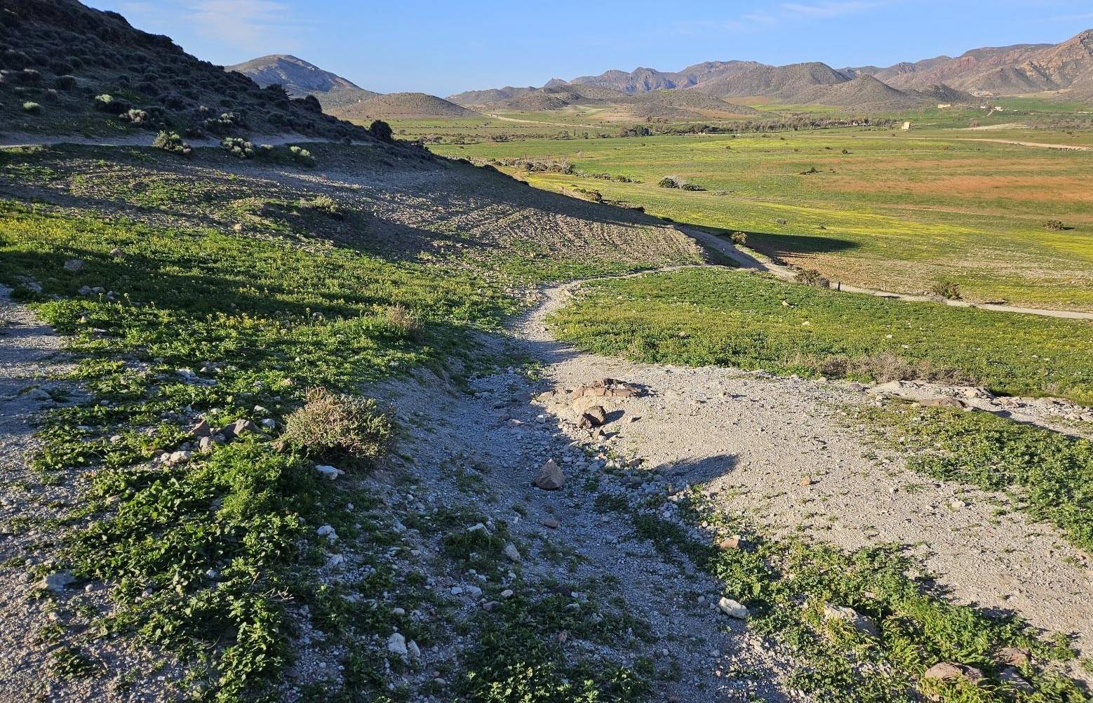
Follow the wide dirt track, bearing left onto a footpath which runs up to the windmill on the hilltop.
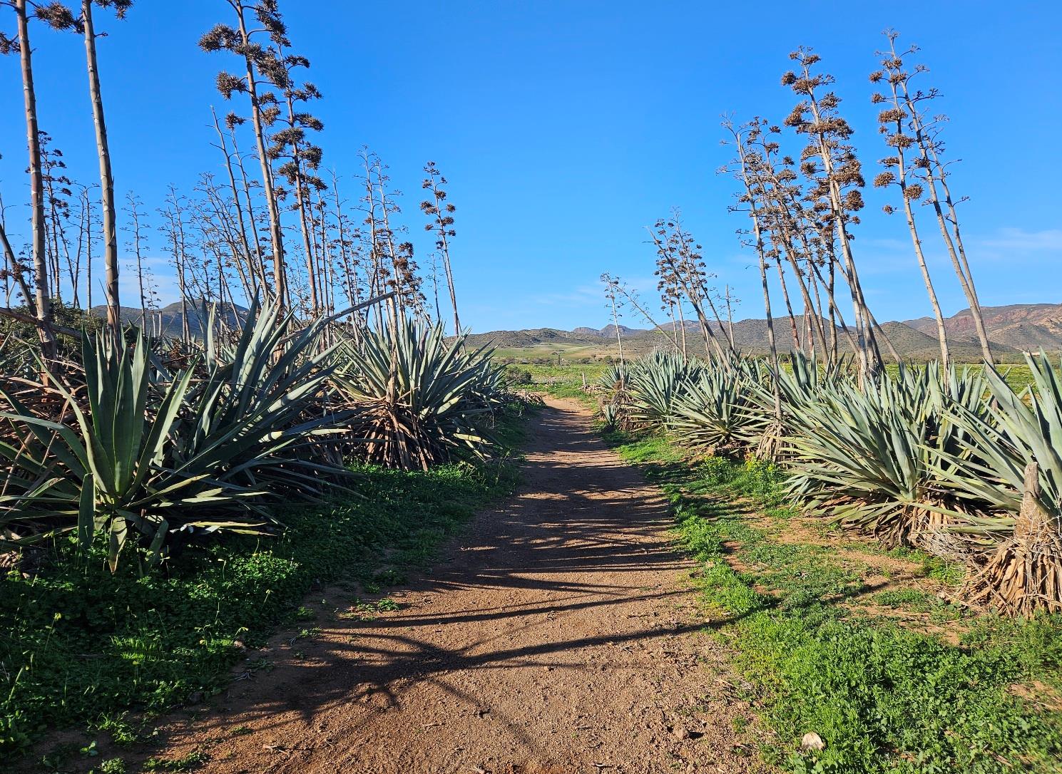
Keep to the left of the windmill. Follow the path down, heading through the agave and prickly-pear cactus plantation, then bear left to enter the avenue of pine trees to the beach.
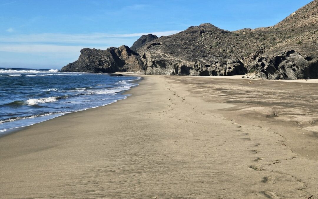
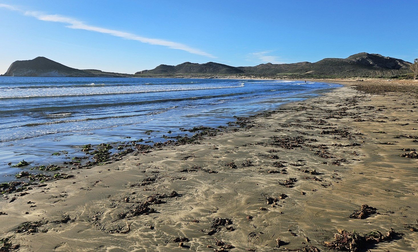
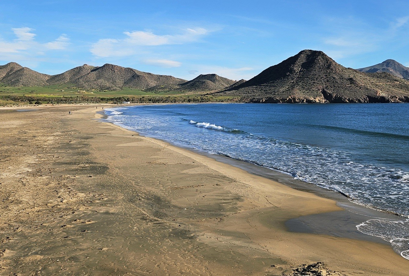
At the sea we turn right to walk the length of magnificent Playa de los Genoveses on the hard sand by the water’s edge; it’s a good opportunity to have shoes and socks off and get some salt water on tired feet.
Around three quarters of the way along the beach we cross over a large, fossilized dune. Here the sand has been cemented by the elements; a process known as lithification, which is the transformation of sediments into stone.
At the end of the beach, continue onto the coastal path which goes uphill. Around three quarters of the way up, the waymarked path bears left to go along the sea side of the cliffs.
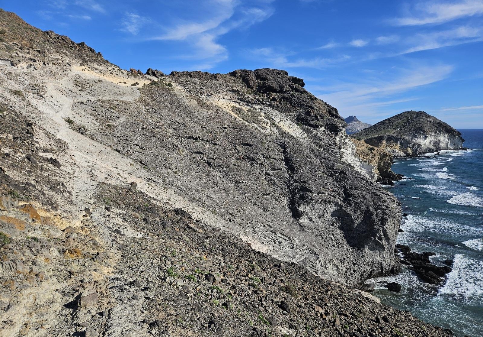
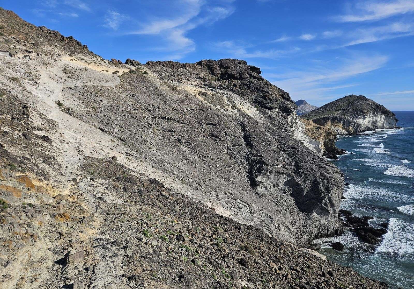
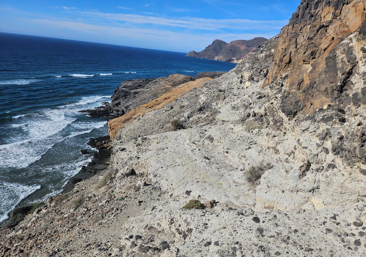
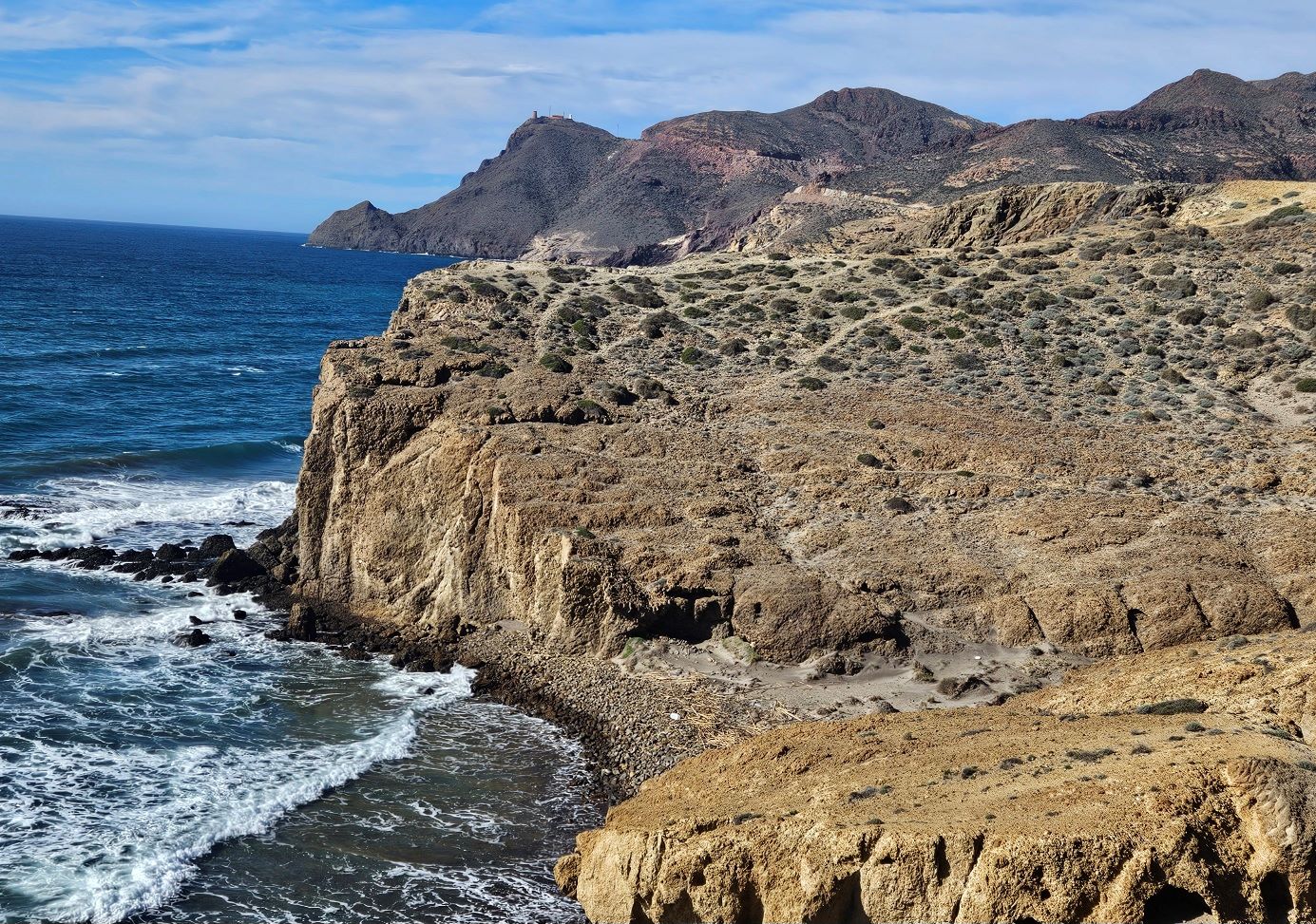
The following couple of kilometres of the route offer a spectacular traverse of the volcanic coastline; up and down to coves and along beaches. There are short sections which require great care as the drops from cliffs are potentially dangerous.
If at any time you feel uncomfortable on the path, there are several routes that go inland, away from the coast to meet up with the wide track that goes to Mónsul beach at the end of this section.
This is an option at different points if you find that the coastal route is not for you.
Back on the pilgrim route, after the climb from Genoveses, we have a descent to undertake. It isn’t as difficult as it looks because the volcanic rock gives good grip. But care has to be taken.
Do not to descend too far or you’ll be over the cliff edge; the path goes around the corner, bearing right. Follow the waymarks.
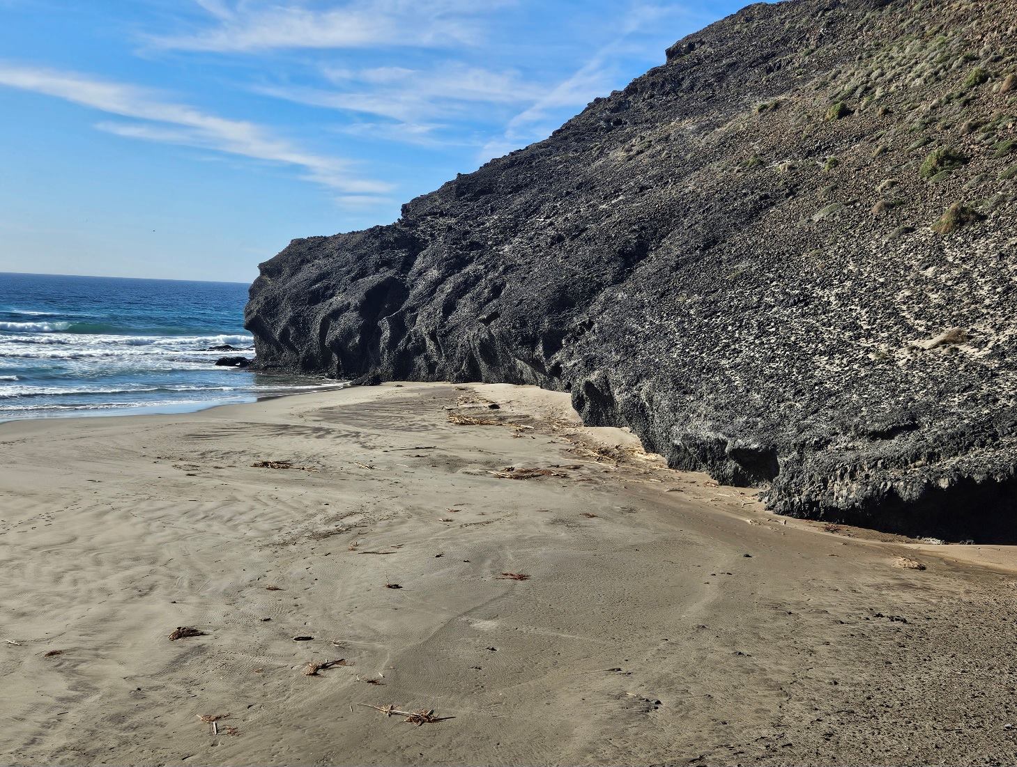
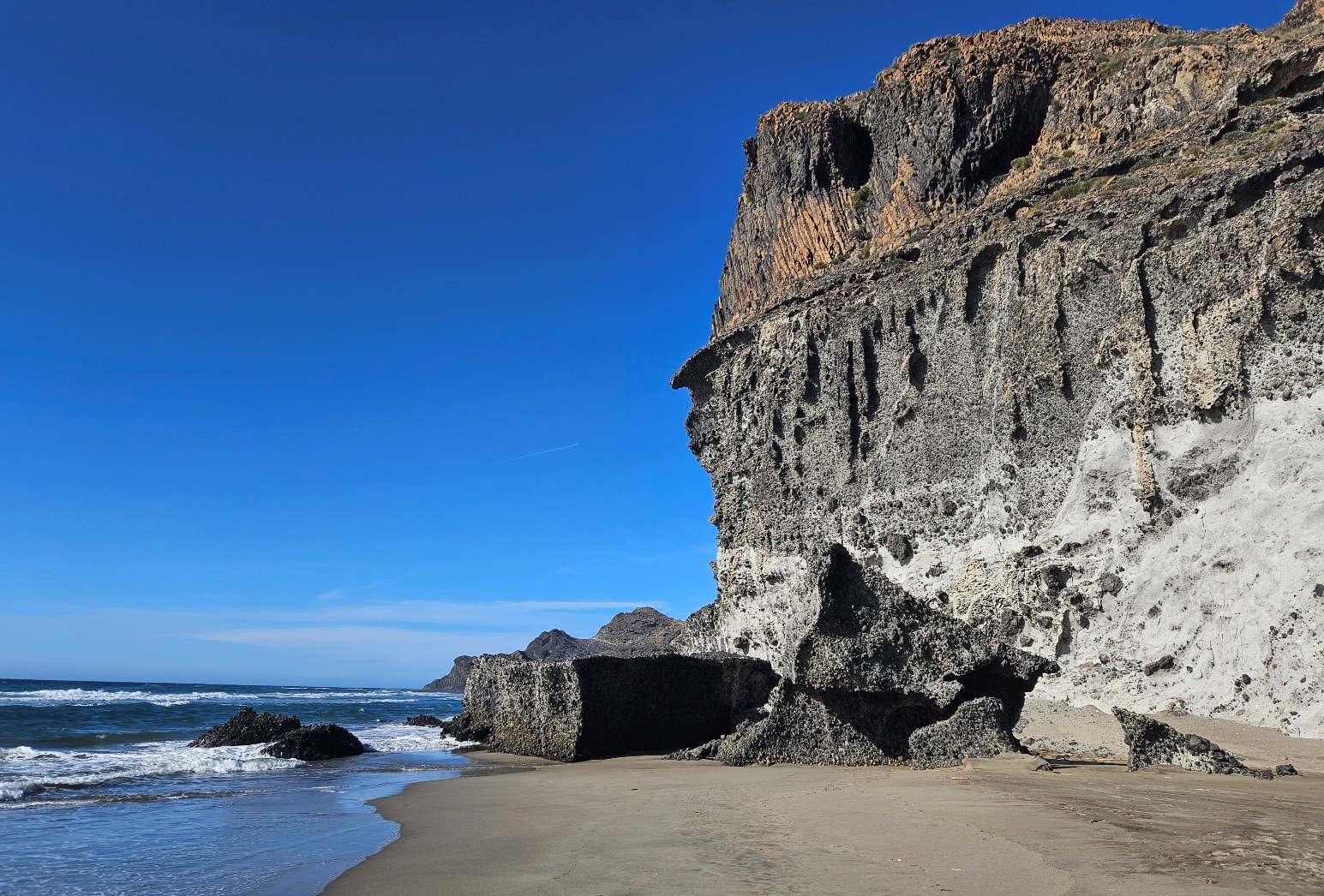
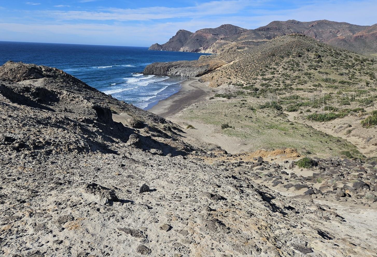
The route crosses over to a wonderful cove. It skirts the edge of the beach, keeping to the right of the cove, to then ascend the coal-like volcanic rock of the hillside.
It’s a short, steep climb to the top of the rise. Bear left to then embark on a descent to a glorious stretch of beach. It’s a clear path going down.
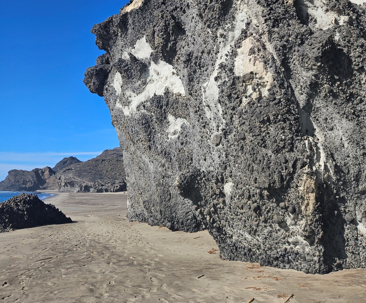
We walk along the volcanic sand under the curling wave-shaped cliffs. It may be necessary to remove shoes and socks, depending on the tide.
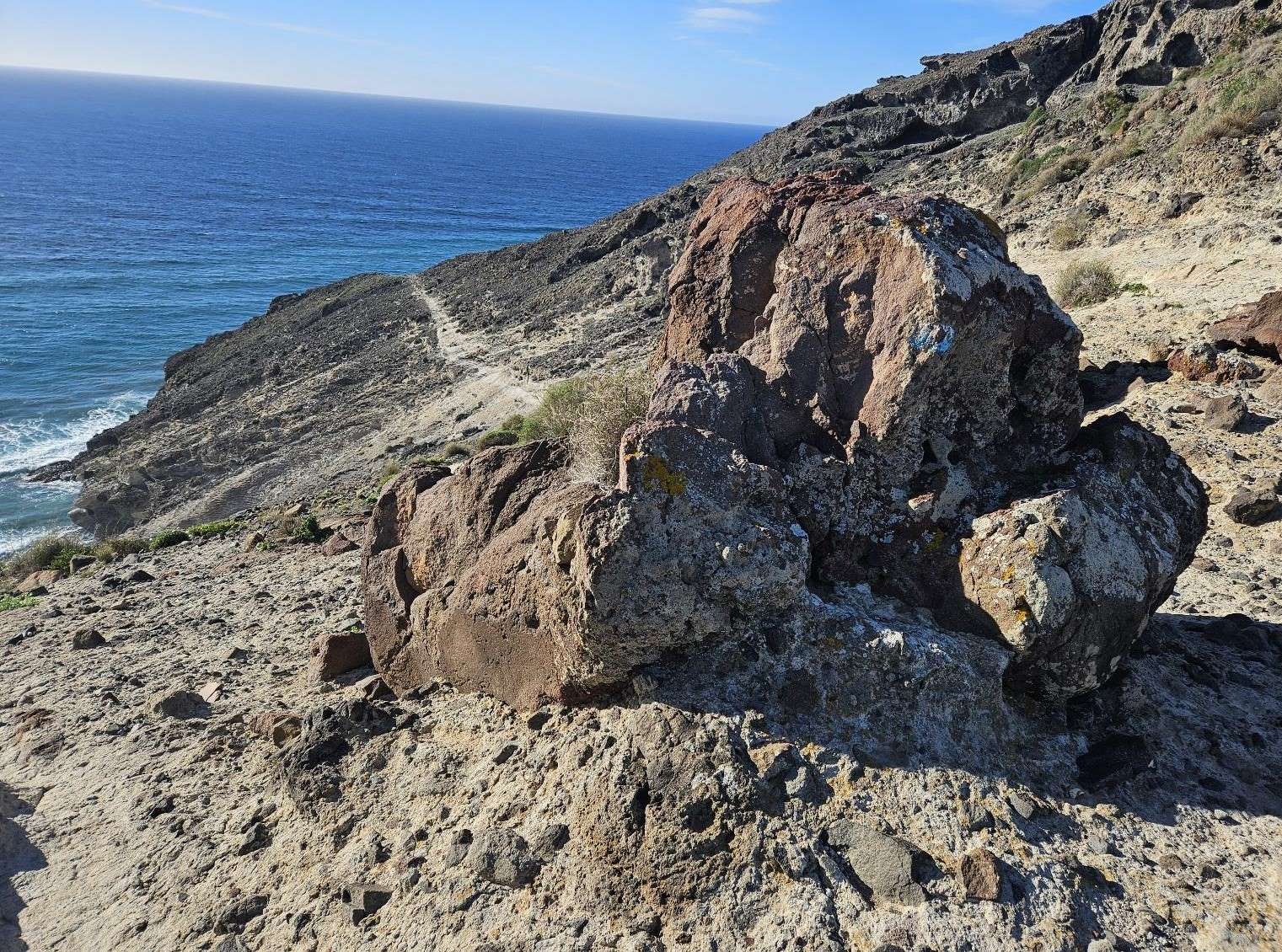
Geologists will want to spend some time observing the incredible rock formations, which are no less impressive to the untrained eye (like mine).
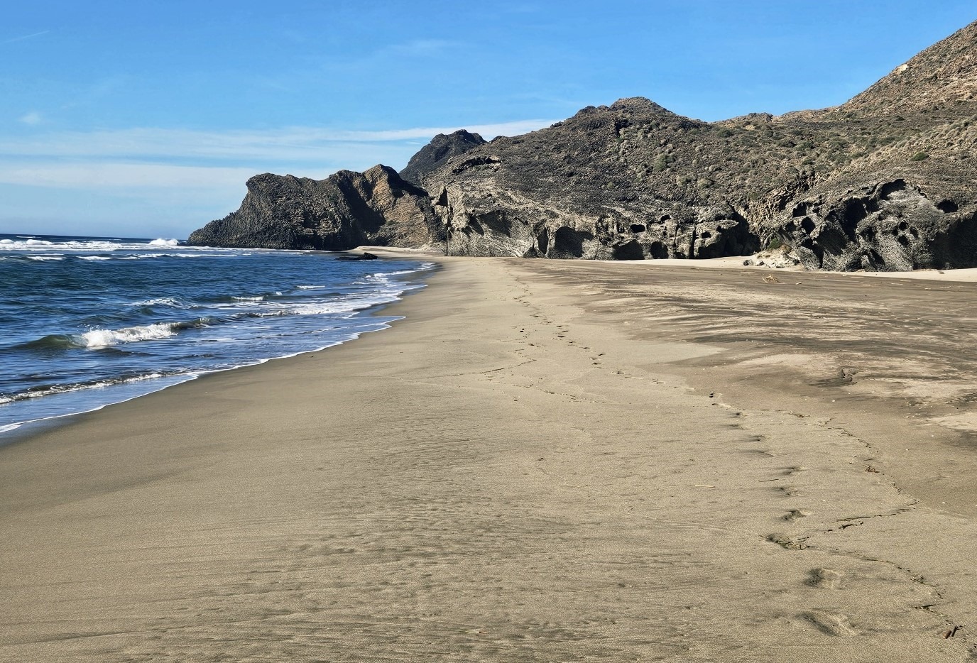
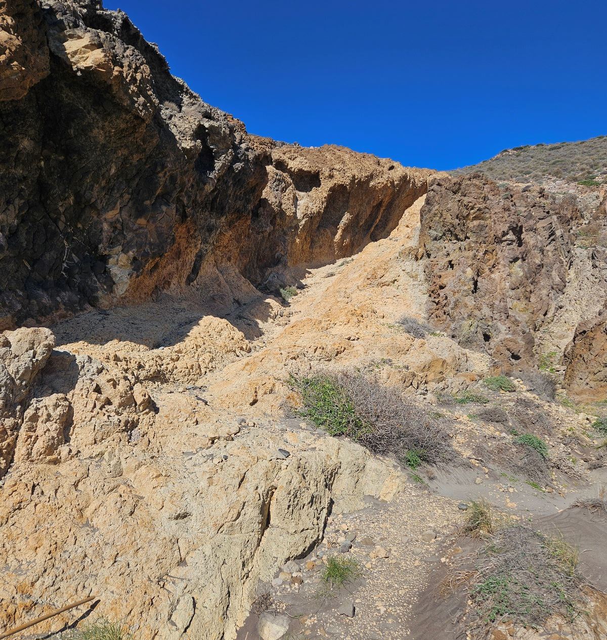
We walk the length of the beach. At the end see the path heading up on the right, on the lighter-coloured rock.
Around half way up the climb, bear left to follow the line of the coast again. There is now a short section on which enormous care has to be taken.
The path goes along the cliff. The ‘dodgy’ section isn’t that long but absolute concentration is needed, with sharp drops off to the left.
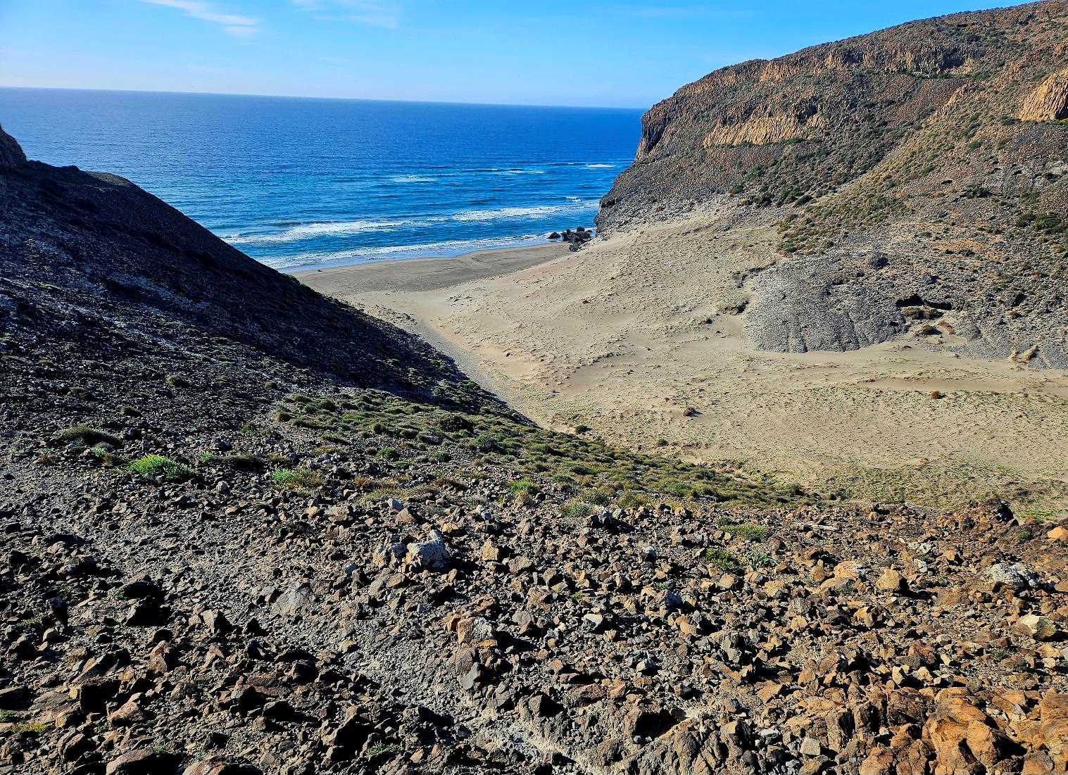
The path emerges at a piece of volcanic rock; we go over and down to the next beach.
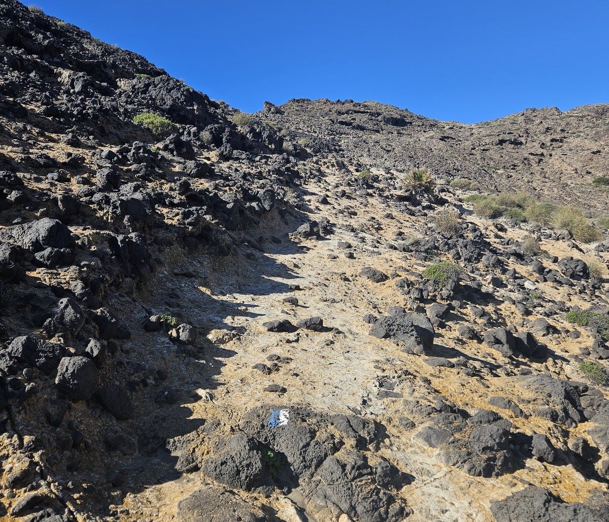
Cross the sand. At the end, see the gulley on the right in the rock, which goes up from the beach; this is where we ascend.
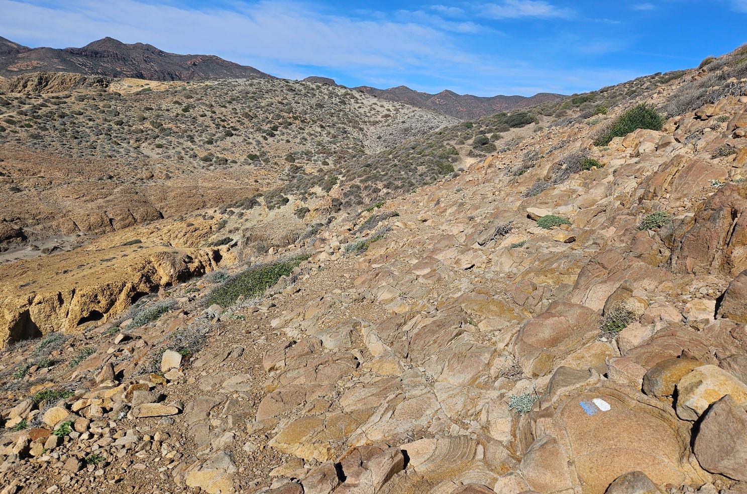
It’s a short but steep climb. Around halfway up, see the white/blue waymark. This is where we bear left to walk parallel to the sea once more.
The first good views appear of the Vela Blanca watchtower on its hill in the distance. This is where our route is heading later.
The path is now on fragmented ground as it follows the curves of the coast, not losing much height. Keep an eye open for the occasional waymarks.
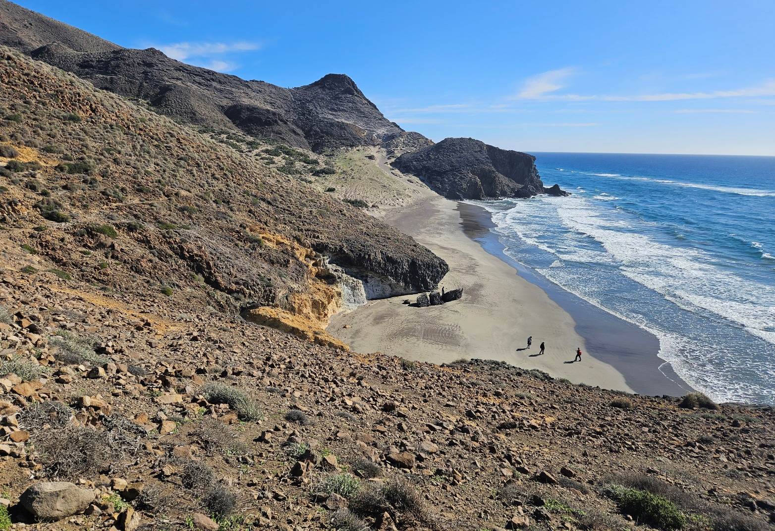
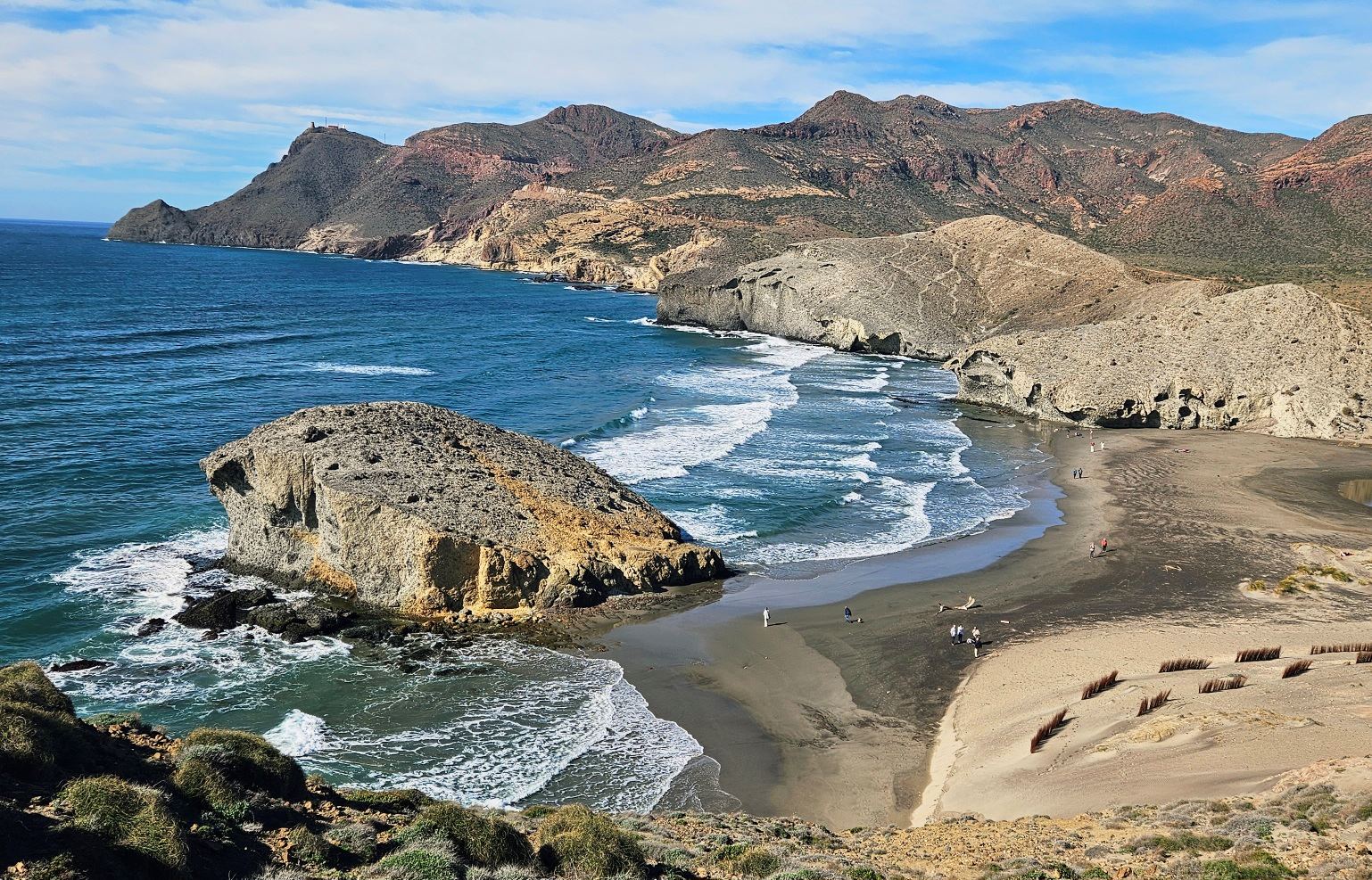
Head over a rise, emerging above magnificent Mónsul beach, one of the best-known in the Cabo de Gata.
It was the worth the effort to get to this fantastic vantage point.
Part 2 follows
Recent Comments