The PR-CV 7 waymarked footpath is sometimes referred to as the ‘Volta a Bèrnia’ (tour of the Bèrnia) – because it traces a route around the mountain. The circular hike takes place at a good height, starting at 600 metres above sea level and reaching a highpoint of around 850 metres.
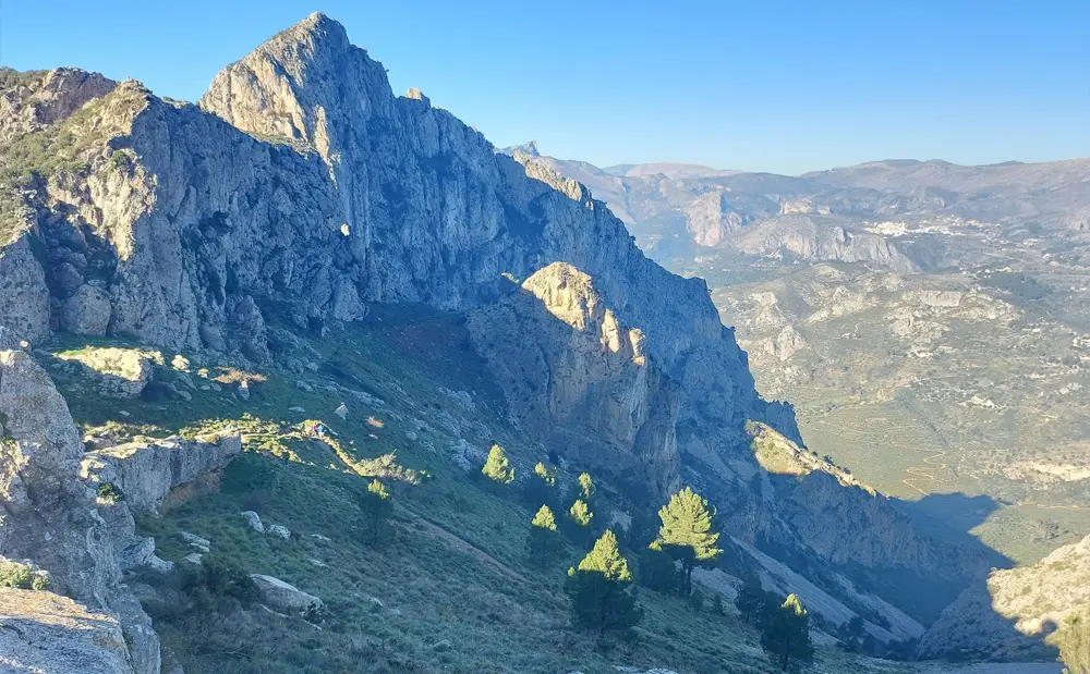
Up above the footpath is the elongated and, in places, wizened Bèrnia ridge. Anyone who fancies a shimmy up to the main summit, which stands at 1,129 metres, can do so from the Bèrnia fort. However, this is a route that should only be taken on by experienced mountain walkers and people who have a good head for heights. A very narrow ridge has to be traversed to get to the peak. And there are precipitous drops, where a false step would certainly prove fatal.
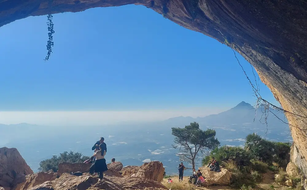
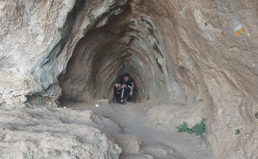
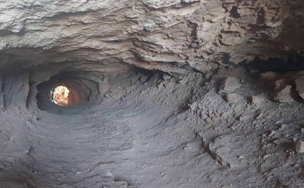
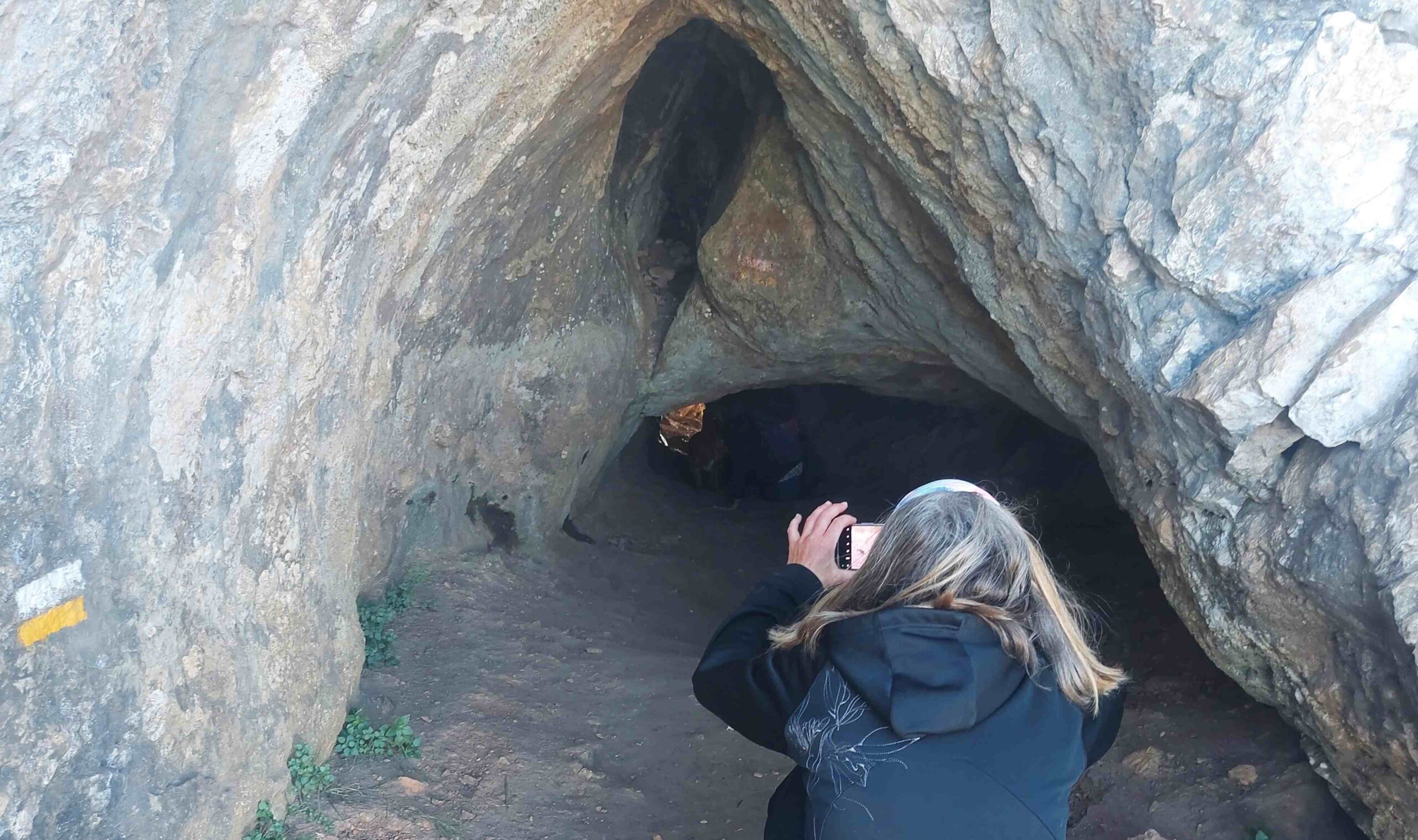
Our route passes underneath and far below the summit ridge and continues on in the direction of the sea to reach the cave of the Forat de Bèrnia. This is a wonderful spot – a natural tunnel which passes through the rock from one side of the mountain to the other. It is low and narrow but only short. And it is terrific fun. You can always see light at the other end and it only takes a minute or so to crawl through. If someone who feels slight claustrophobia, like me, can do it – then you probably can too. It is traversed by dozens of people each day at the weekends.
The ‘Volta a Bèrnia’ can be started from two different points; from the Altea (south) side of the mountain, and the northern side – from the Casas de Bèrnia in the municipality of Jalón. This route sets out from the northern side.
The walk
We start from close to the Casas de Bèrnia hamlet. Park up just before the Sierra de Bèrnia restaurant, where there is plenty of space off the country lane which leads to the eatery. From the parking spot walk along the lane which passes to the right of the restaurant and leads down to the Casas de Bèrnia hamlet – a collection of farmhouses.
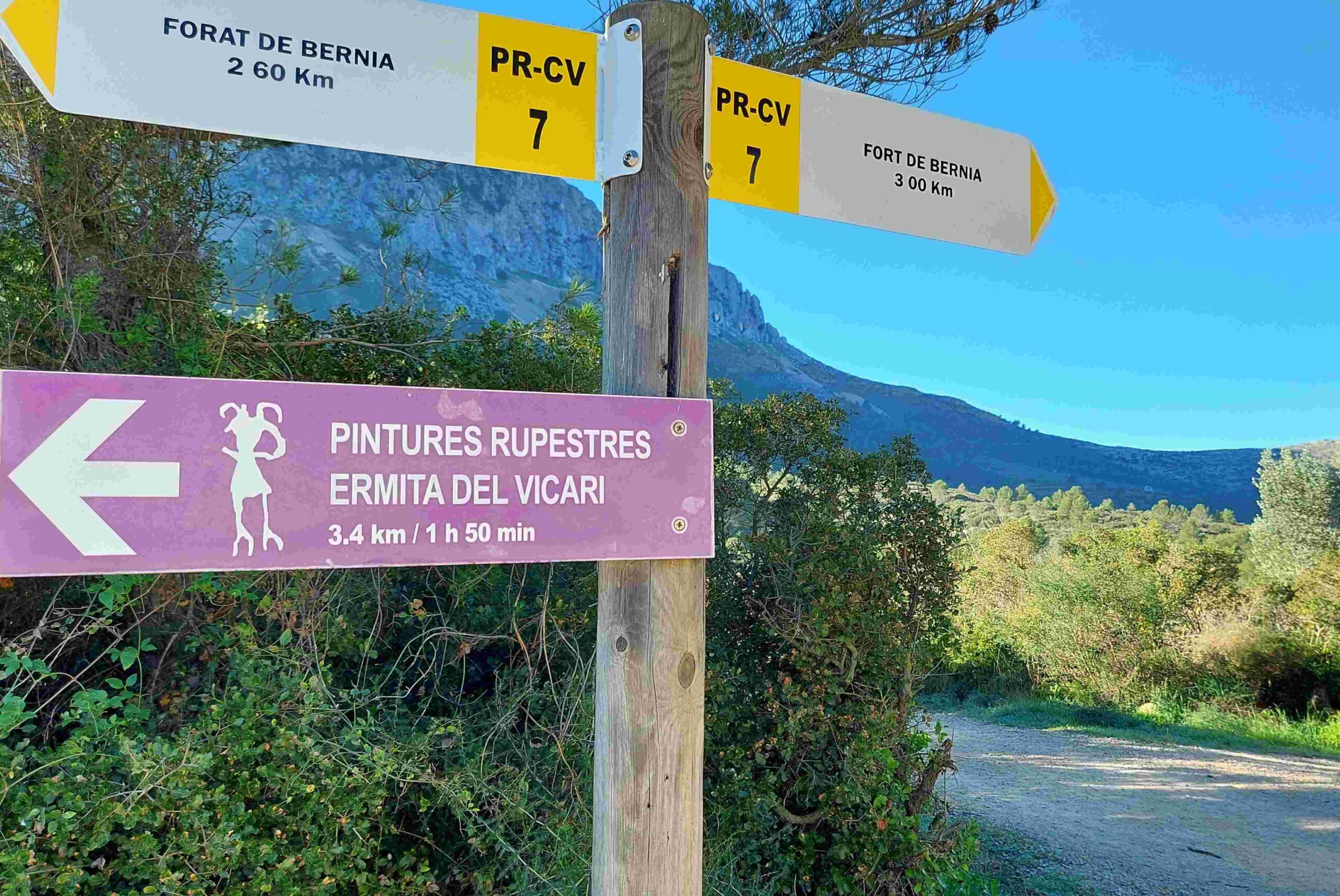
Here you will find walk boards with information about the PR-CV 7 waymarked path, and a map. Follow the signpost which tells us that the Fort de Bèrnia is 3km away, bearing right at the junction of two lanes. It’s a flat lane which heads straight for the mass of mountain ahead. After passing through the fields close to the Bèrnia hamlet, the lane turns into a track and starts to ascend, with the white/yellow waymarks helping to show the way.
The track is leading us to the right-hand side (western side) of the long Bèrnia ridge. The track continues to ascend, keeping right. And it soon turns into a path, with the waymarks appearing on rocks and trees. It emerges at a wide flat area where there are fantastic views back to the sea, Montgó and the surrounding mountains of Las Marinas – and south to the Sierra de Serrella and Aitana.
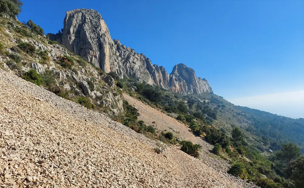
The plateau leads onto a spectacular part of the walk in high mountain country. The footpath runs along the side of the mountain, with wonderful views of the summits of north Alicante province. It’s a section which would not be out of place in the Pyrenees. Up above, the Bèrnia ridge towers over the path.
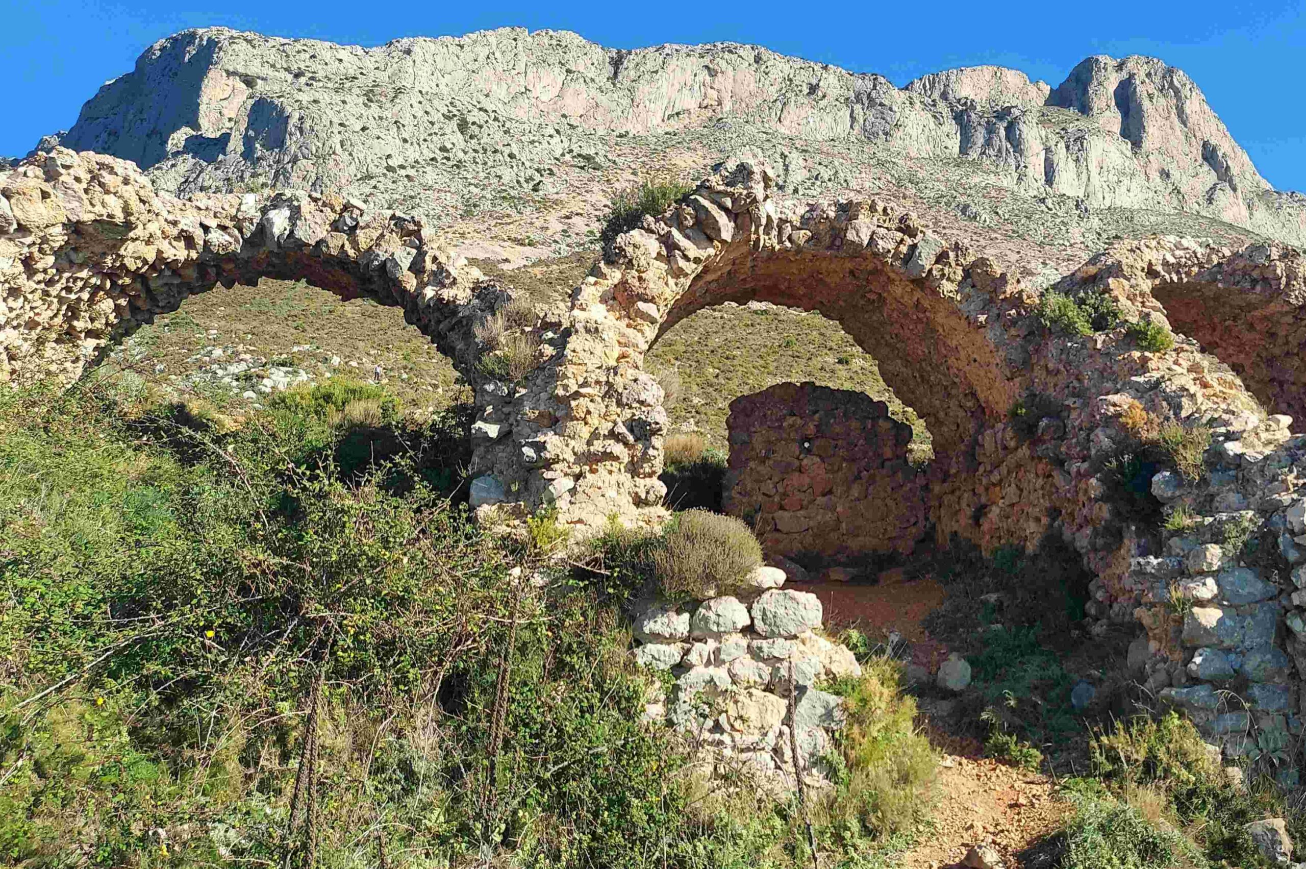
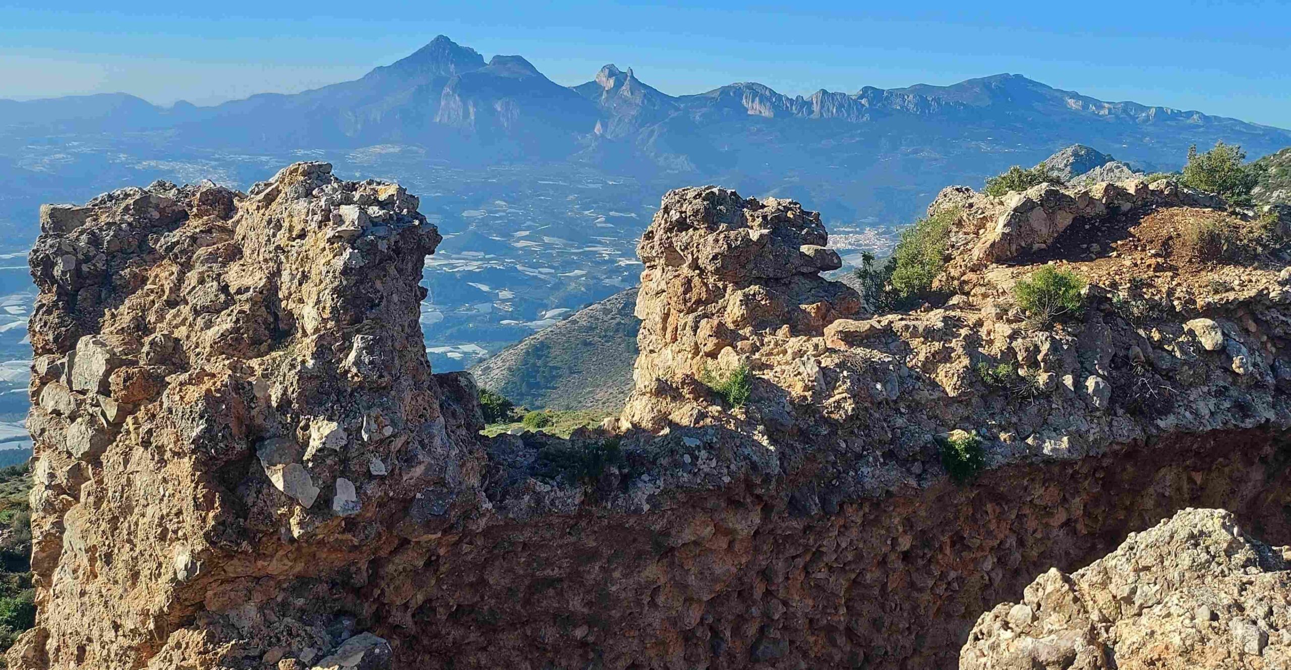
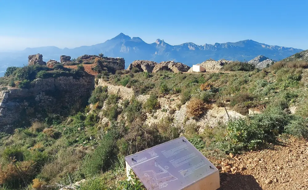
The path swings round and then ascends a short distance to reach a wide, flattish area which contains the Bèrnia fort. The waymarked route takes the walker to the defences, where it is worth a pause to look around. Altea council received a sizable grant to shore up the fortifications which date back the 16th century. This is no bad thing as many irresponsible people clamber over the 500-year-old arches, as if the historic site were some sort of playground. It is evident that the fort was quite a sizable structure in this mountain location. Outer ramparts surrounded the fort, as explained on the information boards. The views from the defences are magnificent – across to Puig Campana (1,408 metres) in Finestrat, Monte Ponoig and the start of the Aitana ridge.
From the fort, the waymarked footpath moves across the mountain slope, in an undulating fashion, running parallel with the Bèrnia ridge above and heading towards the sea. The summits along the ridge can be admired as progress is made. This is a south-facing section and it can get hot in the full sun.
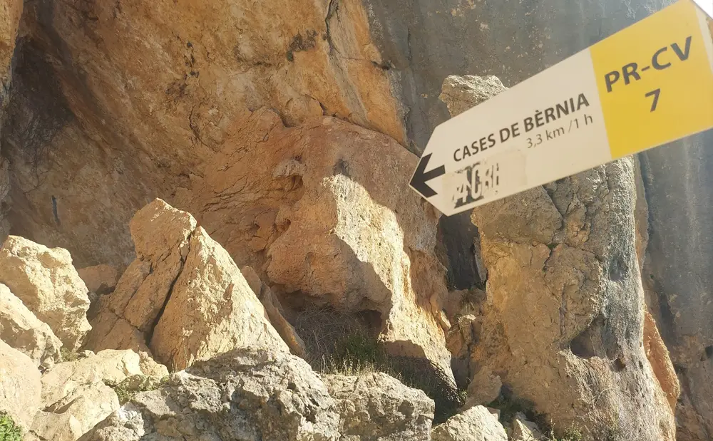
Signposts reveal that the walker is heading for the ‘forat’; the exciting tunnel/cave which leads through to the other side of the mountain. It is 3km from the fort to reach the cave. Moving across the slope towards the cave, there are places of interest and walk boards with information about the landscape. After passing a large shady tree, note the ‘resting place for livestock’, where a board explains how this rock shelter was used in the summer to protect goats and sheep from the heat. Next up, it’s the ‘forat’ tunnel/cave. The information board tells us that it is a ‘natural passage’ which has existed since ‘time immemorial’ that ‘goes right through the mountain’.
The cave entrance is large. This narrows down quite quickly. The tunnel is not difficult to get through, but involves bending down to crab-walk through, or crawling. You can always see the light on the other side and there is only around 10 metres of low, narrow tunnel to pass through. It is good fun and not too difficult to do.
On the other side, the walker is confronted by a very different landscape to the arid south. On this north-facing slope greenery is in evidence – pines and terraced slopes for agriculture. There is also a terrific view across to the sea.
The waymarked path descends what is often a shaded slope, with the Bèrnia ridge towering above and casting a shadow. The cooler conditions can be very welcome. It is not a dramatically-steep descent but care needs to be taken. After less than 2km the path emerges at a natural spring, where there are steps and signs. Keep straight on along the wide surfaced track to cover the short distance back to the Casas to Bèrnia and the parking spot.
This round walk measures just under 9km on the PR-CV 7 waymarked route, with around 425 metres of ascent.
There are two ways to get to the start point and parking spot just before the Sierra de Bèrnia restaurant, both of which involve a fairly tortuous drive up a mountain road. The route from Jalón village is slightly less painful than the one from the Benissa/Calpe side. Both involve taking the CV-749 road – from Benissa you will pass through the village of Pinos/Pinoso and from Jalón it’s via the Port de Bèrnia pass, then on to the restaurant.
Be aware that it can get rather warm in the sun on the exposed south side (fort side) of the mountain.

Recent Comments