

Cross-border ‘camino’; stage 8
It rained all night in Beariz and the forecast was for the precipitation to continue for most of the day as I walked to Codeseda. The only silver lining was that the last two days of my ‘camino’ were set to be dry and sunny. My aim was to get...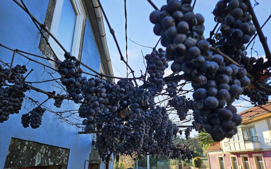
Cross-border ‘camino’; stage 9
I left Codeseda on a chilly, misty morning which promised to be dry. This penultimate stage of the Camino da Geira e dos Arrieiros, which goes to Pontevea, is not a difficult one. It measures 26km with around 230 metres of ascent. Despite the large...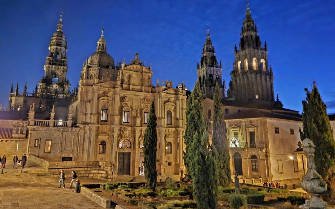
Cross-border ‘camino’; final stage
“¡A Santiago!” It was a shout from an elderly resident as I passed through a Galician village; meaning, ‘to Santiago!’ A traditional call of encouragement to pilgrims. The rucksack and peculiar headwear must have given me away. I...
The squirrels’ tale
The squirrel population is on the rise in La Mata-Torrevieja natural park. The largest numbers are found around the picnic area on the southern shore of La Mata lake. Here they have access to food most of the year round; and tall pines and eucalyptus...
The Emptied Spain
Away from the coasts, but not necessarily that far from the big cities, lies La España Vaciada; the Emptied Spain. The term ‘España Vaciada’ isn’t one that I have made up on the hoof; it has become a political movement in recent times, as well as...
It isn’t just about the olives
The alternative headline for this piece is ‘underneath the arches’; with the emphasis on the plural because there are a lot of arches to walk under in this historic town in the north-east of Aragón region. Anyone arriving in Calaceite and seeing the fields...
Iberian village visit from Calaceite
The hilltop was first occupied by the Iberians in the 5th century BC. They built rectangular stone houses along a central street, protected by walls and towers. Then in the 3rd century BC the settlement was expanded when terraces were constructed on the hillside....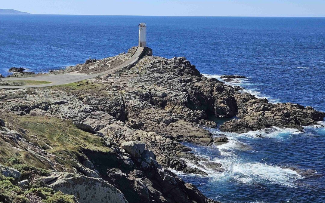
The Coast of Death
It sounds grim, but you only have to look at the photos to see that on many days of the year the Costa da Morte is a spectacularly beautiful coastline with some of the best beaches on the planet. But, when Atlantic storms sweep in, it becomes easier to understand how...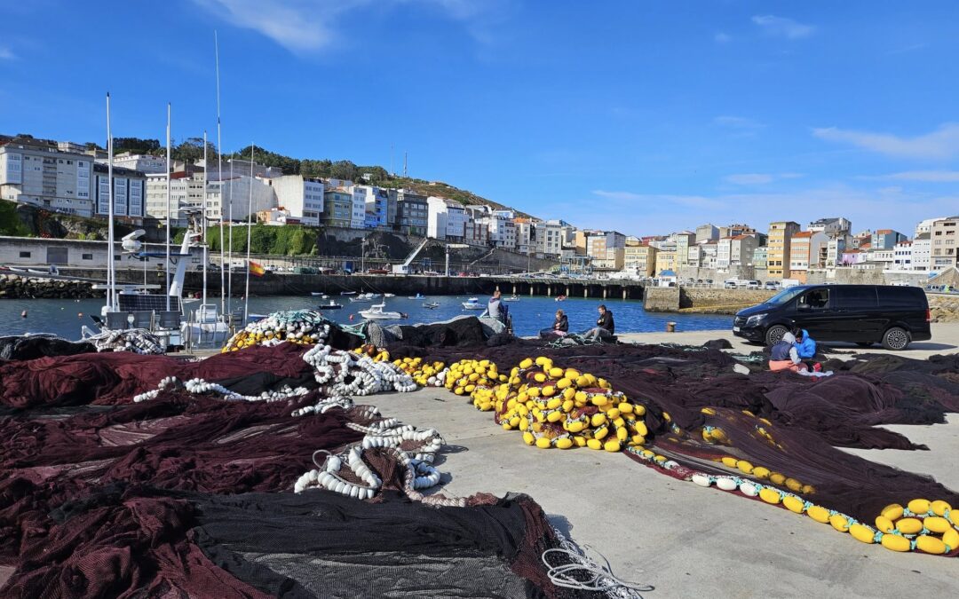
Coast of Death – Day 1
The Camiño dos Faros (Lighthouse Way) walk starts in Malpica’s port. The official route for the first day goes to Niñons beach (Praia de Niñons) and is 21.3km in length. Due to the lack of accommodation available for single travellers in Niñons I opted to do a...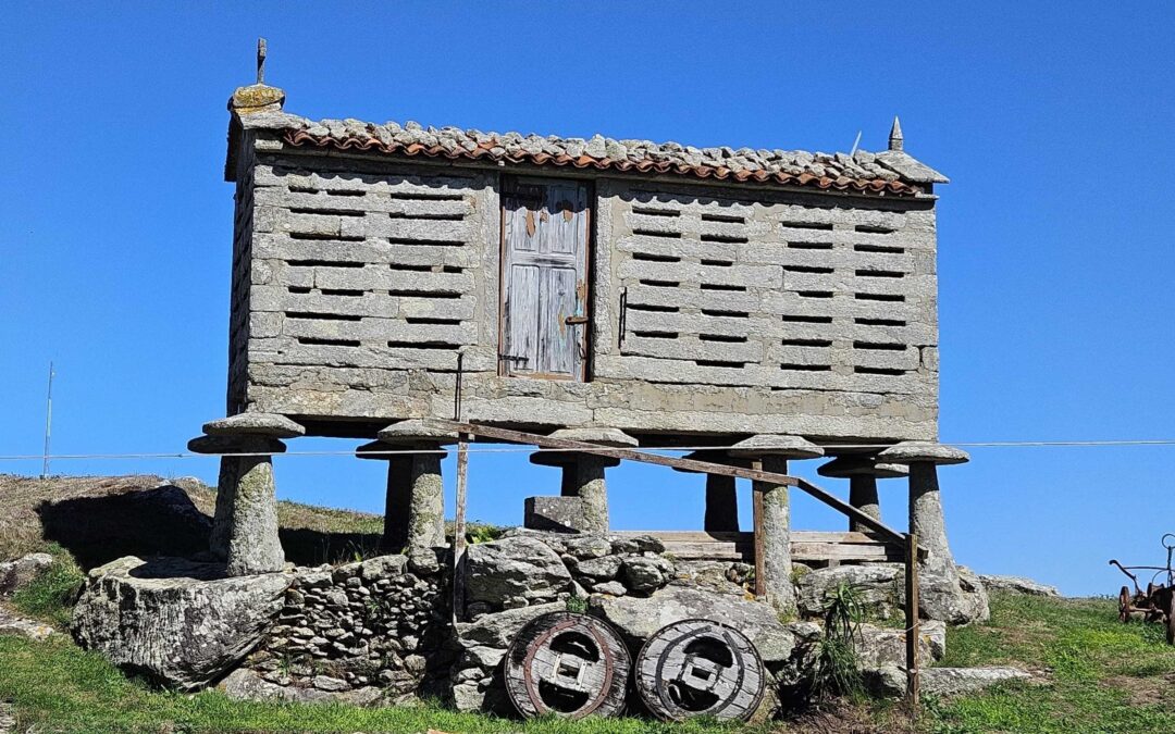
Storage in stone
One of the ever-present sights in the Galician landscape is the hórreo; a type of granary traditionally used to store cereals and others crops. They can be seen in almost every village and in some hamlets every home has its own ‘hórreo’. They stand on...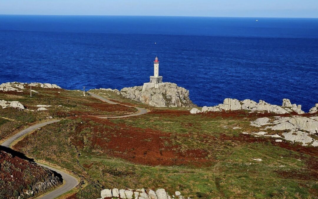
Recent Comments