The second stage visits the extinct volcano of the Mesa Roldán, a flat-topped ‘table’ (mesa) which reaches a height of 222 metres.
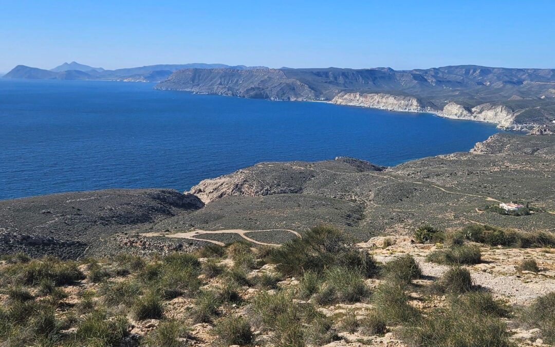
The ascent offers a first view along the mountainous coastline of the Cabo de Gata. It’s an extraordinary vista taking in the coves, cliffs and headlands; and the distant twin-peaked volcano of Los Frailes (also extinct).
Our route runs from the port town of Carboneras to Agua Amarga. It measures around 14km, with approximately 370 metres of height gain and is likely to take between five and six hours.
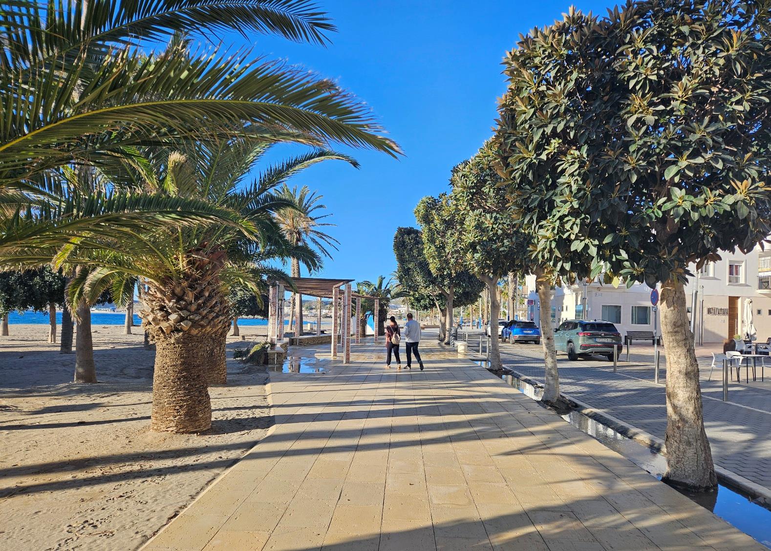
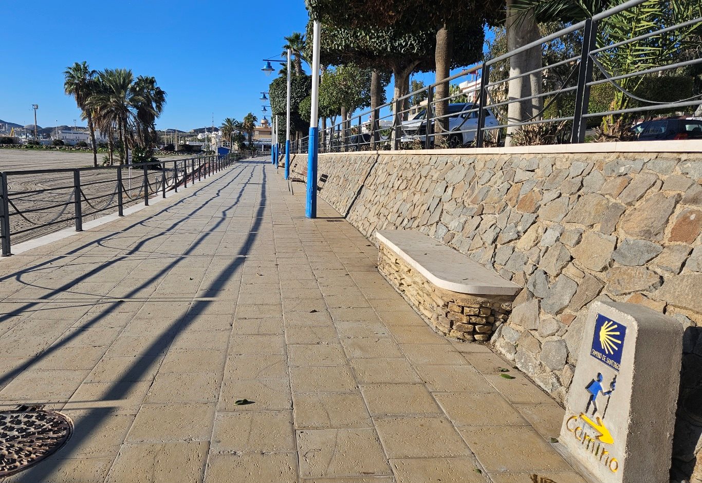
We leave Carboneras walking along the beach-front promenade, noticing the marker post for the ‘Camino de Santiago’ on the way.
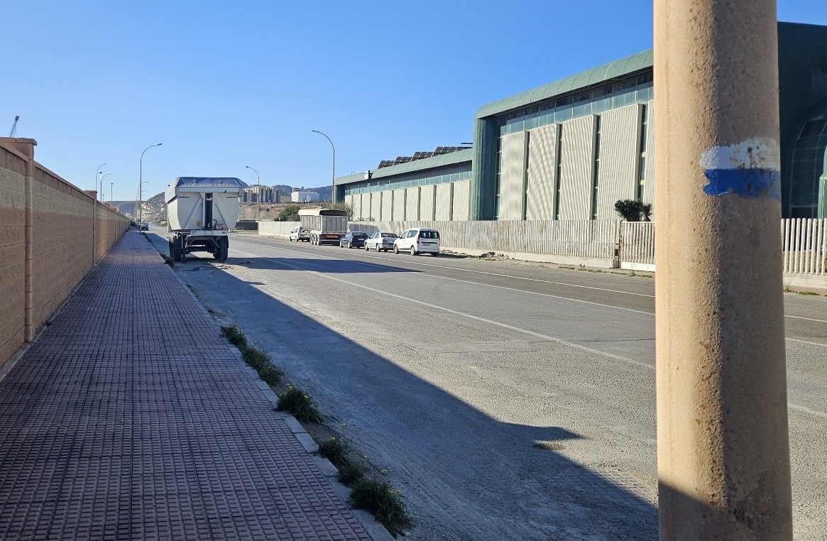
The promenade runs along the shore as far as the industrial port zone. Next up is the coast road.
Fortunately, there is wide area next to it; first a pavement and then a very large hard shoulder which can be walked on.
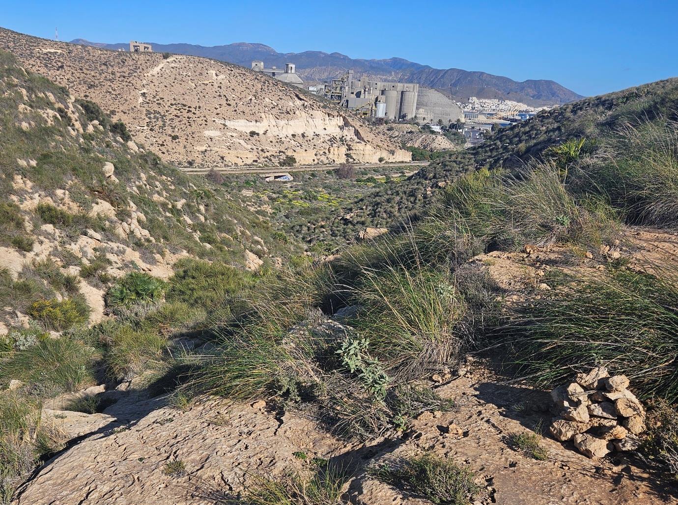
This is not the most inspiring section of the walk; it’s around 3km to get through the industrial area, with the cement works at the end.
Leaving it behind, there is a very short spell directly on the road; only around 20 metres.
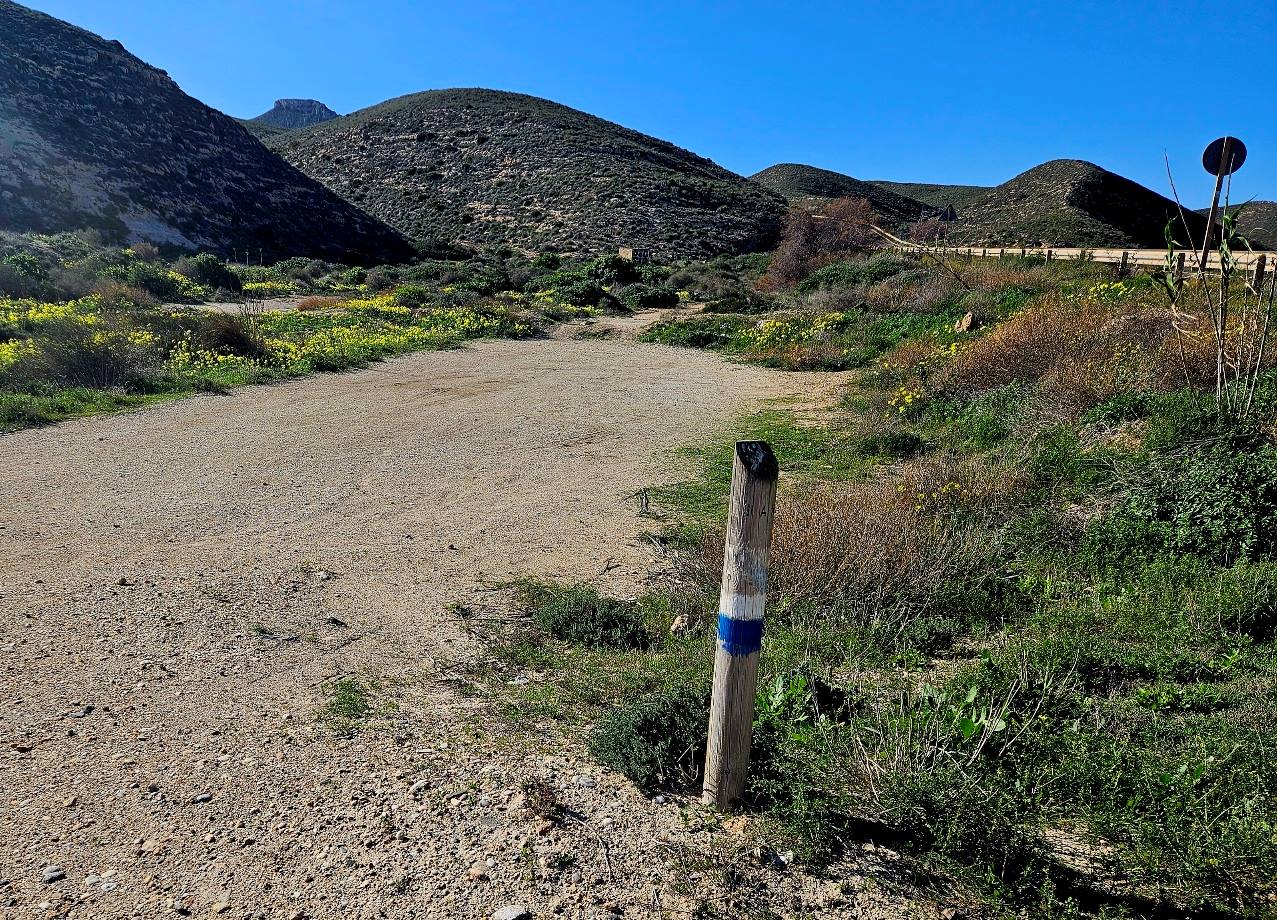
Then turn off left onto the track running alongside the road, following the white/blue waymarks.
Now we start the ascent of a shallow ravine. The path passes to the left of graffitied concrete structure, then turns sharp left to go up the ravine.
Notice the white/blue waymarks which show the way up.
We are entering the first area of ‘pure’ Cabo de Gata on this walk, with dwarf fan palms, esparto grass, an absence of trees and proliferation of rock.
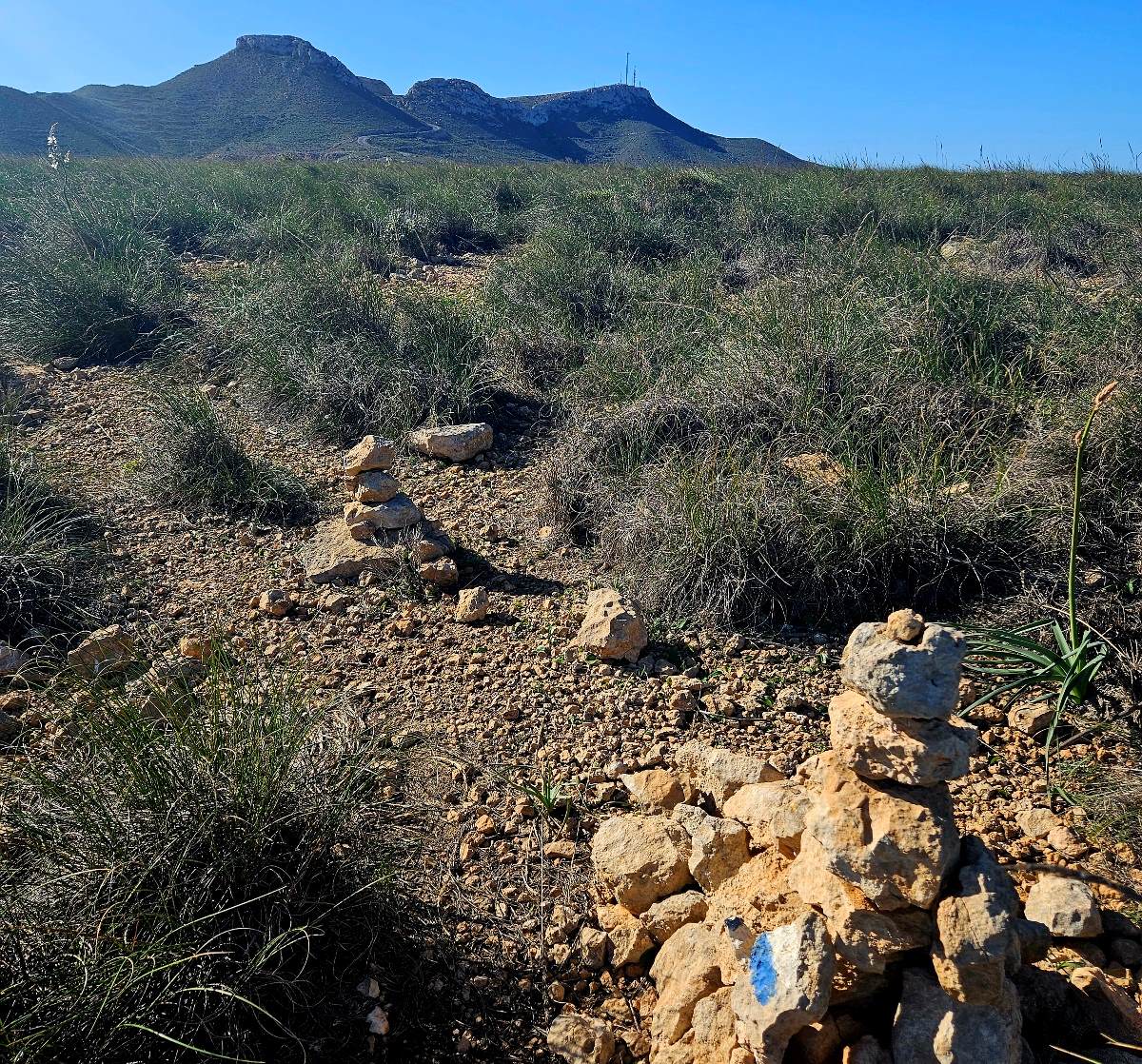
Keep a close eye on the waymarks on the ascent of the ravine. After reaching the first shelf, the path moves off to the left.
At the top of the ascent the route turns south again, now following waymarks and cairns heading towards the marker of the Mesa Roldán volcano in the distance.
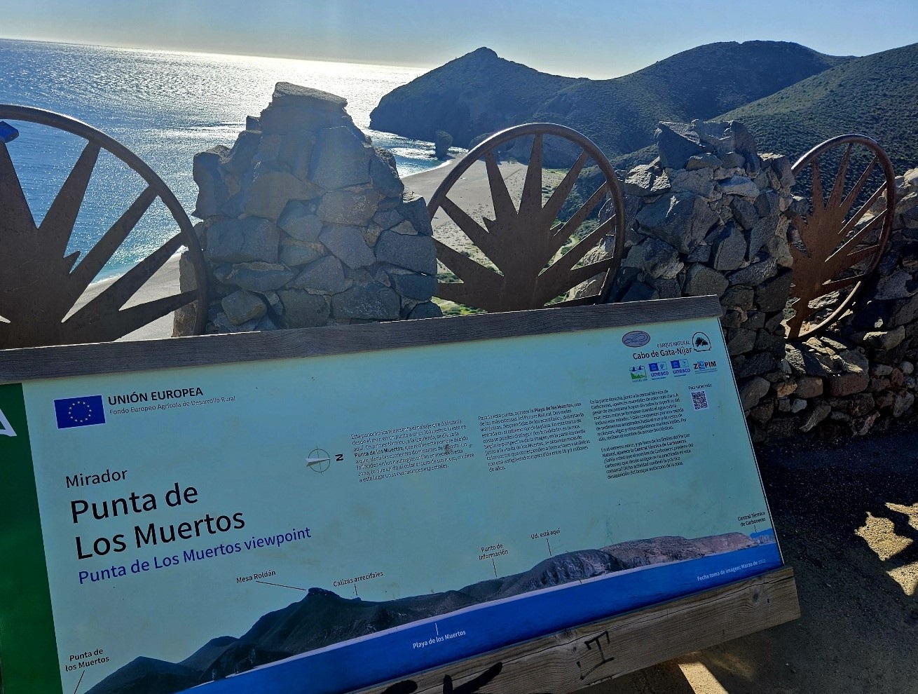
The path emerges at a surfaced track, where the waymarks indicate a right turn. However, it’s worth turning left to walk a couple of hundred metres to the Punta de los Muertos vantage point.
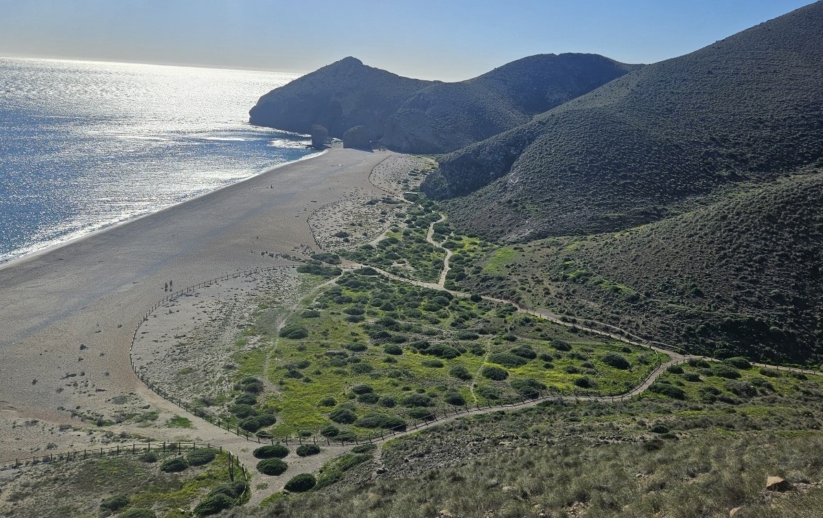
High above the shore, it offers fantastic views over the Playa de los Muertos. The ‘beach of the dead’ gets its name from the fact that when shipwrecks occurred, the sea currents would wash bodies into this area.
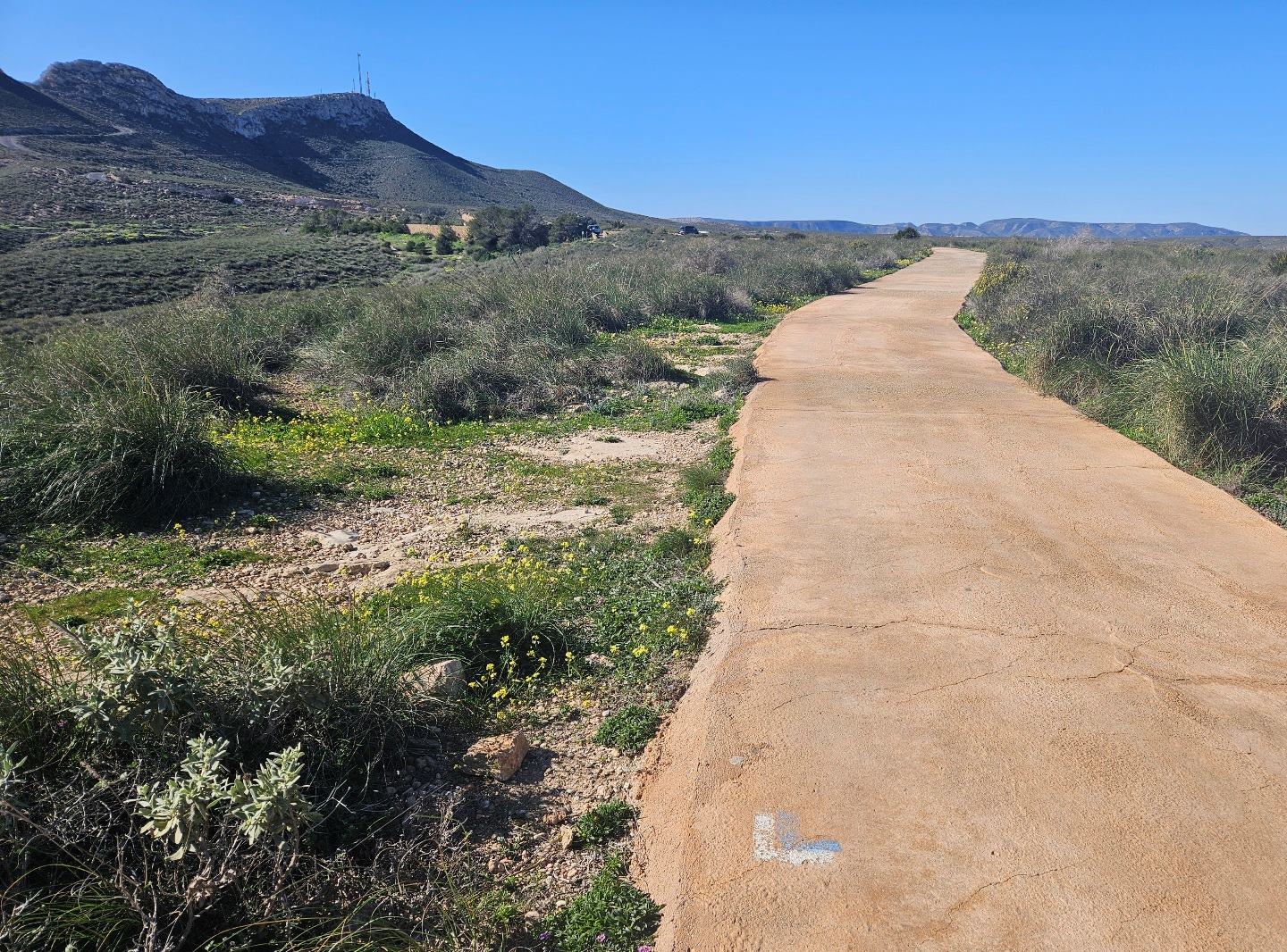
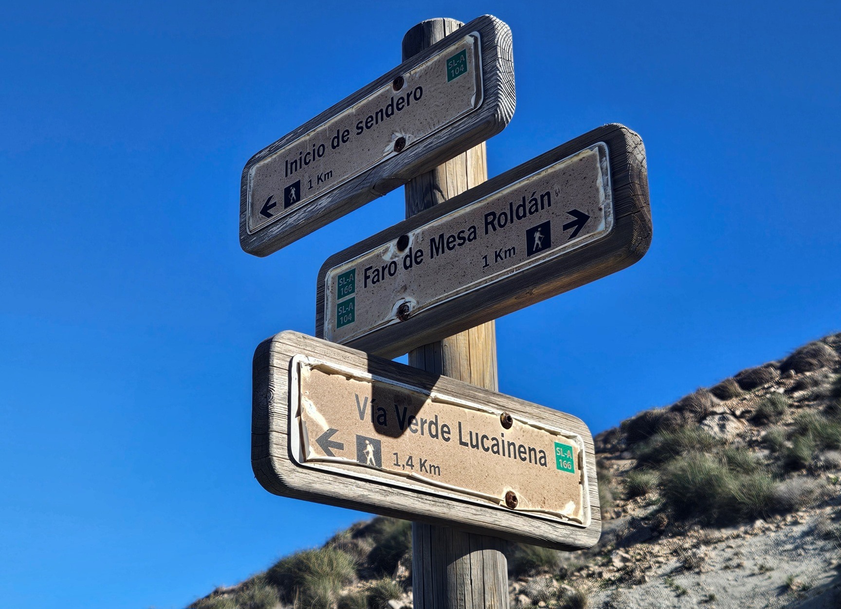
Retrace your steps to the turn-off and continue along the walkway which leads to a car park. Walk through the parking area. On the other side follow the left-hand lane which goes uphill towards the Mesa Roldán, following signs for Faro de Mesa Roldán (‘faro’ means lighthouse).
A couple of hundred metres up the road our route branches off right on a wide track heading up an incline.
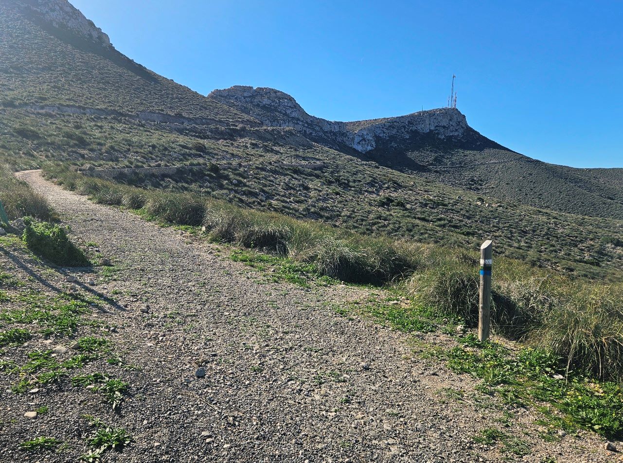
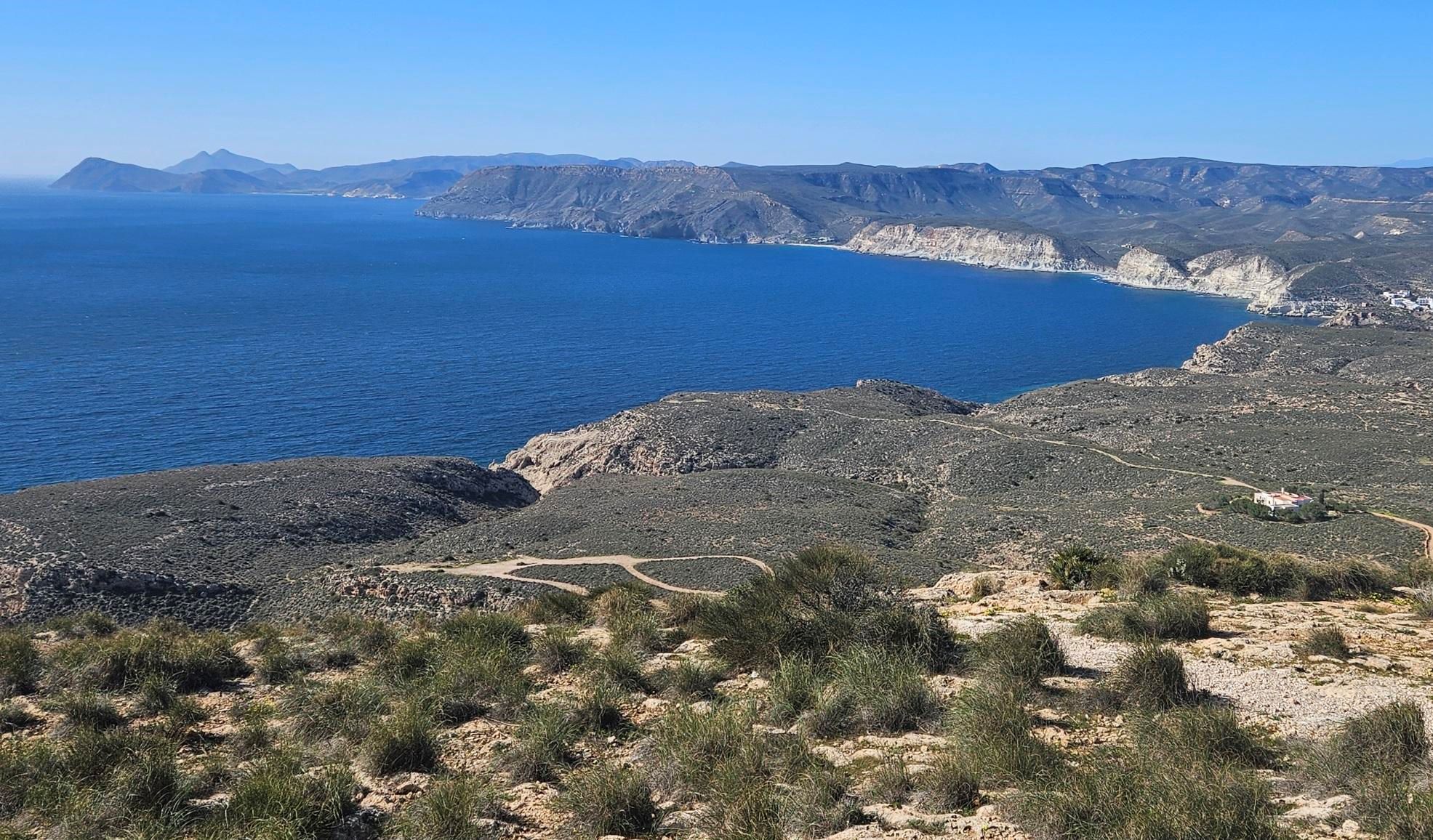
It’s a gradual climb. The track goes around the hillside and up the Mesa Roldán. There are great views back towards Carboneras as height is gained.
Arrive at a sign which points right for the Vía Verde Lucainena; we will return to this spot later to take the path down towards Agua Amarga.
Before this we follow the sign for Faro de Mesa Roldán, continuing the ascent on the track.
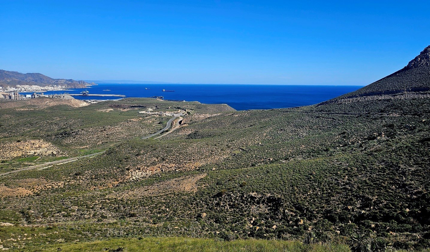
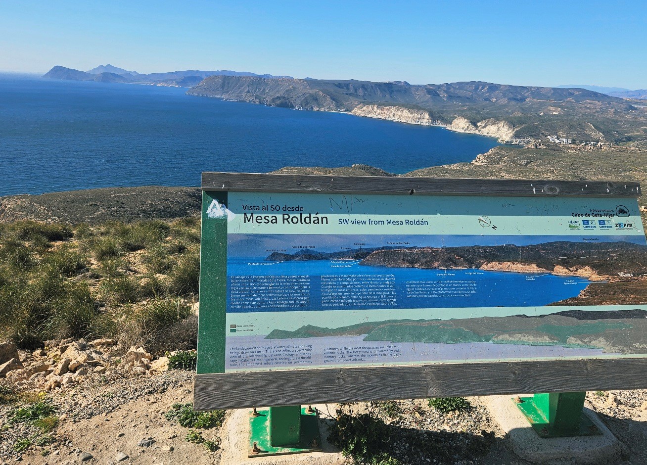
The magnificent view of almost all the Cabo de Gata is now upon us, improving as we gain height.
The track comes to an information board that points out the coves and hills that lie ahead, which can be seen with the naked eye.
This is the area we will walk through over the next couple of days. It’s an enticing and exciting prospect; a truly stunning coastline to explore.
Part 2 to follow
Recent Comments