
The path runs along the right side of the wide valley/ravine, high above the river. It arrives at a sign which points left for the ‘cascada’ (waterfall). Leaving the GR-7 behind, this offshoot heads down into the ravine. It is not overly steep and the waterfall area is a couple of hundred metres away.
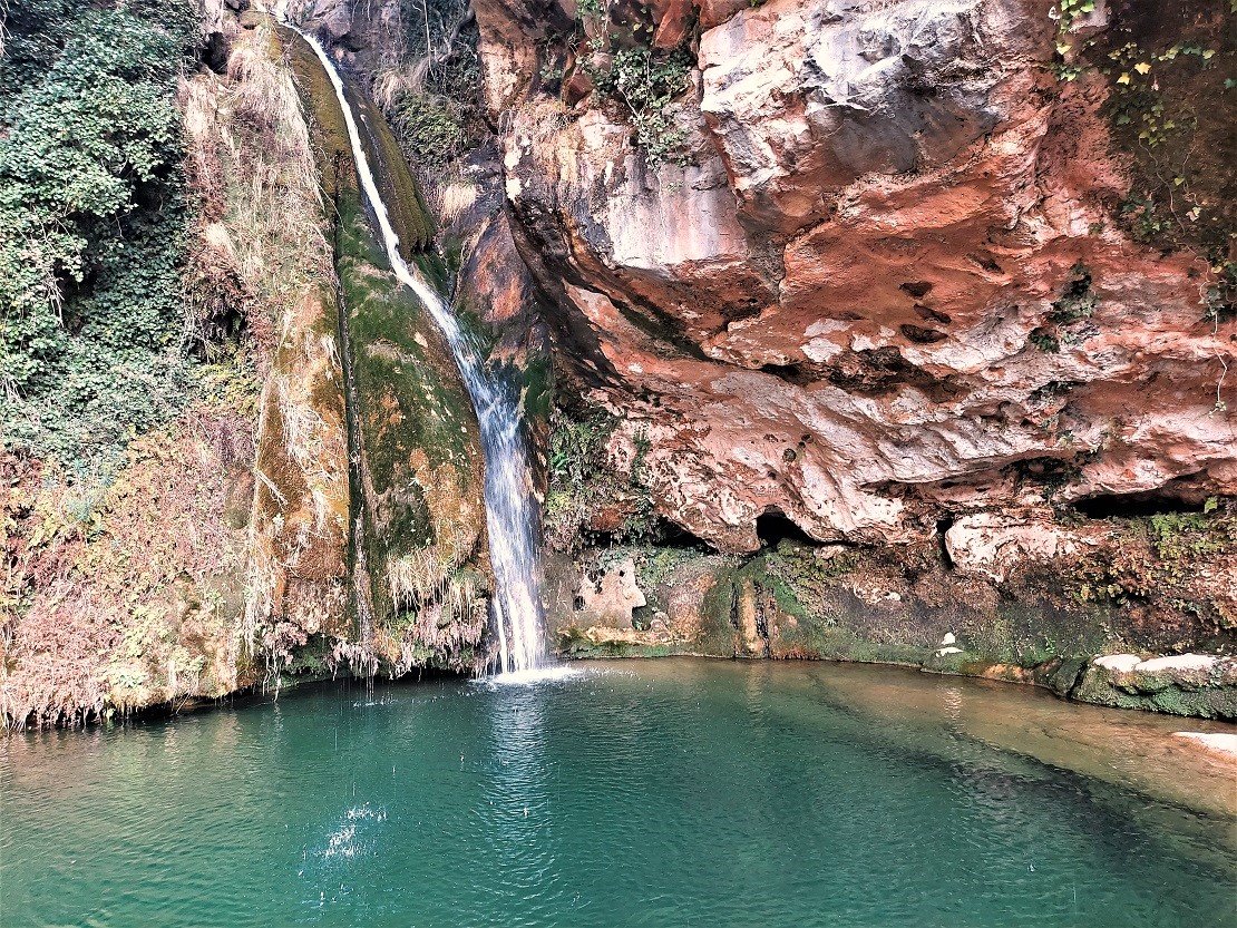
The path stops at an information board, which gives details about the route, but it is still around 20 metres short of the tumbling cascade. To get to the pool in the photograph it is necessary to clamber over large boulders and around an overhang of earth. It’s not an impossible task but it will not be to everyone’s liking and it’s the type of spot where accidents can happen. Therefore, great care must be taken if you are going to do this. Also, be aware that rocks have been worn smooth in some spots as this is a popular place to visit.
Those who reach the pool formed by the waterfall will see that it is an enchanting spot, with the cool spray coming off the cascade and droplets falling from the rock overhang above, making it refreshing as well as visually intoxicating. A sign explains that it is prohibited to practise canyoning from the cascade, but it does not say that swimming in the pool is banned.
Many will head back to the village after seeing the waterfall – it’s 6km one way with 307 metres of ascent.
However, back at the path – and back on the GR-7 – there are options. You could complete this stage of the GR-7 by continuing on to the sanctuary at Sant Juan de Penyagolosa, which is a further 4.9km one-way; or head up to the summit of Peñagolosa and return via the sanctuary, which is the route that I did.
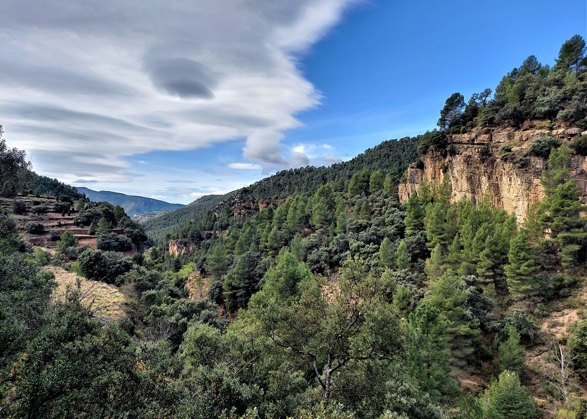
Back at the GR-7, continue the gentle ascent of the Carbo valley/ravine. Gaining height, the views improve over the wooded landscape. Looking across the valley, there is a large ‘masía’ farmstead which appears to be abandoned – but very soon we pass another which has been renovated and is now being lived in. After some more ascending arrive at a signpost which tempts us away from the GR-7, with the ‘blue’ sign pointing for the ‘Pic de Penyagolosa’.
Swapping red for blue, our path for the ‘pic’ runs across the mountain slope while also ascending. There are cairns to help with orientation as the path cuts across other tracks, taking a more direct route up the slope. Eventually it emerges at a wide forestry track and there are no more ‘cut-offs’, so bear right to ascend on the track. Pass a farmstead which has seen better days and can only now be described as ‘tumbledown’. Peñagolosa summit is now in view.
The next landmark on the track is a sign pointing for the ‘nevera’ – a snow well on the flank of Peñagolosa. Do not take it – stay on the wide track, now ascending through sweet-smelling pine trees. Round a bend and out of the trees, notice another farmstead to the left called the ‘Mas de la Cambreta’. Don’t turn off – stick on the main track, now passing underneath the summit for a short distance before arriving at a right turn, which is the track that leads up to the top. There is a large rock and sign here pointing to the peak.
The ascent from this spot is a popular one and it’s not difficult. It’s a track through the pines for most of the way. It’s not monstrously steep but the gradient does get a little bit more challenging in the final short section which criss-crosses up to the peak.
At the top there’s a weather station which doubles up as a forest fire look-out point. There are two distinct summit areas, which can both be accessed. The views are spectacular and vast swathes of the surrounding region can be contemplated on a clear day.
The return leg to the village of Villahermosa del Río is partly on a different route. It’s not quite a round walk but there is some variation. The initial descent from the peak is on the same path. Walk down to the large rock and signpost which marked the start of the ascent to the top. Back at the wide track, bear right and walk around 150 metres along the track, arriving at the mass of pine trees. Turn off left to follow the sign which points for the PR-CV 79 footpath to ‘St Joan de Penyagolosa’ (and the Barranc del Forn).
It’s 2.6km to reach the hermitage at Sant Joan and we are now helped by the white/yellow waymarks of the PR-CV 79, although the footpath through the pines is not difficult to follow. It’s a pleasant route on a gentle descent through the trees. At one point a low wire fence blocks the path. Notice the waymark on the other side of the wire. The fence shouldn’t really be there. Step over it and continue on the waymarked path.
The path emerges at the holy site of Sant Joan (also San Juan), where there is a hermitage and other buildings which form part of this ancient pilgrimage site. It is worth have a quick look round the area, where there is also accommodation for pilgrims, as well as the church.
The signposts tell us that we are back on the GR-7 long distance footpath, now following the signs for Villahermosa del Río to return to the village. It’s a wide track, slightly uphill, which leads away from Sant Joan and ascends to the head of the Carbo river valley. At the crest there is a signpost which points left for the Carbo. Turn off to continue following the white/red waymarks of the GR-7.
The path now descends the Carbo valley/ravine all the way back to Villahermosa, running along the left side, high above the nascent river. On the first section there are some wonderful views down the valley, as the path descends the gentle slope. The route eventually arrives at the point where we turned off the GR-7 earlier in the day to start the ascent to the summit of Peñagolosa. Here, keep straight on. Pass the turn off for the Carbo waterfall and continue all the way back to Villahermosa del Río on the same route, which is the GR-7 all the way.
The walk taking in the summit is approximately 24km, with more than 1,200 metres of ascent. You should allow between nine and 11 hours to complete the route, which includes the stops at the waterfall, summit and other points of interest.


Recent Comments