Castellón Province
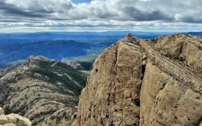
Rugged and remote. That’s the interior of Castellón, where the best footpaths in the province can be found. It’s no surprise that it borders Teruel; they have much in common. Castellón shares the Maestrazgo with its neighbour, but here it’s known as the Maestrat, with the Valencian language predominately spoken. It has the same limestone landscape, the ravines and escarpments; and some high peaks too. The ascent of the sacred mountain of Peñagolosa (1,814 metres) is one of the most enjoyable routes. Ibex and griffon vultures are just two species of fauna to watch out for.
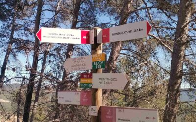
Montanejos; unrivalled ravines
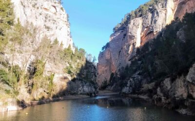
Rivers slicing through limestone rock have formed incredible ravines with towering walls in Montanejos. A network of waymarked footpaths in the municipality means these natural phenomena can be explored and enjoyed from different angles. The trails aren't always easy...
Walking above the narrows
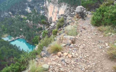
This waymarked route in Montanejos heads to the top of 'the narrows' – the Estrechos de Chillapájaros – where towering cliffs close in and the Mijares river creates a sheer-sided ravine. The views from above, looking over the gorge, are spectacular. The walker also...
Monumental Maimona
This route runs along the side of the gargantuan Maimona ravine, up towards the summit of La Rosada at 949 metres. The walk follows the GR-7 footpath through the ravine, which is signed with white/red waymarks. There are spectacular views of the rock walls which...
Morrón manoeuvres
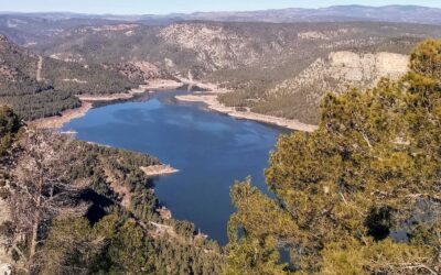
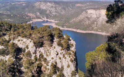
This circular walk goes up the highest mountain in the area, the Morrón de Campos (967 metres). There are fantastic views from the top, over the Arenoso reservoir and large swathes of the surrounding area. The route drops down to the water and crosses the canyon below...
Morrón manoeuvres; part 2
There two ways to descend from the summit of Morrón de Campos to the Arenoso reservoir. It can be done on the wide forestry track which is used by vehicles driving up to the look-out point; or via a path that is not waymarked and which runs along the top of the...
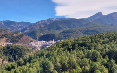
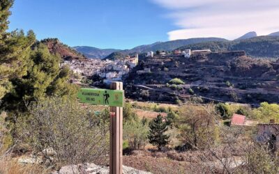
Villahermosa – it’s a beauty
The name Villahermosa del Río originated in the Moorish era. Meaning ‘beautiful village of the river’, it is hard to quibble with the sentiments. But, after visiting, it begs the question – which river? The village is perched on a ridge flanked by two long ravines...

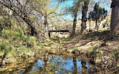
Villahermosa ravine walk
This short walk takes in the spectacular ravine forged by the River Carbo, which passes the eastern edge of Villahermosa del Río, with the whitewashed houses standing above, along the cliffs. There is no real difficulty to the route, but walkers should be aware that...
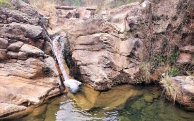
Carbo waterfall and Peñagolosa
This is probably the best walk from Villahermosa del Río. It can be an all-day affair, or a shorter route as far as the Río Carbo waterfall. The longer trek goes to the top of the second highest summit in the Valencia region, which is Peñagolosa (1,814 metres) – a...
Carbo waterfall/Peñagolosa – part 2
The path runs along the right side of the wide valley/ravine, high above the river. It arrives at a sign which points left for the ‘cascada’ (waterfall). Leaving the GR-7 behind, this offshoot heads down into the ravine. It is not overly steep and the waterfall area...
Pine pilgrims and a hermitage
For this route from Villahermosa del Río it's back on the GR-7, which – as long-distance routes go – is extraordinarily long, spanning several European countries. However, our ambitions (at the moment) are not so grand, and we will content ourselves with a walk to the...
Pine pilgrims and a hermitage – part 2
The track continues to ascend, shaded by the pines that produce impossibly large cones which cover the forest floor and trail. The track flattens out. Notice the sign pointing back for Pino Cacho/Villahermosa; our turn-off onto a path is here on the left and it's easy...