This route is littered with glacial lakes. There are at least 12 to be seen on the ascent of the Gerber valley, some of which are small and without names; others much larger and ringed by summits.
Not forgetting the three beauties which can be viewed on the other side of the pass.
Water is a constant protagonist; there are mountain streams as well as the lakes. Much of the route lies inside a national park, the Aigüestortes i Estany de Sant Maurici.
The starting point gives walkers a leg-up; it’s at 1,900 metres, which is a pretty good launch pad for getting very high. And the high-point of the route is a pass at 2,585m, the wonderfully-named Còth der Estanh Gelat.
There are words there which are worth explaining; a ‘còth’ is a term from the Aranés language, spoken in the Val d’Aran, which means a ‘col’ or pass (collado in Spanish).
On the map we see two spellings for glacial lake; in the Gerber valley it is ‘estany’ which is in Catalan, and once over the pass it is ‘estanh’ which is in Aranés (this language has many similarities to Catalan).
It is approximately 6.5km to reach the pass, with 750 metres of ascent; some people will decide to turn back here and return on the same route, and not only because it is shorter than doing the circular walk.
Two points which may persuade walkers against carrying on after the pass are the very steep climb out of the Ruda valley towards the end of the walk (around 300m of ascent). And the final section which means running the gauntlet of the ski station ‘guards’ by walking down the snowless slopes, or heading down the main road (or a potential path next to it).
On balance, I would advise that if you are feeling fit at the pass then you should carry on to see pastures new and experience some more dramatic mountain scenery.
The circular walk measures approximately 18km with around 1,100 metres of ascent. The route took me eight hours.
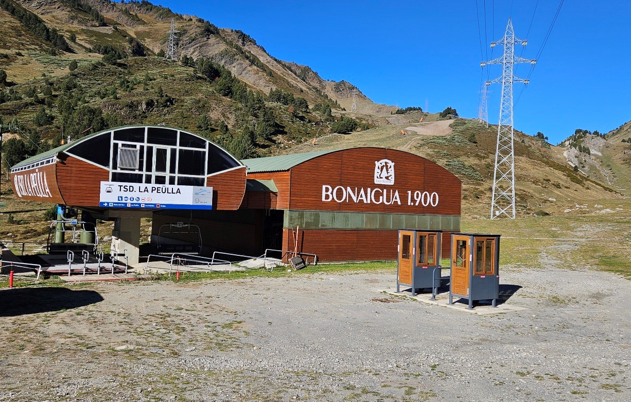
To get to the starting point take the C-28 road out of Vielha, passing Arties and heading up to the Port de la Bonaigua pass at 2,077m. Then follow the road down for just over 2km to the car park which is opposite the Peülla ski lift and building, which has Bonaigua 1,900 written on the side.
The Editorial Alpina 1:40,000 scale map entitled Val d’Aran shows the entire walk, while their Sant Maurici sheet at 1:25,000 has all but the final section, in better detail.
I did the walk in mid-October when the conditions were just about perfect, although I did get a bit too warm on the final steep climb. Bear in mind that a very early start would be needed on a hot summer’s day.
The walk
Cross the road from the car park to walk down and to the left of the ski station building. A small footbridge crosses the Bonaigua stream; here walk signs mark the start of the route.
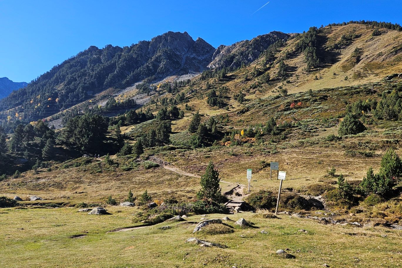
The first part of the route is up to the Gerber glacial lake and it’s a popular one; this section measures 3.3km.
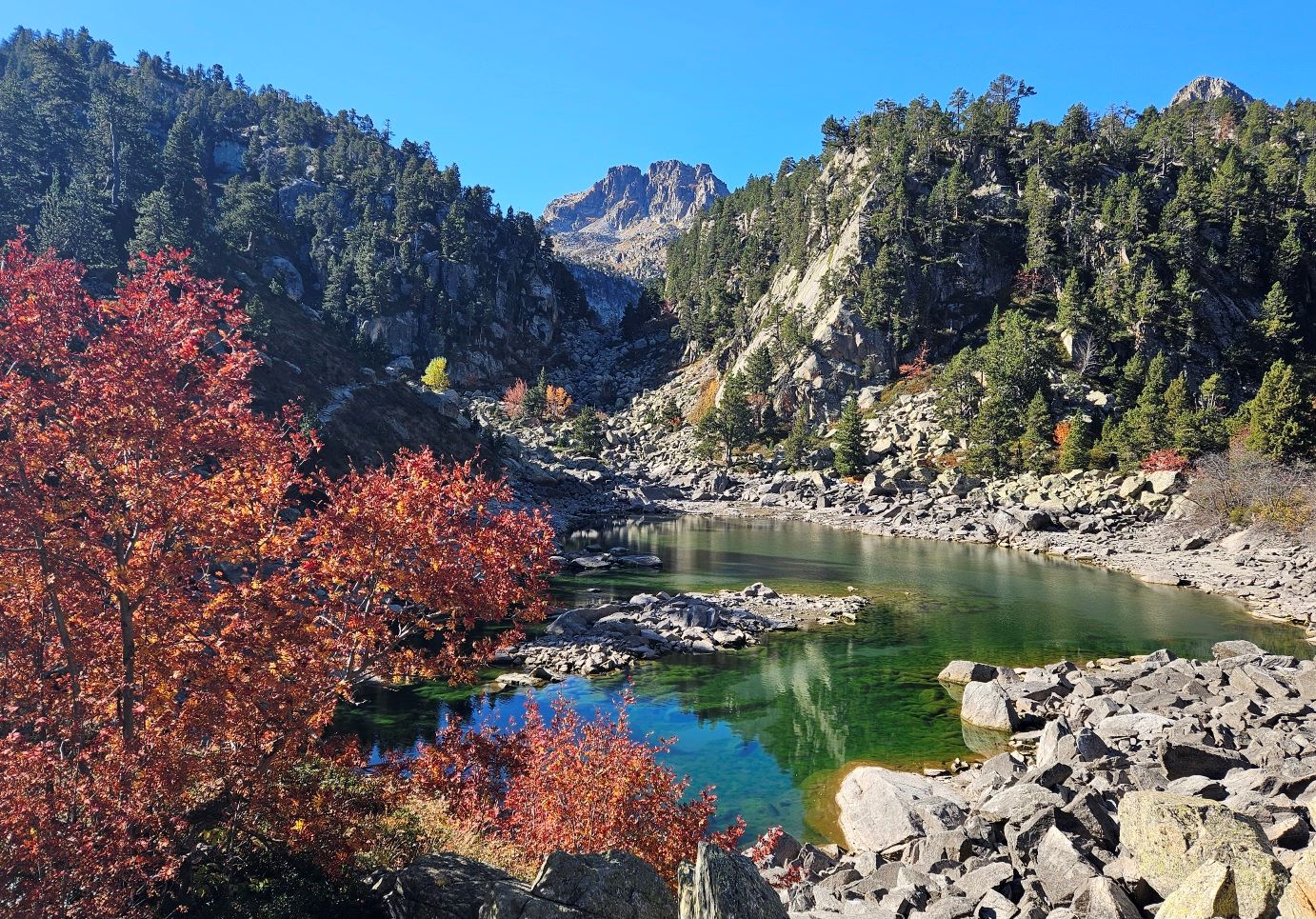
The ascent is fairly gentle at first as the path goes across the slope, heading towards the mouth of the Gerber valley. The path reaches deciduous trees, which are very colourful during the autumn.
Our route bears round to the right to enter the valley and the Aigüestortes i Estany de Sant Maurici national park.
The first glacial lake is soon upon us; named Estanyera. The large peak in the distance is the Xemeneia at 2,825m.
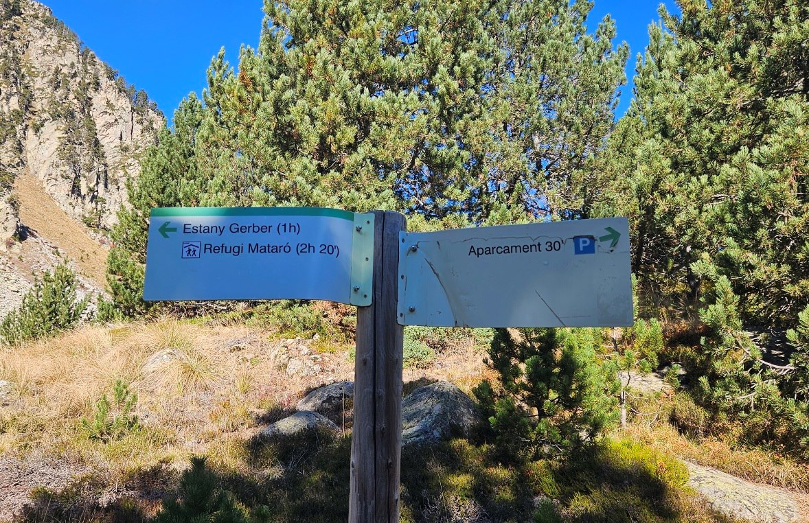
The path goes along the right-hand shore of the lake and continues to ascend. A sign says the Estany Gerber is one hour away, but you will probably be moving a fair bit faster than that.
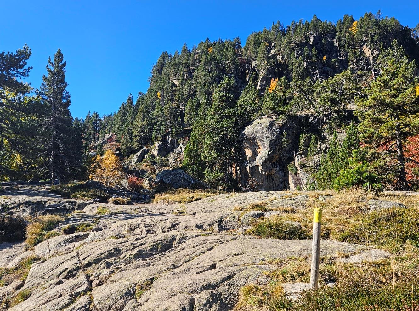
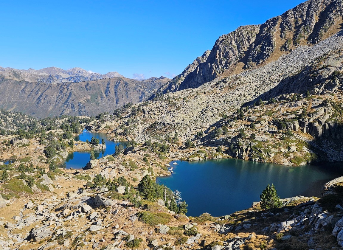
A marker post points the way across a section of flat rock and soon we are over the rise and at the shore of the second lake, the Estanyera del Mig.
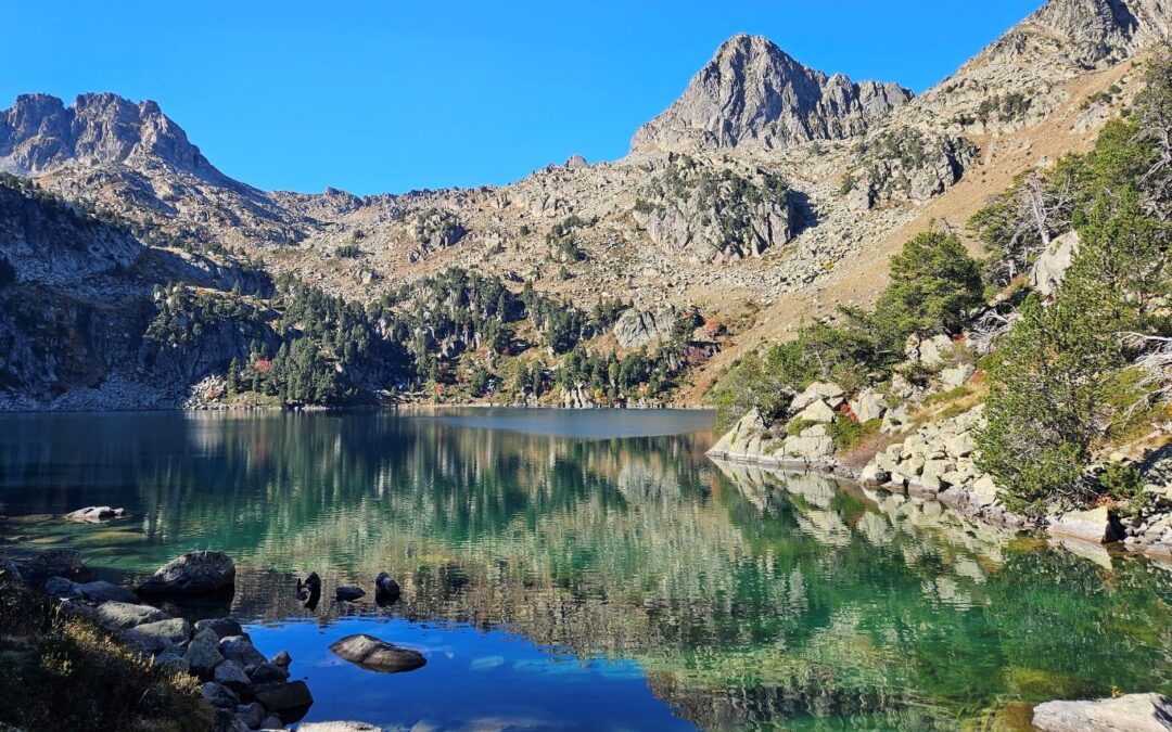
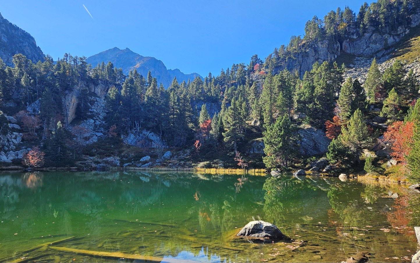
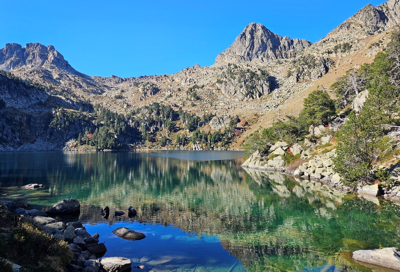
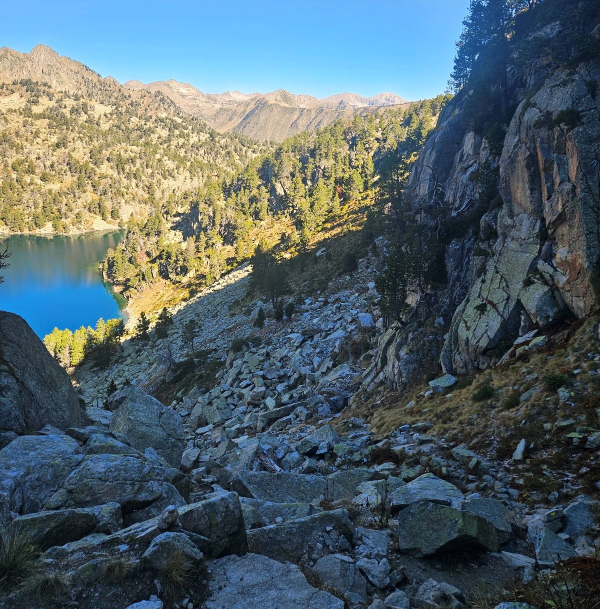
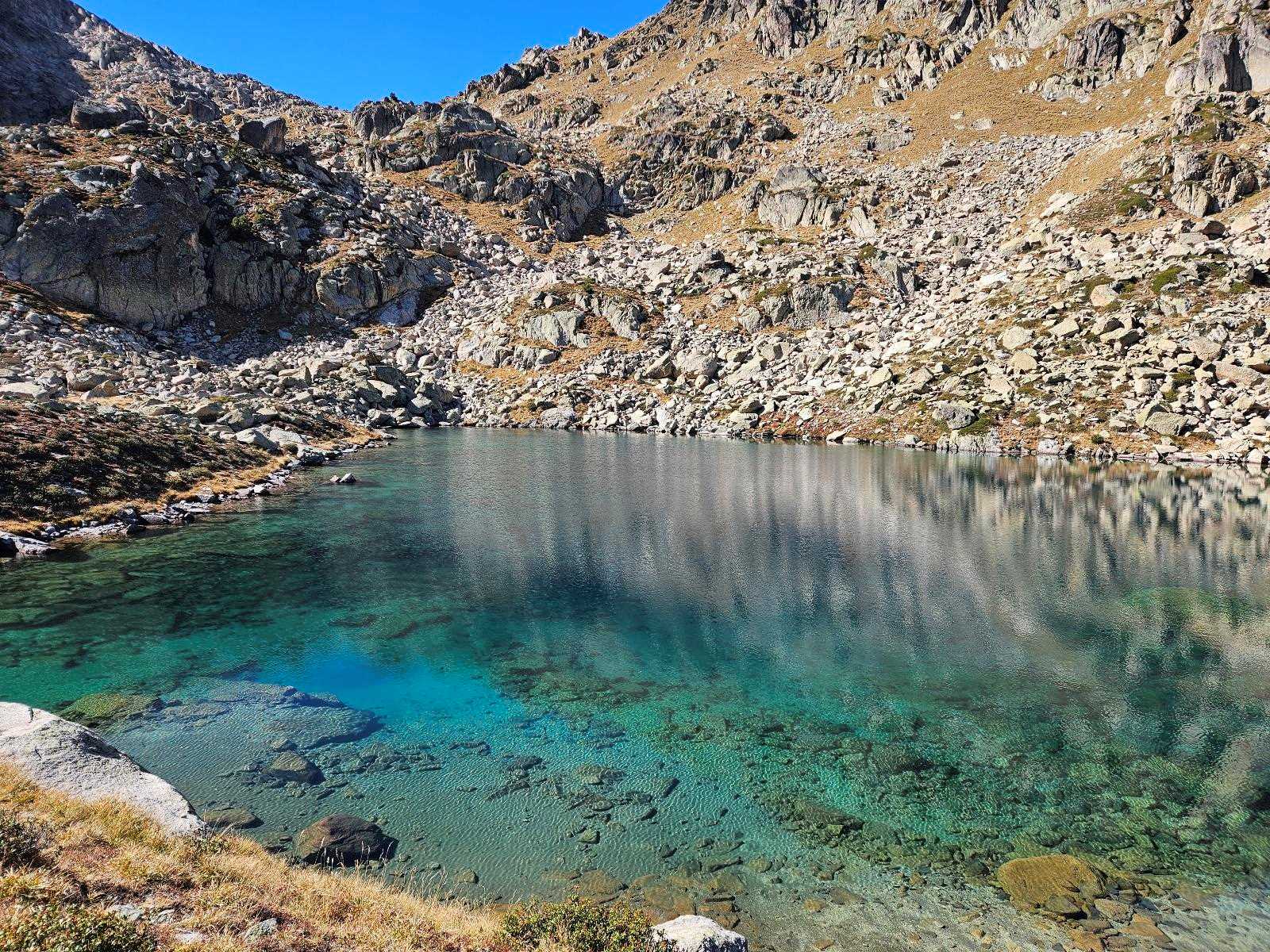
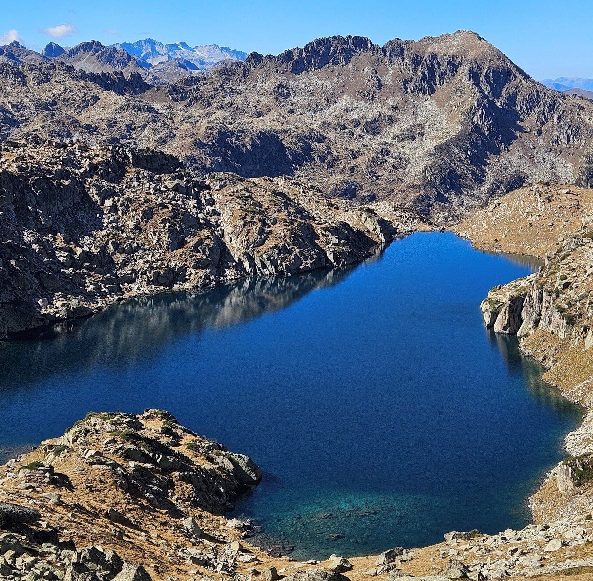
The route passes on the left and it’s a fairly short climb to emerge at the shore of the much larger Estany Gerber glacial lake.
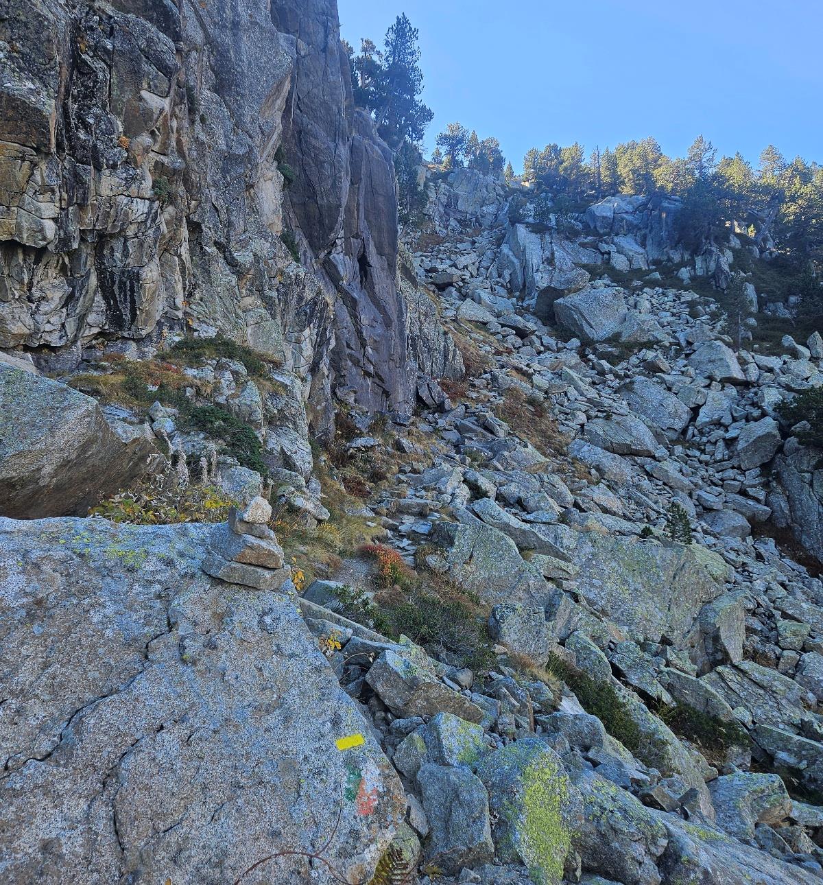
It is an impressive sight; the surrounding peaks can be reflected in the water. Gerber lake stands at 2,165m; from there the path bears left to start an ascent through the trees.
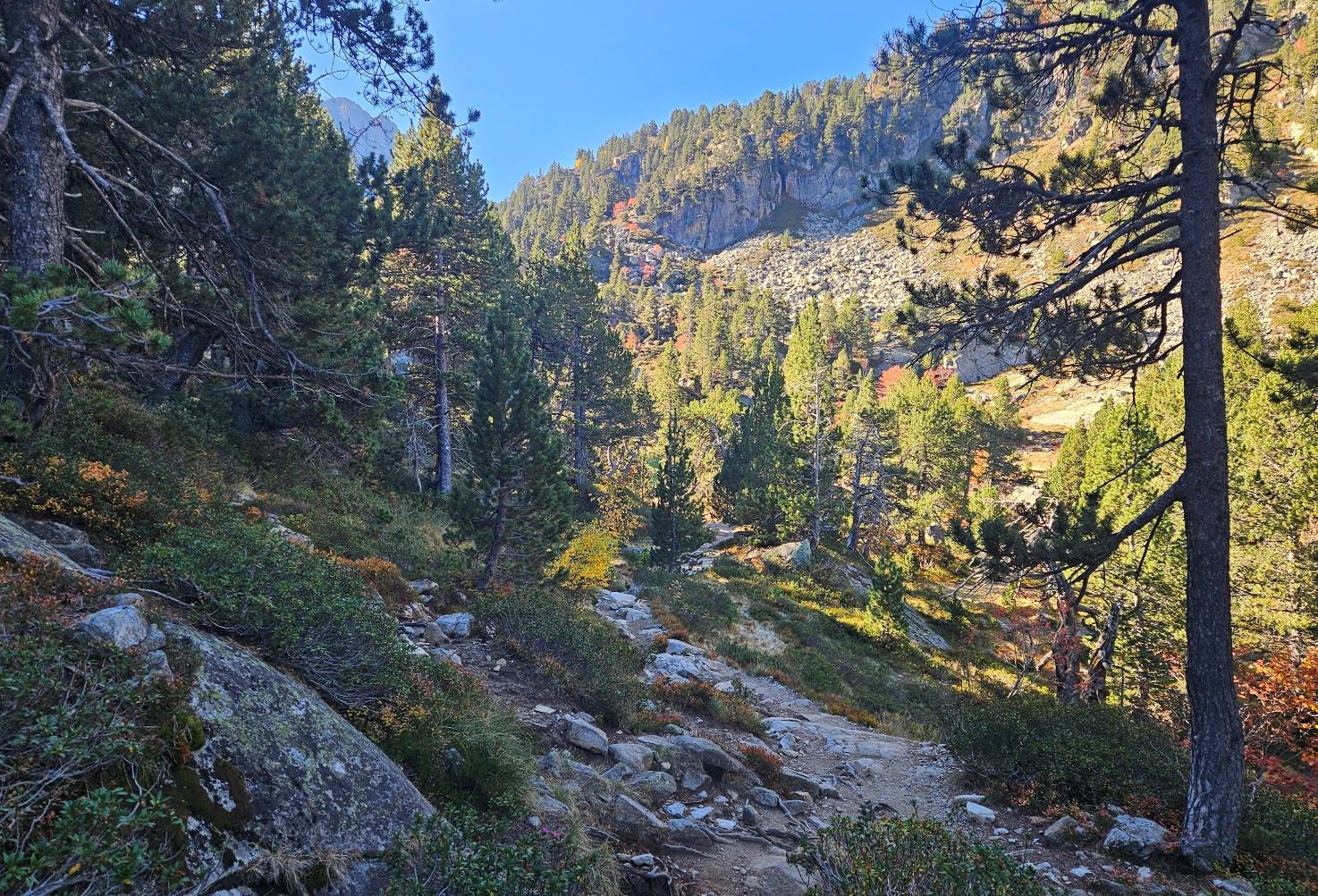
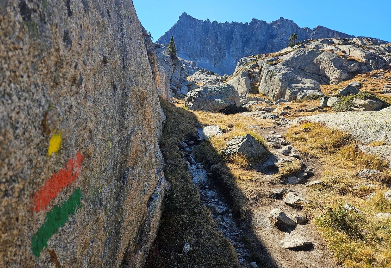
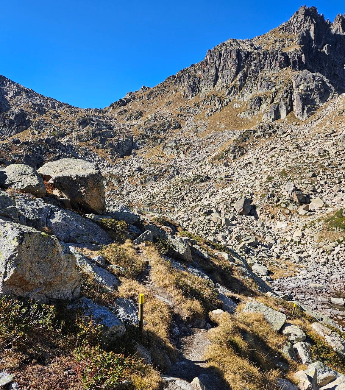
There are occasional waymarks but the path is clear even though it’s a rocky one. Gaining height, the route offers fantastic views over the water.
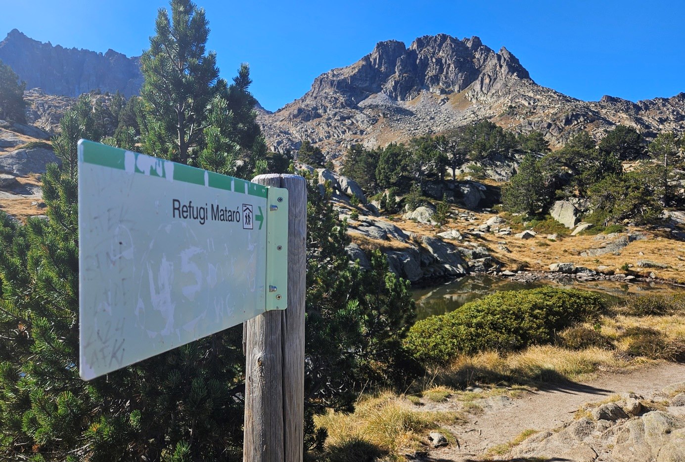
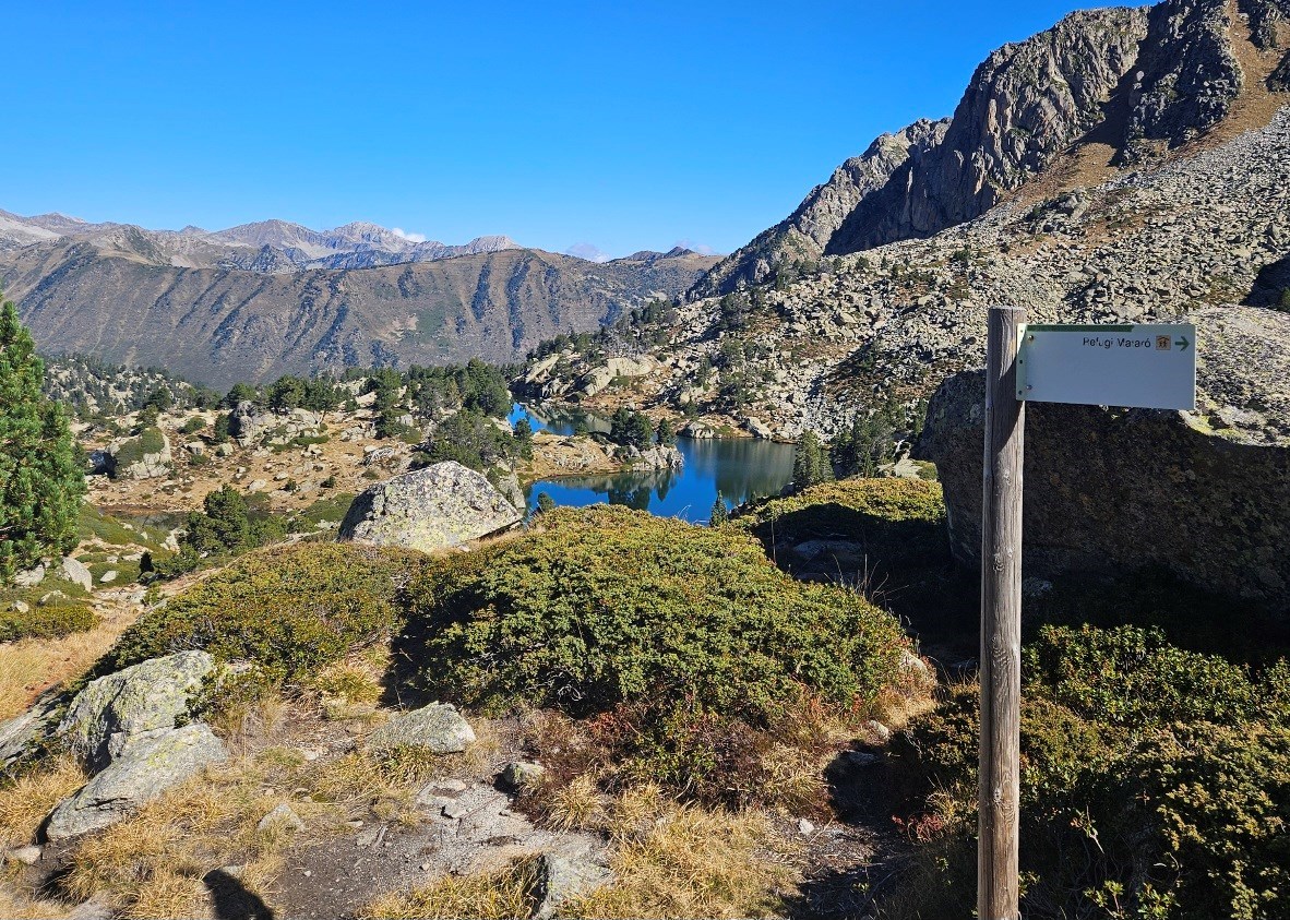
Our route emerges high above the lake. After completing the climb it flattens out. Signs are now pointing for the Mataró mountain refuge.
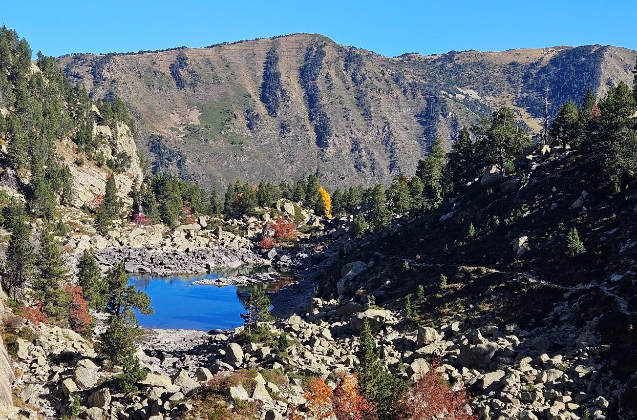
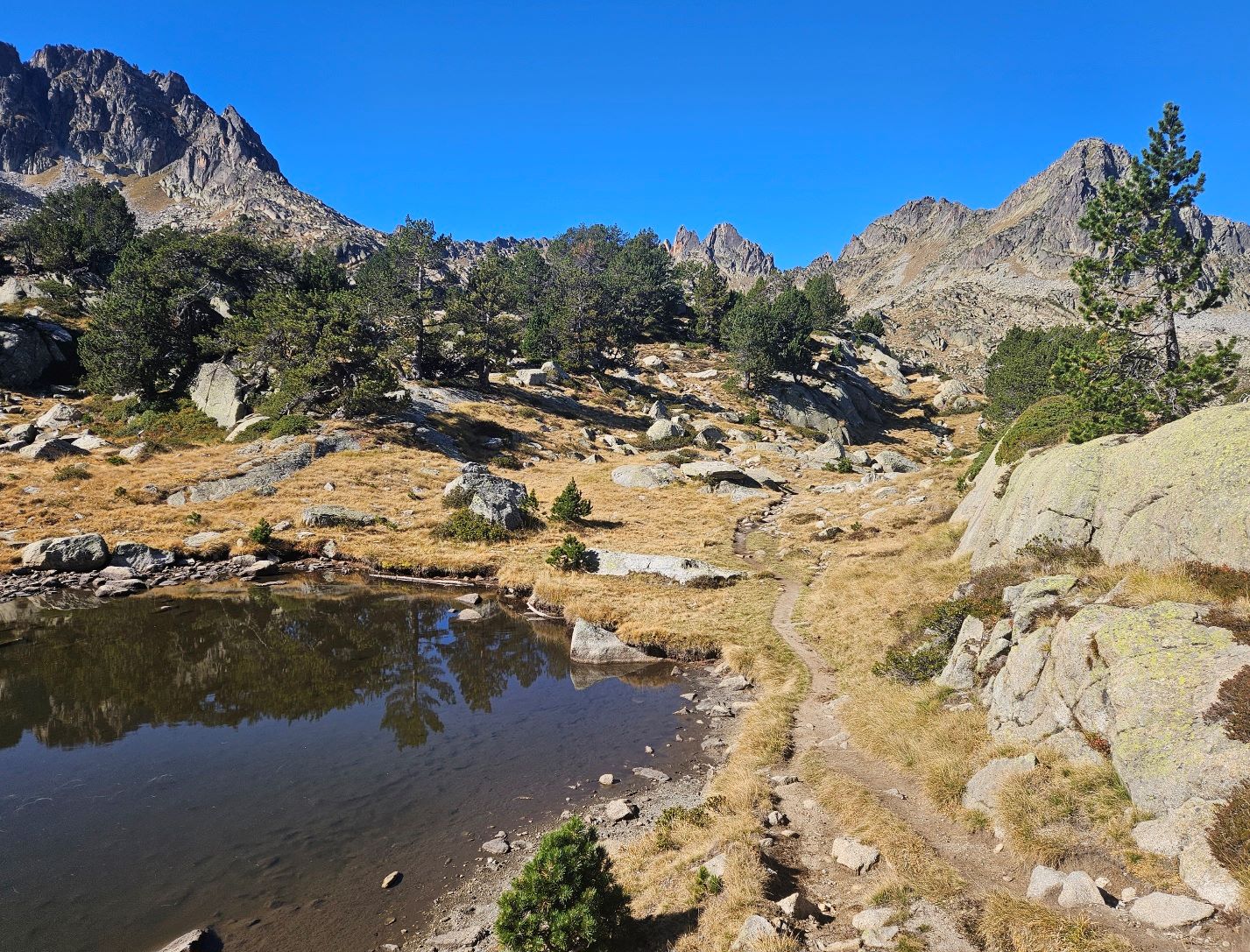
The path passes a couple of small lakes which are not named. We don’t see the larger Estany Llong at this point.
As well as signs, the occasional waymark appears on rocks to help with orientation. At the next sign for Mataró refuge, looking back, there is a great view along the Llong glacial lake.
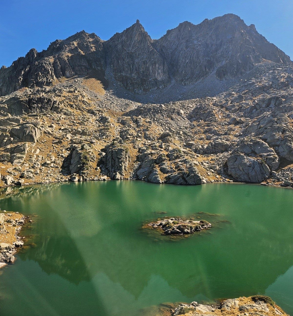
Very soon we pass close to the Redó lake, which is on the left; as the name suggests it is almost round.
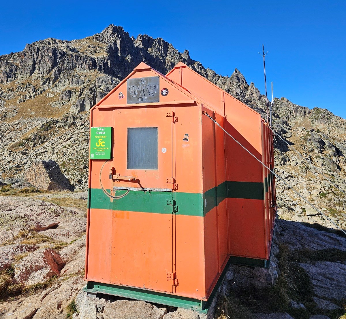
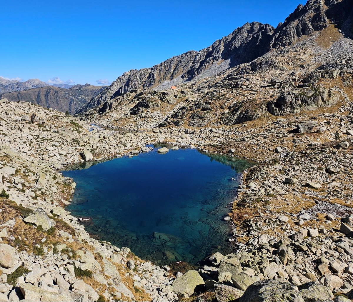
Pass more waymarks on the rocks. Next up, before reaching the refuge, is the Estany Gelat lake, which is just below the Mataró.
Perched on the rock, above and to the right of the lake, is the refuge at 2,476m. It’s a small, unmanned shelter which would be useful in emergencies.
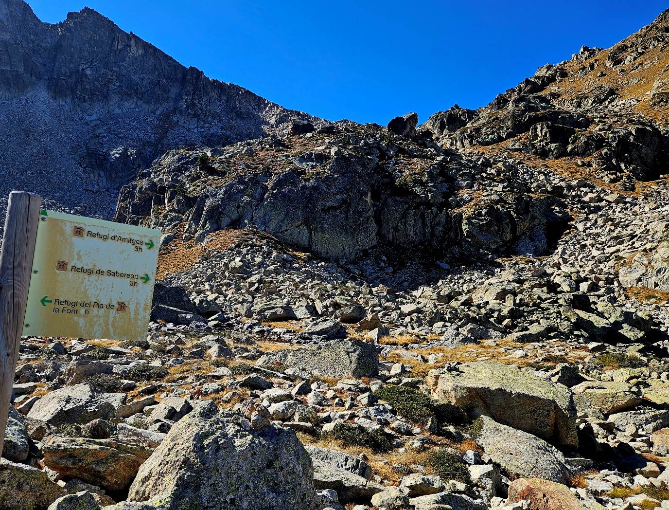
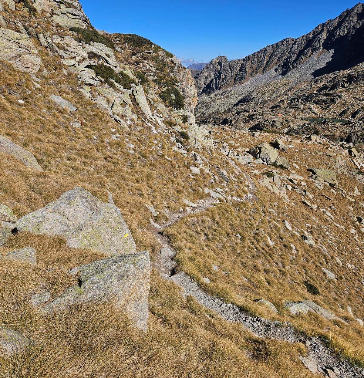
Heading away from the refuge, a post points the way. The path descends to the shore of another lake (not named on the map) and heads along the left bank.
We are now following signs for Refugi de Saboredo. There is a series of large rocks to cross before the path gets back onto earth.
On the ascent to the pass, looking back, we can see another glacial lake which isn’t named.
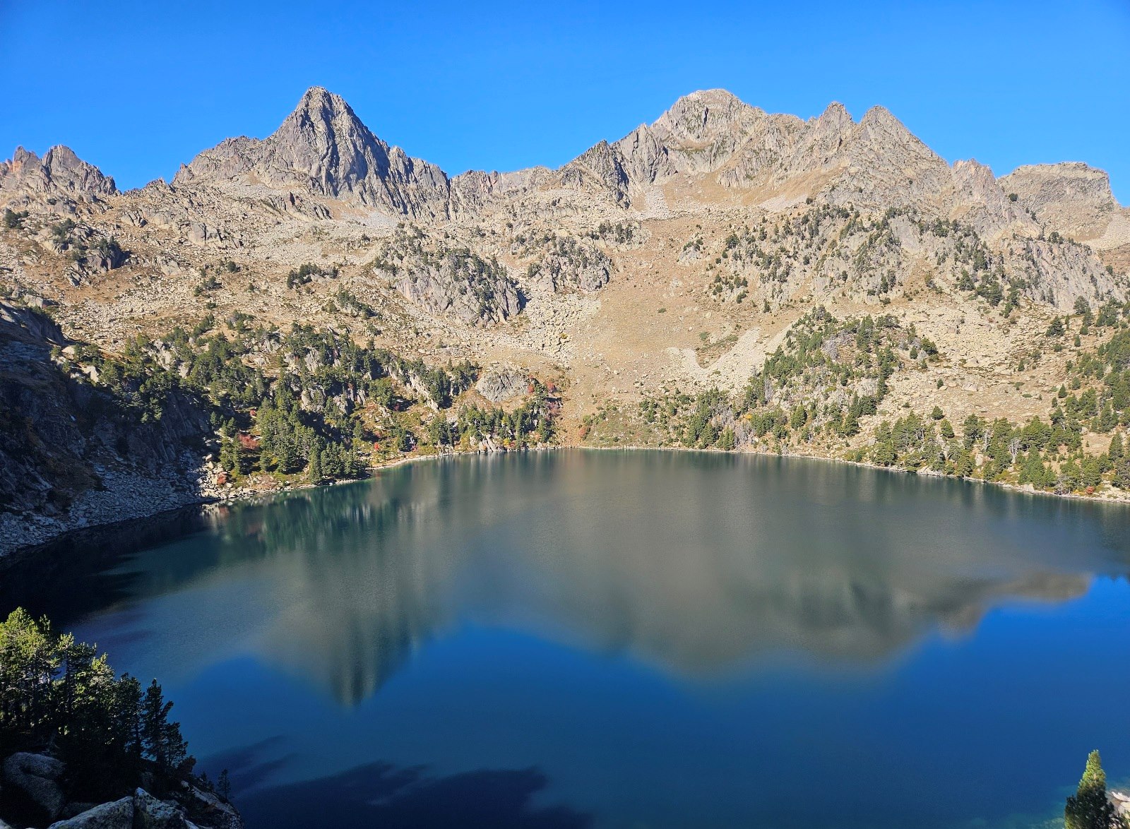
The path emerges at the Còth der Estanh Gelat, which is place deserving of the magnificent name. The views are absolutely incredible.
Just below, on the side not yet seen, is the lake which the pass is named after, the Estanh Gelat.
There are many lakes named Gelat in this area of the Pyrenees; the word in Catalan means ‘frozen’. Of course, we have already passed a different one on our route, next to the Mataró refuge.
Looking across the Estanh Gelat, far in the distance, we can see the Maladeta massif with its glaciers and string of peaks over 3,300 metres, with Aneto being the highest (3,404m).
If we continue pointing west (towards Aneto), the path on our left leads up to the Col d’Amitges and the peak of the same name at 2,848m.
Looking right we can see a path stretching out, well above the Estanh Gelat; this is the route for those who are crossing the pass.
Those who are returning from the pass on the same route will turn their backs on the Maladeta massif and descend towards the Mataró refuge.
Part 2 follows
Recent Comments