
Entering from the west for a multi-day walk is a great way to see the Catalan lakes. The route on the GR-11 – the long-distance footpath which crosses the entire Pyrenees mountain chain – requires a serious amount of effort, with views of epic proportions the main reward. The hike starts in Benasque in Huesca province, next to the highest peaks of the range, found in the Maladeta massif. It crosses one of the highest passes on the GR-11; Vallibierna at 2,732 metres to enter the lake district and pass dozens of these spectacular remnants of the area’s glacial past.
Our walk makes use of the network of mountain refuges which offer overnight stays, lightening the load that the walker has to carry. It takes four days to reach Espot, which marks the end of the lake district and the Aigüestortes i Estany de Sant Maurici national park. However, one more short stage on the GR-11 is needed to get to La Guingueta d’Àneu, where a bus can be caught to Barcelona. This means that both the start and finish points of the route can be accessed by public transport, with details at the end of this piece (part 2).
Most of the route is in Cataluña and the passage from Aragón into the neighbouring region is highlighted by the change in the name for glacial lakes shown on the map. To the west of the Vallibierna pass they are known as ‘ibón’ but to the east they are ‘estany’. The latter word is Catalan and the first comes from the less well-known language of Aragonese (aragonés).
There is another peculiarity on the first day; while the map name for the main valley and pass is Vallibierna, the signs in the area have it down as Ballibierna.
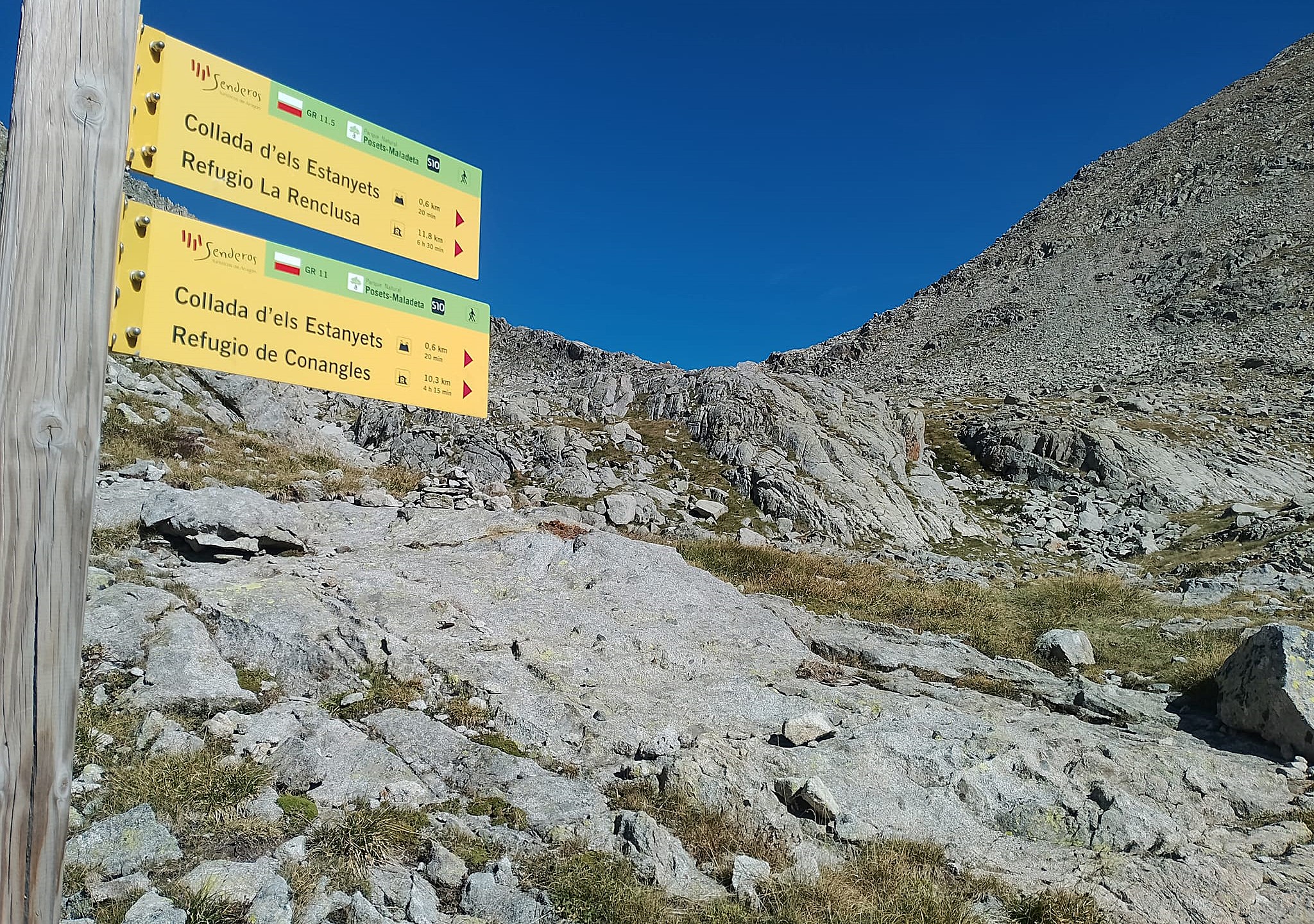
The map of the area which shows the route in Cataluña is the Editorial Alpina’s 1:40,000 scale sheet entitled Val d’Aran. Interactive maps can be found online at the website of the Catalan walkers’ federation, Federació d’Entitats Excursionistes de Catalunya (FEEC). On accessing their site at www.feec.cat scroll down to ‘senders’ (footpaths), where they give the stages and maps of many of the GRs in their region, including the GR-11. The interactive maps also allow the user to check out the GR-11.18. For the first stage from Benasque use the Editorial Alpina Valle de Benasque 1:30,000 scale. This part of the route can be viewed online at the Aragón region’s tourism website which includes the GR-11. Our route is etapa 13 (stage 13) Puente de San Jaime – Ref Cap de Llauset https://senderosturisticos.turismodearagon.com/senderos/gr11
Day 1 – Benasque to Cap de Llauset
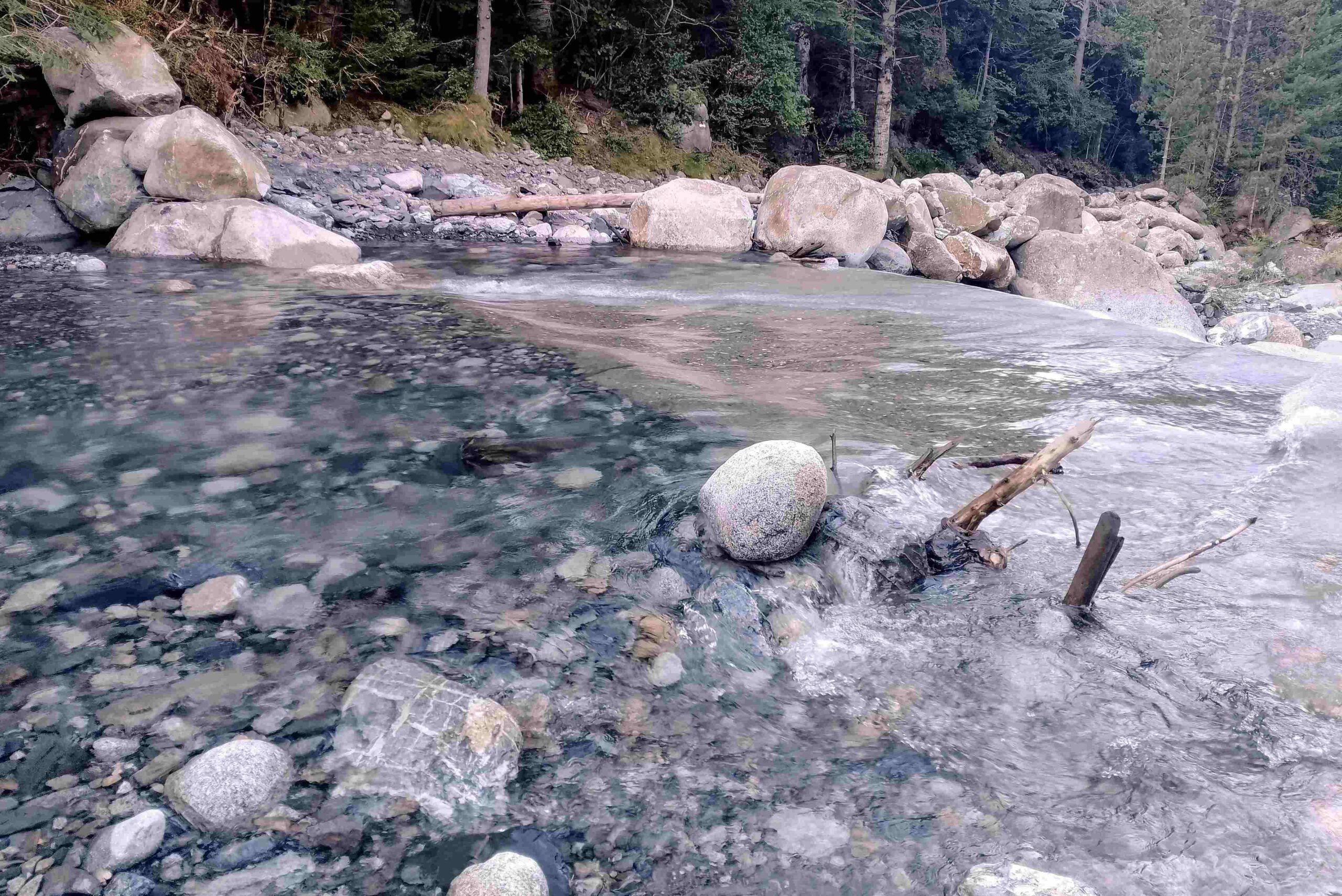
Walk out of the back of Benasque on the A-139 for just over 3km, using the grass verge where available. Pass Camping Aneto and just before the bridge over the Ésera river, take the track on the right, picking up the GR-11 at this point. The track runs above the right bank of the Paso Nuevo reservoir (embalse). Just short of the Plan de Senarta flats, it crosses the Vallibierna mountain stream, which can be lively after heavy rain and during periods of snow melt. It often requires shoes and socks to be removed to get across and great care has to be taken not to slip in the cold water.
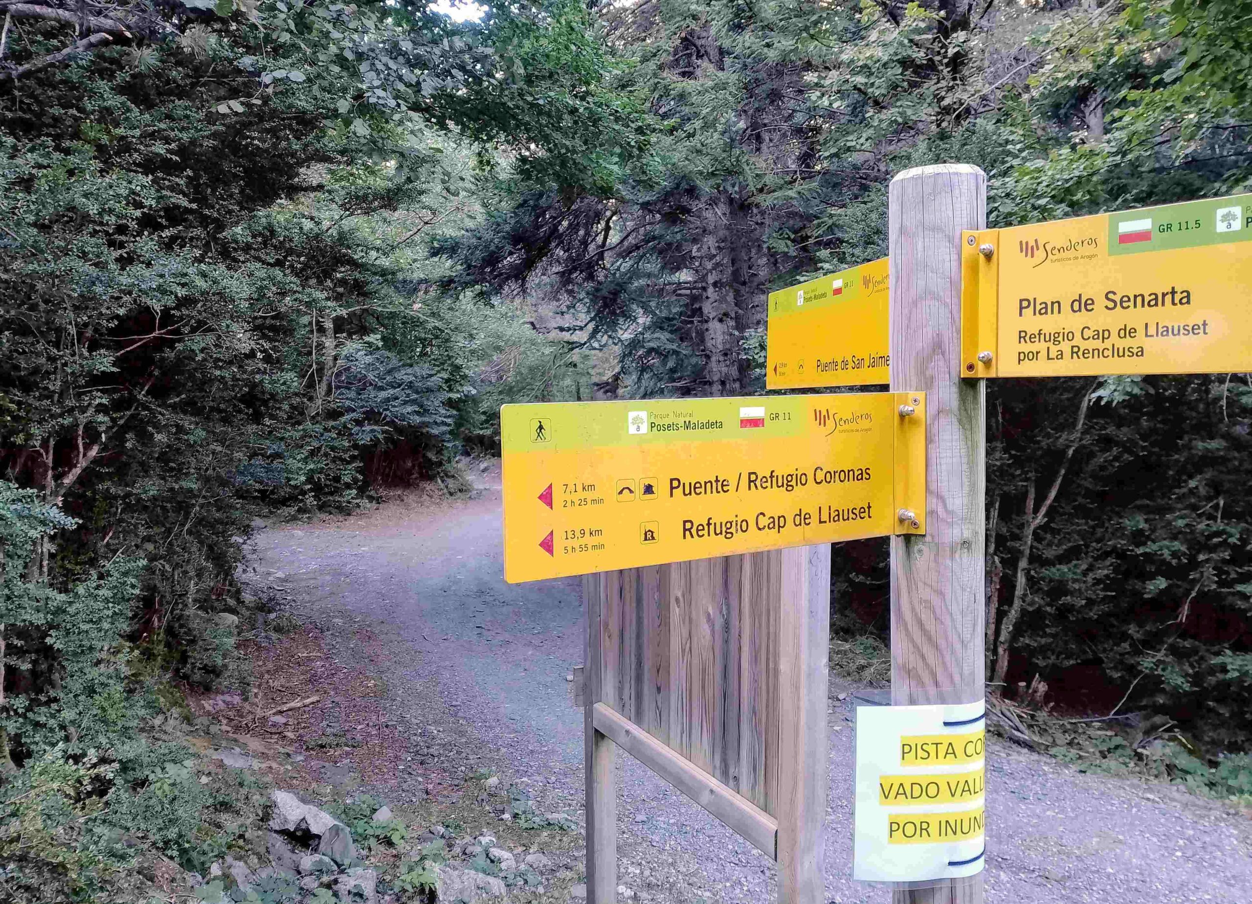
At Senarta follow the sign pointing for Puente Coronas and Cap de Llauset on the GR-11. It is 7.1 km from this point to Coronas at just below 2,000 metres, heading up the wide track. It’s a steady climb with one early lung buster on a path which cuts off a section of the track. Incredibly a mountain mini-bus covers this journey at peak times of the year, shipping up climbers to Coronas who are looking to reach the summits.
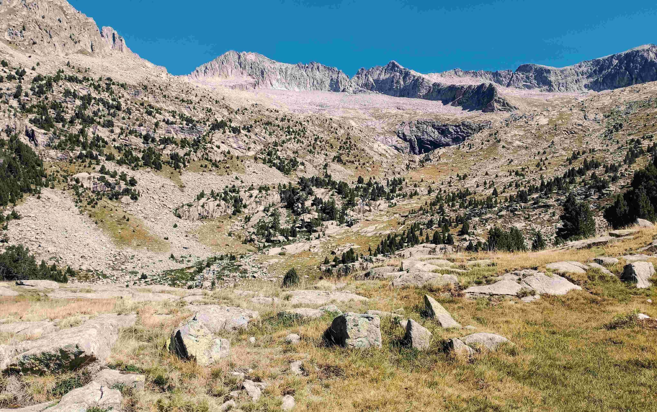
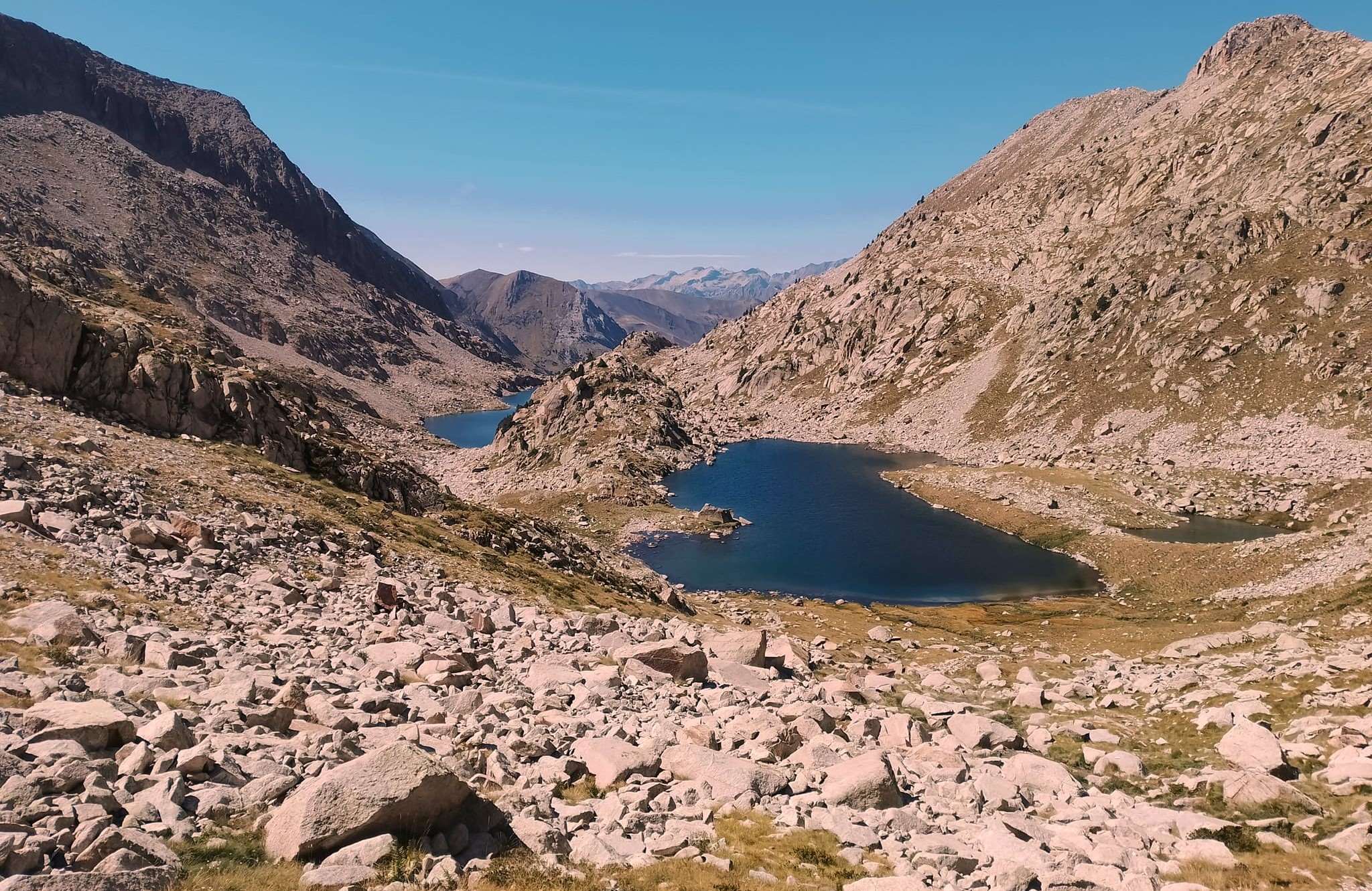
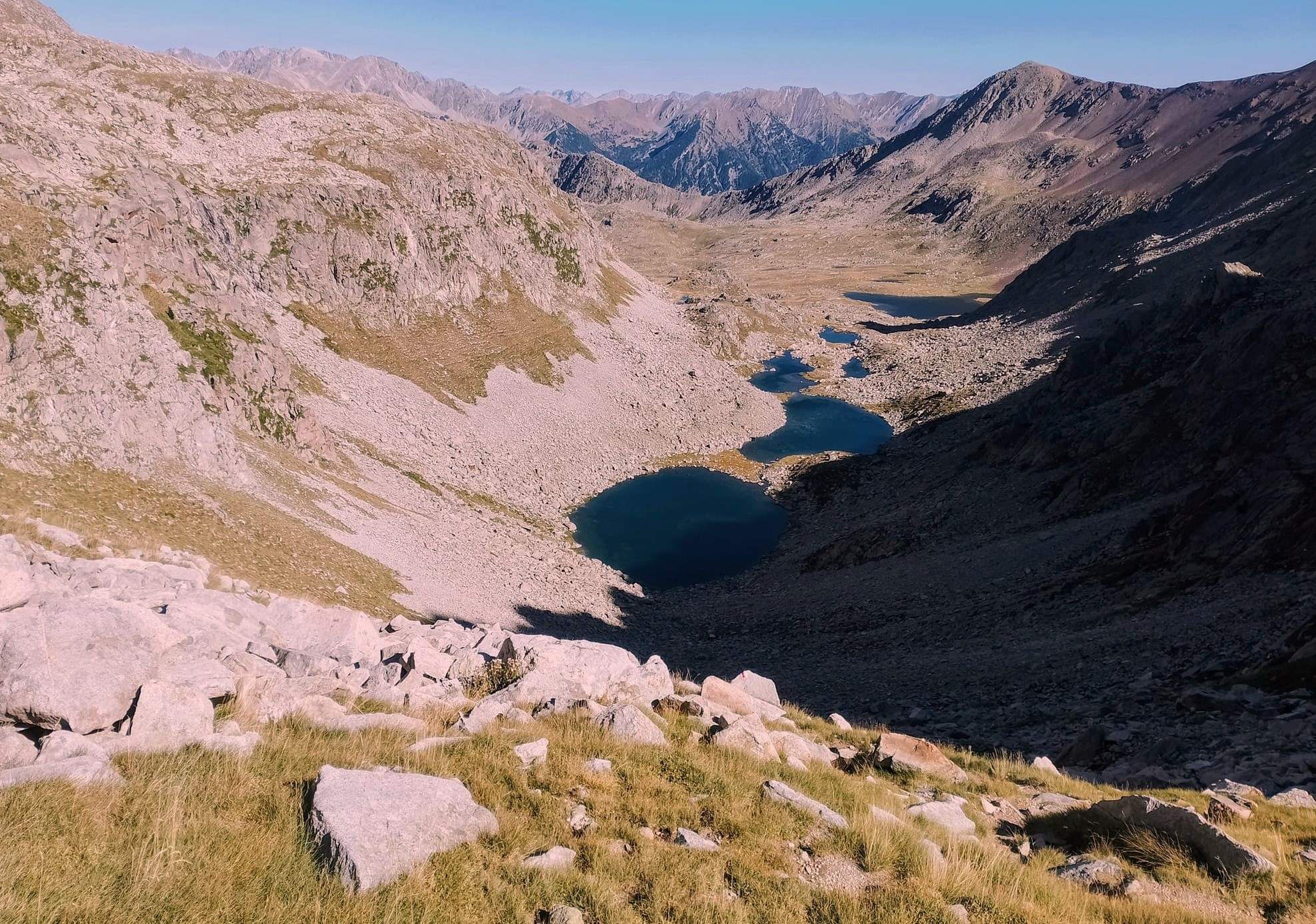
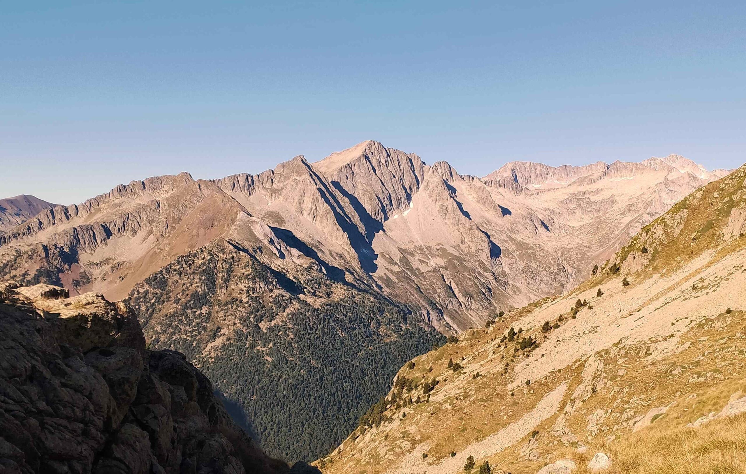
Track turns into path at Coronas as the route up the Vallibierna ravine takes on a more verdant hue. Following the stream, the walking is very enjoyable and views left to the Malladeta massif and the giant peaks are humbling. There’s a wood bridge to cross before the climb starts to the first of the glacial lakes. Ibón Baixo is the lower one and Ibón Alto the higher, collectively known as the Ibónes de Vallibierna. The path weaves between them, with number two at nearly 2,500 metres and more than 200 metres of ascent still to go to reach the pass. The final section is strewn with boulders. It is quite hard going but not difficult technically, just a bit of a slog over the glacial moraine as the path moves up to 2,732 metres and breathing becomes more difficult. Looking back, the views from the Coll de Vallibierna are quite incredible as the savage beauty of the area around the Maladeta massif is laid bare.
On the other side, the view down from the pass is not too dissimilar. The signs of glacial activity abound and once more boulders have to be negotiated on the descent. Things get easier as progress is made and grassy areas start to appear. Cross the stream at the bottom to get to the Cap de Llauset refuge where welcome sustenance awaits.
The first day involves 1,600 metres of ascent, with 19.5km to cover. It will take between seven and nine hours
Day 2 – Cap de Llauset to Restanca
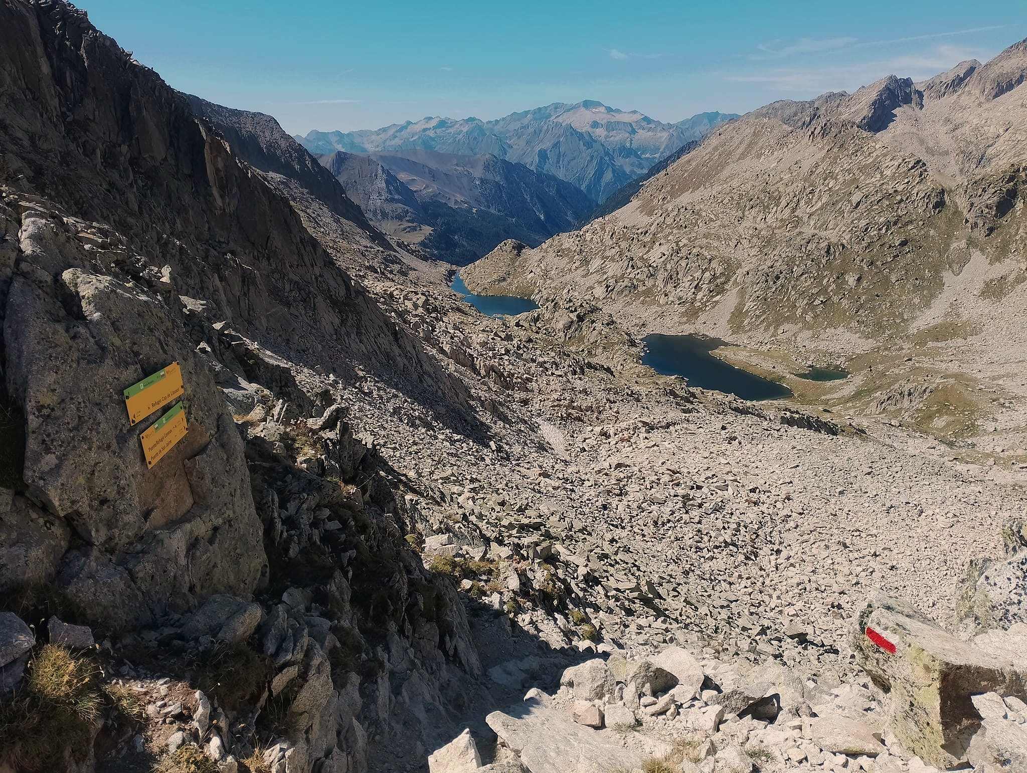
From the Cap de Llauset refuge, it’s straight back on the GR-11 to follow the waymarks and sign up to the Collada d’els Estanyets pass. It’s a short ascent, with the refuge at 2,425m and the pass at 2,524m, which is the highest point of the day. There is an incredible view from the pass over the path that lies ahead, with a series of glacial lakes strung out along the valley floor. Behind, see back up to the Vallibierna pass and over the Cap de Llauset glacial lake near the refuge of the same name.
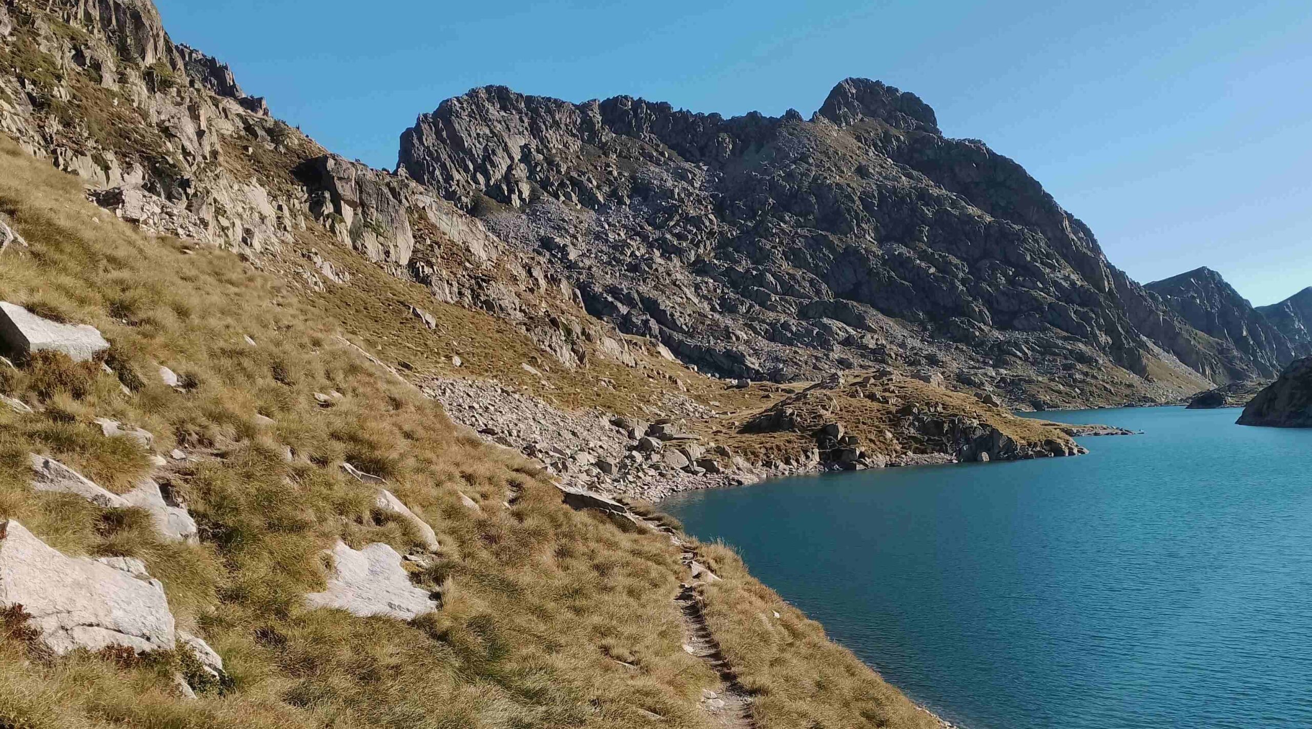
The descent from the pass is boulder-strewn at first but the going becomes easier on the way to the first of the lakes. The path runs along the shore of beautifully-blue Estanys d’Angliós, which is actually a couple of lakes. It’s a short distance to the next of them, the Estany del Mig. The path passes on the right bank, with the Estany de la Ubaga away on the right. Now the walking is on grassy, high-mountain pastureland, which is an absolute joy. Bear to the left, cross a stream and pass close to the Angliós hut. Then follow the right-hand shore of the Estany Gran glacial lake. This is a wonderful section which should not be rushed.
Next comes the descent of the Angliós ravine. The first part, alongside the stream following the GR waymarks, is enjoyable walking. But care has to be taken as the path gets steeper; it can be slippery, especially when wet.
Once the path begins to level out it becomes a delight once again as it enters a deciduous forest which is many hundreds of years old, following the tumbling stream on its right bank. The path comes out at the Salenques bridge having completed a very long descent from the pass at 2,524m down to the N-230 road at 1,445m. Turn left to follow the road for less than 500 metres, before turning right onto a track to cross a bridge over the river and bear left to ascend for just under 3km along a pleasant woodland path to the Conangles mountain refuge. This section of the walk measures 10.2km.
The track from Conangles continues through the forest before emerging into an open area, where there is a sign indicating that the GR turns to the right to start the ascent to the Port de Rius, with the pass at 2,344m. It is a pleasant climb, gradual at first then becoming steeper. The signing of this section of the GR is not at its best, and care has to be taken to ensure that you are following the waymarks.
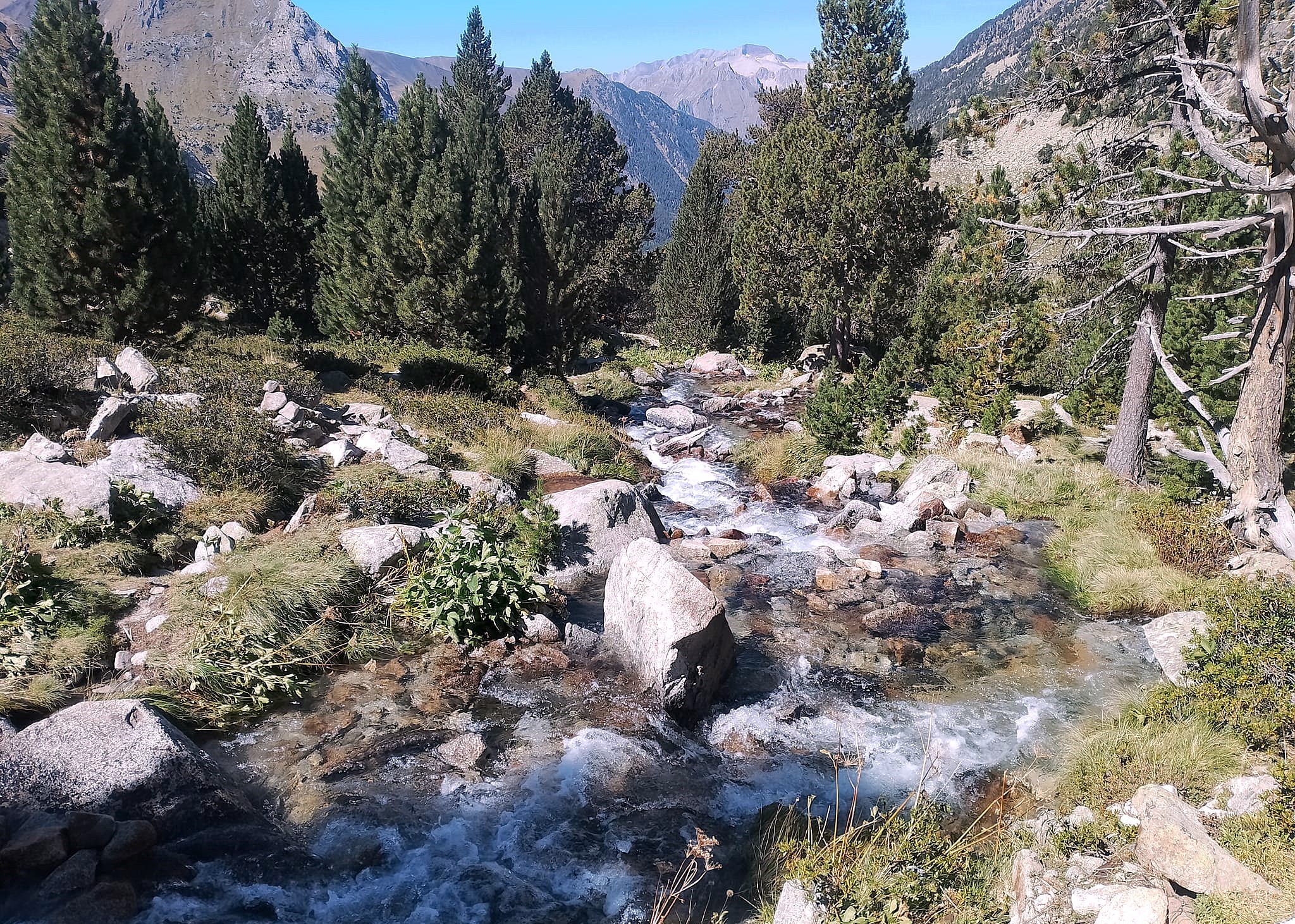
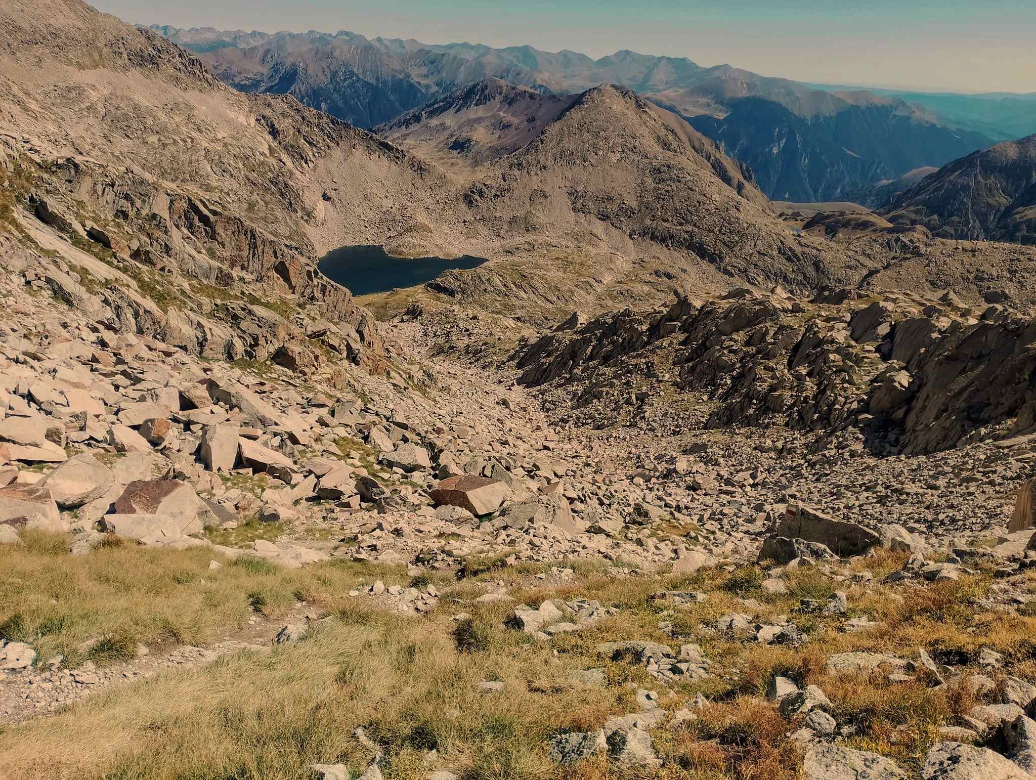
The path swings to the left to start the main ascent. It emerges at the pass, where it is imperative to look back to gaze upon the Maladeta massif in the distance; the formidable beauty of the bare rock and summits is engrossing. Continuing, the footpath soon arrives at the Lac de Rius and runs along the left bank of the glacial lake. The first part of the descent of the Rius ravine (barranc de Rius) is very enjoyable, with the stream never far away. It is verdant, with terrific views ahead. It is only towards the bottom that things start to get awkward, with a rocky section to negotiate near the treeline. Then, surprisingly there is a short but steep climb up to higher ground. Up top there is a good view over the Restanca lake and the dam which is crossed to reach the mountain refuge named after the lake that provides meals and a bed.
There is 1,320 metres of ascent on this 22.4-km stage, which will take between eight and 10 hours.
Part 2 comes next

Recent Comments