This is the easiest and most frequented route up Montgó, the enormous lump of rock which stands between Jávea and Denia. It rears up just behind the coast and the elongated mountain snakes inland, eventually petering out after several kilometres. The route up from the sea side is a well-trodden path, which is not overly punishing – unless you do it in the heat. Much of the ascent is on a track crafted hundreds of years ago by the farmers and traders who used the slopes of the mountain. However, although it has survived centuries of use, in recent years it has become worn and is beginning to crumble in parts.
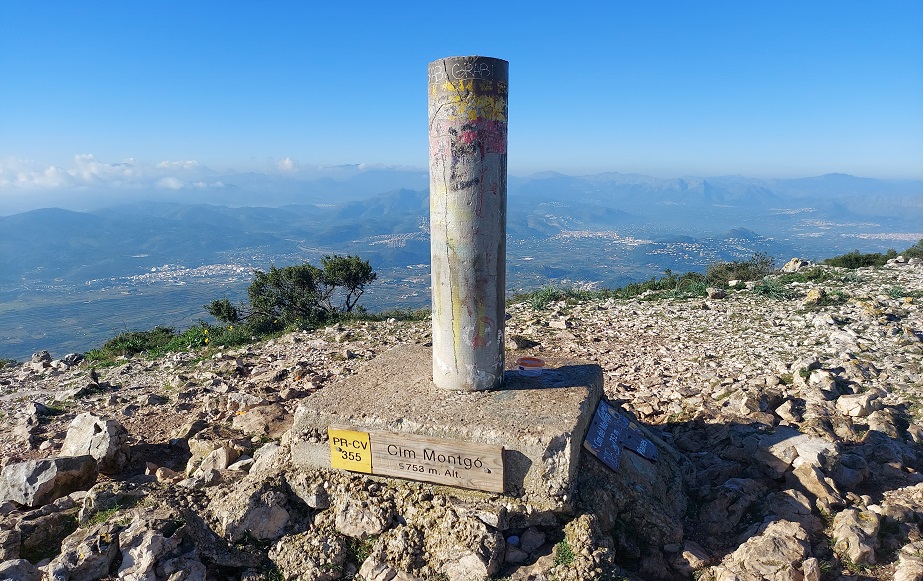
On the lower slopes of the mountain there are dwarf fan palms, prickly pear cactus and pines which are all protected under the auspices of the Montgó natural park. From the summit, at 753 metres above sea level, there are stupendous views up and down the coast; inland to the sierras of the Marinas; and over Denia port and the municipality of Jávea.
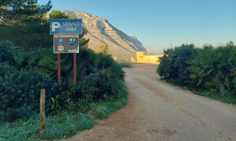
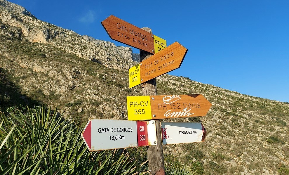
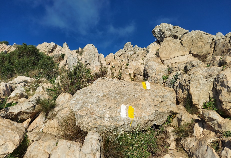
This is a waymarked route on the PR-CV 355 footpath, with ample signage and white/yellow waymarks to help with orientation. It starts from a point off the CV-736 Jávea to Denia road near Denia shooting club (campo de tiro). Parking can be found just before the club building and walk information boards shed more light on what lies ahead.
The route
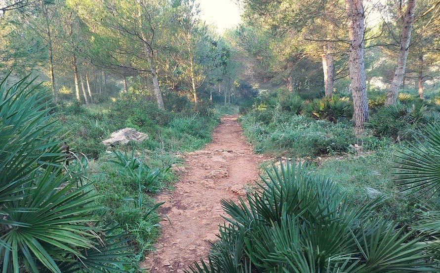
At the entrance to the public car park just before the shooting club notice the walk information boards on the left as you drive in. This is the start point of the walk. From the boards, the path runs into the trees and bears right, skirting the edge of the shooting club property, before plunging into the shaded wood once again.
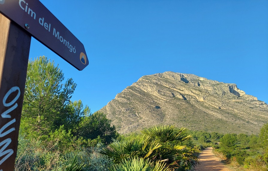
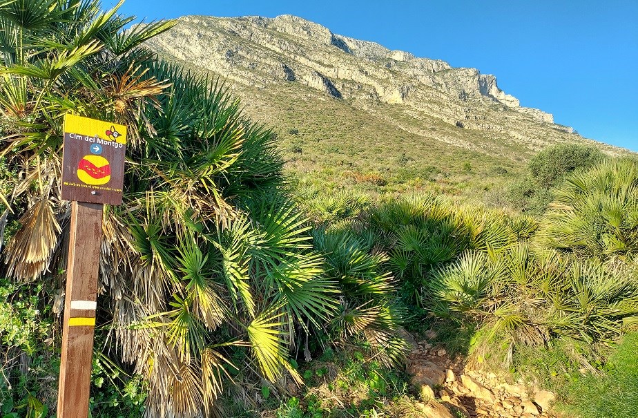
Having progressed through the vegetation, the path emerges at a wide track. As the sign points out, it’s a right turn for the ‘cim’ (summit in Valencian) of Montgó. From here, there is a fantastic view of the mountain which lies straight ahead. Continue along the wide track towards Montgó, ignoring the offshoots, until a signpost appears (ahead right), which marks the start of the ascent of the mountain. This is on a path, with a small sign pointing for the ‘cim’, initially passing through dwarf fan palms.
Keep on the path, noticing the waymarks. The gradient is negligible at first. Next up is a signpost which offers lots of possibilities. We bear left for the ‘cim Montgó’ which is 2.7km away. Rather excitingly, the PR-CV 355 now shares the way with the GR-330 long-distance footpath which traverses the whole of Alicante province. If you were on the GR you would be doing the Denia to Gata de Gorgos stage, following the white/red waymarks.
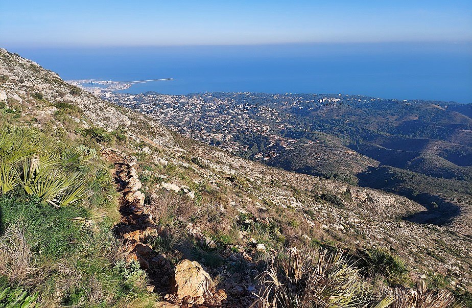
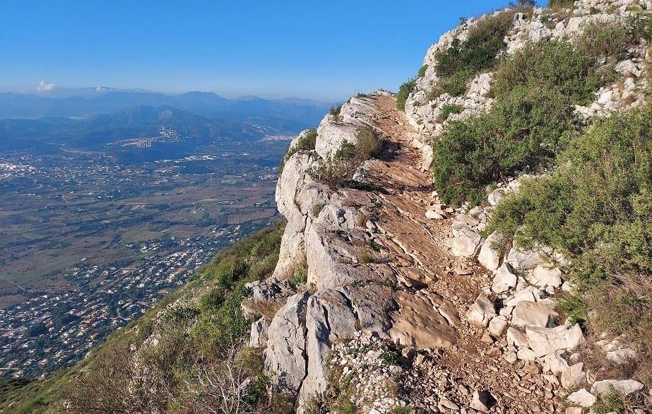
Now the climb starts. It’s on a switchback route which ascends the mountain, with some panoramic views across to Denia when walking in a north-easterly direction. The path levels out temporarily as it passes under some imposing cliffs. This is a good spot to pause for water and to admire the improving views across Jávea.
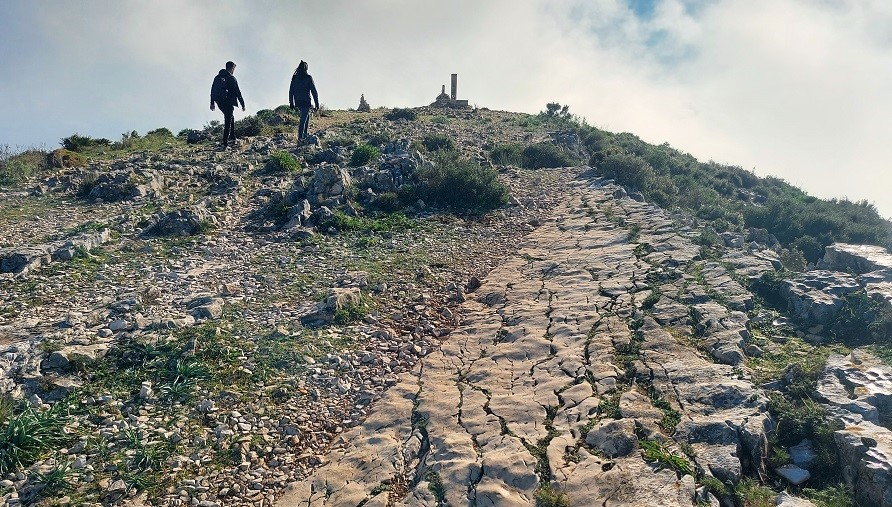
Eventually the trail/track comes to an end at a sheer cliff face which drops vertiginously to the villas of Jávea below. Our route now bears right to follow a path which hugs the cliff edge for a few metres (take care here), before shying away from the precipice to ascend the wide rocky area towards the summit. Take a minute to admire the views over large swathes of the Marina Alta, before following the waymarks which clearly show the way up. It is a bit of a scramble in places over the rocks, but never overly difficult.
The views from the small plateau which includes the summit at 753 metres are a suitable reward for the climb. To the north the coast sweeps up towards Valencia. Down below is the port of Denia, where ferries weigh anchor for the Balearics. And out at sea Ibiza is visible on a clear day. Perhaps the most captivating sight, however, lies to the south over to the magnificent Bernia ridge with the mountains of Puig Campana and Aitana behind.
It is possible to continue all the way along the wide Montgó ridge and descend towards Jesús Pobre. But we retrace our steps, taking the same route back to the car park. On the way down there are obvious short cuts which eliminate sections of the switchback path – but these run-offs are causing further erosion to the mountain and the historic trail. It is up to the walker to decide whether he/she will use them or not.
Walk Facts
Length – 9 kms; ascent – approx 600 metres; time – 4 to 5 hours; getting lost rating – low; season – spring/autumn/winter/summer; getting to the walk – take the CV-736 coast road out of Jávea, heading for Denia. Turn off left after around 2.5 kilometres onto the track that leads to the ‘campo de tiro’ (Denia shooting club). Drive along the wide track which leads into the natural park, taking the first right to head for the shooting club and parking area
Recent Comments