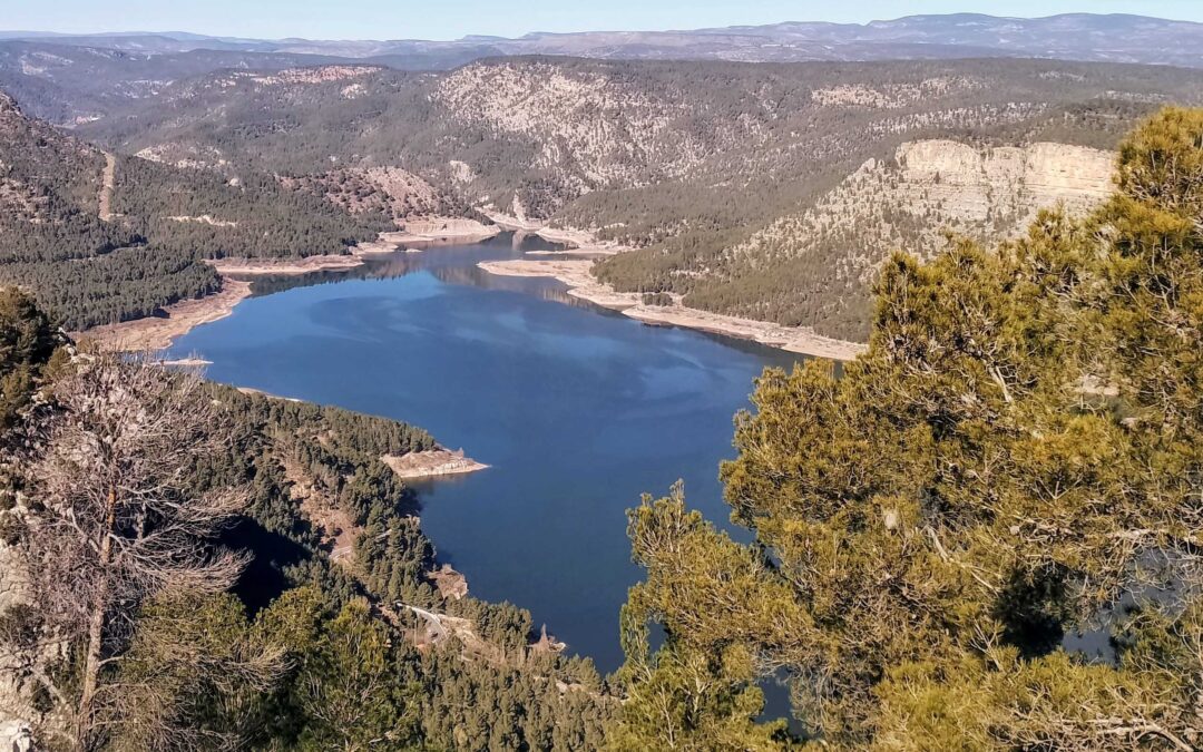
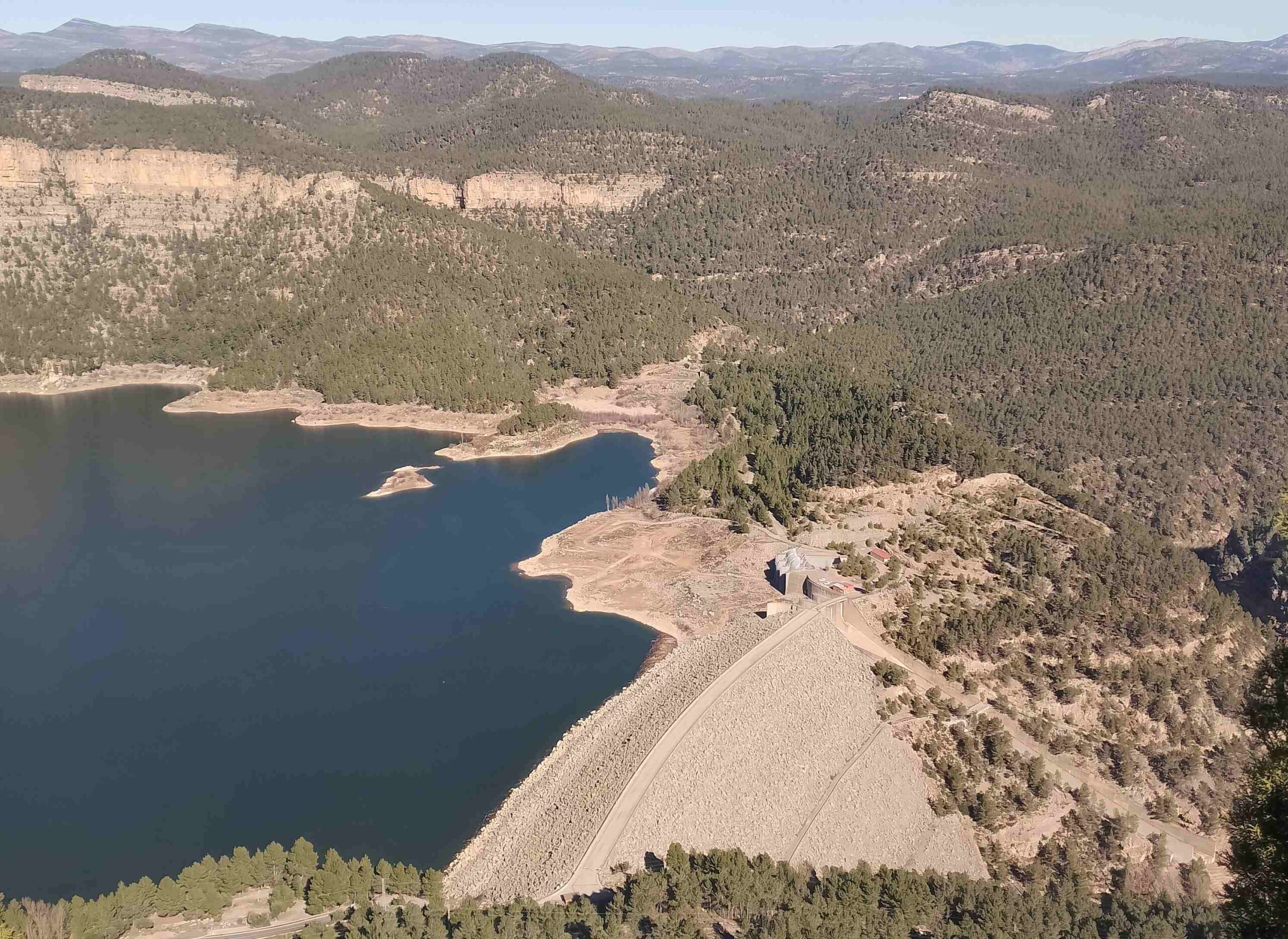
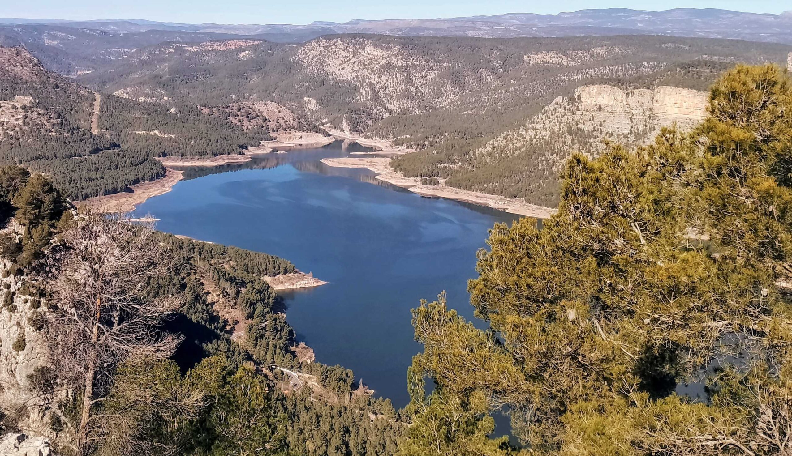
This circular walk goes up the highest mountain in the area, the Morrón de Campos (967 metres). There are fantastic views from the top, over the Arenoso reservoir and large swathes of the surrounding area.
The route drops down to the water and crosses the canyon below the reservoir dam, before ascending again to a point close to El Cubo summit at 807 metres. Then starts the descent back to Montanejos.
It’s not an easy walk, with a steep climb up the Morrón, so it is only recommended for experienced mountain walkers with a good level of fitness. The route is mostly on waymarked paths but orientation is awkward on parts of the Morrón due to damage caused by a forest fire.
As happens with many mountains in Spain, there are different heights published from official sources for the Morrón de Campos. The town hall map and walking leaflet has it down as 967m, while the faded board at the top states 941m and other figures can be found online. Take your pick.
This circular route measures approximately 20km, with around 950 metres of ascent and will take between eight and nine hours.
The walk
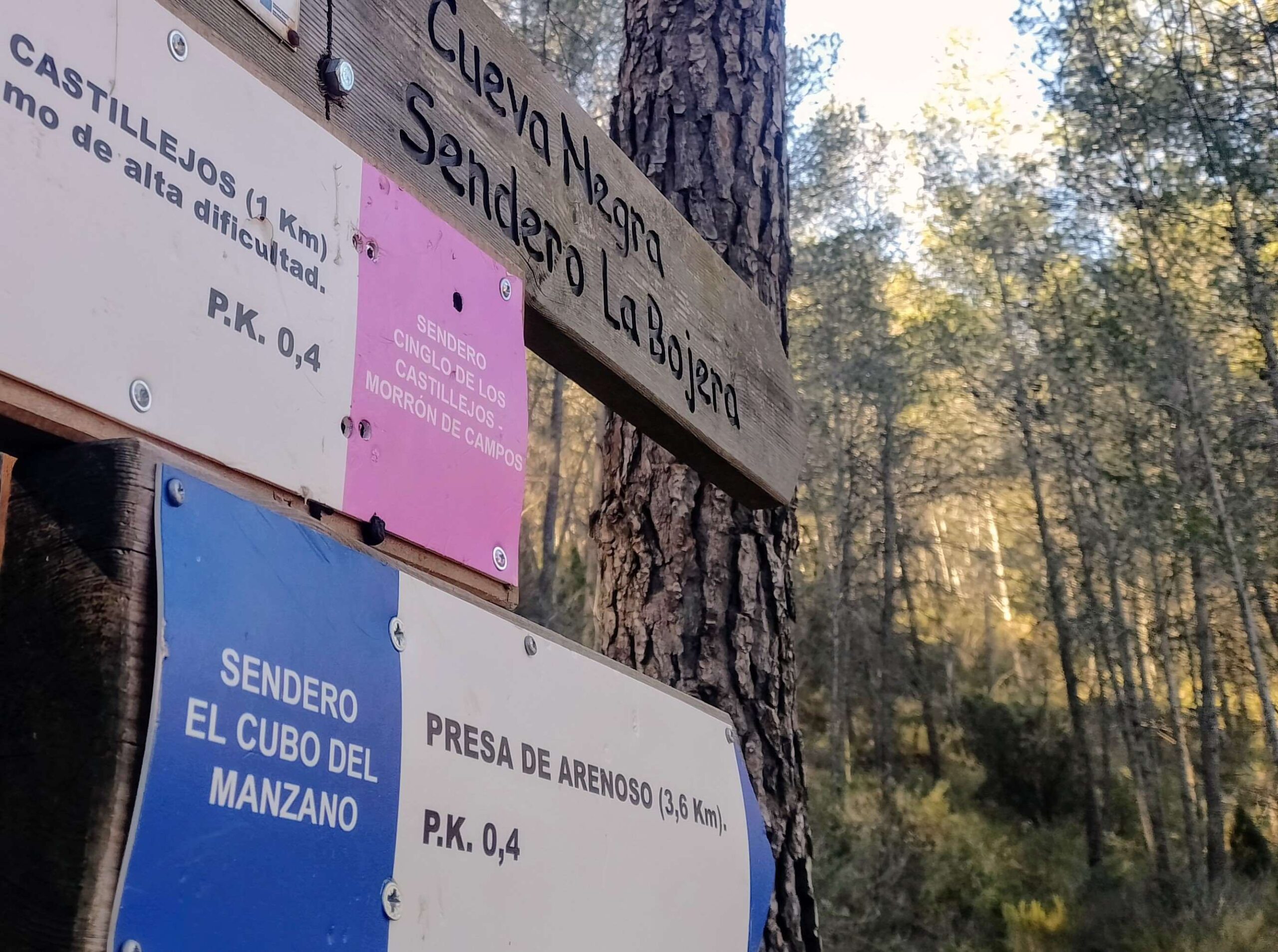
The route starts from the meeting point on Carretera de Tales in Montanejos, just before the bridge over the Maimona river. Cross the bridge and walk on the pavement up the side of the road for around 50 metres. See the signposts on the left; head up the steep bank to reach another set of signs, turning right here for Presa de Arenoso (Arenoso dam) on the blue route.
The undulating footpath snakes around the hillside, at first running parallel to the road below, before it turns left to head up the slope. Follow the waymarks and the signposts; do not turn off left at the sign for the Cueva Negra (black cave).
The footpath heads up through the trees. It ascends to a fork; there is a board here with a map of all the routes in the area. Ascend another five metres to a sign and bear right, now following the pink route (white/pink waymarks) for the Morrón de Campos. The sign states that it’s 1km to the summit; be aware that it’s a very steep climb.
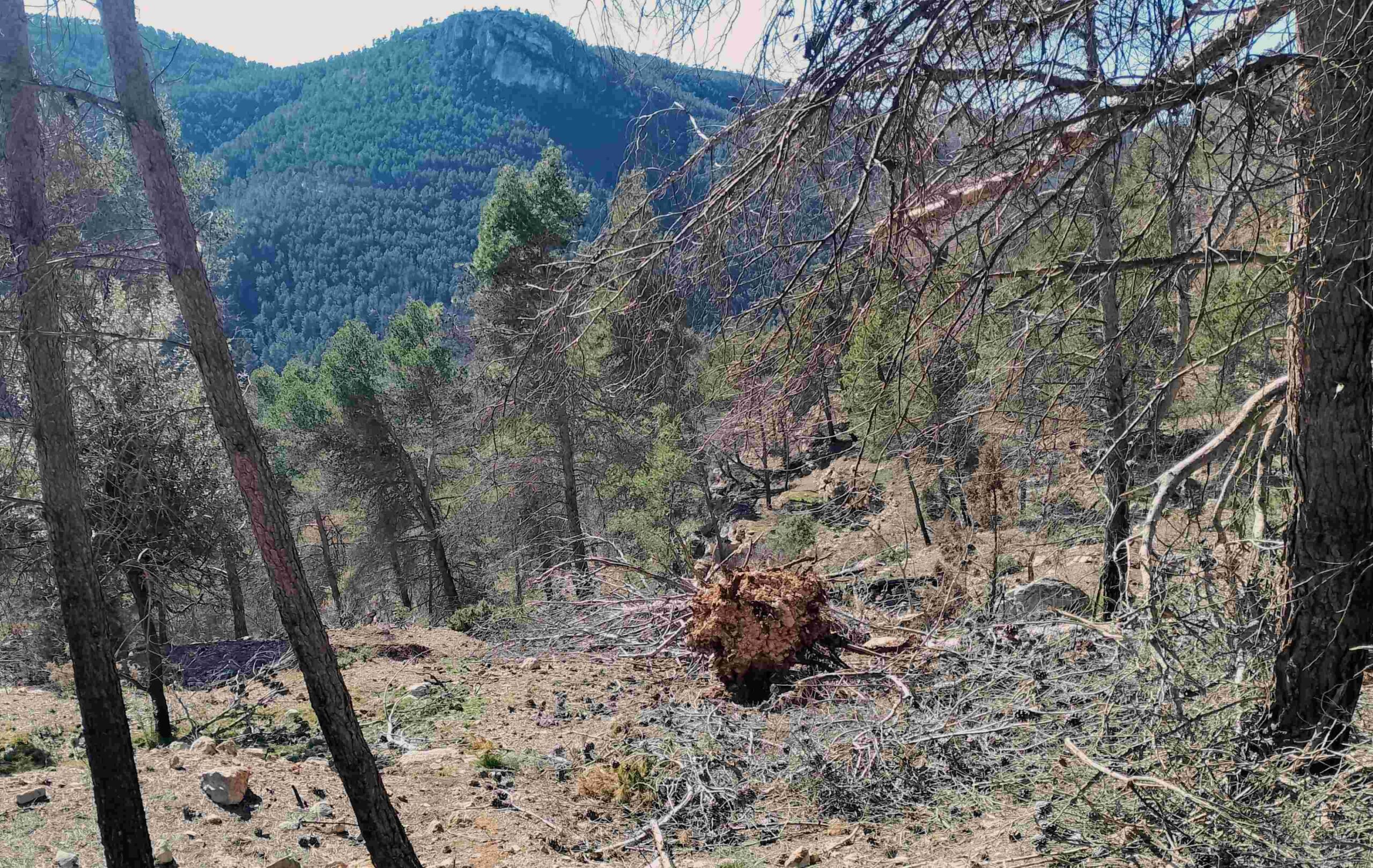
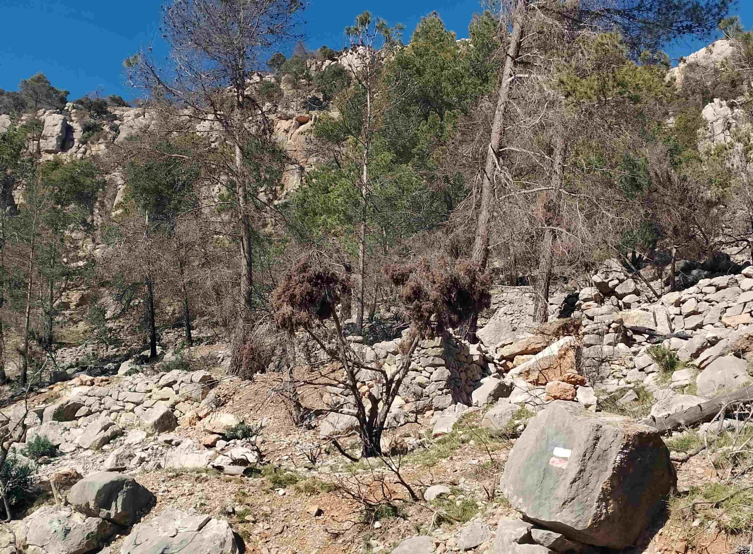
After the first section through the trees, the path bears to the left to start a zig-zag ascent of the mountain. The footpath traverses an area which was burnt in a forest fire; negotiate a route around the stumps.
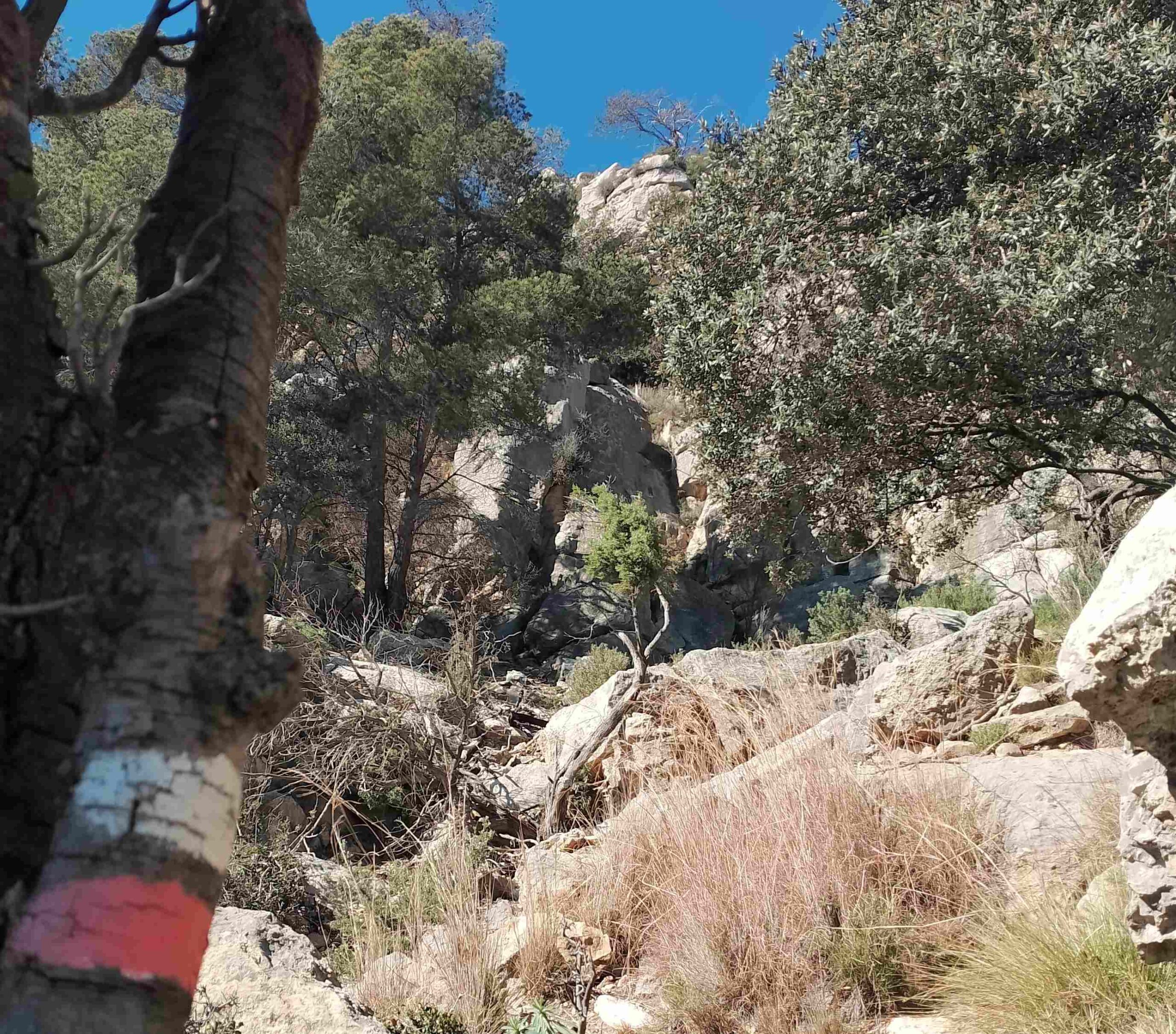
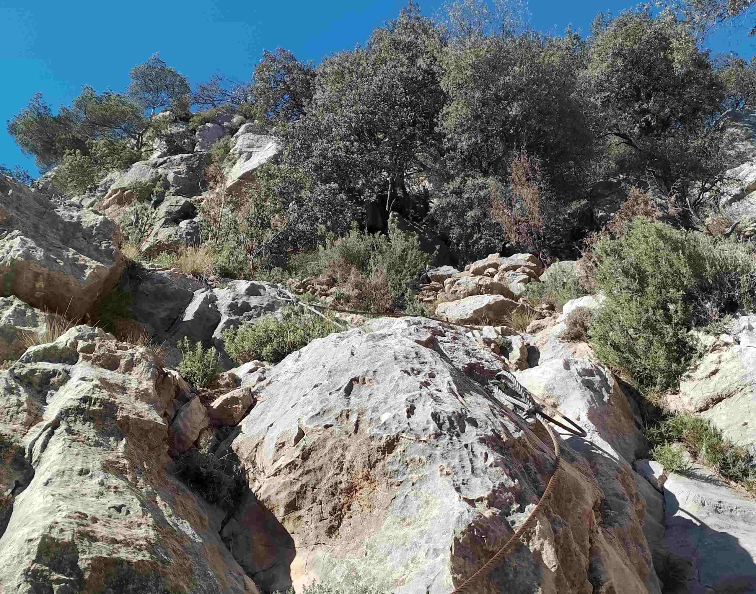
The steep path is well waymarked and there are shady spots in the pines. Reaching an area of rock, there is a fixed wire in place to help with a short section of climbing. Soon after there is zone where many burnt trees have collapsed, obscuring the path. Pick a path around the pine trunks; our route heads more or less straight up the slope. The waymarks are hidden by the debris but there are some cairns to help with orientation. It is around 100 metres in distance through the burnt area to reach the next waymark, which is on a rock (see photo).
The path approaches a section of steep ascent, up a passageway through the rocks. There are small steps cut into the slope to help with the climb. Next up, a fixed metal wire offers help on a short section of rocks. The path then goes to the left, before bearing round to the right, passing a cairn and into shady pines.
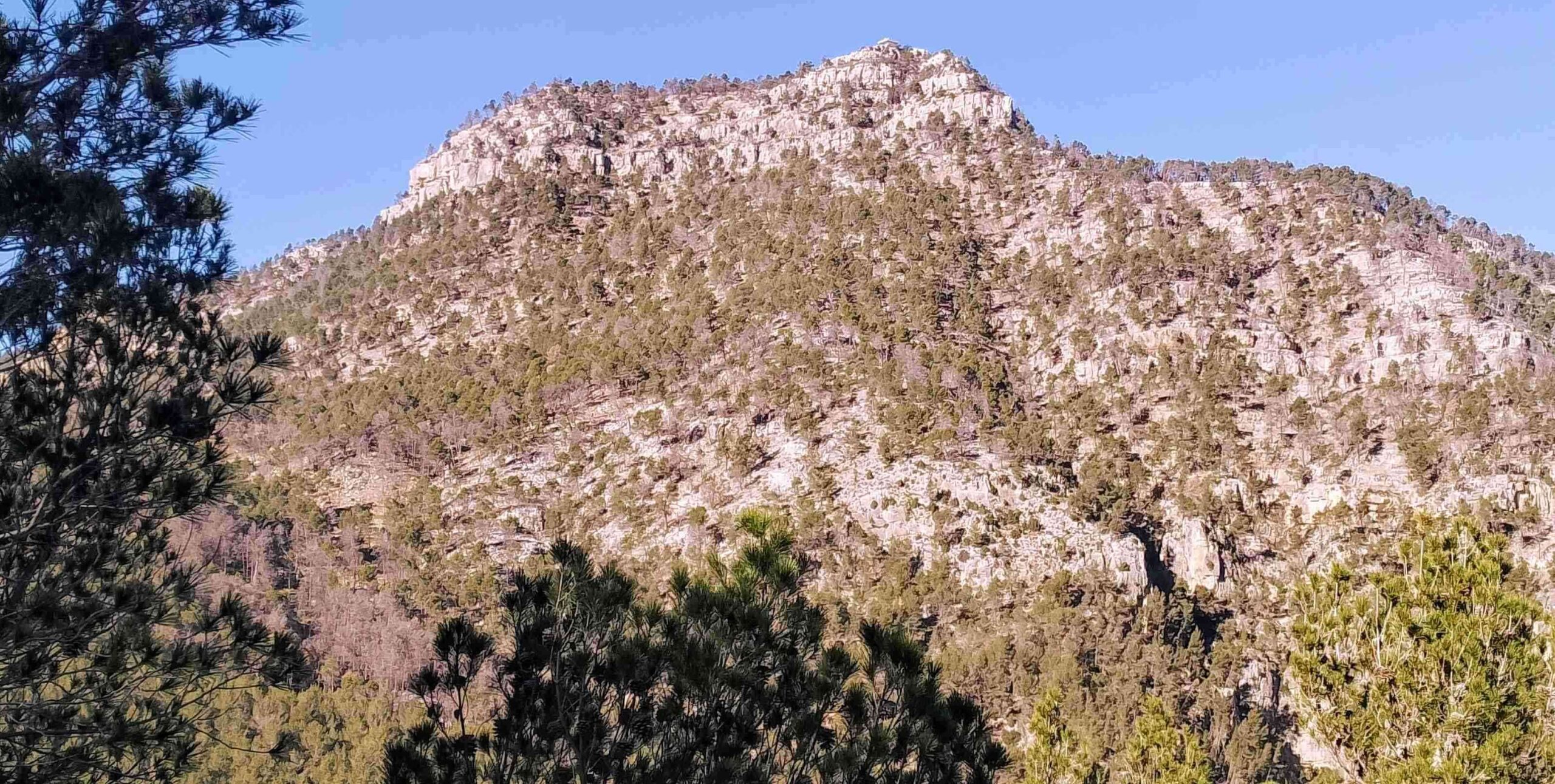
Almost immediately it’s a left turn to head up a short but steep section, emerging at a rock outcrop where there fantastic views across the forested hills to Peñagolosa (1,814m) in the distance.
The summit is now clearly visible above, on the rocky crags. The path bears to the left to go beneath the summit rocks. There are drops off the path on the left, as well as wonderful views over the Maimona ravine. The walking is now much easier. The path bears right to start a switch-back ascent of the terraced hillside towards the summit.
At the top an improved look-out building has been constructed to aid in the fight against forest fires and provide vital early warnings to the emergency services. The proliferation of burnt trees in the area shows the importance of this facility.
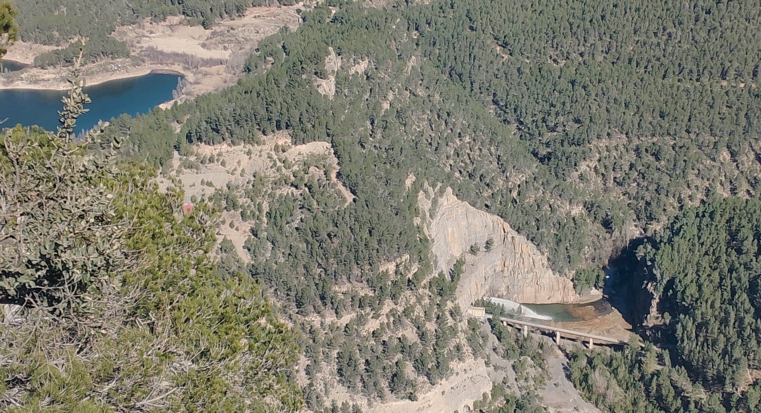
The views from the summit are extraordinary and allow the walker to appreciate the vast area of forest which runs as far as the eye can see, with limestone ravines cutting a path through at regular intervals.
There is also a terrific view over the Arenoso reservoir and its dam, as well as the ‘aliviadero’, where water shoots out of a tunnel in the natural rock wall which now forms part of the dam, kick-starting the Mijares river once more.
Read about the descent from the summit and the next section of the walk in part 2 (coming soon)


Recent Comments