
Some of the most incredible scenery in Spain lies in and around the Ordesa y Monte Perdido national park. The protected natural space measures some 89,000 hectares and the area includes the Bujaruelo valley; the monumental canyons of Ordesa and Añisclo; Roland’s breach; and the three sisters, the trio of 3,000-metre peaks that stand side by side, with magnificent Monte Perdido in the middle. It would take a couple of months to do all the walks available in the area, so multiple visits often follow after an initial exploration.
The historic village of Torla is the gateway to it all; an attractive spot which is worth seeing in its own right. Torla does get very busy in high summer and the car parks at the entrance to the Ordesa canyon are closed, with regular buses running up from village. Much more information and other practicalities can be found at the park website www.parquenacionalordesa.com
Torla has several campsites, a good range of hotels and one of my favourite restaurants; it’s called La Brecha, on Calle Francia, which serves a great set menu full of rustic food. Hotels and other accommodation options can be viewed at www.booking.com and via the park website.
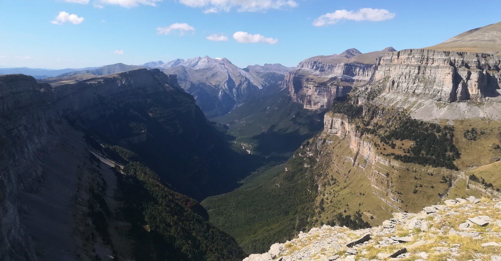
Many people will have heard of the Ordesa canyon and will have seen photos of this phenomenon of nature which was sculpted by glaciers. It seems the logical place to start, with a great hike available which can easily be turned into a multiday adventure with the help of the Góriz mountain refuge.
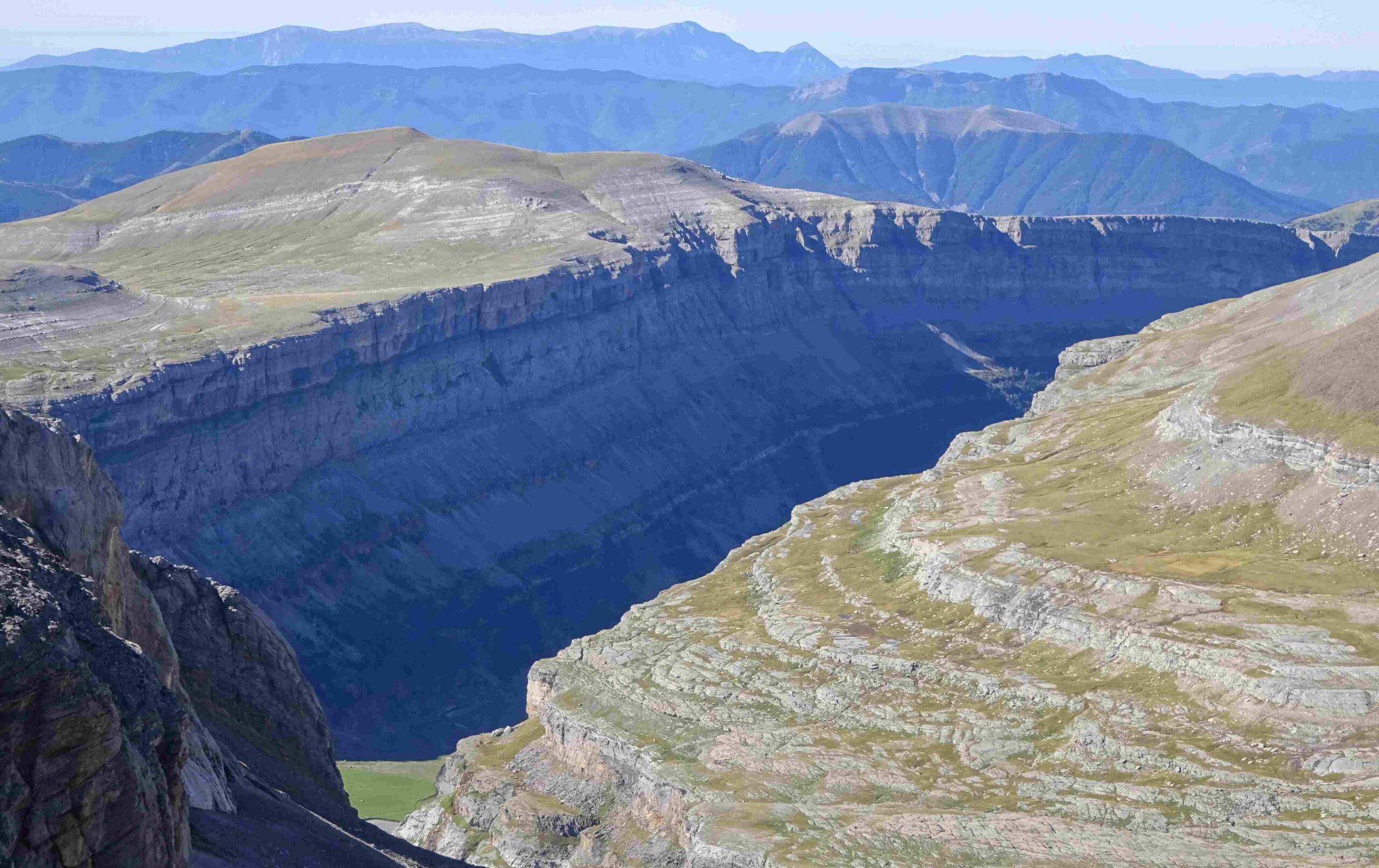
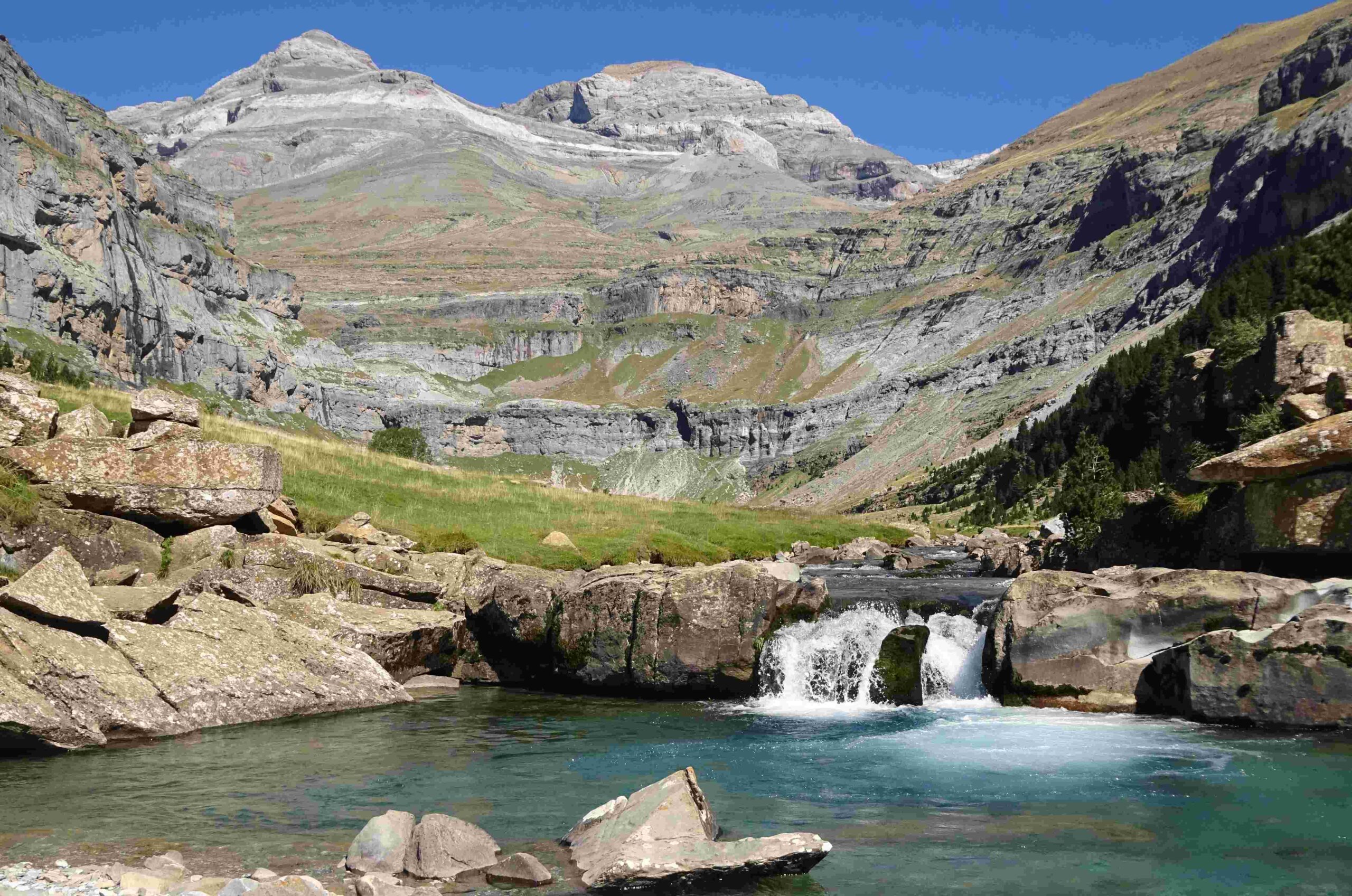
The GR-11 trans-Pyrenean footpath provides the basis for some of the best walking. It runs up the floor of the Ordesa canyon, following the River Arazas. The mountain stream descends via a series of cascades which are very attractive but beloved by the multitude. It means that this walk can be teaming with people dragging themselves along the track towards the Cola de Caballo waterfall at the top of the valley. This is just one of the reasons why a different route is suggested here; and it is a better one, in my opinion. This is because it offers extraordinary views of the canyon from above and the best views across to Monte Perdido (the lost mountain). And it’s a much less-used route.
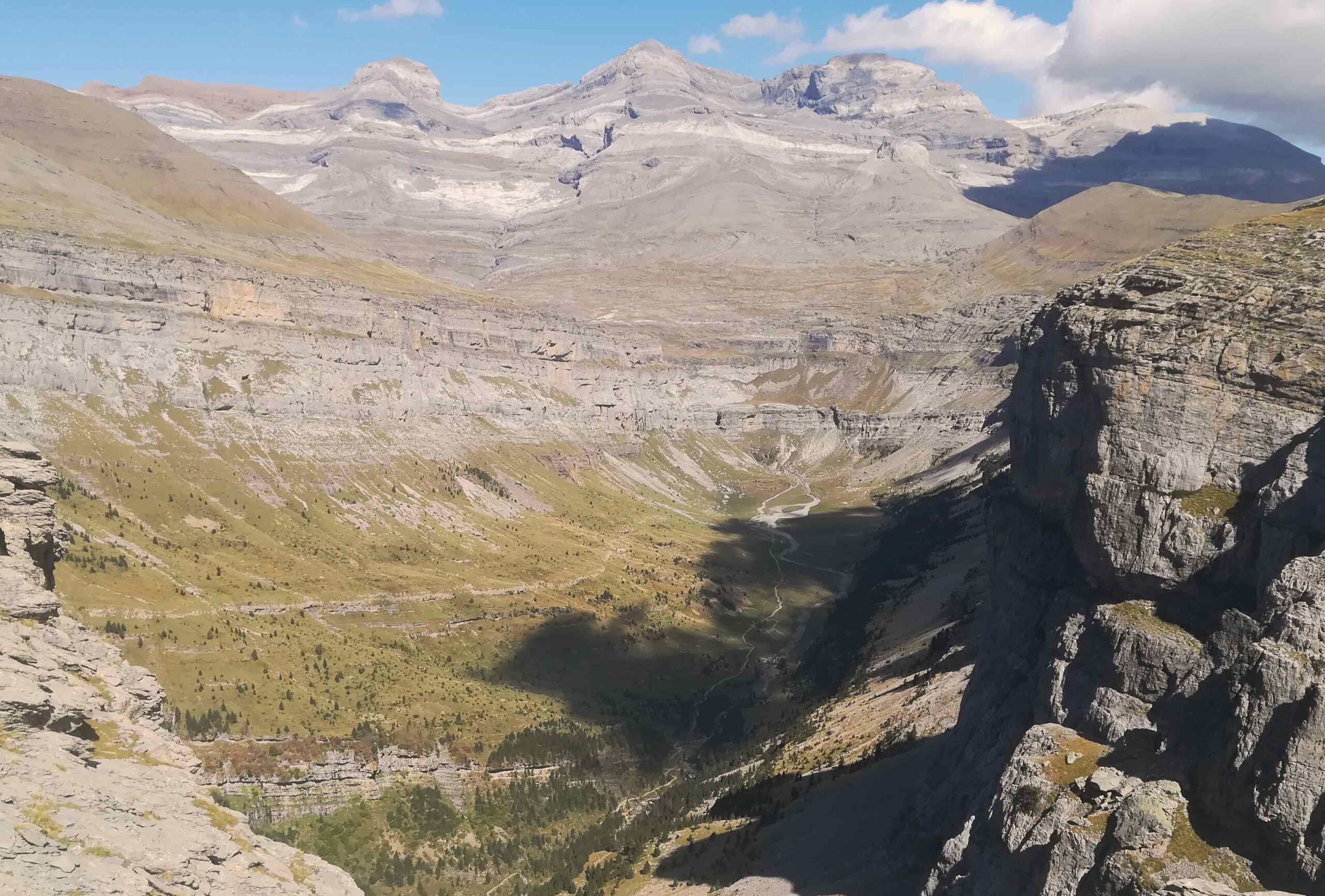
While Ordesa has an all-powerful pull for the masses, it is Monte Perdido which exercises a magnetic attraction for mountain lovers. It is quite simply magnificent and although I have never got to the top, I have been able to walk around it on a six-day hike which went into France and allowed me to see it from different angles. It is thought that the ‘lost mountain’ got its name because it is very difficult to see this towering summit from the French side of the border – even though it is the third highest in the Pyrenees, at 3,355 metres. It is known as Le Mont Perdu in French and Monte Perdido in Spanish, with ‘perdu’ and ‘perdido’ meaning lost in the respective languages. The route which is outlined in the article that follows this one runs along the top of the Ordesa canyon wall, on a wide ridge, allowing the walker to admire the peak in all its glory.
The photos below show that there are three very high mountains – the ones flanking Monte Perdido are Cilindro de Marboré (3,328m) and Pico de Añisclo (3,263m). Collectively they are known as the three sisters (Las tres sorores), with sisters having the religious meaning of the word (ie, nuns). And! As is almost always the case in Spain, different sources will give different heights for the same mountain. The national geographic institute (IGN) has Monte Perdido down as 3,355m, as does the Editorial Alpina map. UNESCO has it down as 3,352m; and the national park website records it as 3,348m, as does the Prames map. I happen to like 3,355m. It should also be noted that Monte Perdido is the highest limestone peak in Europe.
Anyone who wants to follow the GR-11 up the canyon to Góriz mountain refuge can see the route via an interactive map on the Aragón tourism website https://senderosturisticos.turismodearagon.com/senderos/gr11
It is under stage 8; Etapa 08: San Nicolás de Bujaruelo – Refugio de Góriz. The route outlined in the next article can also be viewed on the interactive map, although it is not highlighted. Walkers should also consider buying a map of the area, which shows all the routes. One of them is the Editorial Alpina 1:40,000 scale called Ordesa y Monte Perdido, available from shops in the village.
Torla can be reached by public transport. Reasonably-priced AVE high-speed trains run from Elche and Alicante city to Madrid. Then it could be an AVE or slower train to Huesca. Those trains are available via the websites and apps of Renfe and Ouigo. From Huesca intermodal station it’s a bus, operated by the company Avanza to Sabiñánigo; and the same company from there to Torla. All info and tickets via their website and app.
Recent Comments