
The verdant Echo valley (also called ‘Hecho’) lies to the north-west of the historic city of Jaca in the region of Aragón, close to the border with Navarra. There are dozens of routes to choose from on waymarked trails, including the GR-11 trans-Pyrenean footpath. If you like your ridge paths to be green and dramatic – and free of rocks and obstacles to allow unencumbered strides – then there is a stunning walk along the French border at the top of the valley. There is also an interesting ascent of the Castillo d’Archer, an elongated mountain with several peaks; the main summit standing at 2,384 metres.
A good base is the Selva de Oza, with its campsite which has pitches for tents and campervans, as well as rooms. Camping Selva de Oza is around 12km north of Echo village heading towards the French border on the road which follows the River Aragón Subordán. This is the ‘business end’ of the valley, right in the heart of the walking zone, with hikes from the site. The Selva de Oza lies inside a protected natural park – the Parque Natural de los Valles Occidentales – and the campsite is situated at 1,150 metres above sea level. More information at https://camping-selvadeoza.com
The Echo valley is not an area with giant peaks – the 3,000+ metre summits lie to the east – but there are many mountains well over 2,000m, with the highest of them, Bisaurín at 2,670m. You will need the Editorial Alpina 1:25,000 scale hiking map ‘Valles de Ansó y Echo’ to see all the walks available, of which there are many. The map can be ordered from their website at www.editorialalpina.com/es/mapa-alpina/valles-de-anso-y-echo-alpina25
To get there by car, drive to Jaca. Then to Puente de la Reina de Jaca, where it’s a right turn to head up the Echo valley on the A-176. Continue on through Echo, Siresa, to get up to Selva de Oza.
Border ridge walk
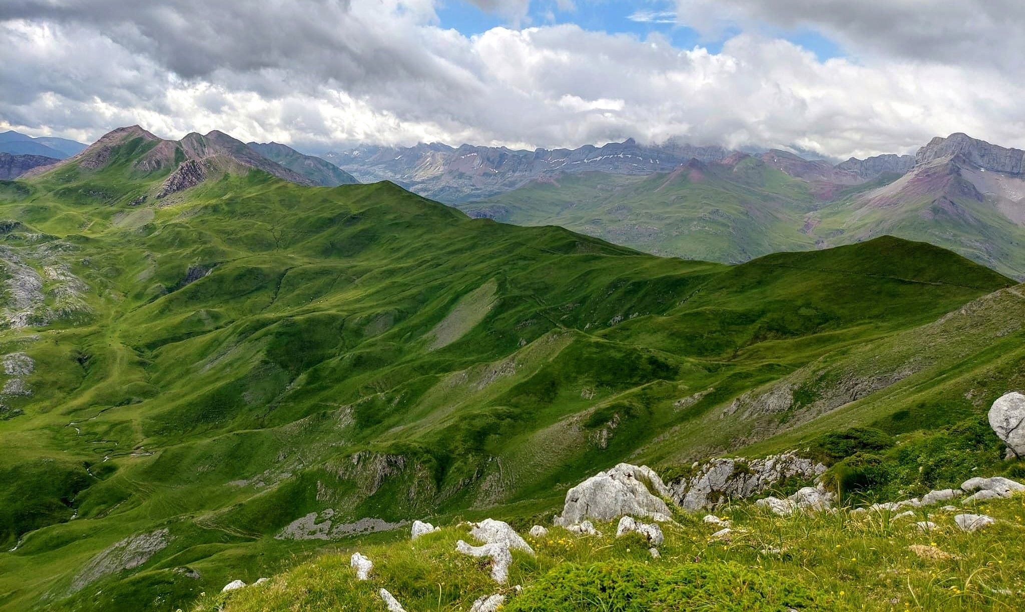
This hike from the Selva de Oza is a wonderful walk through incredible mountain country. The remarkable ridge path comes after the ascent to the Palo pass (Puerto de Palo in Spanish; Col de Pau in French) at the Spain-France border. The path at around 2,000 metres follows the wide, grassy frontier for several kilometres to the Arlet glacial lake and mountain refuge. Including the Palo, the route crosses no fewer than five mountain passes, although three of them are ‘minor’ and barely detectable as such.
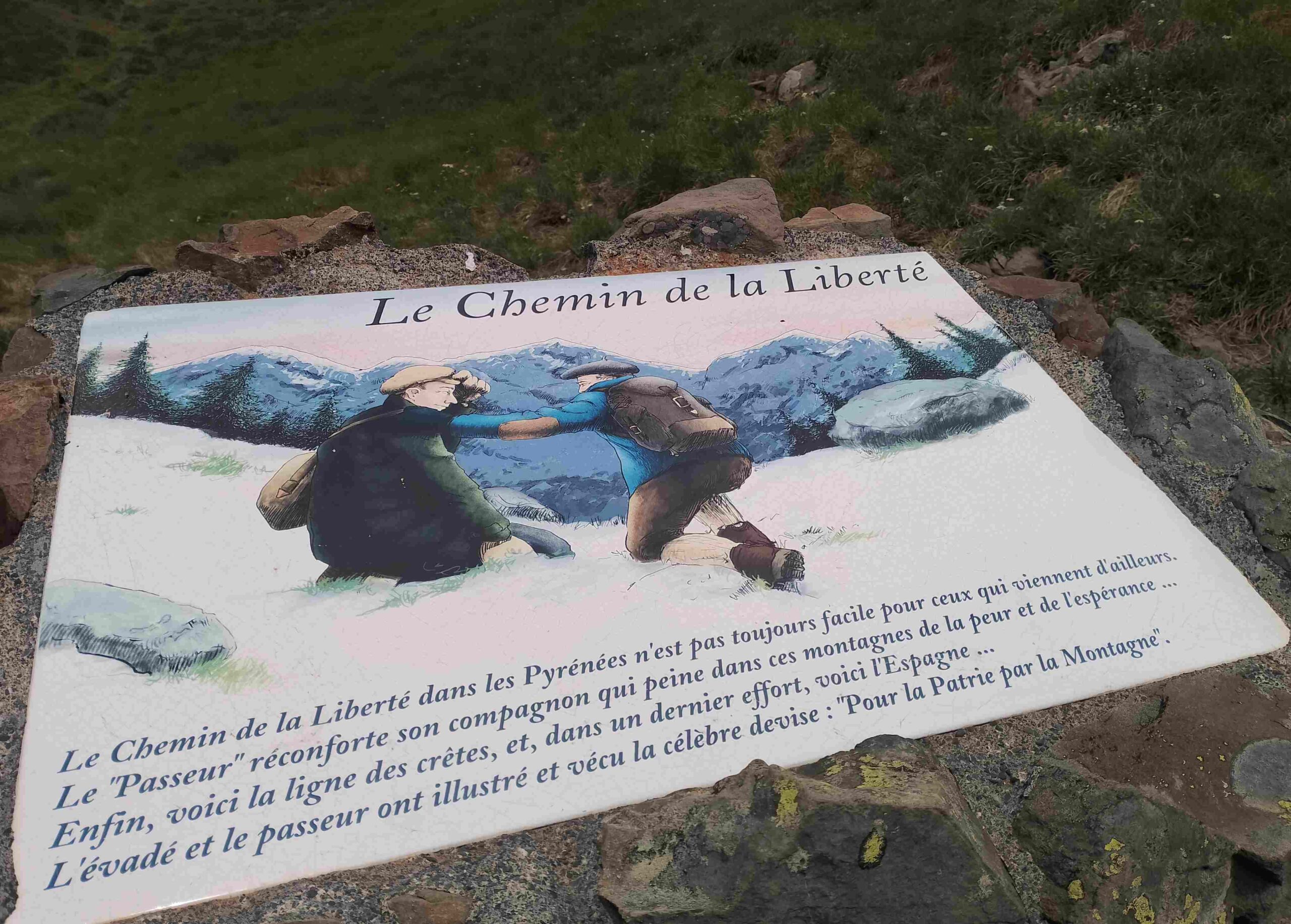
Much of the route to Arlet follows a stage of the HRP (Haute Randonnée Pyrénéenne), the long-distance footpath which traverses the whole of the Pyrenees mountain chain. Unlike the GR-11 and GR-10, it crosses from country to country and is described by the French ramblers’ federation, FFRandonnée, as ‘permanently oscillating between France and Spain’. The walk also follows part of the ‘Camino de la Libertad’, the route taken by Republicans fleeing Franco’s troops at the end of the Spanish Civil War, who were seeking refuge in France.
It can be started from the campsite at Selva de Oza or by driving approximately 2km further on to park up at the Guarrinza picnic area, next to the Aragón Subordán river. The only downside to the route is that it is only advisable for experienced mountain walkers – and with 1,750 metres of ascent, it means you need a high level of fitness to take it on. The walk measures around 29km in length (4km less if you drive to Guarrinza).
You will need the ‘Valles de Ansó y Echo’ map for the route. And an online map can also be found by googling rutas valle de hecho; it’s the first walk in the ‘travesías’ section.
For those who do not fancy the full route, you could walk up to the Palo pass, see some of the ridge and then go back down on the same path.
The walk
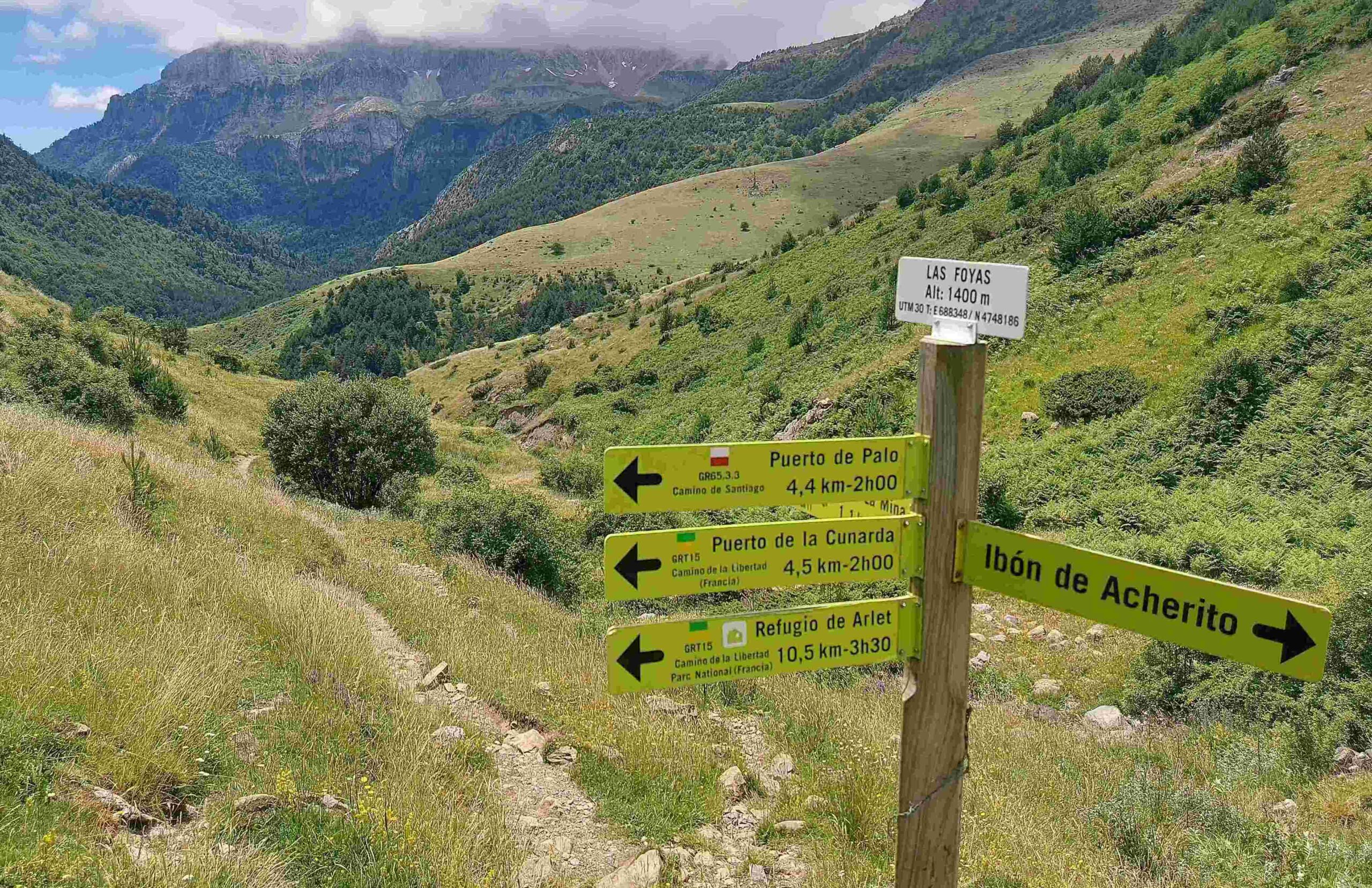
Head up the mountain road from the campsite, which follows the Aragón Subordán river to the Guarrinza picnic area. Turn left to follow the sign which points for Puerto de la Cunarda – the wide track runs alongside the river. Cross the river on the bridge and continue on the wide track, now on the left bank of the river. After around 500m, cross the small bridge over the final section of the Archerito ravine, and peruse the plethora of walk boards offering information about the GR-11 and other routes. You are now at Guarrinza-La Mina at an altitude of 1,235m. Follow the sign which points for Puerto de Palo, which is 5.3km away. This means taking a left turn and following the path, through the gate and up the right-hand side of the Archerito ravine, walking next to the stream. It is a pleasant ascent through an area where ferns proliferate in season.
After 1.1km from Guarrinza-La Mina arrive at the sign for Puerto de Palo. Turn right to follow the path up the grassy hillside. There are white/red waymarks to help with orientation. The path climbs before bearing left to start a straighter ascent up a grassy hillside. There are marker posts here to show the way. Be aware that this area is grazed by cows and they can knock posts over, and also create other paths which are not the one we are following. For this reason, try to pick out the waymarks and posts in order to keep on track.
There are fantastic views across to the Castillo d’Archer peak on the right. After crossing the grassy section the path heads up to what appears to be a minor ‘pass’. The sign here is badly damaged. Keep straight on, following the waymarks. Cross the right-hand side of the grassy area which lies ahead, stepping over the stream and emerging at an expansive, verdant valley. The path bears to the right to ascend the right-hand side of the ‘valley/ravine’ up to the Palo pass. Cows also graze this area, so other paths have been created. Try to follow the waymarks. However, the pass in the top corner is fairly obvious if you get off track.
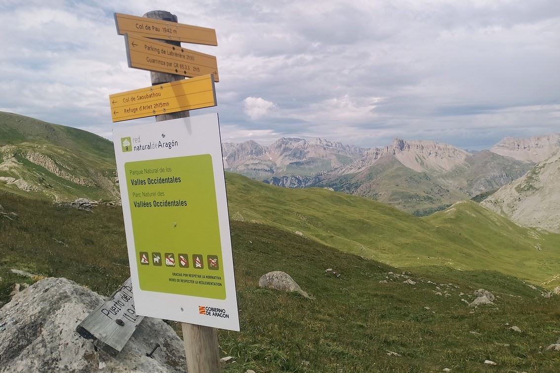
The Puerto de Palo at 1,942m is a wonderful spot, with fantastic views. Over the border in France the area is a national park, which is the highest level of protection available. At the pass turn right to head for the ridge path. Begin the gradual ascent to the second pass of the day, the Col de Burcq at 2,064m – which is in France, but only just. It’s a short but dramatic section of the walk, following the white/red waymarks of the HRP long-distance footpath. The path sweeps round the mountainside, which is verdant with patches of grey rock, before bearing right to start the short climb to the Burcq pass. This magnificent footpath gives views over vast swathes of the Pyrenees.
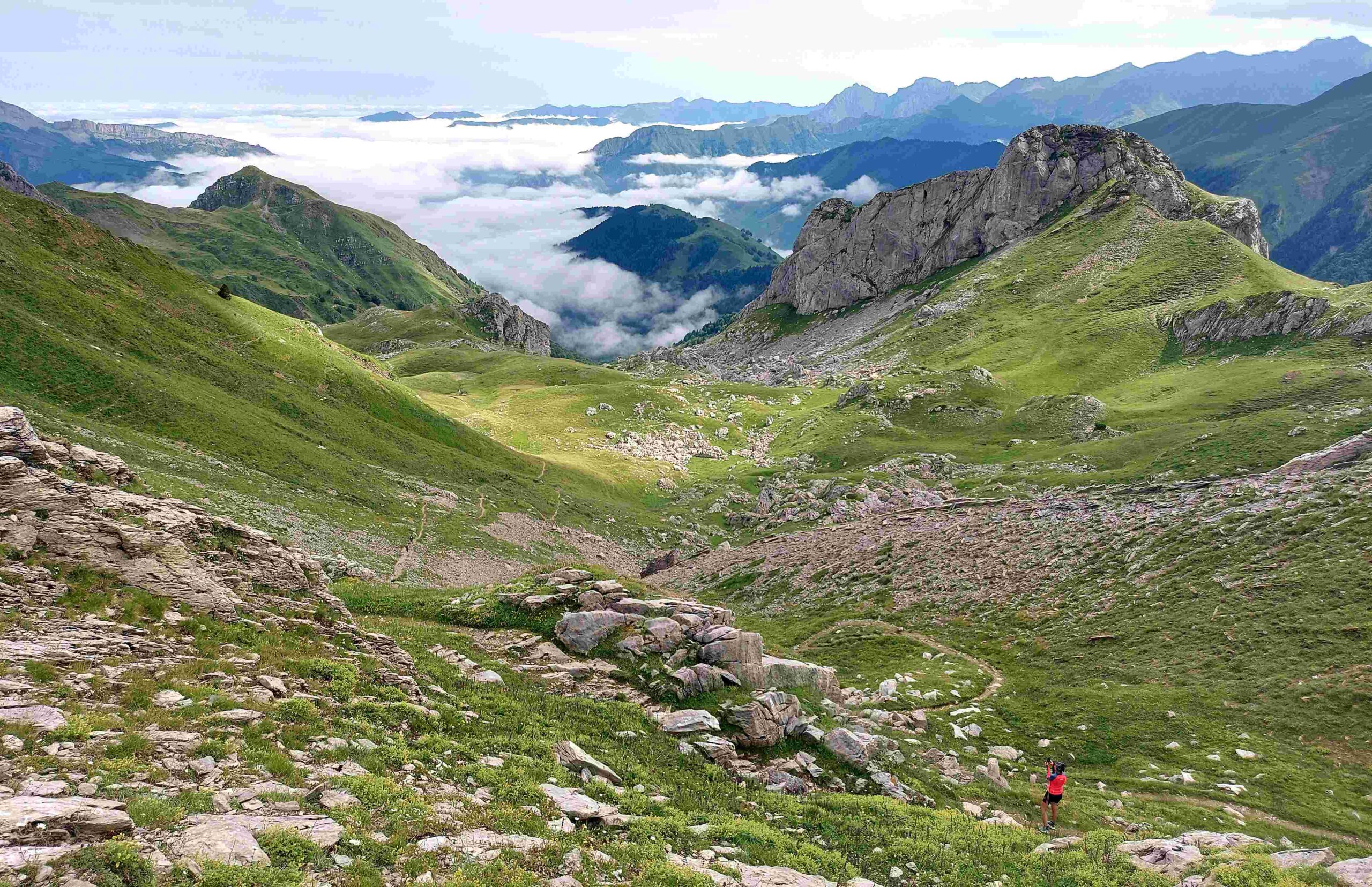
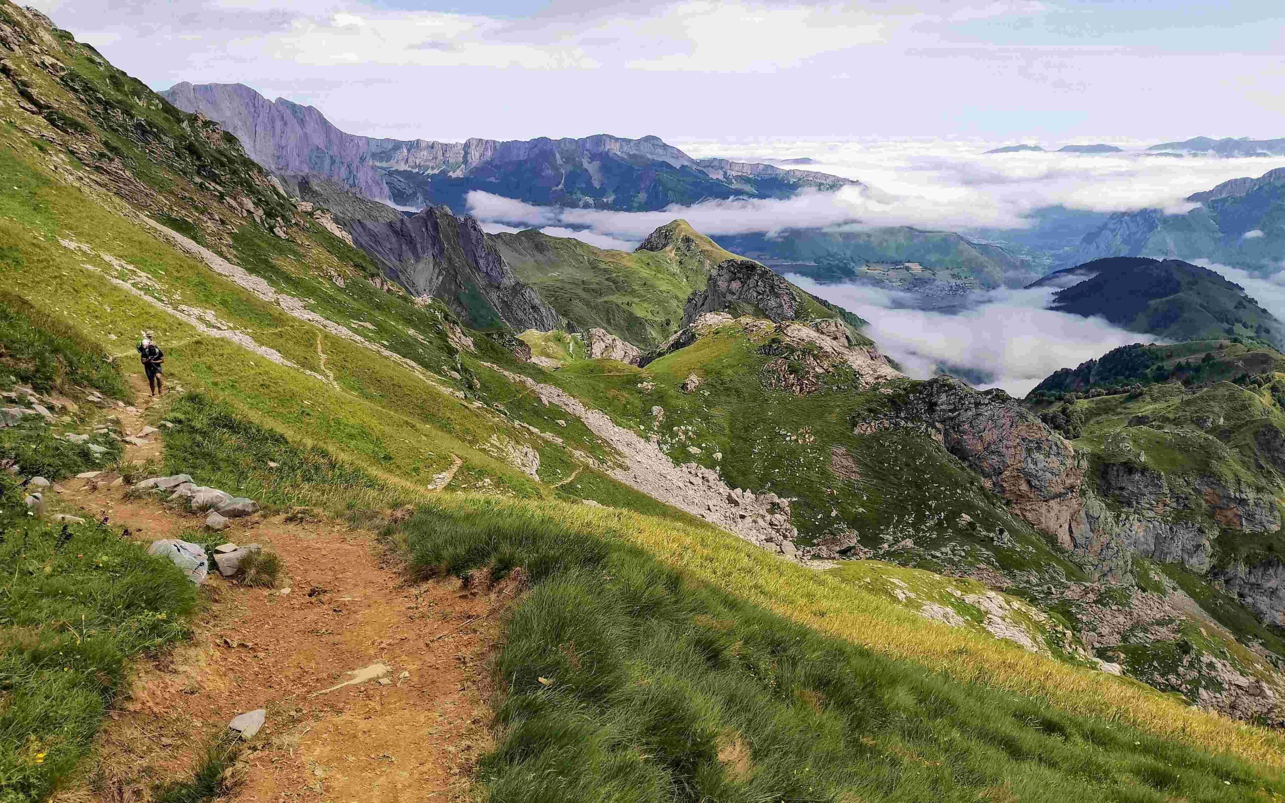
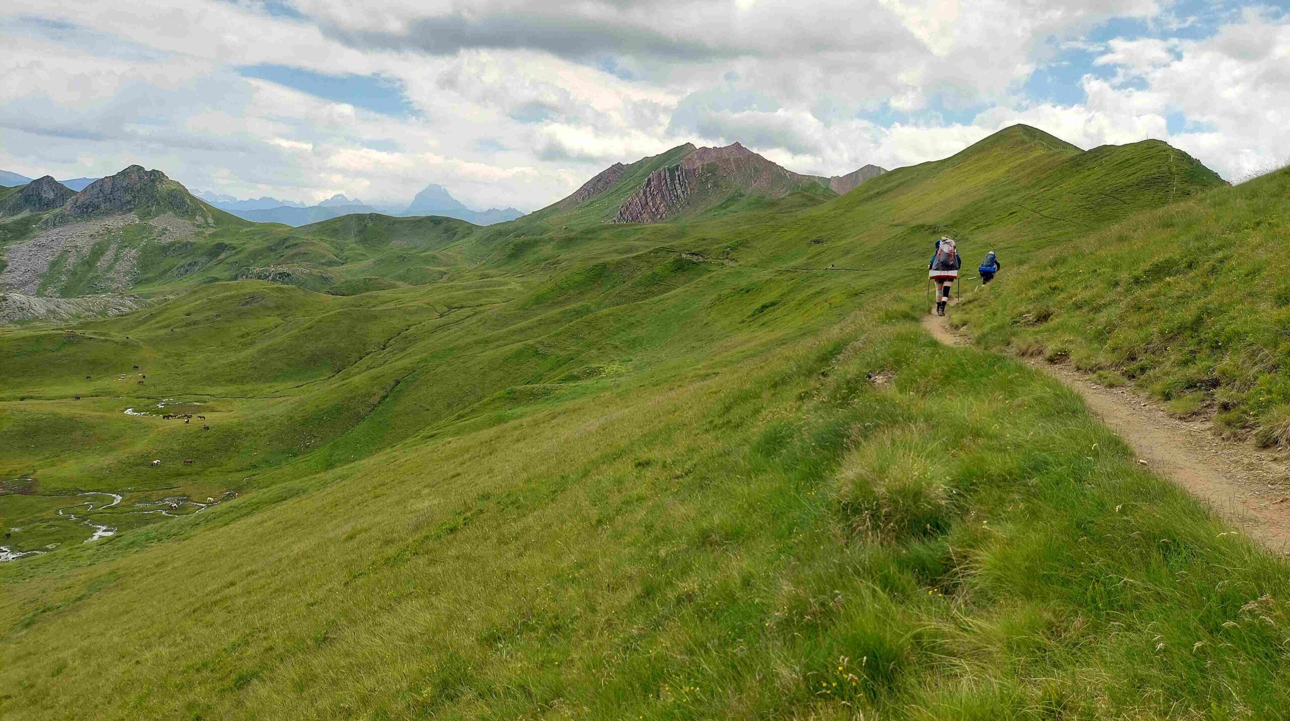
It’s a dramatic position up at the grassy pass, which demands a sit-down to contemplate the vistas – and the snow-capped 3,000-metre peaks in the distance to the east, including Vignemale (3,299m). Much closer is the Pic de Burcq (2,104m) and peak-baggers may want to take five minutes to amble up to the summit, as is at hand. The ridge walk begins from close to the pass. Take care on the short section which leads down to the grassy ridge as there are some loose stones. The path lies just below the crest of the wide ridge on the France side of the border. It is wonderful walking – rock-free, grassy, with the giant peaks to gaze on in the distance. Wild horses may be grazing on the high mountain pastureland below the ridge.
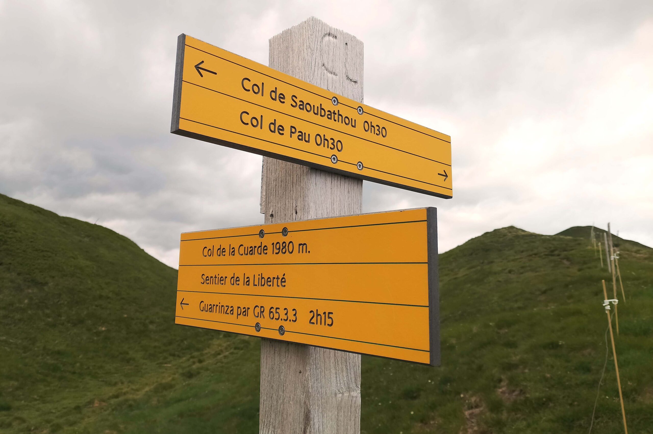
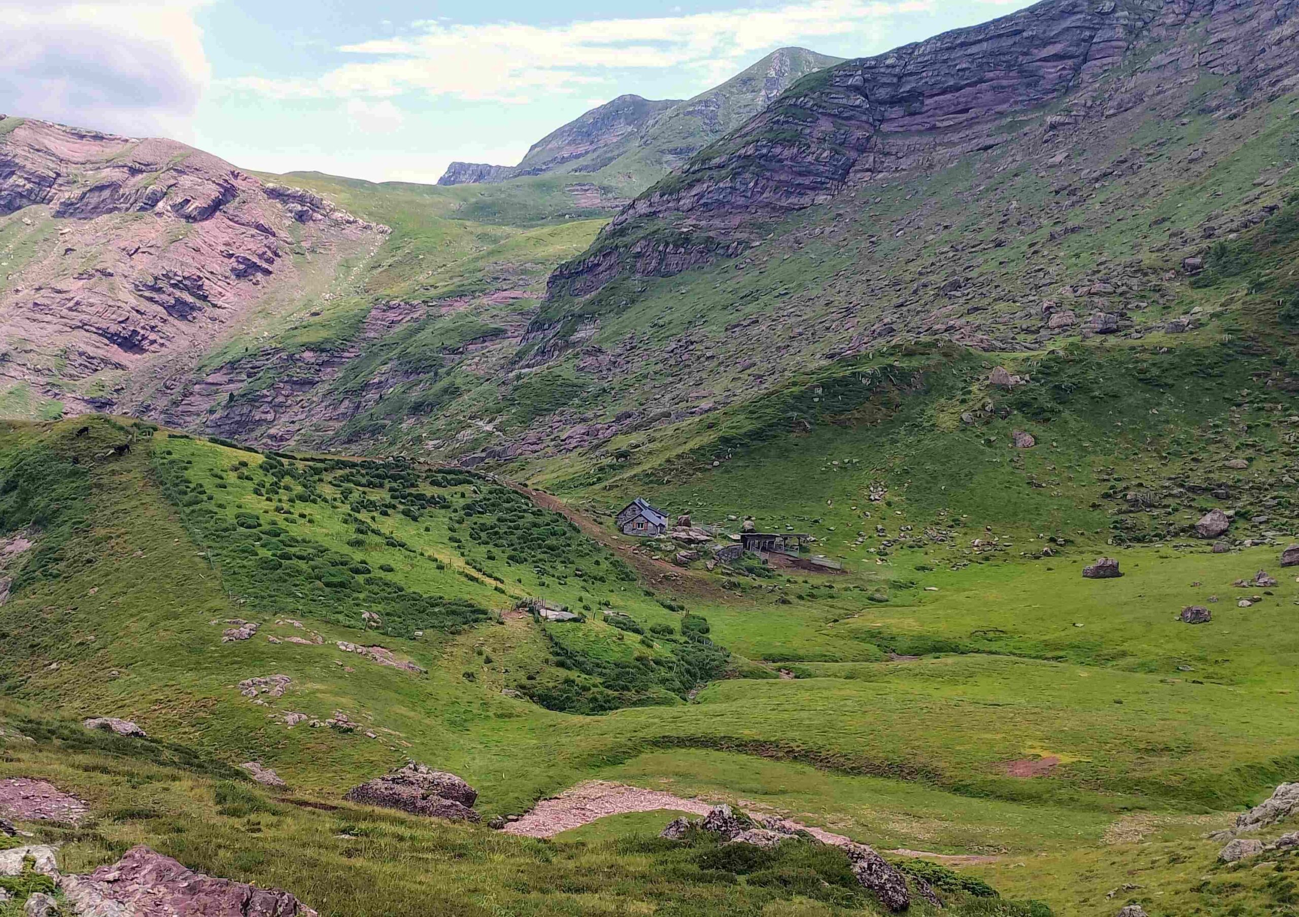
The next point on the map is the Cunarda pass (Portillo de la Cunarda in Spanish – or Col de la Cuarde in French) at 1,980m. This is also on the ‘Liberty’ route which was followed by Republicans freeing Franco’s fascists. A plaque marks ‘the way to freedom’. It’s around 1km to reach the next pass – the path drops below the ridge on the way to the Col de Saoubathou, which stands at 1,949m. From this pass, the path continues below the ridge on the France side, now following the signs for the Arlet refuge. After some undulations it comes to the Cabane de Lapassa, a farmstead where there are animal pens for livestock. The path passes on the right-hand side. Signs tell us that it is 30 minutes more to reach the Arlet glacial lake. The route on the HRP – following the white/red waymarks – continues to be magnificently verdant.
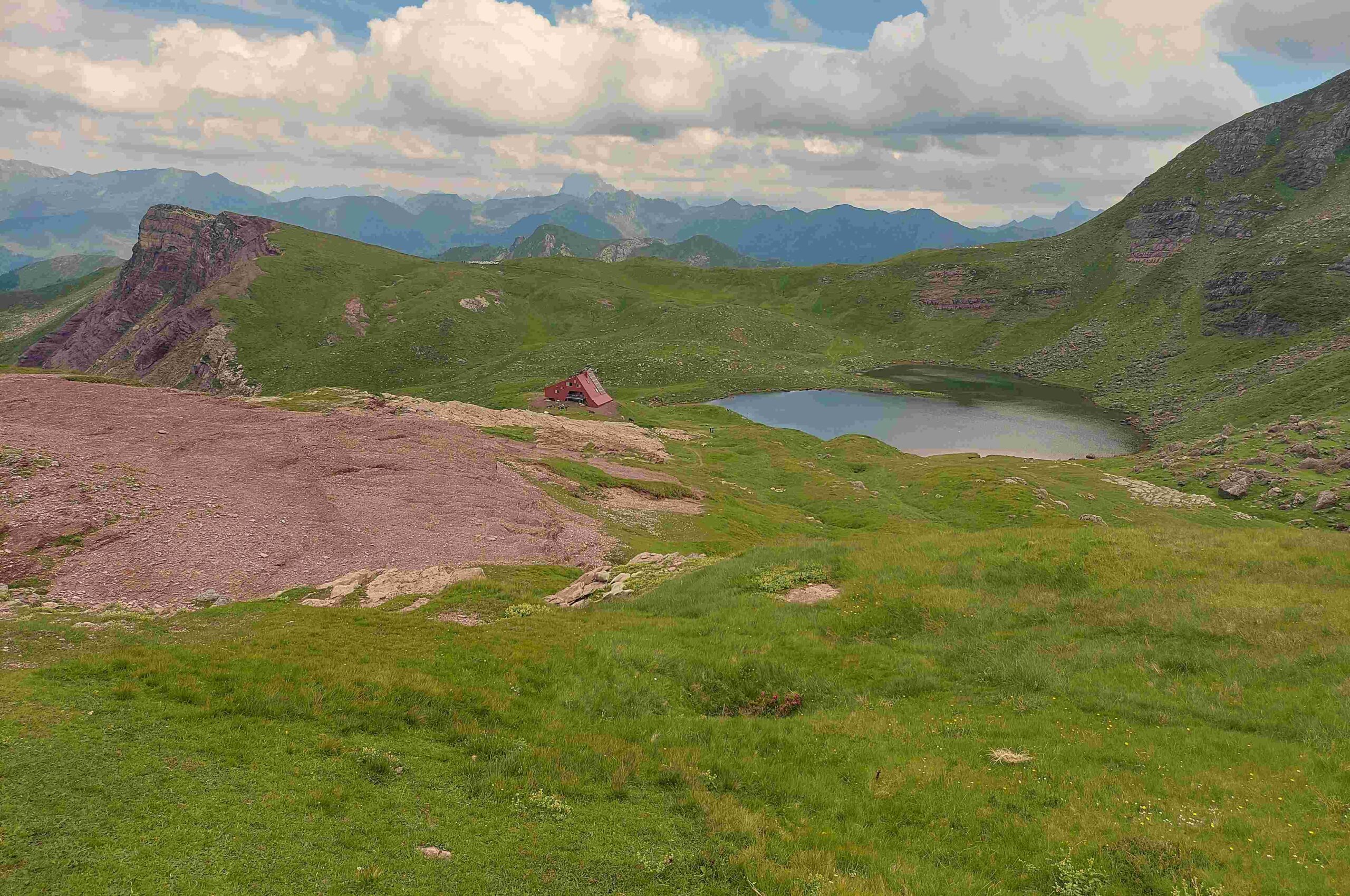
The path bears to the right to start the ascent to the lake. There is a little more than 100m of height to be gained on a switchback path as it climbs up to the Ibón de Arlet at 2,000 metres. The route emerges at the lake shore. Bear right for the short climb up to the refuge. From the refuge it’s an easy ascent to the pass. The path can be seen from the back of the refuge and a sign points for the Col d’Arlet pass (known as the Portillo de Coda del Rey in Spanish).
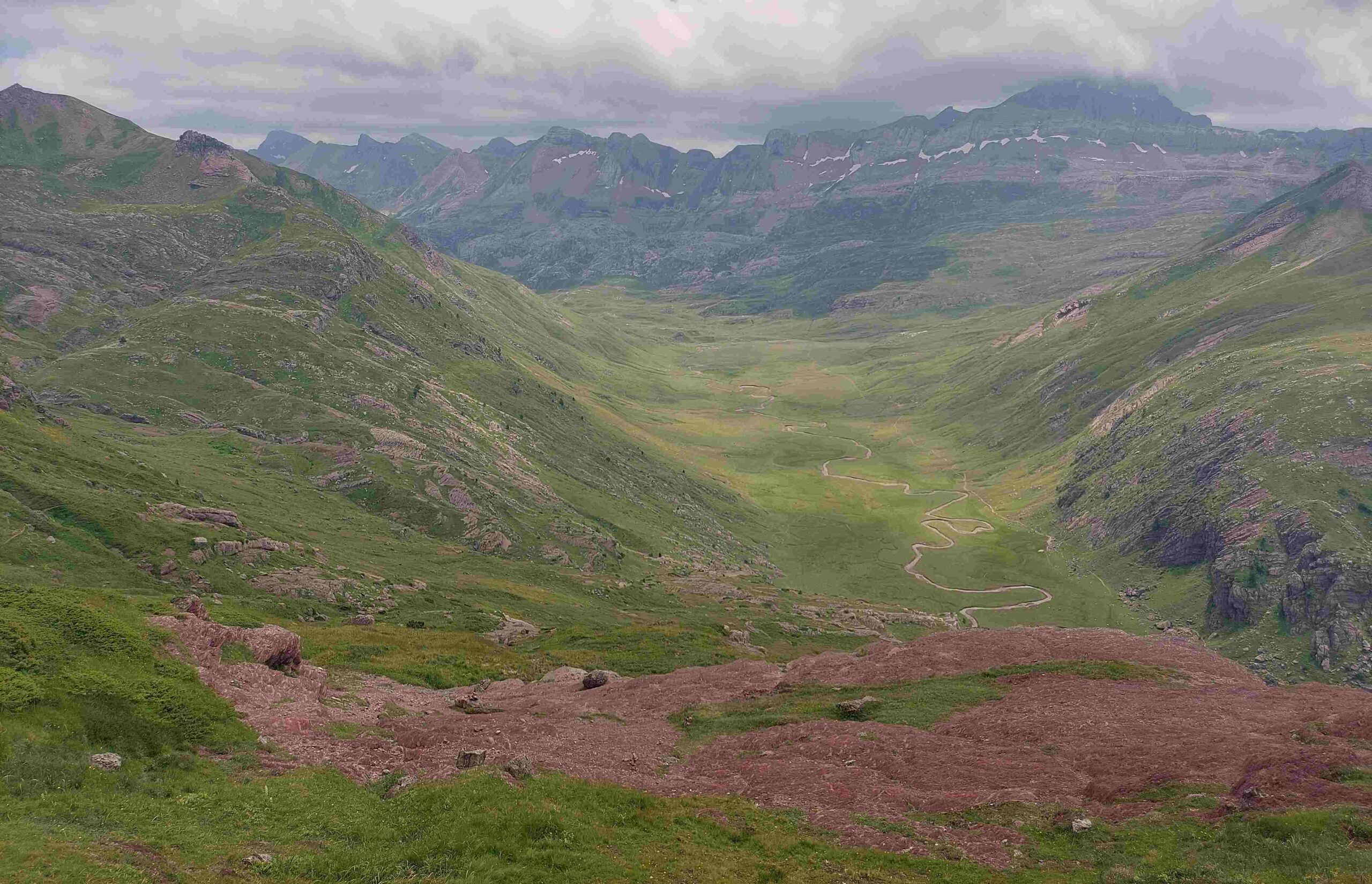
The pass stands at 2,098 metres, which is the highest point of this route. There are panoramic views, with the most captivating being the sight of Bisaurín (2,670m) across the valley which still had snow on its north face in mid-July. Down below is Aguas Tuertas – a flat area criss-crossed by streams (with one large one) which provides great grazing for cows. It looks like a nasty, steep descent at first glance. However, it’s not too bad. From the pass bear left to follow the path, heading towards the valley below. There are small cairns to help with orientation and also red dots. After initially heading directly towards what appears to be a precipice, the path veers left – this allows a more gradual descent across the mountainside.
At first rocky, the route becomes grassy as it loses height. The path passes across the shallow Barranco de Acué ravine and doglegs right to complete the final section of the descent to the flats below. The Aguas Tuertas – at around 1,600 metres – can be a bit boggy. It is best to go straight across to the far side, crossing the stream where possible, which will involve removing shoes and socks. On the other side is the GR-11 long-distance footpath. Bear right to follow the trans-Pyrenean route for a couple of hundred metres to the corner, where there is a shepherd’s hut on a rocky outcrop at a spot known as Achar de Aguas Tuertas. This is a good place for a sit down in the shade. You may even want to have a dip in the stream to cool off.
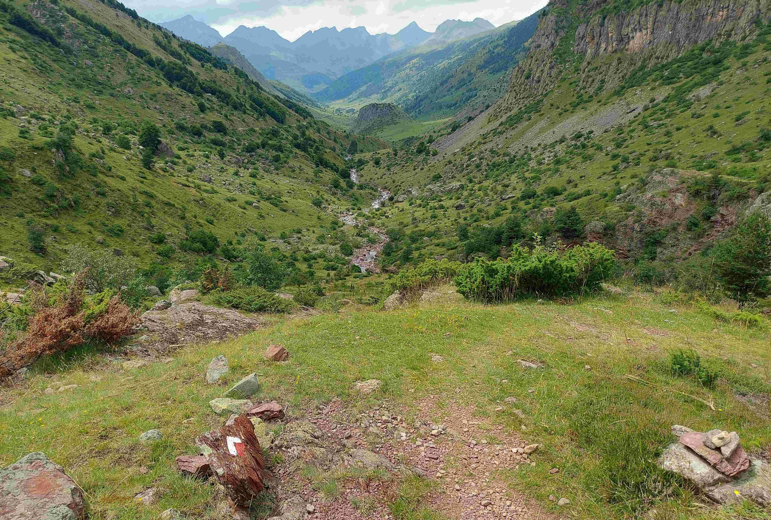
Then it’s time to gird your loins for the final section of the walk. It’s all downhill (more or less) but you will be tired and there is almost no shade. It is 6.8km to the Guarrinza de Mina picnic area and a couple more to the campsite. The GR-11 is, in general, easy to follow. The first part of the descent is steeper than the rest – the path follows the stream from Aguas Tuertas down to the stone bridge, the Puente de les Chitanos. Cross the bridge and follow the path on the other side. Keep a close eye on the white/red waymarks as the path meanders – at times it is next to the river, at others on the hillside above it. Continue the long descent. Near the bottom of the valley, pass the Refugio de la Mina building, with the path turning into a track. The track then reaches the start point – the collection of walk information boards. Some will have their car nearby; others will walk back to the campsite.


Recent Comments