
The track continues to ascend, shaded by the pines that produce impossibly large cones which cover the forest floor and trail. The track flattens out. Notice the sign pointing back for Pino Cacho/Villahermosa; our turn-off onto a path is here on the left and it’s easy to miss. Follow the path, keeping a keen eye out for the white/red waymarks. Arrive at a marker post. Here, just afterwards, the path bears right, to cross a grassy area and enter a wood of kermes oak. It doesn’t take long to pass through these shrub/trees.
There is another marker post, before the path reaches a wide, open area with a farm building and electricity pylons. From here, take the track which passes to the left of the farmstead. It runs alongside the dry stone wall. Again, keep a keen eye out, looking left as the track begins to bear left. There is a waymark there – you need to follow it, along a path. The path is going through a kermes oak wood once more. It drops down to a track. Cross it and pick up the waymarks once again at the dry stone wall. Follow the path through the trees, which are small oaks and pines.
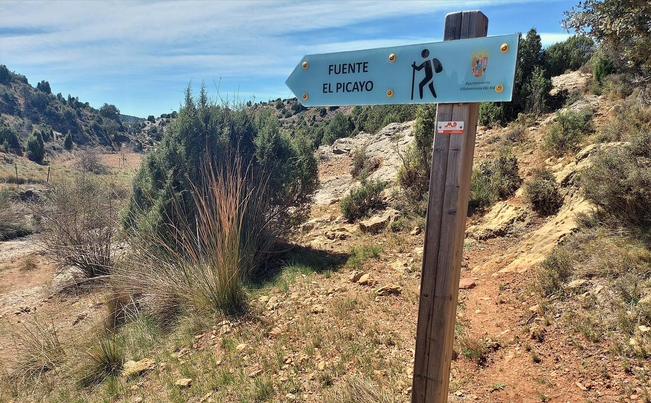
At a field, follow the path along the right-hand side, keeping an eye out for the waymarks. The path bears right, initially through trees before the countryside opens out once again. The path makes its way to the head of a very shallow ravine. And reaches a verdant spot – the Fuente el Picayo. Here, at the natural spring, there are pools with amphibian life. The path keeps to the right of the water, following the right-hand side of the shallow ravine.
It’s a little over 500 metres before the path reaches the San Bartolomé area. The ravine and any water it is carrying spills out into a wonderful green zone with tall shady trees, and grass to sit on by the side of the stream, where there is also a footbridge.
Before exploring this area, it is worth bearing right to walk up to the San Bartolomé hermitage, where there is a barbecue area. The place of worship is built at the site where a shepherd allegedly found a statue of Saint Bartholomew in 1325. From here, the GR-7 continues on to San Vicente de Piedrahita but this is our finish point for the day. The best spot to have lunch is in the beautiful natural area down by the stream, seen on the way in. The path down to it crosses the bridge. There is a grassy spot on the far side and plenty of shade under the tall trees.
Return to Villahermosa del Río on the same path. The total distance for the route is 13.4km – 6.7km one way. There is around 500 metres of ascent.


Recent Comments