This is a terrific round walk on the PR-TE 26 footpath; sections also follow the GR-8. The canyon which carries the Alcalá river is one of the most dramatic natural features of the area – and our route runs through pine woods, along the top of the canyon and then descends into the ravine to run alongside the river/stream before climbing out and returning to Alcalá de la Selva. The canyon is verdant and tree-clad. At times the pines hide it – on some sections it is hard to recognise that you are in a canyon at all, until a gap in the forest appears and a wonderful view unfolds.
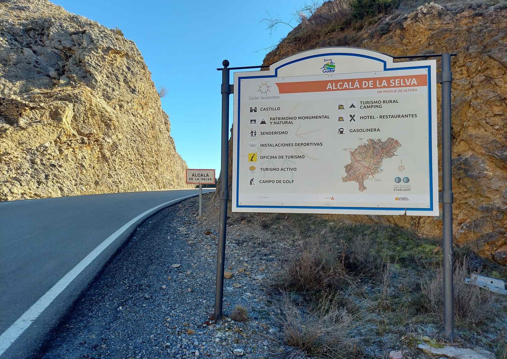
This is a great route for nature; one of the best spots in the area to see herds of ibex which inhabit the more remote zones and griffon vultures which soar overhead. The round walk starts and finishes in Alcalá de la Selva, a village which is a short drive from our base of Mora de Rubielos. There is a free car park below the village – follow the signs on arrival to find it.
The walk
Walk out of the back of Alcalá de la Selva on the only road which leaves the village, at the opposite end to the point of arrival from Mora de Rubielos.
After around 300 metres, turn left at the water purification station following the sign for Cabra de Mora on a minor country road. There is a good view back over Alcalá’s impressive castle from this point.
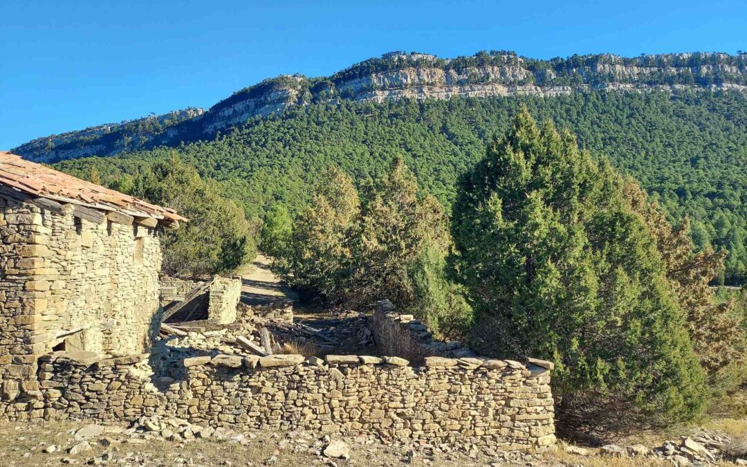
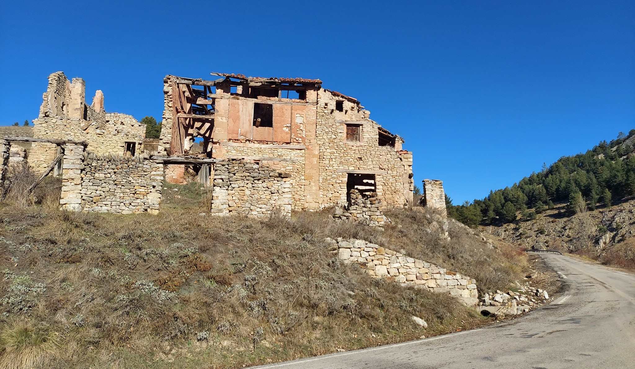
A short distance further on, the next landmark appears – the ruin of a large ‘masía’ farmstead on the right of the road. This is where our route turns left, off the road. Here a GR-8 sign tells us that the Alcalá canyon is 5.8km away.
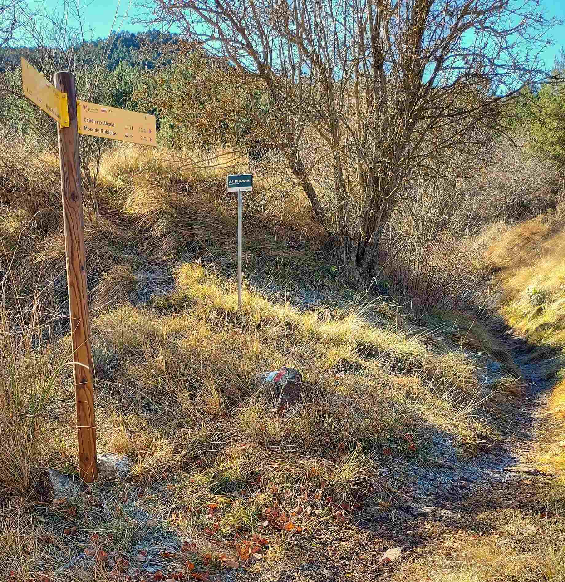
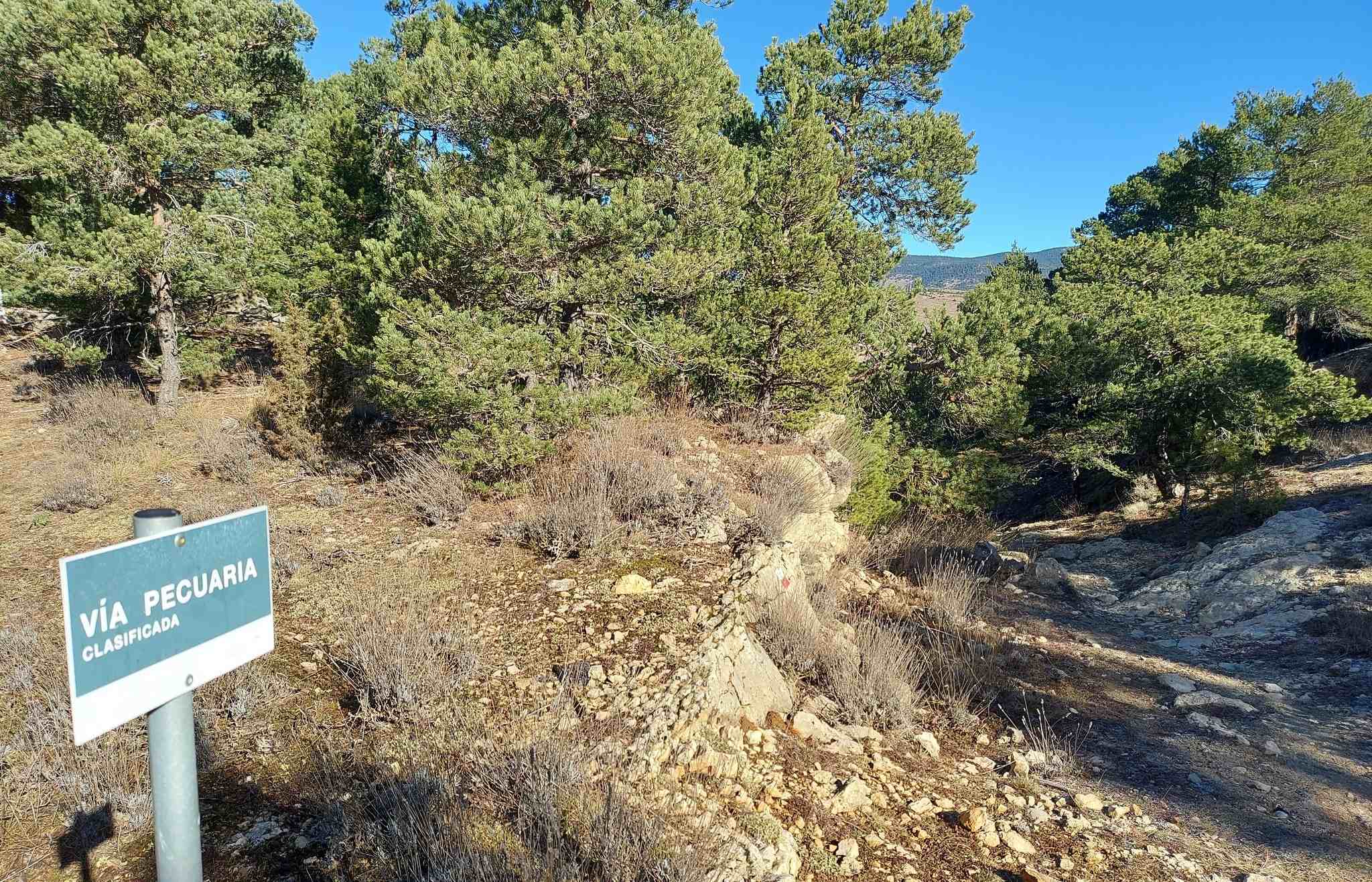
The track fords a stream, with a footbridge a few metres downstream to prevent the possibility of wet feet. Walk up the track for 200 metres as far as the next GR-8 sign, which points right for the canyon. Now on a footpath which ascends through the pines, notice a sign which explains that this is a ‘vía pecuaria’, which is an official route used by shepherds to take their livestock between pasturelands.
It is a very pleasant section through the pines on a footpath which ascends the slope. There is another sign to explain that the walker is on the old livestock trail. The route arrives at wire fence which claims that this area is private property. Cross through the fence to reach the next sign; our route turns right – off the track and away from the GR-8. The sign tells us that the canyon is 1.5km away. Be aware that this distance is not to the bottom of the canyon, where the path runs along the river, but to the side of the canyon which is covered in pines.
A path runs away from the sign, indistinct at first, but cairns show the way into the trees to start the descent. The white/yellow waymarks of the PR soon appear, and the path is now very clear, descending through the pines. This is a good spot to see ibex. Keep quiet or they will disappear like the morning mist.
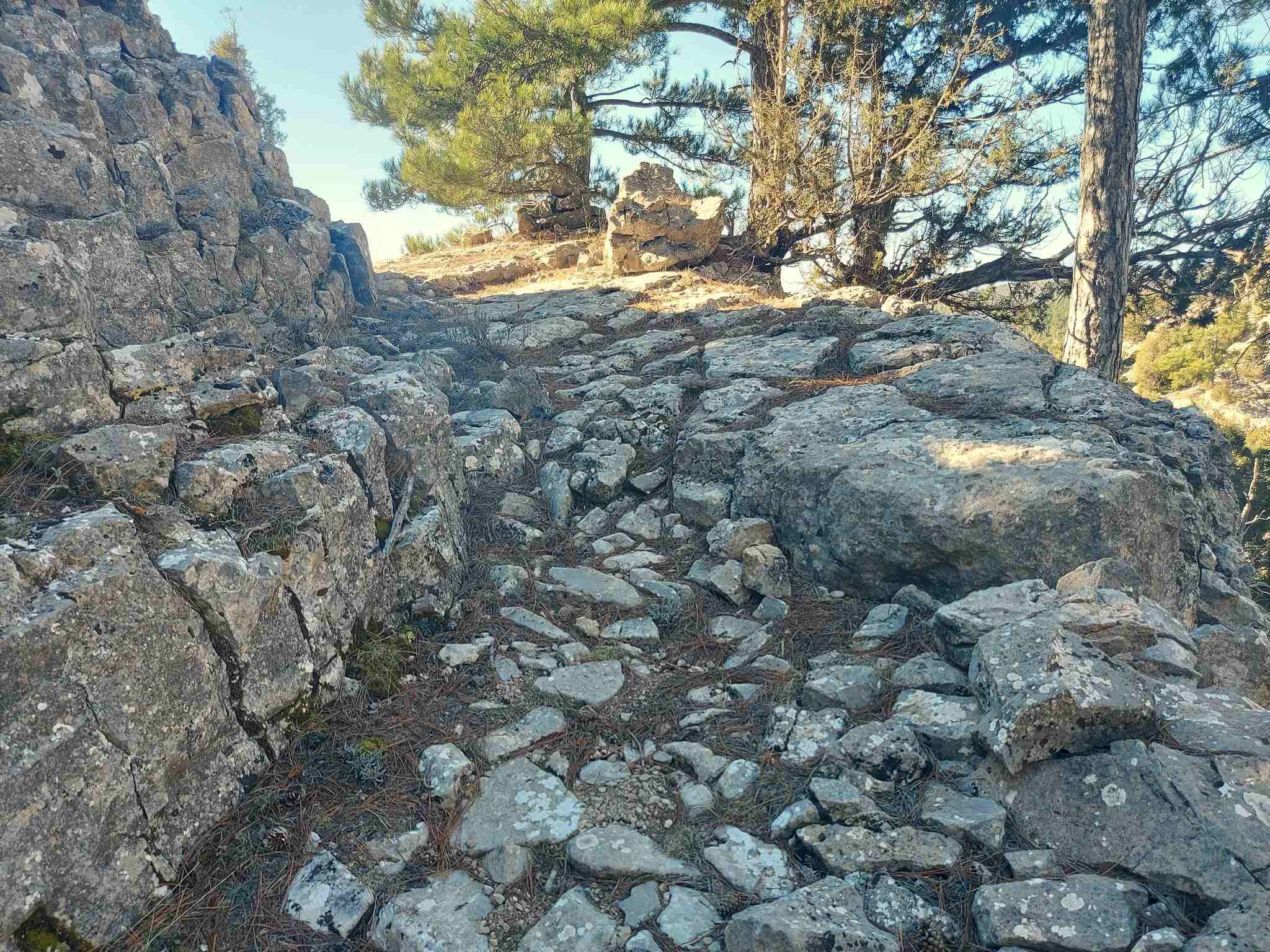
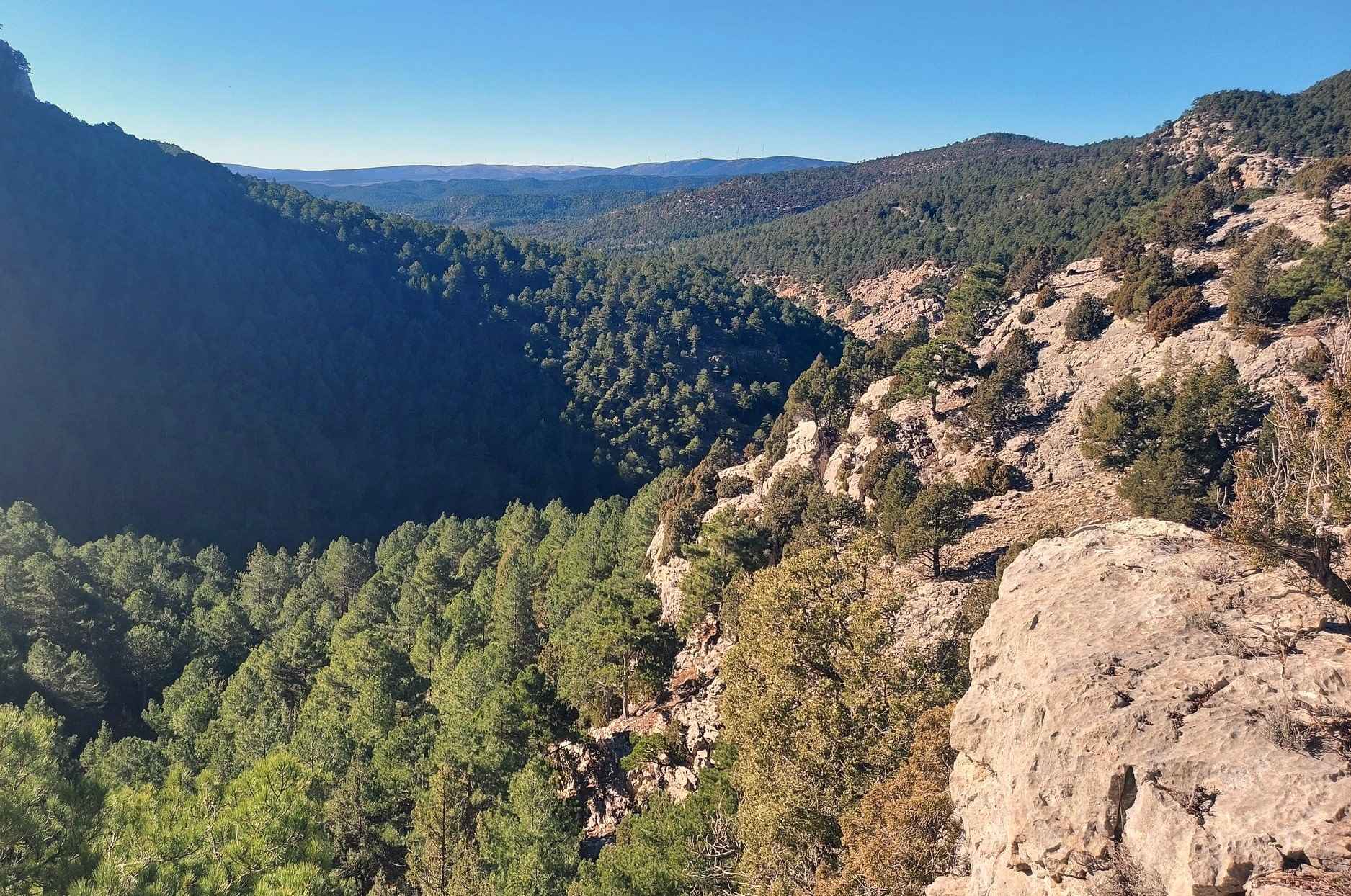
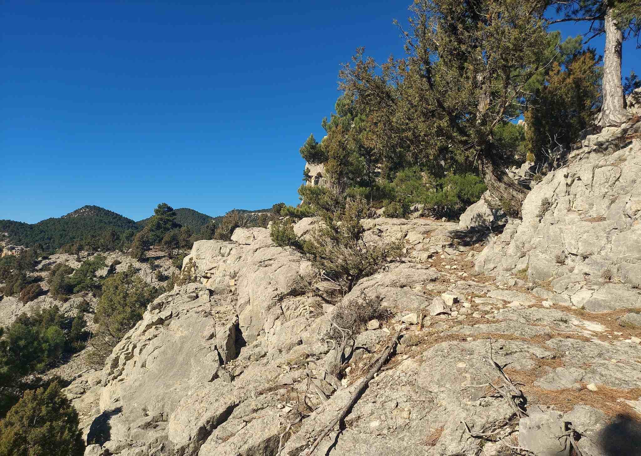
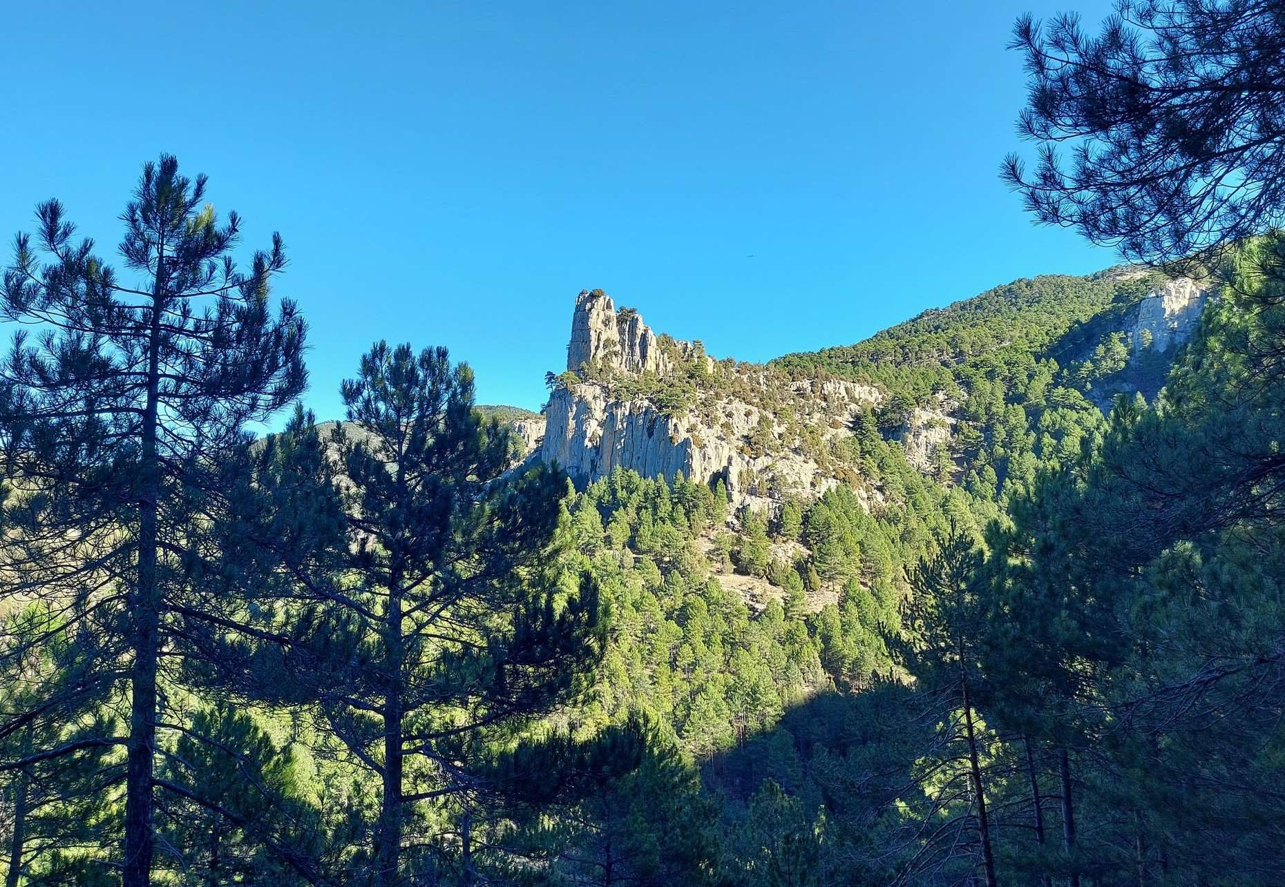
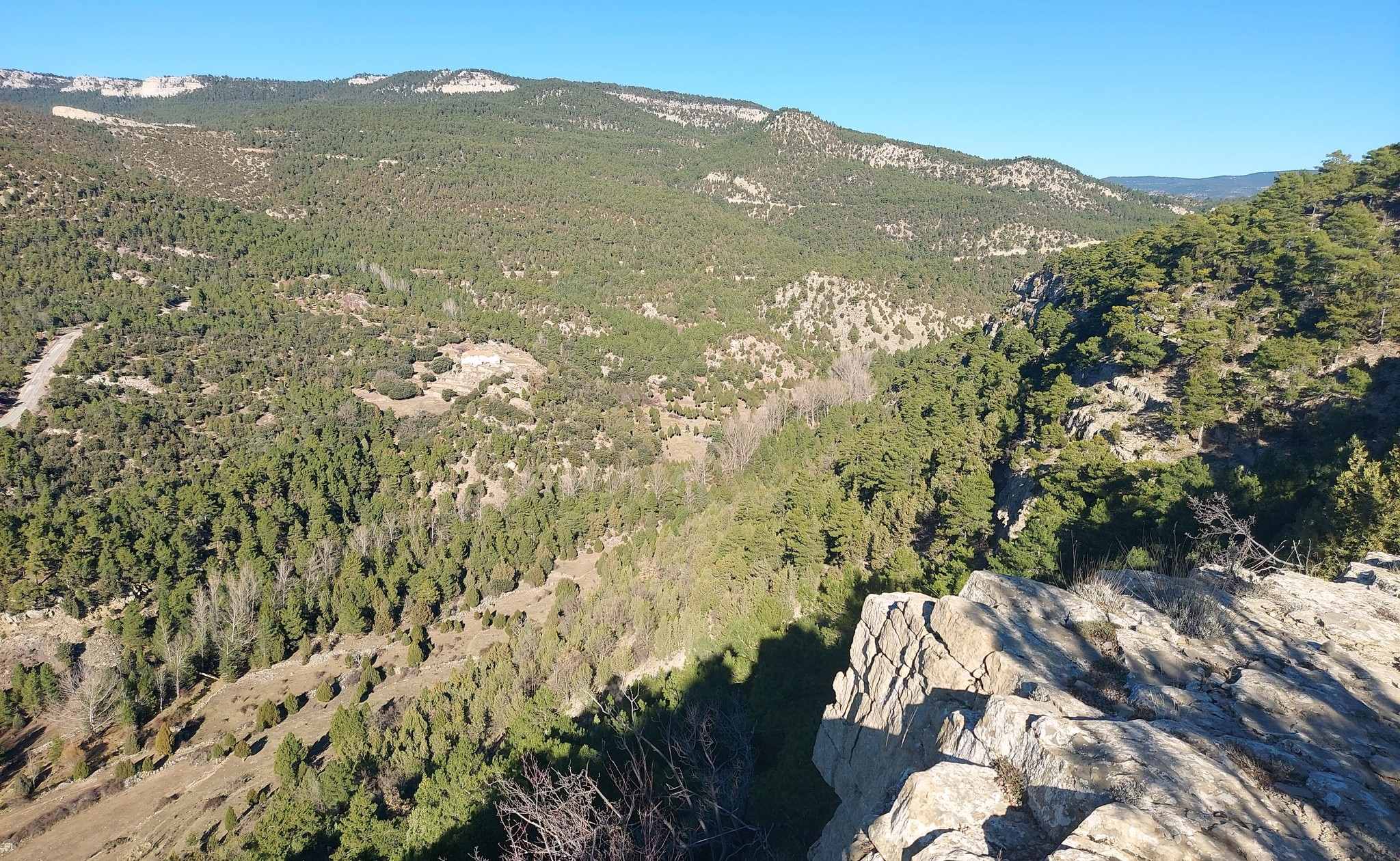
Soon it becomes apparent that you are on the side of the canyon and views of fantastic rock formations appear through the trees. The path starts to ascend. This is one the most dramatic sections of the walk. Now fashioned out of the rock, the path rounds a bend. From the promontory there is a terrific open view of a section of the canyon. Although this may sound like heart in your mouth stuff and ‘walking on the edge’ – it isn’t, although obviously care must be taken. There is now a short descent to a track. Here turn left, following directions for the Río Alcalá.
Shortly there are some fantastic views through the pines of the protruding rocks of the tree-clad walls of the canyon. There is now quite a long section along the track through the trees. It is very pleasant but the thick tree cover does not allow any views of the rock formations around about. Emerge at a sign for the river (to the right) and ‘mirador’ (vantage point) to the left. You will be itching for a view of the surroundings so it is advisable to bear left to reach the viewpoint, even though you have to retrace your steps to the sign.
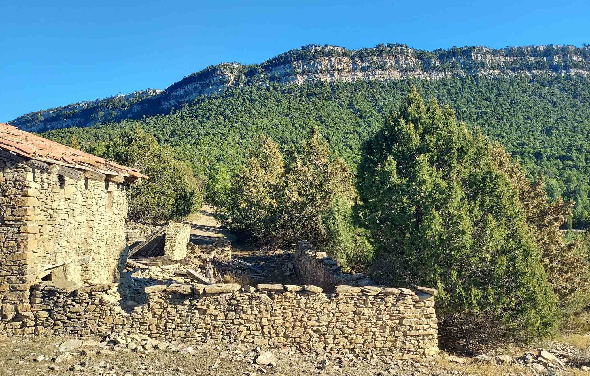
It’s a couple of hundred metres. The ‘mirador’ is in fact an old tumbledown farmstead called ‘El Castillo’ which occupies a privileged position on the edge of the canyon. Manoeuvre round the back of the walls to get a wonderful view up the canyon, where you will soon be walking, and to the rock escarpment above.
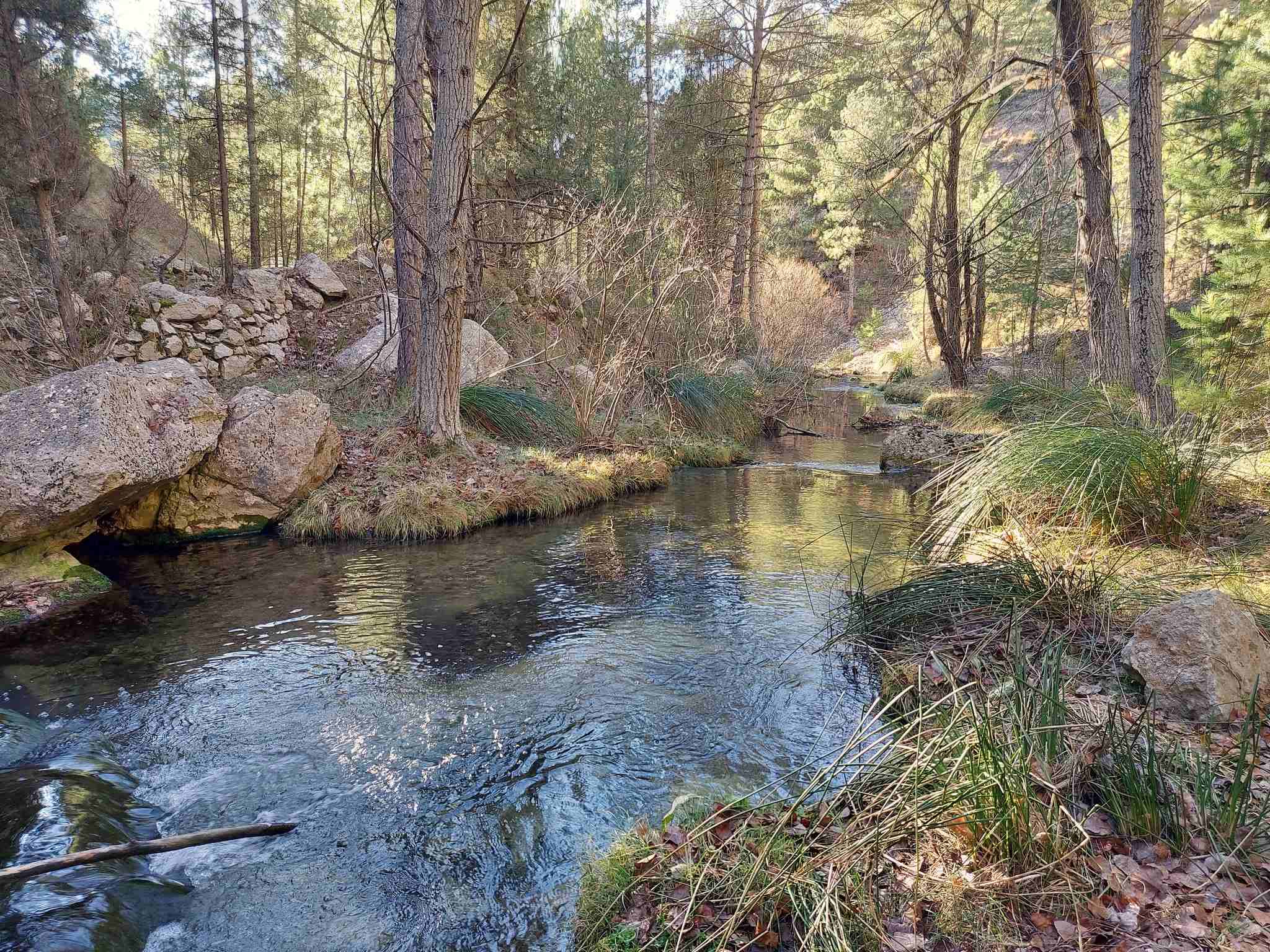
It is around 200 metres to return to the sign and rejoin the PR-TE 26 route into the Alcalá canyon. Now it’s a downhill section which leads to the river bank. There is no bridge – it’s a make-shift crossing of the shallow river/stream on strategically-placed rocks. The path now hugs the left bank of the narrow river, following it through the pine trees. The path is waymarked. It crosses a small section of boulders.
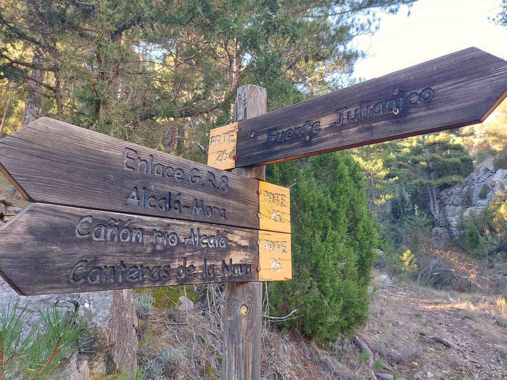
A great view of the limestone rock formations above emerges as the path leaves the river bank. The path climbs to a sign, which points right to the Fuente Julianico (on the PR-TE 26). The true PR-TE 26 continues straight on, climbing up to the road which was utilised at the very start of the route. Once there, it’s a right turn to return to Alcalá de la Selva on this rural road.
At the time I didn’t know this – and headed for the Fuente Julianico, as it sounded like a lovely spot (with ‘fuente’ meaning natural spring). The route I took was a pleasant one, reaching a wide track which ascended very gently to the road (although there was no sign of the spring!). The problem with this option is that it leads to a fence just before the road which has to be scaled. It’s not too difficult but a sign on the other side reveals that you have emerged from private property, which is ‘forbidden to enter’. The ‘true’ route is more direct heading more or less straight up to the road. For both options, it’s a right turn at the road to walk back to Alcalá on the carriageway.
The walk measures approximately 17km, with around 300 metres of ascent – and takes between six and seven hours.


Recent Comments