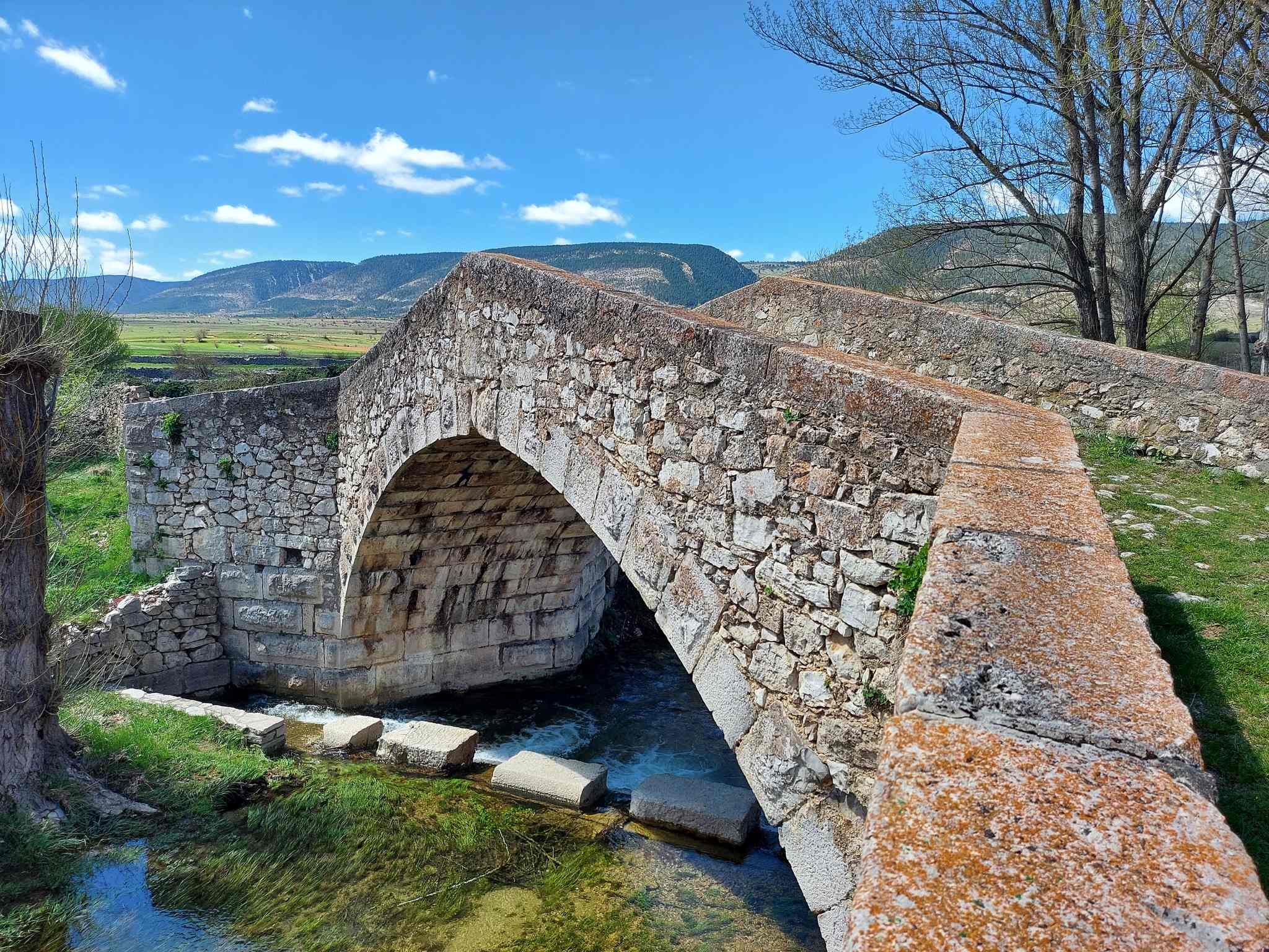
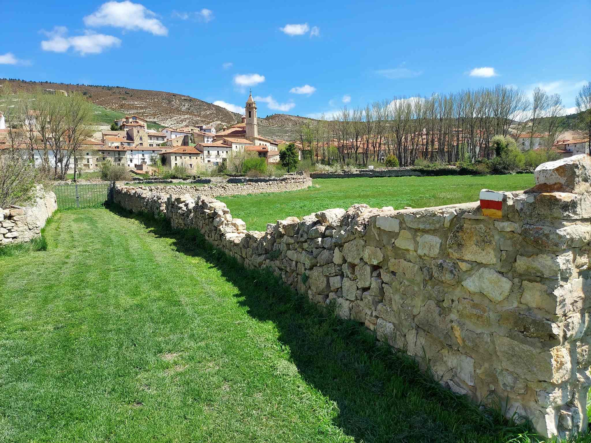
The old stone bridge across the river, the dry stone walls which house the village allotments, and the green, green grass. These are all factors which combine to create an idyllic pastoral scene at the start of this walk to the impressive Zoticos ravine. For this reason, it could also form the basis of a short stroll, without embarking on the path to mountains in the distance.
It’s another route on the GR-8. The full stage to Valdelinares is quite a long one, weighing in at 18km one way. Not many walkers will be hiking there and back in a day. Accordingly, the proposal here is stop at a point chosen by the protagonist – and a suggestion of when to do that will be made at the appropriate time.
An interactive map can be found at https://senderosturisticos.turismodearagon.com/senderos/gr8 under Fortanete-Valdelinares. It is useful at certain points of the walk, so if you have a smartphone, you can download it for access at any time without having to rely on an internet connection. Fortanete stands at an altitude of 1,350 metres and the route rises to just below 1,800m, before descending into the magnificent Zoticos ravine and running along the side of it before climbing out at the end and moving on towards Valdelinares, the highest village in Spain.
The route
The walk starts out from the road which runs through Fortanete, the A-226.
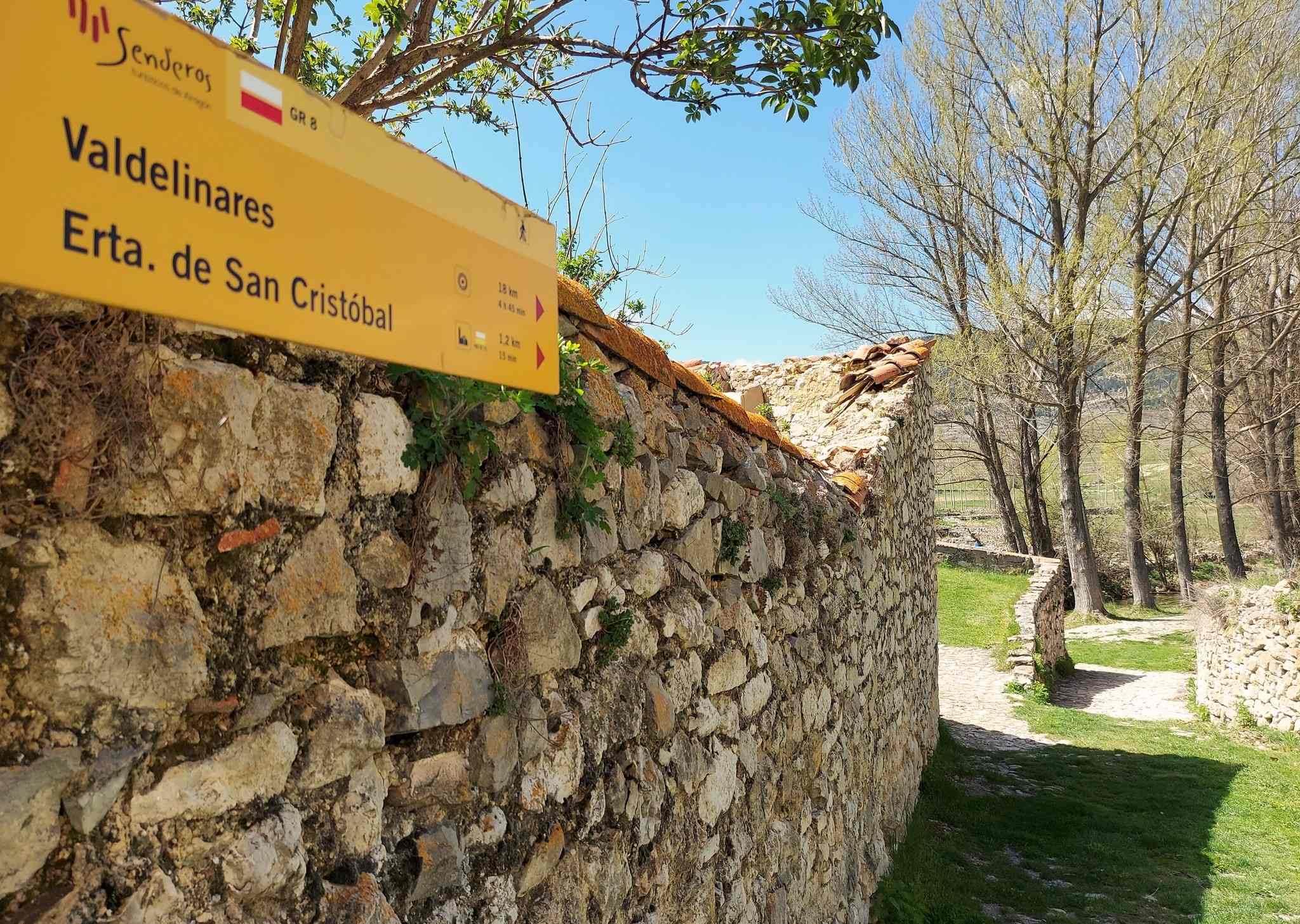
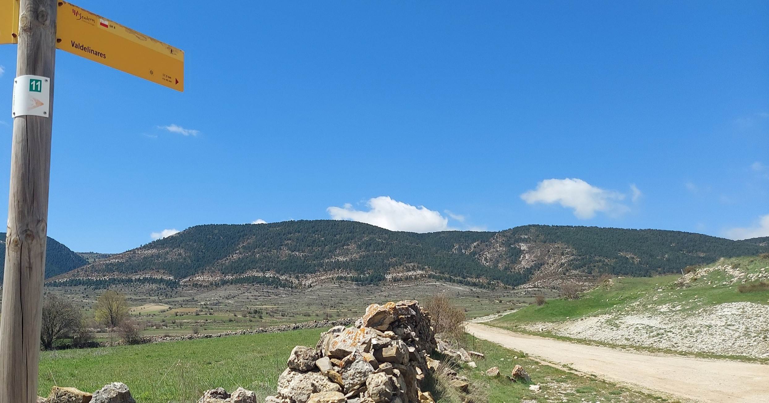
From the village square walk down to the road. Bear to the right and notice the large stone wall on the other side; here you will see a sign for the GR-8 pointing for Valdelinares. Head down the cobbled track to the lovely old bridge and cross it. Green alleyways are flanked by dry stone walls, providing a carpet of grass for the walker. There is a panel in Spanish with information about construction using the dry stone method.
It’s not exactly a labyrinth, but there are a couple of turns before the waymarked route emerges at a wide track. Bear right here, following the waymarks. The wide track starts to run away from the village, making for the high ground ahead. Soon there is a sign telling us that it is 17.5km to Valdelinares, pointing straight on towards the hills.
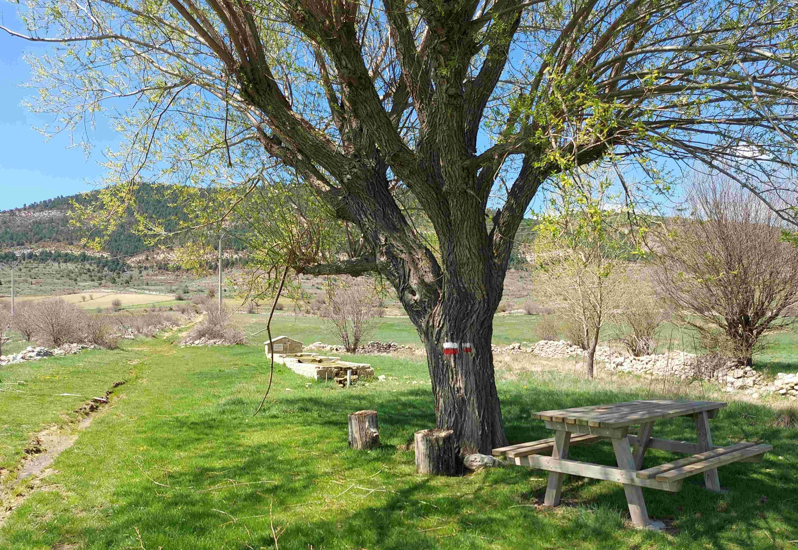
The track turns into a path and passes a large shady tree which has a picnic table underneath. It may be a little early to be stopping for sustenance, although some people may want a short walk from the village to this point. The path starts to rise, moving towards a wooded area where signs give information on the types of pine trees and other flora which can be found in the area. Moving towards the trees, the path enters a shallow ravine, the ‘arroyo de Peñacerrada’.
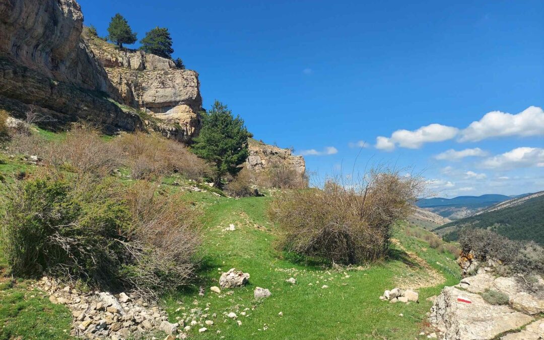
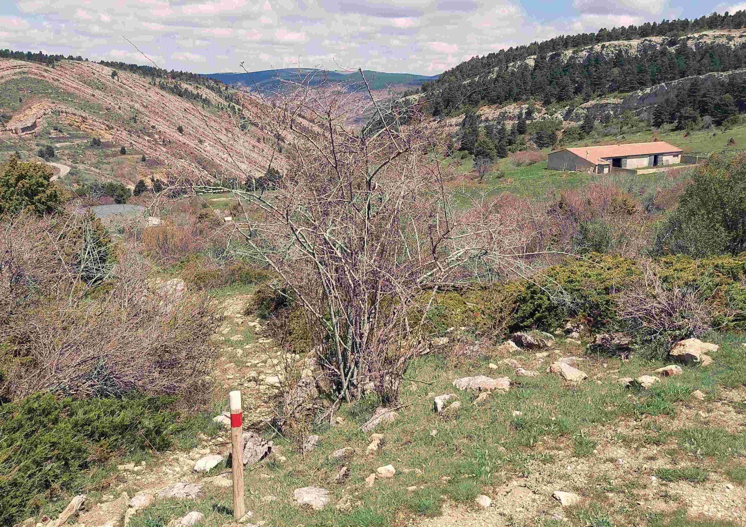
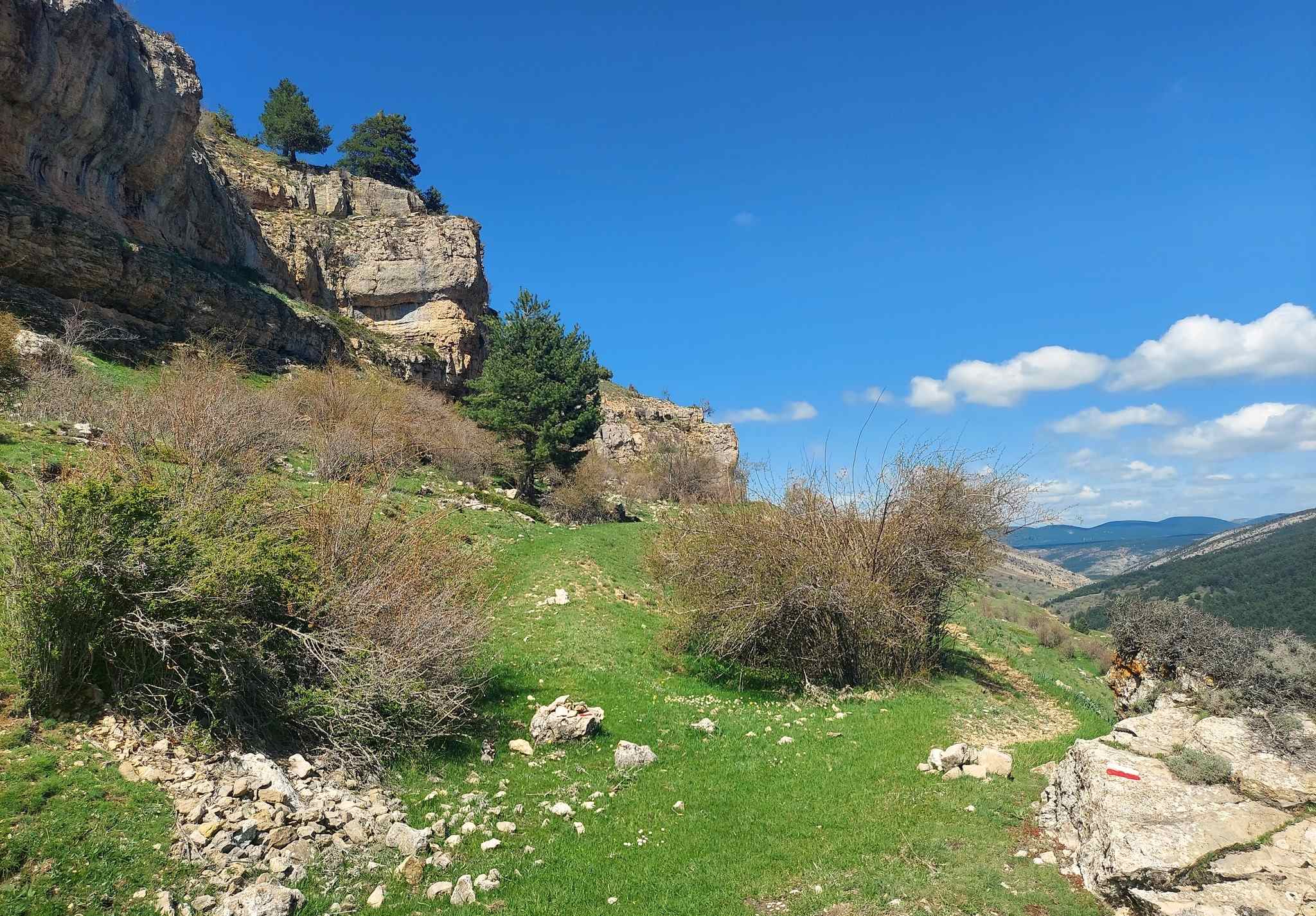
There is a short section along the side of the ravine before the path crosses a stream and ascends to meet the mountain road which runs to Valdelinares. Turn right and walk up the road for a little under 1km. Arrive at a GR-8 sign which tells us we have come 2.7km from Fortanete – the sign points off the road, and down then up the bank, to start a waymarked ascent. The path reaches some farm buildings. Pass to the right of them. The next short section is slightly tricky as cattle have knocked down some of the walking signs. In essence, you are ascending straight up but bearing slightly to the right on the climb – first on grass and then on the path through the shrubbery (see the photo).
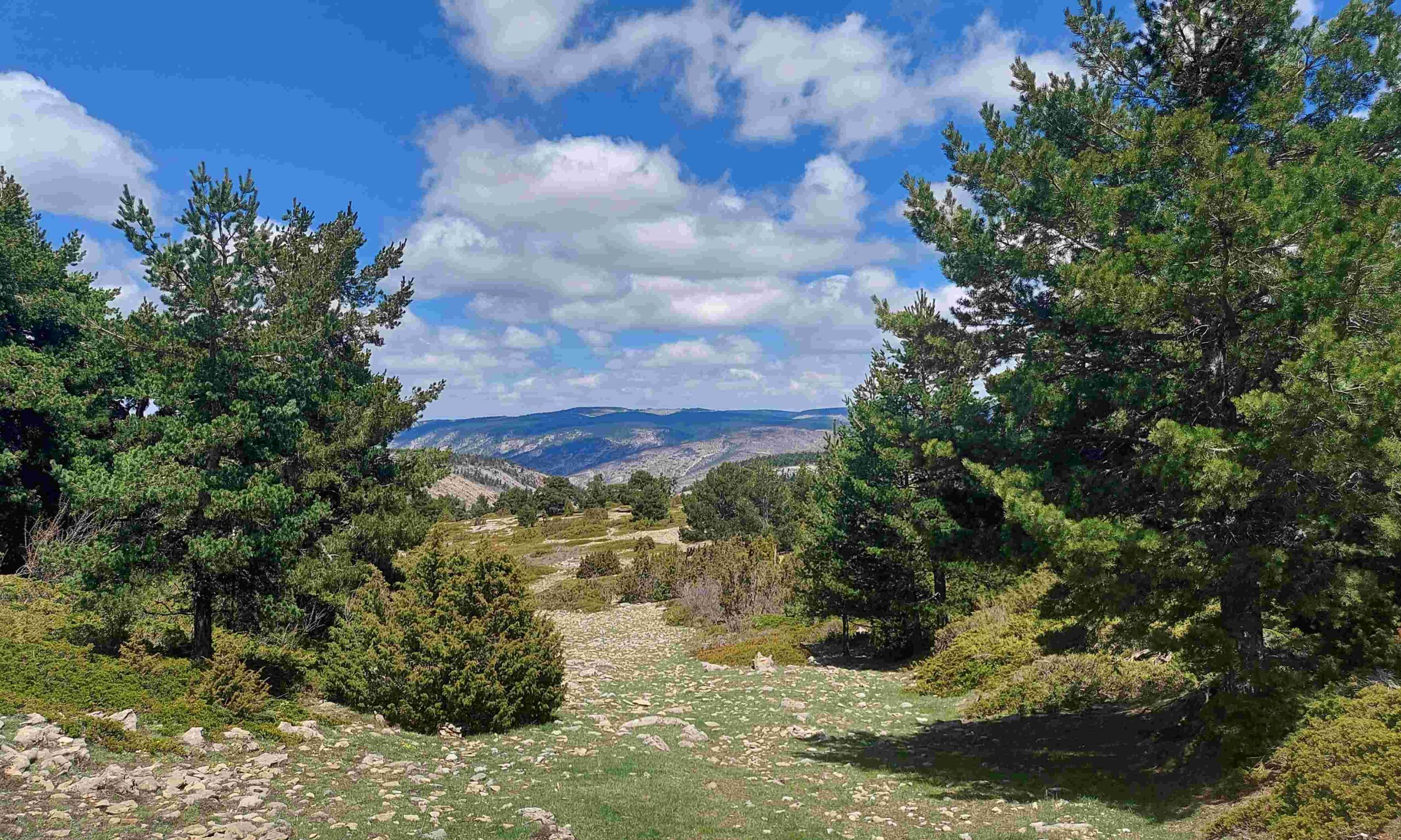
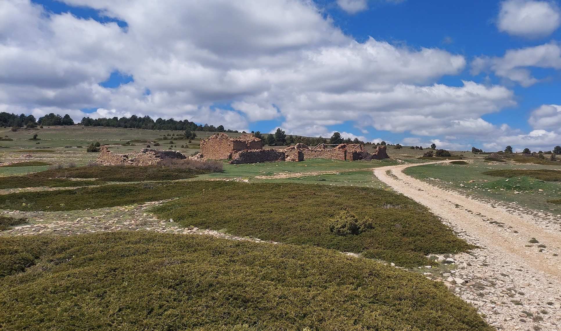
The GR-8 soon returns to a track, ascending through a high mountain area, where there are great views and more pine trees. Emerge at a wide track and bear right. Walk along the track for less than 500m to reach the next junction and bear left, turning off just before the tumbledown farmstead (masía). The track is now heading ‘cross country’ and the walker should be alert to the next turn off. The junction is well before the trees. Bear right here to continue ascending into the trees. A waymarked track passes through the pines and goes as far as the mountain road, where a sign tells us we have come 6.5km from Fortanete. This the highest point of the walk at an altitude of nearly 1,800m and is close to the rounded summit of Tarrascon (1,813m).
Walk along the side of the road for approximately 600m before spotting the waymark (on a pine tree) indicating a turn off left. Descend on a path to meet a track. Turn right at the next junction to follow the waymarked track.
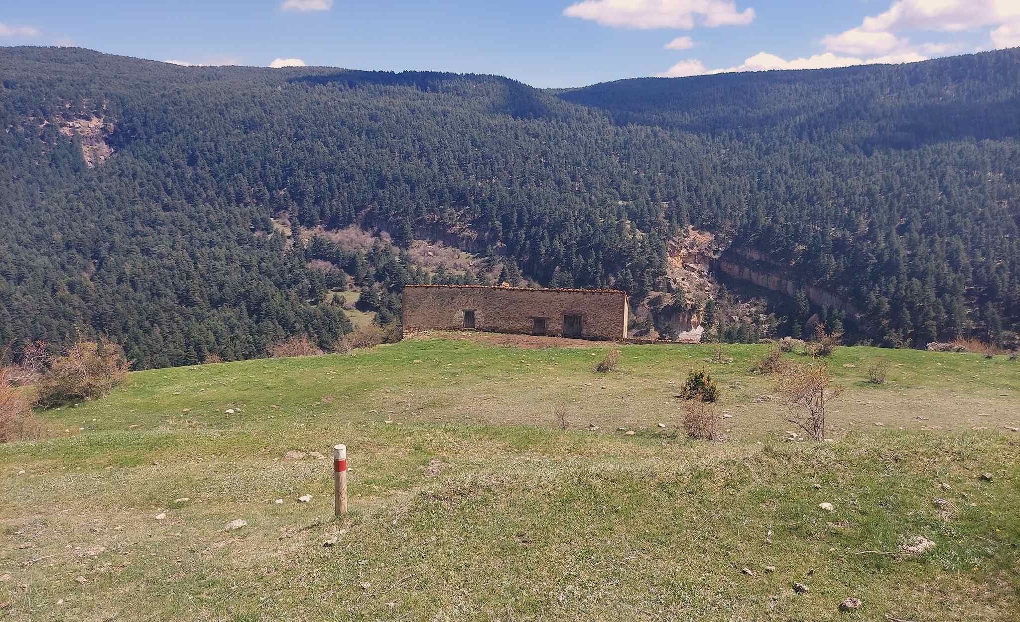
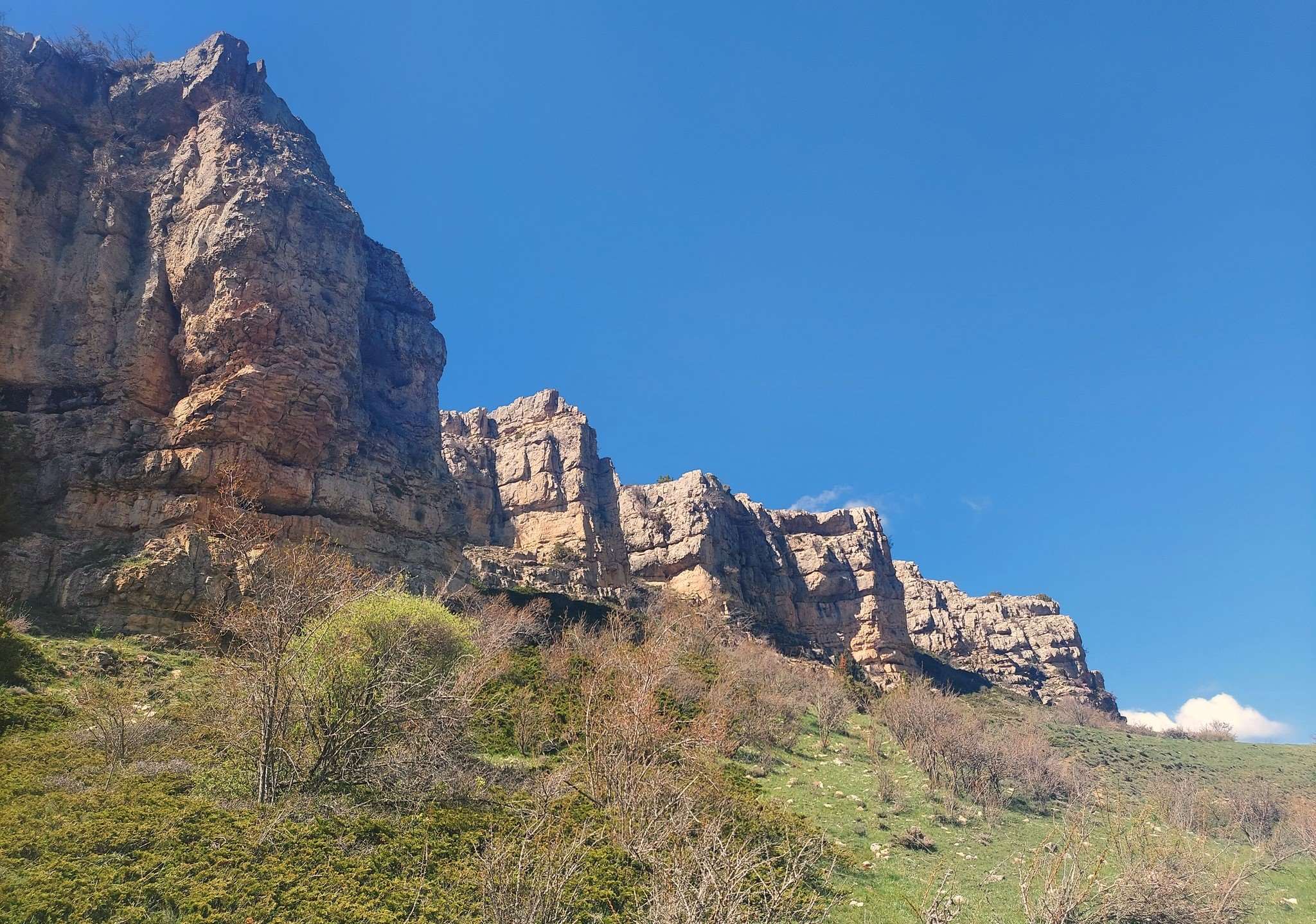
The walker is now heading into the spectacular Zoticos ravine, which is deep, verdant and picturesque. The rock formations of the limestone landscape are a wonder to behold. Follow the track downhill as it bends round to emerge at a point just above the Mas Alto farmstead. Now in the ravine, the path bears to the right to follow the right-hand side of the Zoticos. It is not dangerous walking and there is plenty of space to amble along and contemplate the surroundings.
It is down to the walker to decide how far to progress from this point. The ‘flat’ walking in the ravine – which is highly pleasurable – lasts for about 1.5km. Then the path starts to ascend. It’s decision time at this point, with around 10km completed. The walker will be returning on the same path. Obviously the route goes all the way to Valdelinares – our next destination in this series. And one of the walks from Valdelinares is the route back to this ravine on the GR-8.
Those with ‘good legs’ may decide to do the ascent up to the neck of the ravine for more fantastic views. The decision to turn for home can be made at any time. There is around 600m of ascent on the route outlined here, before starting the climb out of the ravine.

Recent Comments