
This ascent of Mallà del Llop – up two fantastic ravines to get to the summit at 1,361 metres – is a route that would not be out of place in any of Spain’s great mountain ranges. It is a fantastic walk and one of my favourites in Alicante province.
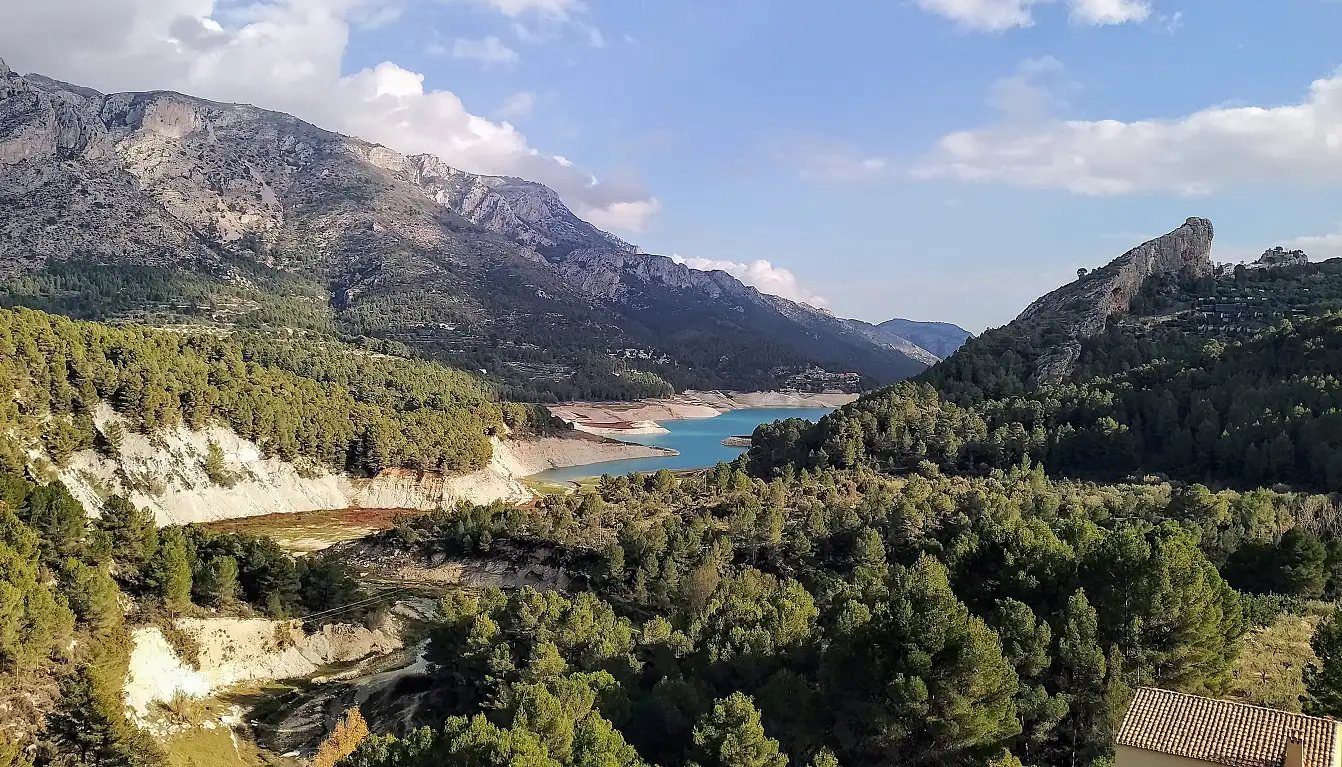
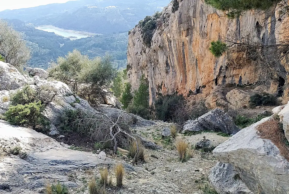
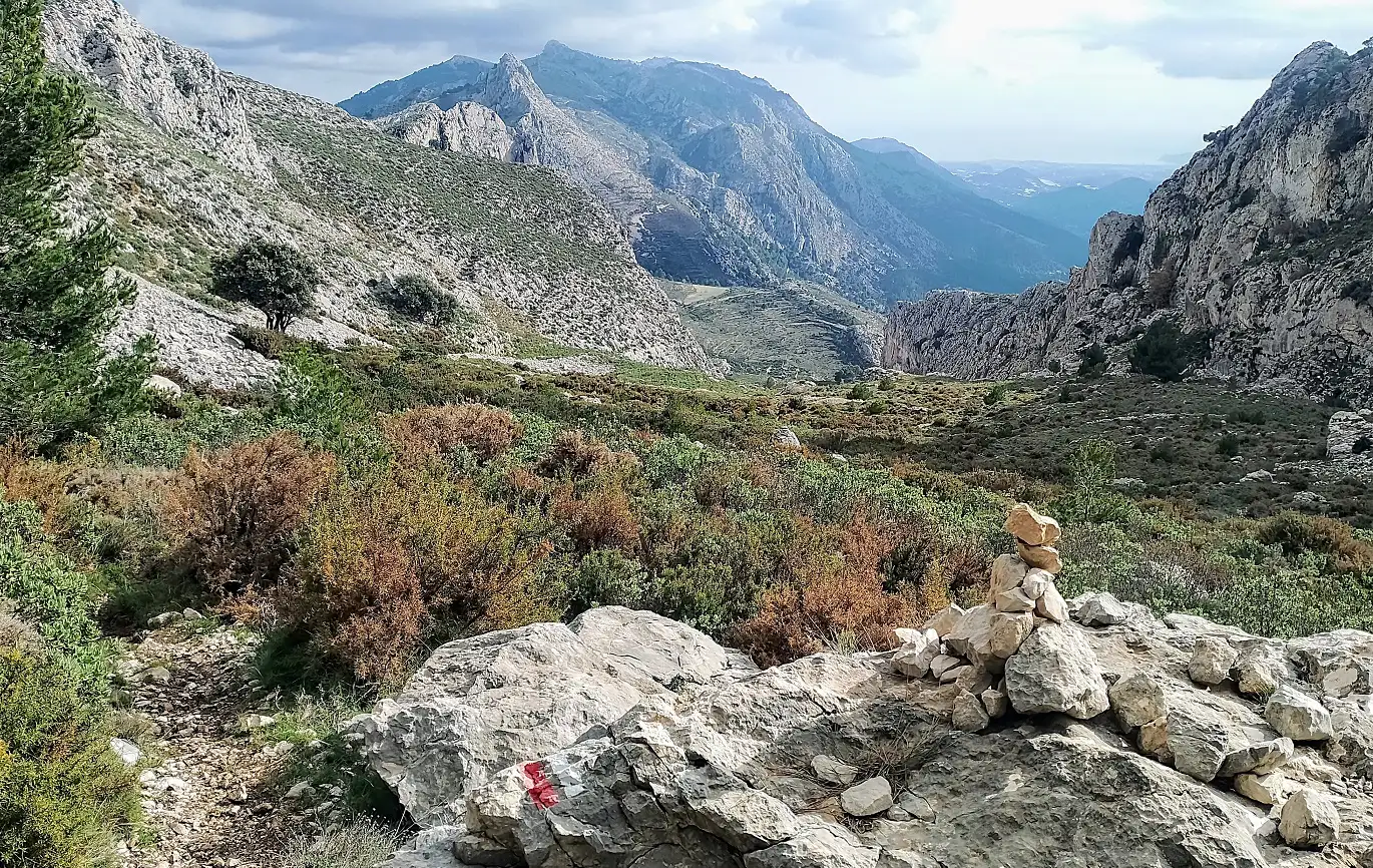
Starting in the picturesque village of Beniardá, the path skirts Guadalest reservoir, then ascends the Barranco de les Coves and the Barranco de la Canal, with the first ravine running into the second one. As the path climbs, the walker heads into real mountain country with terrific views back over the reservoir to the sea.
The spectacular footpath zigzags up the north-western side of the Guadalest Valley, in a sort of no man’s land between the Sierra de Aixortà and the Sierra de Serrella. The ultimate goal is to reach the summit of Mallà del Llop, but this is long way and may be a bit too far for some. There are other options too. One would be to only do half the walk, ascending to the top of the first ravine – the Barranco de les Coves – for the panoramic views over Guadalest reservoir.
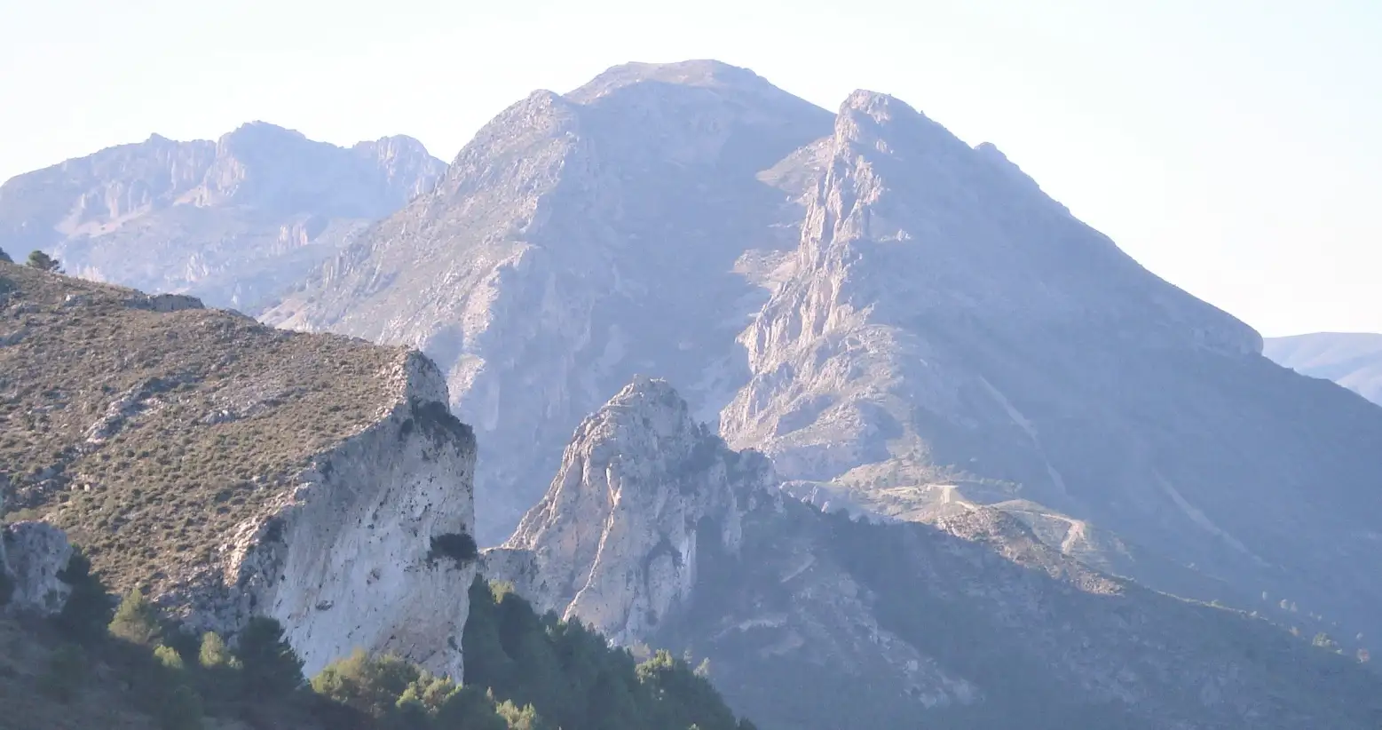
The second section is up the Barranco de la Canal – a wide ravine with steep sides, which is a monumental geographical feature, one of the most extraordinary in the province. For those who reach the top of Mallà del Llop, an even longer walk is possible by continuing along the spectacular ridge to Pico de Serrella (1,323m), then descending to a snow well, and back up, before starting the return on the same path down the two ravines.
However, the route outlined here only goes to Mallà del Llop and returns on the same path. Maps (1:20,000) of the area can usually be purchased from Pension Pirineo in Confrides. Be aware that this map refers to the ‘Coves’ ravine (which means caves in Valencian) as the Barranco de les Mates.
The walk
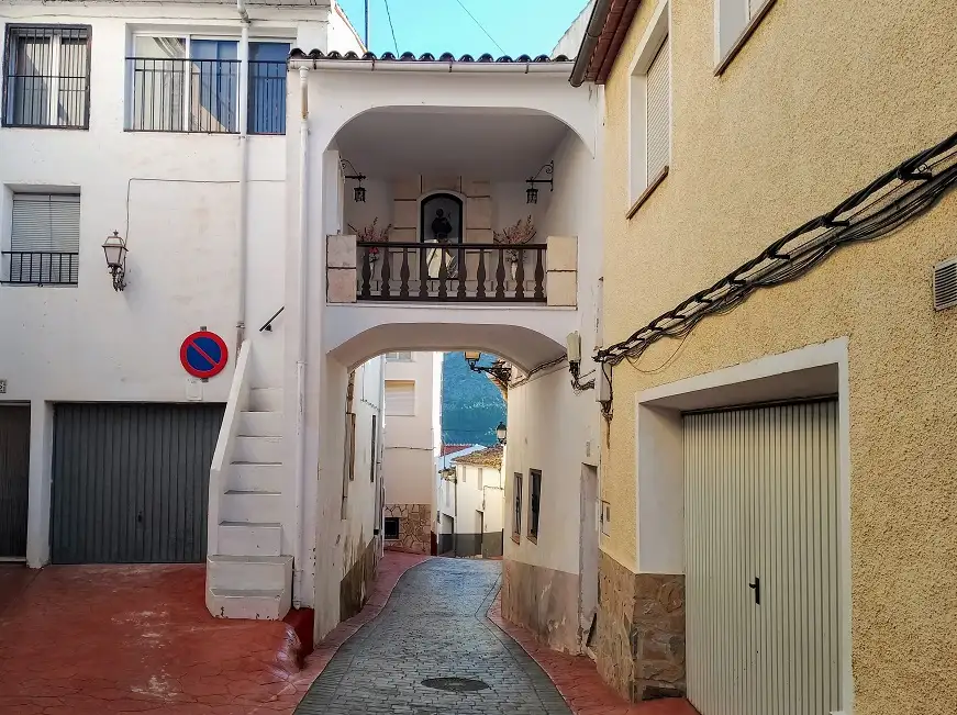
Park up at the entrance to Beniardá (car park on the left) and walk down through the village passing to the left of the church and then under the house arch (pictured), heading for the reservoir.
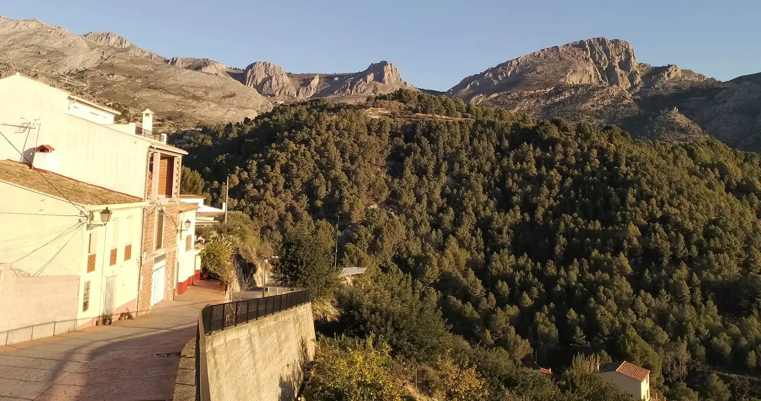
Emerging from the last of the houses, Guadalest reservoir appears below on the right. Head down the lane. On the right is a vantage point in the form of a mini skywalk which juts out and offers vistas over the reservoir and up to Guadalest village on its precipice. Go down the country lane, passing the municipal swimming pool. Cross the bridge at the bottom and turn right following the sign for the ‘presa de Guadalest’ (Guadalest dam), which is 5.9km away. Continue along the lane for 2.1km, enjoying more views of the reservoir and the village perched on its crag, ignoring any offshoots to the left.
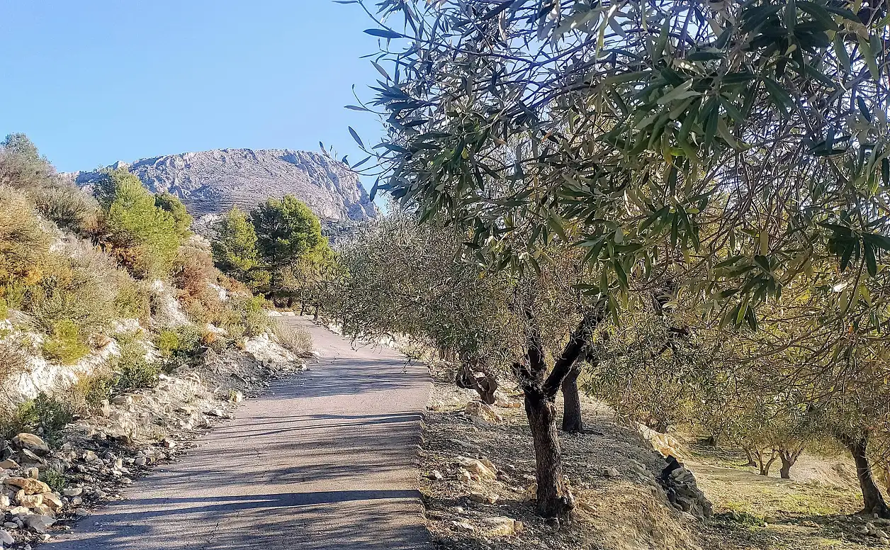
At a sharp bend, see another sign for the ‘presa’, this time 3.8km distant. Bear left here. After 20 metres keep right, now following the white/yellow waymarks of the PR-CV 18 footpath. Keep left at the next fork, which comes shortly afterwards. Continue up the lane and notice a tumble-down farmstead on the right-hand side; take the next left, which is about 75 metres past the building. Now off the PR-CV, follow the country lane. The narrow lane starts to ascend, passing olive groves.
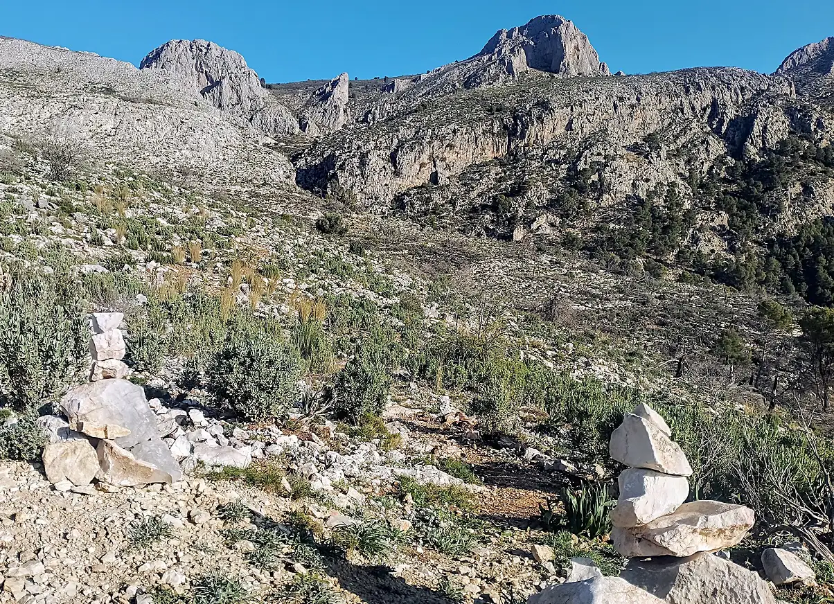
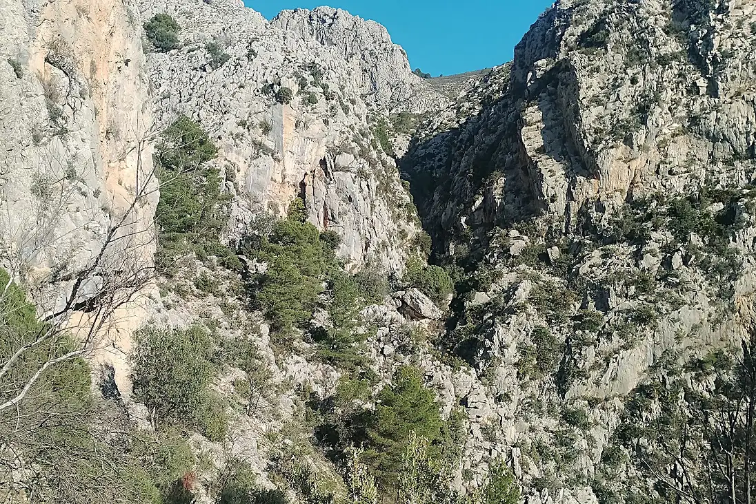
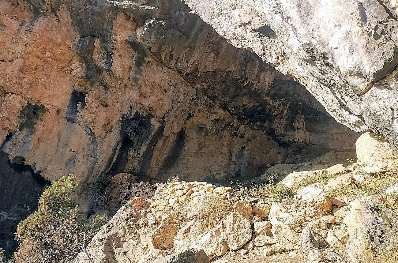
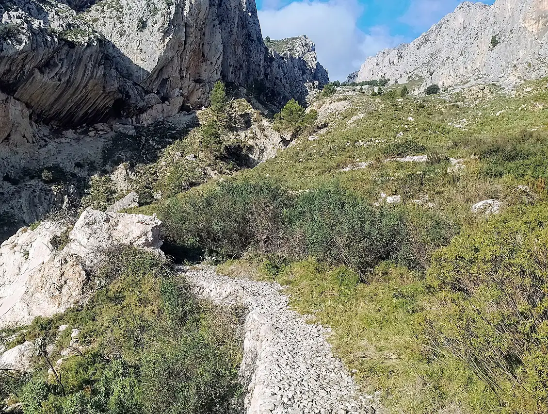
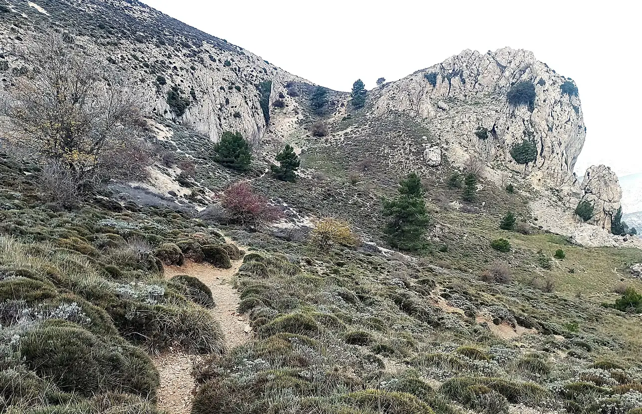
After a couple of tight bends, pass another tumble-down property. The road turns into a track at a sharp bend. Continue to ascend, round the dogleg bend – and 30 metres further on, turn right off the track onto a path at two small cairns, which are easy to miss. The path heads across the slope. This area was damaged by a wildfire several years ago. It is recovering but the authorities have failed to remove some trees which have collapsed and may block the path in some areas, and have to be skirted. The path winds round and then hugs the left of the sheer-sided Barranco de les Coves. The route remains close to the huge looming wall of the ravine on the left. The ‘coves’ (caves) soon appear. Pass the large cave on the left, which was used by shepherds as shelter for their goats and sheep. Still following the side of the ravine, the path swings round to the right. Near the neck of the gorge follow the cairns which lead out on the right-hand side. Out of Coves, emerge at the bottom of the magnificent Barranco de la Canal.
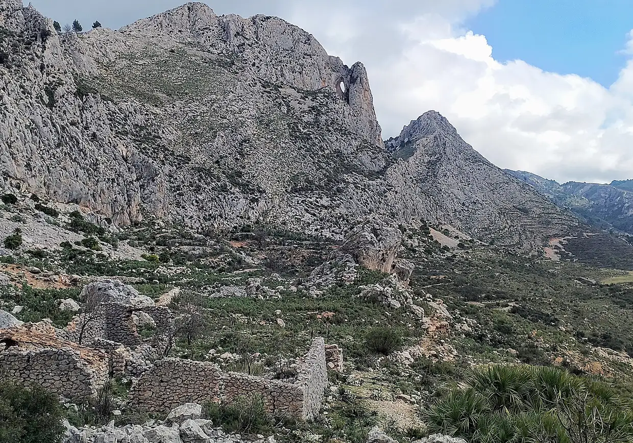
Take care with orientation. The path goes straight on then bears to the left, crossing an old terrace that used to be farmed many years ago. There are cairns to help as the path moves towards the centre of the ravine to arrive at a tumbledown farmstead – only the walls have survived. Pass on the left of the building and continue to ascend.
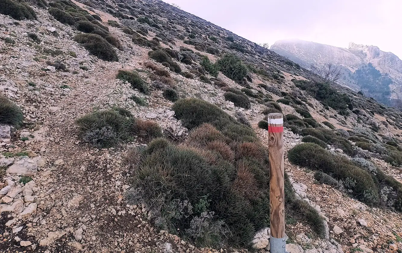
The path goes up the centre of the ravine. It passes through a clump of pine trees, before ascending a short, steep bank. About half way up the ravine it joins the GR-330 long-distance footpath and white/red waymarks appear, helping with orientation. Take note; you will have to remember to leave the GR at the same point on the way back down.
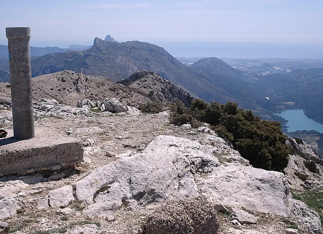
The path continues up the centre, with ever-improving views eastwards to the sea. At the top of the ravine, emerge at a wonderful high-mountain area. Cross the flat, grassy section. The path drops down slightly, then it’s a short climb to a saddle. Here, a sign tells us that it is less than 0.5km (377 metres to be precise) to reach the summit from this point. The path ascends on the left and there are posts and waymarks to help with orientation as the path crosses the slope and turns left to climb up in a more direct fashion. It emerges at the rounded summit of Mallà del Llop, where there is a trig point and extraordinary views over Guadalest, across to the Sierra de Bèrnia and inland along the ridge to Pico de Serrella (1,323m) which can be reached by following the waymarked path on the GR-330.
Our route returns on the same path to descend the Barranco de la Canal, following the waymarks, turning off the GR-330 at the same point to continue down the centre of the ravine, passing to the right of the farmstead walls and then back into the Coves ravine to descend on the same route back to Beniardá.
If you do this route in the summer you would need to start before dawn to avoid climbing in the heat. Take plenty of water, food, fruit, a hat, sunglasses and sun lotion. This route should only be attempted by experienced mountain walkers as most of the walk is not waymarked and it involves a long climb over terrain which is difficult in places.
Walk facts
Length – approx 20km; time – 6-8hrs; ascent – approx 1,050 metres; getting lost rating – medium/high; difficulty – high; season – spring/autumn/winter; getting there – From La Nucía take the CV-70 road for Guadalest. Drive though Benimantell and then turn off for Beniardá
Recent Comments