Rivers slicing through limestone rock have formed incredible ravines with towering walls in Montanejos. A network of waymarked footpaths in the municipality means these natural phenomena can be explored and enjoyed from different angles. The trails aren’t always easy but the views are reward enough for the effort put in.
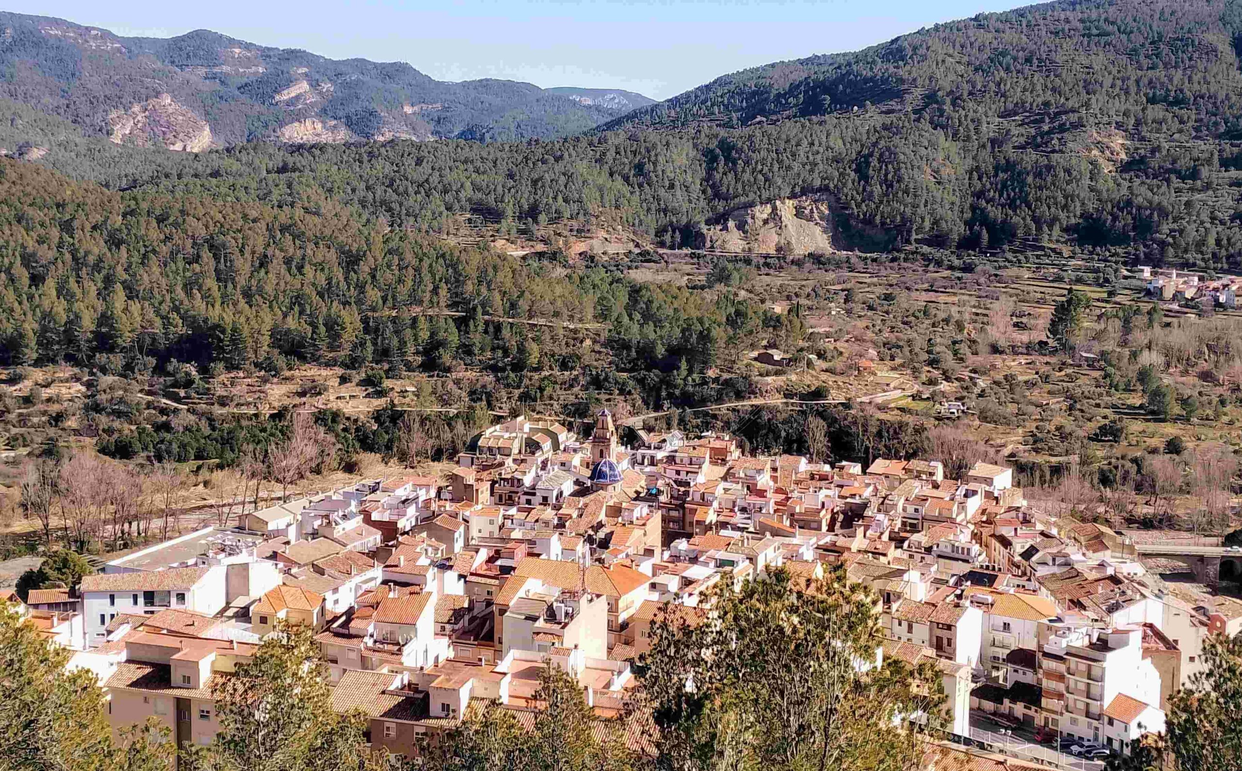
The town sits in a corner of Castellón province, close to the border with Teruel, at an altitude of 470 metres. It is not a great height compared with others in the area, but Montanejos is surrounded by a ring of summits, two of which reach above 900m. Three rivers converge on the town, ensuring water is never far away.
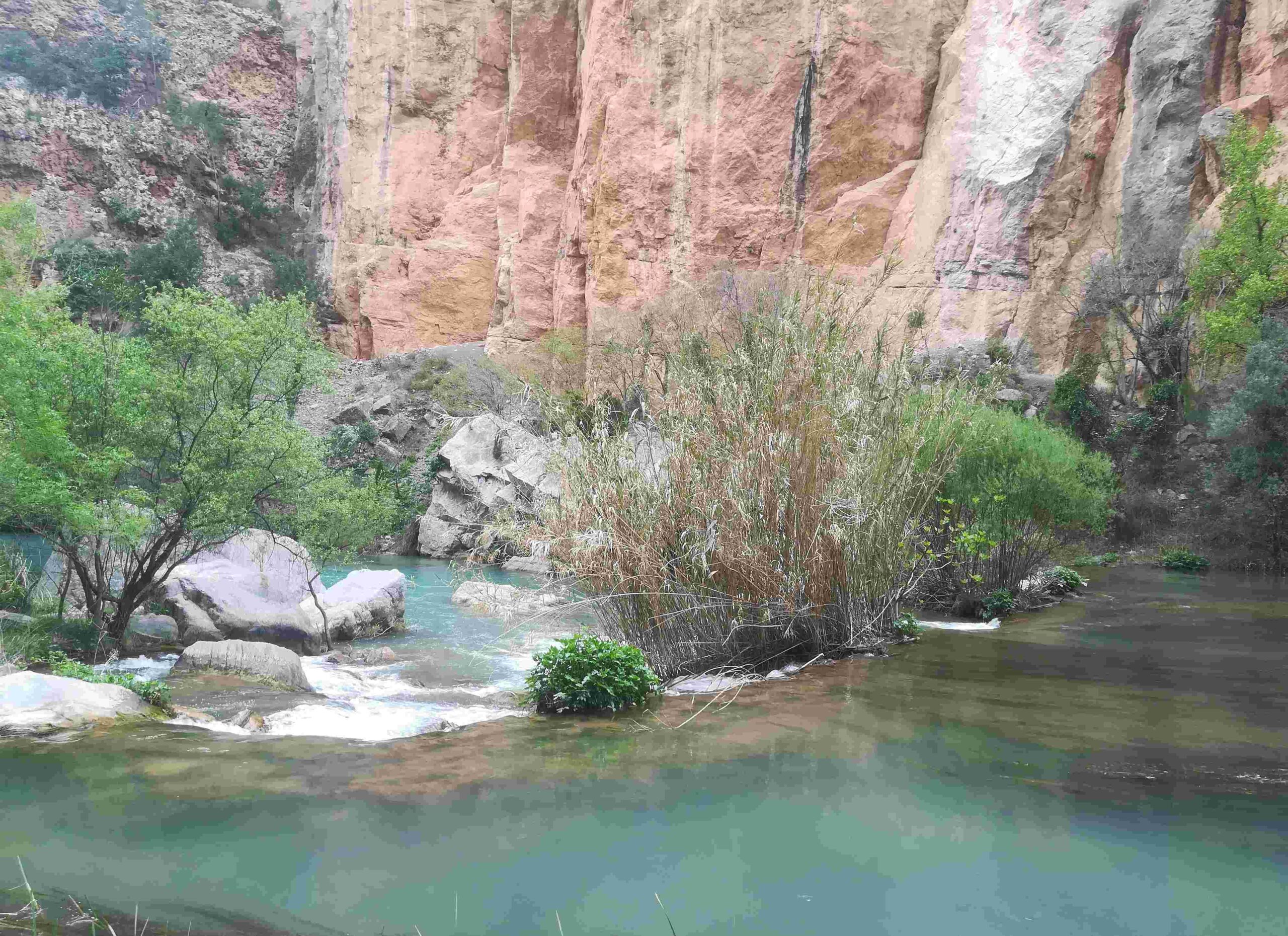
And it is water which has made a name for Montanejos. A hot spring turns part of the River Mijares into a popular location for therapeutic bathing; there are also spa facilities at several spots in the town. The tourism publicity for Montanejos promotes it as a ‘villa termal’; the Oxford dictionary explains that a ‘thermal’ spring is one that produces ‘naturally hot water’. Signs by the river state that the temperature is 25°C. Having tested the water, I would say this is slightly ambitious. But it was a February day when I ventured in, so maybe my senses were affected by external factors.
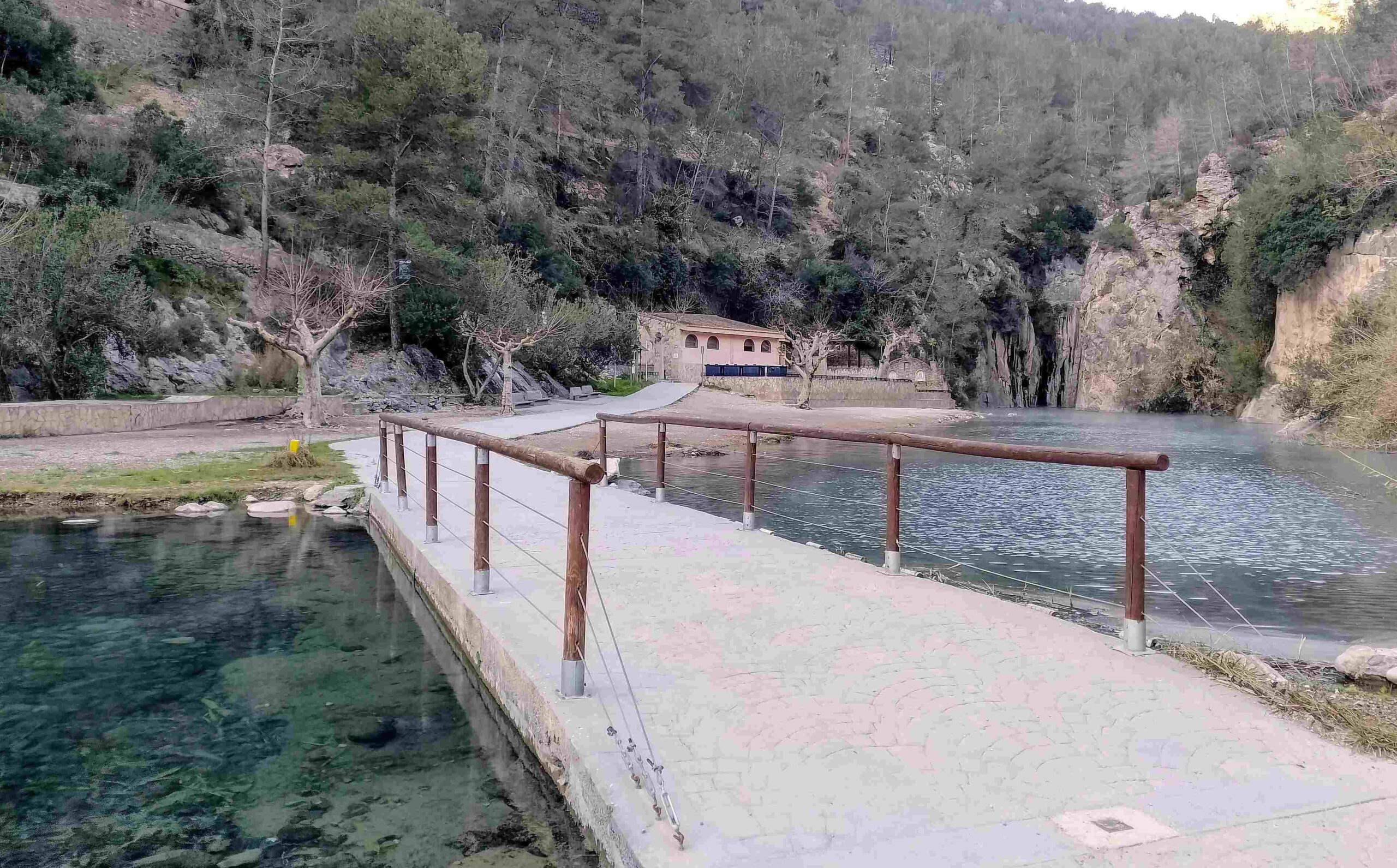
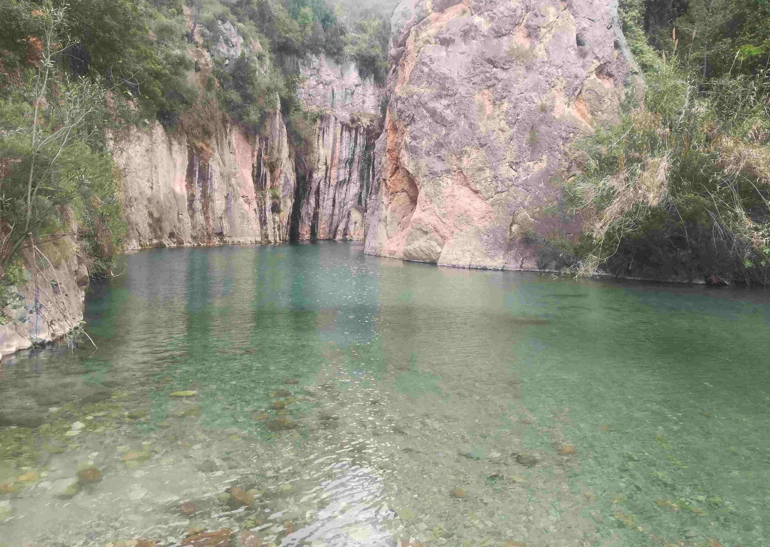
Warmth aside, it is certainly a very beautiful setting, with the hot spring emptying into the river just after it emerges from a ravine. The deep, aquamarine area at a bend in the waterway is extremely inviting and a source of great publicity photos for the local tourism office.
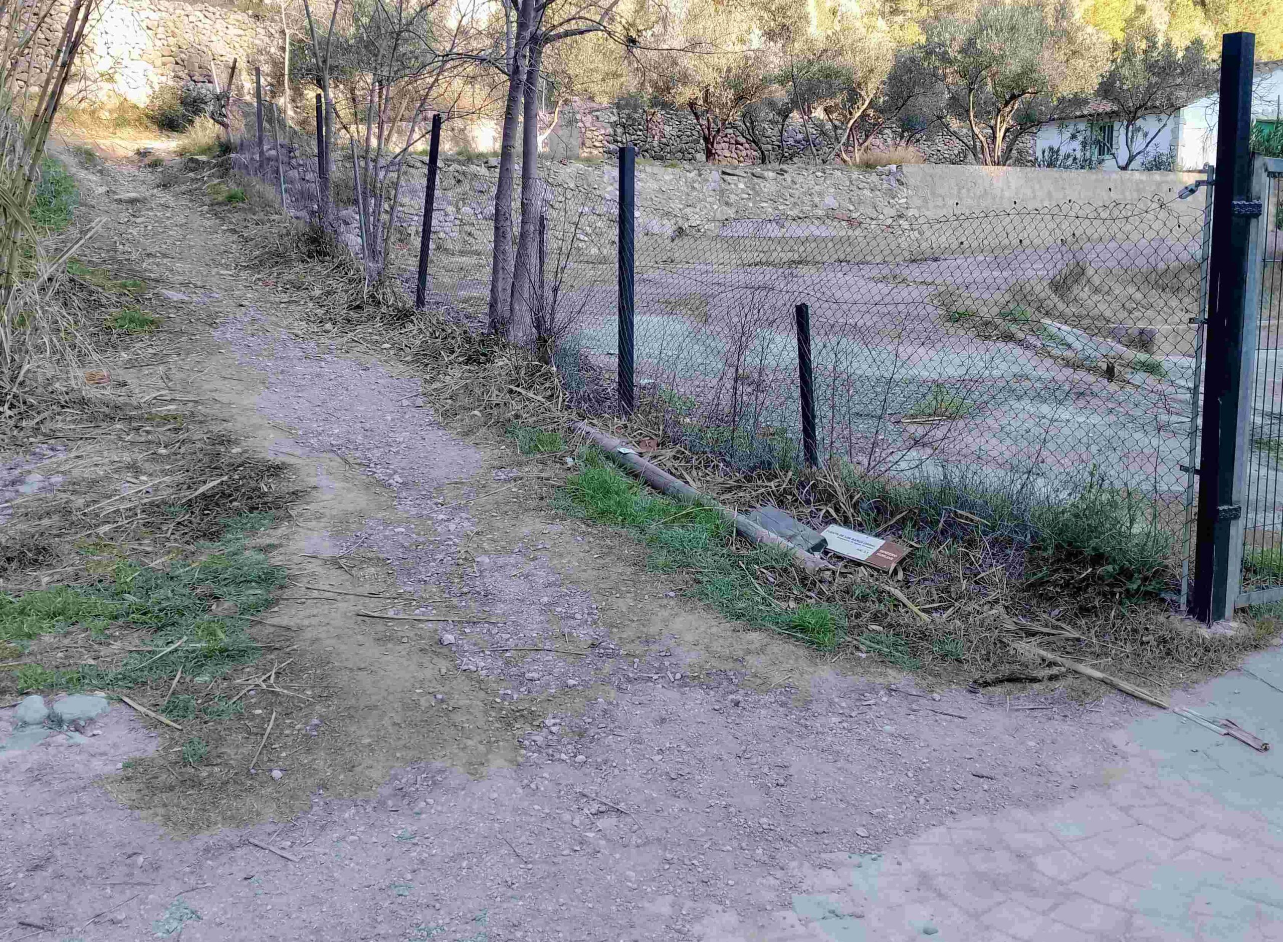
This point on the river can also be visited as part of one of the walks. And while hiking would not be in the thoughts of many visitors to Montanejos, the town hall has done its best to make sure its an activity which can be enjoyed. They publish a handy leaflet containing information on nine waymarked walks, all starting from a spot designated as the ‘meeting point’ (written in English). It has a map on the back with all the routes marked on it. Many hotels and accommodation outlets have copies of the ‘plano senderos’ to give away and the leaflet is available from the tourism office at Avenida Fuente de los Baños, 10.
Almost all of the walks require some climbing, but that it is to be expected in such a location. Other waymarked routes include the GR-7 long-distance footpath which arrives from Montán and leaves for San Vicente; and the GR-36 which forms part of the Ruta de las Fuentes (natural springs route).
Montanejos has a variety of accommodation options and many of these can be viewed via booking.com. Two places that I have enjoyed staying in are the reasonably-priced Campuebla self-catering apartments at www.campuebla.es and Hotel Xauen which has spa facilities and can be found at https://hotelxauen.com/
It can get very hot in Montanejos in the summer (and very busy) so the best times of the year to visit are spring, autumn and winter.
The shortest of the footpaths is the Sendero Familar, which goes to the hot spring and into the river gorge.
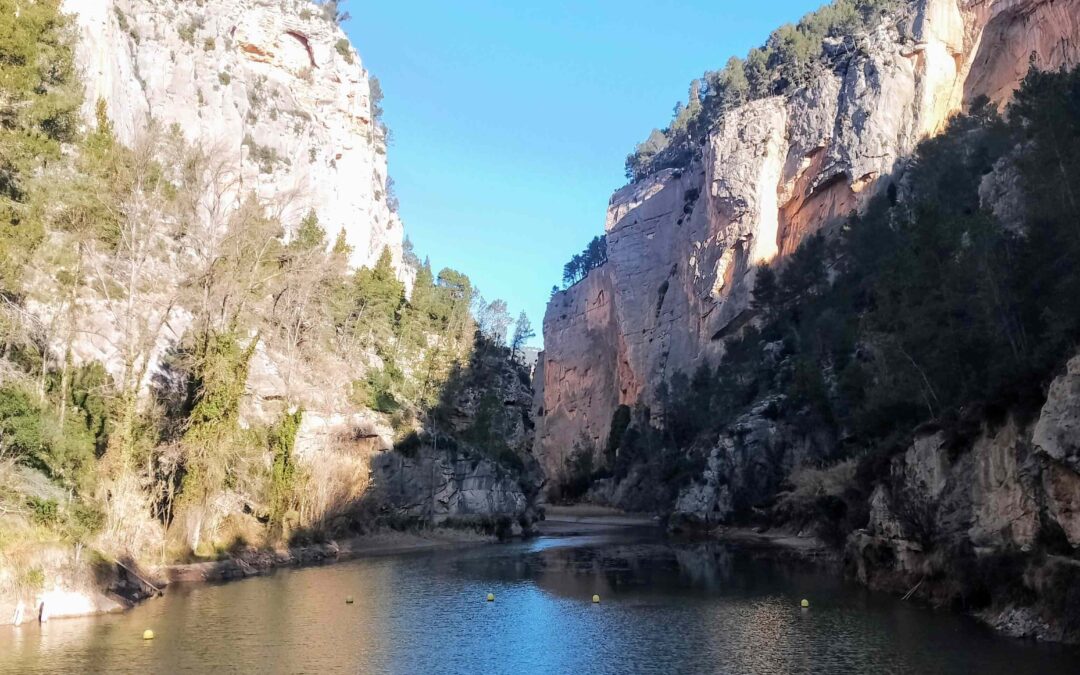
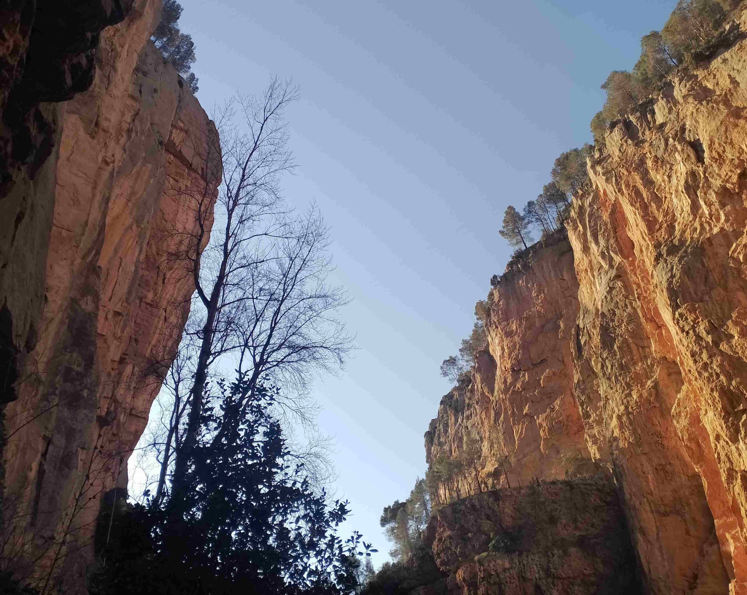
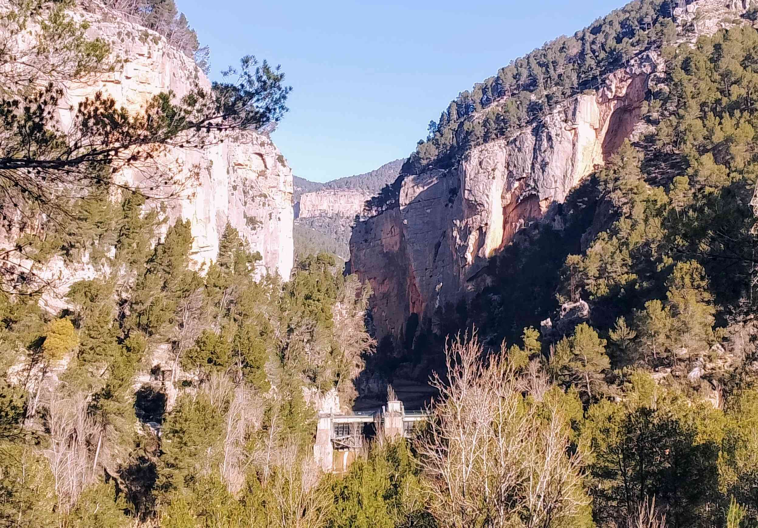
Nearing the narrows
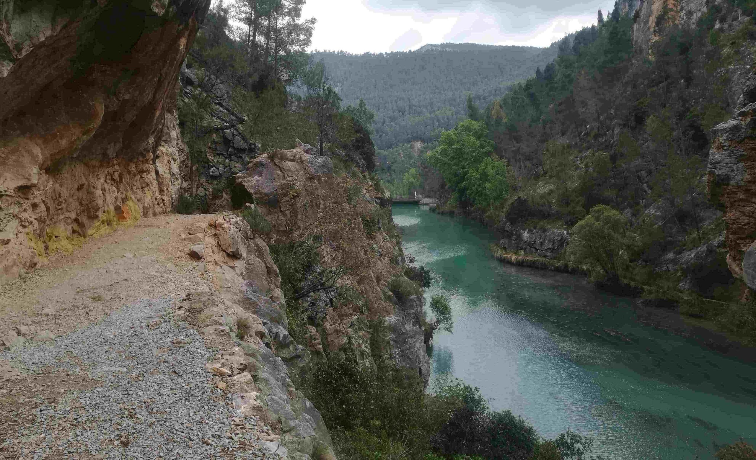
The ‘Sendero Familiar’ heads to the Fuente de los Baños (the name given to the hot spring) and takes in part of the Mijares river gorge, close to the bathing area. It also gives walkers the chance to enter ‘the narrows’; the Estrechos de Chillapájaros. This is a point where the towering cliffs close in and the river runs through a spectacular sheer-sided ravine. Signs make it clear that people enter this area at their own risk as stones and rocks can fall from above.
The basic walk, according to the town hall, measures 4.2km with 200 metres of ascent. It follows white/brown waymarks and doesn’t include the narrows.
The route starts from the meeting point, which is on Carretera de Tales just before the bridge over the Maimona river. Cross the bridge and bear right to traverse the Puente Nuevo (new bridge) over the River Mijares, then bear left to walk down to the Polideportivo sports area. Pass to the left of the sports courts to join the wide, paved walkway. At the walkway, bear right to follow the Mijares up to the hot spring.
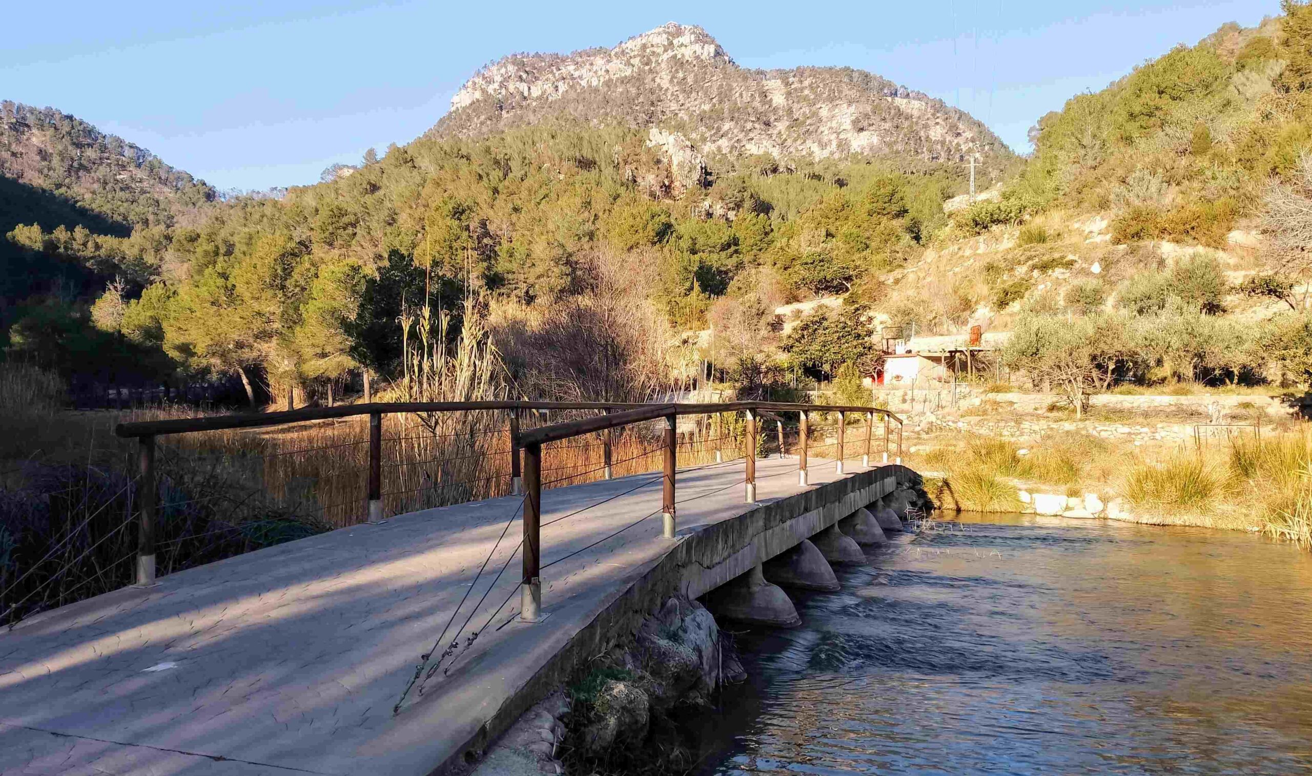
It’s pleasant, easy walking on a flat surface that could be used by people with restricted mobility; it allows people of all abilities to walk to Fuente de los Baños. Here the river ‘gorge’ is wide and the route passes over two footbridges which give great views along the waterway.
Approaching Fuente de los Baños, just before another footbridge that leads to the bathing area, notice the footpath on the right, which the route taken by the Sendero Familiar. Before leaving the river, most people will want to walk the short distance to the bathing area to test the water and maybe have a swim. The town hall website states that ‘during the busiest times, in order to keep the area in optimum condition, a ticket system is brought into operation to visit the Fuente de los Baños’. They explain that tickets can purchased on their website www.visitmontanejos.com and from booths at the access points. This system has not been in operation when I have visited outside the busy summer season.
After enjoying the hot spring, walk back over the bridge, with the turning around 30 metres along the walkway. Head up the waymarked track which turns into a path, passing some olive trees. The path bears left to go up the hillside, passing a narrow irrigation channel. In late winter the hillside is full of sweet-smelling rosemary.
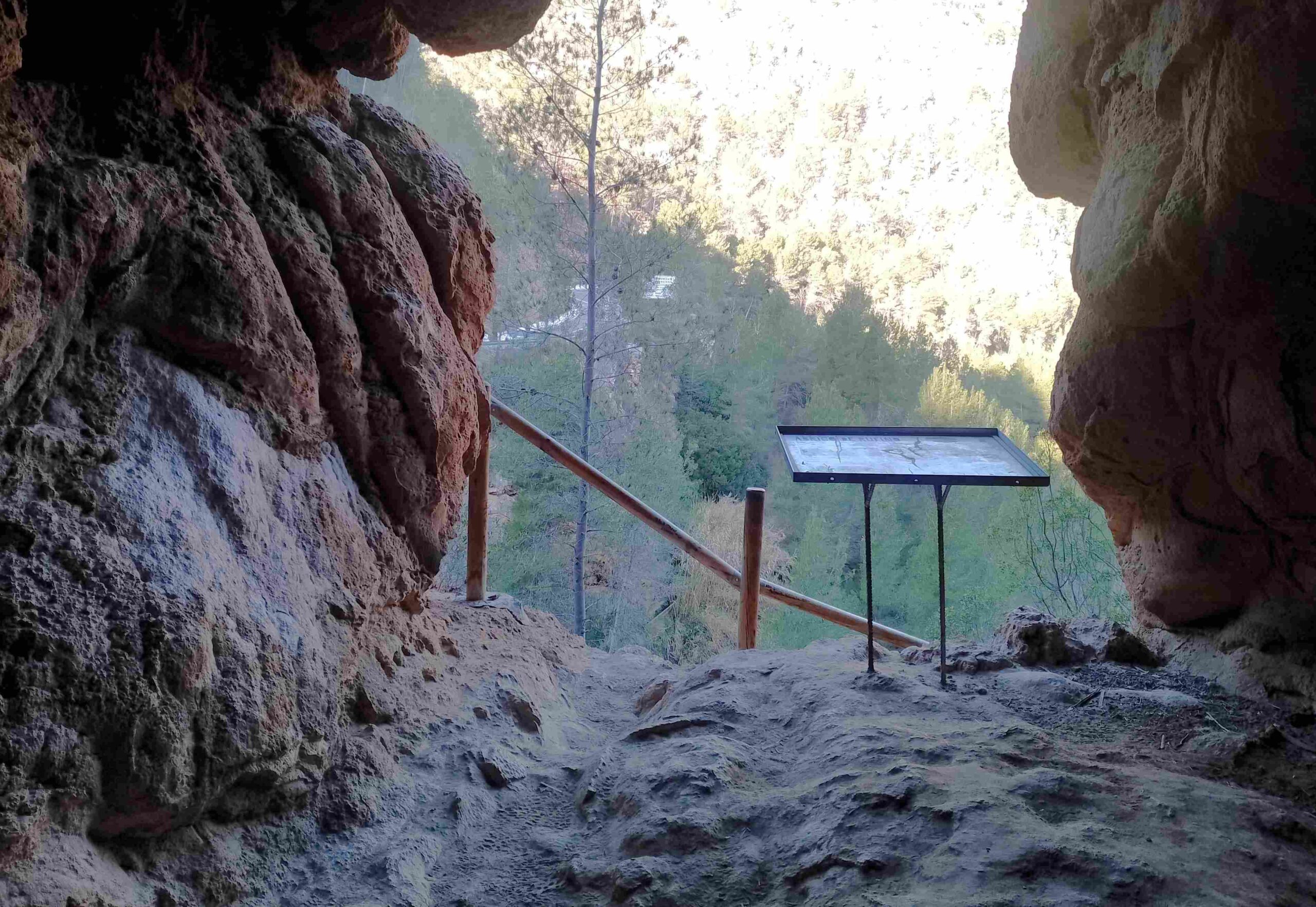
The path reaches a rise and passes over; at this point there is a left turn for the Abrigo de Rufina, which is a limestone cave. It’s a very short distance to reach it and worth a look. Care has to be taken, it’s high above the river, although there is a safety railing and wall. An information board states that in the past it was used to house livestock, principally sheep. Inside, there are wonderful rock formations created by rainwater entering the cave.
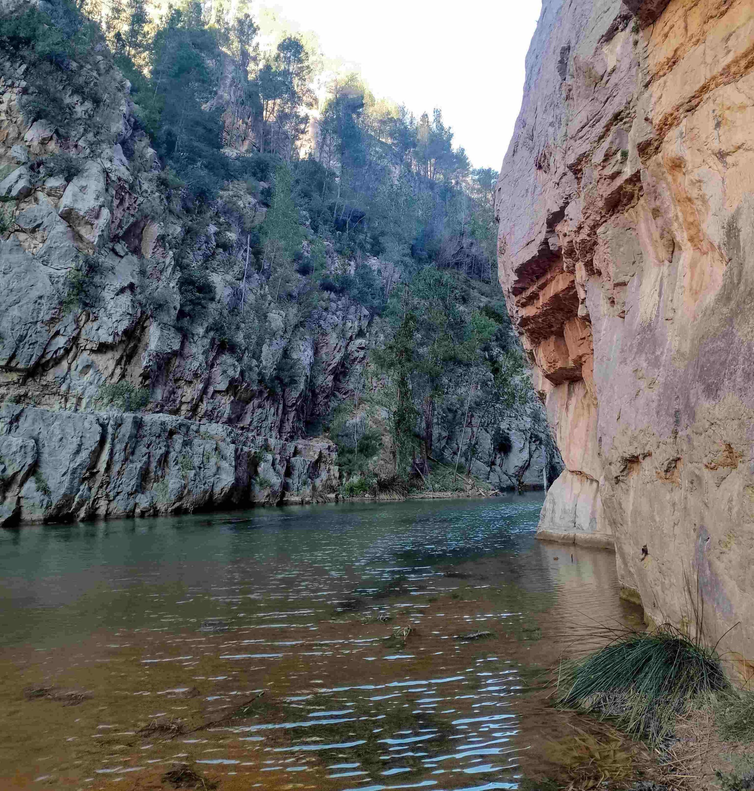
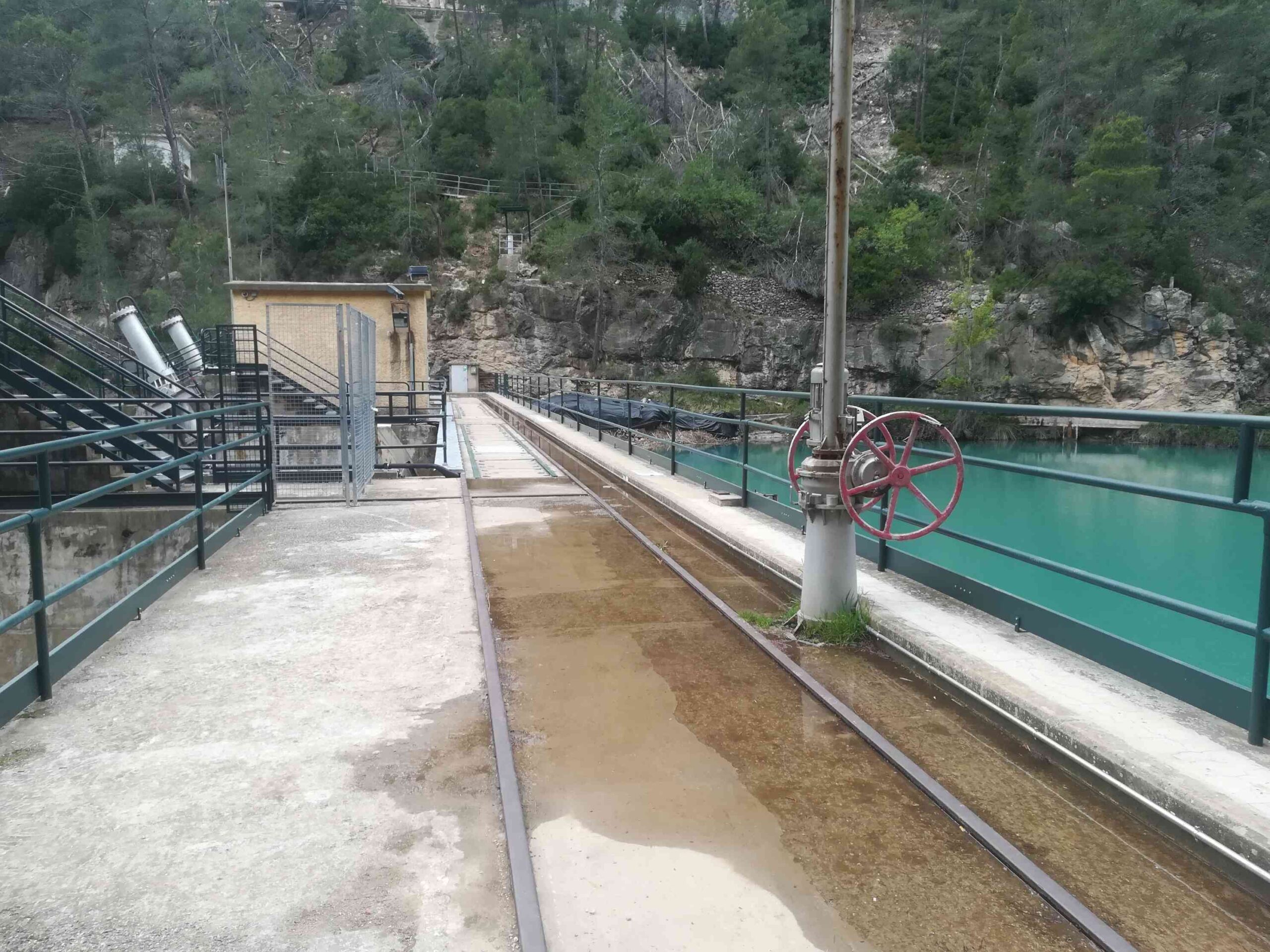
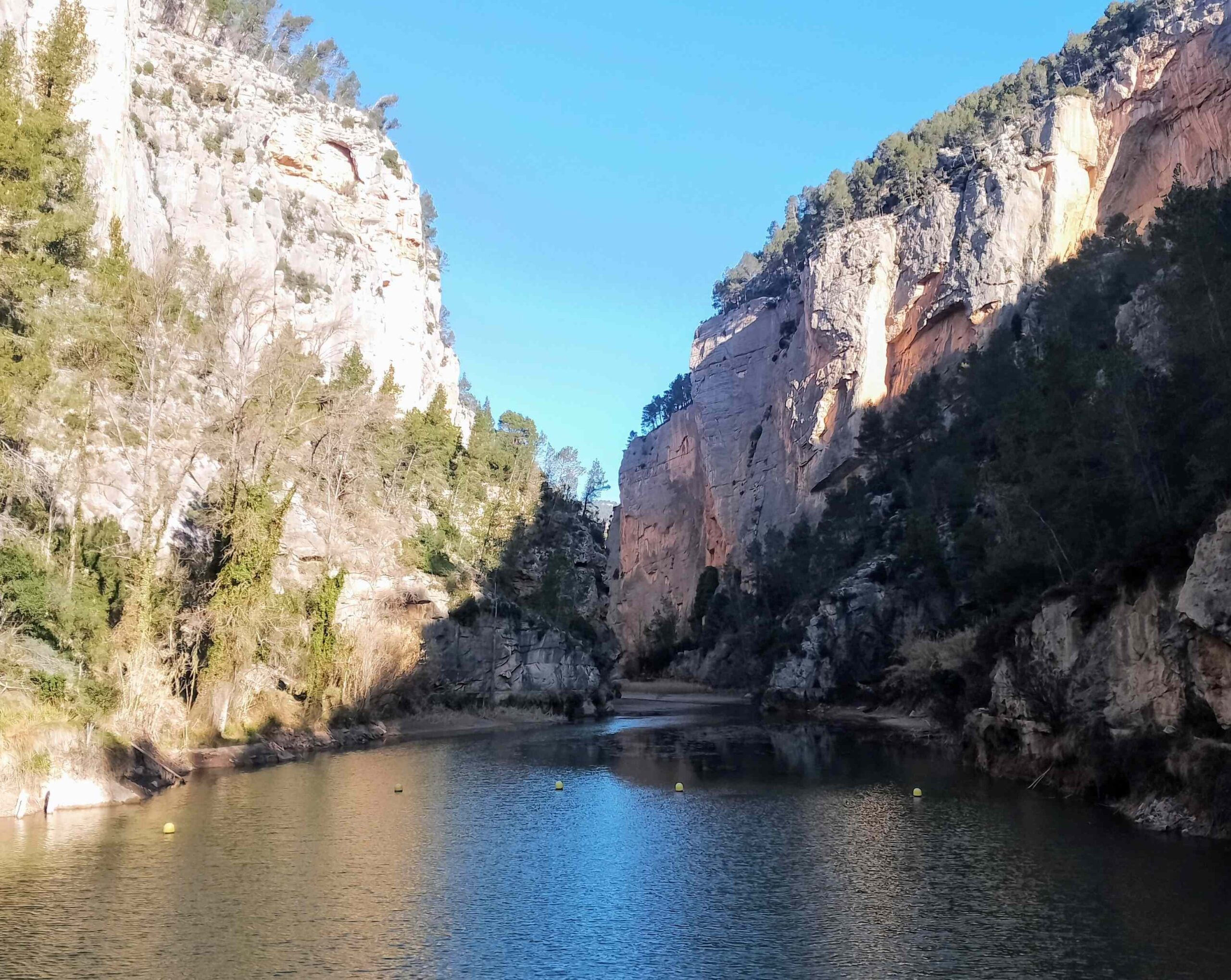
Back on the path, the route drops down to the river. It’s a pleasant walk along the right bank. After rain there may be a short muddy section. The path emerges at the Cirat dam, which is a bit of monstrosity in this idyllic natural setting. The dam has to be crossed but before that walkers can continue along the path into the narrows; the Estrechos de Chillapájaros (‘estrechos’ are narrows, ‘chilla pájaro’ is a bird screech). The name comes from the echoes produced when birdcall rings out in the gorge.
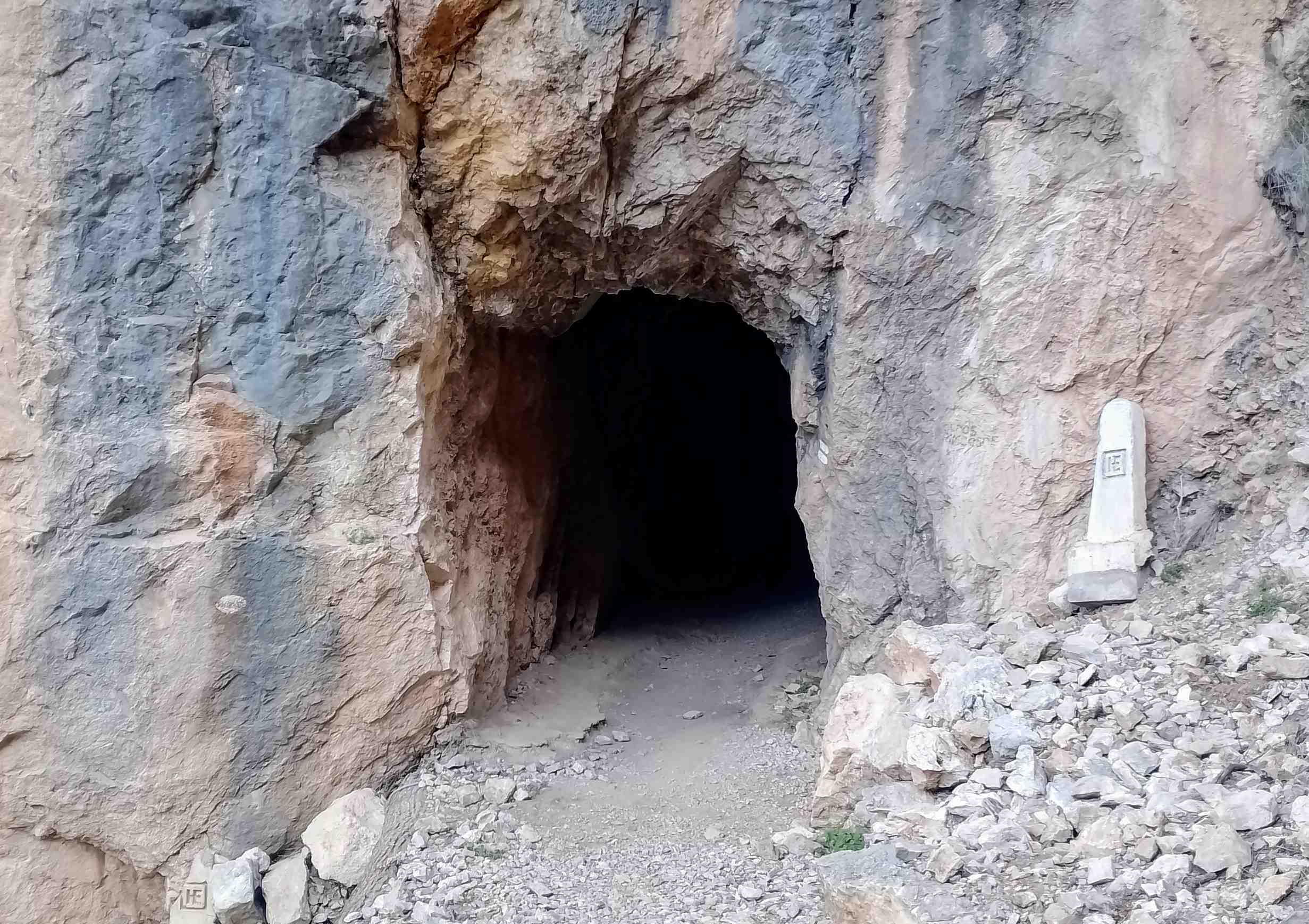
However, note that the sign says that rockfall from above is possible, which people have to take into account if they want to use the footpath. It takes around 10 minutes to walk one-way. To start this section, head through the gate and walk along the path on the right-hand side of the gorge. There is a short tunnel to pass through. A torch isn’t needed as there is light at the other end, but some people may prefer to use one.
The path reaches the narrows area, where spectacular cliffs rise up from the riverbed. Openings can be seen in the rock above, where a road passes through tunnels to the Arenoso reservoir. The route drops down to the river and no further progress can be made; enjoy the views before heading back on the same path.
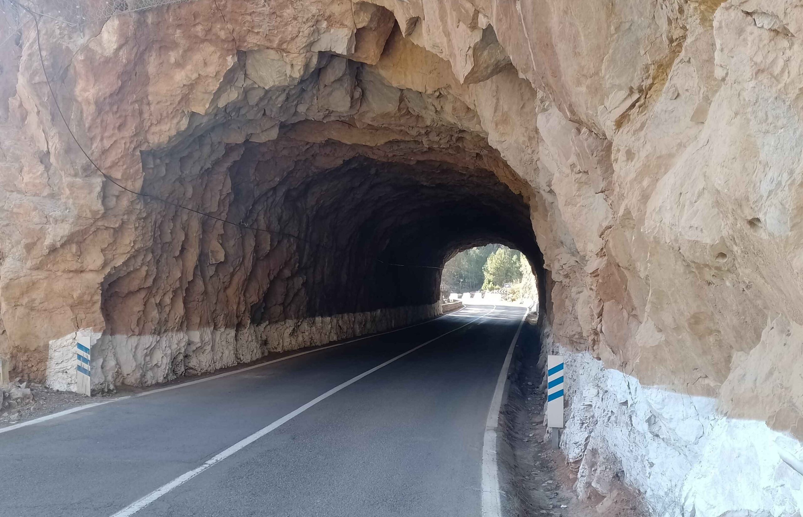
Back at the dam, walk across it; then follow the waymarks which lead up the concrete walkway, ascending to the road. Bear left at the road. Unfortunately there is no alternative but to walk through the short road tunnel. It is only around 40 metres long and outside the busy tourism season there is very little traffic.
After passing through the tunnel, the walker has options. A short way along the road there is a sign on the right, where the Sendero Familar climbs into the pine trees to head towards the Cueva Negra (black cave). It is posssible to see the cave. The waymarked route then bears left to head back to Montanejos, eventually descending back down to the road just before the Puente Nuevo bridge. The other option is to walk back to the town along the road.
Bear in mind that the 4.2km distance for the route does not include ‘the narrows’; add an extra kilometre for this section.

Recent Comments