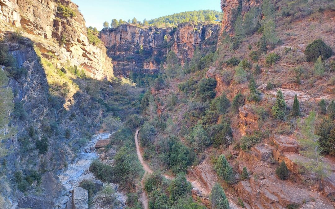
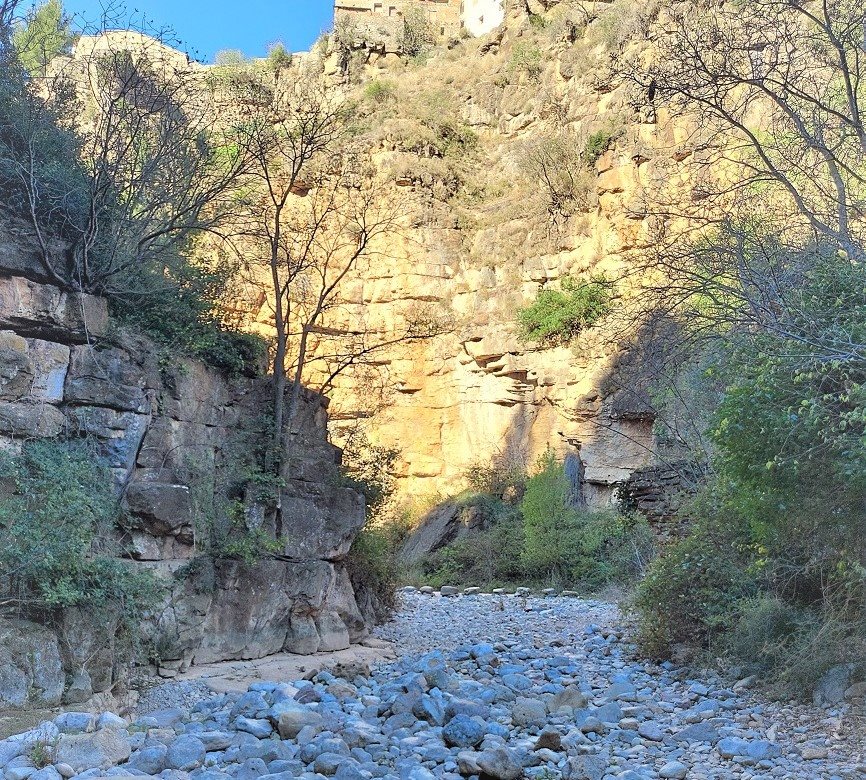
This short walk takes in the spectacular ravine forged by the River Carbo, which passes the eastern edge of Villahermosa del Río, with the whitewashed houses standing above, along the cliffs. There is no real difficulty to the route, but walkers should be aware that they are walking along – and sometimes in – a riverbed which is often dry but can be swollen by heavy rain and become a torrent. It’s a limestone area and parts of the river flow underground, with this rock formation also responsible for the towering walls which rise out of the ravine floor.
Orientation around Villahermosa del Río is fairly easy due its size and location – and helpfully the tourism office in the church square (at the highpoint of the village) has a couple of maps on its exterior walls which point out where the walking routes start from. It is wise to have a good peruse of the maps and get yourself ‘orientated’ before undertaking anything more strenuous.
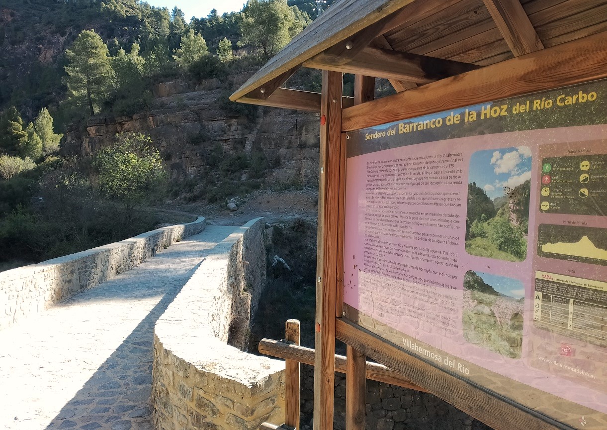
The wonderful ravine is called the Barranco de la Hoz, with a walk information board at the bridge telling us that the route is 3.8km long, with 100 metres of ascent. They advise ‘dedicating a few minutes to observing the fanciful shapes created by water and wind erosion on the rocks on both flanks of the river’. This is sound advice.
On the way to the ravine, we can see how the slopes of the village have been turned into allotments by villagers and all sorts of produce can be viewed – from potatoes to olive trees. Information boards also note that walkers should be on the look-out for the ‘great diversity of botanical species’ which inhabit the ravine and also the sure-footed ibex that accomplish seemingly-impossible feats of climbing.
The route
I found that it was easiest to do the route in reverse to the way suggested. Setting out from the tourism office in Plaza de la Iglesia, this involves descending to Plaza del Ayuntamiento and walking to the bank in the corner; then turning left down Calle Arrabal. Then turn right and left to reach the steep-ish street which leads down to the River Carbo (you can view all this on the map outside the tourist office).
Here the river is crossed by the Puente Romano, which isn’t really a Roman bridge, but is still pretty old and impressive (a ‘puente’ is a bridge). Interestingly (or not, as the case may be) the phenomenon of having ‘puente romano’ that are only several hundred years old also occurs in other villages and towns in Spain. One explanation is that there may have been a Roman bridge there ‘back in the day’ which was brought down and replaced, but kept its name through the ages.
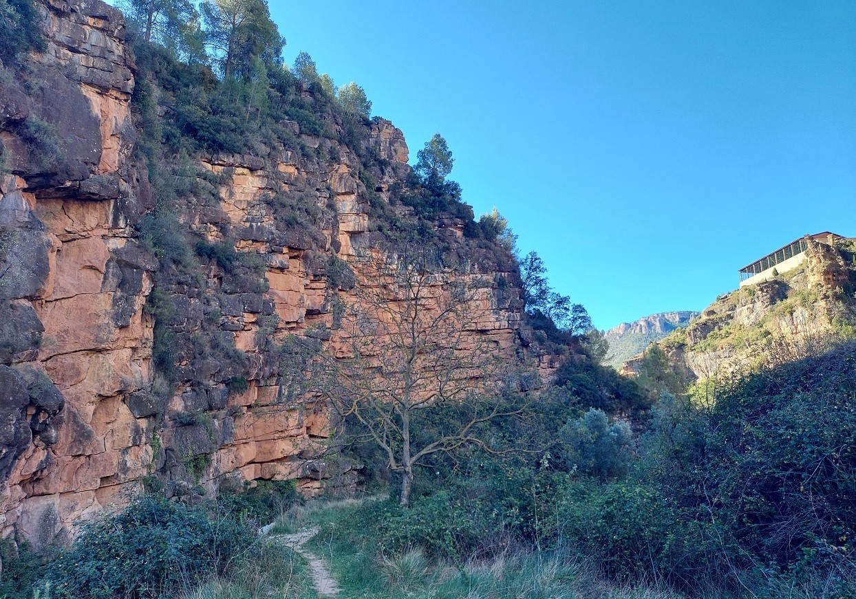
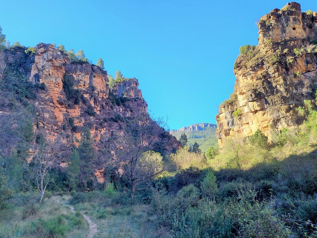
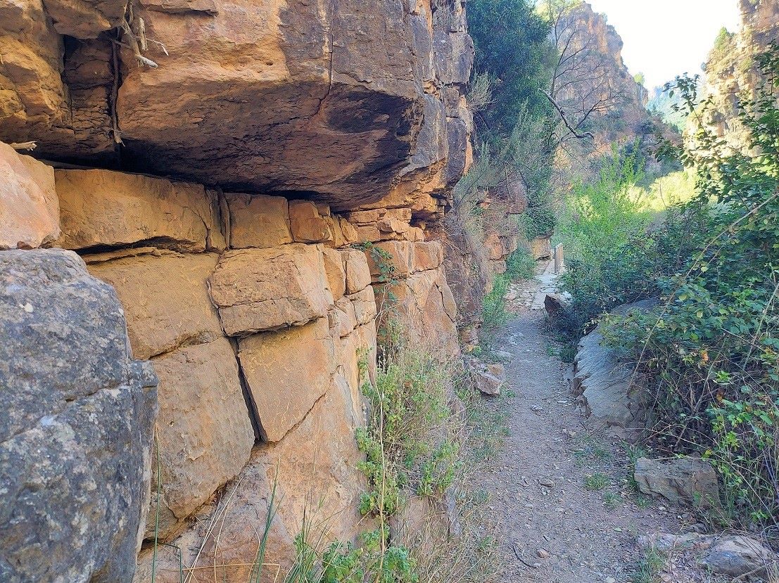
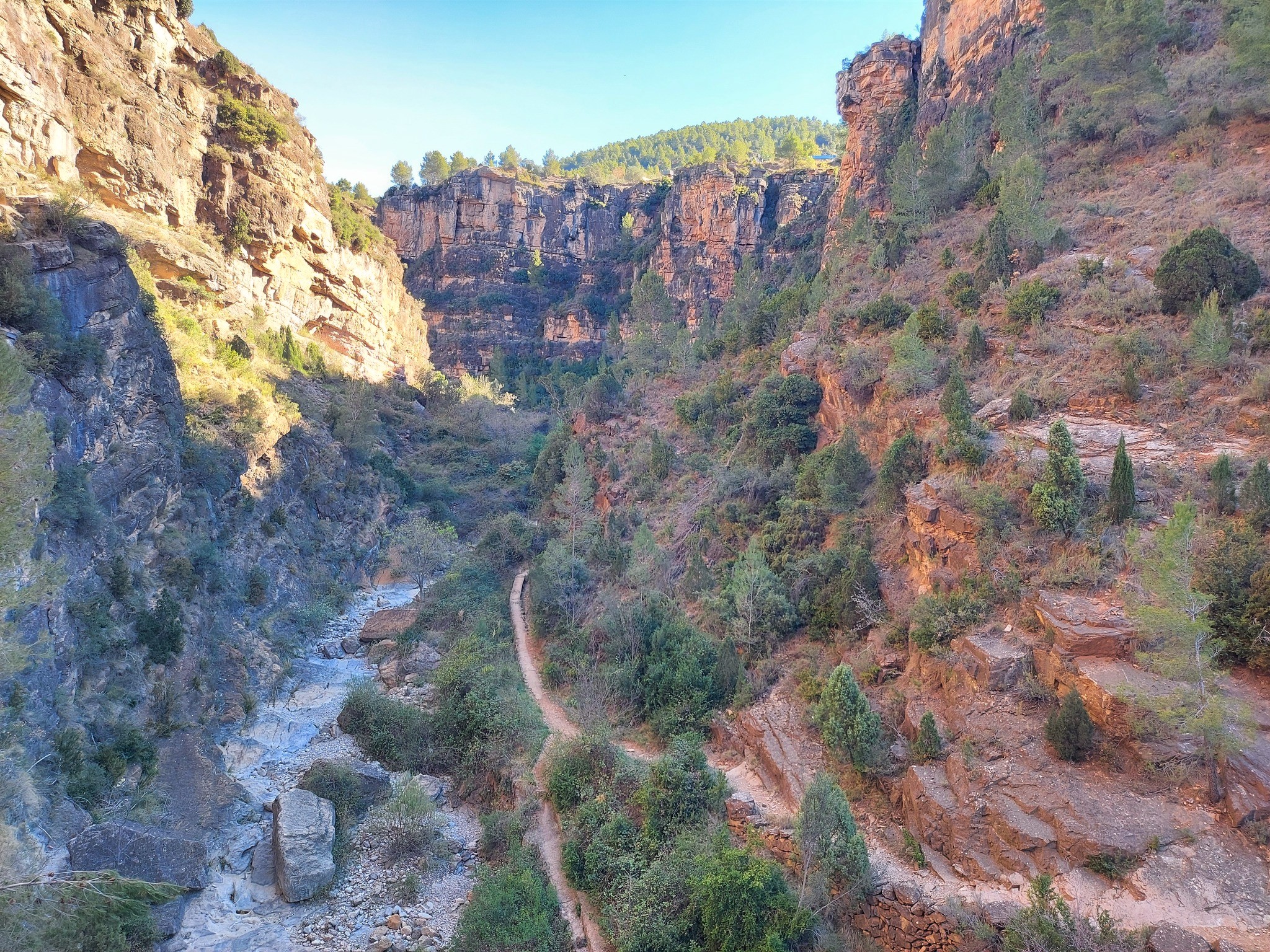
Don’t cross the bridge. Have a gander at the walk information board which stands at its side and turn right to access the path which runs along the right-hand side of the Carbo. The spectacular nature of the ravine is immediately apparent, with rock walls veering up from the riverbed. In places pine trees cling to impossible perches on the rutted limestone cliffs.
After a very short grassy section the path drops into the stony riverbed. Here it is dry, apart from after heavy rain. The route meanders along the right-hand side of the riverbed, then stepping stones cross to the left ‘bank’, giving notice that there is sometimes water about. The towering cliffs are partly coated in vegetation, making the ravine verdant, along with the background colour of sandy brown and reddish rock. Up above, buildings from the village appear on the edge of the precipice.
The path continues along the left-hand side, at times passing under the granite blocks. In the spots where the ravine opens out there are some amazing views of the snaking passageway through the canyon. Information boards appear on the left, noting the points of botanical interest, and also the fauna which lives in the caves and fissures of the ravine.
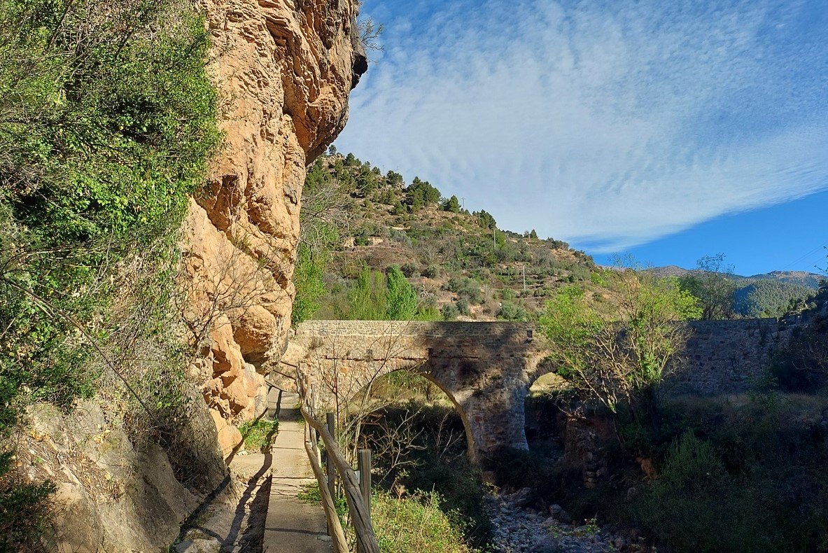
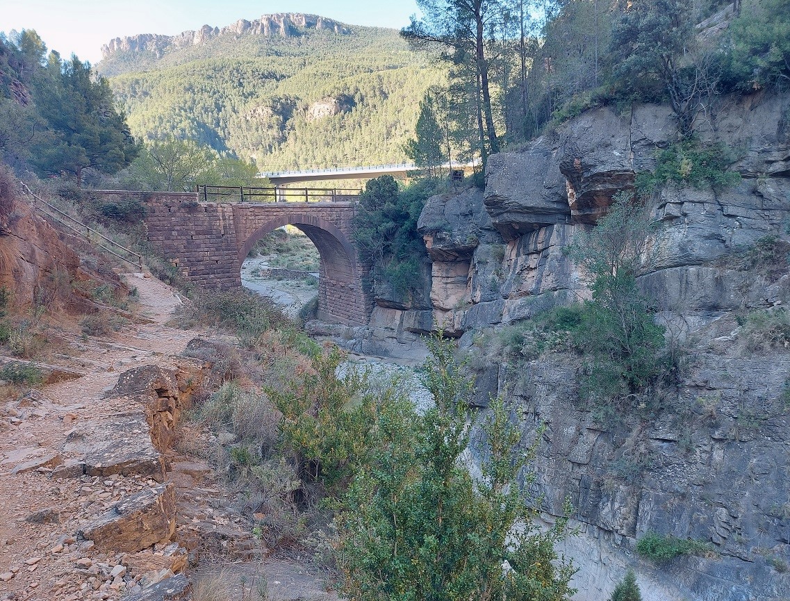
The end of this section of the ravine is signalled by the appearance of another bridge, which is not Roman either. The path leads up to a rural road which crosses the bridge. The ‘puente’ offers a very good view up and down the Barranco de la Hoz – it is worth pausing for a while to take stock.
On the far side of the bridge is the start point of a ‘via ferrata’ called La Muela, which is described on the information board in situ. This is a climbing route up the side of the ravine which should only be attempted by people with ropes, helmets and proper equipment. You may want to take a look at the start of the route, but – be warned. Even here, there are sharp drops from the path into the ravine below, and no handrail to prevent a fall which could be fatal. So take great care if you venture along this path.
At the bridge, there are options. The circular route takes the walker across the bridge and up to the road, where it is a right turn to get back to the village. It’s a short, but not overly inspiring stroll along the road, although the views are very pleasant. The alternative is to retrace your steps from the bridge back along the ravine – seeing this wonderful natural creation from a different angle.
Recent Comments