The ascent to the Plan d’Aiguallut, close to the France border – starting from the very top of the Benasque valley – is walking at its best. The route sets out from the meadow at the Hospital de Benasque, with ‘hospital’ being a place that offered hospitality to travellers in times gone by.
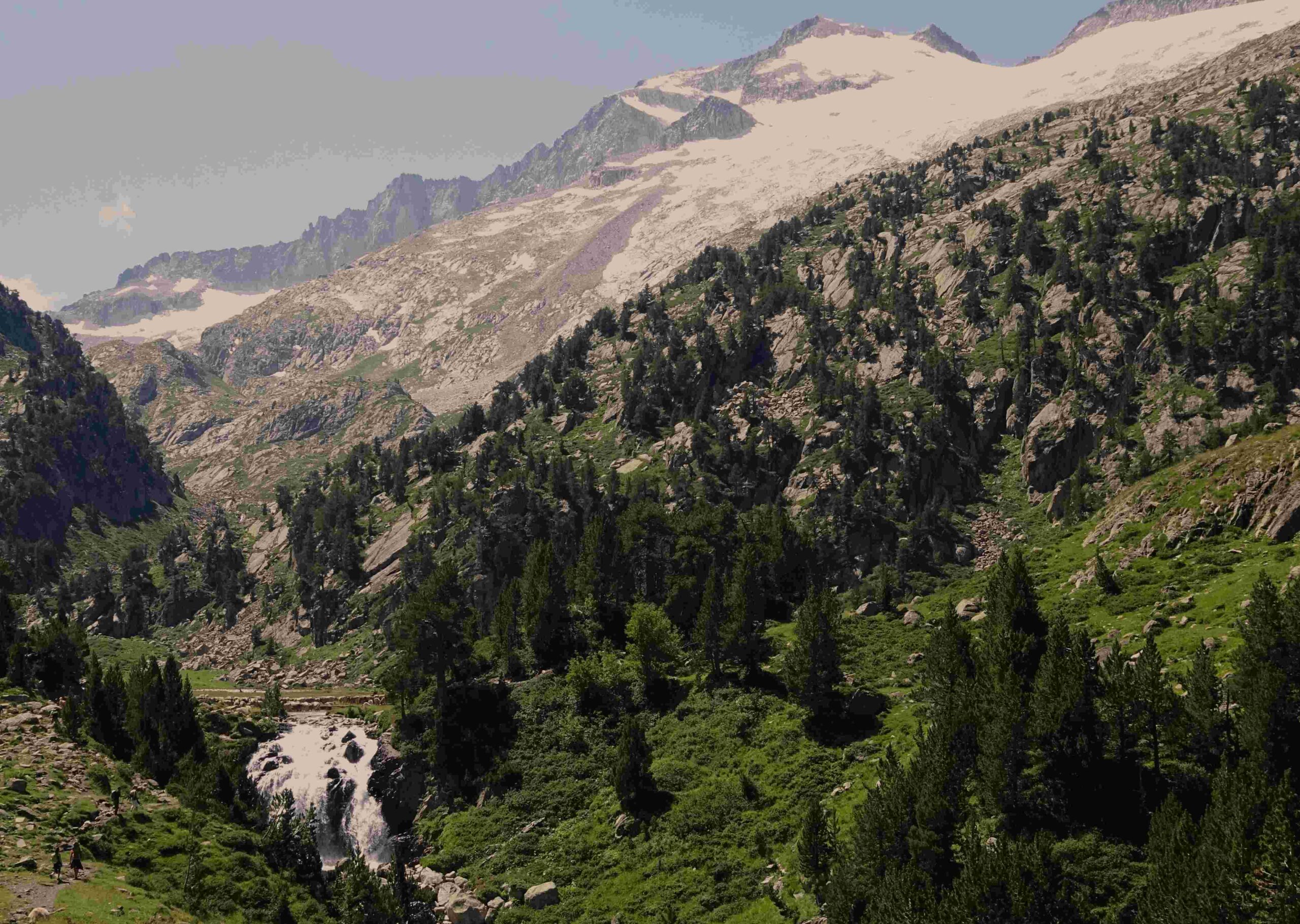
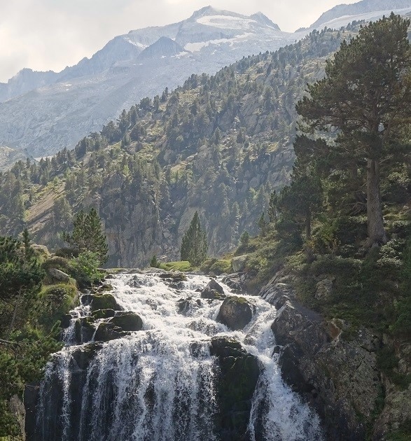
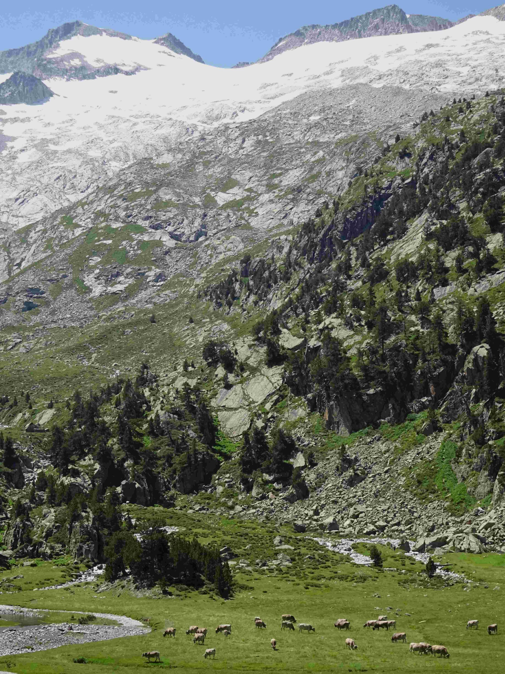
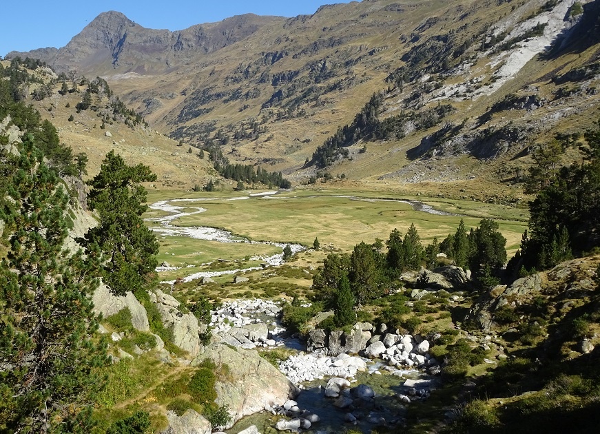
Following the GR-11 offshoot – the GR-11.5 – the path climbs in stages to reach several flat, verdant (or snow covered) meadows. As height is gained, the route arrives at the remarkable gorge at the Forau d’Aiguallut with its waterfall. Then its the Plan d’Aiguallut – a vast flat pastureland standing above 2,000 metres, which is criss-crossed by a wide, meandering stream. Up above is the Mazico de la Maladeta, the magnificent massif which is home to Aneto (3,404m), Pico Maldito (3,350m), Pico de la Maladeta (3,308m) and other giants. While the row of summits more than 1,300 metres above the Plan is mesmerising, the eye is also drawn to the extensive glaciers which contain a large percentage of the glacial ice remaining in the Pyrenees chain, which sadly is disappearing quickly as the planet heats up.
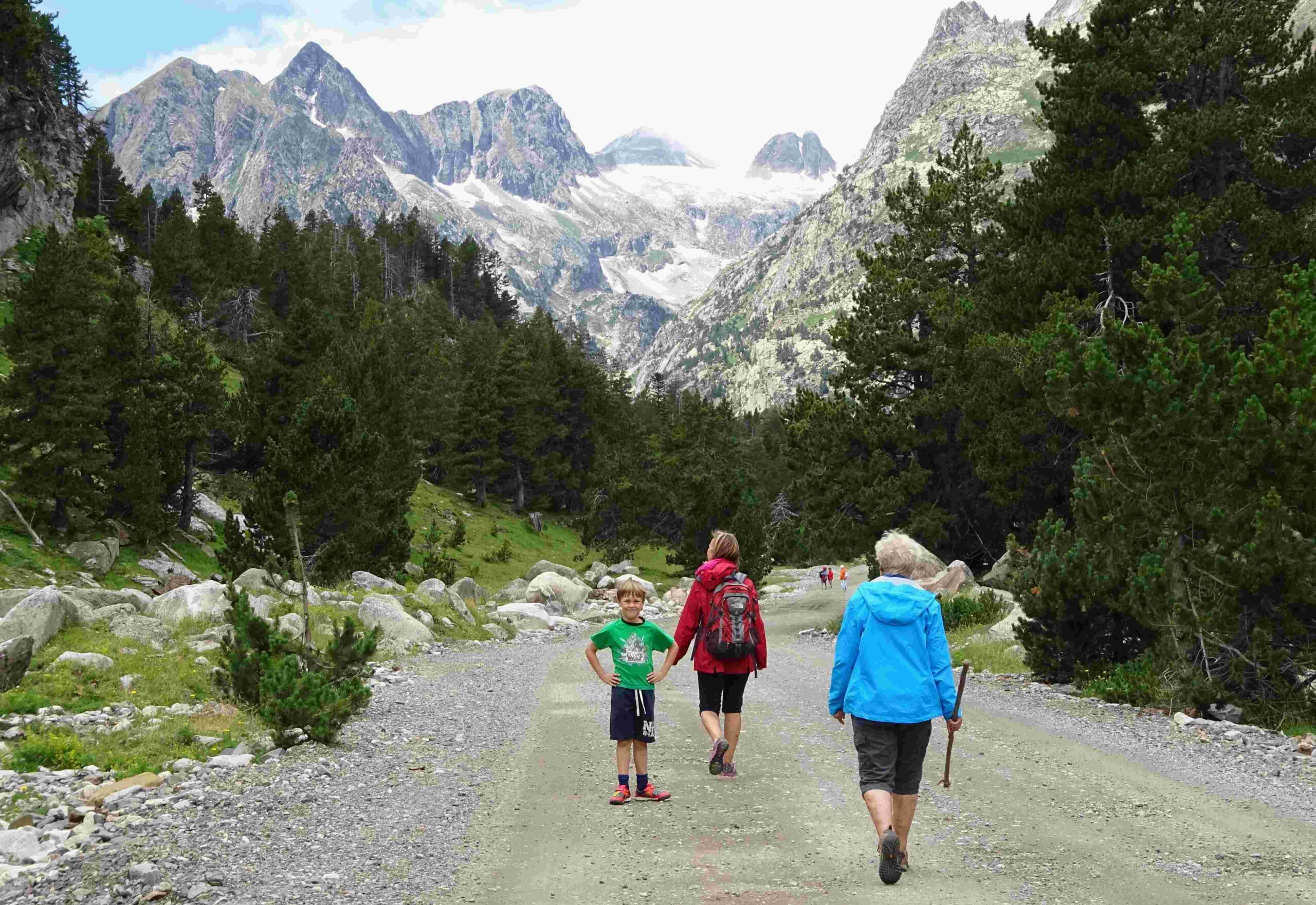
To get to Llanos del Hospital, drive out of the back of Benasque on the A-139, past the campsite, turning off on the last available right turn before the road ends. The narrow road continues on to a large public car park. In the summer there is an option to take the mountain bus from the car park up the lane to La Besurta, which runs approximately every 45mins (usually end of June to mid September). By starting at La Besurta (1,920m) there are possibilities of getting up very high. The basic route from La Besurta is a short one, within the grasp of most walkers as it’s 2km one way to the Aiguallut waterfall with an ascent of around 150 metres.
The route
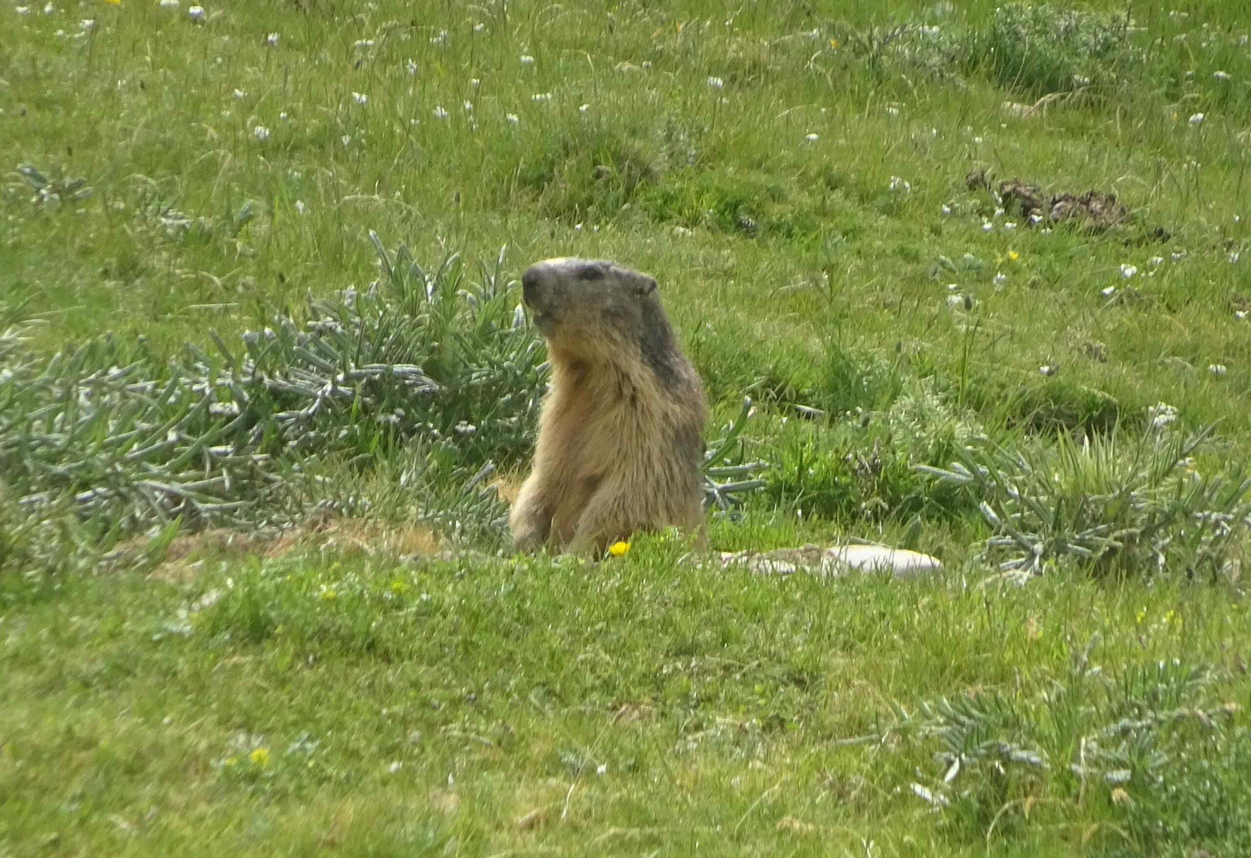
Set out from the car park which is just short of the Hospital, the highest point that can be reached by car in the valley at 1,750 metres. Following the red/white waymarks of the GR-11.5, cross the Llanos del Hospital flats, never far from the nascent River Ésera. The path climbs through the pines, then crosses the Plan d’Estañ (with a ‘plan’, also written as ‘pllan’, being a high, flat area – usually of pastureland). Here marmots abound and there is a good chance of seeing this adorable ground squirrel.
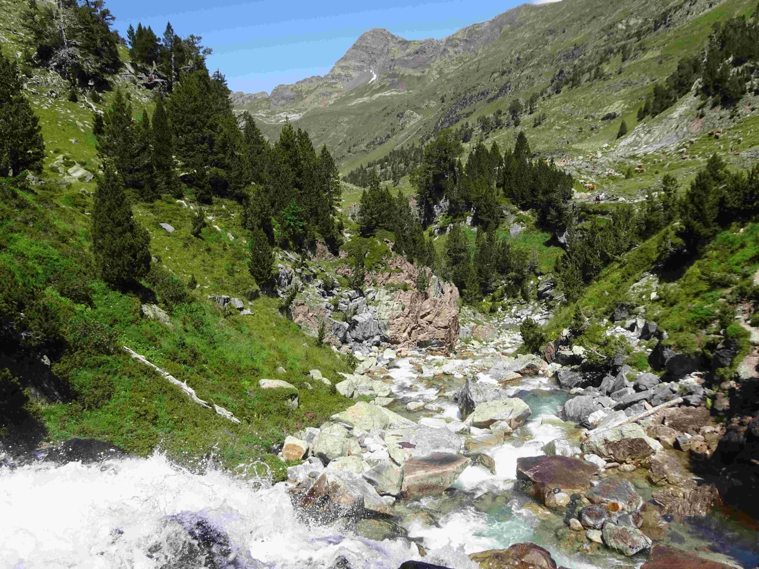
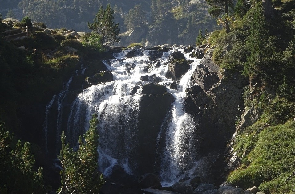
On the far side, take the waymarked ascent to La Besurta; and from this picnic area follow the signs for Aiguallut. At a fork bear left and ascend on the path. It emerges at the Forau d’Aiguallut – a beautiful verdant area in summer, scored with shallow ravines which mark the source of the Ésera. Straight ahead is a remarkable gorge, sculpted by torrents of snowmelt and storm water. However, it’s a picture of tranquillity on a summer’s day. At the head of the short gorge is the Aiguallut waterfall (cascada), where the water tumbles onto permeable rock and disappears into caves to run underground.
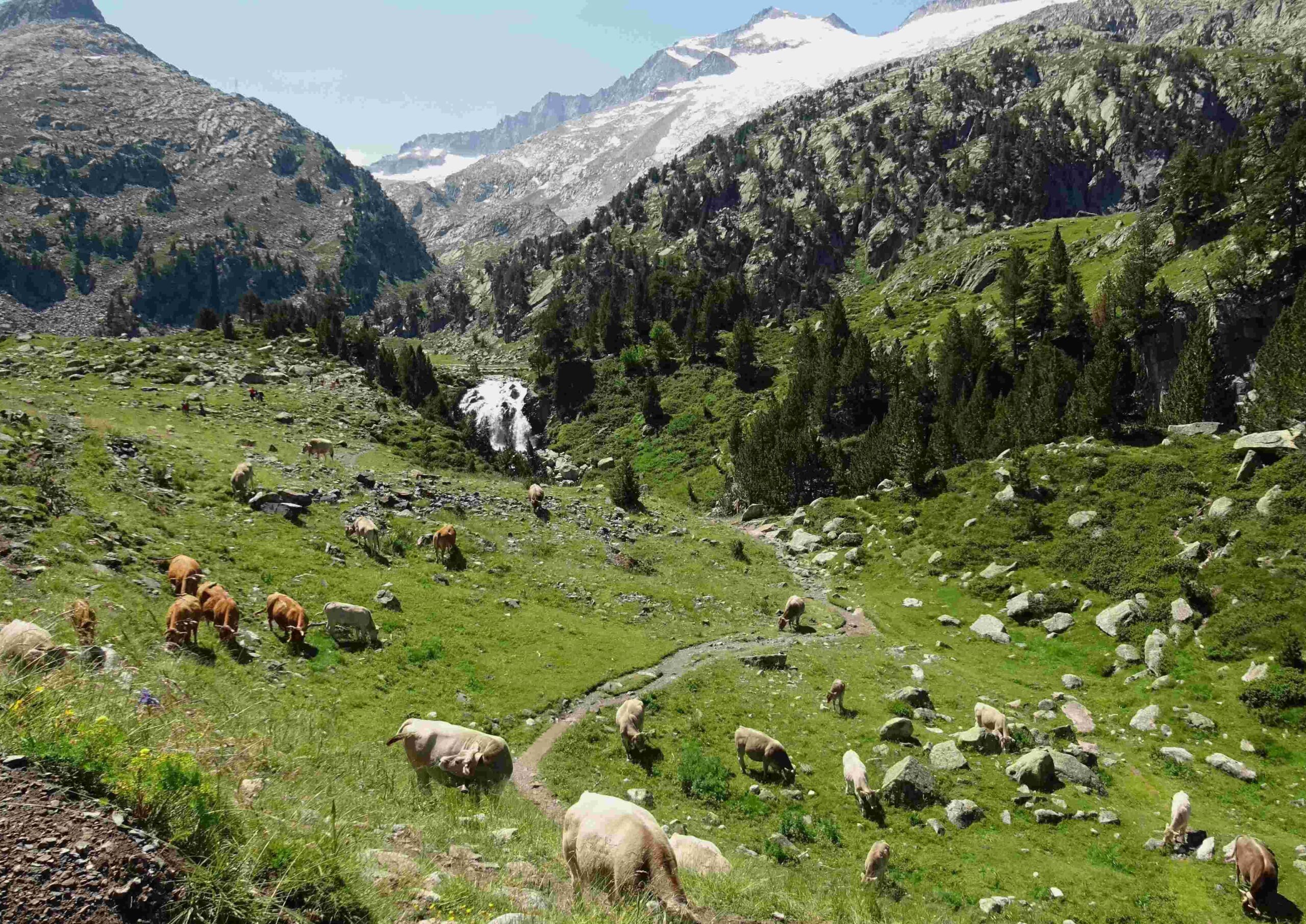
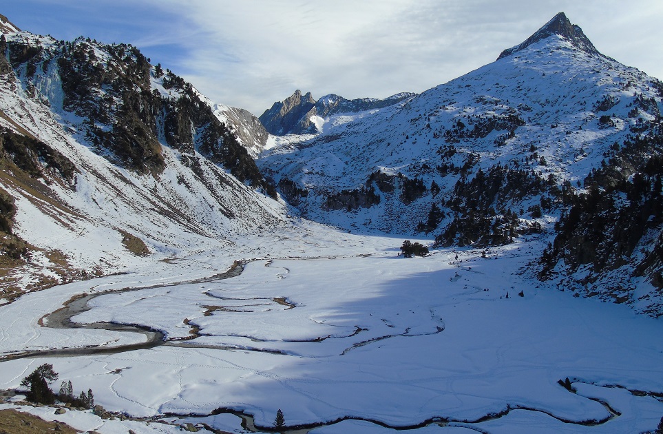
The path goes to the left of the cascade to emerge at the Plan d’Aiguallut – a wide flat pasture area above 2,000 metres. Gazing across the Plan – and upwards – it is hard to imagine a more beautiful creation. A stroll around it, taking in the views from different angles, will be enough for some visitors. Others will feel the urge to go higher, to get closer to the summits and look down over this enchanted place. On the far side of the meadow a sign points for the Collado de Salanques, the pass which stands at 2,809m and is a further 4.3km distant. Here the ascent is more difficult in places, crossing boulders at the side of a stream which drops from the peaks. It is a difficult pass to reach, and requires a big effort and a lot of time. The Barrancs glacial lake at around 2,400m, which is half way up the ravine, may be a better option for some. Whichever, the views over the Plan and up to the Maladeta massif are worth the extra effort.
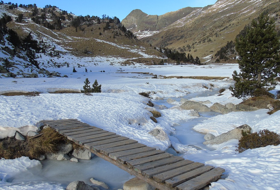
Walkers could also try the easier route to the Col del Toro at 2,241m, with the glacial lake of the same name just above it. For this shorter ascent, head straight across the pastureland on the left-hand side. The valley/ravine heading out of Aiguallut in the far left corner is Valleta de L’Escaleta. In winter conditions the route is straight up the area occupied by the stream, over the snow. When the snow melts, the path passes to the right of the stream over the bridge. There is a short climb before the path straightens out to follow Escaleta ravine. It’s not long before the route emerges at another wide open area, flanked by towering peaks. The path runs across it, before turning left for the short ascent to the Toro pass. From here, enjoy the expansive views into France. The walker can continue on to the Toro glacial lake and place a toe over the border. It’s around 5km for the return walk from Aiguallut.
For all the options, return on the same path.


Recent Comments