This waymarked route in Montanejos heads to the top of ‘the narrows’ – the Estrechos de Chillapájaros – where towering cliffs close in and the Mijares river creates a sheer-sided ravine. The views from above, looking over the gorge, are spectacular. The walker also needs a head for heights as the path passes along the precipice for a short section; great care has to be taken as there is no safety rail.
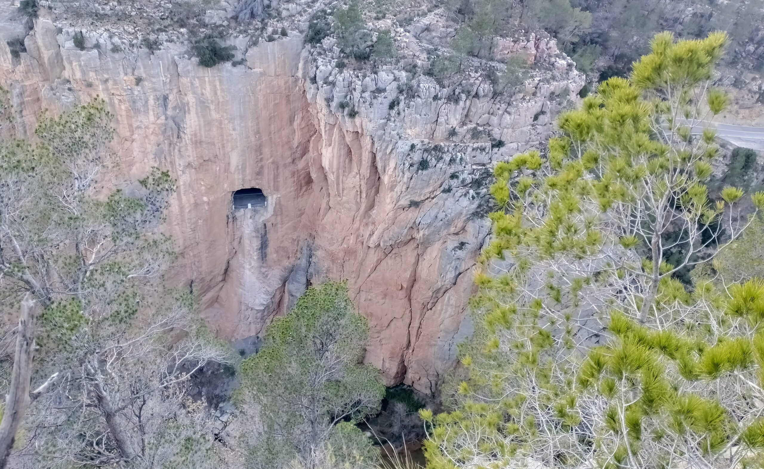
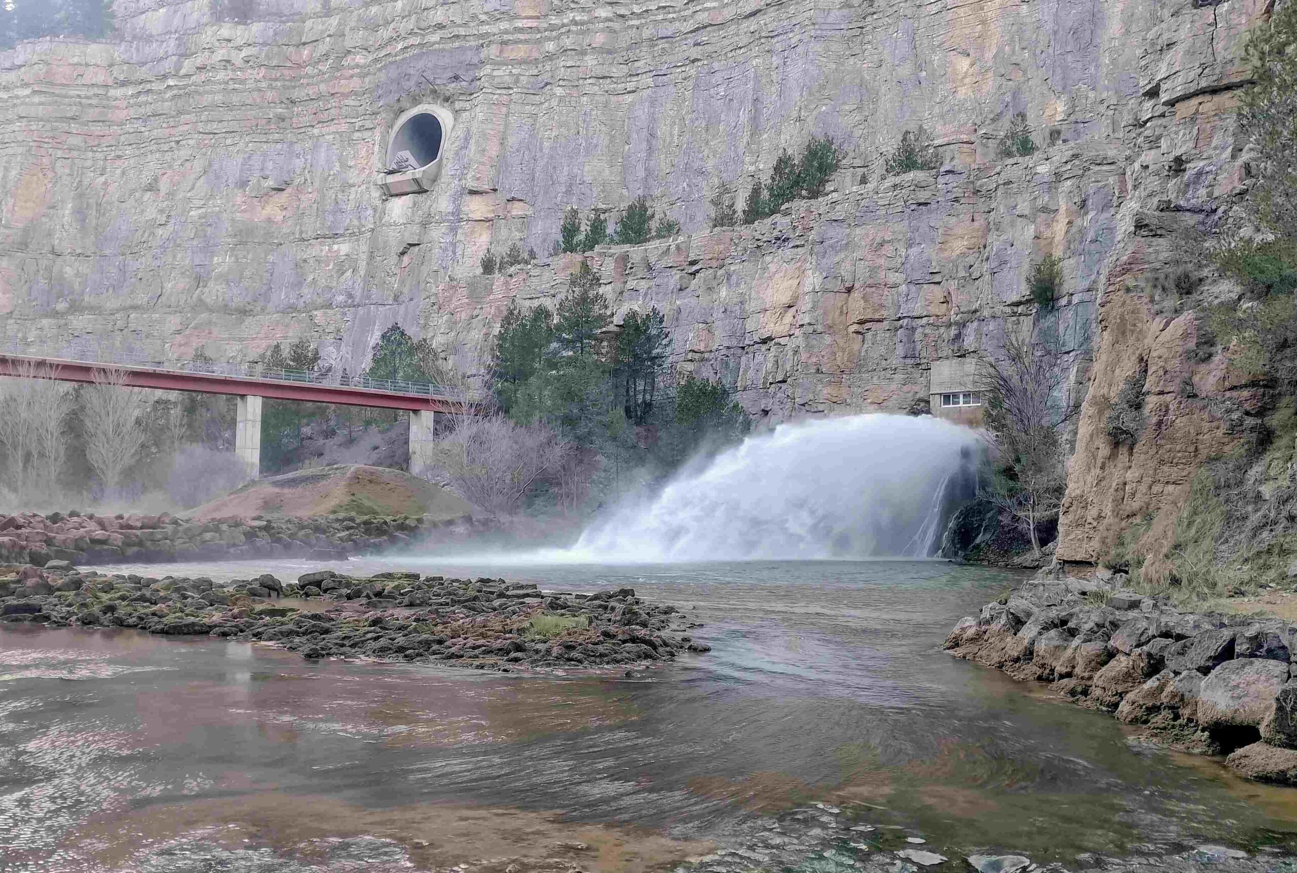
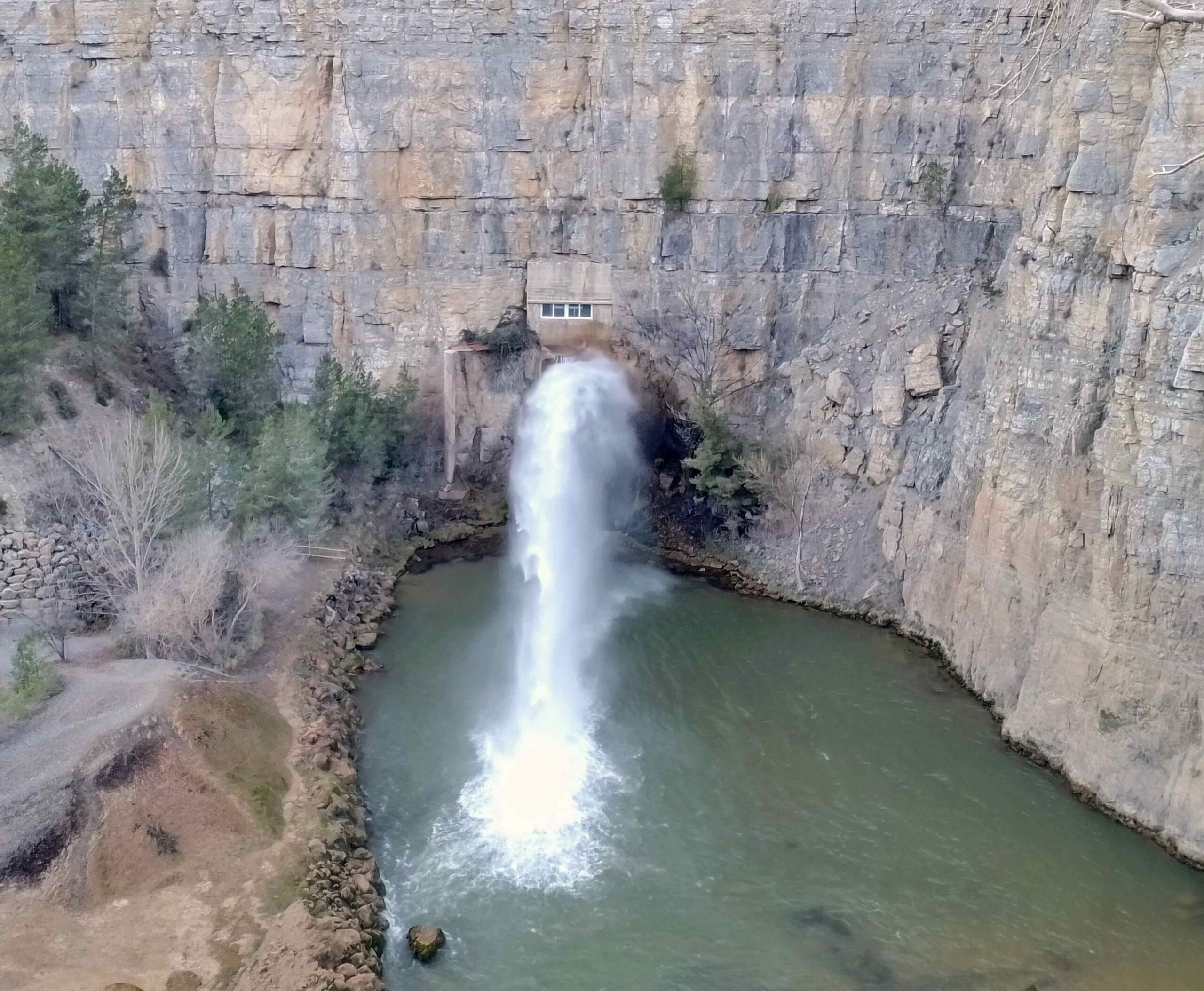
The path descends into the ravine and follows the river to the ‘aliviadero’; which is a tunnel in the giant slab of natural rock which forms part of the dam of the Arenoso reservoir. Here, water surges out of the hole, alleviating pressure on the dam wall and providing the Mijares with some of the water it would have had in the past, before mankind decided to interfere with the workings of nature.
This said, the gushing water is an arresting sight; and the sound of it crashing into the pool that restarts the river, along with the spray which blows off it, certainly stimulates the senses.
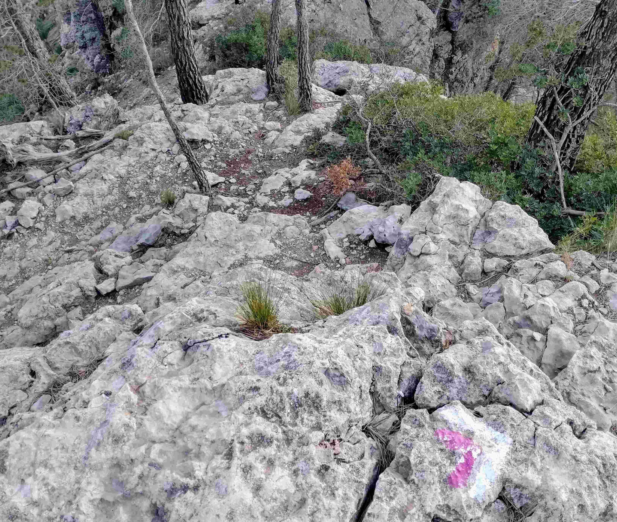
The return from the dam is not an easy one. The path heads up a steep slope then across some narrow rocky sections along the opposite side of the Mijares ravine. The route is called ‘Los Estrechos’ (the narrows) in the town hall walks leaflet and they describe this section as ‘crossing a rocky area, with a few delicate passages’.
This is not a route that will present a problem to regular mountain walkers with a good level of fitness, but others may enounter difficuties due to the nature of the terrain.
The circular walk measures 8.6km, with 460 metres of ascent and will take between three and four hours. The route is well signposted and follows white/purple waymarks.
The walk
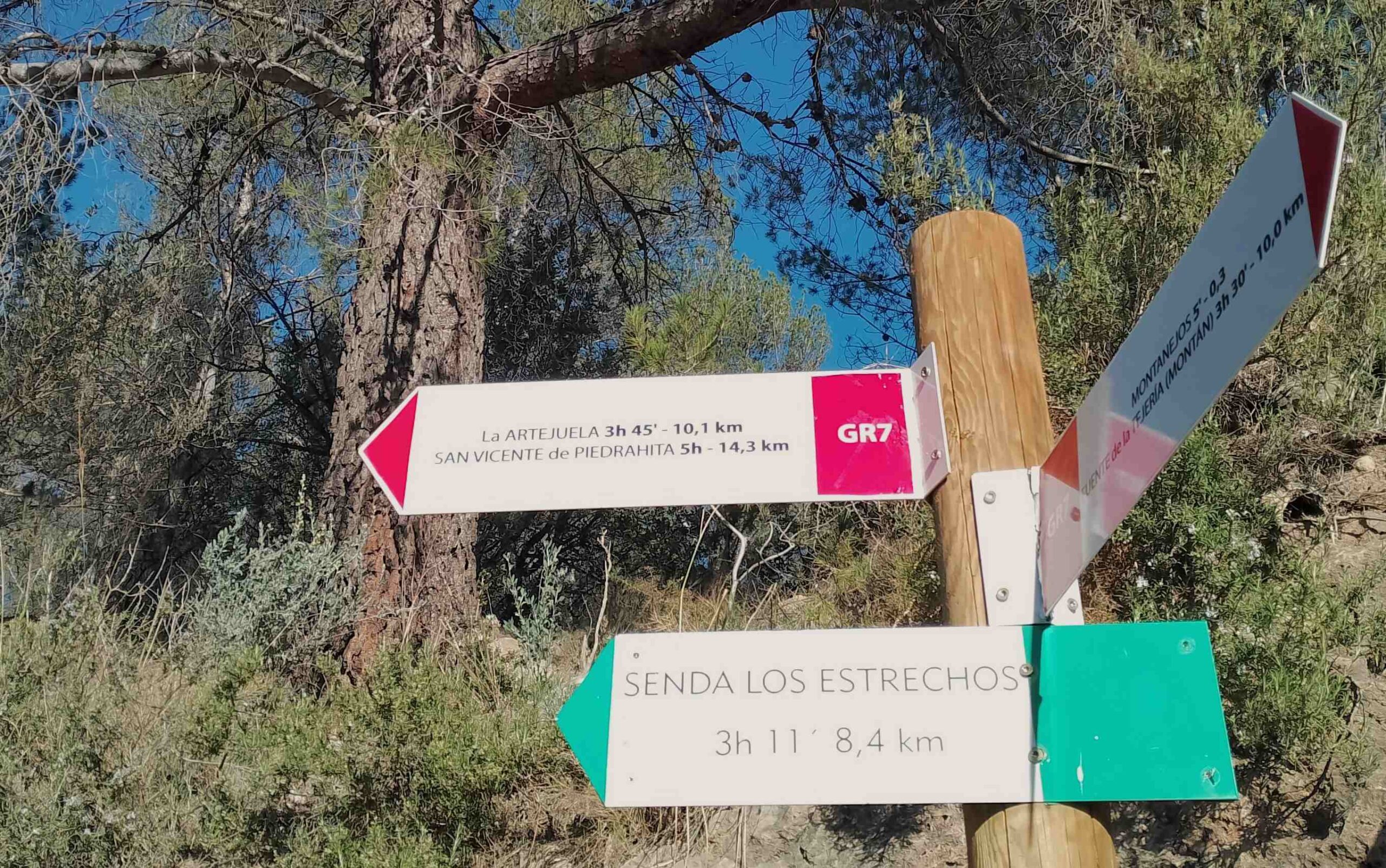
The route starts from the meeting point on Carretera de Tales, just before the bridge over the Maimona river. Cross the bridge and bear right to traverse the Puente Nuevo (new bridge) over the River Mijares, then bear left. See the signs at this point. It’s a right on the purple route, the Sendero de los Estrechos; the first part of the walk is also on the GR-7 long-distance footpath which has white/red waymarks. Head up the wide track, keeping an eye open on the right. It’s only around 20 metres to the next signs and the right turn onto a path. The path ascends through the trees and reaches a surfaced lane. Bear left here. Continue along the lane for more than 500 metres and notice the path on the right; it’s a shortcut to reach the next level of the switchback lane, bearing right to continue.
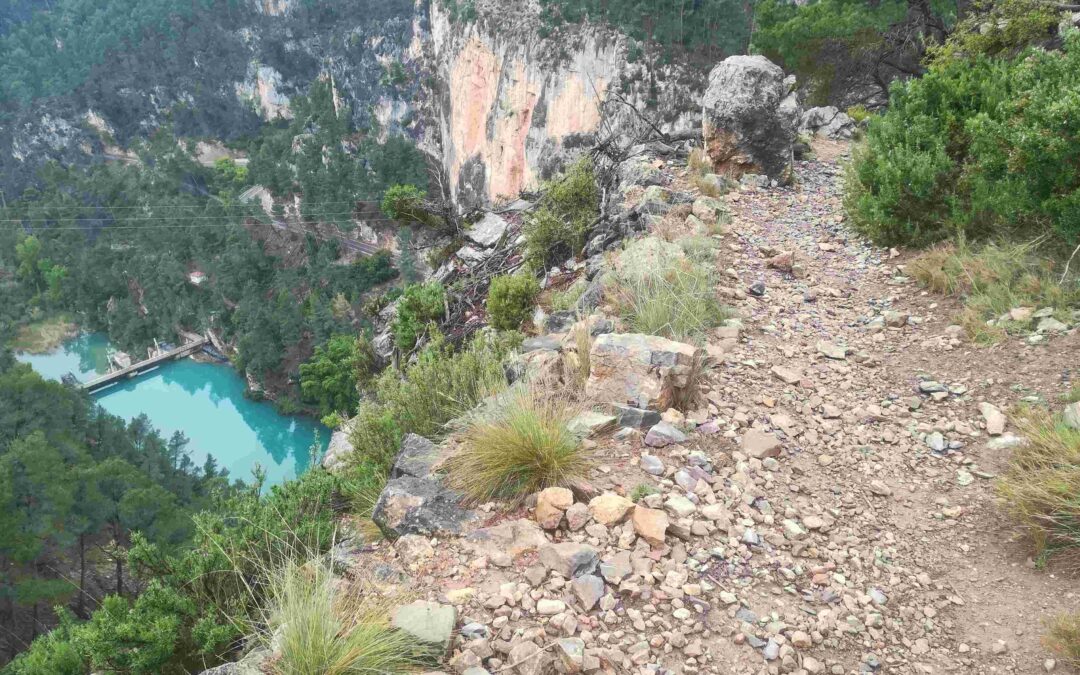
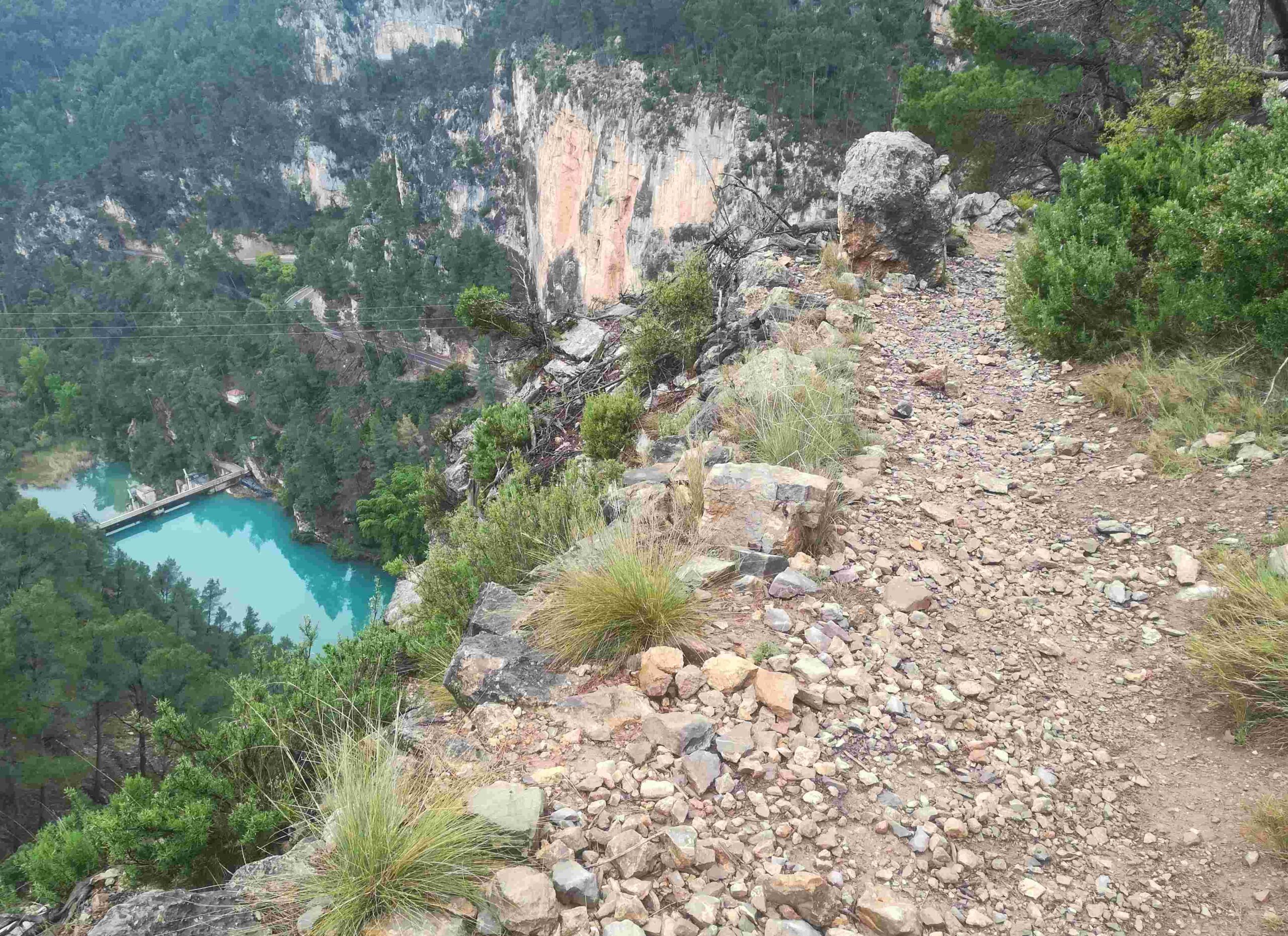
The lane turns into a wide track as it continues; ignore the turn-off right as the GR-7 departs to head up the mountain. The track runs straight and eventually turns into a path; follow the white/purple waymarks up the hillside. It emerges at a point high above the river and runs along the top of the cliffs. There are unimpeded views into the ravine, which are breathtaking and knee-knocking in equal measure. The precipice is very close and great care has to be taken on this short section. Loss of concentration could prove fatal.
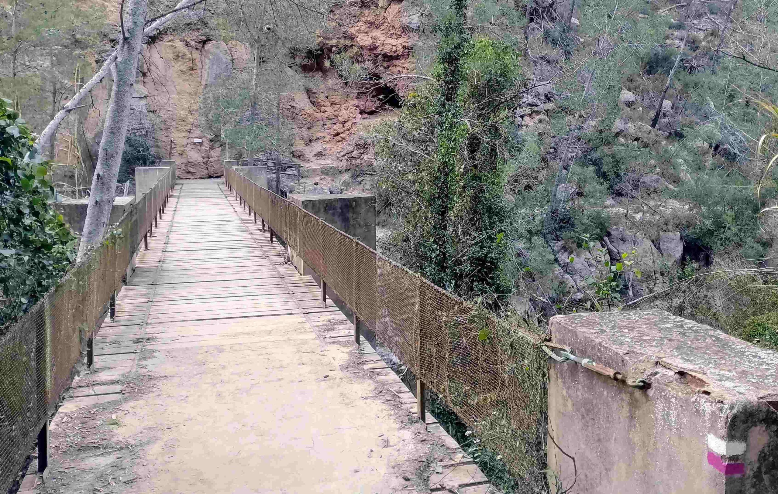
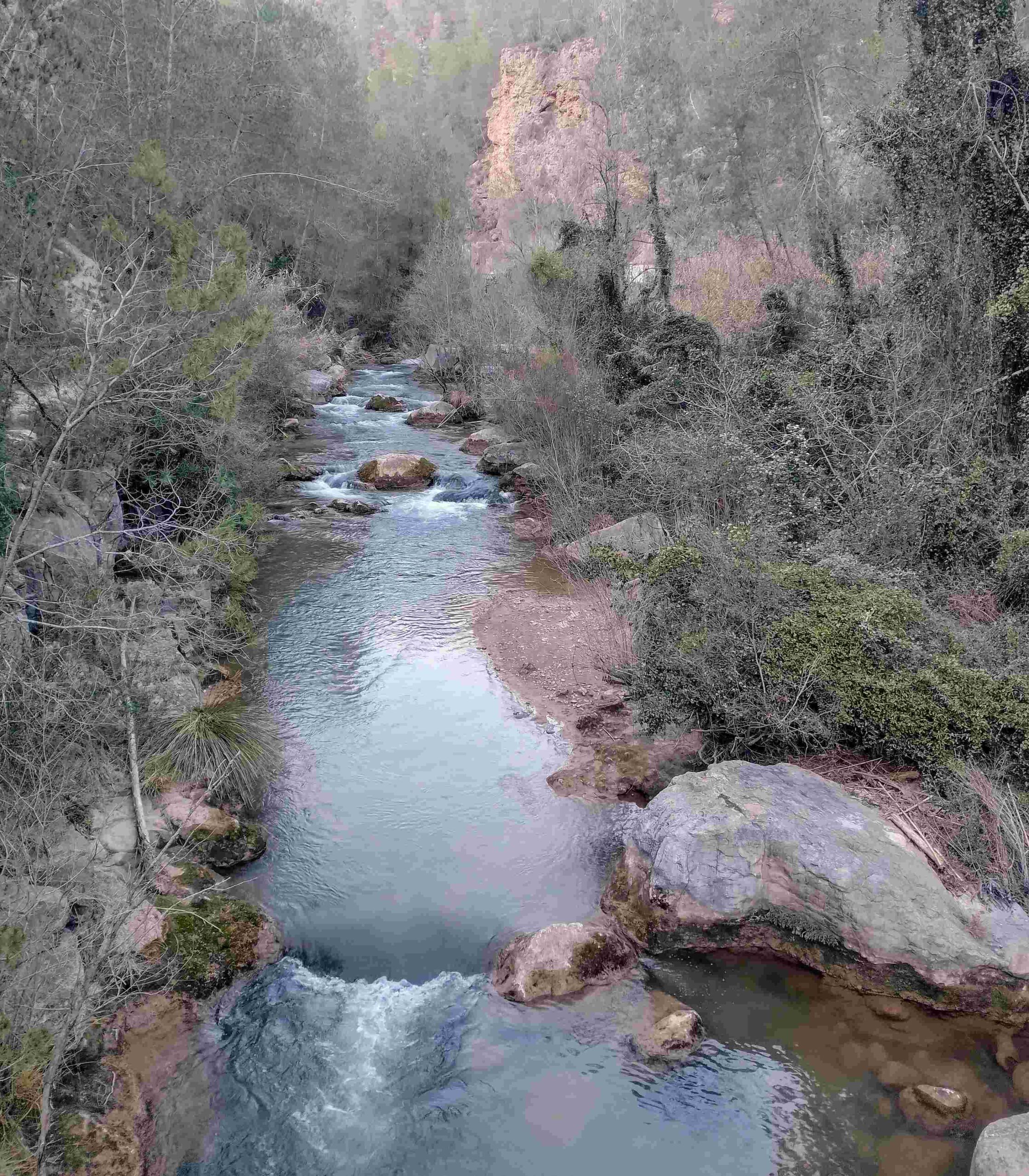
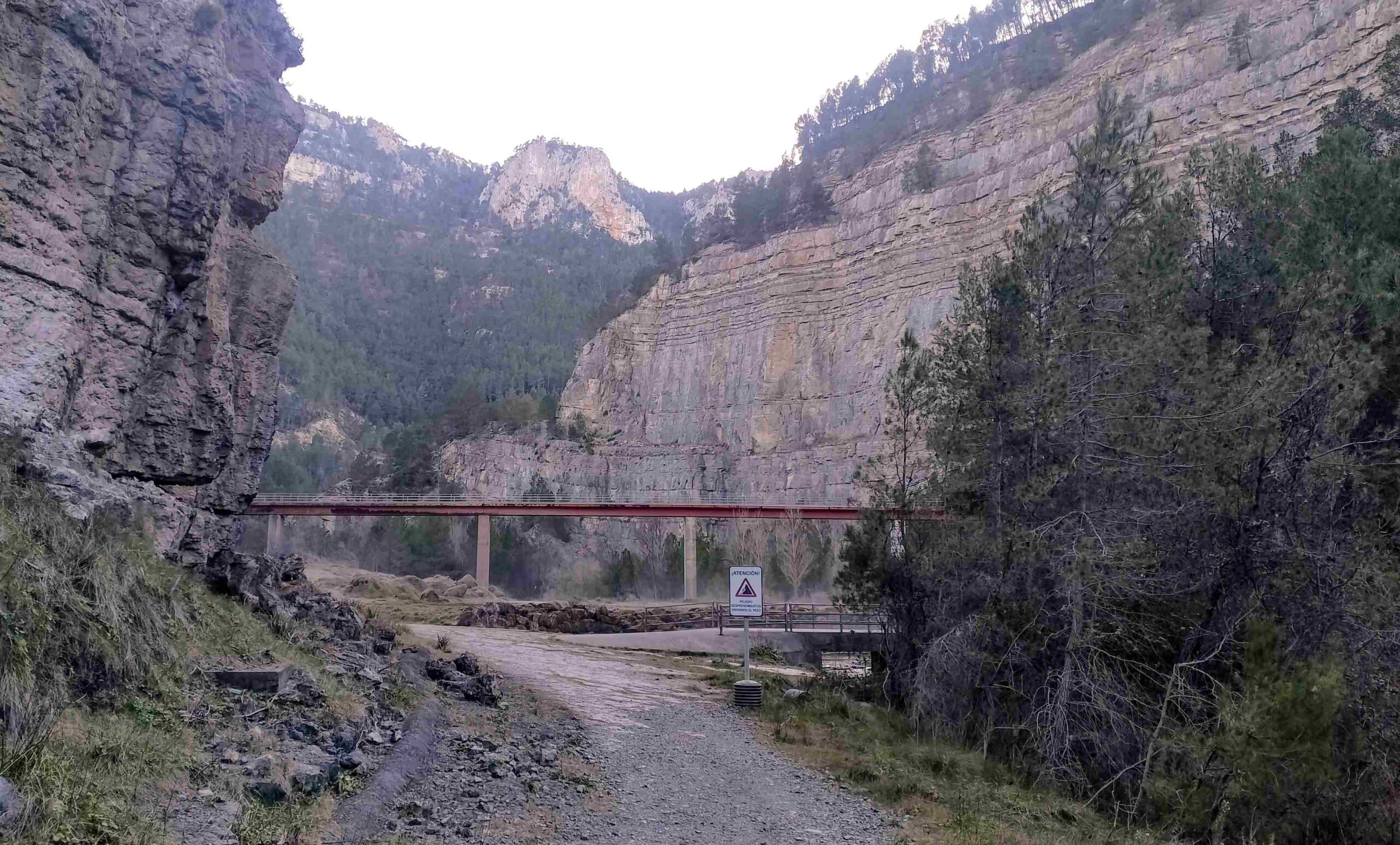
The wide path does not spend long on the cliff wall; it embarks on a switch-back descent through wooded country. It is not a dangerous section but there are drops off to the left. The path reaches the bottom of the canyon and a footbridge across the Mijares, with good views up and down the river. On the other side, bear right to continue on the waymarked trail.
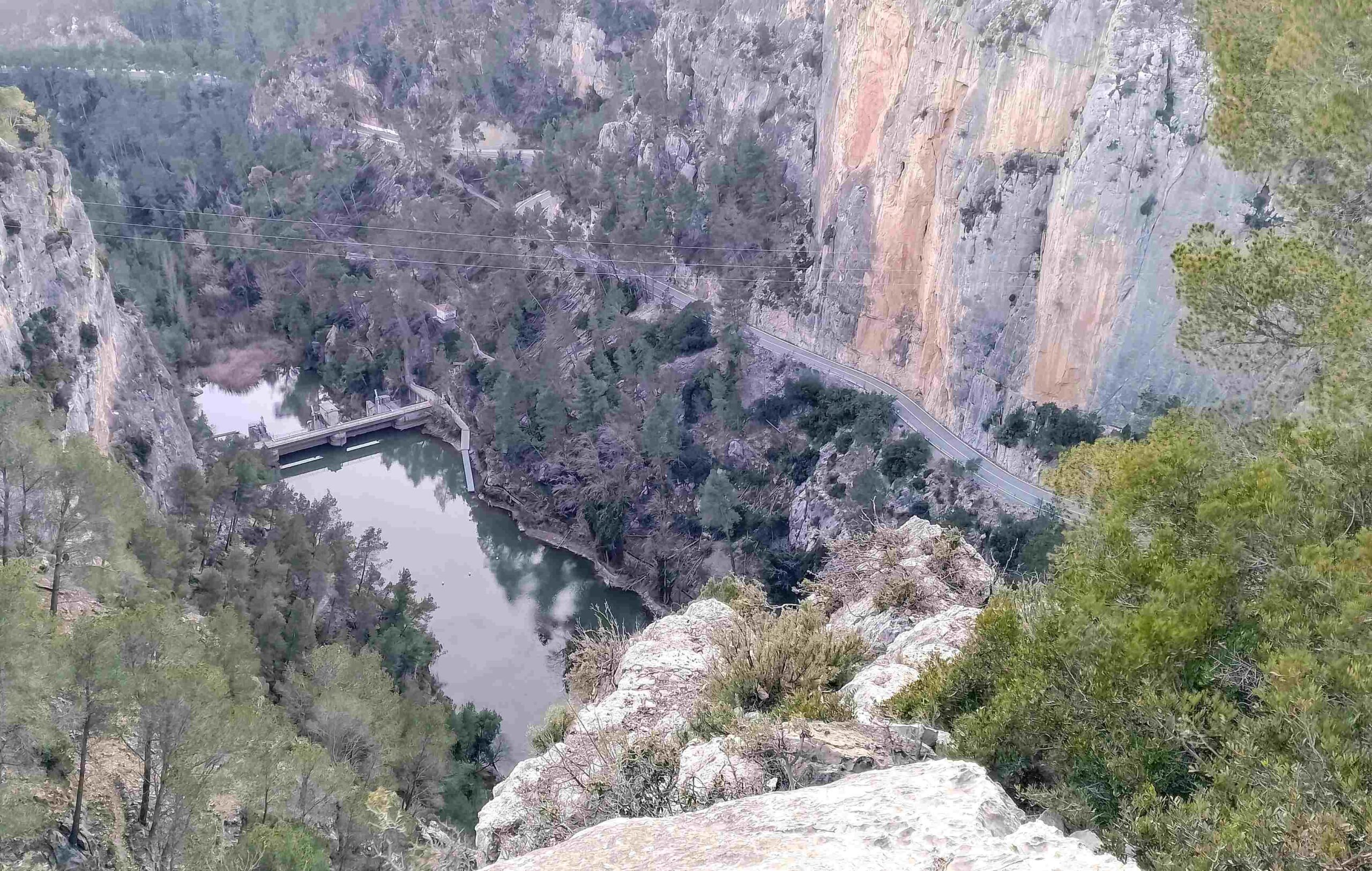
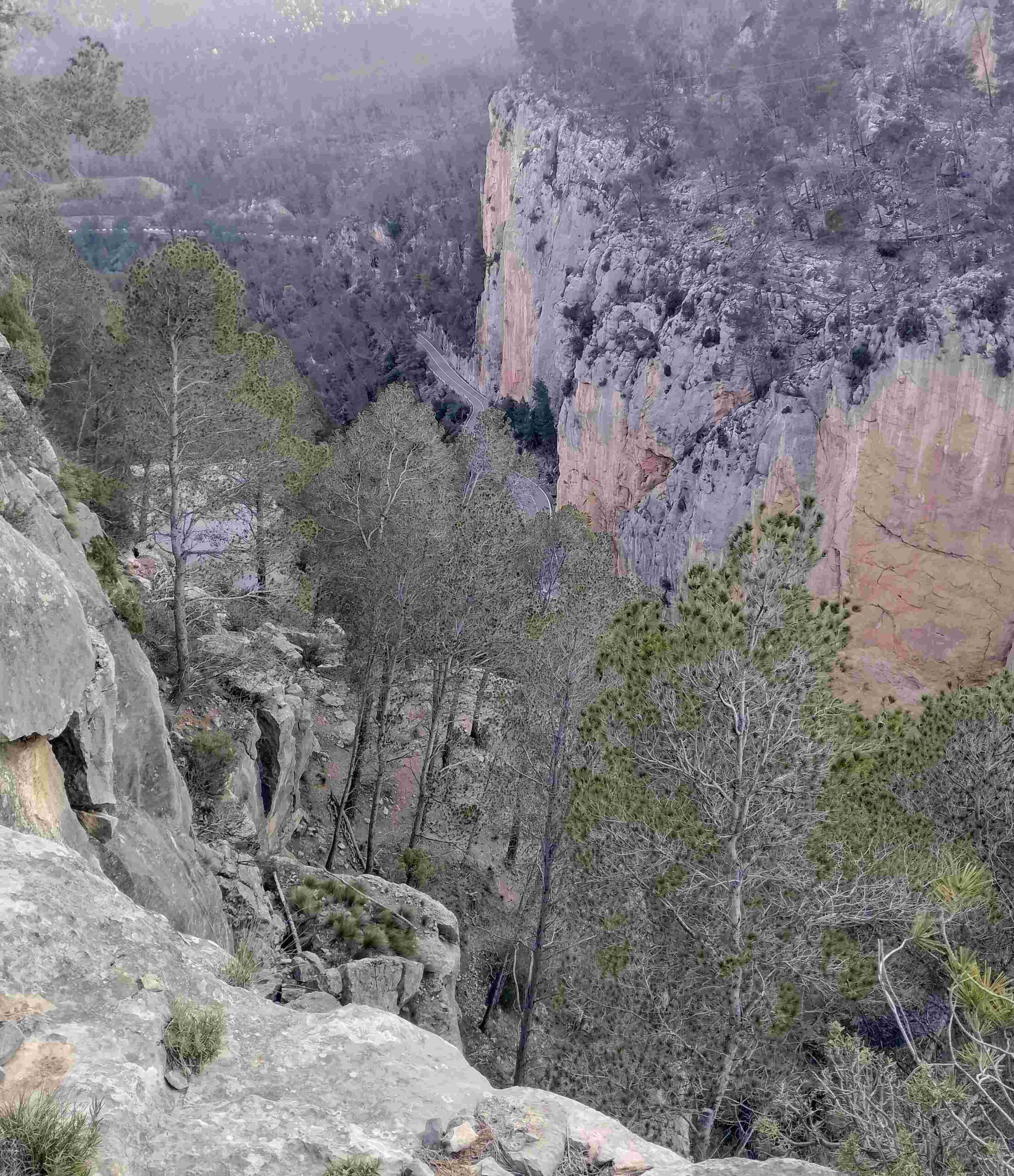
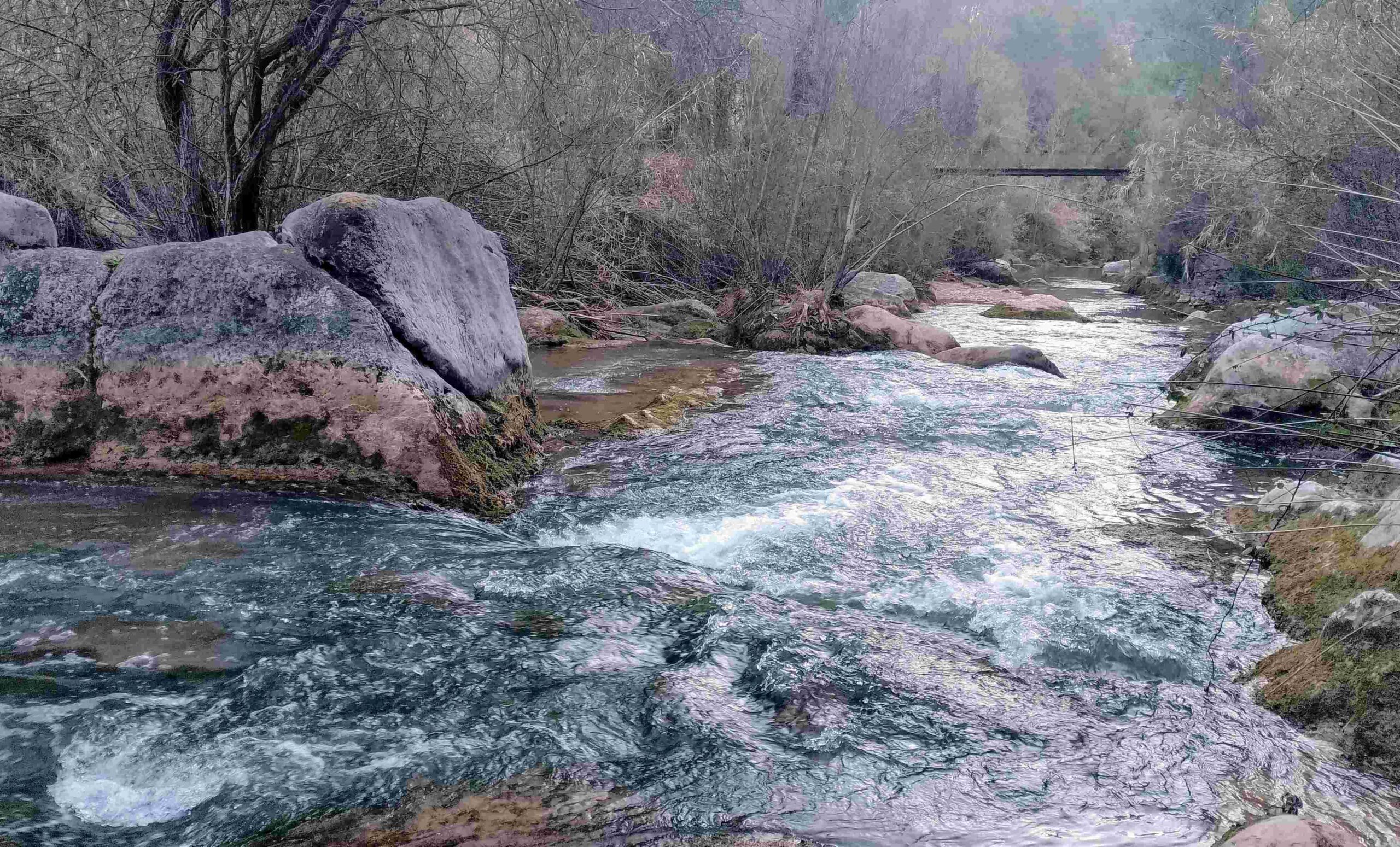
The path follows the left bank of the Mijares, then bears left to emerge at a point below an enormous slab of rock. This vertical wall helps to contain the Arenoso reservoir, while a tunnel through it allows water to shoot out into the riverbed. Named the ‘aliviadero’, it prevents the dam from overflowing and ensures that there is a flow of water in the Mijares.
The water thunders out and standing in the spray is fun, although bear in mind that the rocks here are very slippery.
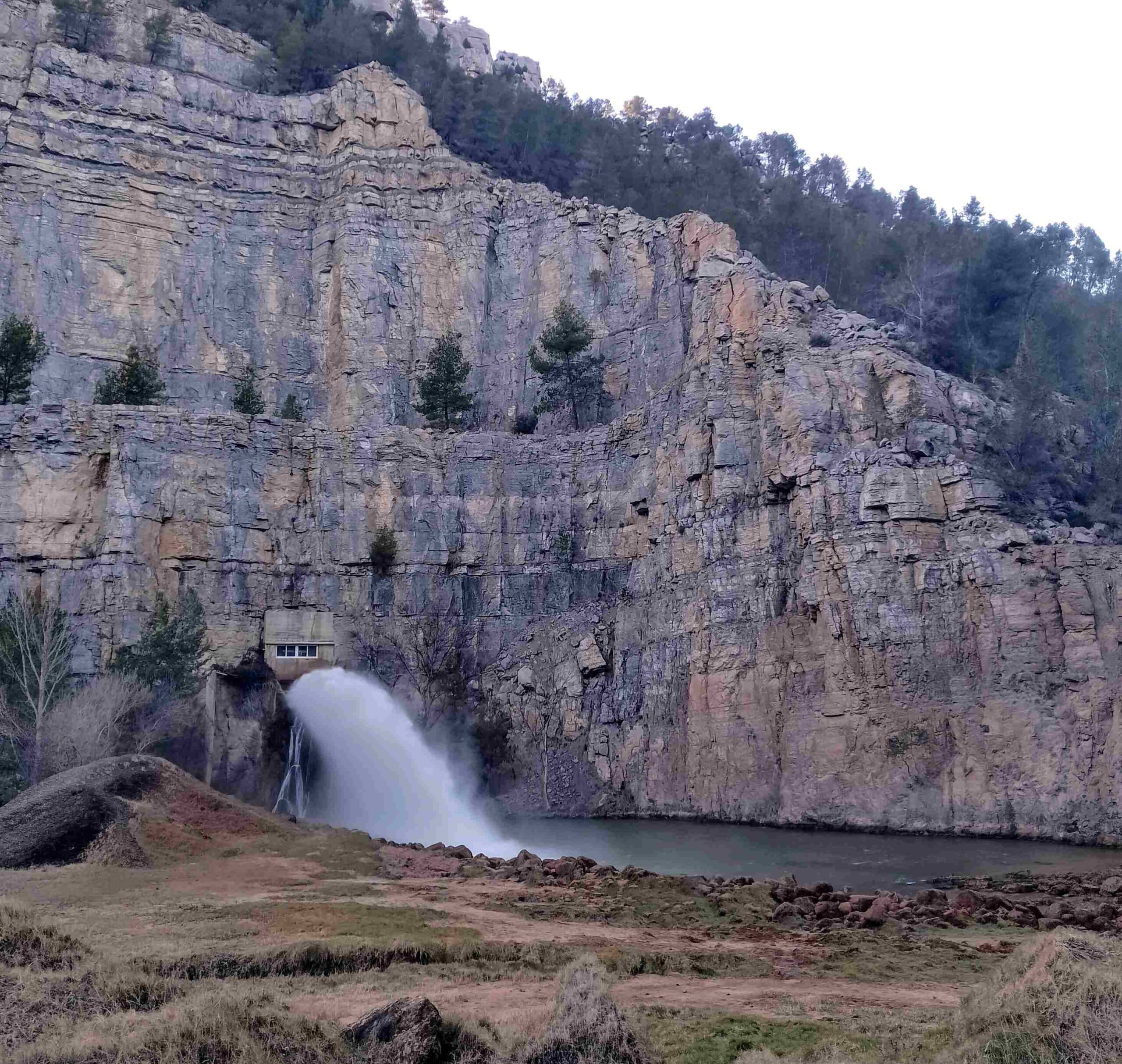
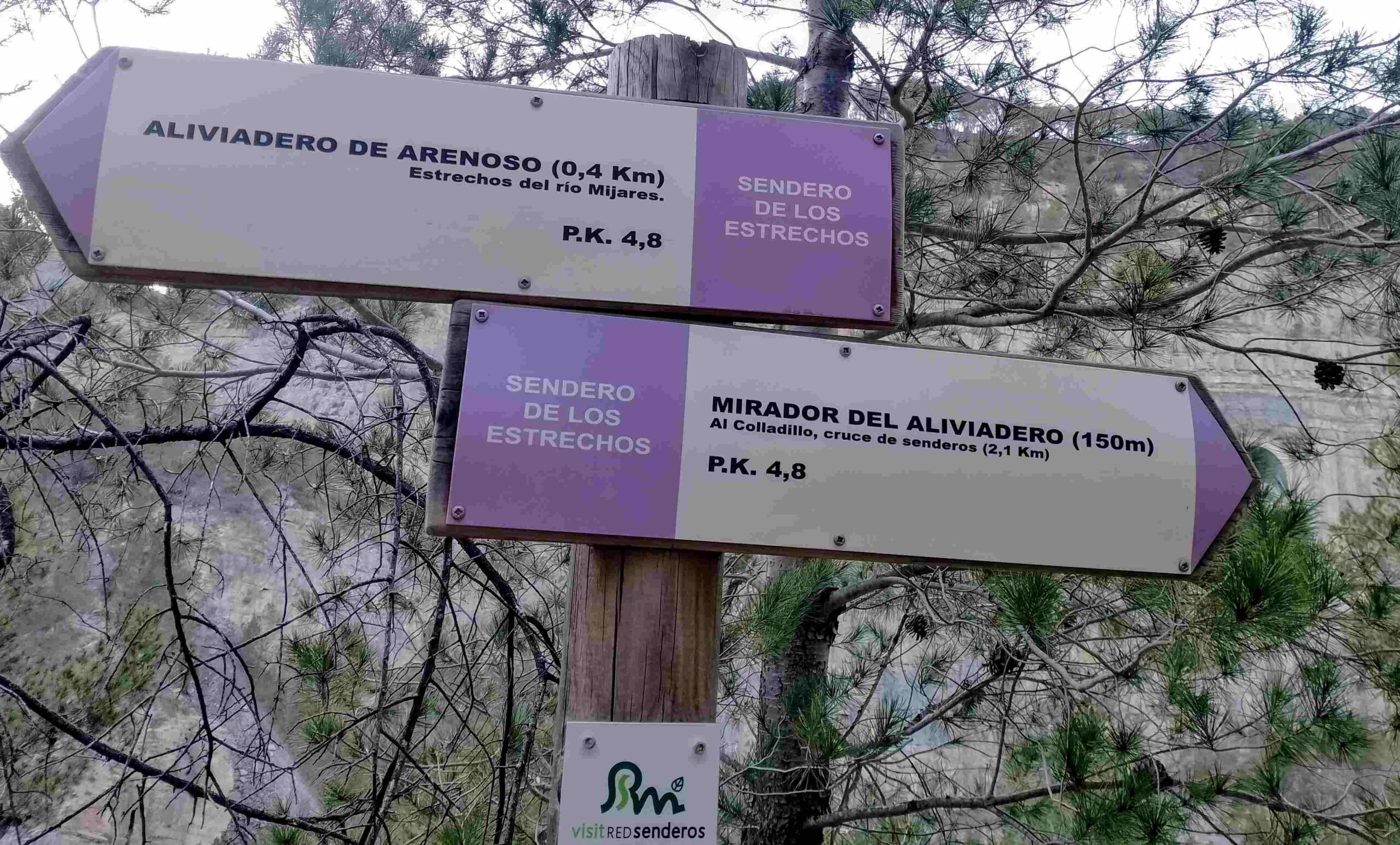
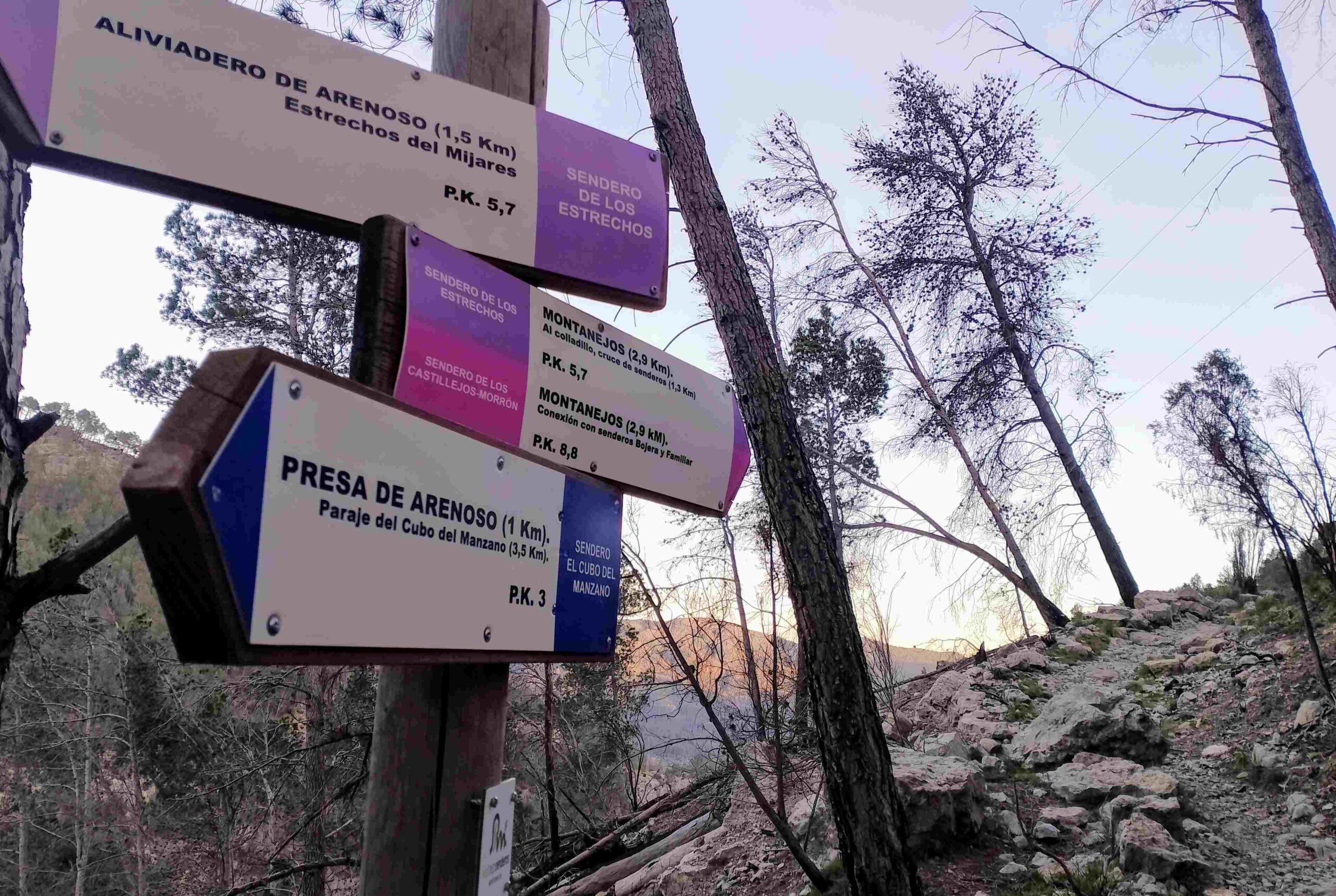
Our route goes up the concrete track, away from the aliviadero pool. There are dramatic views to the right of the Mijares ravine walls, which now form part of the dam structure. Ascend for around 200 metres and bear left on a path to go up to the next section of road. Here, bear left following the sign for Mirador del Aliviadero (a mirador is a vantage point), which is 150 metres away; it’s along the road, then left onto the footpath just before the road tunnel. It’s a short climb up to the ‘mirador’, which is just off the waymarked path, and worth a look for a different view of the water spout and the giant wall of rock.
Back on the path, bear right to continue the climb. This is a fairly difficult section and the only alternative is to return to Montanejos along the road, which would mean going through three short tunnels; not an enticing prospect.
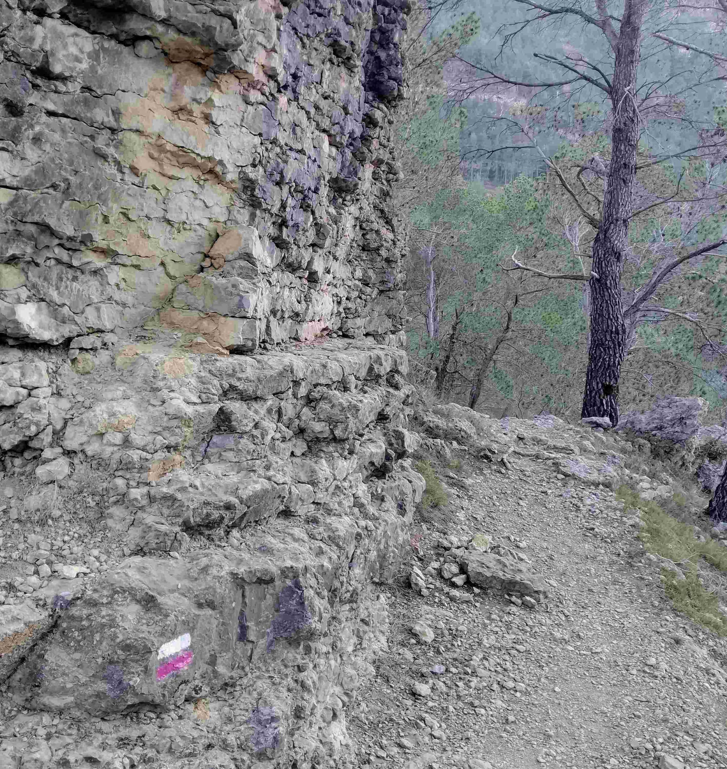
It is quite a steep ascent of the hillside, following the waymarks. Soon there is a rocky section which has to be crossed and a very short descent via the rocks. Then it’s along a short section of ridge with drops off either side, where great care has to be taken. The ridge then starts to run through the trees.
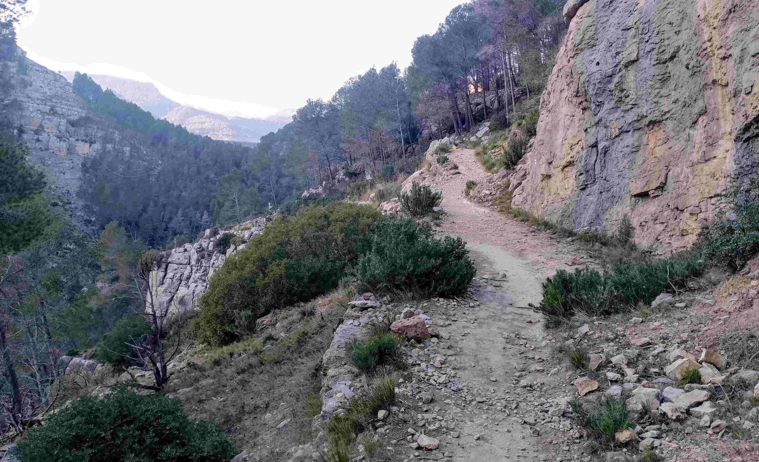
The path embarks on a steep climb through the trees, to emerge at a point where a signpost says it’s 2.9km to get back to Montanejos. The path is now on top of the Mijares ravine wall, on the opposite side to the one traversed earlier. It’s a good, wide path in most areas, heading through the trees. It moves away from the ravine to cross another area of pines that have been damaged by fire.
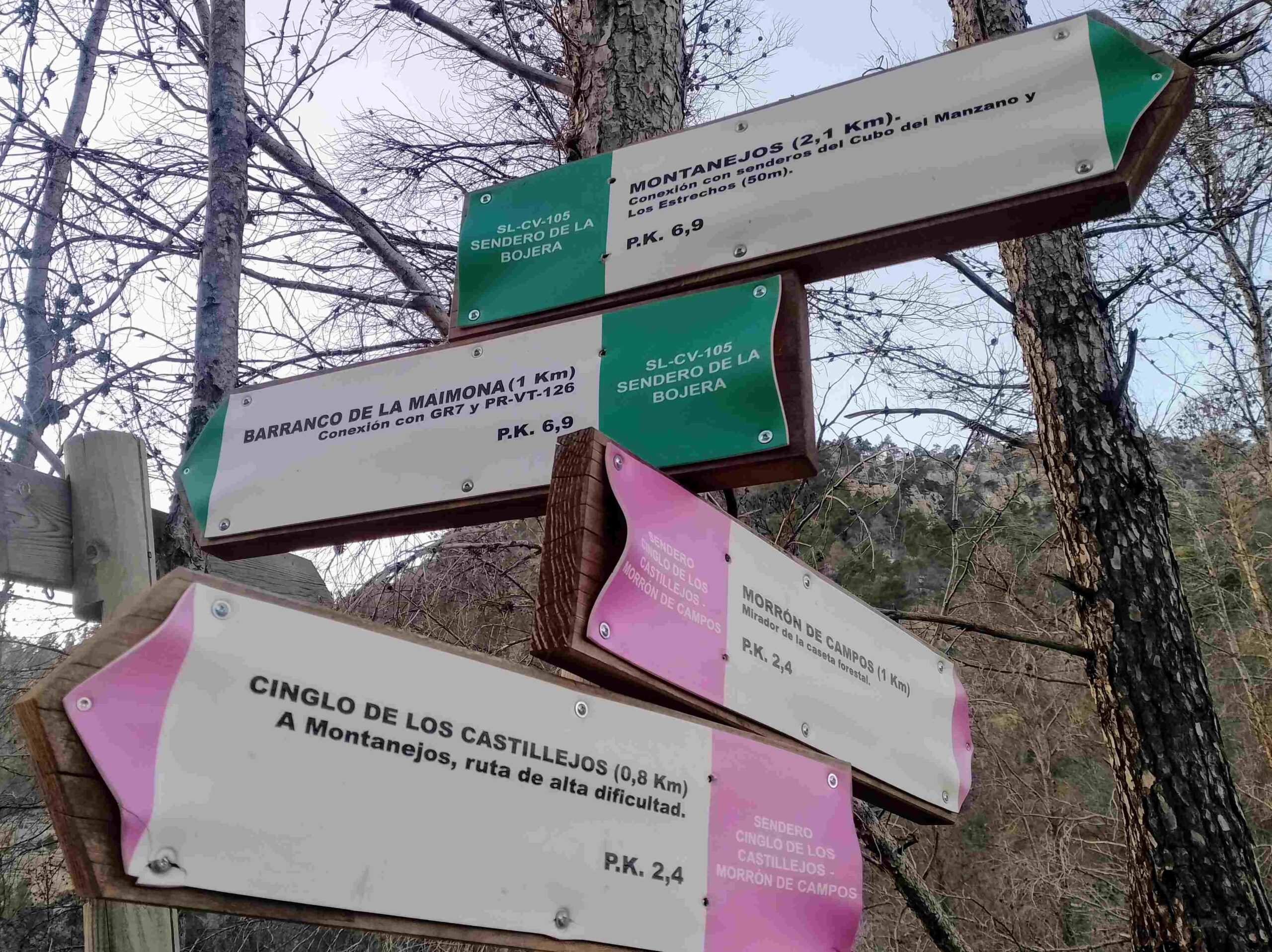
At a confluence of paths, bear left to start descending; this is the route back to Montanejos which is 2.1km away. At the next fork, bear right; a sign states that there is 1.4km remaining, on the Sendero de los Estrechos. At the next sign don’t bear right for the Cueva Negra (black cave), unless you want to go; our path continues straight on, running parallel to the road below.
The path starts to descend again, reaching a sign where we are told that its 500 metres to get back to Montanejos; bear left here to drop down to the road. Then bear right to walk along the pavement back into the town.
Recent Comments