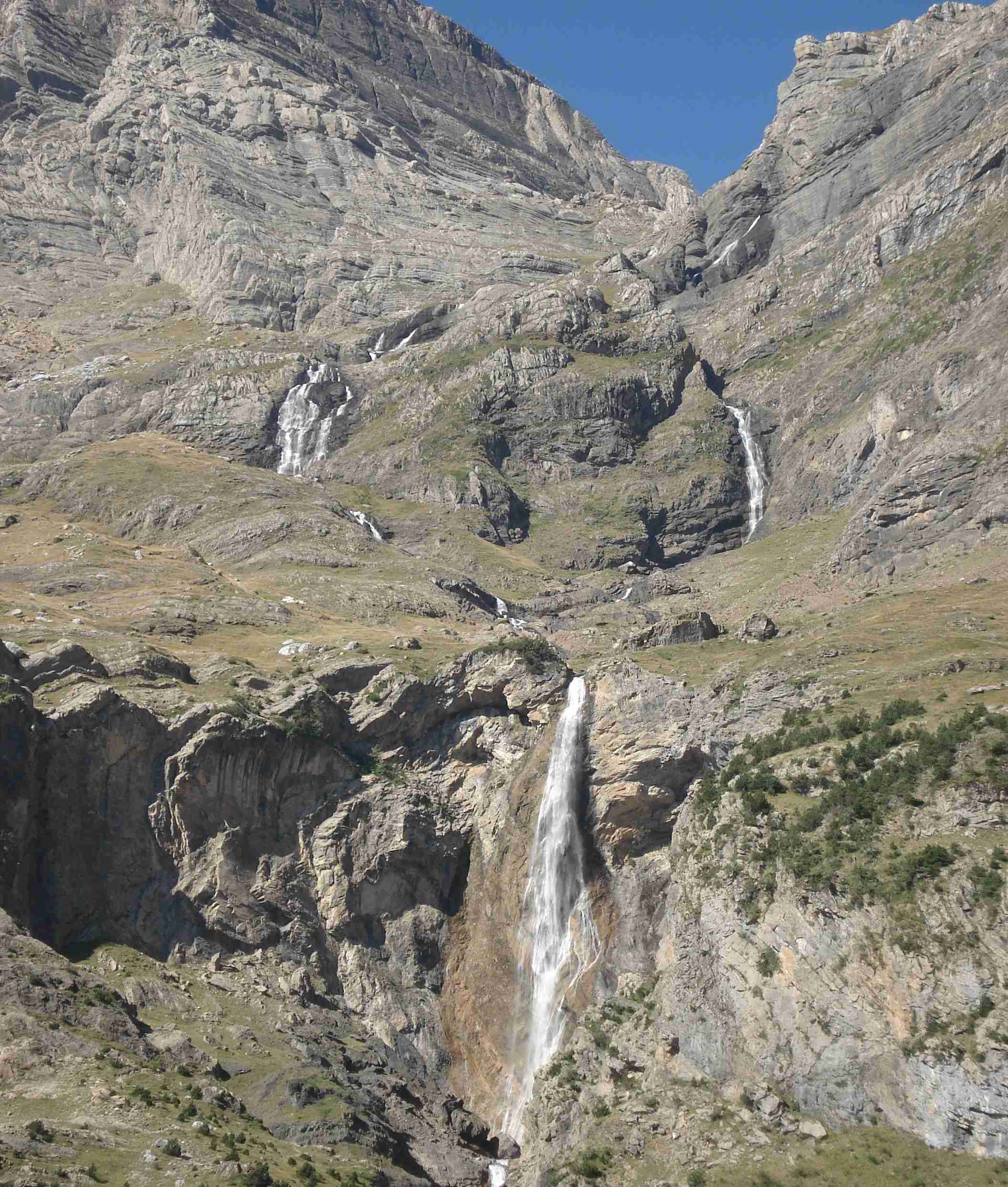
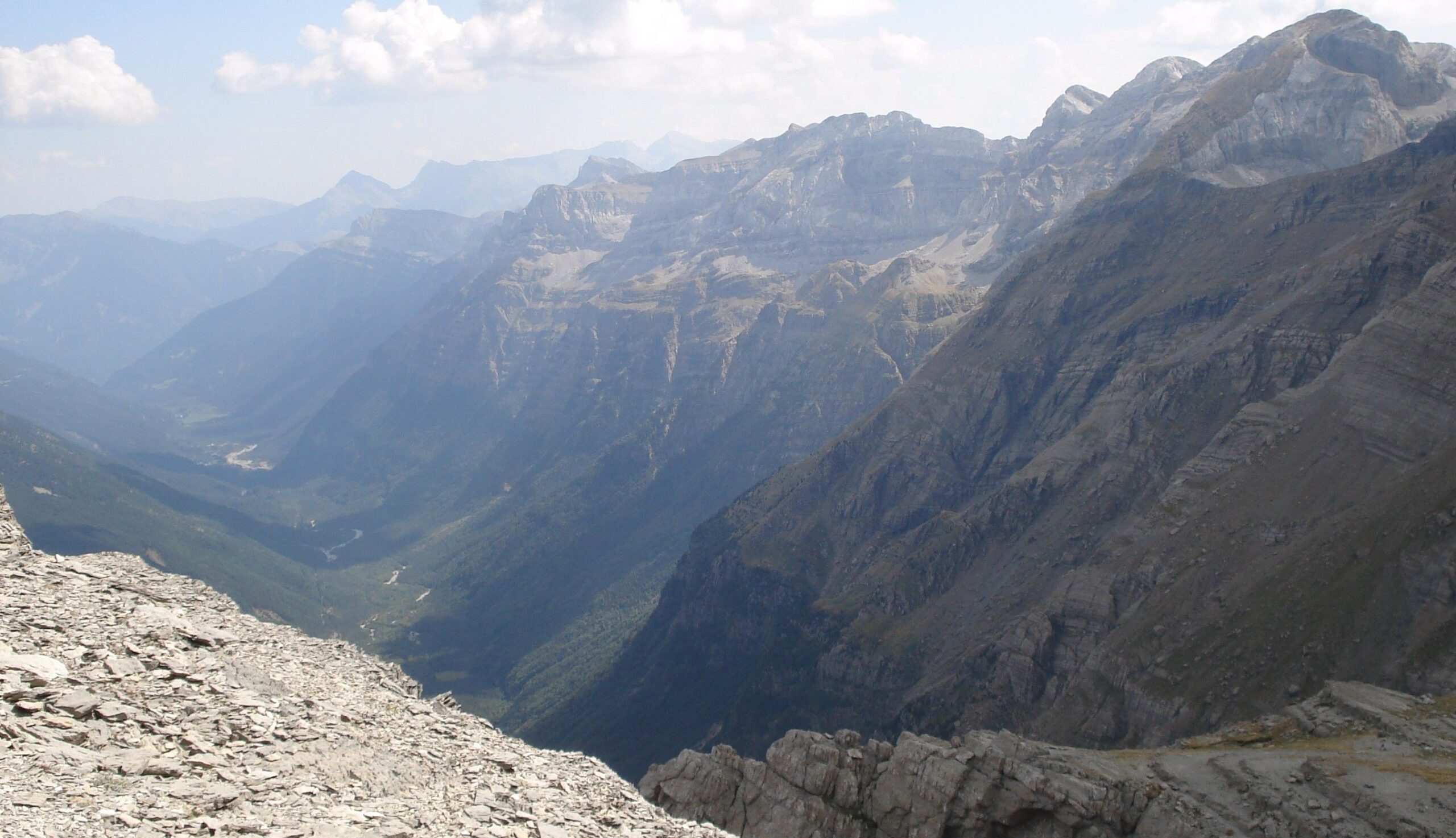
Bielsa is situated at the end of the Pineta valley, which was gouged out during the last ice age; wide, green and with soaring peaks on either side, the River Cinca flows down its centre to the Pineta reservoir. At its head is the Pineta Cirque. Here waterfalls tumble down from great heights, with the peaks of Cilindro de Marboré (3,325m) and Monte Perdido (3,355m) up above.
Bielsa is one of my favourite town/villages in the Pyrenees; although not everyone is as enthused as I am about the place. The Lonely Planet refers to it as a ‘cheapo mecca for bargain-hungry shoppers’. However, having spent several weeks in this place over the last 20 years, it is a description that I really do not recognise of my beloved Bielsa. Other people I know have also failed to be seduced by its charms. But, all I can say is that readers should go themselves and make up their own minds.
The Bielsa I know is an unspoilt village which has kept its ancient streets intact and is a joy to stroll round. You wouldn’t want to do it during peak season (August) – but that could be said for many places in Spain. Also, it has none of the new development which has afflicted the outskirts of nearby Benasque, which the Lonely Planet is much kinder about. Don’t get me wrong, I love Benasque too – but it has certainly grown more than some would have hoped.
The heart of Bielsa is the square that is home to the historic town hall, which is also a museum that tells the story of the ‘Bolsa de Bielsa’ (more on that shortly). There are a couple of shops which could be accused of selling ‘tourist tat’ – but as that is done from lovely old stone buildings I think we can forgive them the crime. Just around the corner, on the street heading down to the river, is the newspaper shop where visitors can pick up detailed maps of the surrounding valleys.
And of course, there are plenty of walks. Ascending out of the back of Biesla, there is a lovely stroll up to the hamlet of Javierre. The route then heads round into the opening of the Pineta valley, going to the Pineta reservoir, then back round to Biesla via a path through the forest.
A couple of the best routes lie at the top of the Pineta valley. Inevitably, the GR-11 is one of them, with this stage heading from the Pineta mountain refuge to Parzán, which is a couple of kilometres up the road from Bielsa. From the refuge the footpath heads towards the parador, before turning right at the Pineta hermitage and ascending to La Larri flats/plateau. From here on it’s a wonderful route through high-mountain country with views across to the Cilindro de Marboré, Monte Perdido and the glaciers below the summits which sadly are shrinking at an alarming rate. If walkers have parked near the parador they will have to decide when to turn back to the start point.
An interactive map of the route can be found at the website https://senderosturisticos.turismodearagon.com/senderos/gr11
It can be found under Etapa 10: Refugio de Pineta – Parzán
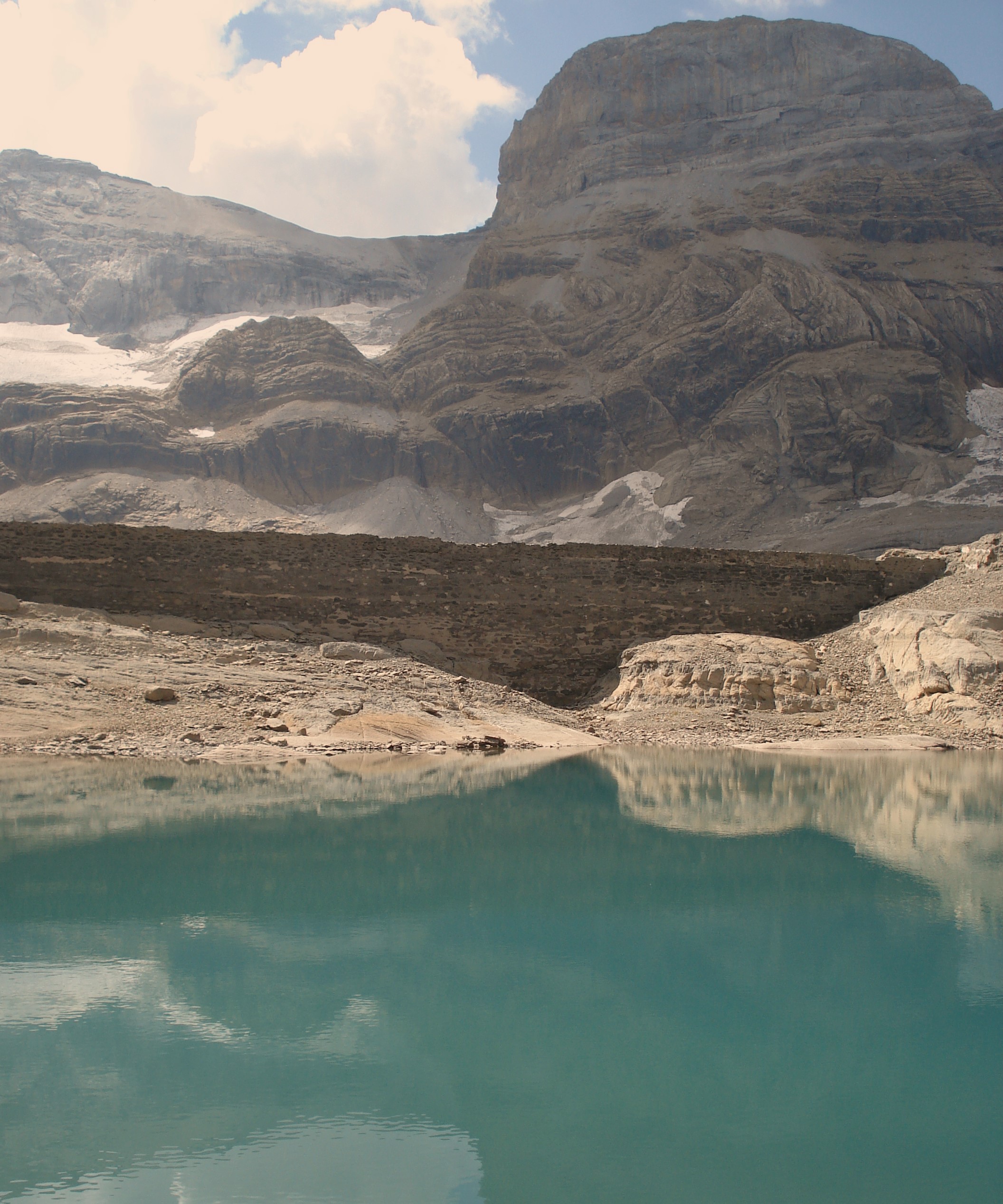
Another great path, starting from the car park just before the Parador de Bielsa climbs up to the Balcón de Pineta, continuing on to the Ibón de Marboré (or Marmorés) glacial lake which sits under the glaciers of the massif that includes Monte Perdido. The lake stands at an altitude of 2,590 metres and it’s a steep climb up from the start point at 1,300 metres on a switchback path; this is only a route that should be attempted by experienced mountain walkers. The spectacular Pineta waterfalls are just a couple of kilometres from the start point for those who want a shorter route.
Bolsa de Bielsa
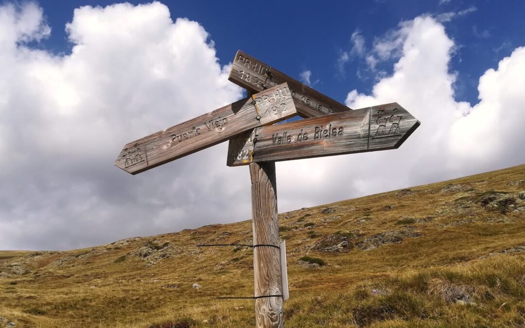
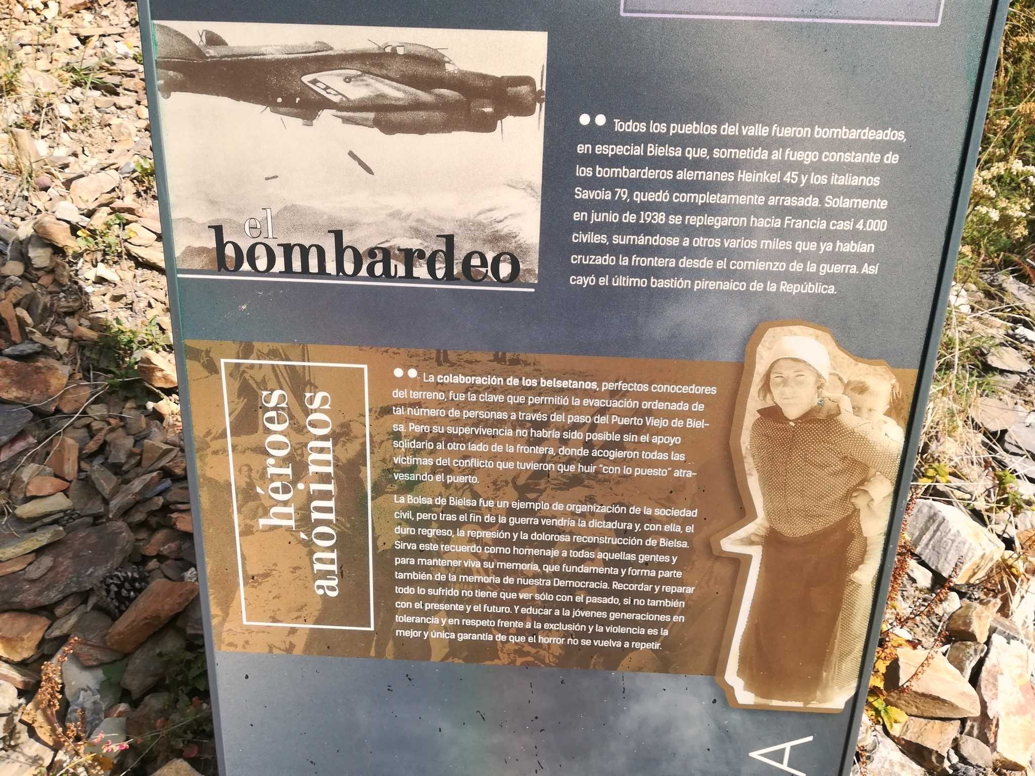
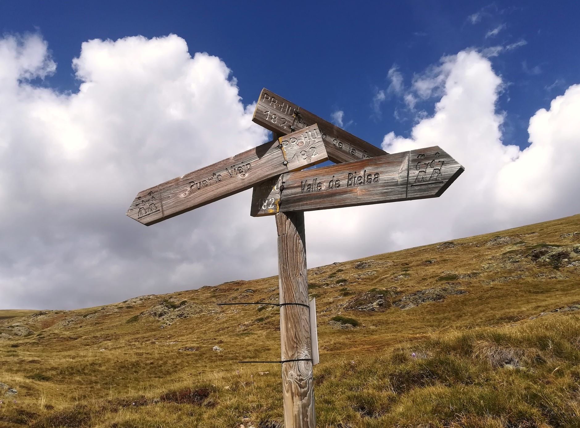
The main featured walk here is on the PR-HU 182 short-distance footpath. This was the route taken by Republicans at the end of the Spanish Civil War as they fled from Franco’s forces and sought refuge in France. The people of the area had witnessed the heroic defence of the central Pyrenees, now known as the ‘Bolsa de Bielsa’, when the 43rd Division of the Republican Army tried to keep the advancing fascist troops at bay. But in April, 1938 the time had come to evacuate – on foot. The refugees, carrying what belongings they could, walked up the long road towards the mountain pass which would take them to comparative safety in France.
The first section nowadays is along the A-138 which leads to the road tunnel into France. This could be avoided by taking a taxi to the mouth of the tunnel, saving more than 10km of road. Or by driving up.
For the less sensible option, walk out of the back of Bielsa on the road heading up to the small village of Javierre. At the first dog-leg bend notice a sign which points for Parzán on the PR-189. Stay on this path until it reaches the A-138. From here it is main road all the way to the tunnel. The traffic is not too heavy – and comes in fits and starts because the tunnel into France is single lane and operates with traffic lights.
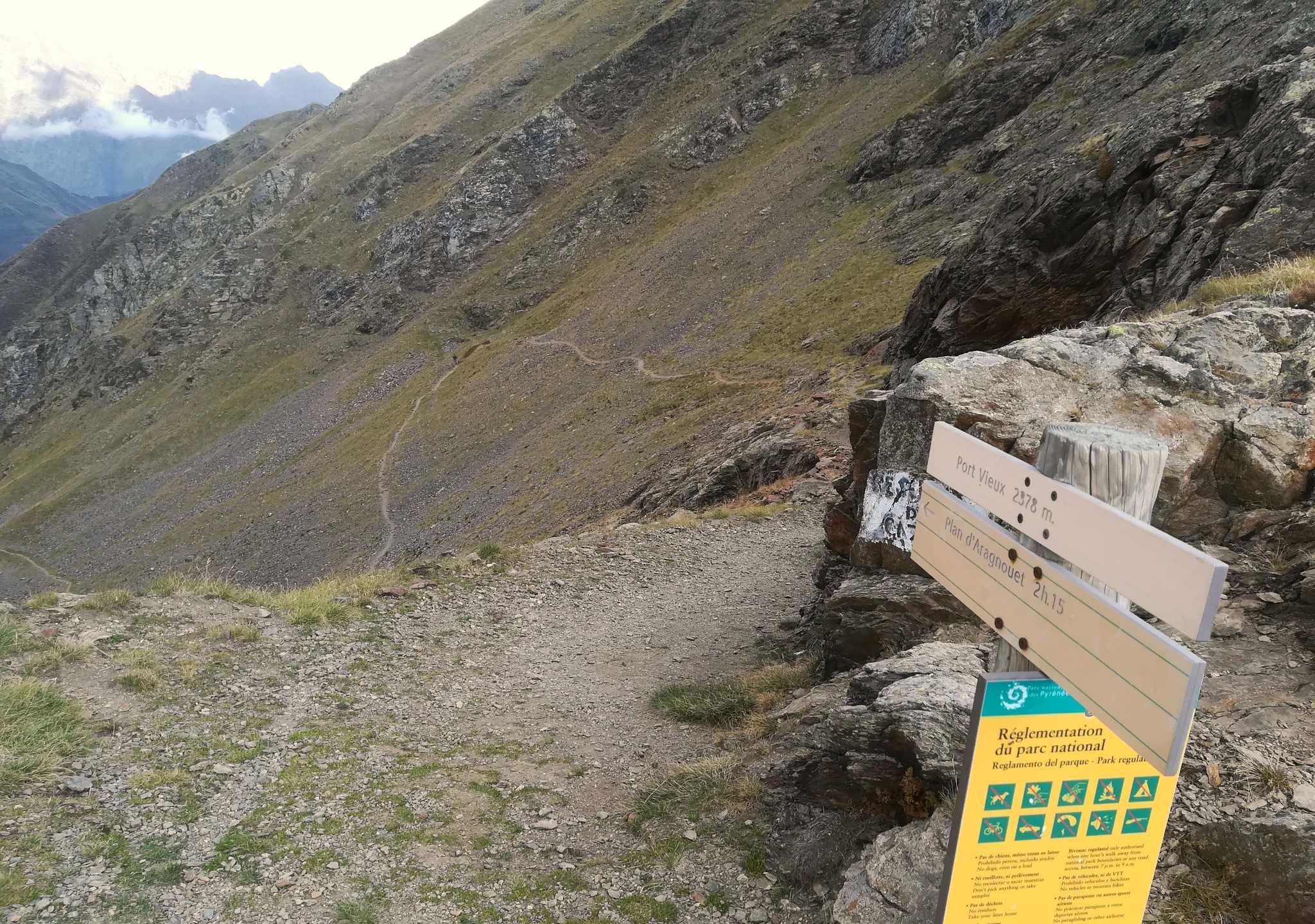
Most people will use a vehicle to get up to the parking spaces, which lie to the right of the tunnel entrance at the ‘tunnel HQ’. The path to the pass starts round the back of the building, where there are walk boards and signs telling the story of the refugees’ escape. The path starts at a height of 1,660 metres and heads up to the ‘Puerto Viejo’ at 2,378 metres (in the French it’s the Port Vieux, with both meaning Old Pass in English).
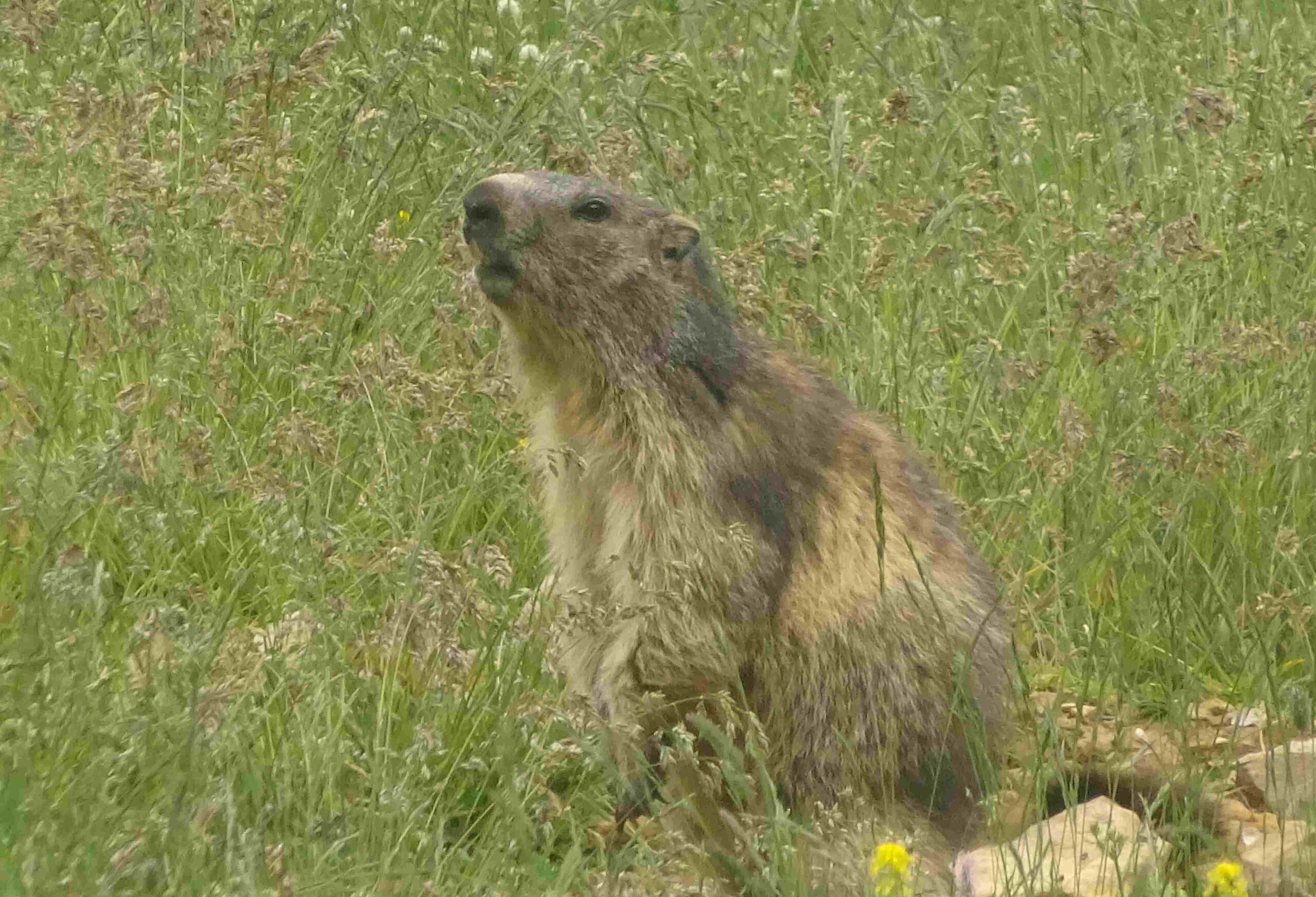
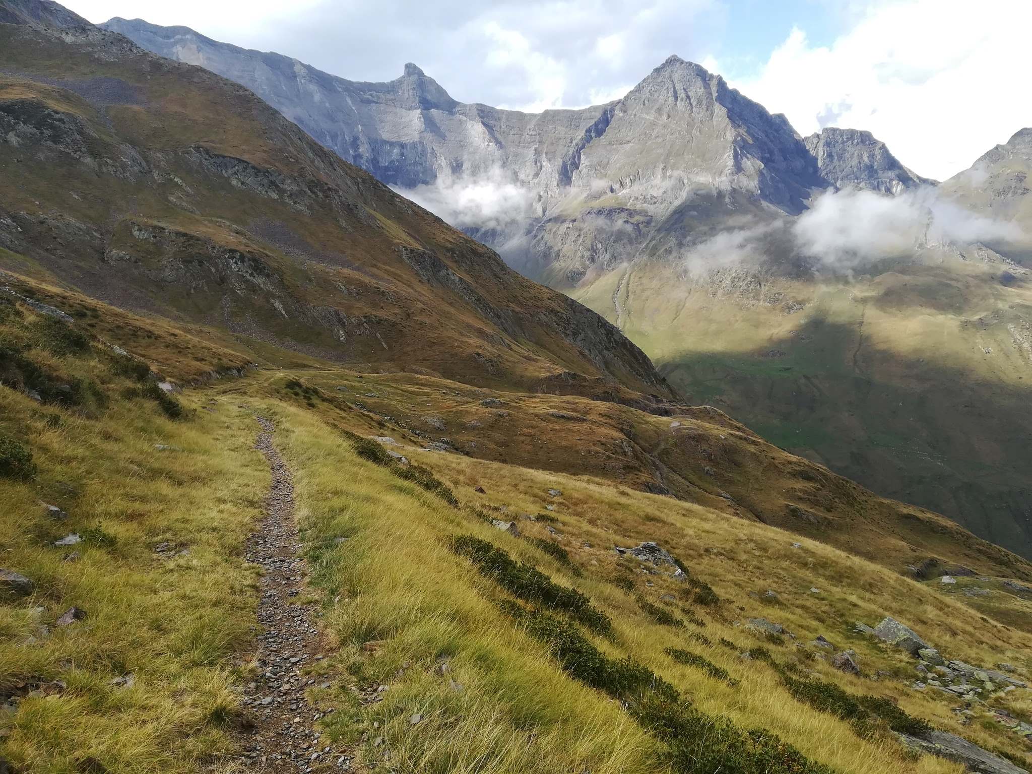
Ascend on a switch-back path to the top of a waterfall, where a pause is in order to admire the view. The route then heads straight up the grassy valley, first following the stream and then keeping to the right. It is a well-used path. You may see marmots on the way. Keep straight on, up to the old border post where there is a plaque to remember the ‘Bolsa de Bielsa’. From the border there are stunning views into France and back down the valley into Spain.
I have to admit that I had a Tony Blair moment when standing at the ‘Puerto Viejo’ and ‘felt the hand history’ upon my shoulder. It is hard not to think of the fleeing Republican refugees who had struggled up here in the snow in 1938 – men, women and children carrying all their worldly goods – who then faced the long descent into France and an unknown future in another country. The disused sentry box is a reminder that we can now pass freely from one country to another without having to produce a passport or anything else for gun-toting frontier guards.
The walk which returns on the same path to tunnel HQ measures 8.5km, there and back, with 720 metres of ascent. It’s not a long walk and some people will be tempted to venture into France. It’s a long descent to a hamlet called El Plan. Most will not want to go that far, settling for a point on the path where the views aren’t going to get any better, before turning round to head back.
Accommodation options for Bielsa can be found via booking.com
I have enjoyed staying in Hostal Pañart; although it doesn’t have its own website it is on booking.com. The campsite on the edge of the village close the River Cinca also has rooms, chalets and a good restaurant. More info at www.campingbielsa.com

Recent Comments