
This is a route steeped in history, as well as incredible natural beauty. In the spring wildflowers abound, adorning fields around the villages and mountain slopes and ridges.
Delicate flowers grow in seemingly impossible places after seasonal rain has worked its magic. This makes it the best time of year to do the walk.
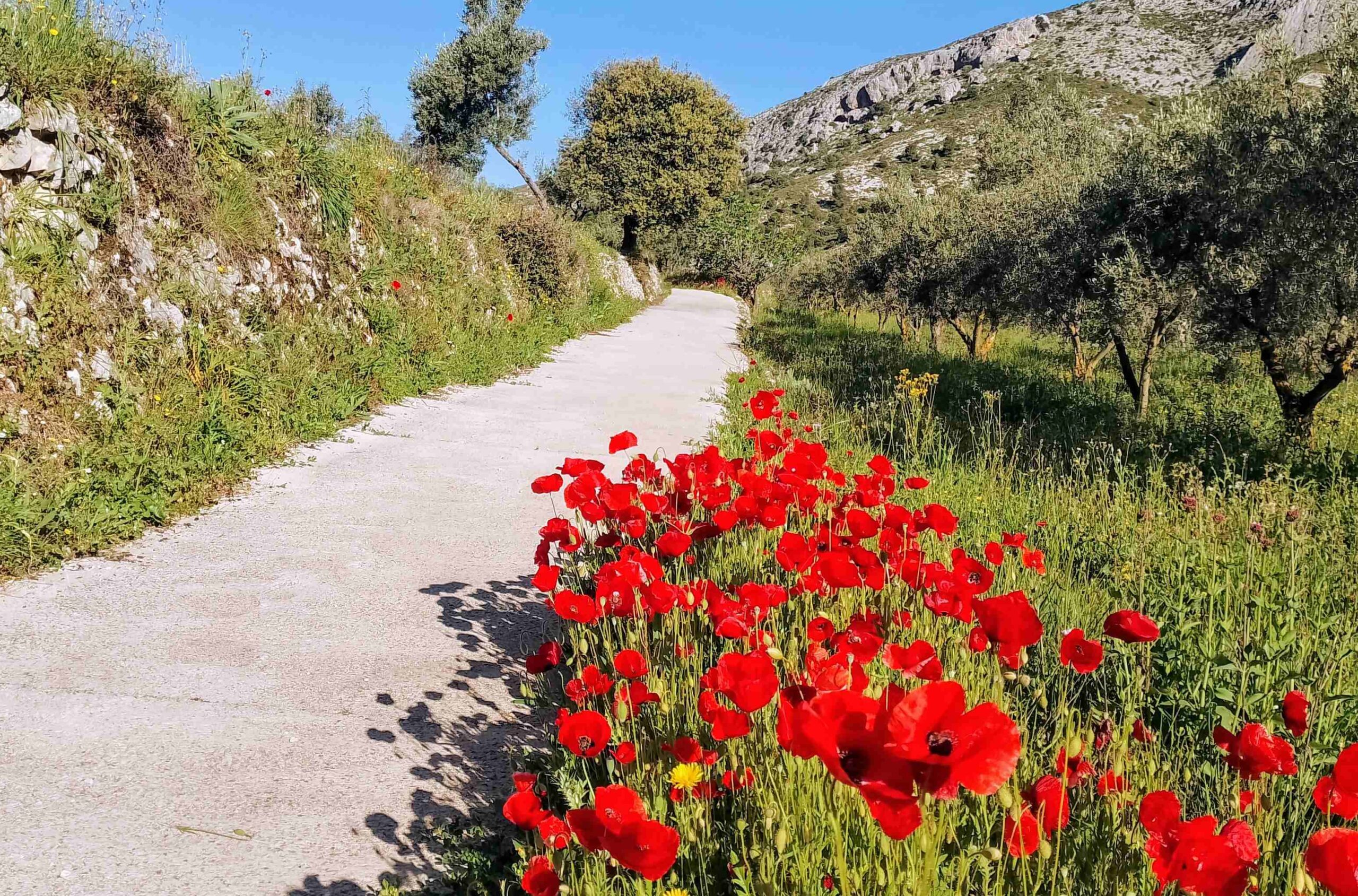
Starting in Fageca (also Facheca), the route follows lanes through cherry, almond and olive orchards, with a procession of poppies lining the path to Famorca in the spring.
Ancient dry stone walls show that farming has provided a way of life for centuries. The two villages have natural springs which serve old public washhouses.
They feed from the Sierra de Serrella, a massif which includes the summits of Mallà del Llop, Pic de Serrella (also known as Morro dels Regalls) and Pla de la Casa; the first two joined by a wonderful ridge that our route traverses.
The GR-330 long-distance footpath is at hand to help us to negotiate the Barranco del Moro (with ‘moro’ being a ‘Moor’) and ascend towards Pla de la Casa, before turning down the Moro to follow this spectacular ravine to its end, returning to the start point of Fageca.
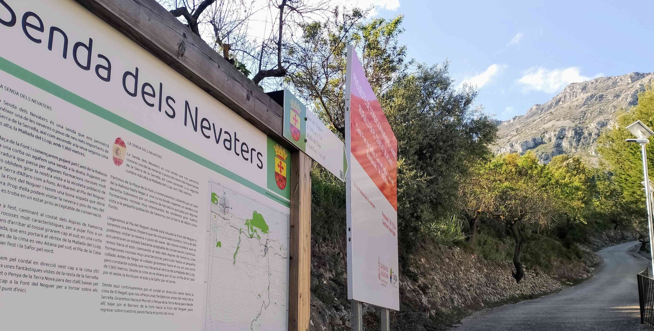
It is in Famorca that we pick up the Senda dels Nevaters; the route used by the hardy folk who harvested ice at the snow well which stands at 1,137 metres; the Nevera del Noguer.
They would fill the deep, stone-walled well with snow in winter and compact it to form ice; then the ice was taken down to the valleys in pre-fridge days to be sold as a luxury product.
The ‘senda’ (path) leads up to the snow well, a fascinating feature of mountain existence, with the wells standing as a testament to a way of life that has long gone.
This circular route makes use of several different waymarked paths, jumping from one to the other. On the sections that do not have waymarks, there are signs to help with orientation.
Our route starts from the Fageca municipal sports centre, which is on the edge of the village, off the CV-754 road that heads to Quatretondeta. Parking spaces are available outside the building, which also has a bar.
The walk measures around 14km in length, with approximately 900 metres of ascent. People wanting a shorter route with very little ascent could walk along the lanes to Famorca, returning the same way, seeing the plantations and the wonderful spring flowers in season; this is a total of 5km.
The walk
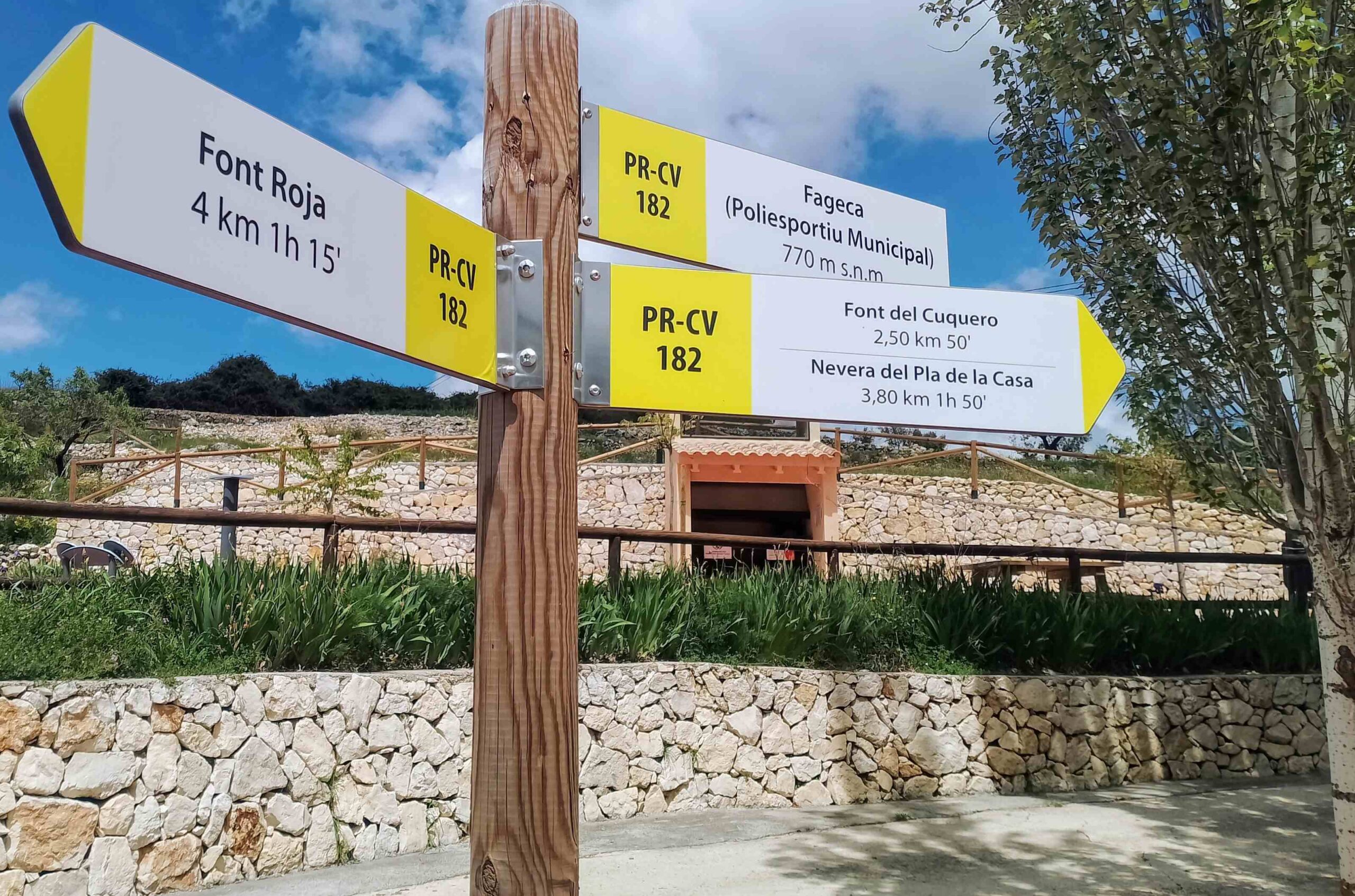
See the signposts outside Fageca sports centre for the PR-CV 182 footpath. Follow the arrow which points right for the Font del Cuquero.
The route heads along the quiet road into the village. Turn right at the junction to walk along the CV-720 as it heads through Fageca.
Notice the area on the left which advertises the tourist attractions of the village. Immediately afterwards is another PR-CV 182 sign at Plaza de l’Esglesia which points under the road via a tunnel.
The route emerges onto a lane which heads to the Font de l’Esperit Sant spring and washhouse. Pass the washhouse and continue along the lane, heading towards the mountains in the distance, the Sierra de Serrella.
The lane which goes to Famorca is flanked by dry stone walls and cherry and almond plantations, with some olive trees thrown in for good measure. Around 100 metres after the ‘font’ arrive at a junction with multiple signs. It’s a left turn for Famorca, which is 1.8km away; now moving onto the PR-CV 168 footpath.
At the next junction keep left, taking the lower lane. Lane turns into a track and passes through the orchards; in the spring the fields will be full of poppies, the red providing a vivid contrast with the deep green of the grass.
The track goes east, running parallel to the CV-720 road below. Keep following the white/yellow waymarks, ignoring offshoots until arriving at a cairn, where our route bears left, moving off the lane onto a surfaced track which runs into Famorca.
Follow the waymarks through the village. Traverse the short street tunnel, emerging in the picturesque Plaza del Font, which has an old washhouse and magnificent trees. Walk across to the walkboard on the far side of the square; it has information on the Senda dels Nevaters, the route taken up the mountain by the ice men.
Here a map shows how the route leads to the Noguer snow well and on to the summit of Mallà del Llop (1,361 metres). A sign points up the lane, telling us that the summit is 3.64km distant.
This write-up is divided into two parts due to the large amount of information and photos included. Read part 2 on the next post


Recent Comments