The Guadalest valley is home to the highest peaks in Alicante province.
Rising close to the Mediterranean coast at Altea, it heads inland and forms a long dogleg which ascends to the Confrides pass at 970 metres.
The southern flank includes the Sierra de Aitana, with the highest summit in the province at 1,558 metres. On the northern side the mountains are lower, but not by much, and there are some wonderful peaks to climb in the Sierra de Serrella.
One of the best of them is Pla de la Casa (1,379m), standing on its rocky perch looking over a sumptuous high-mountain plateau, where an ancient snow well is located.
The GR-330 trans-Alicante footpath offers a signed and waymarked route to a point just short of the summit. Then we jump onto the PR-CV 182 path for the final short ascent to the top.
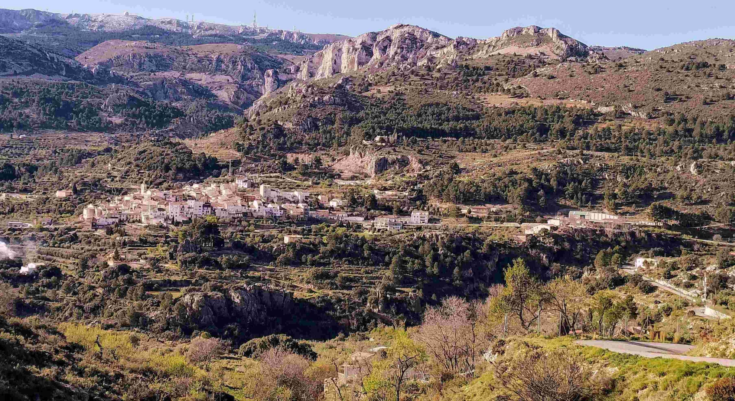
Our walk starts in the attractive village of Confrides at an altitude of 780m. The path climbs on country lanes, through orchards and pine forest, before heading up through a dramatic breach in a wall of rock; a gateway to the Sierra de Serrella. Once you know the breach is there it can be used to explore other summits and different footpaths.
With around 750 metres of ascent and 19km of hiking, this is a route for experienced mountain walkers with a good level of fitness.
The walk
Parking is available in Confrides in front of Pension Pirineo (hotel) on the CV-70 road which ascends the Guadalest valley and passes through the village. A drink and a meal can be taken here at the start and/or end of the trek.
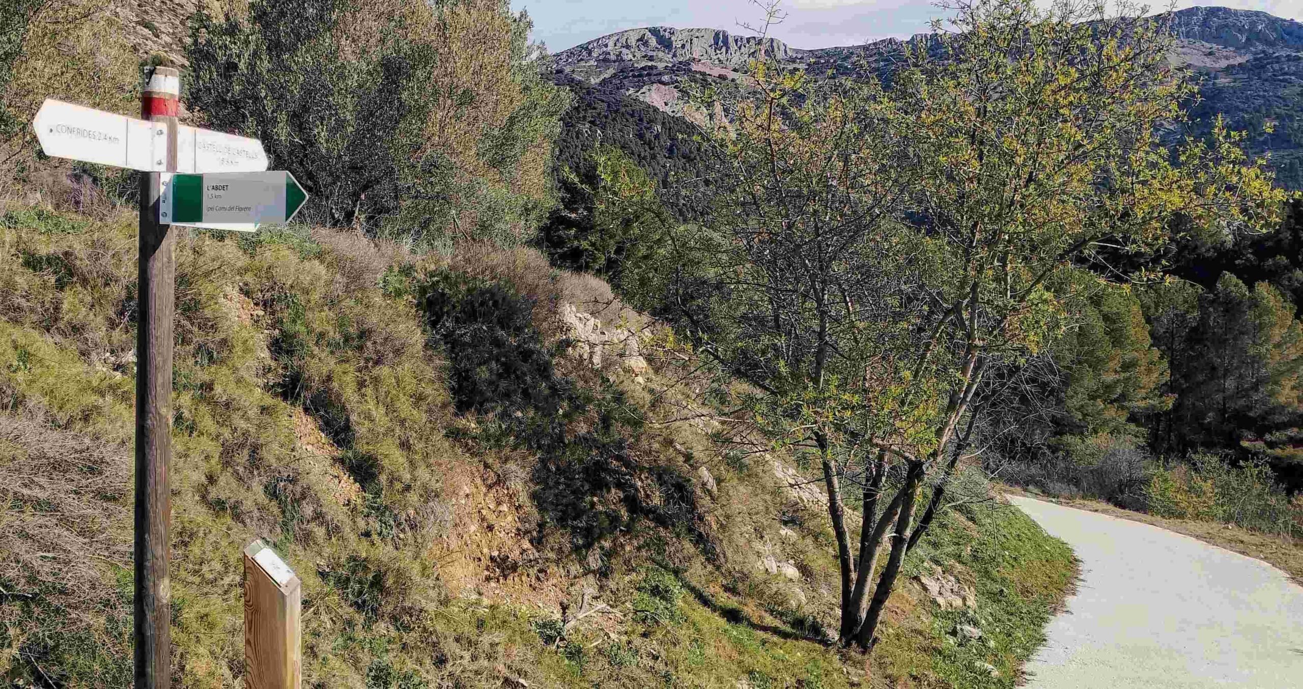
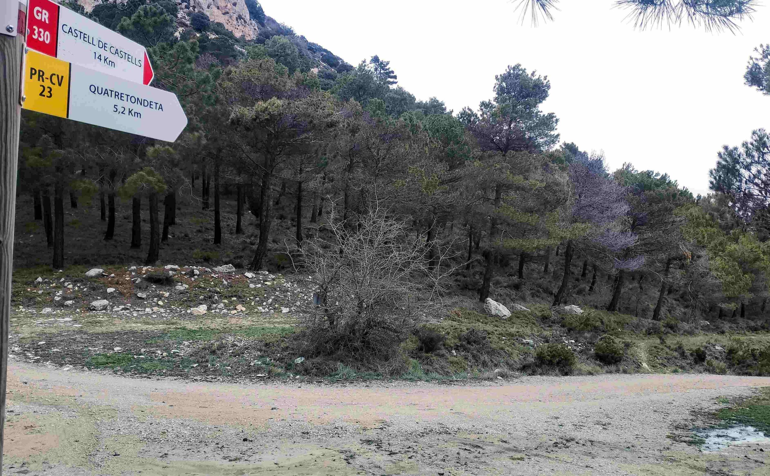
Walk up the CV-70, out of the back of Confrides towards Alcoy. The road exits the village and goes downhill. After around 100 metres take the first right. There is a sign here for the GR-330, which says it’s 20.9km to Castell de Castells.
The white/red waymarks of the GR appear on the country lane, which crosses a stream and starts to wind its way up the hillside. Pass the mobile phone mast.
The views over Confrides and the looming Sierra de Aitana behind it improve as height is gained. The lane crests a rise and then goes downhill with white/red waymarks showing the way.
A couple of minutes into the descent, turn off left onto a surfaced track; there is a GR-330 sign here pointing for Castell de Castells. Heading down the track, bear left at a fork. The track passes between olives trees on the right and an irrigation pool on the left.
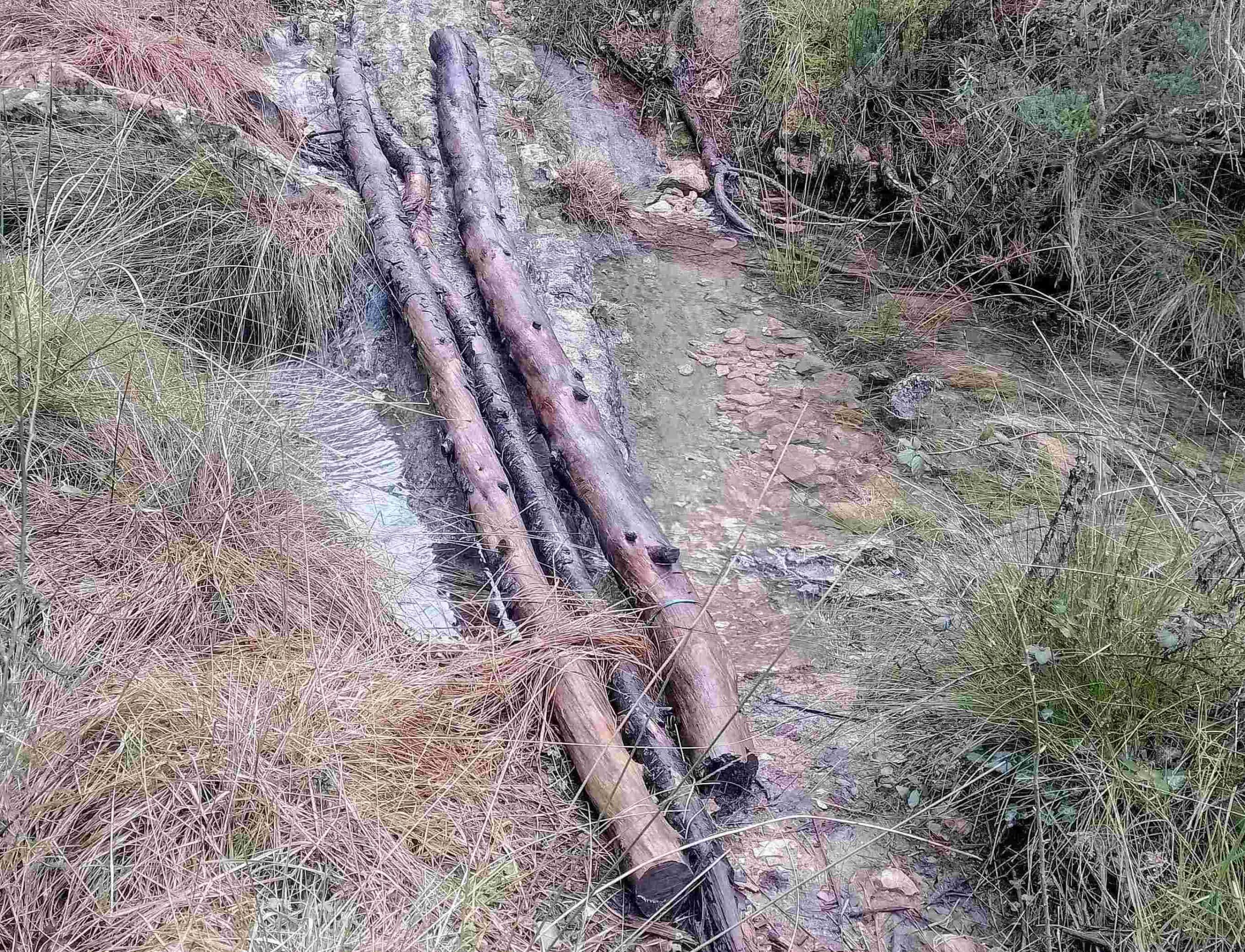
Pass to the right of a small white building with a solar panel on a tall post; then bear left to start a descent on a path, ignoring any turn-offs. Reach a stream and cross it. The path follows the far bank of the stream, then criss-crosses this narrow waterway.
Arrive at a point where the path runs along the bottom of a rock wall. Waymarks show the way. After entering the bed of the stream for a short section, the path then embarks on a steep-ish climb out of the ravine which carries the stream.
The wide path now runs along the side of the ravine, passing through the pine forest. It’s very pleasant, shady walking. Path turns into track, and passes a rural dwelling; now running parallel to the mass of rock above which is home to the summit of Pla de la Casa.
The track emerges at a junction and the GR-330 bears to the right, where a sign states that Castell de Castells is 15.5km away. The track is now heading up a steeper slope, ascending in a switchback fashion.
It emerges at a spot which looks like it’s the end of the line; but it isn’t. Our route swings to the left, turning into a path to start a steep ascent of the mountainside towards the breach.
Follow the cairns and waymarks on the path as it goes up. The breach in the rock is visible from below. Up at the breach you will probably want to take a moment to savour the views over the area and up to the Sierra de Aitana on the far side of the valley.
The path bears immediately right after passing through the breach. It runs along the side of the shallow ravine, with the wonderfully-shaped rocks now on the right. Heading up through the trees, keep a keen eye open for the white/red waymarks.
At the top of the rise the path bears left; it’s only around 70 metres through the trees to reach a wide track. Bear right to follow the sign which notes that Castell de Castells is 14km away.
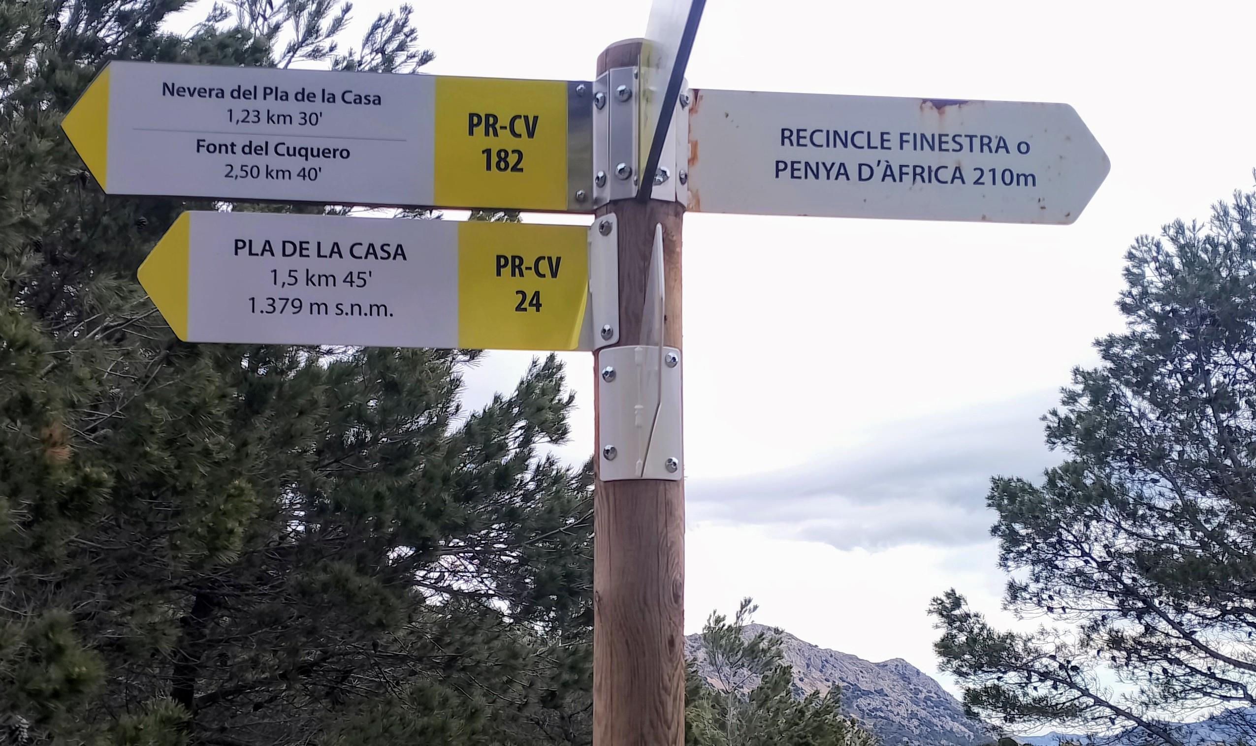
The wide track descends. Ignore any offshoots and follow the waymarks. The track emerges at a confluence of paths, where signs point in different directions. The PR-CV 24 bears left to go up to the summit plateau, but this is the way we come down. Our path bears slightly right at the signpost, however the arrow which points the way for the GR-330 has been snapped off.
See the first white/red waymark on a pine tree around 10 metres along the path. Soon the waymarked path is running parallel to the summit ridge above. The path passes underneath Pla de la Casa, then comes to a junction. The GR-330 bears right, but we turn left.
After around 15 metres come to a tall signpost which points left for the final ascent to the summit. This is on the PR-CV 182, with the sign pointing for the ‘nevera de Pla de la Casa’ (a nevera is a snow well, as well as a fridge), which is only 0.35km distant.
It starts off in fairly gentle fashion and then becomes steep and switchback. It’s a clear, waymarked path.
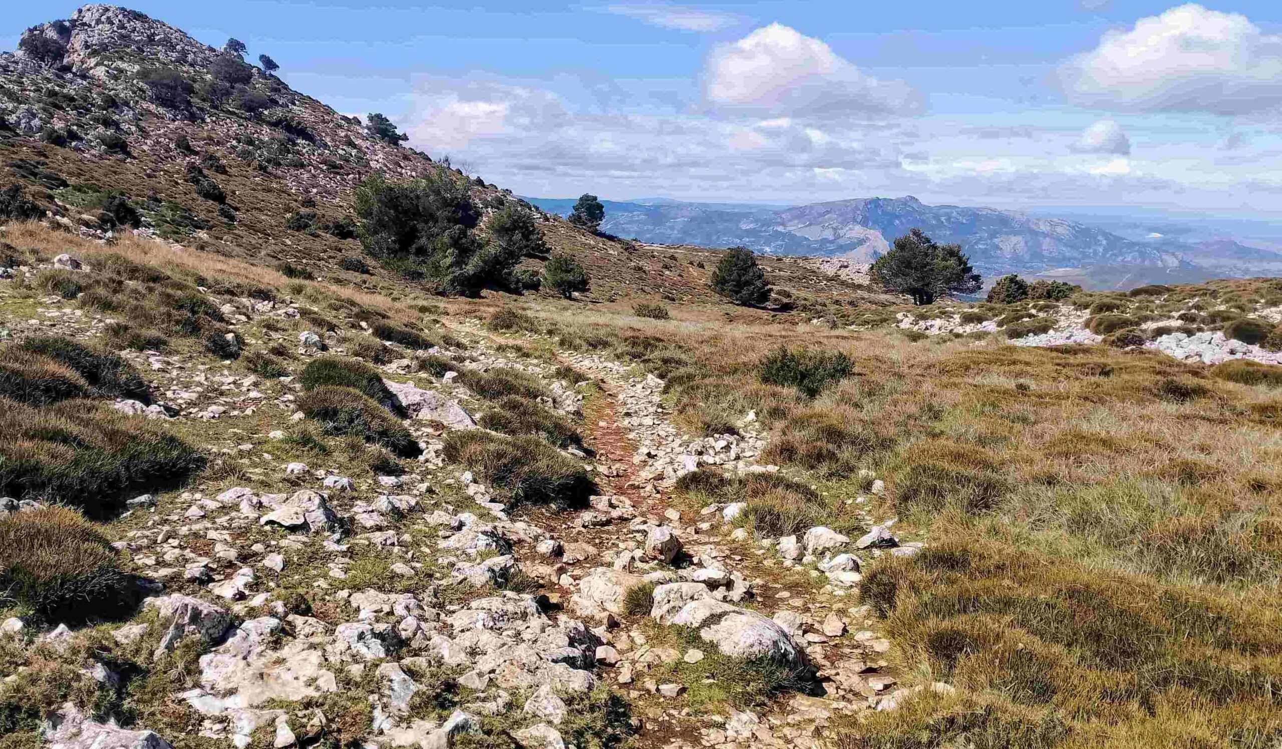
It emerges at a wonderful, wide, high-mountain area above 1,300m, which can be covered in snow in the winter. A sign reveals that it’s a left turn and a 100-metre-long ascent to the peak.
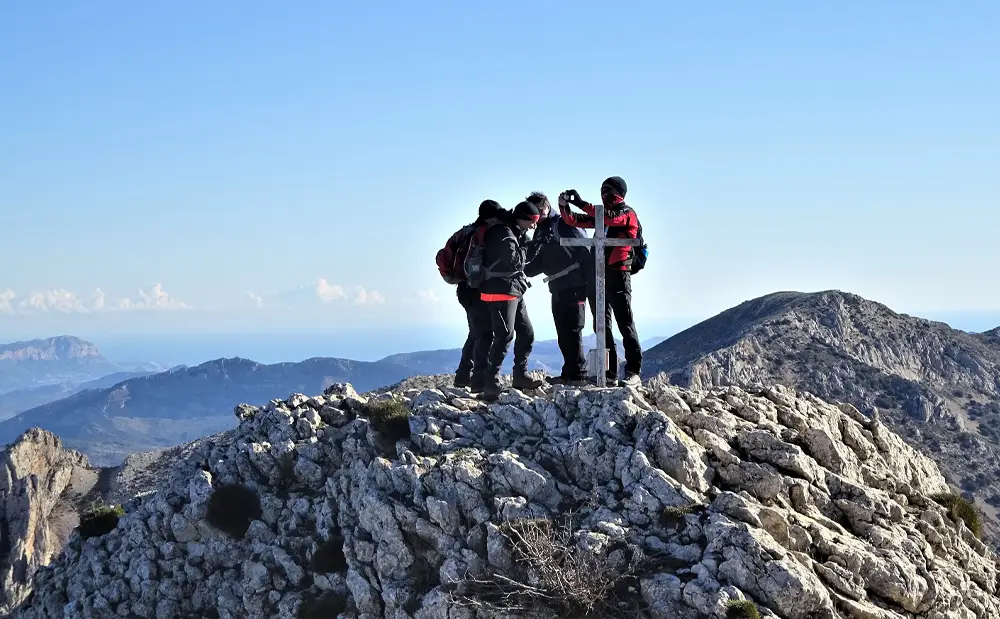
There is a cross on the summit rock and stupendously good views over swathes of Alicante province and up towards Valencia. Be aware that great care has to be taken up here as fatal falls await off the sides. Try not to get distracted.
Just below the summit, on the wide, grassy plateau, is the deep snow well, which is being refurbished. There are great views over the well from the top.
Walk back down to the signpost and bear left to follow the path which runs past the snow well. The well is fenced off but it is possible to see part of the interior and imagine how it was packed with snow in the winter, with the resulting ice taken down to the valleys in the summer to be sold as a luxury product.
The waymarked path goes up and crosses this fantastic rolling plateau, with more expansive views awaiting the walker. It reaches the end of the plateau. The descent back to the signpost reached earlier is quite steep and care has to be taken on sections of scree.
Below, at the sign, bear right to get back on the GR-330 and follow the wide track which was taken earlier, returning on the same route.
Retrace your steps on the GR-330, following the track through the pines. It goes back up to the sign, bearing left onto the path into the wood to reach the rock wall which contains the breach.
After descending from the breach, reach the sign which states that Confrides is 5.7km away. Here the walker has a choice. Bear left to return on the same track. Or turn right to go back via the CV-70 road, which is more than 2km shorter.
For the road option, on reaching the CV-70, bear left. It’s downhill to Confrides. Generally the road is not overly busy but there can be speeding vehicles, particularly motorbikes.
The full route with the return by road is approximately 19km.


Recent Comments