Pyrenees Huesca
An area of savage natural beauty, the mountains of Huesca province form the most extreme landscapes in the Pyrenees. The highest peaks are found here with dozens of summits over 3,000 metres. In the Maladeta massif near Benasque, Aneto reaches 3,404 metres, with the largest remaining glaciers in the chain on the high slopes. Incredible natural features have been formed by the ice ages; the Ordesa canyon and nearby Añisclo canyon, with the three sisters at the head them – the mountains of Cilindro de Marboré (3,325m), Monte Perdido (3,355m) and Añisclo (3,259m).
South to north valleys dominate the landscape, running up to the France border, with off-shoot valleys spilling out of the sides to the east and west. A network of footpaths reach glacial lakes, high passes and the peaks. The GR-11 trans-Pyrenean footpath is the thread that links it all together for the walker; a constant companion offering magnificence at every turn. Our exploration of the Huesca Pyrenees starts in the west at the border with Navarra region and runs to Cataluña
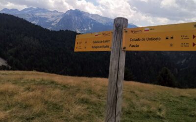
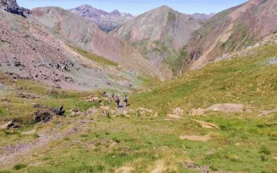
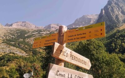
From Góriz to Añisclo
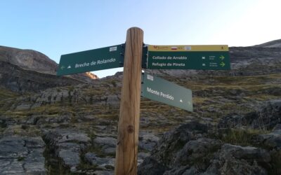
After overnighting at the Góriz mountain refuge – be it in a tent outside, or on a bunk inside – there are mouthwatering possibilities to choose from; after breakfast has been consumed, of course. Three of them are shown on a signpost, a photo of which appears on the...
Bujaruelo is best
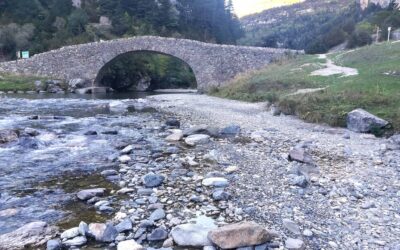
No trip to the Torla-Ordesa area would be complete without a foray into the Bujaruelo valley. It is home to my favourite camping ground in Spain, on the banks of the River Ara at San Nicolás de Bujaruelo, where there is also a walkers' hostel made of Pyrenean stone....
The GR-11 to Torla
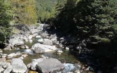
The route to Torla from San Nicolás de Bujaruelo is mostly on the GR-11. It's an undulating path, following the River Ara, passing below the high walls of two gorges, first the Garganta de Bujaruelo and then the Garganta de los Navarros. After Navarros, the...
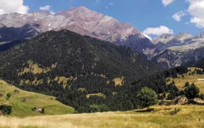
Back to Bielsa
Bielsa is situated at the end of the Pineta valley, which was gouged out during the last ice age; wide, green and with soaring peaks on either side, the River Cinca flows down its centre to the Pineta reservoir. At its head is the Pineta Cirque. Here waterfalls tumble...
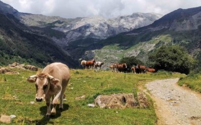
Happy as Larri; the waterfall walk
This is a short, circular walk from the top end of the Pineta valley which offers captivating views of Monte Perdido (3,355 metres) and its glacier. The vantage point can be found after climbing to La Larri, a flat area of pastureland where horses and cows graze in...
On high in the Chistau valley
The Chistau valley (also known as Gistau) is dominated by the 3,000-metre summits of the imposing Posets massif. The area is replete with footpaths which lead to glacial lakes, mountain passes and peaks. Many of them follow wonderful streams which offer the...
On the GR-11 to the Chistau valley
Anyone using public transport to get to Bielsa, and those who prefer to park up in the village, will need to walk a stage of the GR-11 trans-Pyrenean footpath to get to the Chistau valley. It is always a joy to get onto the GR-11 and this is a good opportunity to see...
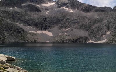
Up to the lakes in the Chistau valley
Following a stream up a wooded ravine, this route makes use of the GR-11.2 footpath as it ventures into the Posets massif. In mid-July, areas of deep snow remained in the upper reaches of the north-facing Val de la Ribereta, with the waymarked path ascending towards...
Up and around the Chistau pass
The Chistau pass (Puerto de Chistau) at 2,577 metres is a point of some significance in the Pyrenees. It is the bridge between two important valleys; the Valle de Benasque to the east and Valle de Chistau to the west. In times gone by, local people would have used the...
From Benasque to Viadós on the GR-11
This route goes up the long Estós valley, following the river of the same name. It crosses over the Puerto de Chistau at 2,577 metres before descending to the Viadós mountain refuge. The Estós valley is flanked by two magnificent massifs; to the right (north) is...
In the land of the giants
The giants of the Maladeta massif stand close to Benasque, making it a favourite destination for mountain walkers and climbers. The peaks of Aneto (3,404 metres), Pico Maldito (3,350m) and Pico de la Maladeta (3,308m) form part of a striding ridgeline flanked by...
Valley walks from Benasque
The lower part of the Estós valley is a good option for those who prefer gradual ascents. A wide track runs up the picturesque valley following the River Estós and the signs of the GR-11 long-distance footpath. As height is gained there are views across to the...