Running north from the town of Sabiñanigo to the France border, the Tena valley has three exceptional bases for hiking. Staying in Sallent de Gállego, Formigal or Panticoso, walkers have a network of routes on their doorstep. The GR-11 trans-Pyrenean footpath is an ever-present thread, linking high mountain areas with the villages. And there are dozens of other options. The Editorial Alpina map, ‘Valle de Tena’ shows all the footpaths on a 1:40,000 scale. Several of the best routes will be outlined here in the following posts.
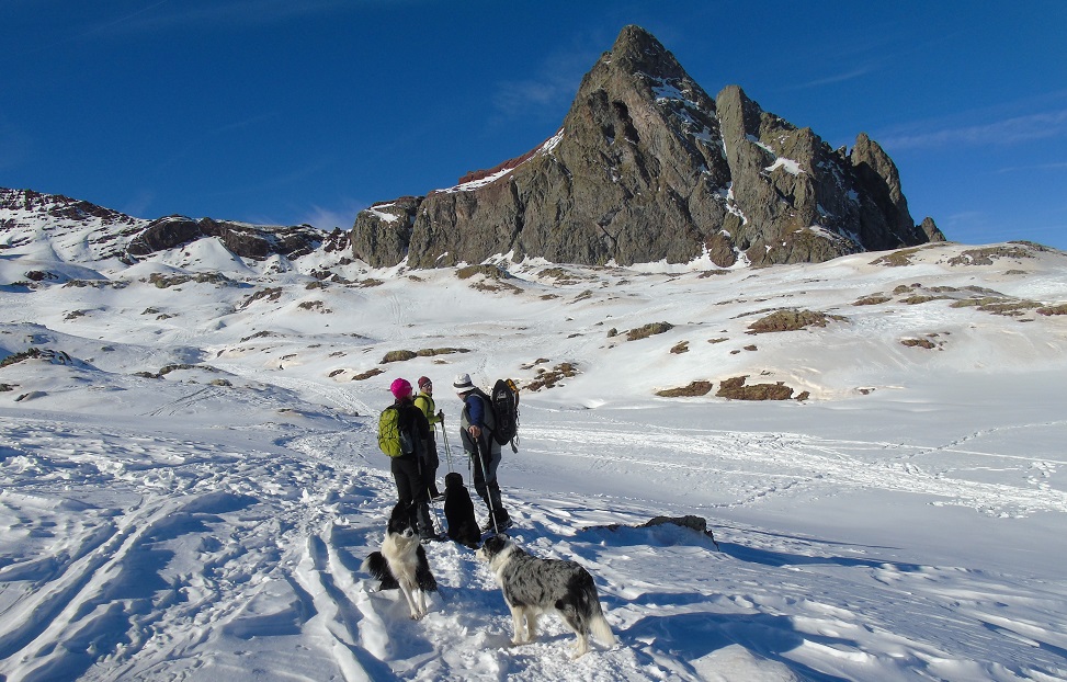
Formigal is a village for all seasons. Its position – standing above 1,500 metres – gives a lot of benefits to the visitor; not least because starting at such a height makes passes and summits more accessible. In summer cool-ish periods for walking can be enjoyed, particularly before noon. Formigal can also benefit from breezes that come down from the peaks, which help to refresh those who are out exploring the hills. The village is best known as a ski resort – and is one of the most popular winter sports locations in Spain. But walkers will find they can ply their trade at any time of the year, with snow shoes used by many hikers to tackle some – but not all – of the routes. Snow shoes (raquetas de nieve) can be hired in the village or bought from local sports shops.
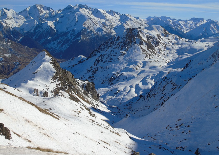
There are a number of mountains in the vicinity which tower over 3,000 metres, including Balaitús (3,144m), the Garmo Negro (3,066m) and the Picos del Infierno (hell’s peaks – three summits over 3,000m). Although these giants are beyond the reach of mortal souls, we have plenty of opportunities to admire their stature and beauty – and imagine how we would climb them, if only we had a bit more time. El Portalet pass (1,794m) and border crossing is just a couple of kilometres up the road, offering opportunities for some terrific walks into France in one of their national parks where the level of protection is so high that dogs are not allowed to enter, even on leads.
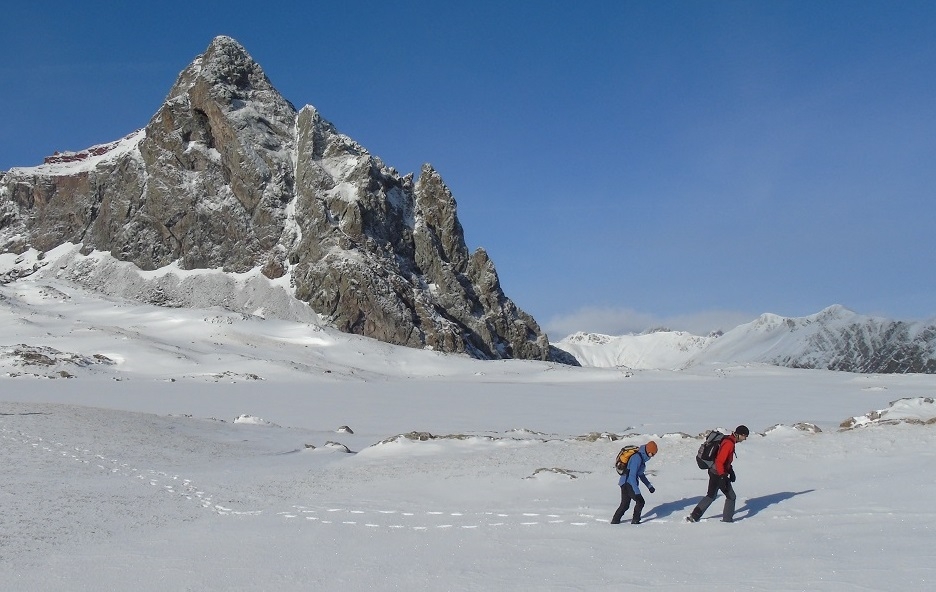
Walking in the winter in the Pyrenees is very rewarding, with the mountains transformed by the snow. The thick blanket of white changes the shape of summits and ridges. But the highest peaks burst through the snowline, with the jagged rock refusing to be bound by the constraints of freezing weather. These dramatic views can be appreciated from all sorts of vantage points, be it a shorter path closer to the villages, or a longer route which reaches a high-mountain area.
The weather is the most important consideration. Some conditions will make walking dangerous. A period of very low temperatures will turn old and melting snow into ice, and great care has to be taken. Avalanches are also possible after heavy falls, particularly when the snow starts to melt. As usual, close attention has to be paid to the website of state weather agency AEMET at www.aemet.es Daily forecasts are available for Sallent de Gállego which is the village next to Formigal; and for Panticosa.
On the GR-11 to Anayet
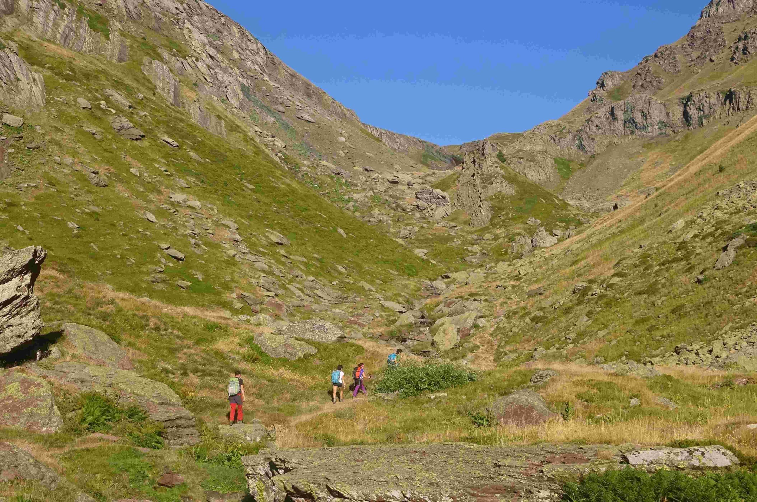
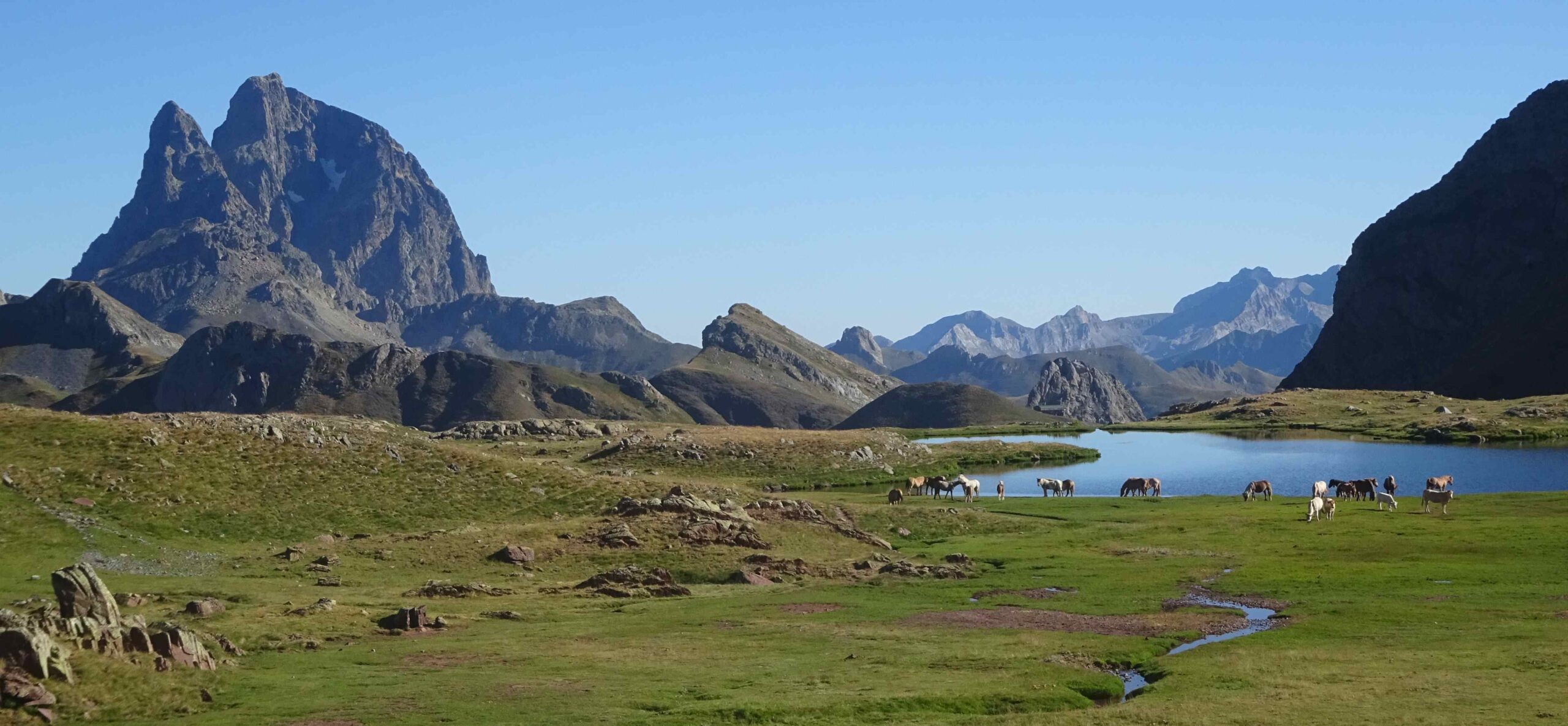
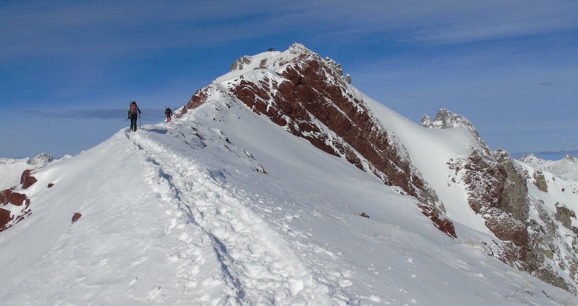
This is a fairly easy walk which can be done on the green grass of summer or on white slopes of winter (with snow shoes); and anything in between. The route runs from Formigal on the GR-11 long distance footpath to the Anayet glacial lakes and the two peaks of the same name. The ascent is gradual, with only a couple of short, steep sections. The highpoint (in more ways than one) comes at the Llanos de Anayet – a wonderful, undulating grassy plateau at around 2,250 metres, where the lakes nestle beneath the summits, with stupendous views into France.
Setting out from Formigal, head down to the A-136 and turn right. The road goes up to the French border at El Portalet pass. Follow the road for around 3km to the left-hand turn which is signposted for Anayet car park; at the junction a signpost says it is 5.5km to Anayet lakes (it is also possible to park here, but space is limited). The country lane leads up to the ski station and is closed to traffic in the summer. It’s a couple of kilometres up the winding road to the ski station, passing under a tunnel/bridge. After arriving at the ski station building, set off up the hill following the lines of the ski lift – and the red/white waymarks of the GR-11. The path runs above a stream and a shallow gulley (on the right). It rises gently. Soon the path doglegs to the right to cross the stream and start the ascent of the sumptuous green valley which leads up to the lake area. This is a popular walk so an early start to the day is essential to avoid the heat and the ‘crowds’ in high summer.
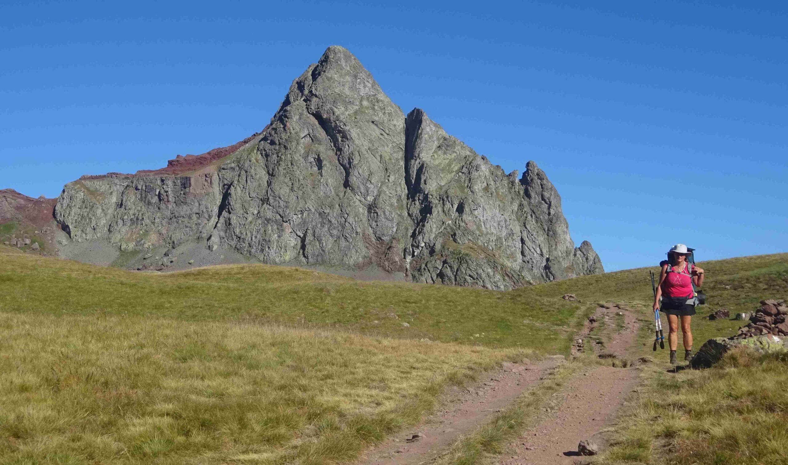
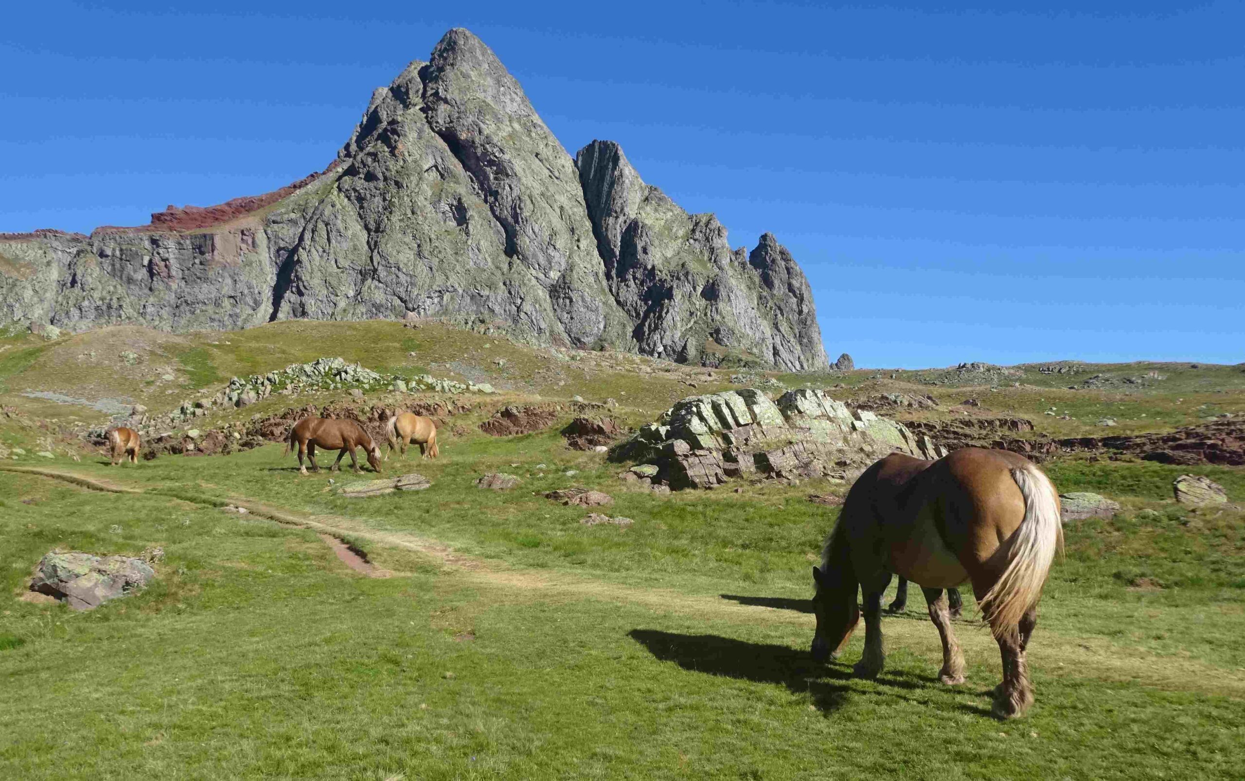
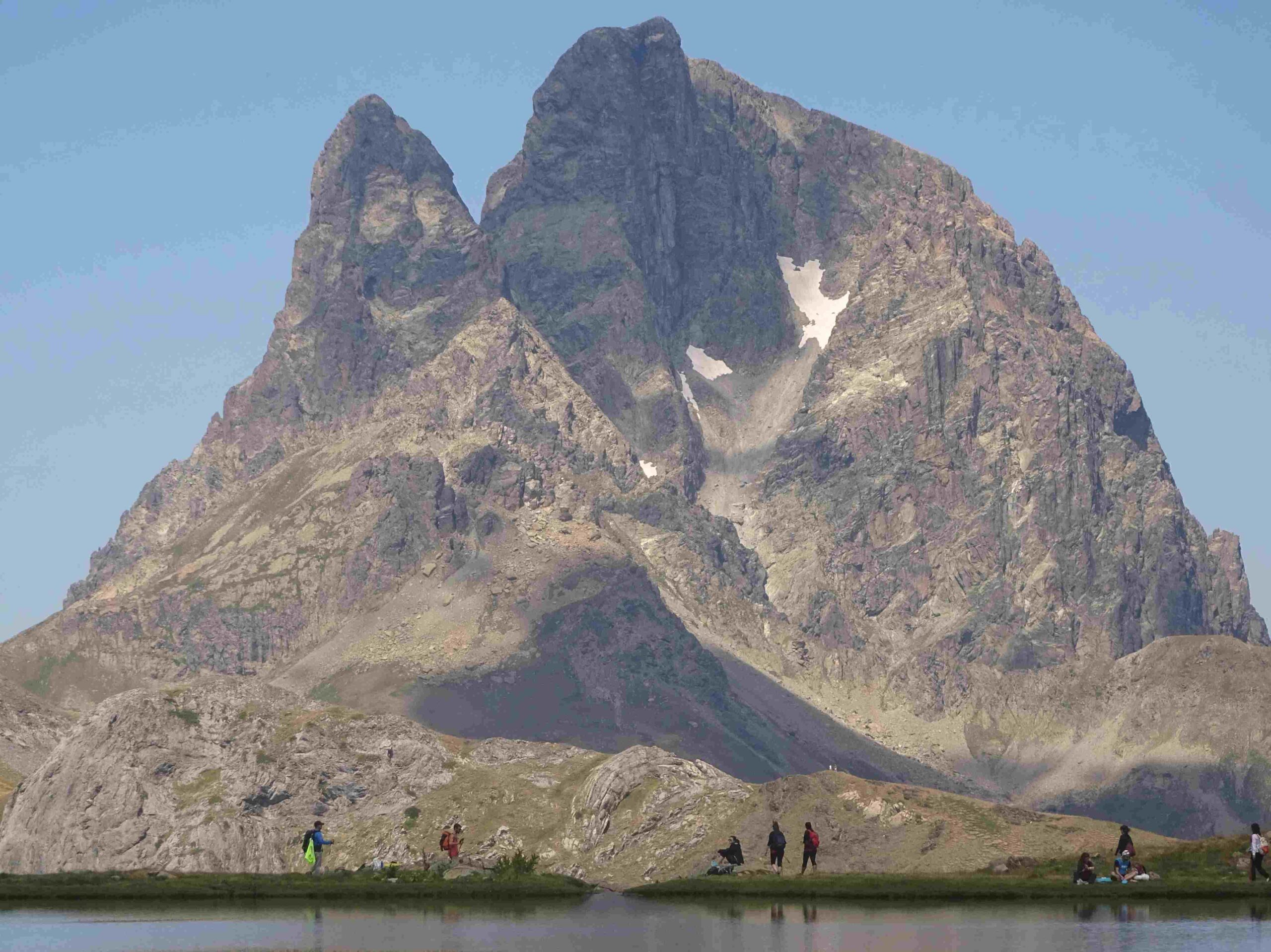
It is very enjoyable section, following the stream and admiring the grassy slopes of the valley. The route becomes steeper as the path approaches the ‘pass’ at the top of the valley. Emerge on the right of the stream to a spectacular sight. In front is a wide expanse of high-mountain pasture, along with the glacial lake – and rising up behind it is the extinct volcano, Pico de Anayet (2,574 metres). It’s a moment to pause and take stock of this incredible scene.
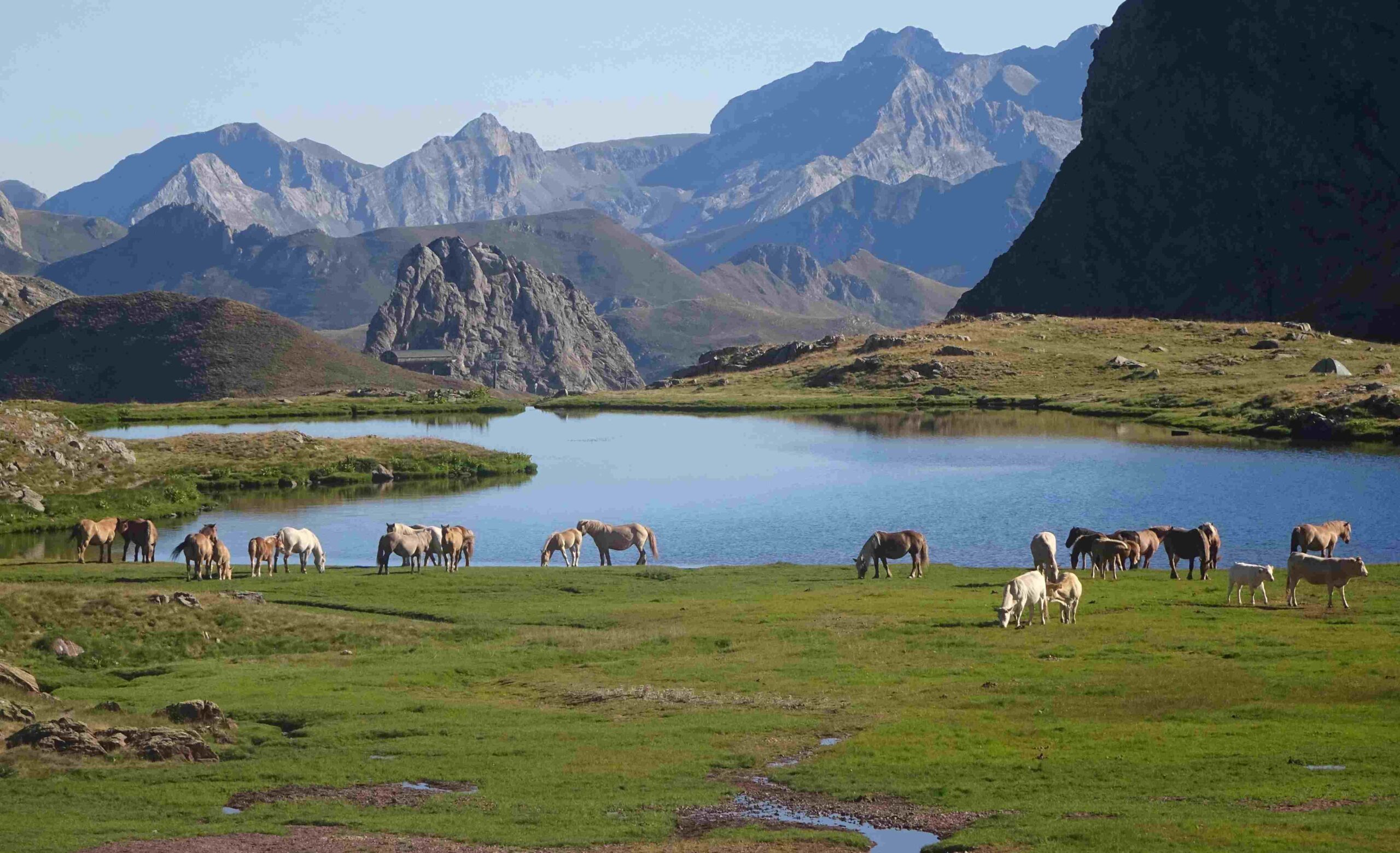
After taking in the views, cross the Llanos de Anayet plateau on the left-hand side of the glacial lake. A signpost points the way, noting that the GR-11 will descend the Canal Roya valley, with La Rinconada 2km away. The path bears right, along the top of Anayet glacial lake. From here, vistas of the magnificent Pic du Midi d’Ossau (2,884 metres) across the border in France dominate the horizon. A winding descent begins into the Canal Roya valley from this point. Many walkers will decide to head back on the same path after further exploration of the plateau area.
Others may be tempted to continue on the GR-11 towards Candanchú. The descent into the Canal Roya valley is fairly steep in parts but not alarming. As the path drops it passes ‘El salto del agua’ waterfall before emerging at the sumptuous stream-crossed pastureland of La Rinconada. This is a great area for free, unencumbered walking. As the valley narrows the path becomes more undulating. Down below the path is the Río de Canal Roya – the mountain river which descends the valley to meet up with the larger Río Aragon. The GR-11 heads into an area called El Mal Paso. Streams plunge down from the heights, crossing the path, which the walker in turn will step over. The water offers opportunities for cooling off. Bearing in mind that there is more than 400 metres of ascent to get back to the Llanos de Anayet, most hikers will not want to venture further than the Mal Paso, returning on the same path.
It is around 8.5km one way from Formigal to Llanos de Anayet, with around 750 metres of ascent.
Where to stay
Formigal is not short of hotels and many of them can be found via booking.com It can be more economical to go the dedicated website of the hotel and book with them direct. On my last visit I stayed at the Sno Formigal, www.snohotelformigal.com


Recent Comments