
The ‘Vuelta a Sollavientos’ route is a cracker – and not too long, weighing in at 8km. As the ‘vuelta’ bit in the title suggests, it is a circular walk which comes back to Allepuz after dipping in and out of the Sollavientos valley/ravine that runs close to the village and carries the river of the same name.
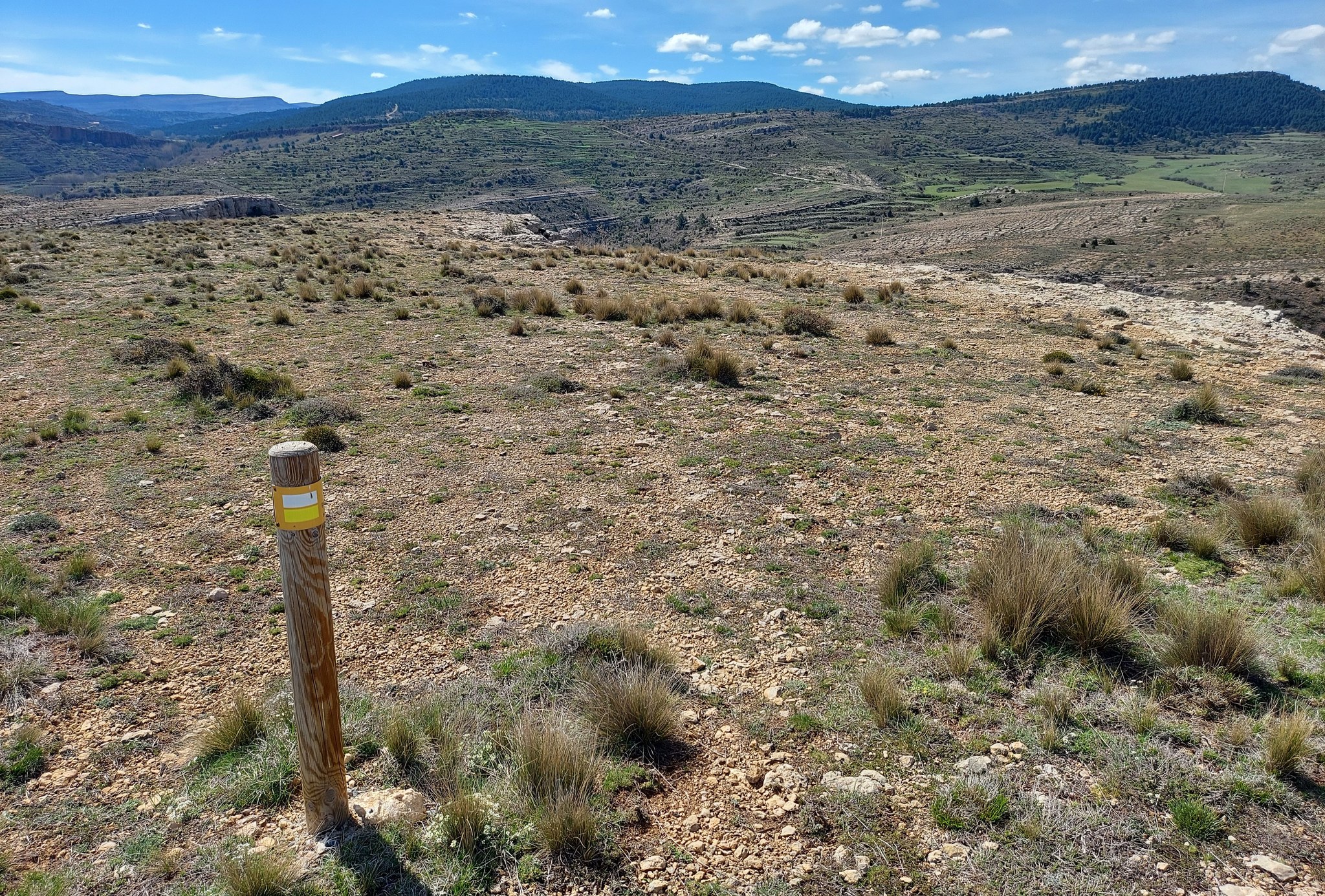
It’s a signposted route on the PR-TE 78 short-distance footpath, and has plenty of white/yellow waymarks to show the way. A varied and fun route, the walker will see the peculiarities and spectacular rock formations of a limestone landscape at almost every turn. There are also opportunities to dangle feet in the stream; and on one crossing the removal of shoes and socks is unavoidable.
The walk
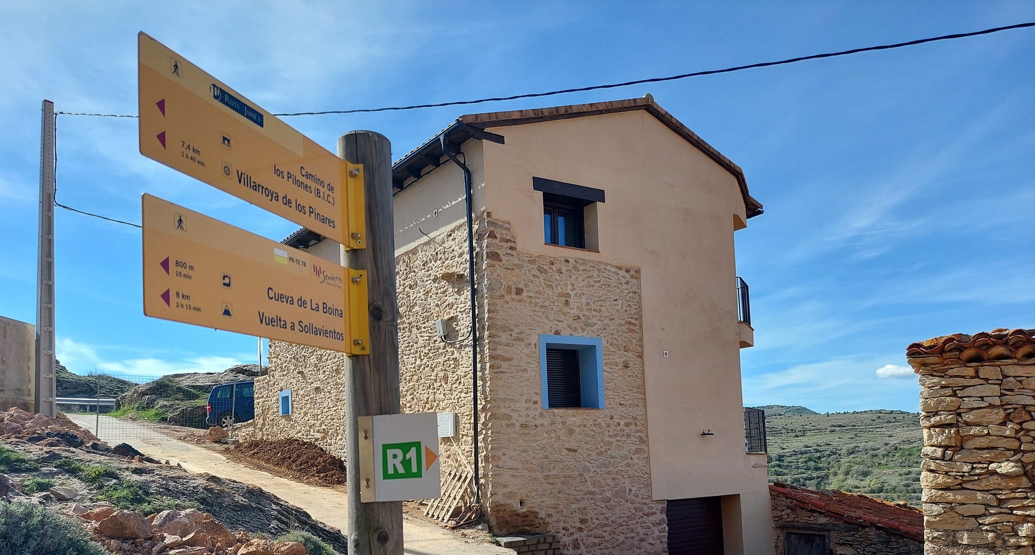
A signpost for the ‘Vuelta a Sollavientos’ appears in the street in front of the Hospedería Palacio de Allepuz palace/hotel, where you might be staying if you are lucky. Exiting the hotel, bear right. Then, after a few metres, it’s a left to follow the ascending street as it leads to the top of the village.
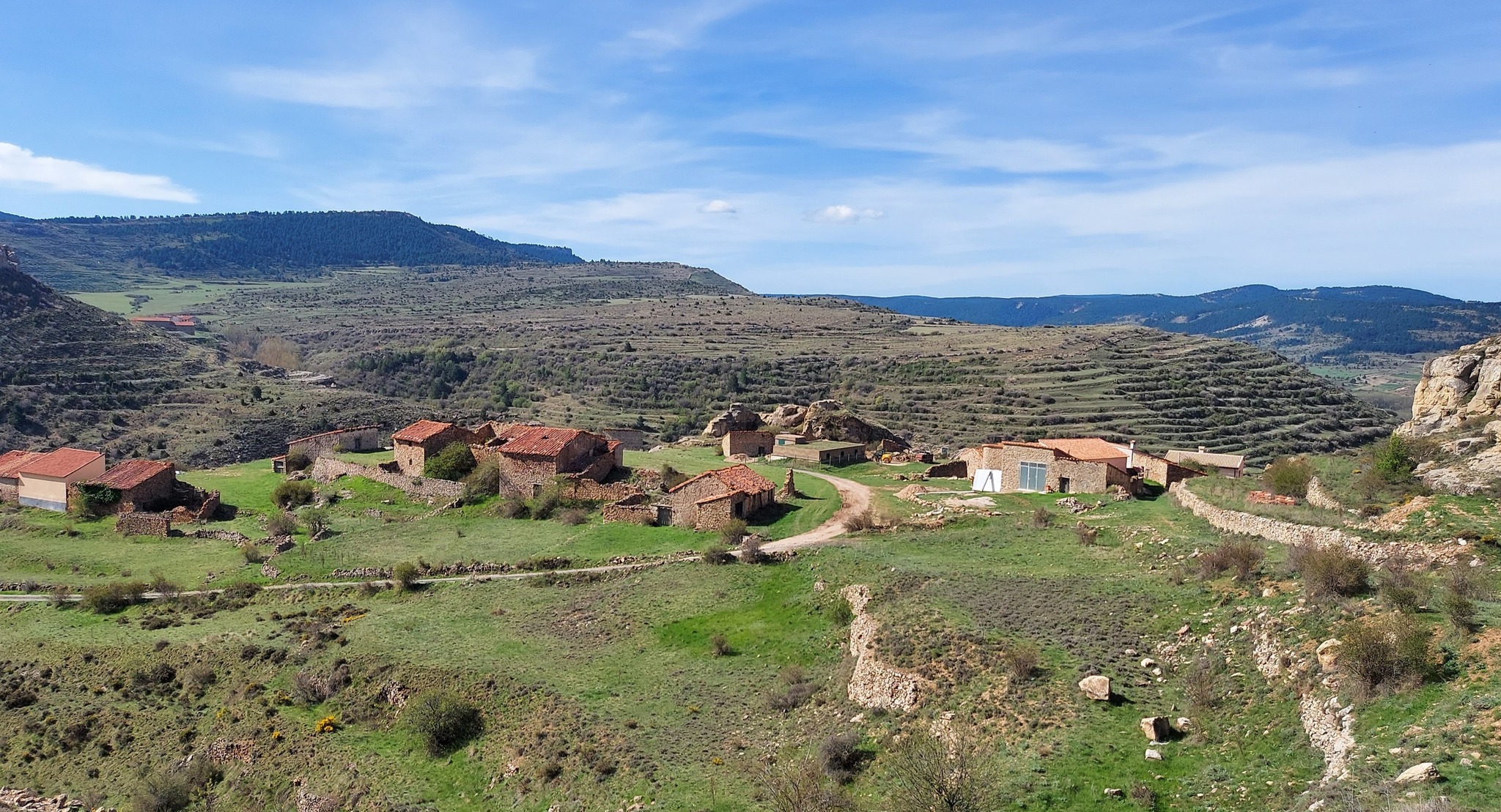
The next sign on the edge of the village is also a left turn. The street emerges at a grassy spot above the village. Keep straight on, following the dry stone wall towards the limestone escarpment. Looking down, see a wonderful old farmstead (masía) on the edge of the village which has been abandoned.
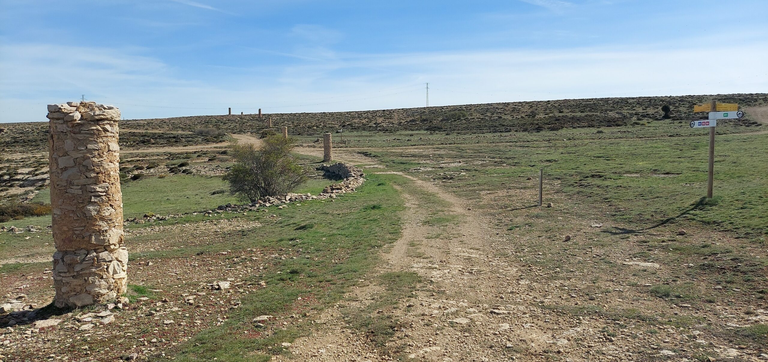
Just before the wall of rock, bear left to follow the passageway which leads up to a pillar. This tall structure marks the beginning (and end) of a line of stone pillars stretching for several kilometres across this high mountain area. They were constructed in the 18th century to guide traders and residents through snow and mist. Allepuz stands at nearly 1,500 metres above sea level and the hills around can be covered in snow in winter.
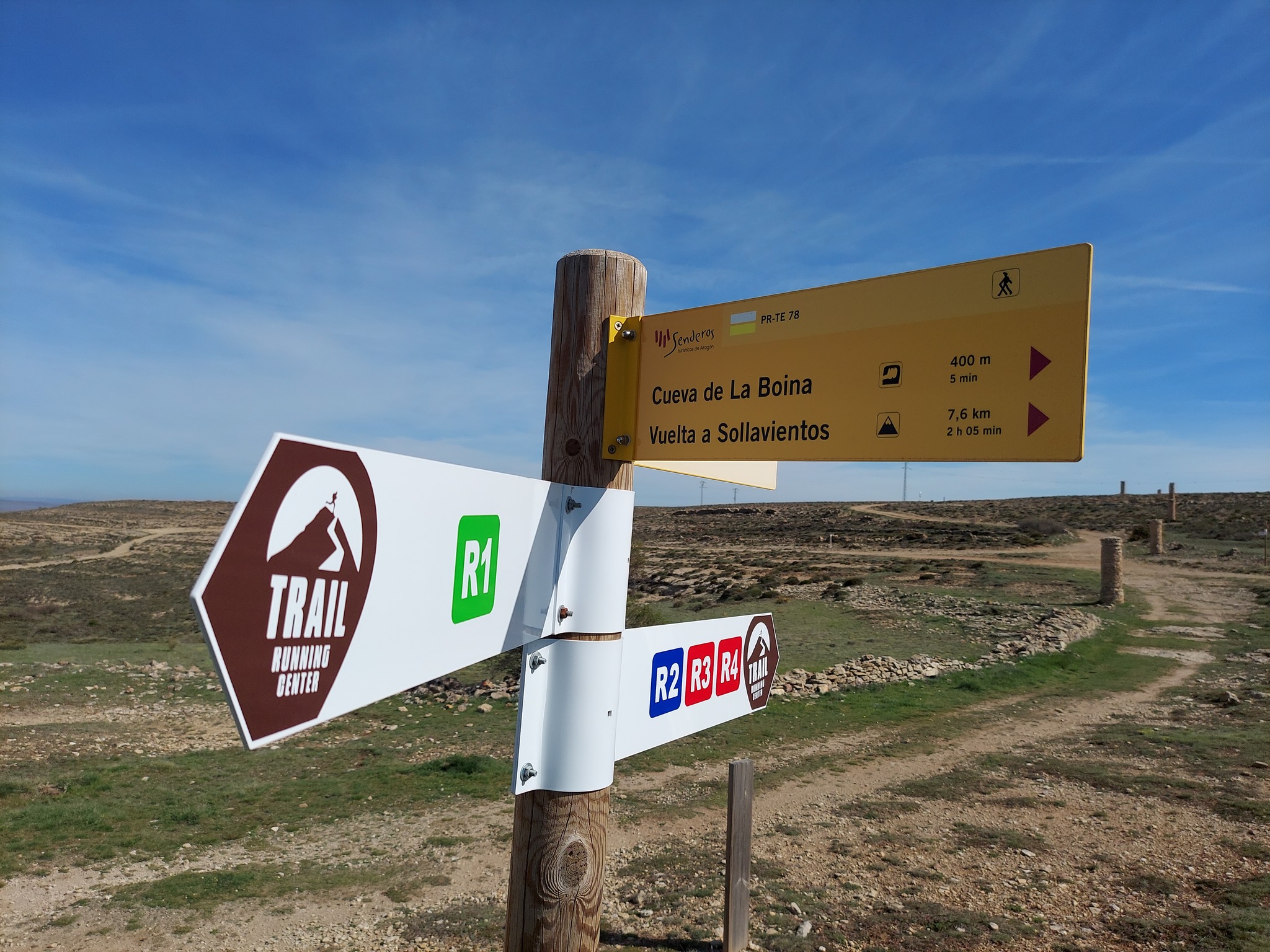
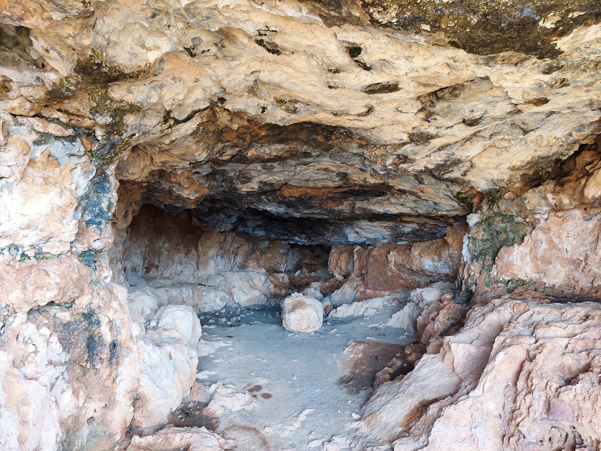
Our route bears right at the start of the pillar line to follow the wide track which runs parallel with the edge of the limestone escarpment. A sign tells us that the Cueva de la Boina is just 400 metres away. The cave lies to the right of the wide track. There is a bench there to admire the view and a sign to mark the spot. The cave entrance is below the top of the escarpment. Some people will fancy having a look; it is under the ridge and a footpath leads down. Walk for around 30 metres to reach the mouth.
It is quite a large cave – typical of a limestone landscape – which shows signs of being inhabited in the past. Warmer in winter and cooler in the summer, it would have been a sought-after residence in bygone days. Back up top, the PR-TE 78 footpath follows the edge of the ridge, before a marker post signals that the path is moving away on a diagonal to the left. It’s a gradual descent, following the waymarks, before turning back to the right.
Notice the road below. The route winds its way down and eventually crosses the road to reach a wide track.
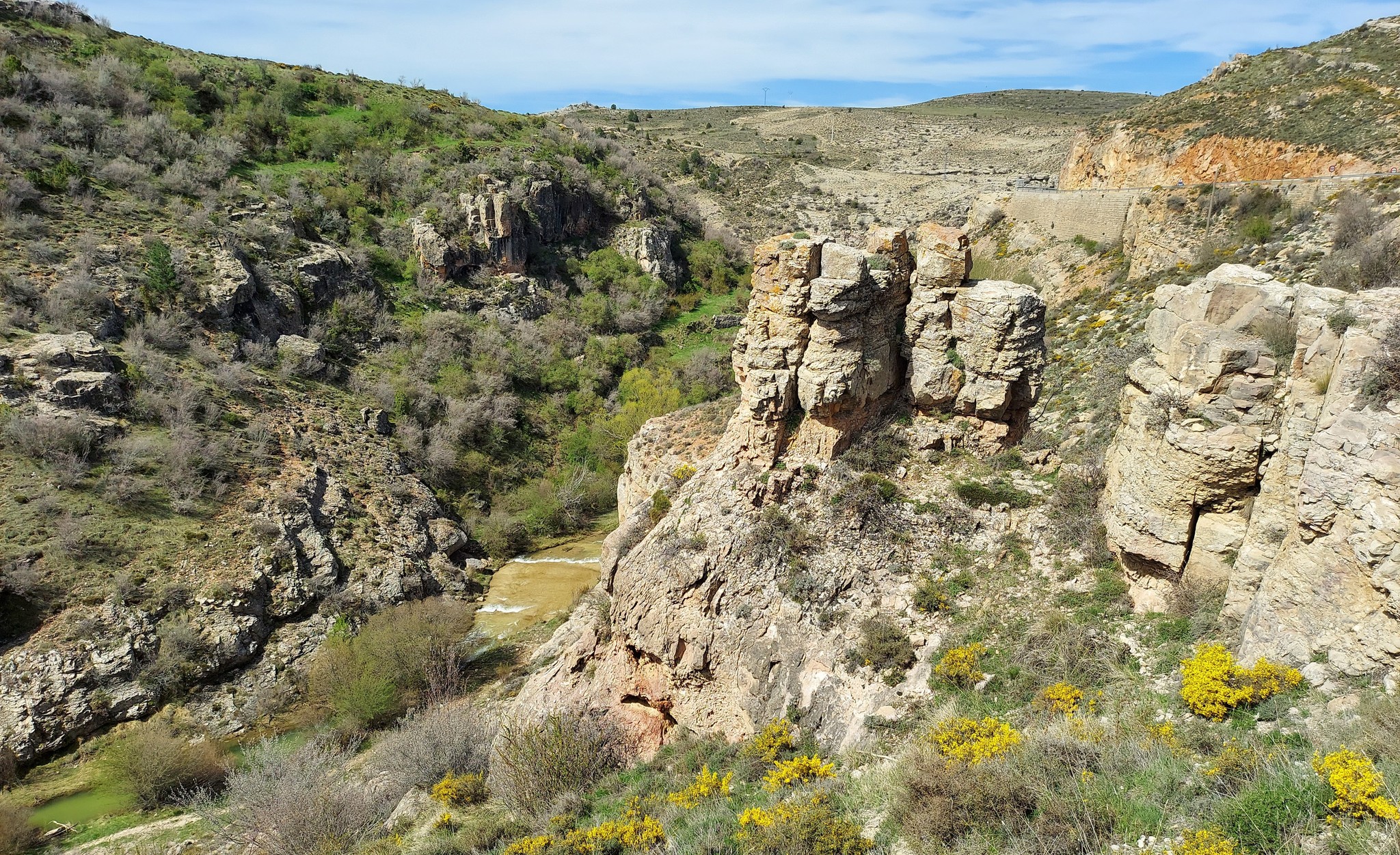
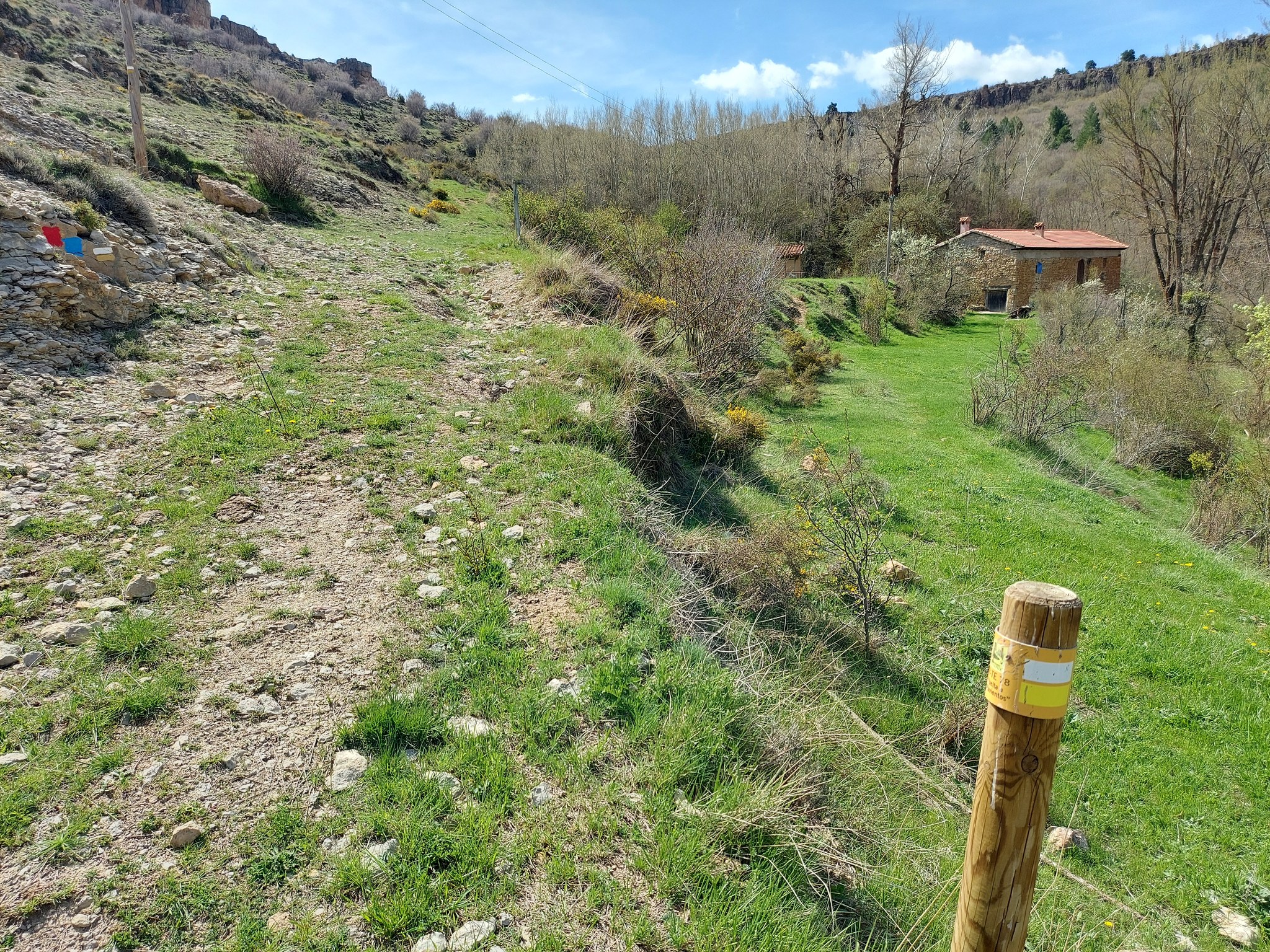
The walker is now entering the valley/gorge of the Sollavientos. Follow the wide track as it runs above and parallel to the river below. The weird-shaped pillars of rock that rise out of the river valley are another feature of limestone erosion. Soon a sign appears which tells us that we have walked 2.7km from Allepuz – and there is 5.3km to go to the finishing post. Walkers will notice that there are offshoot paths down to river and ravine bed which could be explored.
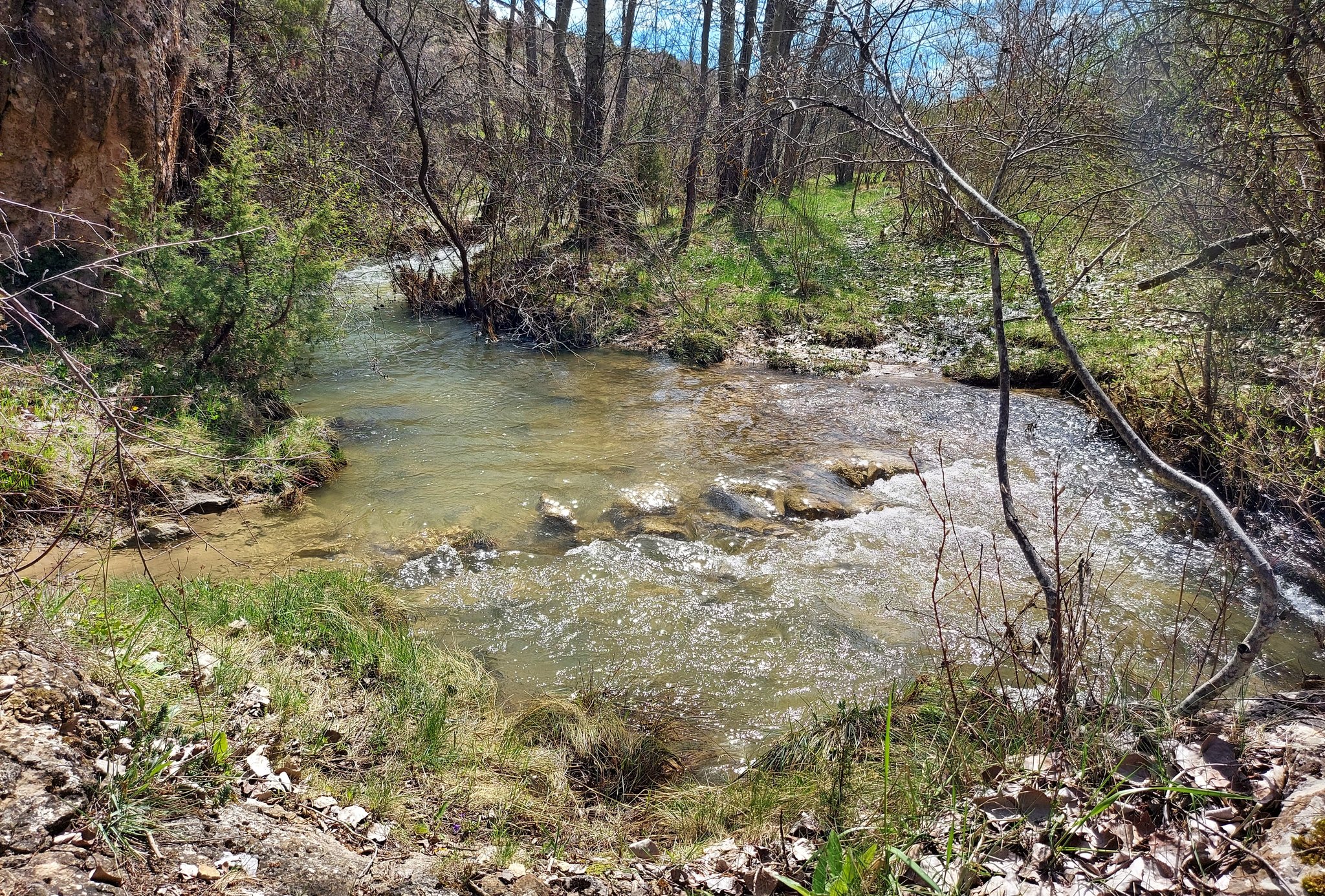
The valley was green in the spring (I did the walk at the beginning of May) and the gentle ascent which follows, passing a farmhouse on the right, was a joy. The track turns into a path, and the river on the right is closer now. More weird and wonderful rocks can be seen to the left of the path – shapes that appear to have been sculpted for a Gaudí building.
At the top of this section the river suddenly appears ahead, apparently blocking the path. At first the walker is confounded and thinks it might be shoes and socks off time. However, there is a ‘hidden’ passage on the left – a short labyrinth which leads through the walls of rock. This is best part of the route and is great fun.
Part 2 comes next
Recent Comments